![]()


DPA "Virtual" Short Walk. This group walk was cancelled because of the Coronavirus situation - this is a recon walk from 3rd March. 2020-3-25. Growan path, Birch Tor, Ace Fields, miners' house ruins and gardens, Vitifer chimney stump, miners' dry, blacksmith's shop, Rex's Bridge, Redwater Valley, flue, turbine house, water wheelpits, Birch Tor & Vitifer Mine Leat, mine captain's house, carpenter's shop, Soussons was Southsands, Golden Dagger dry, waterfall, 6-impost clapper bridge, large wheelpit, Dinah's House (officially Stamps Cottage), engine house, buddle. D365-(I13), J13, J14.
Walk details below - Information about the route etc.
Previous walks in this area: 12 December 2009, 29 August 2012, 9 July 2014, 4 September 2014, 30 September 2015,
Reconnaissance walks: 3 March, 11 March 2020,
Google Satellite map + GPS track of the walk
Old maps
OS 25-inch Single Sheet map 1885/1886 - red buildings
OS 25-inch map 1892-1914 Series - showing Warren House Inn, Birch Tor & Vitifer Tin Mine and Golden DaggerTin Mine
From the same map, zoomed in to show .....
OS 25-inch map 1892-1914 Series - Birch Tor & Vitifer Mine
OS 25-inch map 1892-1914 Series - Golden Dagger Mine
OS 25-inch Single Sheet map Surv.1885/Publ.1886 - old detail of Vitifer, Birch Tor and Golden Dagger Mines
1841 North Bovey Tithe Map See bottom left corner. 1/10th way in from left, 1/5th way up fom bottom

Copyright permission -
Devon County Council
North Bovey Tithe Map 1841, showing the Birch Tor Mine area, where Plots 1215-1217 are all labelled as "Garden (Headland estate)" and 1218 is "House garden (Headland estate)" - this was the mine captain's house. The Headland estate no doubt refers to the nearby Headland Farm. The Vitifer Mine (across the Redwater Brook, to the left) does not show on the tithe map because no land was enclosed for food production and therefore "tithing" was not appropriate. The nearby "Ace Fields" were on the tithe map - they were for growing vegetables to feed the miners. The fields were built with rabbit-proof walls because rabbits were bred by Headland Warren for meat.
The Redwater Valley has a complicated history. "Tinning" and possibly underground mining started in the Middle Ages, with tinning probably from the 1300s and perhaps in the Bronze Age (bronze being an alloy of copper and tin). There are four mines here:
(1) Vytifer Mine
(2) Birch Tor Mine
(3) East Birch Tor Mine (aka Headland Mine)
(4) Golden
Dagger Mine.
Vitifer and Birch Tor were separate mines, then combined, then separated,
and then
combined again.
Seemingly, either name can refer to either or both
mines - whether they were combined at the time or not!
The modern era ran from 1750 (Vitifer, Hemery) to 1913 (underground working) and (1939, surface working, reprocessing old waste). In 1838 - Birch Tor (with Vitifer) employed 117 men (+ they had families).
Their histories are intertwined, records are scarce, there are several books about them - some saying slightly different things, leading to confusion. I have used five books listed below plus online sources.
The mines were powered mostly by water - by the Birch Tor & Vitifer Mine Leat.
This came from 7 miles away with leat take-offs at .....
(1) the entrance to Sandy Hole
on the East Dart
(2) North Teign River, under Little Varracombe
(3) South Teign River, under Whit Ridge
(4) effluents from the wheels at West Vitifer and
Caroline Mines.
Waterwheels were used for pumping out water, raising ore from shafts and driving the crushing stamps. Small waterwheels were used for other work e.g. driving the "sweeps" that swept the crushed ore on buddles. Waterwheels were sited at (from the north) .....
(1) SX 68164 81241 (east of Sandy Park "Ace" field, 2nd from
north "Ace" field)
(2) SX 68067 81108 (north-west from central
smithy/dry)
(3) SX 68154 80906 (immediately south of smithy/dry)
(4) SX 67878 80824 (way out west-south-west of central area)
(5) SX
68326 80726 (south extension of Birch Tor Mine)
(6) SX 68373 80245
(Golden Dagger, beside the path)
(7) SX 68333 80123 (big one with 16
Cornish stamps, on right bank before Dinah's House)
(8) SX 68448
80066 (just yards north of Dinah's House)
East Birch Tor Mine (aka Headland Mine) extends east over the hill into the head of the West Webburn River valley, at Headland Warren Farm.
West Vitifer Mine is across the road, 2 km away at SX 679 827.
1. Michael Atkinson, Roger Burt & Peter Waite
(1978), Dartmoor Mines: The
Mines of the Granite Mass,
University of Exeter, pages 12-16.
In 1798, Vytifer Mine, in
North Bovey parish, 13 shafts, one to 40 fathoms (240 ft). Revealed one
ancient 15 fathom (90 ft) shaft. Birch Tor and Vitifer
mines were worked separately except in the 1820s. In 1838, Birch Tor
employed 117 people. About 1845, the mines were combined. In 1862, the
sett was divided, with New East Birch Tor working the eastern section,
referred to as Headland Mine. 1862-1866, produced 562 tons of
black tin. By 1870, had reached 70 fathoms (420 ft). Work stopped in
1883 until 1903. In 1907, there was a peak in activity when 22.6 tons of
ore were sold. At this time, 35 men were employed, with 20 underground.
Underground work ceased in 1915 but surface work continued until 1926.
Total production of Birch Tor & Vitifer, incl. East Birch Tor, between
1852 and 1913 was about 1,300 tons of dressed ore (black tin).
Aside: There was an East Vitifer Mine at SX 706 822, also known as
Headland Mine
(Also, known as: Hookney Mine, King's Barrow Mine and
Devon Great Tincroft?)
Birch Tor was powered almost totally by leats and waterwheels. One chimney existed in the 1930s, indicating that a steam engine was used at that time. Dressing floor site - ruins of buildings and 2 wheelpits uphill to the west. These probably pumped Dunstan's Shaft on Old Engine Lode.
2. AK Hamilton Jenkin (1974),
Mines of Devon Vol. 1: The Southern Area,
pages 101-106.
In 1838, Birch Tor had had two 40 ft and
one 32 ft waterwheels which were often frozen up for weeks in winter. In
1864 it was recorded that Joe Hamlyn had worked at Birch Tor for 75
years, and Jacob German for 60 years. They were hard men.
3. Eric Hemery (1983), High
Dartmoor, Robert Hale, London, pages 614-619.
Found evidence that Vitifer was working in 1750. Redwater
Brook - 1st footbridge was called Redwater Bridge by the miners. 2nd
bridge at SX 68395 80111 was for carts, before reaching Dinah's House.
Vitifer Wheelpit, 36-ft long (SX 68156 80906).
Dagger Wheelpit (old), 24 x 11 ft, p.619 (SX 68374 80245).
Big Dagger Wheelpit (new) was north of Dinah's House on
right bank., 35-ft, narrow breast, location is a few yards north, p.615 - details of
Vitifer/Birch Tor names, ownerships and production.
4. Tom Greeves (1986),
Tin Mines and Miners of Dartmoor,
Devon Books, Newton Abbot, pages 21-44.
From 1925, no work was
carried out at Vitifer although Golden Dagger men lived in the bunkhouse
there. During WW2, unexploded bombs from Plymouth were brought here to be
blown-up,
causing damage to the remains. The opencast workings are Medieval in
origin. Around e.g. 1902, the miners worked in 3 shifts a day: forenoon
(7am-3pm), afternoon (3pm-11pm) and night (11pm-7am), 5 shifts a week
plus the Sat fore noon shift. Photo c.1905 p.33, Captain Richard Jory
(Cap'n Dick), from Newlyn, came in under Cap'n Moses Bawden,
who had managed the Whiteworks mine.
Bawden built King's Oven Bumgalow - known as "Bawden's
Bungalow" along the road from Warren House Inn. There was a
stable behind the bungalow for his pony. He was manager of Vitifer and Golden Dagger
mines. The building was demolished in 1976 as an eyesore.
The buildings - Plate 21 p.26 (looking north) - a problem is that maps are
old and buildings were added
Extreme left -
carpenter's shop
further left, out of sight -
blacksmith's shop and dry
next right, large 2-storey
house - Miners' House, weekly boarding with 'canteen'
next right - substantial stone house with thatched roof, like a
Dartmoor farmhouse, mine Captain's House
attached -
a cottage
next right - with a prominent porch, mine
office and home (= Accounts or Count House)
next right -
a bungalow for miners' families
way off right -
wooden bungalow for a mine captain (Mr Padfield),
burned down pre-WW1
5. Jeremy Butler (1991), Dartmoor
Atlas of Antiquities, Vol. 2 - The North, 5-8: The Redwater Brook and
Golden Dagger Mine
(figs.24.5 and Map 24), pages 21-25.
Around 1845, tin price was low, skilled labour short, pay and conditions
poor, the mines attracted criminal elements leading to the mine being
described as the "Botany Bay for miners".
Numbered locations in the Dartmoor Atlas of Antiquities map .....
3 - nothing left of stamps, sheds, dressing floor and two wheels -
destroyed by WW2 bombs from Plymouth.
4 - carpenter's shop
5 -
long building, 5 rooms, blacksmith's shop and miners' "dry"
6 -
miners' dormitory above a kitchen and canteen
7 - mine office
8 - bungalow for miners
and their families
9 - manager's house
10 - Dunstan's shaft,
started 1846, reached 40 fthm (240 ft)
11 - Lance's shaft, similar
date
12 - Walled shaft
13 - large wheelpit
14 - Hambly's shaft
15 - New shaft
6. Mike Brown (2001) Guide to Dartmoor, CD-ROM, Dartmoor
Press, Grid Square 6815
8090.
Behind a large mound approximately west of the Dry is
the site of a turbine house and a large ruined wheelpit
lying hidden in a hollow.
7. Heritage Gateway
West Vitifer Mine, Chagford (aka New Vitifer) -
1850-1875, with three round buddles, stamping floor and wheel pit served
by a leat. Several shafts and adits in the area are associated with the
mine. On Chagford Common.
8. Dartefacts website
All items recorded in the area were checked online, especially the
wheelpits.
The origins of the name, Golden Dagger, are not known. What is known is that part of a prehistoric dagger was found "nearby" in 1872. It was decorated with gold. One description is that it was found "here" (Source: Royal Geographical Society in collaboration with U3A (2014), Tors and Tin: A self guided walk on Dartmoor in Devon, p.26). Another suggestion was that the mine may have been named after a dagger being found in the four cairns in Soussons Wood or possibly in old stream-works (Source: unknown). A third suggestion is that the exotic name of Golden Dagger may derive from a bronze dagger that was found many years before in a nearby cairn (Source: Dartmoor Walks - Golden Dagger Tin Mine). The name was in use in the 1850s, before a gold-studded pommel was found on Hameldown in 1872. In 1872, Spence Bate, a Plymouth antiquarian excavated the northernmost of the two cairns at Two Burrows found the pommel and separated blade of a dagger. The pommel was made of carved amber studded with hundreds of pins made from gold wire arranged in the form of a cross. It was dated to about 1,500 BC. The artefacts were handed to Plymouth Museum but were lost in a WW2 air raid in 1941. Sources: (1) Legendary Dartmoor - The Hameldon Dagger, (2) Devon & Dartmoor HER - MDV7409 - Two Barrows (northern) - Hamel Down, (3) Jeremy Butler (1991), Dartmoor Atlas of Antiquities, Vol. 1 - The East, Map 20: Cairns on Hamel, Hookney and Blackaton Downs, cairn 11, p.148.
1. Michael Atkinson, Roger Burt & Peter Waite
(1978), Dartmoor Mines: The
Mines of the Granite Mass,
University of Exeter, pages 22-23.
Early history is not well known, it was
working 1860s and abandoned in 1866. Re-opened in 1880 by Moses Bawden
until 1913 (stoppage in 1885). Height of activity in 1892 when 23 men
were working underground and 18 on the surface, when 25.6 tons of black
tin were produced. Total production of black (dressed, unsmelted) tin
1880-1913 was 220 tons. Re-prospected 1940-1942 to assess value of the
dumped materials, when remains of an electric separator were found. This
was to remove problematical specular i.e. shiny haematite from the black
tin. The workings run uphill to the west of the building ruins. The main
adit was driven in from the open works. These contain a number of
gunnises - where an underground stoped area has broken through to the
surface. Along the works is a still open air shaft (14 fathoms, 84 ft).
and at the end of the gert is the
main Machine shaft (45 fathom, 270 ft), operated by a water
wheel for lifting and pumping. The wheelpit is still
present, at SX 67790 80226. Back to the main site, a little way
down the valley is another wheelpit, at SX 68374 80245.
2. AK Hamilton Jenkin (1974),
Mines of Devon Vol. 1: The Southern Area,
page 106.
Golden Dagger "said to have been developed 1835-1860".
Acquired by Moses Bawden in 1880, spent �10,000 on machinery. Several
shafts sunk, incl. Machine Shaft (40 fthm, 240 ft), and a long adit
under older workings. At one time, post-1909, �131 per ton of black tin
was obtained, the best price for fifty years. Equipped with 16
Cornish stamps driven by a 22 x 9 feet waterwheel with Wilfley tables
that could concentrate 35 tons of pulp per day. In 1924 a turbogenerator
and a magnetic separator were added. Work stopped in the late 1920s.
3. Tom Greeves (1986),
Tin Mines and Miners of Dartmoor, Devon Books, Newton Abbot, pages
45-80.
In Oct 1855, the name appeared in a notice of sale, although the mine
has medieval origins. It was also in use in 1851. After WW1, surface
work carried on exploiting the old waste. Round buddles:
Introduced on Dartmoor in mid-1800s as a preliminary method of
concetrating the stamped ore. The powder was shovelled into a launder
and fed into the centre of the conical structure. A small waterwheel
drove "sweeps" of wood and rags around to help heavier tin particles to
settle while lighter sand etc was washed away. Once a depth of up to a
foot had settled a vanning shovel was used to test for heads, middle
heads and tails. Heads was the heaviest and best quality particles and
settled near the centre cone. The "tails" were poorest qulity and
usually discarded as waste. In the latter stages the surface working
involved reprocessing the ground below and beyond Dinah's House . It was
tramwayed to a long stepped sluice to look for tin left behind by
earlier working methods.
4. PHG Richardson (1992),
Mines of Dartmoor and the Tamar Valley after
1913, Northern Mine Research
Society, Sheffield, pages 18-26.
This book chapter concentrates on the last years
at Golden Dagger, from 1924. The lodes run east-weat as seen by the open
works that followed them. There were open works from time immemorial.
The lodes filled fissures only about 6-inches to 2-feet wide. Underground mining
ended in 1913 but recovery of tin from the surface alluvium and
incompletely processed waste from earlier workings went on until 1939.
This whole undertaking was quite technical and involved moving a turbine
and generator from Vitifer, managed by Donald Smith, engineer and later
manager, while he was 21 yrs old. A magnetic separator to remove
specular iron ore was also moved. A Petter semi-diesel engine was
installed, this had a dome that was heated by blowlamp and then started
by cranking with compressed air. Also involved were trommels and
buddles. The material was not crushed but sized by feeding into a
rotating trommel - a large iron cylinder with holes in it, large at one
end grading to small at the other end. Material was sorted into sized
particles by this means. The fine material went to a circular buddle
with a gentle conical shape where heavy material settled near the
top and lighter waste flowed away by washing with water. The best
material went to a square buddle with an inclined plane and then to
chimming kieves - open tubs where manual stirring took place. Next,
magnetic separation was done to remove iron ore particles.
6.
Mike Brown (2001) Guide to Dartmoor, CD-ROM, Dartmoor Press, Grid Square
6845.
Dinah's House, Mine Captain's house, officially
Stamps Cottage, Dinah Hext + children lived here in 1860s and 1870s,
moved from Challacombe. "CEH 1832" in cement on lower side, southern end
of the house - quite "recent".
|
A foot of black tin is generally computed to weigh sixty pounds one with the other that is half a hundred stannary weight. As for moor tin, that is, old stream tin, there is but little of that gotten at present, the old stream works being in a manner exhausted. All tin, either at the blowing houses or melting houses, is taken in by weight, and the moor tin is therefore reckoned the best, because it is a great grain tin, and much purer than the mine tin is for the generality. Yet I find, both by what Mr Carew saith here, and by the Bailiff of Blackmore, that they thought themselves well used, if they had one pound of white for two pounds of black tin of this very best sort; whereas now the tinners have so much improved themselves in the knowledge of the metal, that the very worst sort of black tin will yield more than that; and they have now from eleven to thirteen pounds of white tin for twenty of black, as hath been observed before. Ed. - My emboldening, for clarity. |
Heritage Environment Records - Search results

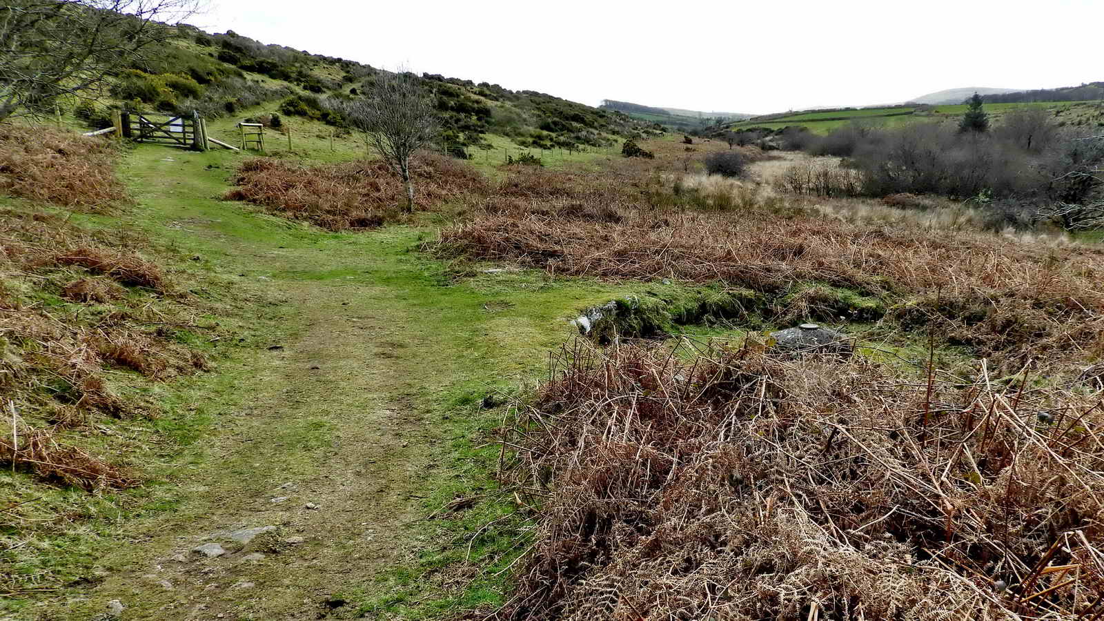
Looking back up the growan path while approaching Vitifer Mine .....
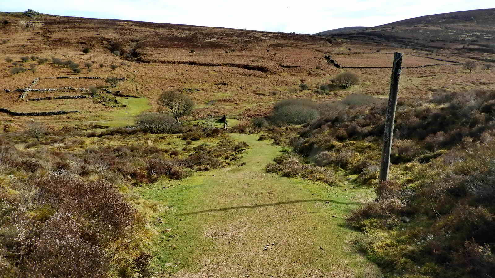
Looking down the grassy path at the Vitifer Mine site ..... Birch Tor at top left and one of the Ace Fields over to the the right (behind the pole) .....
The four Ace Fields, said to have been formed from the aces dropping from the sleeve of Jan Reynolds' jacket as the Devil carried him off from Widecombe church. Actually, rabbit-proof enclosures for growing vegetables for feeding the resident miners. Click the image to see a larger version.

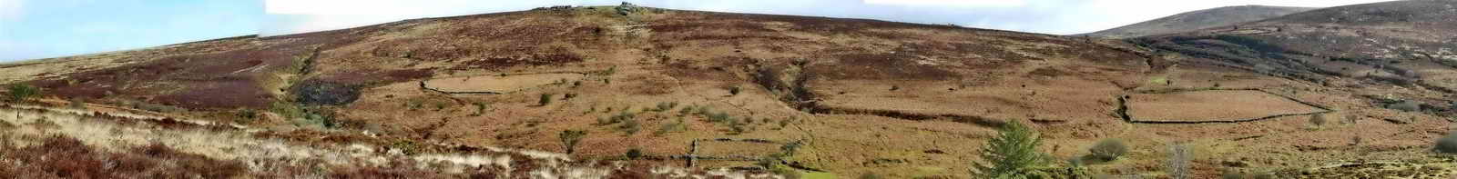
One man and his dog up on Birch Tor, SX 686 814, elevation 487 metres (1597 feet).

A view across the Vitifer site up to Birch Tor. The enclosures are "gardens" in the tithe apportionments, behind the ruins of the miners' house, this being the barracks with the kitchen and canteen (downstairs) and the dormitory (upstairs)

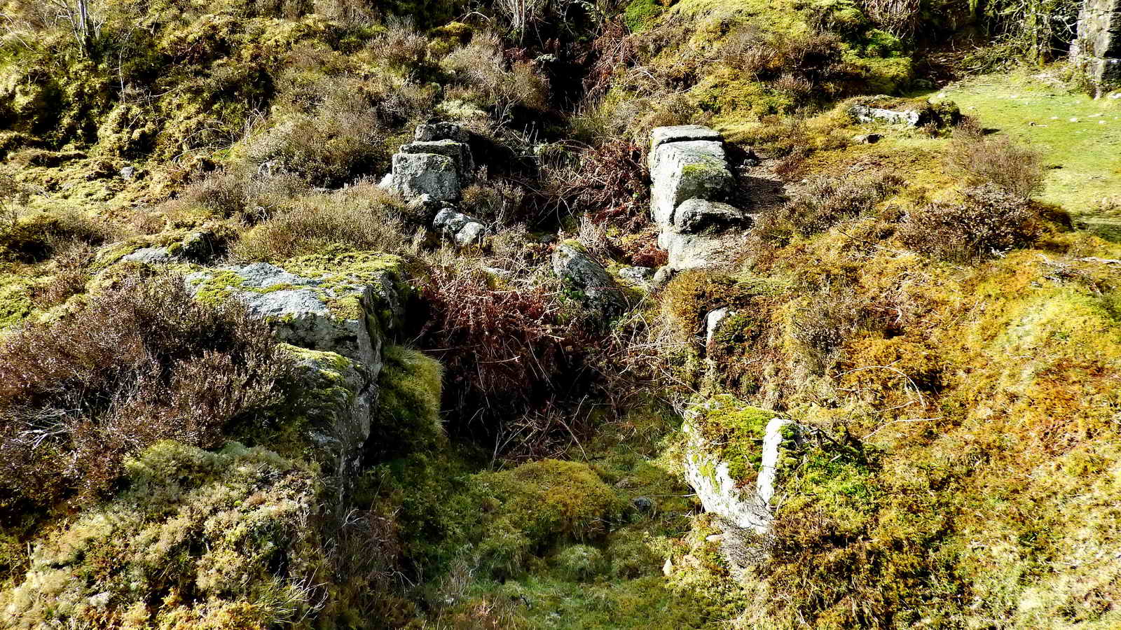
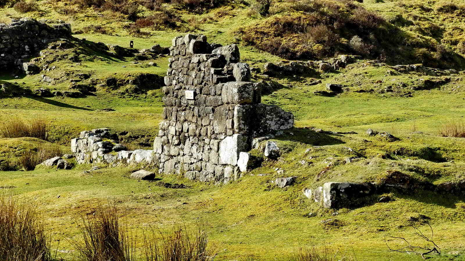
The circular stump of the chimney - this was between the blacksmith's shop and the miners' dry - and the wall of the carpenter's shop at extreme left, with Challacombe Down behind .....
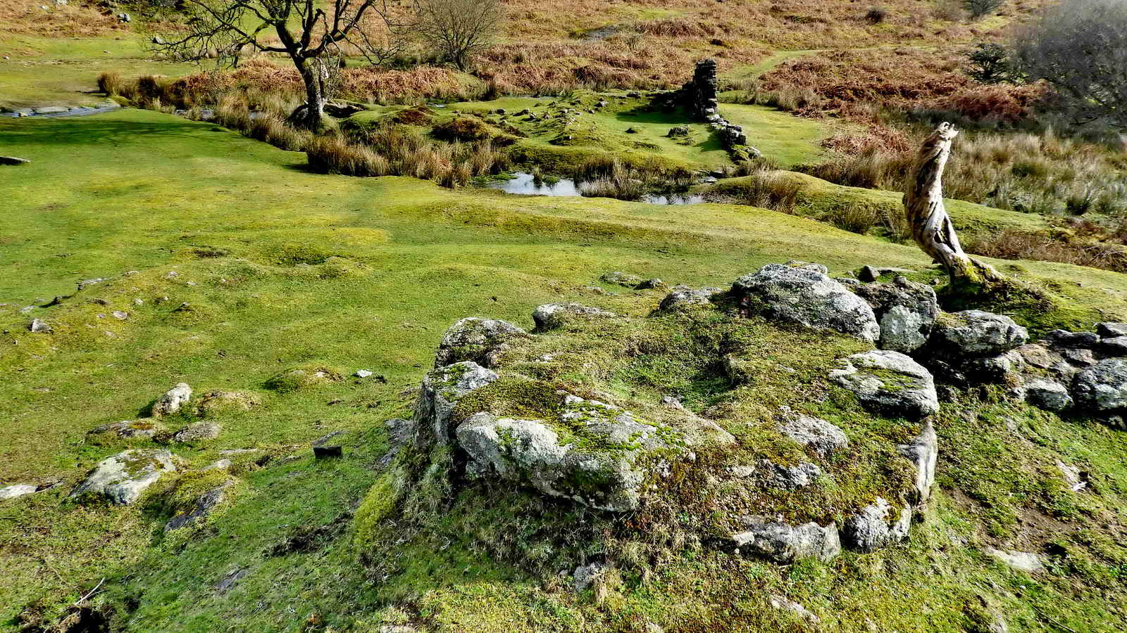
The chimney with the ruin of the blacksmith's "shop" to the left foreground and Rex's Bridge (SX 68186 80977) at top left .....
Slightly different angle on the same view .....

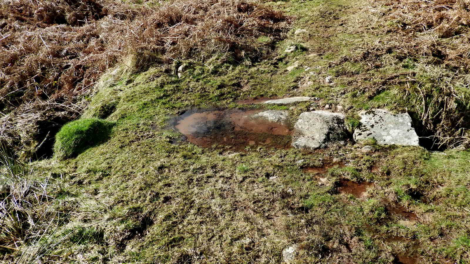
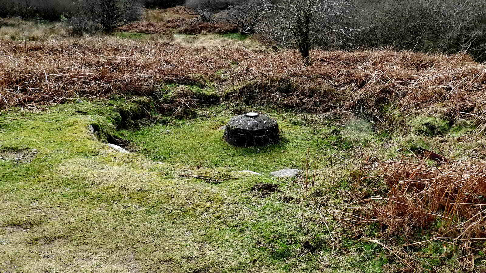
The chimney stump with what appears to be a flue to its left (the black hole) and a view up the Redwater Valley ..... the ruins running to the left from the chimney are those of the miners' "dry" where clothes were dried ..... there is a flue in the ground here .....

Closer look at the flue. No idea what the iron object is (or was) .....

SX 6815 8091 - the site of the turbine house (bottom right) and a large water wheelpit (left side). The turbine house does not appear on the 1904 OS map so it was probably later than that.

The leat above the water wheelpit .....
The water wheelpit .....

View back across the wheelpit to the turbine house and the path from the blacksmith's and carpenter's site .....

Looking across Rex's clapper bridge to the blacksmith's ruins (with the miners' dry" ruins to the right) and the grass path immediately left of the ruins that leads to the turbine house and wheelpit site.

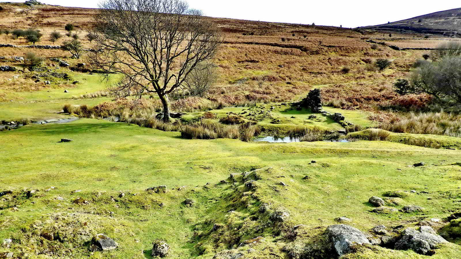
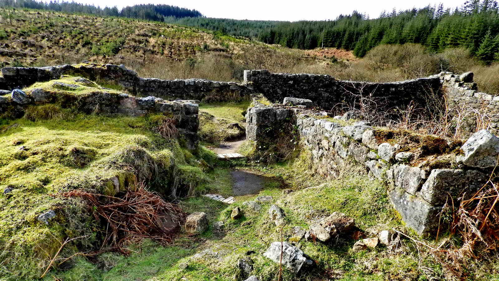
Looking over Rex's Bridge to the ruins of the miners' house with the garden enclosures behind it. The ruins of the mine captain's house are visible near the far right in the bracken.

The ruins of the miners' house and gardens.

A piece of the wall of the carpenter's shop.

Looking up the Redwater Valley towards the main road.
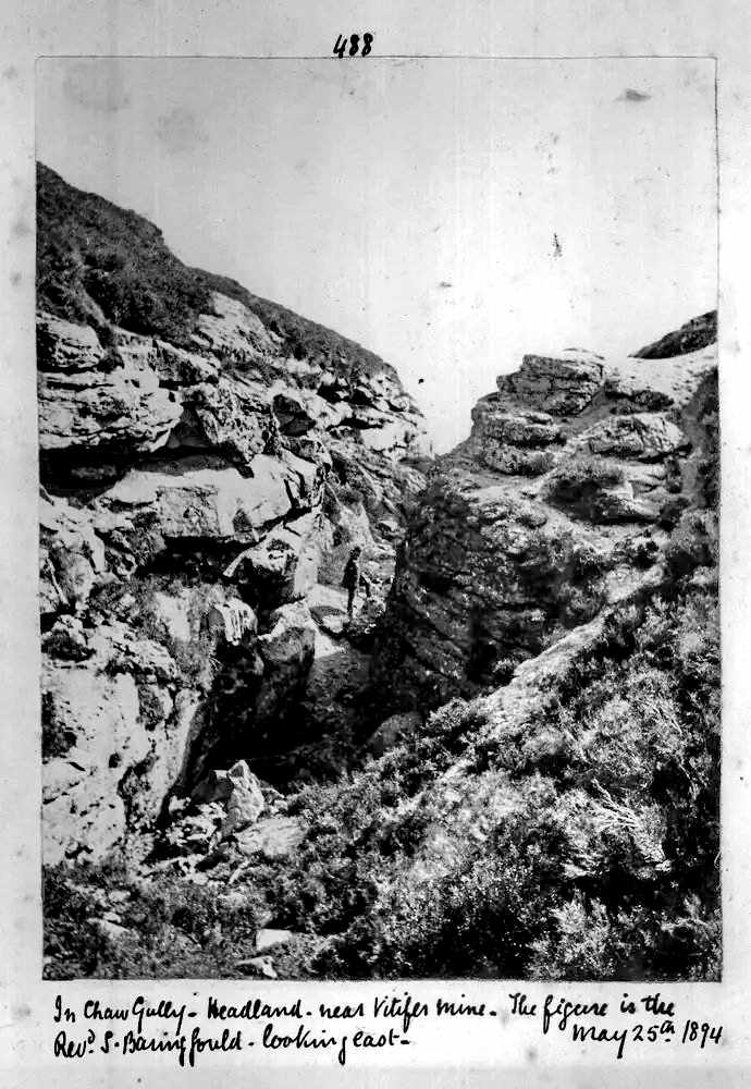
Chaw Gully - Headland - near Vitifer Tin Mine
Image reproduced with permission from Dartmoor
Archive
The figure is the Rev. S. Baring Gould - looking
east. May 25th, 1894
See the image online HERE

Birch Tor.

Looking down the path towards Golden Dagger mine - it has been raining.
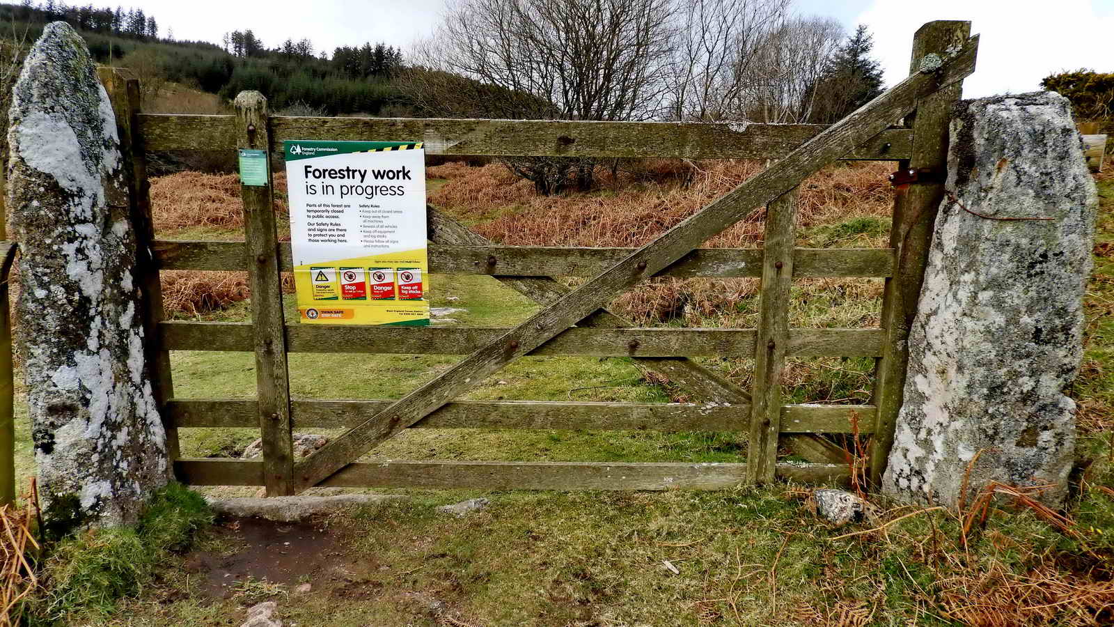
There is a gate into the Golden Dagger area - this being in Soussons Plantation on Soussons Down). This gate is actually at the far side where you leave Soussons and go out onto Challacombe Down, but the Forestry notice was in deep shade on the first gate.

Copyright permission -
Devon County Council
Southsands on the Manaton Parish Tithe Map 1842, now "Soussons" on modern Ordnance Survey maps. The map is rotated more trhan 90� clockwise compared to modern maps.

Bridleway to Bennetts Cross B3212
Bridleway to County Rd. near
Soussons
Footpath to road near Headland Warren and Challacombe.

The miners' dry at Golden Dagger .....
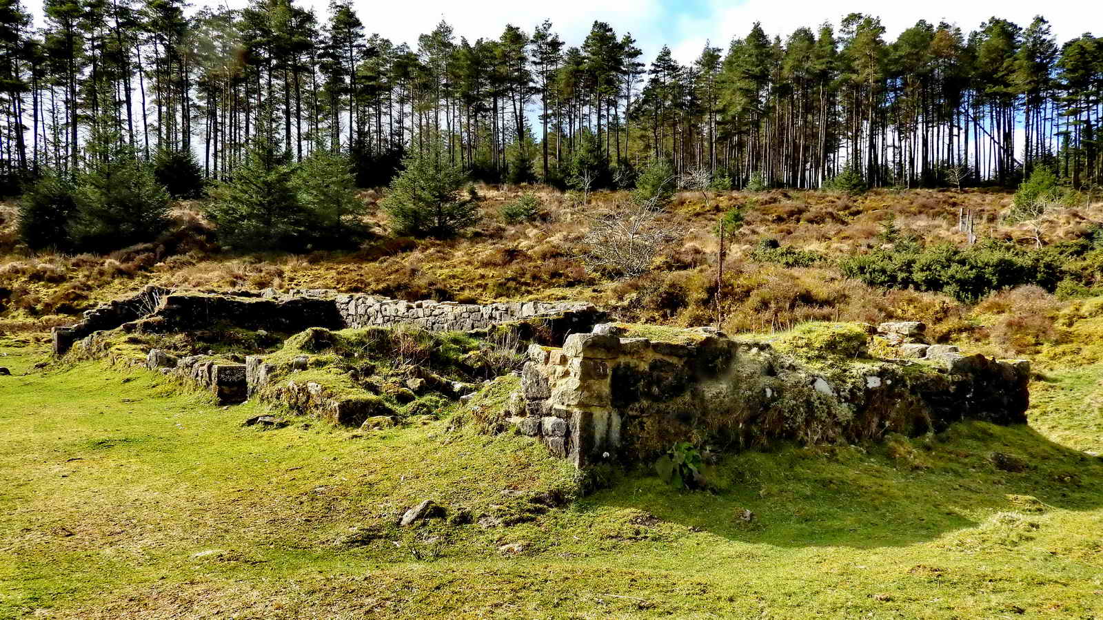
Miners' dry at Golden Dagger .....

Miners' dry at Golden Dagger .....

Footpath and permissive bridleway to Challacombe and Headlwand Warren.

Looking north up the Golden Dagger track towards the main road - with the sun rather than into it!

Waterfall beside the track, at SX 68400 80183.

Another view back up the track.
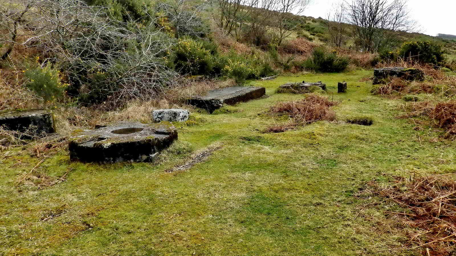
Six-impost (?) clapper bridge at SX 68405 80108 that leads off to a large wheelpit .....

The built-up walls of the wheelpit at SX 68405 80108 - this was the 22 x 9 ft wheel that drove 16 Cornish stamps for crushing the tin ore .....

The wheelpit ..... there is a drain at the bottom to the tailrace .....
Some debris.

Another water wheelpit just a few yards north of Dinah's House, at SX 68448 80066. This must have been the 35-foot narrow breast wheel.

House and wheelpit near Vitifer, photographed 1983?
Image reproduced with permission from Dartmoor
Archive
This photograph complements the one above it.
See the image online HERE

Dinah's House, SX 68465 80048, the wheelpit above is about halfway along the track in this photograph, on the same side of the track as the house.

This was the Mine Captain's house and office, officially Stamps Cottage, Dinah Hext and her children lived here in 1860s and 1870s, moved from Challacombe. "CEH 1832" in cement on lower side, southern end of the house. It was also apparently once a dormitory and a garage.
The front door, there is a photograph of several people stood here.

Looking south, further down the valley, towards the Engine House.

Another view of the house.

This is the rear of Dinah's house, a dormitory and meeting place
for miners at the Golden Dagger Mine
Image reproduced with permission from Dartmoor
Archive
See the image online HERE
Ruins of the Engine House, looking south .....

Engine House, looking north, with the site of the Petter Engine (centre, video), its cooling tanks (extreme left), gas engine (extreme right) and gas-producing plant (centre distance). The Magnetic Separator was left of the camera and the winter turbine/generator to the right. The summer generator was beyond the Petter Engine. This tin mining was a complicated operation - and this was only re-working the former waste material on the surface!
Across the track (same side as Dinah's House) and a few yards further on was a simpler setup - a buddle ..... in the distance is the gate onto Challacombe Down.
This is where crushed ore was separated into heavy (tin-bearing) sand and lighter waste sand. It was fed as a slurry onto the cone by a small leat arrangement and swept by water-wheel-driven wood-and-rag "sweeps" that were driven around the buddle, separating different weight mineral particles.

Challacombe Farm Norice, now somewhat faded. Click the image to see a larger version.

Self-explanatory notice.

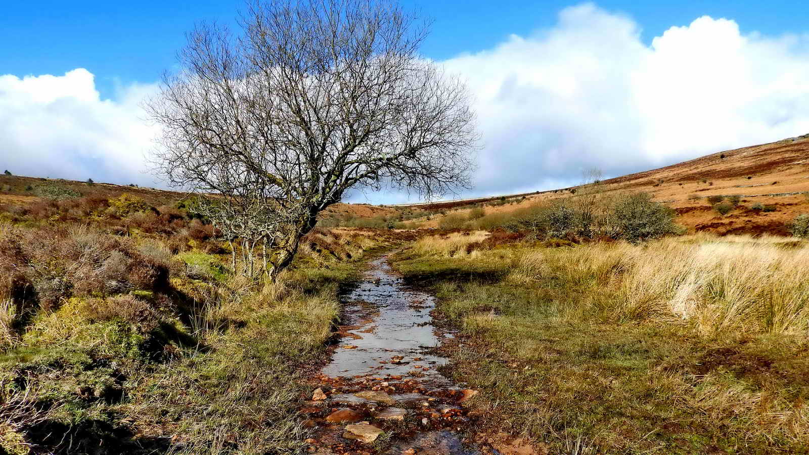
Redwater Brook - this contributed to the powering of the mining complex, but the Birch Tor & Vitifer Mine Leat brought a lot more water to the site.
The path back again .....
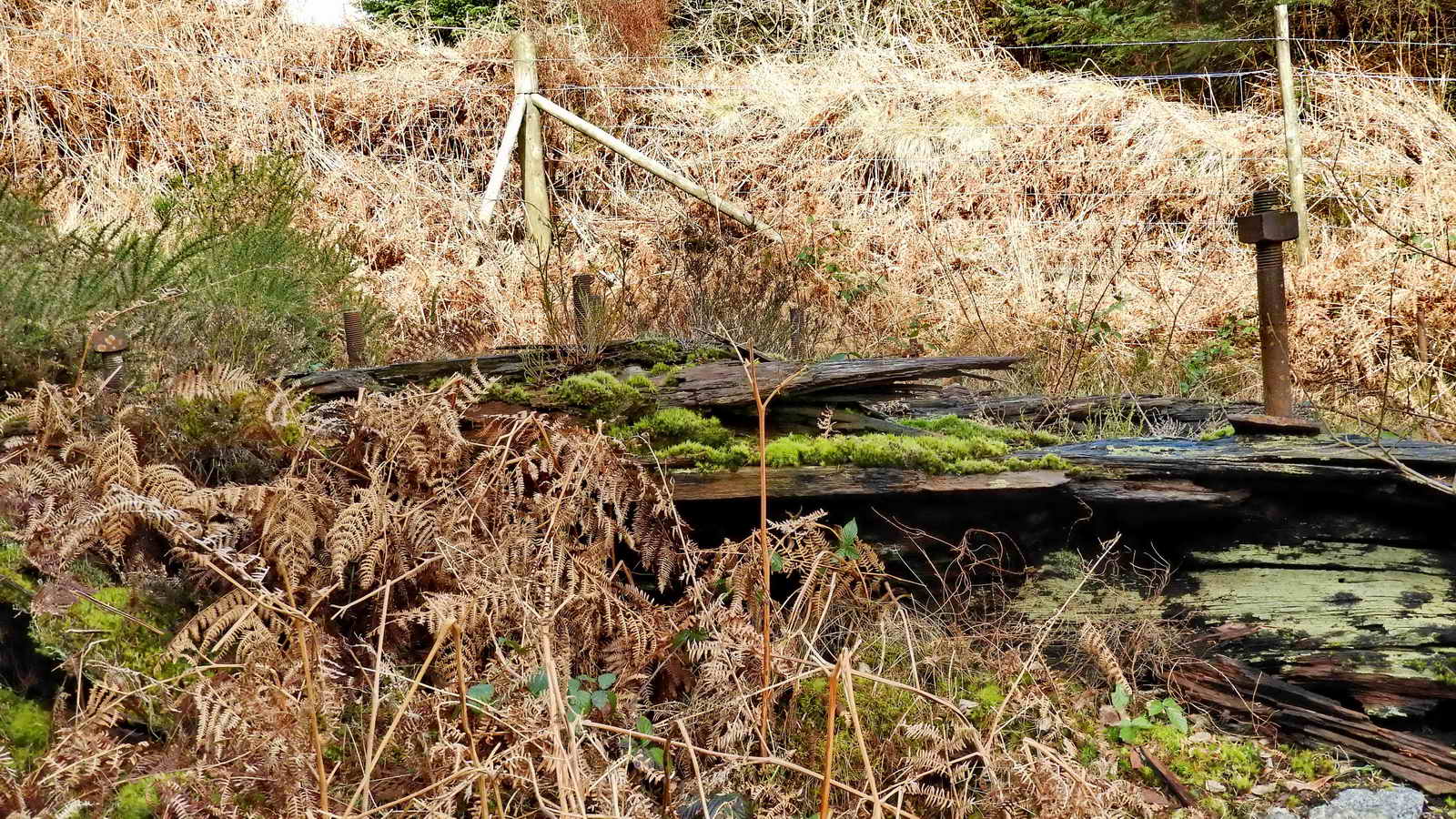
The Carpenter's Shop ..... with a personal memorial screwed onto it .....

Last view, across to Birch Tor.
Addendum
This walk was rescheduled for two groups of 12 to be done on Fri 25th and Mon 28th Sep, but was cancelled due to my car being off the road for engine work. A further issue was that some people did not receive the email due to my sending two group emails, each with 30+ addresses in each, these being sent almost simultaneously which apparently interferes with the addresses being added into each sending. Those people assembled as planned and did parts of the walk, one group completing it and taking some photographs, shown below by kind permission of Robin Humphreys.

Sinkhole beside the track, the subsidence indicating 'diggings' below from mining activities.

Another, recent, sinkhole can be found in the ruins of the Engine House, at the far left corner in this photograph .....
The Engine House sinkhile, covered by a gate.

The group, at the Miners' Dry.

The group - #2.
MAP: Red = GPS satellite track of the walk.
� Crown copyright 2016 Ordnance
Survey
Licence number 100047373
Also, Copyright � 2005, Memory-Map Europe, with permission.
This walk was reached by following the B3212 road from Two Bridges towards Moretonhampstead. There is roadside parking at the Warren House Inn as well as a small car park towards Moretonhampstead and another further away, over the hill, at Bennett's Cross, marked by yellow crosses and the P symbol on the map.
Statistics
Distance - 5.64 km / 3.51 miles
All photographs on this web site are copyright
© Keith Ryan.
All rights reserved - please
email for permissions