![]()


This walk: 2017-10-25. Sharpitor, cist, stone row, Goadstone Pool, Golden Plover, RAF Sharpitor, approach road kerbstones, old stone pits?, Peek Hill, Cold War bunker, Bronze Age cairn, Leather Tor, Burrator Reservoir, Lowery Tor, Lowery Barn, medieval longhouse, Bronze Age enclosure, DPA boundary stones, Walkhampton Common Reave.
Walk details below - Information about the route etc.
Previous walk in this area: 29th April 2015.
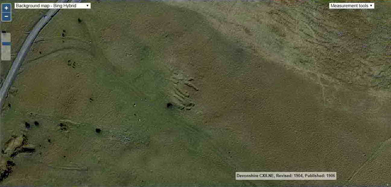
Google Satellite map + GPS track of the walk

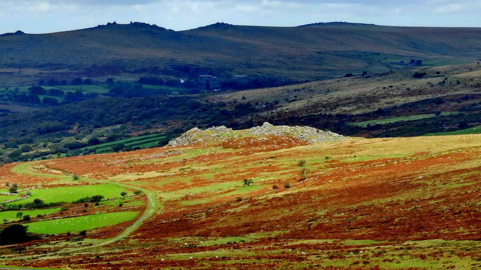
Sharpitor, SX 560 703, elevation 410 metres (1345 feet), as seen from the car park with a little "zoom". The tor and some land around it is owned outright by Dartmoor Preservation Association (the "DPA") - the story about this is one of planned development after WW2 and protest (by the Friends of Dartmoor organisation - the DPA) - it is told HERE. There was already wartime development here with RAF Sharpitor and Cold War use by the Royal Observer Corps until 1991- this will be elaborated on during this walk.
In search of The Goad Stone .....
Goadstone: This name is mentioned on three pages in the book, Dave Brewer (2002), Dartmoor Boundary Markers, Halsgrove, pages 240-242. He discusses William Crossing causing confusion by describing two different stones. In 1905, Crossing describes a stone marking where a track - from Walkhampton (and Routrundle) to Stanlake - crossed the road as Goad's Stone in Western Morning News articles, reprinted later in Dartmoor's Early Historic and Medieval Remains (1987), Quay Publications, Brixham, page 38. However, in his later 1912 Guide (page 91), he describes Goad's Stone as about three miles from Princetown, being the twelfth mile stone from Plymouth with indecipherable markings on the upper half - hardly the stone in the photograph below. Brewer then goes on to discuss Eric Hemery's description of the Goad Stone being the third milestone from Princetown, at the junction of the Routrundle track and the main road. It had indecipherable markings and is no longer there. Further, Hemery discusses a "goad" as being an old tinner's mark or boundary stone. Source: Eric Hemery (1983), High Dartmoor, Robert Hale, London, page 108 (footnote 1) .....

Looking up the hill back towards Yelverton - stones that are quite noticeable ..... the smaller looking stone is a milestone .....

This is the right-most stone from the preceding photograph - a Plymouth Corporation Water Works stone from 1917, marking the edge of the water catchment area for Burrator Reservoir - there is a pillar on each side of the road. To my mind, they should be on the skyline ridge because rain falling between the pillars and the skyline will surely drain down the slope, to the River Meavy and thence to the reservoir? Perhaps they are here out of consideration for the view .....

Low-angle view of the milestone, at SX 55816 70780, inscribed "PLYMOUTH 12 MILES PRINCE TOWN 3".

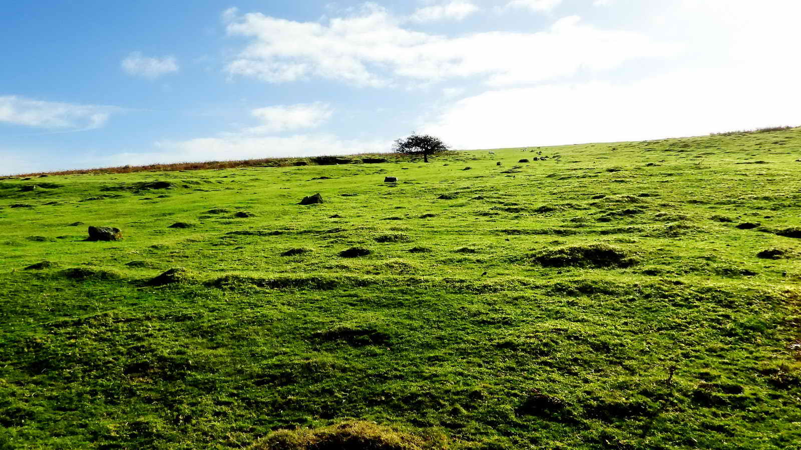
Bronze Age cairn circle with retaining kerbstones and a central burial cist ..... at SX 55838 70695 ..... Sharpitor in the background .....
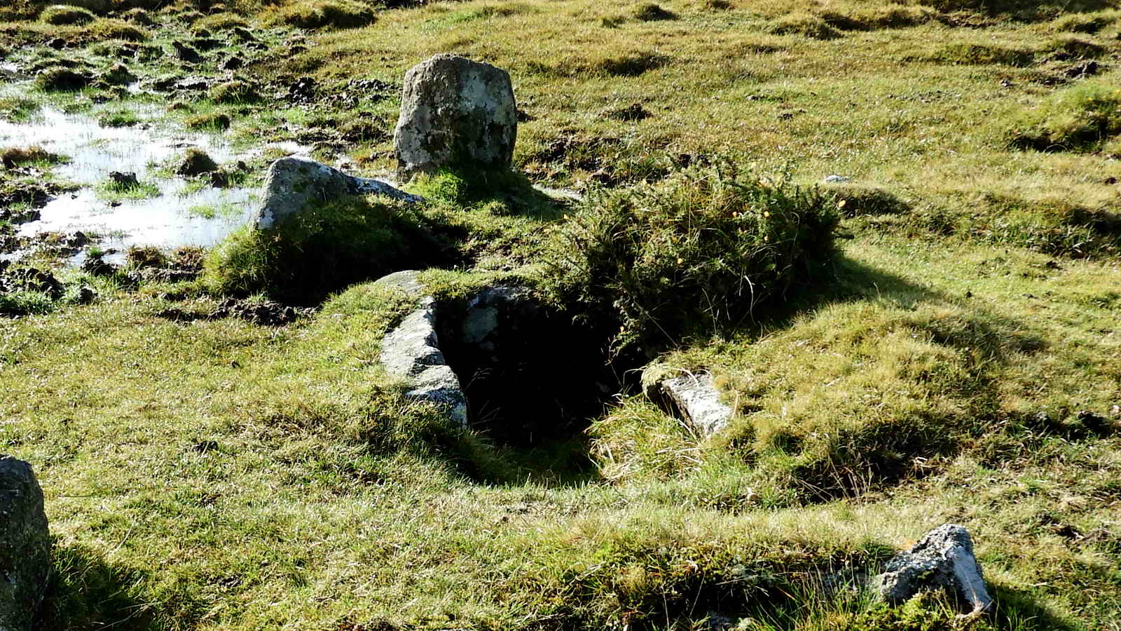
Closer view .....

The cist, from above, with camera flash .....
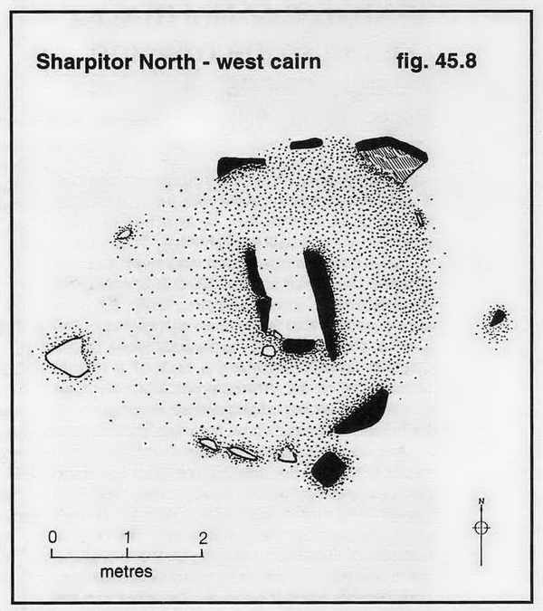
Image © J Butler 1994. Reproduced by kind permission (ref. 29
Sept. 2012).
The cairn and its cist are described by Jeremy Butler (1994), Dartmoor
Atlas of Antiquities III, The South West. 45.12 Sharpitor North-west
single and
double stone rows, pages 44-46: where the surrounding stones, or pillars, such
as survive are described. NB - The diagram has north at the top, the photos were
taken looking south.

First view of the essentially double stone row (but much-robbed, no doubt by road builders); this east end, with a fallen blocking stone, is at SX 55767 70669 .....
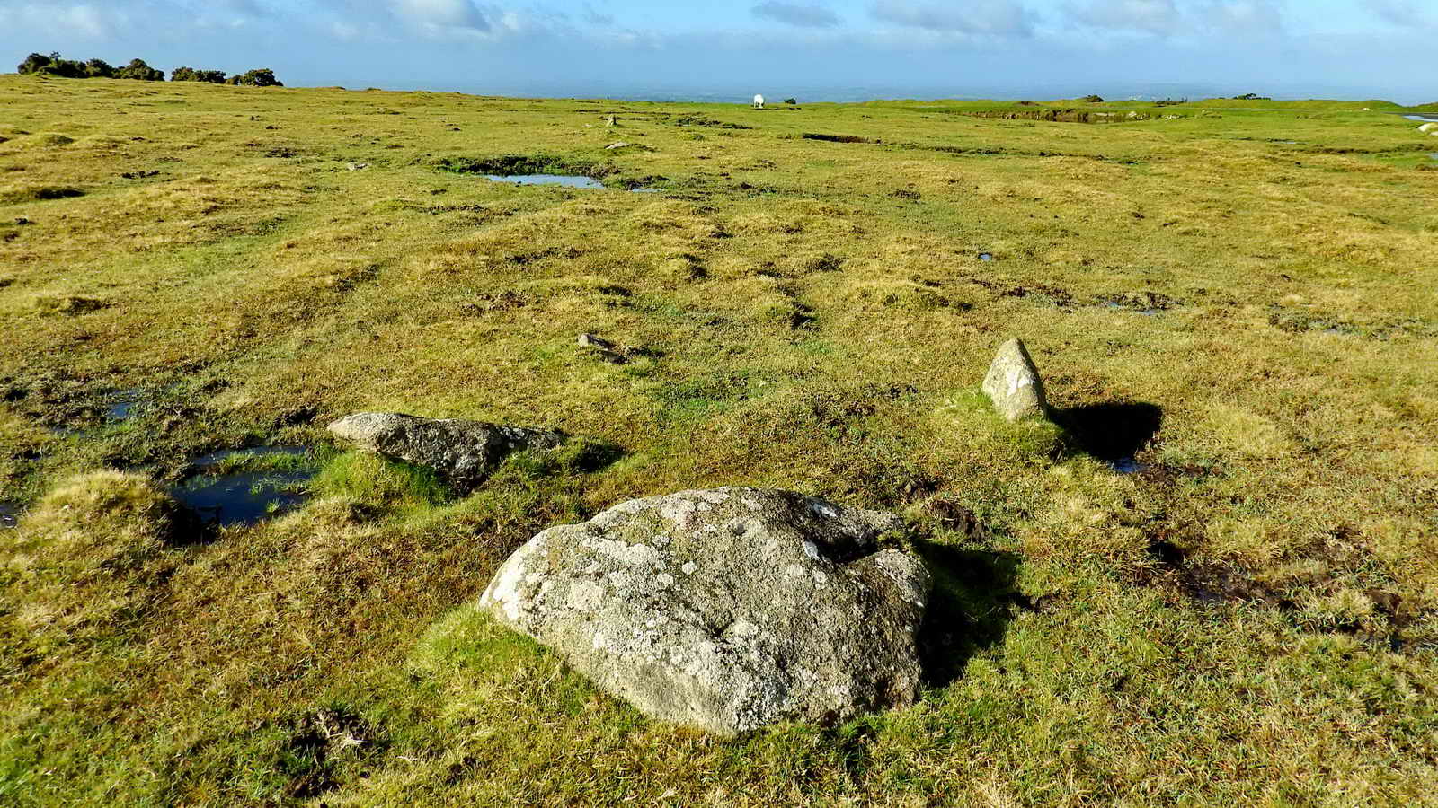
East end of the row, that is 113 metres long from the blocking stone (fallen, above) to the centre of the terminal cairn at the western end. The distance between the stone row and the cist is about 75 metres.

Image © J Butler 1994. Reproduced
by kind permission (ref. 29 Sept. 2012).
The cist seen above is part of the cairn indicated by the arrow at the extreme right of this diagram. Goadstone Pool, right beside the main A386 road, which is indicated above (top left corner of the diagram).

The stone row (very sparse) lies close to the pool. From the "Goadstone" musings above, the pool is probably best-named Goadstone rather than Goatstone Pool.

These are the end stones at the western end of the row, near the terminal cairn, which is not very photogenic. The row is apparently one of only two on the moor to have its cairn and blocking stone in different watersheds - Walkham and Meavy, respectively. Source: William D Lethbridge (2015), Discover Prehistoric Dartmoor - A Walker's Guide to to the Moorland's Ancient Monuments, Halsgrove, Wellington, Somerset, page 20.
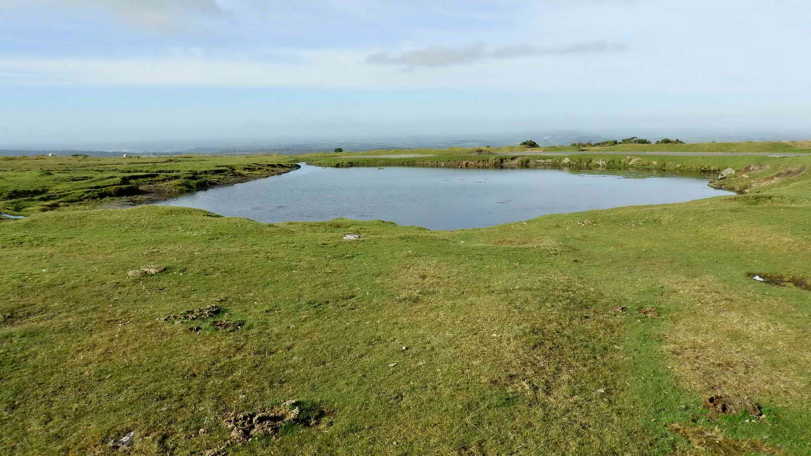
A simple view of Goadstone Pool, with the nearby B3212 road just behind it.

Cox Tor (left), Middle and Great Staple Tors with Roos Tor behind, Great Mis Tor (right). Click on the image to see a larger version.

Walkhampton Church, St. Mary the Virgin.

Flock of about 20 Golden Plover on the slope of Peek Hill, near the main road .....

Golden Plover ..... these are apparently early (seen on a reconnaissance walk on 3rd October) and were reluctant to fly as I walked past them - perhaps they had recently arrived and were recovering after long flight from breeding and summering in the UK uplands .....

Golden Plover, with quite a high degree of zoom.

This was once the road to RAF Sharpitor, with buildings left and right of the road at this location. It was originally lined on the right side by white-painted marker stones. I remember the signpost that said "RAF Sharpitor" beside the main road, from when I was about 5 to 10 years old, in the back of Dad's car, often wondering what planes, such as Hurricanes and Spitfires and Gannets and Skyraiders they might have up there! Such was young innocence - we lived near RNAS Culdrose, in West Cornwall, and we saw the naval versions of these planes on an almost daily basis (naval versions were adapted for flying from aircraft carriers).

There is a landmark hawthorn tree at SX 55500 70239. Just behind it, and to the left in this photograph, are some unusual shapes in the ground - at first it seemed that they might be associated with RAF Sharpitor, but as the "walls" appear to be of loose stones the thought occurred that perhaps they were part of a longhouse system with the upper ends set into the ground. Further investigation suggests they might be part of an old quarry system shown on this old map: Ordnance Survey, Six-inch to the mile, published 1906 - marked "Quarries" west of "Peek Hill", near top left on the map sheet, however, they are somewhat distant from the mapped quarry area. Finally, perhaps they are "stone pits"?
It was pointed out during the walk that there appear to be wheel tracks at the lower end of these features where wagons might have been loaded. Thanks, Ron.

Another view of the disturbed ground.

As noted above, the sides of these pits appear to be just loose stones rather than proper walling or revetment work. Thus, perhaps they are old stone pits, where stones were "quarried" i.e. dug out loose from the ground for building purposes. This could be formed by aggregated clitter from the tors that is then covered by soil and vegetation or by weathering of sub-surface rock into split stones as is postulated in one theory about the formation of tors ..... Stone pits were encountered on the 25th May 2017 - Ingra Tor walk, possibly in connection with the cist, although one would think there would have been plenty of surface moorstone for that construction? Stone pits may have been important in the building of longhouses?
The disturbed area (of stone pits?) appears in the centre of this hybrid overlain 1906 OS 6-inch map. The landmark tree is seen to the bottom-left of the disturbed ground. Also seen are the two (or three) approaches from the main road to the road that led up the hill. An old quarry is seen at the bottom left corner of the image. Reproduced with the permission of the National Library of Scotland

Is this all that's left of the camp flagpole? This area, on the way up the slope, was the "Domestic" site of RAF Sharpitor where the 35 or so personnel were housed, of which 12 were technicians.. The "business" aspect of RAF Sharpitor was the "Technical" site at the top of the hill.

Google Earth image showing part of the RAF Sharpitor Domestic site. The guardhouse is labelled, where the marker stones beside the road begin. Some buildings are also indicated by the map pin symbols. The "landmark" tree is seen at bottom right, as well as the stone pits(?). Image from Google Earth (c) 2015 .....

The same image as the previous one, digitally converted to black and white and then enhanced to show the building outlines more obviously in the vegetation. Image from Google Earth (c) 2015.
The outline of the guardhouse (SX 55433 70263), to the right of the road going up the hill, can be seen across the middle region of the photograph, just an oblong shadow of the foundations. The landmark tree is also seen .....

Another outline of a building to the right of the road. The remains of the flagpole(?) is 35 paces on a compass bearing of 236� from the tree.

On the road up Peak Hill, with the marker stones still in place on the right.
English Heritage Register of Monuments at Risk Register - this mentions "Prehistoric coaxial field system and cairns, an historic enclosure and part of RAF Sharpitor, situated on and around Peek Hill"
During WW2, Peek Hill was developed as part of the nation-wide Gee system of radio-navigation beams for guiding war planes into the continent. The establishment on the hill was designated as RAF Sharpitor.
Another internet record on Pastscape has been suggested by Tim Sandles, Webmaster of Legendary Dartmoor .............
RAF Sharpitor - MONUMENT NO. 1454628
"RAF Sharpitor, a transmitting station established early in World War 2 circa 1942 and abandoned in 1971. This small 'Technical site' served as the master transmitting station for the South Western Gee chain and was one link in the national Gee chain - a radio-navigational system that enabled aircraft navigators to fix their position accurately throughout most of Europe. The station had a 210ft wooden transmitting tower and seven Nissen huts including a transmitter block. A 'Domestic site' nearby (SX 57 SE 230 ) served as the personnel accommodation area until it was demolished in 1949. The station was upgraded with the addition of a new transmitter block and a 240ft high steel transmitting tower in the mid 1950s. In its heyday 35 service personnel were stationed here including 12 technicians who worked a shift system. The station, located just off the prominent summit area of Peek Hill, was demolished and cleared by 1972. The outline of many of the early buildings traceable as slight brick and concrete foundations up to 0.1m high were surveyed in 2007"
Google Map link to the RAF Sharpitor site.
Exposed rock at the top of the road, showing sedimentary slate, with a view of Sharpitor (granite) behind.

The bump in the ground on the left is actually two bumps; in front is the underground Cold War bunker and behind is the hill top with a ruined cairn to the right (out of sight).
This is the hill-top site where the technical area of RAF Sharpitor was located, either side of the road (the kerb stones are still evident). The purpose of the station was that it was part of a radio-navigation system that was proposed in 1938. It was established in 1942. The transmitter mast was to the left and behind the camera. The original 210-foot wooden mast, replaced in 1956 by a 240-foot metal mast, transmitted a radio pulse. This was synchronised with a pulse from a slave station. The signals formed a grid of signal strength. The pulses were received by radio receiving equipment in the planes. If a plane was equidistant from the transmitters, the pulses would reach the planes at the same time. Differences in delay could be used to indicate a plane's position on a map. To pinpoint position, another two slave transmitters were used. These accessory stations were at Worth Matravers* (Dorset), Sennen (Cornwall), Folly and (South Wales). The synchrony of signals was monitored by another station at Trerew, near Newquay. This was the basis of the Gee System (G being the initial letter of Grid). RAF Sharpitor functioned until 26th March 1970, having operated continuously for 28 years. There were a number of such chains around the UK and RAF Sharpitor was the master station of the South West Gee chain.
* Worth Matravers (Dorset) was used after the war as a training base for Gee operators.
Sources: Bill Wilkinson, Dartmoor Magazine, No. 44 Autumn 1996, pages 6-8, and No. 83, Summer 2006, pages 25-27; also Wikipedia-Gee (navigation) and other sources cited previously above.
See also Oboe (navigation) and Gee-H (navigation).
Left - the summit of Peek Hill, SX 556 699, elevation 400 metres (1312 feet). Right - the bump in the ground that covered the Cold War listening post. I was astounded to discover there were 1,573 ROC listening posts around the UK during the Cold War. This can be confirmed via List of Royal Observer Corps / United Kingdom Warning and Monitoring Organisation Posts (A�E).
.

An alignment of the bunker ventilation shaft (nearest camera), filled-in access to the bunker, and behind is the top of Peek Hill.

Today's group on the summit of Peek Hill, 16 of us.
Ventilation shaft, with bent iron bolts .....

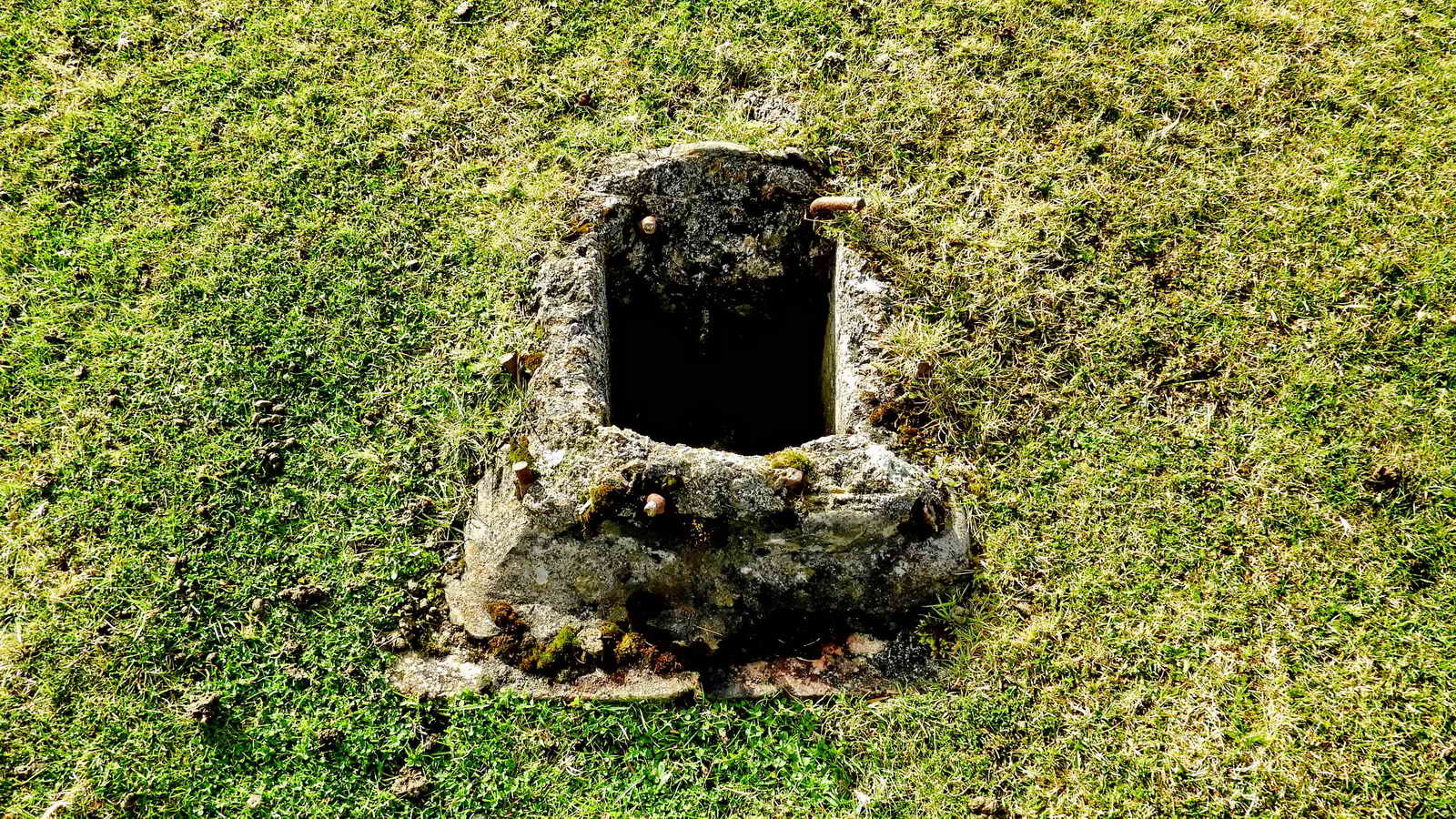
A concrete cist? Actually, the entrance to the underground bunker. There were steps down to a room with a table and a bed until it was vandalised: then it was sealed shut.
The bunker was outside the perimeter of RAF Sharpitor.
Someone who went inside the bunker.
Widecombe History Group Minutes from October 2007 record: Doug & Lyn Pidgeon brought some details of the RAF Sharpitor Mast for Mike Wright who raised the subject at his talk in September. A good article on the subject can be found in The Dartmoor Magazine number 83, Summer 2006 written by Bill Wilkinson.
The following information is culled from The Field Archaeology of Dartmoor, Phil Newman, (2011), English Heritage, pp.241-242 ..... the site, established from 1942 onwards, is poorly represented even on OS maps from the 1950s because its secret nature. The Royal Observer Corps could spot aircraft with basic optical equipment. In the 1950s, an underground bunker was constructed nearby to "listen" for nuclear blasts from the testing of nuclear weapons by the Soviet Union. This particular example remained in use until 1991 (Source: Subterranea Britannica). The blocked access shaft and two blocked air vents are still visible. The standard three-man ROC bunker had two rooms where the larger, monitoring room was over 4 x 2 metres in dimension. Just north of the ROC post are a few remains of RAF Sharpitor-proper: this was a transmitting station set up early in WW2 to guide British bombers into Europe, being part of the Gee Chain (see here). The main feature was a 64 m (210 ft) wooden mast that was replaced by a metal version in a 1956 upgrade. There were at one point 36 personnel stationed here in Nissen huts etc. The site was largely cleared in 1970.
The Cold War effectively started after the Potsdam Conference (1945). In March 1946, Winston Churchill said that an "Iron Curtain" had descended across Europe, from Stettin, on the Baltic Sea in the north, to Trieste, on the Adriatic Sea in the south. It ended when the Soviet Union started breaking down in 1985 and was finally dissolved in Dec. 1991.

Looking back at Sharpitor.
Nearby Leather Tor, SX 563 700, elevation 380 metres (1246 feet).

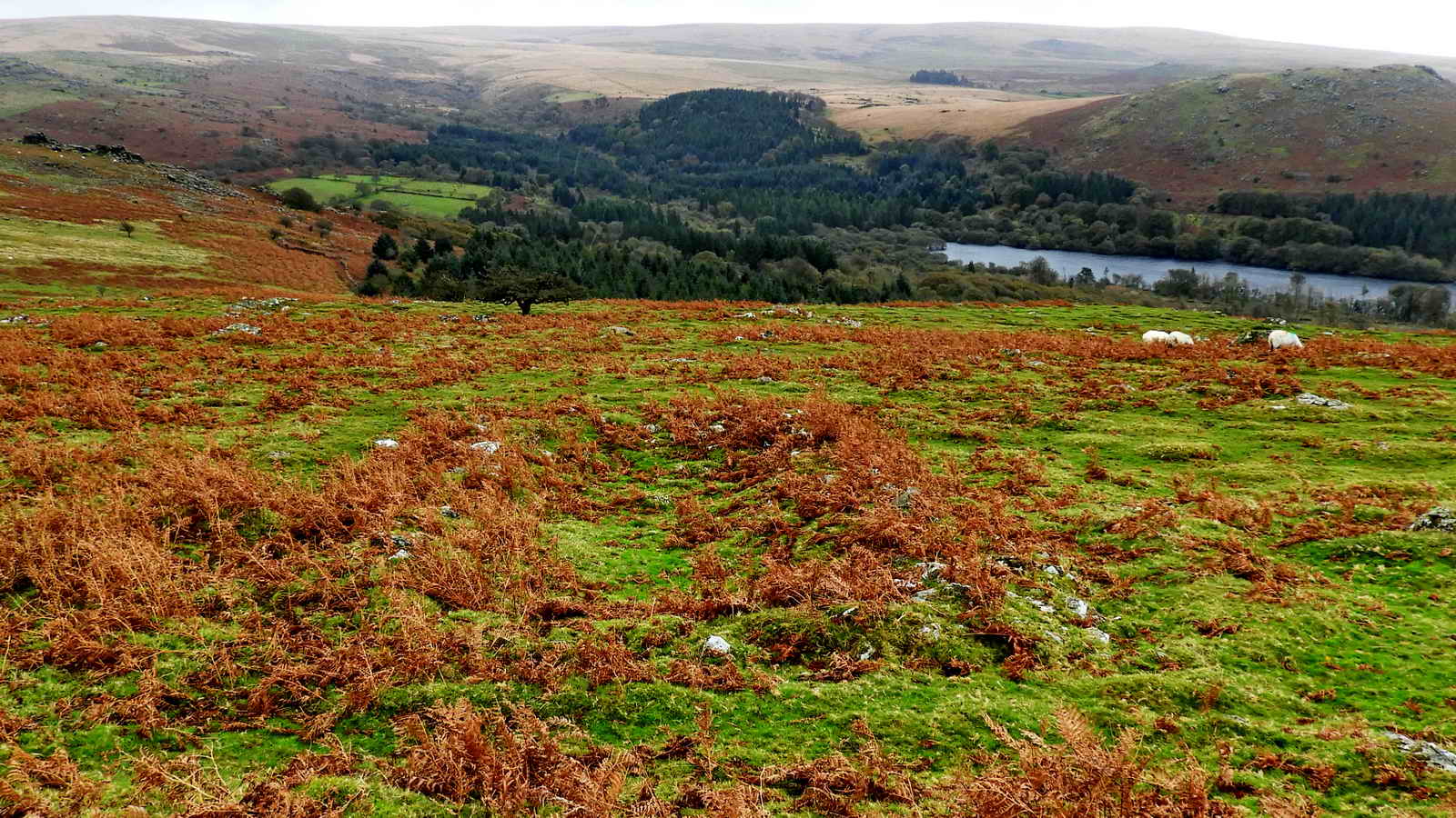
Looking at Burrator Reservoir from the top of Peek Hill .....

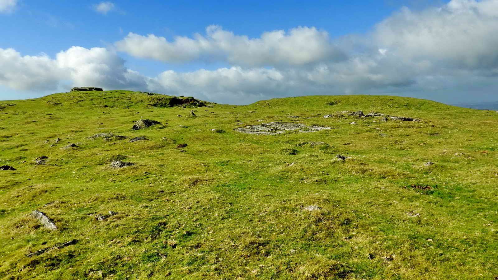
Dispersed Bronze Age cairn near the top of Peek Hill, SX 55618 69935.

Looking towards Leather Tor at bumps in the ground, reminiscent of "thufurs", or features formed by periodic freezing and thawing, possibly simply "frost heave".

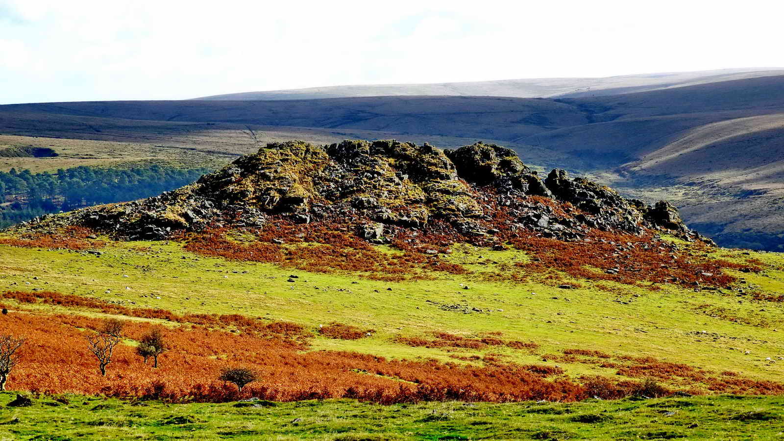
Lowery Tor, SX 55630 69780, elevation 367 metres (1204 feet), a small tor overlooking Burrator Reservoir .....

Zoomed view ..... over halfway down the image, about a quarter of the way in from the left, the sun can be seen reflecting from the new roof at Lowery Barn. Lowery Tor was listed as one of many "Lowery"-named items on a web page from the 25th April 2017 DPA Short Walk, and there is also a dedicated "Lowery Locations" page .....

Zoomed view to Lowery Barn.

Leather Tor seen from Lowery Tor.
Medieval longhouse: - 50 metres NE of the old tree at SX 55793 69927
Quote: Longhouse: SX 55770 69960; Outbuilding: SX 55800 70000.
MDV28528 - Deserted farmstead on Peek Hill
Department for Culture, Media and Sport, 1980, Scheduled Monument
Notification (Schedule Document). SDV220897.
SX 5577 6996; SX 5580 7000. The remains of a medieval settlement on
Peek Hill, comprising a longhouse and outbuilding. The longhouse
measures 13 metres by 4 wide internally, with walling of small
undressed stones 1 metre wide and 0.6 metres high. It is set at right
angles to a fairly steep south slope into which the north end is cut
to a depth of 0.5 metre. The house has rounded corners, a centrally
placed entrance in the east side and an annex attached to the north
western side. A hollow, adjacent to the south eastern side of the
building, represents a drainage ditch. The outhouse lies to the north
east. It measures 8.4 metres by 2.9 metres internally with similar
walling 0.8 metres wide and 0.6 metres high, and an entrance near the
rounded corner in the south west. An outshut is attached to the north
eastern wall. Scheduled.
Ordnance Survey Archaeology Division, 1980, SX56NE185, 3/9/1980 (Ordnance
Survey Archaeology Division Card). SDV220899.
On a shelf on the south-east slope of Peek Hill around 388 metres
ordnance datum are the remains of two probable medieval buildings.
One of the longhouse type at SX 5574 6995 measures 12.3 metres by 3.9
metres internally, with walling of small undressed stones 0.8 metres
wide and 0.6 metres high. It is set at right angles to a fairly steep
south slope into which the north end is cut to a depth of 0.5 metres.
The house has rounded corners and a centrally placed entrance in the
east side.
The second building, probably an outhouse, measures 8.5 metres by 3.8
metres internally with similar walling 1.0 metre wide and 0.7 metres
high, and an entrance near the rounded corner in the south-west. A
possible out-shut 2 metres square internally has been built on its
northern wall.
There are no fields in the immediate area excepting the enclosure at
SX 5578 7015.
Information from the Devon & Dartmoor Historic Environment Record
This is the longhouse, at SX 55736 69960 � 2 metres. This is not easy to see in the bracken ..... An end wall is seen near the bottom of the photograph, occupying the central third, with two walls running down the slope to about halfway up the photo. To see a better view with no bracken, see Johnie's, Meanderings, 5th photograph down the page, (giving SX 55740 69959) from a post dated Feb. 2013 .....

This is a view of the outbuilding, this construction is definitely there - the photograph shows just a near corner of the walls, the bracken obscures most of the remains! The GPS reading for this was SX 55798 70004 � 2 metres. The archaeological descriptions above are dated 1980 - perhaps the spreading bracken has become more of a problem 37 years later. Who does the gardening up here? At least the trusty volunteers of the DPA have cut the bracken on the Bronze Age enclosure wall in the next photograph (see the DPA Blog Tues. 5th July 2016) .....

A Bronze Age pound wall of earth and stones built off the extension of the Walkhampton Common Reave running from Sharpitor (ahead) back towards Peek Hill - away over to the left outside this photograph. There is another reave between to south end of Sharpitor (the right end in this photograph) to Leather Tor. The Leather Tor reave is pictured in Andrew Fleming (1988), The Dartmoor Reaves - Investigating Prehistoric Land Divisions, BT Batsford Ltd, London, page 50, where it is described as "apparently subdividing open pasture land". From the north end of Sharpitor, the Walkhampton Common Reave runs a long way north to the Princetown railway; this is a watershed divider between the Walkham and Meavy valleys. Reaves were described in detail on the 25th May 2017 Ingra Tor walk and some of this information is copied further down this web page.

Image © J Butler 1994. Reproduced by kind permission (ref. 29
Sept. 2012).
The enclosure and reave are described by Jeremy Butler (1994), Dartmoor Atlas of Antiquities III, The South West. 45.5 Peek Hill North enclosure and cairns, page 40: The enclosure is seen below the label "Sharpitor" above and the worn-down wall in the photograph above is the section nearest the "Leather Tor" label..

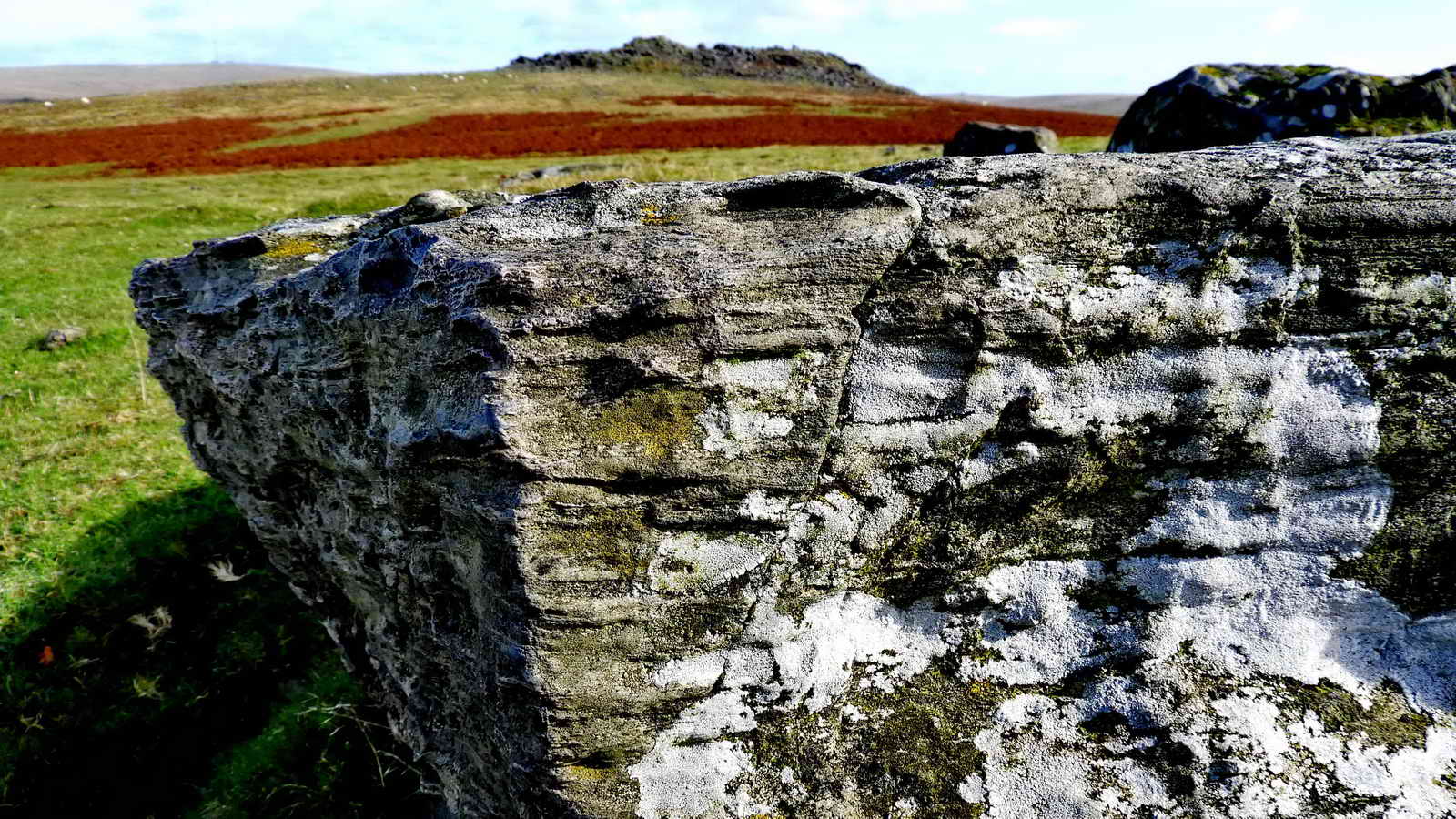
DPA boundary stone at SX 55830 70185, one of five around the Sharpitor property, just a few metres from the enclosure wall seen in the previous photograph. The letters "DPA" can just about be recognised behind the effects of weathering and the lighting of the moment, but just for illustrative purposes, here is another stone from the other side of Sharpitor that shows the design of the stones much better .....
Not seen on this walk, but included to show what the DPA stones look like when not too disguised by lichen growth and poor lighting .....

A low-angle photograph of the DPA stone at SX 56145 70465, on the north-east corner of the land, with Stanlake Plantation behind, taken on another walk (29th April 2015).
A short movie taken during the first reconnaissance for this walk:
|
Dartmoor CAM movie. TIPS .....
A movie scanning from a view of the southern aspect of Sharpitor, panning right, passing Princetown, and looking at the impressive northern aspect of Leather tor. |
|
Click the photo to download |
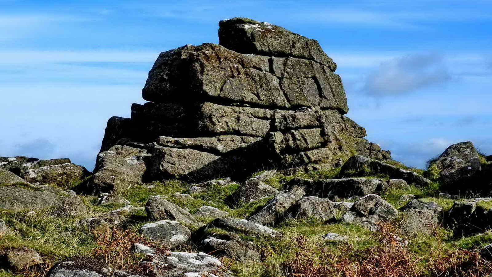
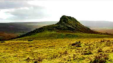
The relatively small rock pile seen near the centre of Sharpitor, not so high as the piles at the ends of the tor ..... if you look over the ridge to the right in this photograph .....

View looking to the east, up the Meavy valley. At the top left are the trees of Princetown, next to the right are trees of South Plantation, and finally, as a small "dot" is South Hessary Tor. The trees in the middle ground are those of Stanlake Plantation, at the north-west corner of the woods at Burrator .....

In the middle of this scene is Hart Tor, SX 5813 7200, elevation 390 metres (1279 feet) .....

Much-zoomed view.

The unfinished cross at Sharpitor (or is it?!). This is at the north end of the tor, with easy access from west side.

An unfinished trough almost at the foot of the "cross".

An attempt to show Walkhampton Common Reave running down the centre of the image from Sharpitor across Walkhampton Common to the north.
This reave was described and illustrated in some detail during the 25th May 2017 DPA Short Walk, from which the following soupcon is taken .....
Reaves - land boundaries of heaped stones
There are essentially four types of reaves:
Walkhampton Common Reave separates the Meavy and Walkham Valleys with a remarkably straight central section, overgrown by peat. Unlike the other water-shed reaves this one is not aiming for a tor or skyline barrow. The reave can be traced from SX 5600 7050 in the clitter of Sharpitor, to SX 5784 7807 at a terrace of the disused Princetown to Yelverton railway line. The total distance is 3170 metres and although there are small irregularities it maintains remarkably straight courses with one re-alignment in the vicinity of an enclosure. Associated with stone alignments, huts and cairns.
Ingra Tor, SX 555 721, elevation 339 metres (1112 feet), caught in sunlight. In the background, extreme left, Middle Staple Tor, Great Staple Tor, Roos Tor (left of centre) and White Tor aka Whittor.

Another DPA boundary stone at SX 55919 70560, seen while returning to the car park on the main road - seen behind the stone.

The story of the DPA Christmas Tree on Sharpitor - see the last photograph in this 11th December 2016 entry in the DPA blog.

On reconnaissance walk no.2, a last look for the Goad Stone was made at SX 56177 70880, where the green track from Routrundle crosses the main road and continued down to Stanlake. In common with other seekers, there seemed to be no pertinent indecipherably marked stone. The wooden post marks the track today as a bridle way and the new concrete structure has signage saying "Street Lighting - Traffic Signals". Perhaps a new radar-operated speed indicator for drivers exceeding the speed limit?
MAP: Red = GPS satellite track of the walk.

� Crown copyright 2016 Ordnance
Survey
Licence number 100047373
Also, Copyright � 2005, Memory-Map Europe, with permission.
This walk was reached by parking at the larger of the two car parks on the north side of the B3212 road from Dousland (Yelverton) to Proncetown, at the bottom of ther hill that has the pool on its top. The car parks are marked by yellow crosses on the map.
Statistics
Distance - 3.51 km / 2.18 miles
All photographs on this web site are copyright © Keith Ryan.
All rights reserved - please email for permissions