![]()


This walk: 2021-10-25. Crip Tor, Swell Tor, tramways, granite setts, Sailor's Home Quarry, powder store, inclined plane, Foggintor Quarry, Ingra Tor Quarry, tramway railhead loading quay, sett makers' bankers, Manager's House, Foreman's Office, Blacksmith's Shop, winch features, Engine House / Compressor House, drill testing stone, loading quay, Crushing House, railway siding, wooden sleepers, weighbridge site, London Bridge corbels, Points Shed site, buffers, King's Tor, King's Tor Quarry, Little King's Tor, logan stone, platelayers' hut base. D365-(M6), N5, N6.
This walk is modified from a recon walk on 7 July 2020.
Walk details below - Information about the route etc.
Previous walks in this area: 27 June 2007, 23 July 2010, 6 April 2011, 6 August 2015
Reconnaissance walks: 7 July 2020, 15 July 2020
Google Satellite map + GPS track of the 7 July 2020 reconnaissance walk
Further reading
Old maps
OS 25 inch single sheet England and Wales, 1841-1952 (surv. 1883/publ. 1885) - original Smithy is up hill
OS 25 inch single sheet England and Wales, 1841-1952 (surv. 1904/publ. 1905)
To save time and space, this web page has no mention of the walk from the Yellowmeade Track car park (B3357) and back: this web page starts at Foggintor. See 25 Feb. 2019 for Foggintor details.
An introduction to Swill Tor, plus some other local names .....
Rev. Bray 1831 ..... writing on May 17th, 1831, about an excursion on Dartmoor Railroad i.e. Tyrwhitt's 1823 Plymouth & Dartmoor Railway. In: Mrs Bray (1836), The Borders of the Tamar and Tavy, Vol 1 of 3, page 279 .....

| "Yeast Tor" above no doubt refers to the
diminutive Yes Tor at SX 5637 7259, in the area of Yestor Brook,
Yestor Bottom and the ruined Yestor farm. The latter has been traced
back to a lease in 1673 when it was referred to as Yeastor aka Easter
Green. Source: Mike Brown (2001) Guide to Dartmoor, CD-ROM, Dartmoor Press, Grid Square 5630 7279: Revd. Bray's mystery name solved! Yeast Tor = Yeastor = Yestor (originally East Tor). |

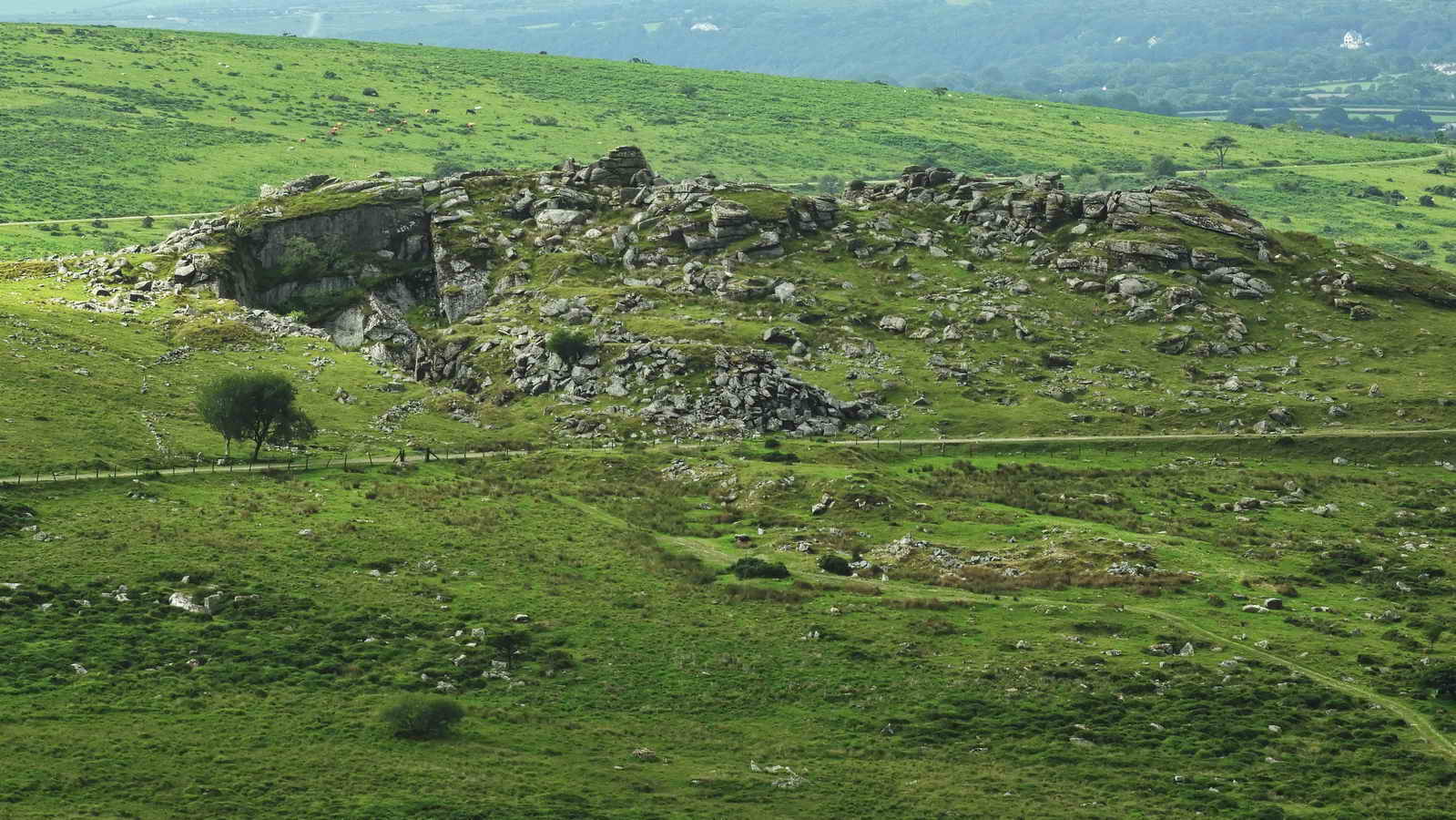
Crip Tor (left) and waste tips at Swell Tor (right). The track up the middle (an inclined plane) is the old tramway from Foggintor that branched off the 1823 Tyrwhitt horse-drawn PDR - Plymouth & Dartmoor Railway. The feature across the photograph, near the camera, is the old 1883 GWR-Princetown Branch Line. The track runs straight to the top of Swelltor Quarry and has two side branches running left, around the hill. The first side-branch (hard to see here) ran to Sailors Home Quarry. The second branch, which this walk follows, and is seen in the photograph, runs left to Crip Tor Quarry (this being the quarry into Crip Tor). These are both seen in the photographs below. There is another Criptor Quarry, near Criptor farm, at SX 5587 7295. The photograph was taken from beside siding that runs to Big Tip, at Foggintor.
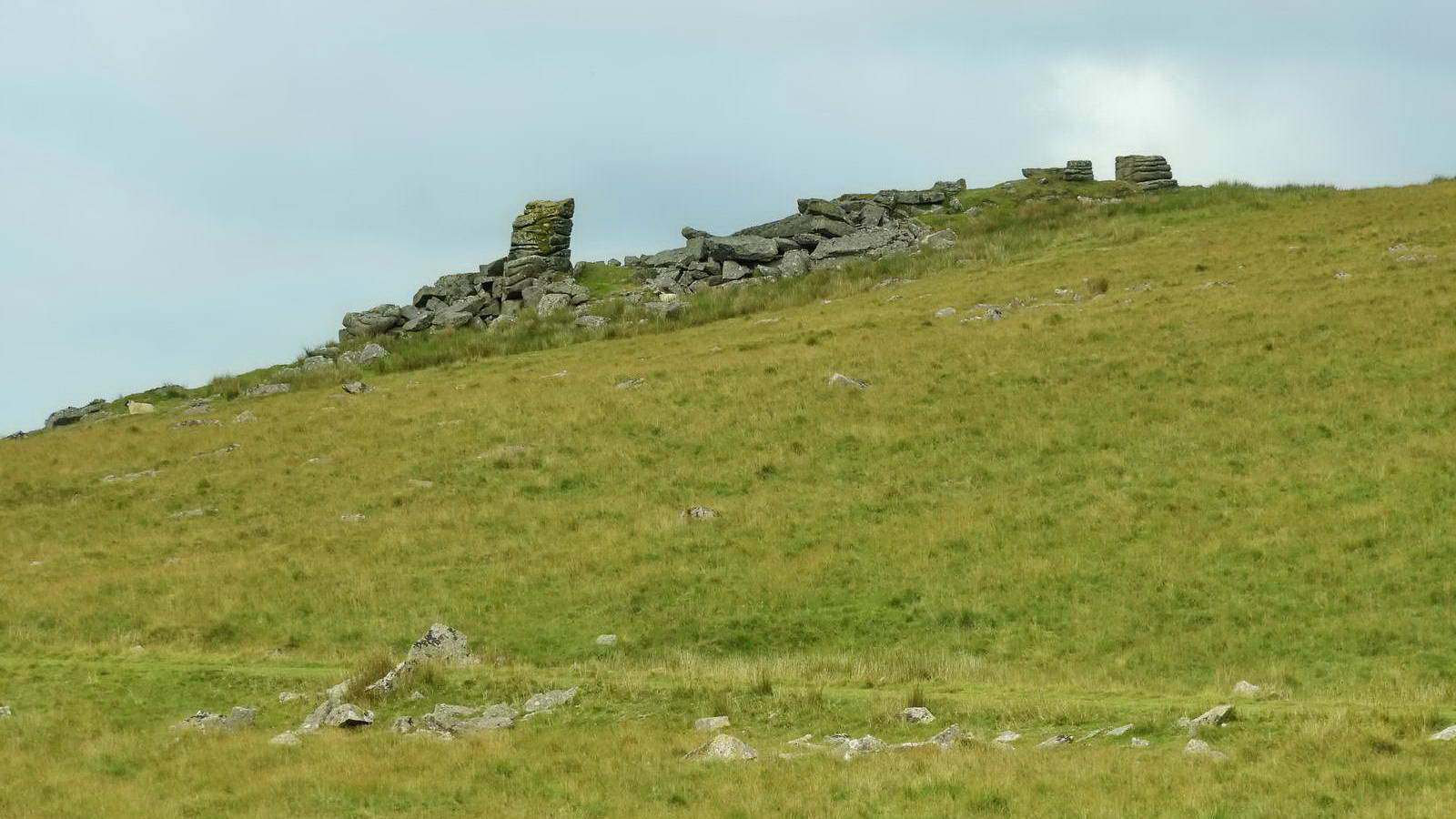
Crip Tor, SX 5616 7317,
is quite noticeable when approaching from Foggintor elevation approx.
386 metres (1,266 feet). It is identified on the
1840 Tithe Map of Walkhampton Parish, although
there is some dispute about the name today. However, it is mentioned in
1831 by the Revd. Bray, cited by his wife in: Mrs Bray (1836), The
Borders of the Tamar and Tavy, Vol 1 of 3, page 279, and in two books by
William Crossing �Amid Devonia�s Alps� 1888 (p.205) and �A Hundred Years
on Dartmoor� 1902 (p.121). It certainly used to be known as �Crip Tor�.
A nearby farm is called Criptor, named presumably after Crip Tor, and
the farm also has a small, disused quarry also known as Criptor Quarry.

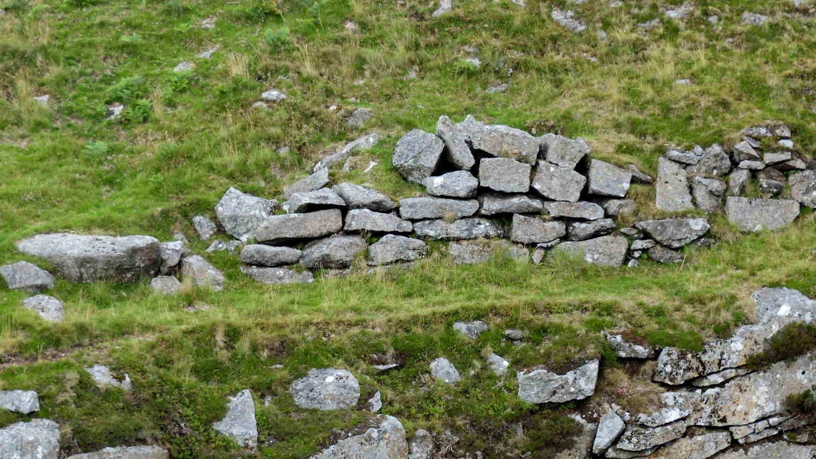
Granite setts in the track that once bore the iron rails that guided wagons carrying granite. These were presumably guided down by horses taking the strain of the weight of the loaded trucks. Fixing holes for the fishplates that bore the rails can be seen some setts .....

As previous photograph.

The track approaching the tor.

A closer view - this rocky tower can be seen later as a landmark at the top of an inclined plane that ran down the other side of the tor, again to the old railways.

Inside Crip Tor Quarry, although possibly more properly called Sailor's Home Quarry ..... we are standing more or less on the end of the tramway track ..... not much of the tor remaining .....

A sturdy gunpowder store in the quarry, possibly used as a shelter during blasting .....
Devon & Dartmoor HER - MDV61878 - EXPLOSIVES STORE in the Parish of Dartmoor Forest, Walkhampton
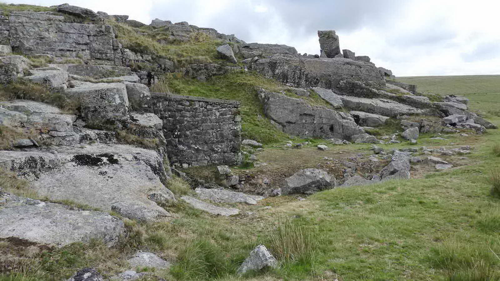
Side view of the powder store .....

Looking into the quarry below - this is Sailor's Home Quarry (Hallett, map p.63, p.69), and the first (lower) side branch off the tramway going straight up Swell Tor ran around the hill into the far end of this view, close to the cleft in the rocks. The old 1823/1883 railway trackbed (pale coloured) can be seen clearly down the hill. Just to the right of the cleft, at the far end of the long workface on the right, is the access to the inclined plane that runs down to the 1823 / 1883 railway.
A diversion to look into this quarry .....
The double "wall" at the right edge of the photograph is at the top of the inclined plane .....

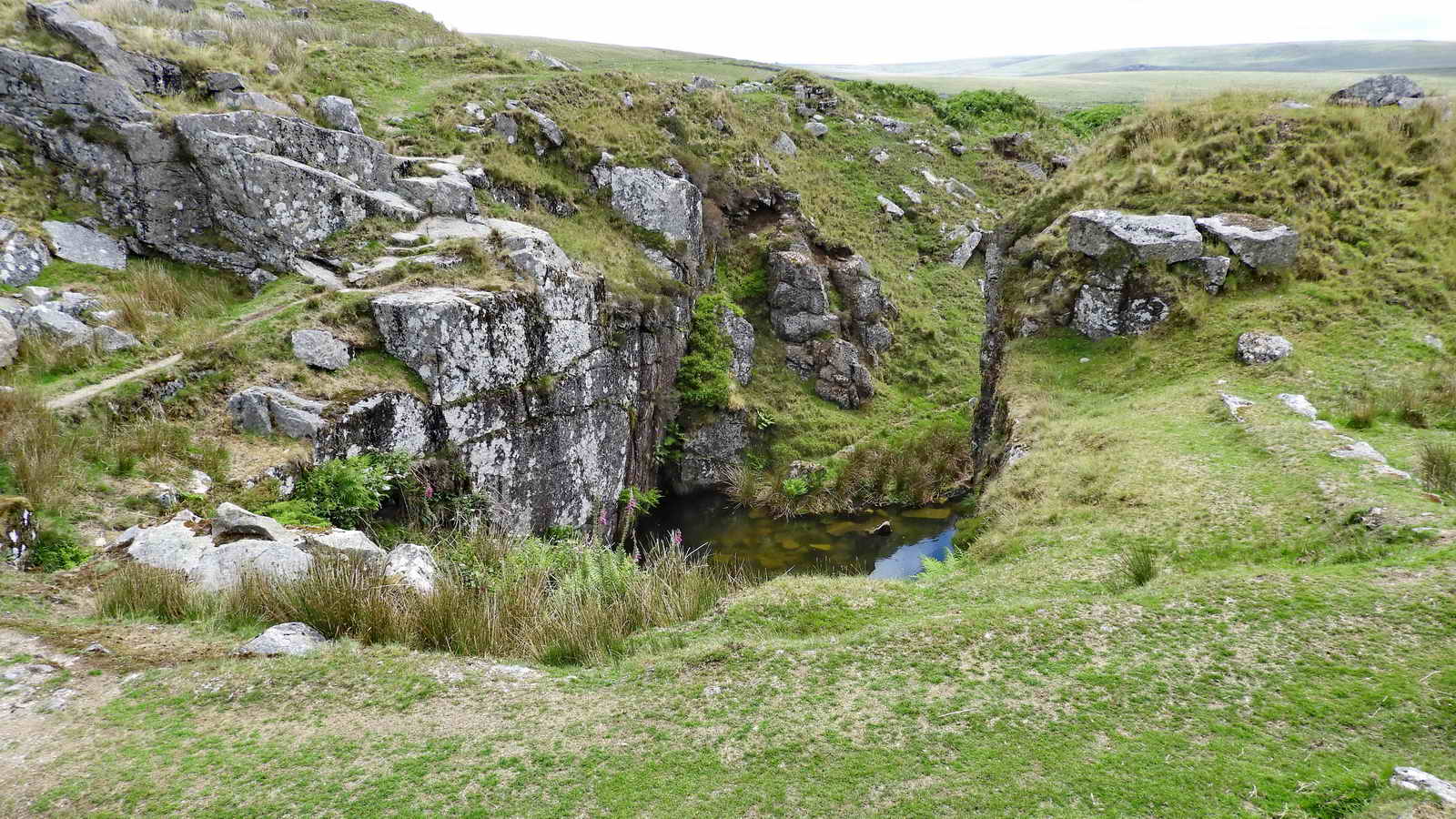
View into Sailor's Home Quarry .....

Inclined plane with some granite setts in
situ ..... there are stone-lined drainage channels in the plane, mostly
V-shaped.
Devon & Dartmoor HER - MDV80767 -
Plymouth and Dartmoor Railway, inclined plane
Crip Tor at the top of the inclined plane .....

Crip Tor "stack" as a landmark.
Back to the group walk .....

Another view of the explosives store.

View over to the large quarry at Foggintor, with North Hessary Tor transmitter mast beyond and with Hollow Tor (far left).
Zoomed view to Ingra Tor with its quarry to the left and the old railway track-bed running across the photograph. The track behind the tor appears to be that running down towards the northernmost of the two circular pounds at Routrundle.
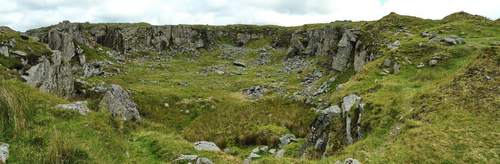
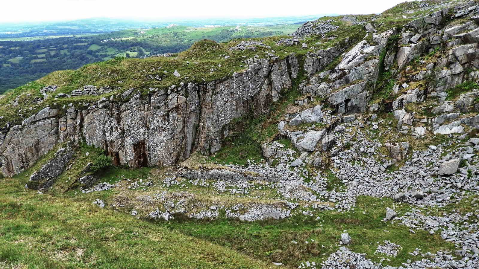
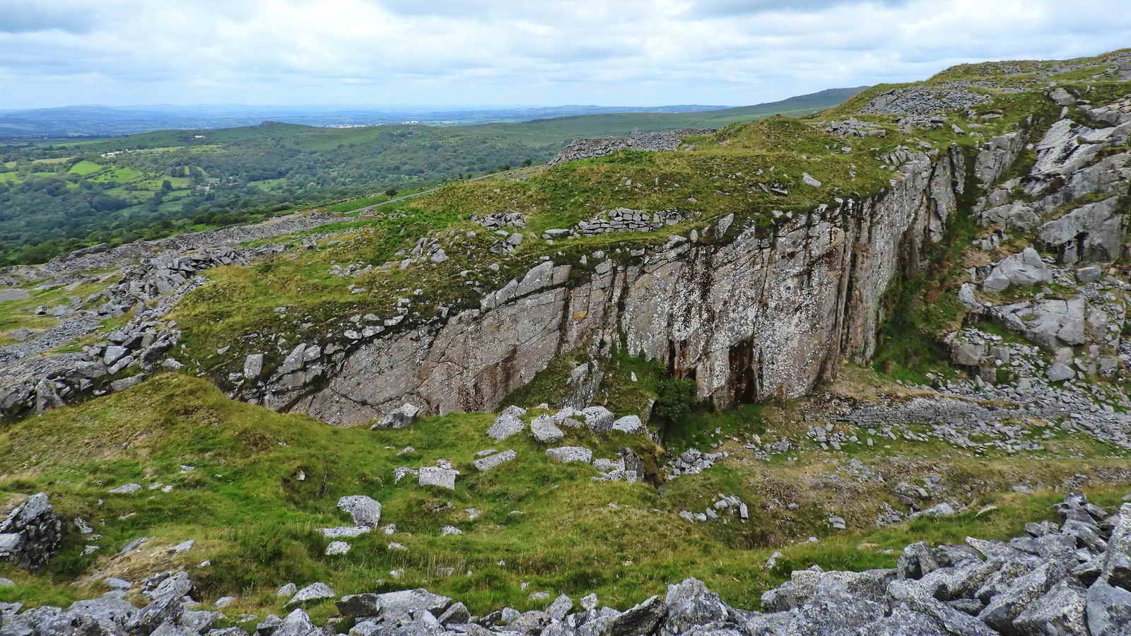
Overview, and today's best view, of Swelltor Lower Quarry; the entrance is hidden in a cleft at the extreme left - and another same-sized quarry is hidden through an entrance to the right - see the next photomontage. Click the image to see a larger version.

Swelltor Upper Quarry - the view is through the connecting cleft to the lower quarry looking down towards the Smithy's Shop. Click the image to see a larger version.
There is a built structure In the centre of this photograph of the lower quarry in the area that on the old map was a "railhead", or end of the tramway out of the quarry .....

Closer view of the possible loading quay.

Remains a building, SX 55982 73237 - it
has a good view of the far-side workfaces; possibly matched by a similar
structure across the quarry in the next two photographs? It might be
part of the original Smithy, shown in the 1883/1885 OS map?
OS 25 inch single
sheet England and Wales, 1841-1952 (surv. 1883/publ. 1885)
- original Smithy uphill beside (or in) the quarry.
This map also shows the apparently abandoned Swell Tor West Quarry. It also shows the "Upper" quarry to be larger than the "Lower" quarry.
View across the entrance gully into the quarry to another man-made structure on the cliff top .....
Zoomed view.
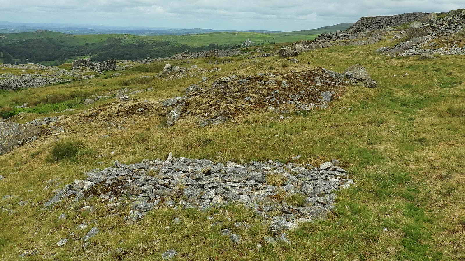
Two sett makers' bankers, where stone workers chipped away at rocks to make the setts that carried the tramway rails - there are telltale piles of rough chippings.

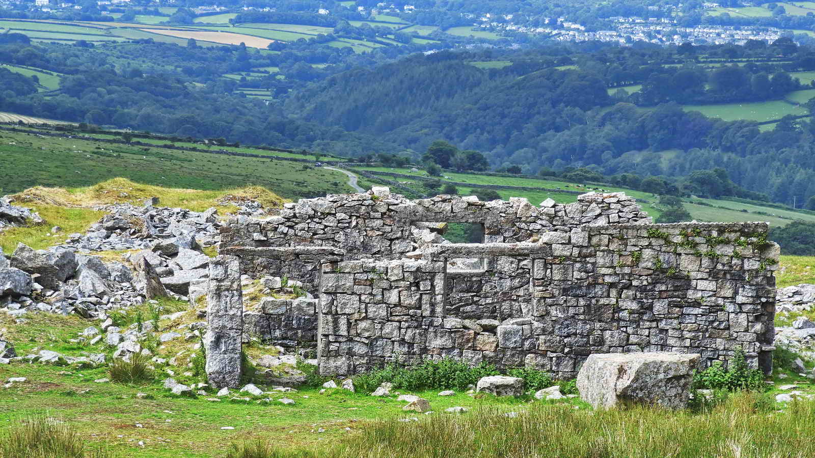
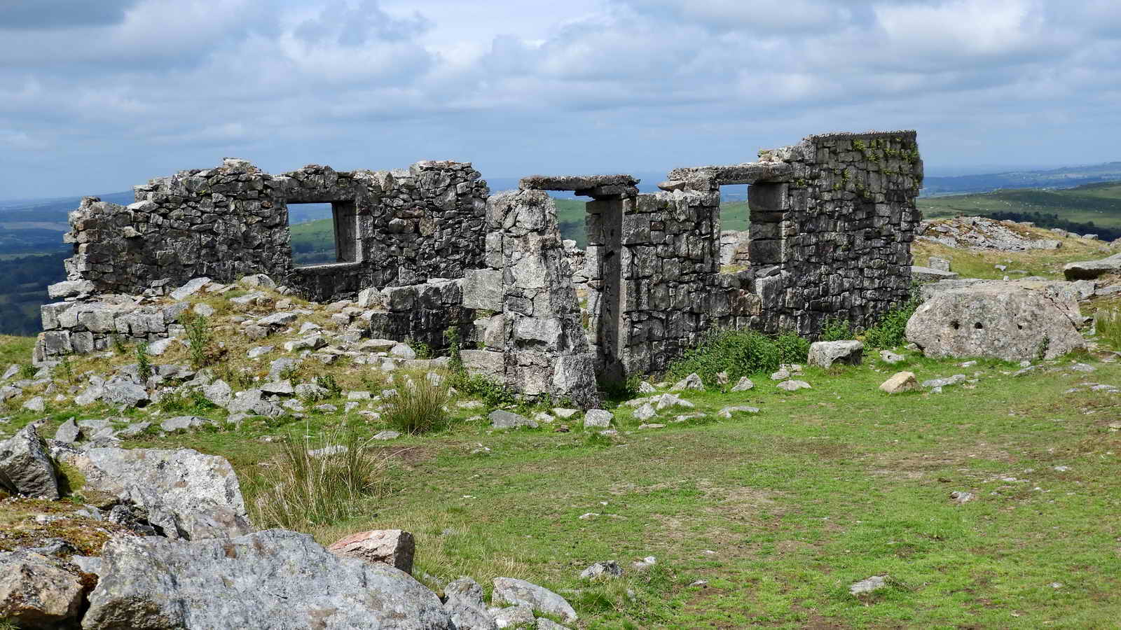
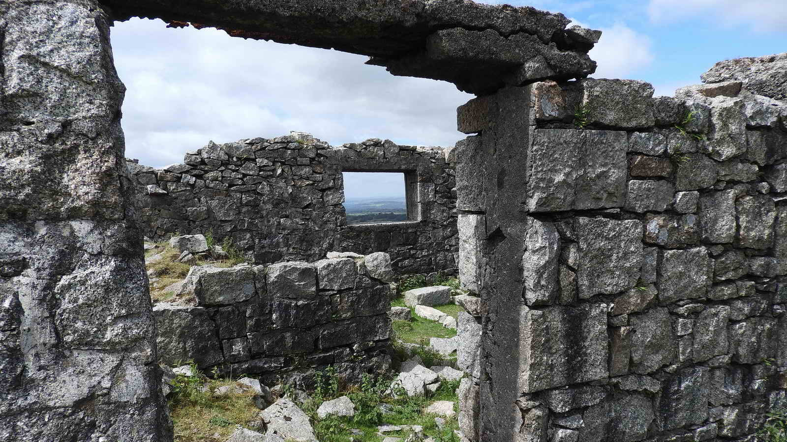
The Manager's House, beside the siding: the Blacksmith's Shop is beyond, with standing walls .....

The Foreman's Office, SX 55920 73164, on the right bank when entering the quarry, looking across the main track at the Manager's House. The Blackmith's Shop is at the upper right edge.
View into the lower quarry ..... showing
the cleft into the upper quarry.
Devon & Dartmoor HER - MDV5004 -
Swell Tor Quarries, Dartmoor
- for details.
The Smithy .....
Devon & Dartmoor HER - MDV51527 -
Remains of smithy at Swell Tor Quarry
Devon & Dartmoor HER - MDV61879 - Blacksmith's shop at Swell Tor Quarry

Foreground - site of a mechanism for winching wagons into the quarry e.g. base for a pulley system?

Close-up of an embedded bolt.

The Steam Engine House / Compressor House
.....
Devon & Dartmoor HER - MDV51526 -
Remains of engine house at Swell Tor Quarry
The Smithy .....
View of the Engine House and the Loading Quay, at front left outside the Smithy is a stone that was used for testing drills.
Winch base, SX 55915 73191, used for pulling trucks into the quarry from the main siding - located in the quarry entrance beside the main track, in the rushes.

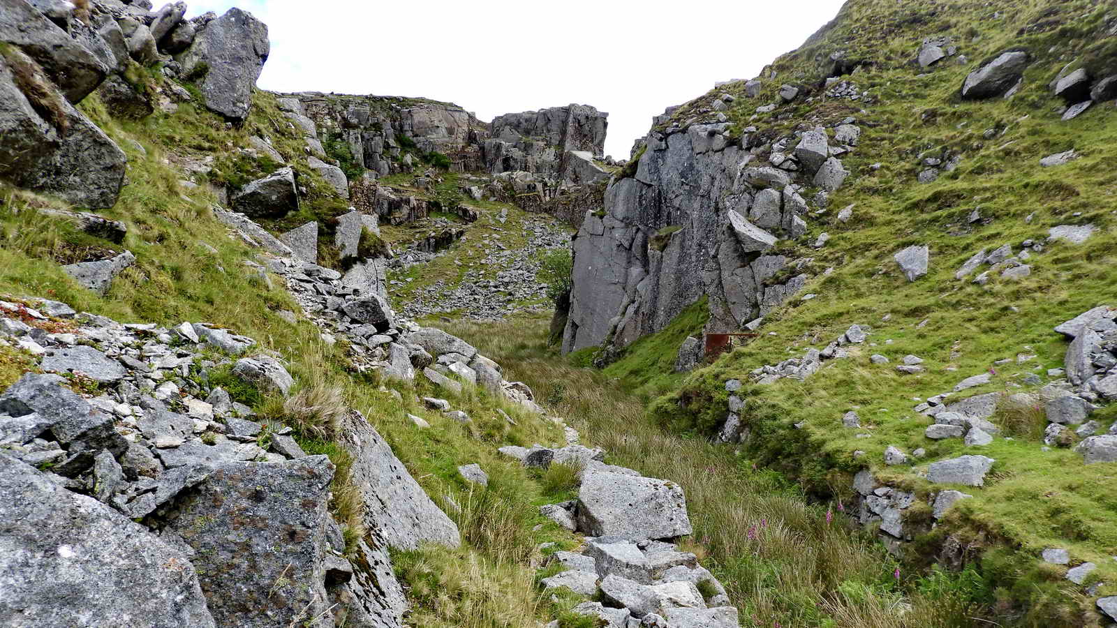
The quarry entrance.
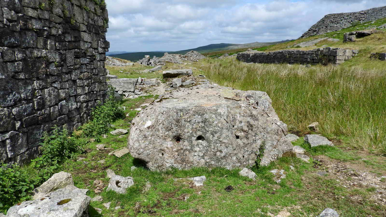
Drill testing stone.
The Smithy .....

View from the back of the Smithy - where the famous Swelltor dinosaur makes an appearance .....

Swelltosaurus roccus - possibly a large relative of Scutellosaurus.

Loading Quay beside the Swelltor railway siding.

Engine House features.

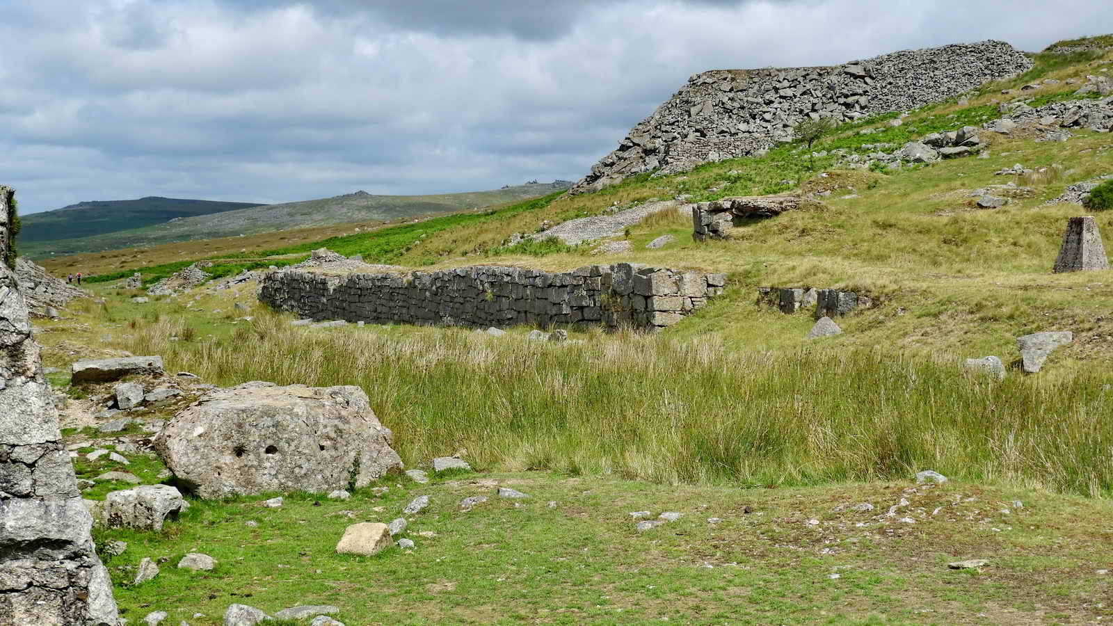
This is the site of the Crushing House for making stone ballast; just beyond this structure is the Engine House.
Crushing area.

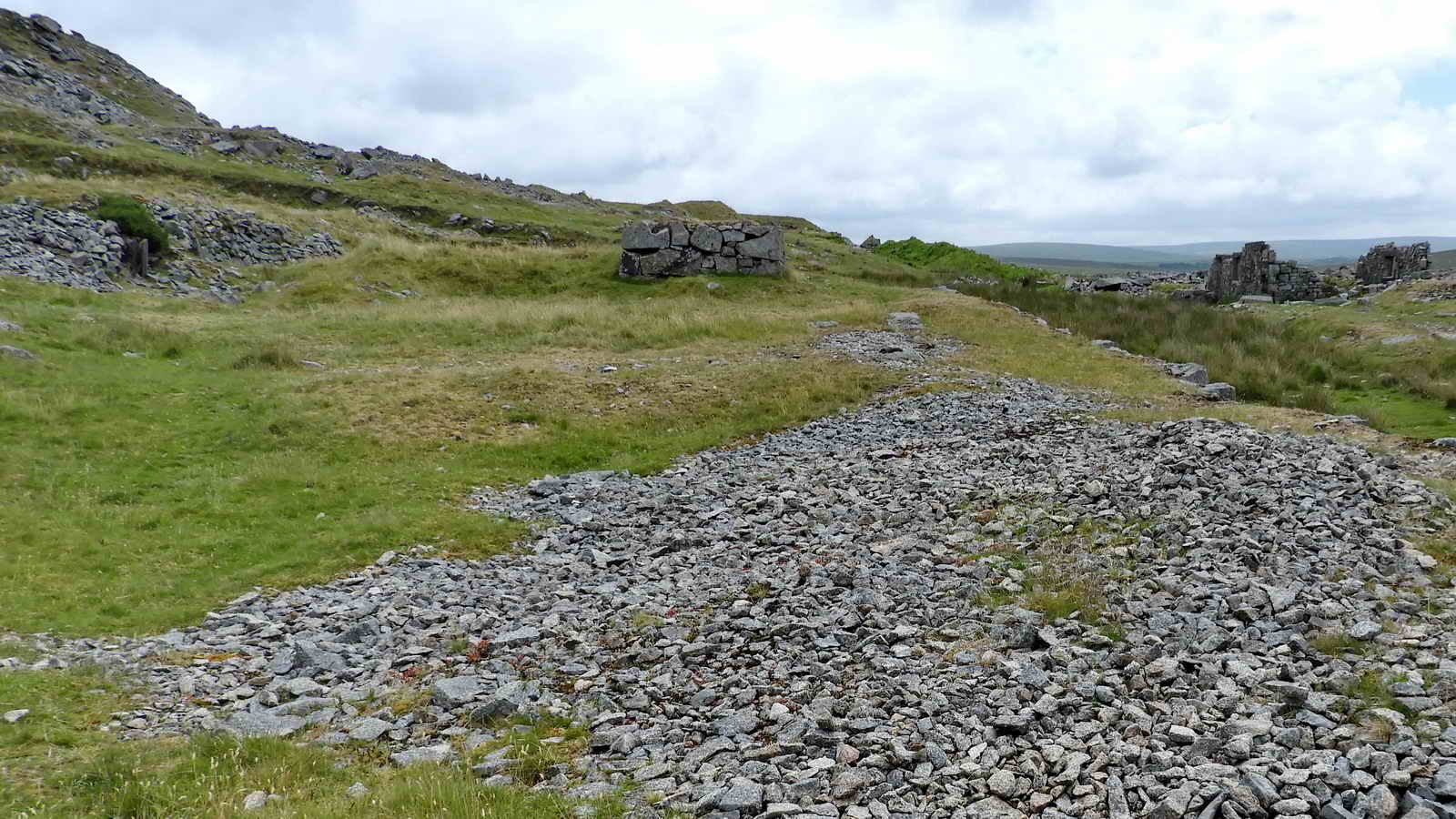
Wooden sleepers on the branch line siding
from the GWR into Swelltor Quarry, still with fixing nails in place
.....
Devon & Dartmoor HER - MDV28209 -
Branch railway at Swell Tor Quarry
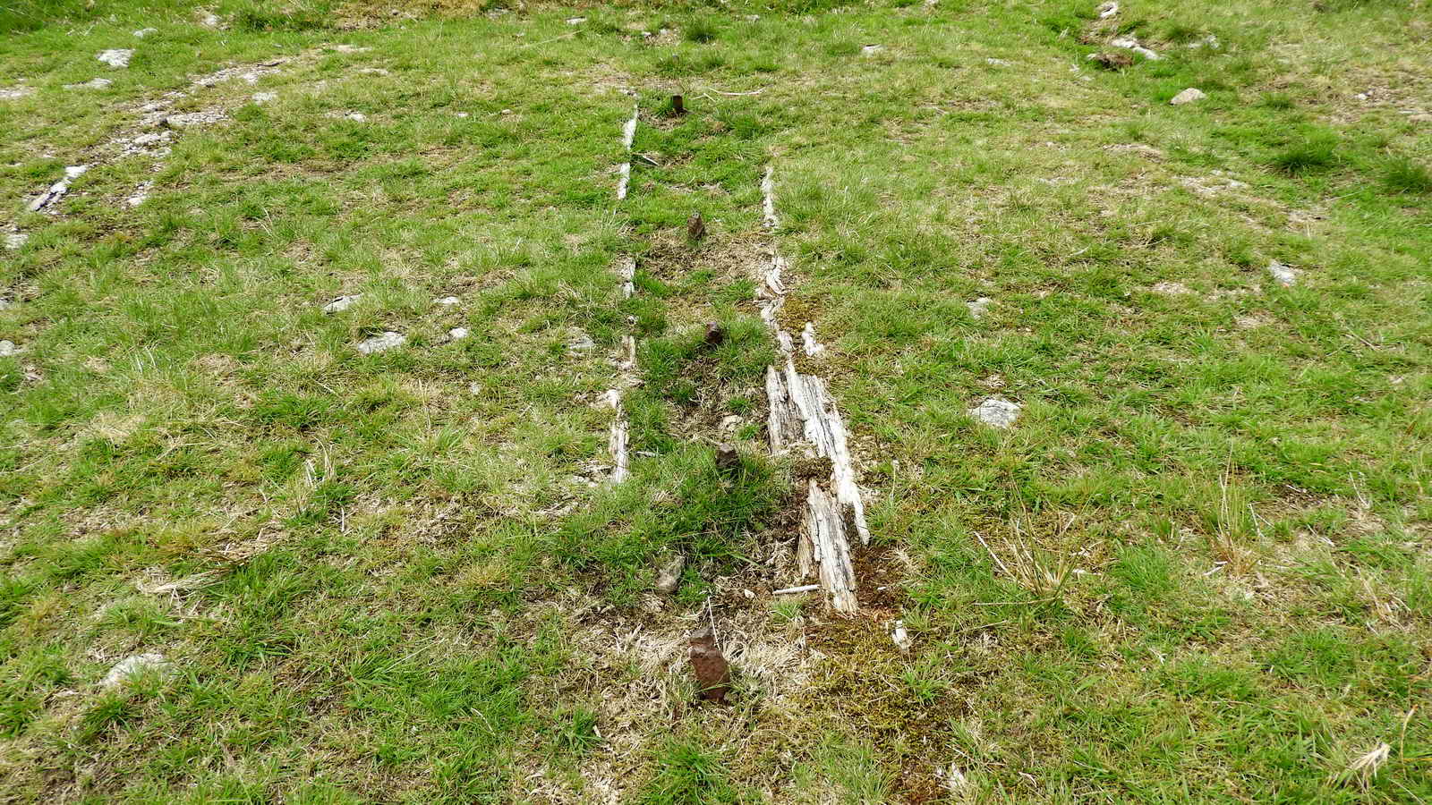
Another view of the nails.

Apparently these are practise work pieces made by apprentices, left on the railway bed.

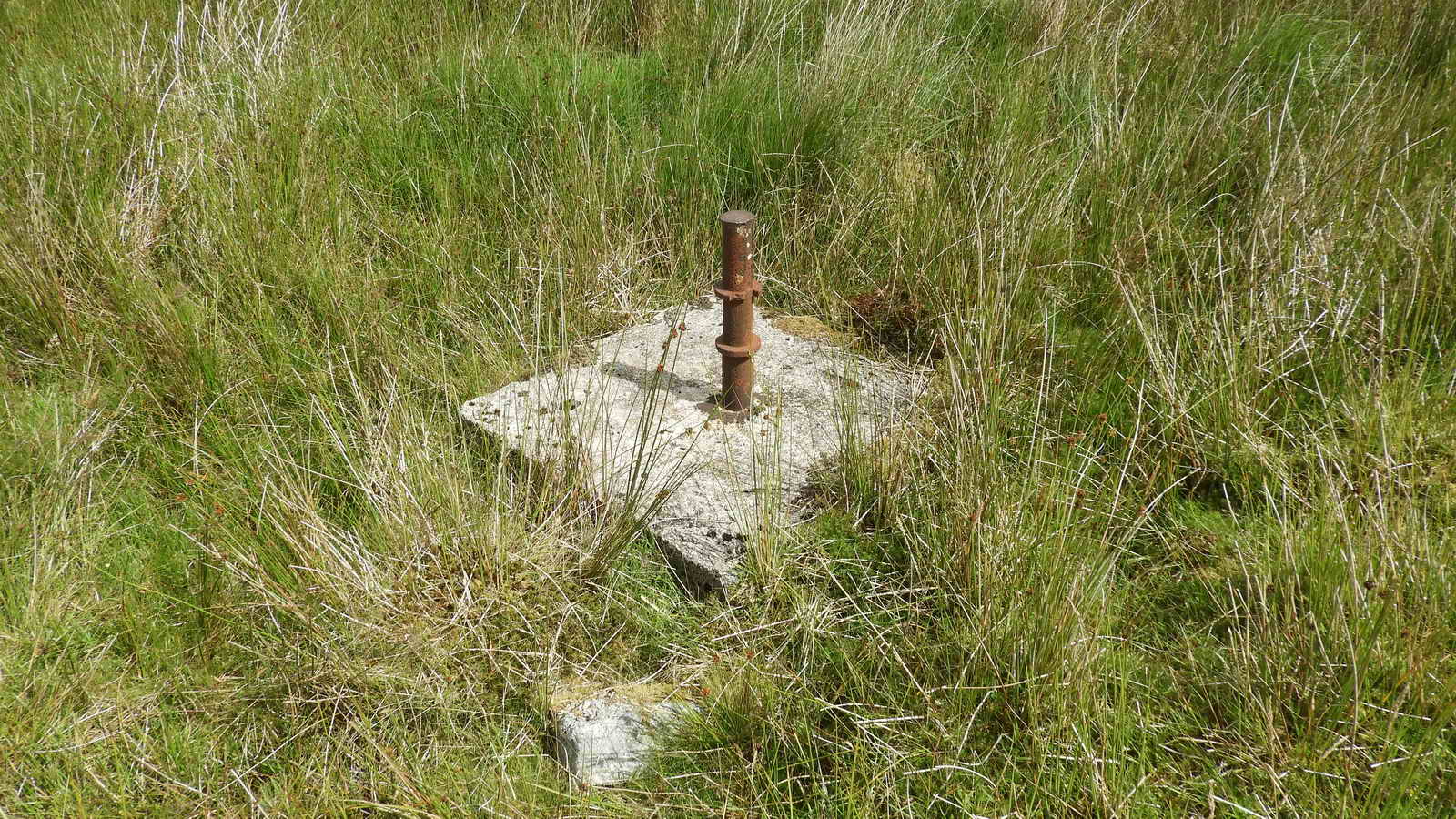
This covered square building was found at SX 55835 73366, during the 2nd reconnaissance walk in the clitters and waste tips above the weighbridge area - not an easy area to explore.

Site of the weighbridge, SX 55745 73291 - the old smithy walls can still be seen in the distance, on the right.
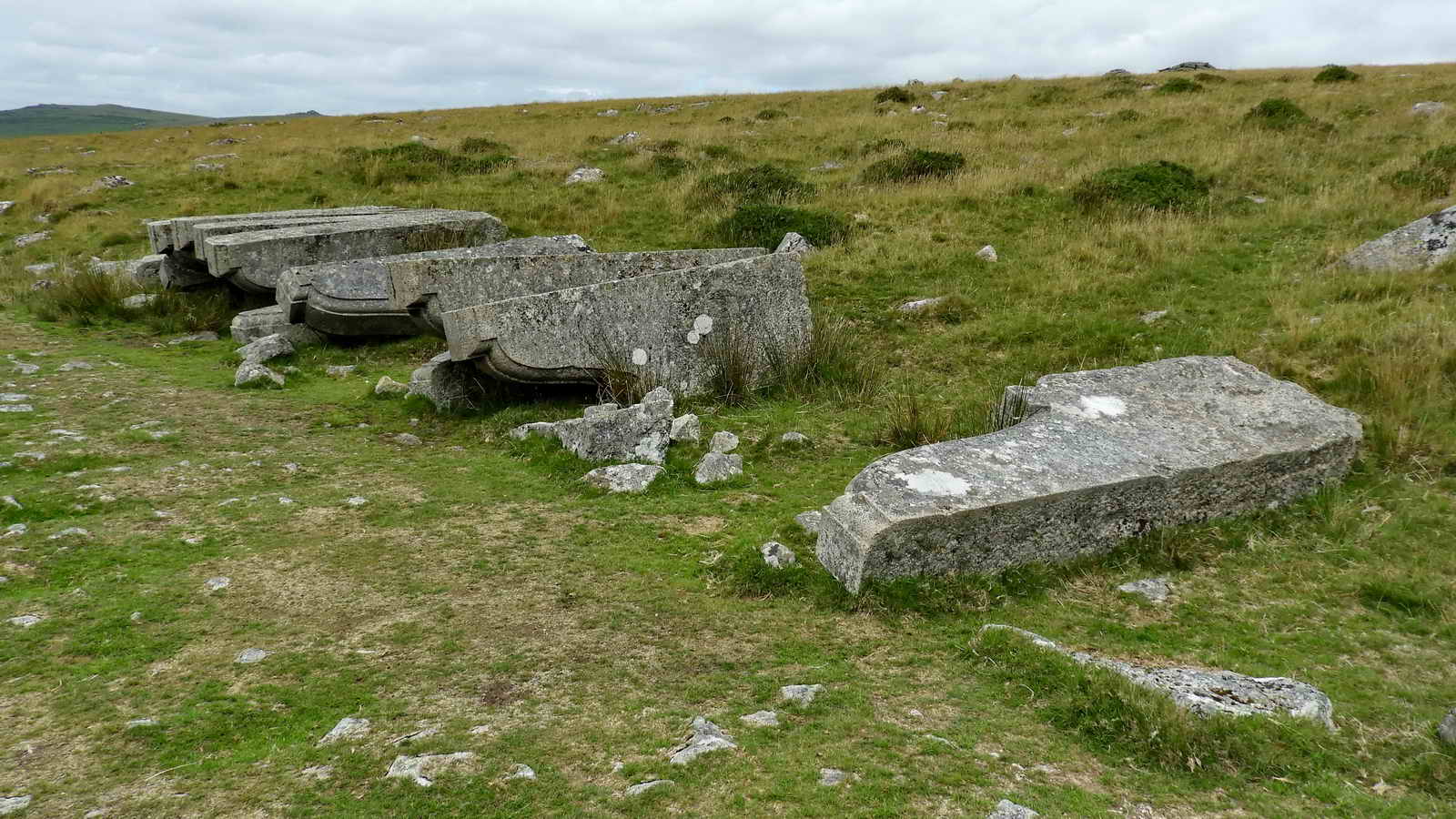
The famous Swelltor corbels (twelve of them left here), 650 were cut in 1903 for the widening of London Bridge. The bridge, "New" London Bridge, was designed by John Rennie, opened by King Wiliam IV and Queen Adelaide, in 1831. It was bought by American, Robert McCullough, in 1968, and re-erected in Lake Havasu City, Arizona.

Some recent history of the time .....
1902
- Grace's Guide - "The bridge was widened to 65 ft in 1902"
1902
-
In 1902 plans were finally put into action and the bridge was widened.
The alterations added four and a half feet to each footpath, and two and
a half to the road
1904 - "Built in 1831 and widened in 1904".
1902-1904
-
"London Bridge was widened in 1902�04 from 52 to 65 feet (16 to 20 m),
in an attempt to combat London's chronic traffic congestion. A dozen of
the granite "pillars" quarried and dressed for this widening, but
unused, still lie near Swelltor Quarry on the disused railway track a
couple of miles south of Princetown on Dartmoor"
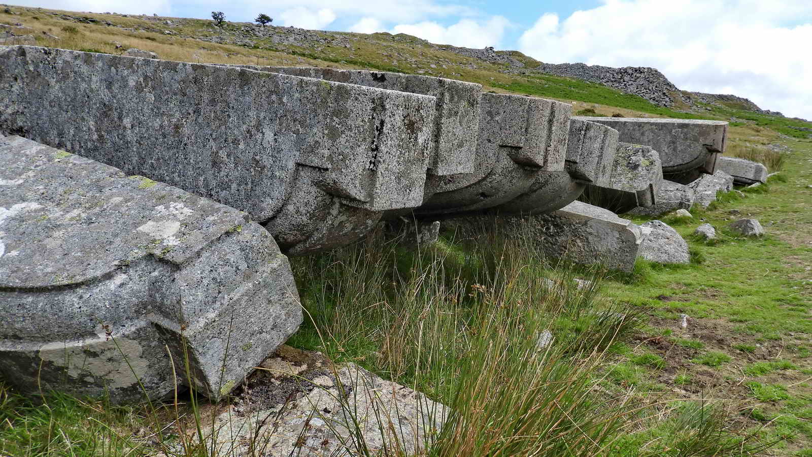
Why are they still here? There has long been conjecture that they were either cut too short or that they were stained with iron (Hallett p.60, K Brewer p.56, Hemery p.1029-1030.
Brewer (p.51) gives their dimensions as noted in The Stone Trades Journal, January 1904, as "The length of each is 10 feet by a depth of 3� feet, and an average width of 1 foot 6 inches, and each has a clear projection or length of leverage 5 feet 6 inches".
Hemery (p.1029-1030) states: "Each measures 9 feet 6� inches long, 1 foot 3� inches wide and 3 feet 7 inches high from base".
Measuring them is not easy because their "inner" ends are rough and miss-shapen. Ten feet = 120 inches, but I measured five as being 110, 109, 110, 109 and 109 inches long, compared to Brewer's specified 120 inches and Hemery's 110 inches long. They are too short?
To see the corbels in action, CLICK HERE.

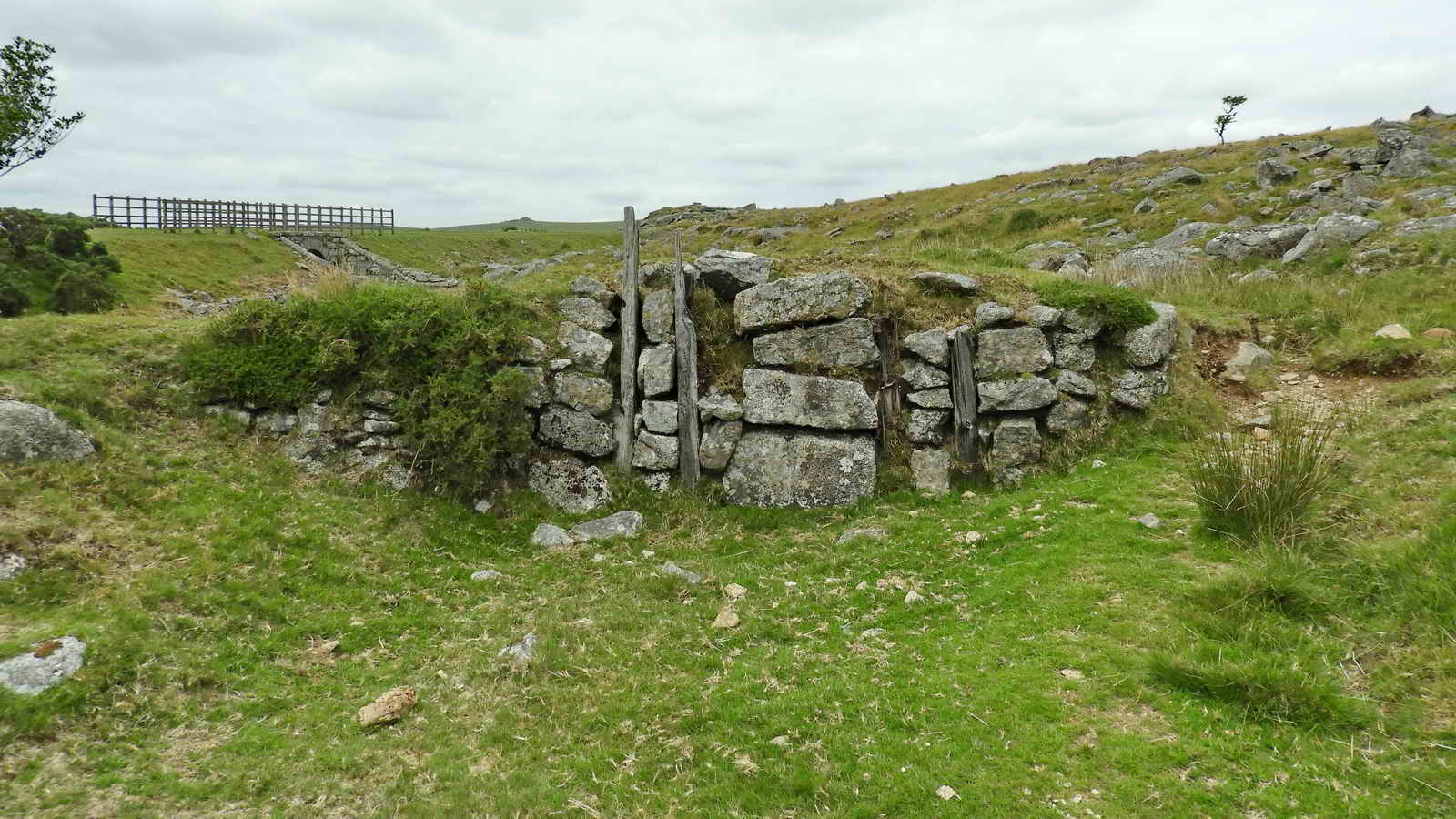
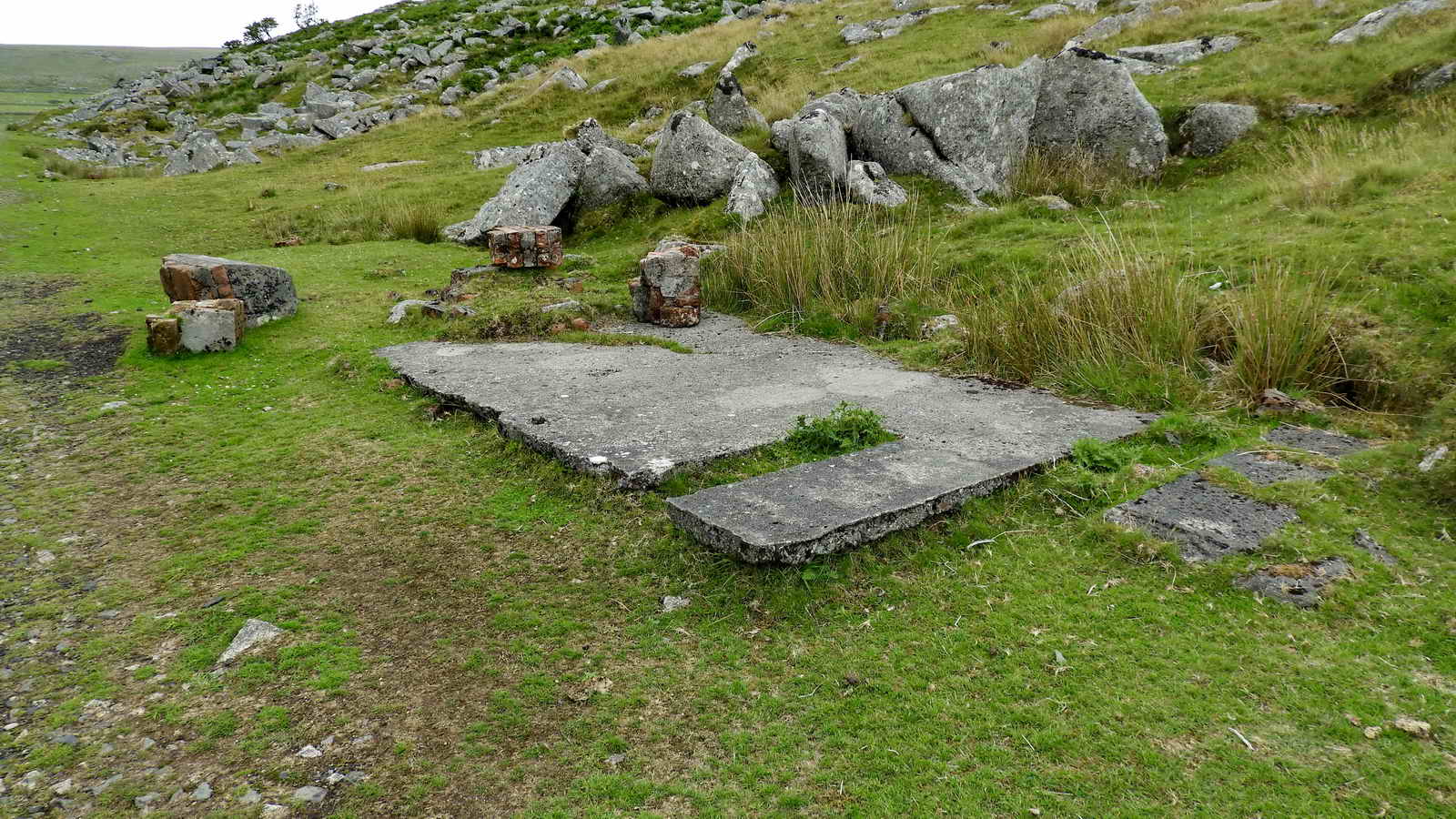
SX 55445 73643 - the remains of two wooden beams embedded in the ground mark the site of the old Points Shed that used to be painted yellow. The points controlled access from the "main" line (coming diagonally from the top right) to the Swelltor siding (running back centrally, left of the "main" line). Apparently, the shed was painted yellow.
SX 55435 73758 - Swelltor siding buffers, at the north-west end of the siding .....
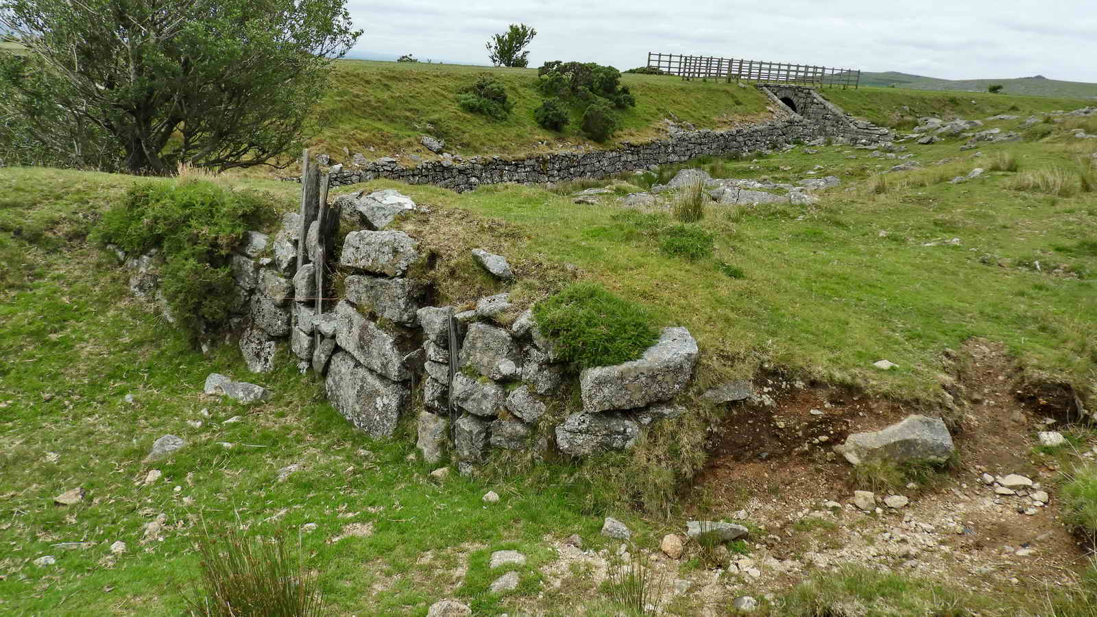
Another view of the siding buffers with a "main" line bridge in the background that allowed livestock to cross the railway ..... this is seen in the map linked in the previous caption .....

SX 55385 73786 - the bridge ..... with two gateposts .....

Clever captive gatehangers that prevent the gate being removed ..... one up, one down .....

King's Tor, at SX 55657 73876, seen through the bridge. Between the bridge and the tor, lies King Tor Quarry - this was the objective of the 1823 Tyrwhitt P&DR tramway, to carry granite to Plymouth docks from the "King Tor Quarries". The line probably went around the tor as far as Foggintor because this was believed started in 1820 under the name of "Royal Oak Quarry". It was extended to Princetown in 1826.
Notes from
Wikipedia � Plymouth & Dartmoor Railway �.
(1)
Williams and Lee (in the Railway Magazine, March 1934), say that �From
Sutton Pool, the Plymouth terminus, to King�s Tor, a couple of miles
short of Princetown, the line was opened with a procession on September
26, 1823�.
(2) At the northern end, Shepherd [page needed]
refers to �the quarries� at Walkhampton; the King�s Tor quarry was on
the high ground within the northward loop of the line when later
completed. Given the shortage of money it seems likely that the
temporary northern terminus was on the approach to Kings Tor; there are
indications on the earliest available Ordnance Survey map (1884) that
support this.
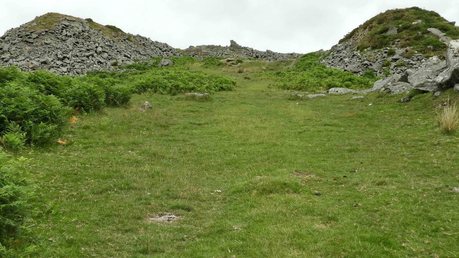
An aside: three photographs from the 2nd reconnaissance walk on 15 July, from Swell Tor summit to Kings' Tor .....

The abandoned face of Great King Tor Quarry, this faces left, west, down to the railway line .....
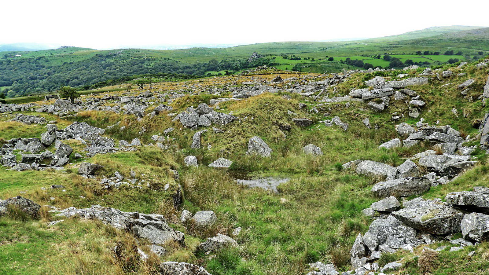
Looking down the quarry, to the railway line, marked by the tree and the railway bridge (actually a cattle "creep" to allow livestock access to the area .....

A zoomed view to the railway bridge.
..... and back to today's walk .....

Little King's Tor logan stone, SX 55345 73915 .....

There is a 6-second video available by clicking on this thumbnail,
with King's Tor behind, from 23rd July 2010.

Little King's Tor, located between the 1823 Plymouth & Dartmoor Railway and the 1883 GWR Princetown Railway trackbeds .....

This is where the 1823 tramway (running straight away from the camera, on the right) looped out with a tight bend around Little King's Tor using horses and shorter wagons whereas the 1883 steam locomotives and no doubt larger wagons had to have a more gentle bend through the tor (on the left of the photograph) .....

Copyright:
Devon County Council and
Devon Heritage Centre
Section of the 1840 Walkhampton Parish Tithe Map with the old railways superimposed using the Devon County Council Environment Viewer. At Little King Tor (far left) the more gentle curve of the 1883 GWR Princetown Branch steam railway can be seen as a cutting through the flank of the tor. The earlier 1823 horse-drawn Plymouth & Dartmoor Railway takes a slightly longer, sharper bend around it.
Base of railway platelayers' hut at SX 55477 73986, just past where the two railways merge together .....

Last photograph - of the hut base, the railway junction and Little King Tor with its logan stone.
Tailpiece: The horse-drawn tramway opened in 1823 to King's Tor Quarry; it was extended to Princetown in 1826. The steam railway opened in 1883. Swell Tor Quarry finally closed down in 1938 and the modern railway closed down in 1956.
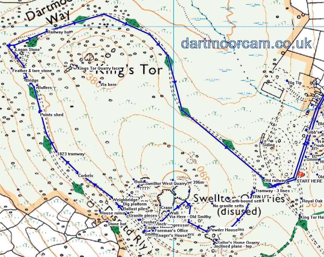
MAP: Blue = Planned route of the walk - based mostly on a shortened 7th July - recon-1 walk above with an untested link between the two sections (upper and lower) of the main quarry.
 � Crown copyright 2016 Ordnance
Survey
Licence number 100047373
� Crown copyright 2016 Ordnance
Survey
Licence number 100047373
Also, Copyright � 2005, Memory-Map Europe, with permission.
This walk was reached using the B3357 and between Tavistock and Two Bridges. Car parking was at the small quarry seen on turning into the track to Yellowmeade Farm the P symbol on the map and across the road from there, by the ruins of Foggintor Mission Hall. There is also some space up the hill at the old Pump House.
Statistics
Distance - 6.73 km / 4.2 miles
All photographs on this web site are copyright
© Keith Ryan.
All rights reserved - please
email for permissions