![]()


This walk: 2015-8-6. Four Winds car park, King's Tor, logan stone, Swell Tor Quarry, corbels, smithy, Merrivale Longstone, cairn, stone circle, double stone rows, cists.
Walk details below - Information about the route etc.Old maps .....
Where we walked: Google Satellite view of the area - including the GPS track of the walk (compare with the Ordnance Survey map plus track below)
 Inside the Four Winds car park area - this was the site of Foggintor School,
built in 1914, having about 55 children from the local quarries. It was closed
in 1936, becoming a private house thereafter, aptly called Four Winds. It was
finally demolished in 1965. Before the school was built, Foggintor
Mission Hall was used. While it was a school, with just the one headmaster,
Fred Stoyle, who was the youngest headmaster in the country, it had a garden
with bees, poultry, goats and rabbits. His wife, Mrs. Stoyle, taught the younger
children. The children played football on a moorland pitch and warmed their
pasties on central heating pipes! The Stoyles' son, Ivan, took the school
Christmas tree into the garden in 1924 and planted it, this is the tree you see
today - in this photograph!
Inside the Four Winds car park area - this was the site of Foggintor School,
built in 1914, having about 55 children from the local quarries. It was closed
in 1936, becoming a private house thereafter, aptly called Four Winds. It was
finally demolished in 1965. Before the school was built, Foggintor
Mission Hall was used. While it was a school, with just the one headmaster,
Fred Stoyle, who was the youngest headmaster in the country, it had a garden
with bees, poultry, goats and rabbits. His wife, Mrs. Stoyle, taught the younger
children. The children played football on a moorland pitch and warmed their
pasties on central heating pipes! The Stoyles' son, Ivan, took the school
Christmas tree into the garden in 1924 and planted it, this is the tree you see
today - in this photograph!
 At the rear of the Four Winds
enclosed area - the Long Ash Leat.
At the rear of the Four Winds
enclosed area - the Long Ash Leat.
 North Hessary Tor with its TV
transmitter and Yellowmead farm .....
North Hessary Tor with its TV
transmitter and Yellowmead farm .....
 Zoomed view of Yellowmead.
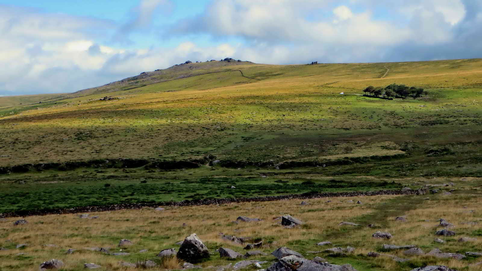 Great Mis Tor, SX 563 769, elevation 538 metres (1765 feet),
with Little Mis Tor to the right and the Four Winds car park.
Great Mis Tor, SX 563 769, elevation 538 metres (1765 feet),
with Little Mis Tor to the right and the Four Winds car park.
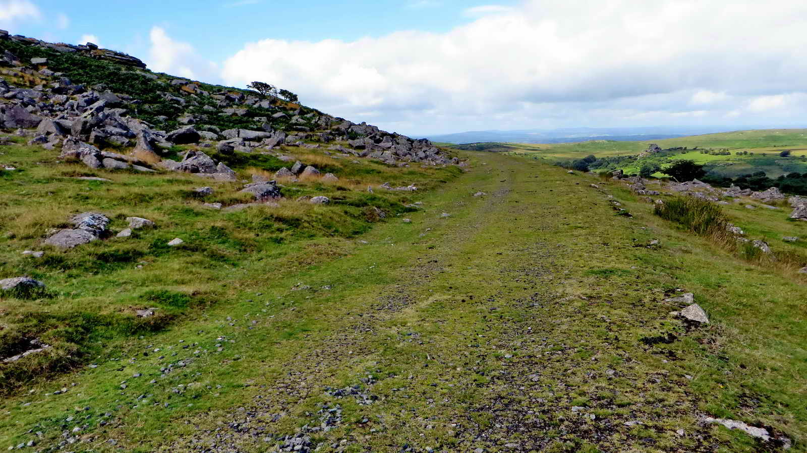 On reaching the old GWR track bed,
originally opened n 1823 as the
Plymouth
& Dartmoor Railway (a horse-drawn tramway).
On reaching the old GWR track bed,
originally opened n 1823 as the
Plymouth
& Dartmoor Railway (a horse-drawn tramway).
 View to Merrivale Quarry with (from
left) Middle Staple Tor, Great Staple Tor and Roos Tor on the skyline, and with
Cox Tor behind (at left)..
View to Merrivale Quarry with (from
left) Middle Staple Tor, Great Staple Tor and Roos Tor on the skyline, and with
Cox Tor behind (at left)..
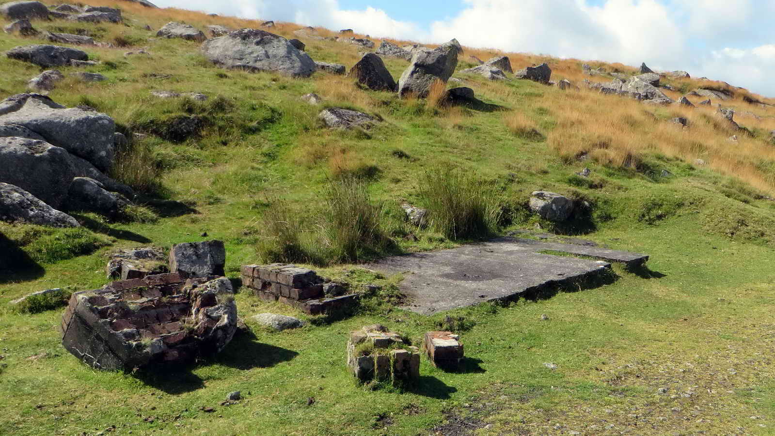 Ruins of a linesman's hut, at SX
55477 73986.
Ruins of a linesman's hut, at SX
55477 73986.
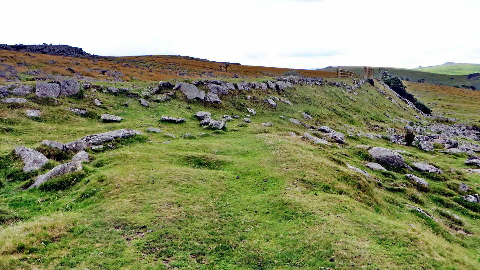
 The location at which the old P&DR
and GWR tracks parted company: the P&DR horse-drawn wagons came around King's
Tor with a relatively sharp bend that steam locomotives could not do - they came
through the new cutting. The tramway is towards the right side of the view.
The location at which the old P&DR
and GWR tracks parted company: the P&DR horse-drawn wagons came around King's
Tor with a relatively sharp bend that steam locomotives could not do - they came
through the new cutting. The tramway is towards the right side of the view.
 The summit logan stone on Little
King's Tor, at SX 55345 73915, elevation 357 metres (1171 feet) .....
The summit logan stone on Little
King's Tor, at SX 55345 73915, elevation 357 metres (1171 feet) .....
 As previous photograph .....
 As previous photograph.
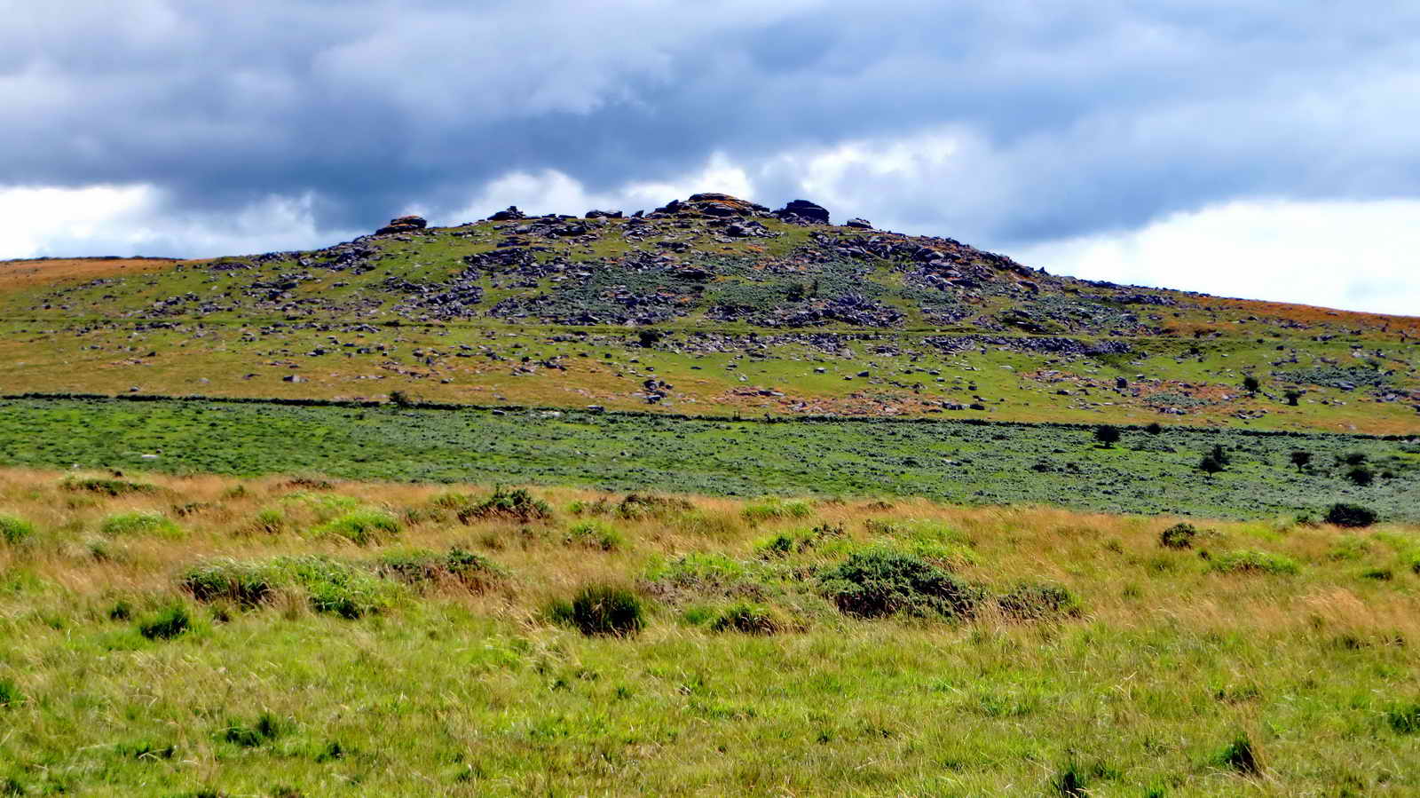
 Looking up at King's Tor, SX 556 738, elevation 400 metres (1312 feet)
..... seen from the old P&DR track that went out around this tor .....
Looking up at King's Tor, SX 556 738, elevation 400 metres (1312 feet)
..... seen from the old P&DR track that went out around this tor .....
 Zoomed view.
 Ahead, the GWR track crossing
left-right built up over the old P&DR track ...... (the way to the corbels is
straight across the GWR track) .....
Ahead, the GWR track crossing
left-right built up over the old P&DR track ...... (the way to the corbels is
straight across the GWR track) .....

Ahead, the remains of the P&DR track - the GWR passed over the bridge seen to the right on the more modern track .....

The GWR bridge (site of) at SX 55385 73786 ..... from this spot was seen .....

Young Wheatear.

Showing the difference in levels of the two railway tracks at this point - old P&DR (left, heading to Swell Tor Quarry) and GWR (right) - looking south-east.

Approaching Swell Tor Quarry and its spoil tips: the quarry was certainly working by 1831 when Rev. Brat saw a 'jumper' being used (in the feather and tare method of splitting granite) and was closed in the 1920s although it was reopened for a short period in 1937 (Source: Kath Brewer (1997), The Railways, Quarries and Cottages of Foggintor, Orchard Publications, Chudleigh, Newton Abbot, p. 58.)
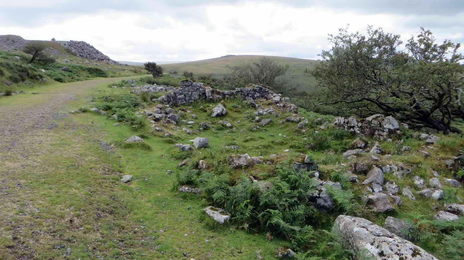
House ruins on the west side of the track, at SX 55697 73237.

Approaching the old smithy.
Dartmoor CAM
movie. TIP .....
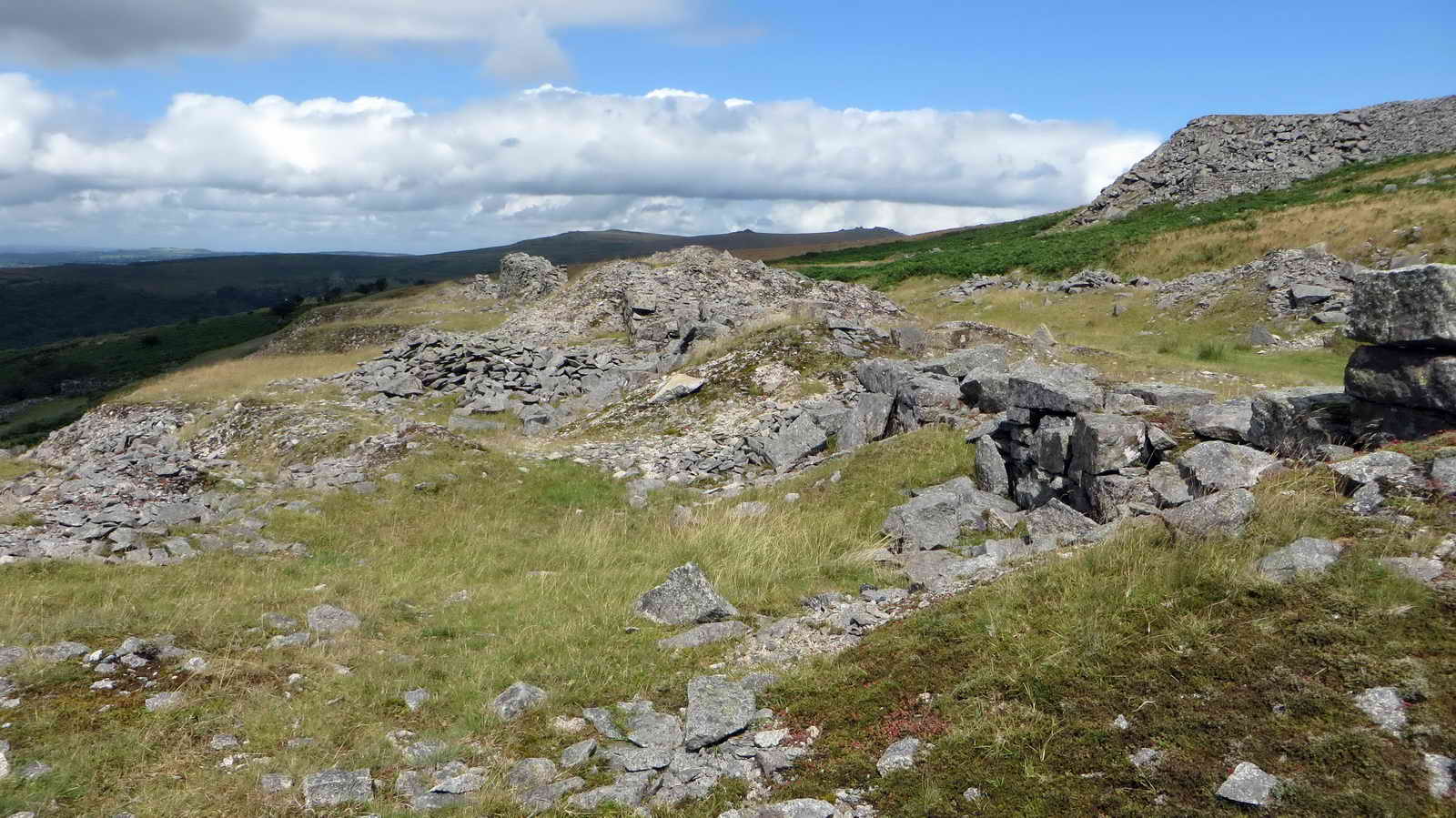
A general panorama looking at the extensive working area of Swell Tor Quarry from near the track. |
|
Click the photo to download File size: 4.4 MB. Length 26 secs |
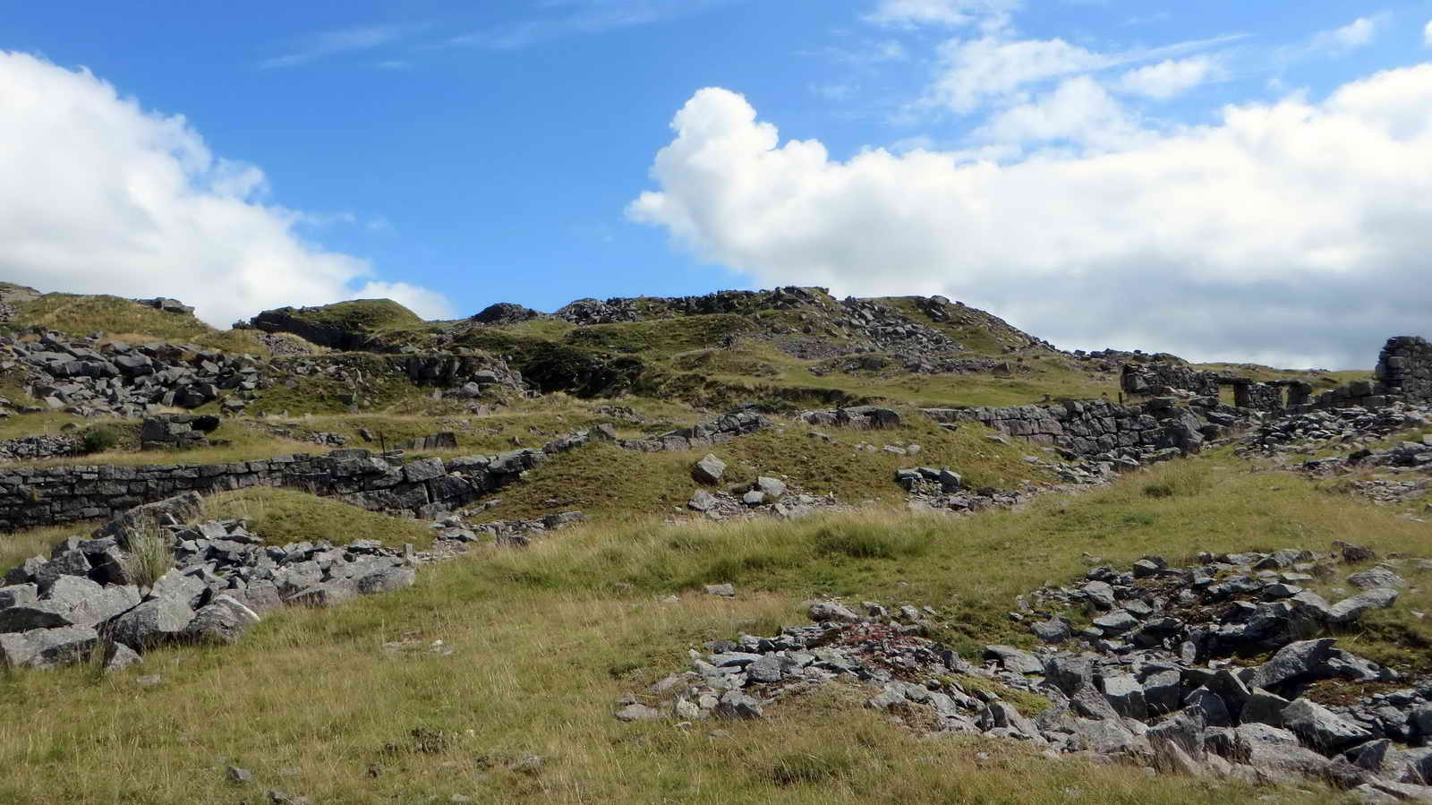
General view of Swell Tor Quarry smithy area .....

A similar view .....
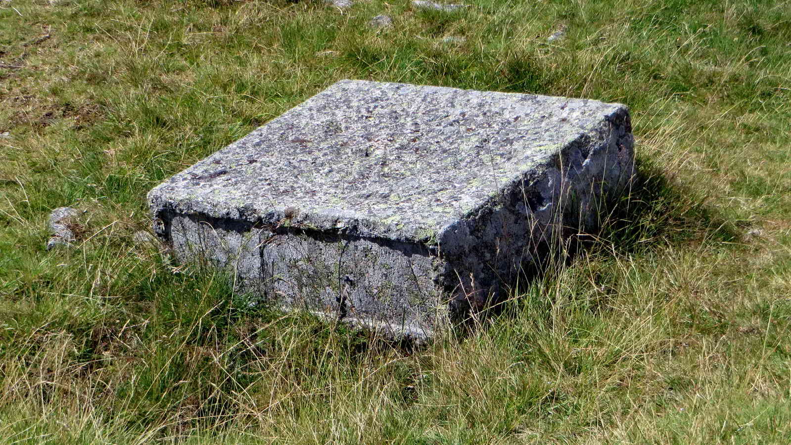
An abandoned, highly-worked piece of granite .....
A Dartmoor industrial landscape .....

Spoil tip .....

Worked pieces .....

The smithy.

Heading back to look at the corbels ..... note the depressions still evfdent from the old sleepers ......
Also, iron fixing spikes/nails .....
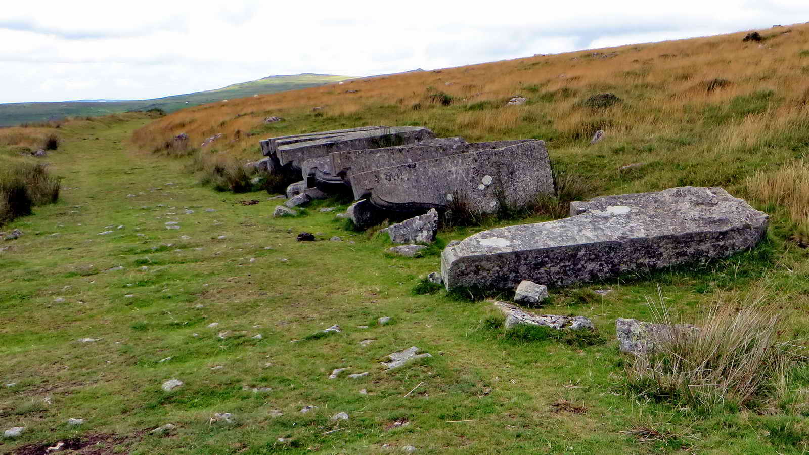
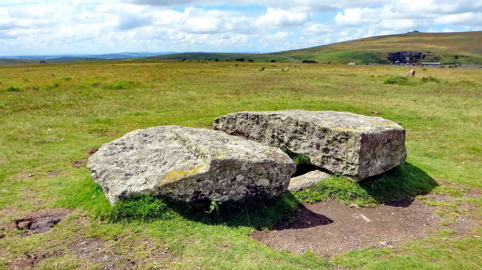
Twelve corbels - "A few corbels short of a bridge" - surplus corbels left in place after the 1902-04 widening of London Bridge (opened 1831), this was the bridge sold in 1967 to an American. In 1896, "it was estimated that the bridge was the busiest point in London, with 8,000 people crossing the bridge by foot and 900 crossing in vehicles every hour.[1] London Bridge was widened in 1902�04 from 52 to 65 feet (16 to 20 m), in an attempt to combat London's chronic traffic congestion. A dozen of the granite "pillars" quarried and dressed for this widening, but unused, still lie near Swelltor Quarry" : Source - Wikipedia. It has been said that while there were a dozen corbels originally, a few were sent as spares to America when the bridge was moved .....

Hmmm ..... they've missed the train!

Another view .....

Ditto.
|
Dartmoor CAM movie. TIP .....
A panorama looking down into the outer quarry. |
|
Click the photo to download |

The old smithy .....

Over there!

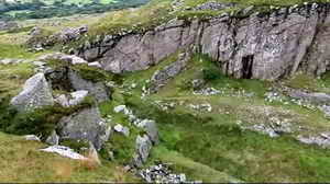
View to the quarry entrance .....

Nicely buttressed wall (nearest the camera) .....

The quarry entrance .....
|
Dartmoor CAM movie. TIP .....
A panorama looking down into the inner quarry and panning right, past Yellowmeade Farm, around to Foggintor Quarry. |
|
Click the photo to download |

View from the inner edge of the inner quarry towards its entrance from the outer quarry .....

Zoomed view .....
![]()
Overview of the inner quarry. Click on the image to see a larger version.
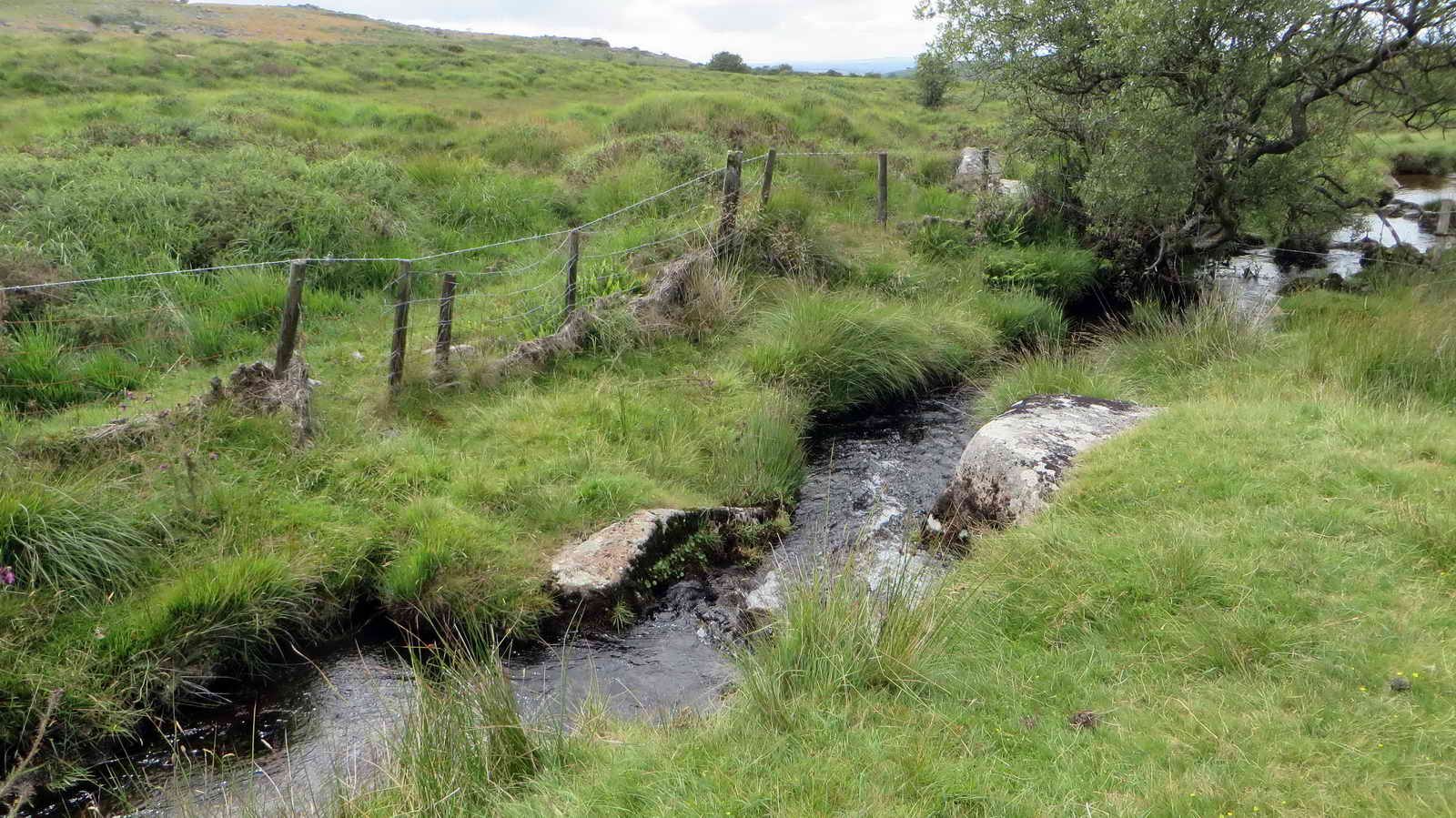
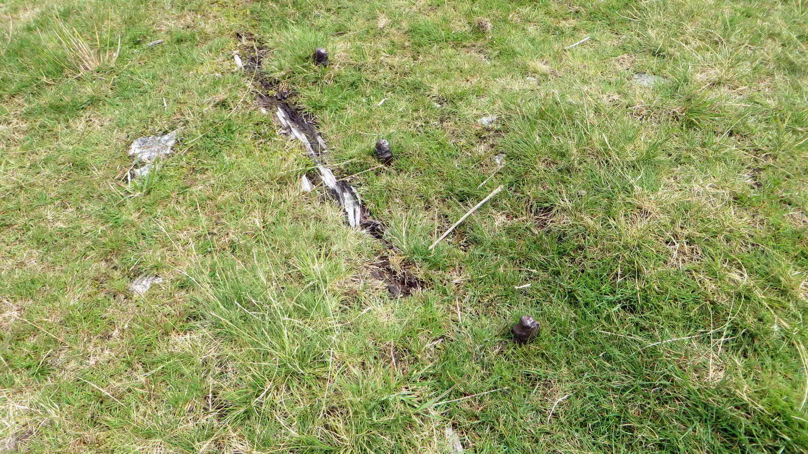
After entering the newtake via the stile at SX 55612 74175, this was the exit point at SX 55657 74436, showing the crossing place over Long Ash Brook .....
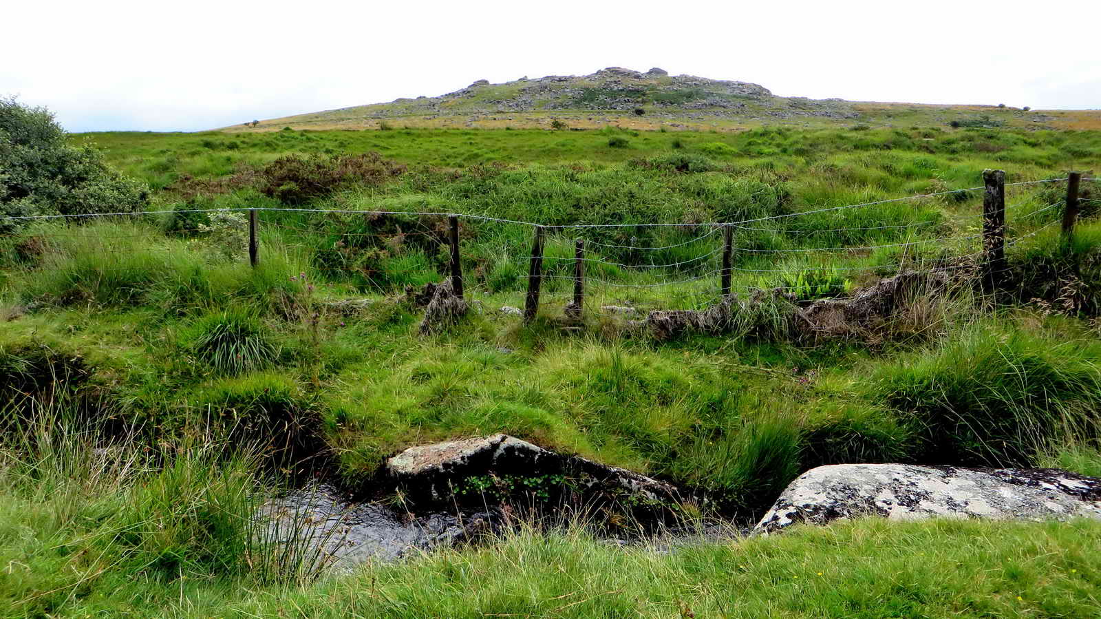
As previous photograph.
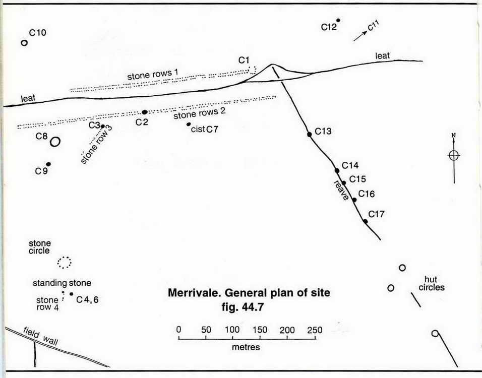
The Merrivale Bronze Age features below are described in Jeremy Butler, 1994, Dartmoor Atlas of Antiquities Vol. 3 - The South West, 8 - Merrivale ceremonial centre, pages 23-32.
|
|

Merrivale Longstone, showing Butler's stone row 4 - this consists of only four stones (mostly hidden behind the clump of soft rush .....

The Longstone, at SX 55355 74588 .....
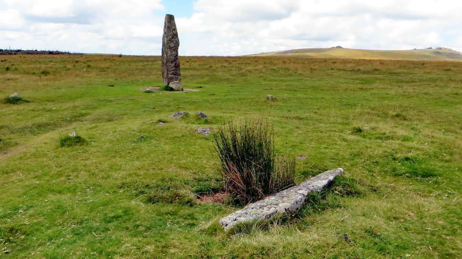
The Longstone with Butler's cairn 6 and flat pillar (beside its pit) .....

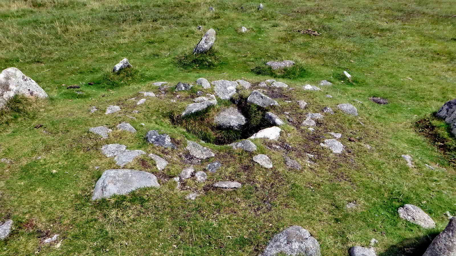
Cairn 6 with surrounding kerb stones .....

Merrivale Longstone.
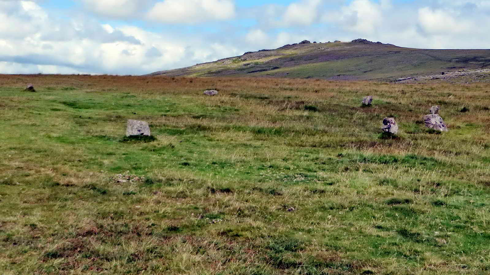
Merrivale stone circle, consisting of eleven quite small stones - about 50-metres north of the Longstone .....
|
|

The west end of stone row 2 (the southern of the two double stone rows) - at the far end there is a triangular slab between the two rows (see below) - this row is 263 metres long .....
|
|

Another view along the southern double stone row .....

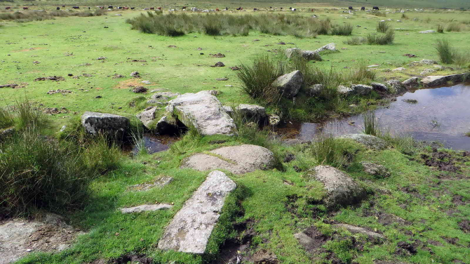
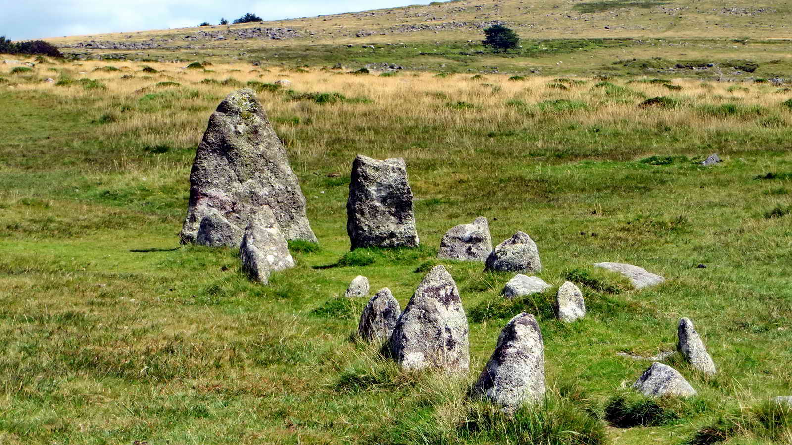
The cairn and cist in the stone double row (C2 in the diagram) .....
Closer view of the cist .....

Cist in cairn C7 in the diagram .....
Another view - someone cut a presumed gatepost from the capstone .....

Triangular blocking stone at the east end of double row 2 .....
King's Tor again ......
The end of the row(s) again .....

Another view .....

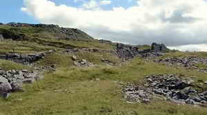
Blocking stone and view of row 1 (183 metres in length) .....

View with Foggintor Quarry in the background.

Notice in the Four Winds car park. Click on the image to see a larger version.
MAP:
Red = GPS satellite track of the walk.
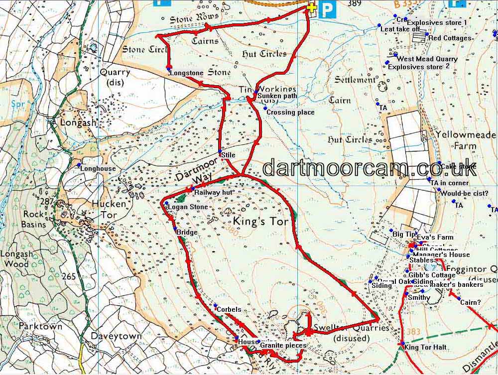
© Crown copyright and database rights 2015. Ordnance Survey
The walk was accessed via the B3357 Tavistock-Two Bridges road. There are three easy car parks indicated on the map by the P symbol, travelling from Tavistock the first one is on the right just after the Dartmoor Inn, followed by a larger one at Four Winds (surrounded by trees, marked with the yellow cross) and the third is a small quarry seen at thr turning into the lane to Yellowmead Farm.
Statistics
Distance - 7.5 km / 4.66 miles.
All photographs on this web site are copyright ©2007-2016 Keith Ryan.
All rights reserved - please email for permissions