![]()


This walk: 2019-5-25. Rowtor, West Mill Tor, abandoned cider press (mention of), swing-up / swind-down flagpole, abandoned trough, anti-tank range, steel plate target, target railway, engine shed, turning loops, military road, O-P-B stone, New Bridge, Black-a-ven Brook, OP 22 (Observation Post), Higher Tor, Winter Tor, Yes Tor, Hart Tor, L stone (Lydford parish boundary stone).
Walk details below - Information about the route etc.
Previous walks in this area: 2 April 2009, 28 October 2009, 10 February 2010, 7 July 2010, 20 July 2011, 13 August 2013
Recconnaissance walks: 28 July 2019, 5 August 2019 - three target railway systems on this map
Google Satellite map + GPS track of the walk

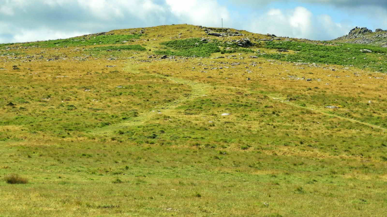
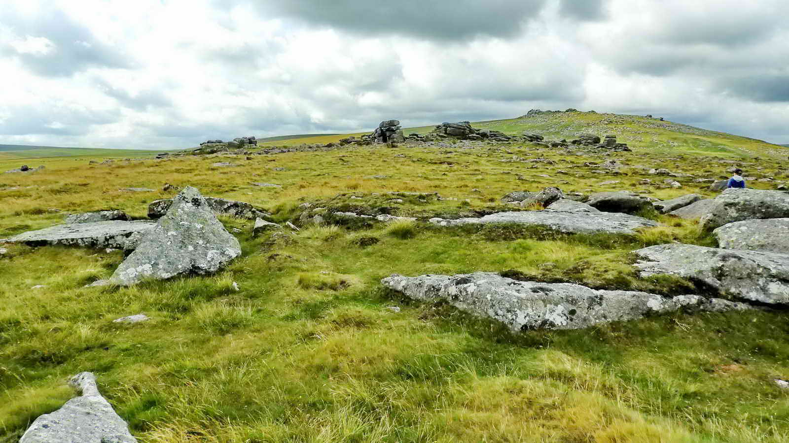
Rowtor, also called Row Tor, Roughtor or Rough Tor and possibly Rowter, SX 593 916, elevation 468 metres (1535 feet), left of centre, nearest the camera seen from the car park, with West Mil Tor behind (right of centre) and possibly Longstone Hill at the distant right.
Zoomed view of Rowtor showing the flagpole (more below). On the map, the tor to the right is labelled West Mill Tor but Mike Brown has another spelling (probably following Hemery's castigation of the Ordnance Survey folk for misnaming many Dartmoor locations - no doubt from mis-hearing the local dialect). He writes "Middle Hill, the middle hill between Rowtor and Yes Tor, from which comes the name of the �west middle tor�, hence West Mil Tor � �west� because there is also an �east middle tor� in the area, although, in fact, there are really two of them, just to confuse matters further (q.v. grid squares 5990 & 5991)." Source: Mike Brown (2001) Guide to Dartmoor, CD-ROM, Dartmoor Press, Grid Square 58 91.
Devon & Dartmoor HER - MDV6489 - Cider press 600 metres north of RoughTor - an apple crusher with a central granite boss and a broken edge. For those of an enquiring nature, I could not find this!

Rowtor flagpole .....
View of the car park from Rowtor flagpole .....

Zoomed view .....
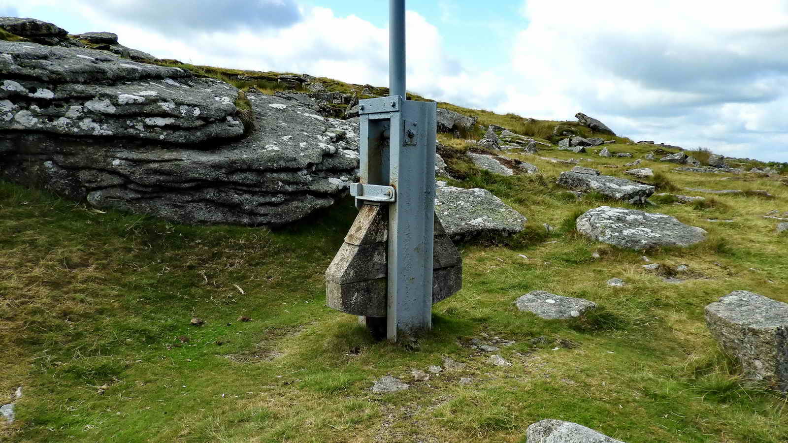
The flagpole, detail - a swing-up, swing-down pole.

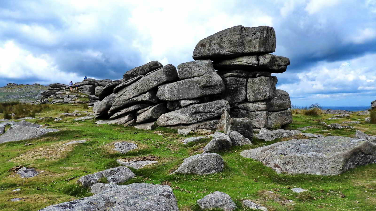
Approaching the top of Rowtor with West Mil Tor behind.

Another quote from Mike Brown: "A partly worked trough lies amongst the clitter on the north northeast flank of Row Tor, near a tall plain set stone, the latter obviously a former boundary marker though for a purpose uncertain. Both features seem to have escaped the notice of previous Dartmoor explorers." Source: Mike Brown (2001) Guide to Dartmoor, CD-ROM, Dartmoor Press, Grid Square 5940 9172. My GPS record for this is SX 59409 91722. I was not too certain about a nearby upright stone (almost touching) being a tall pillar, though.
I think the trough is behind the flat stone at the left edge of this photograph, I can't remember precisely.
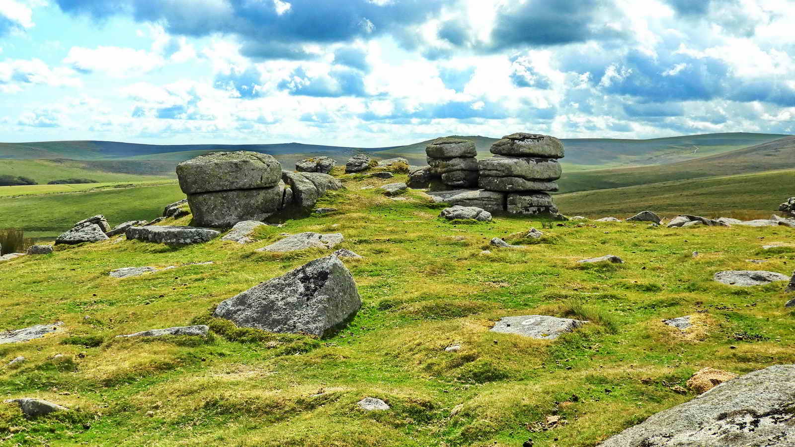
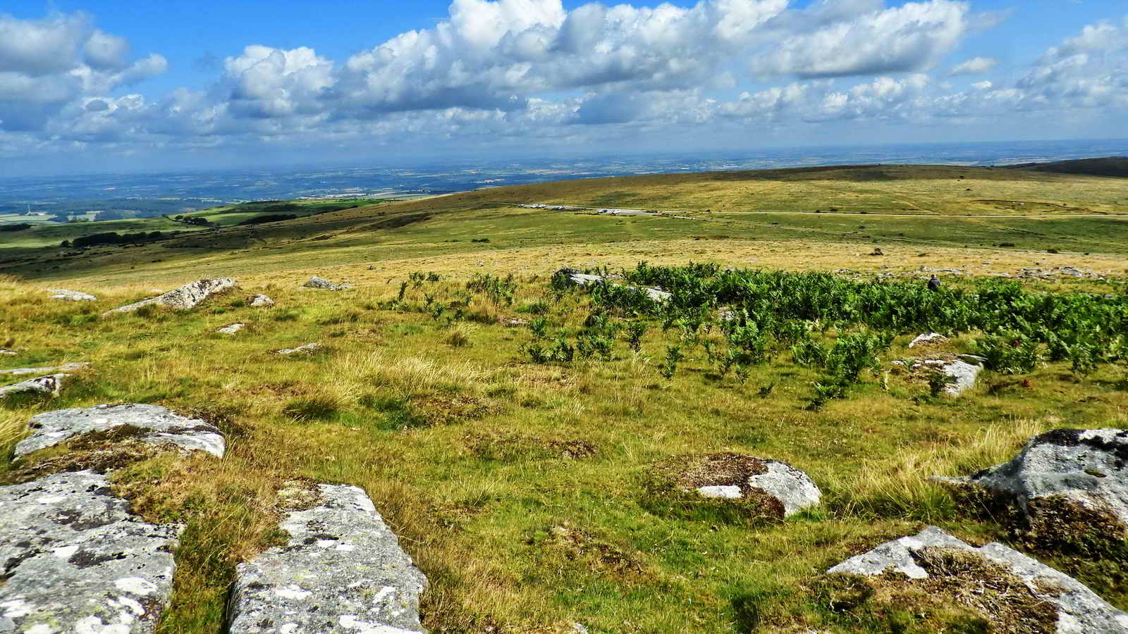
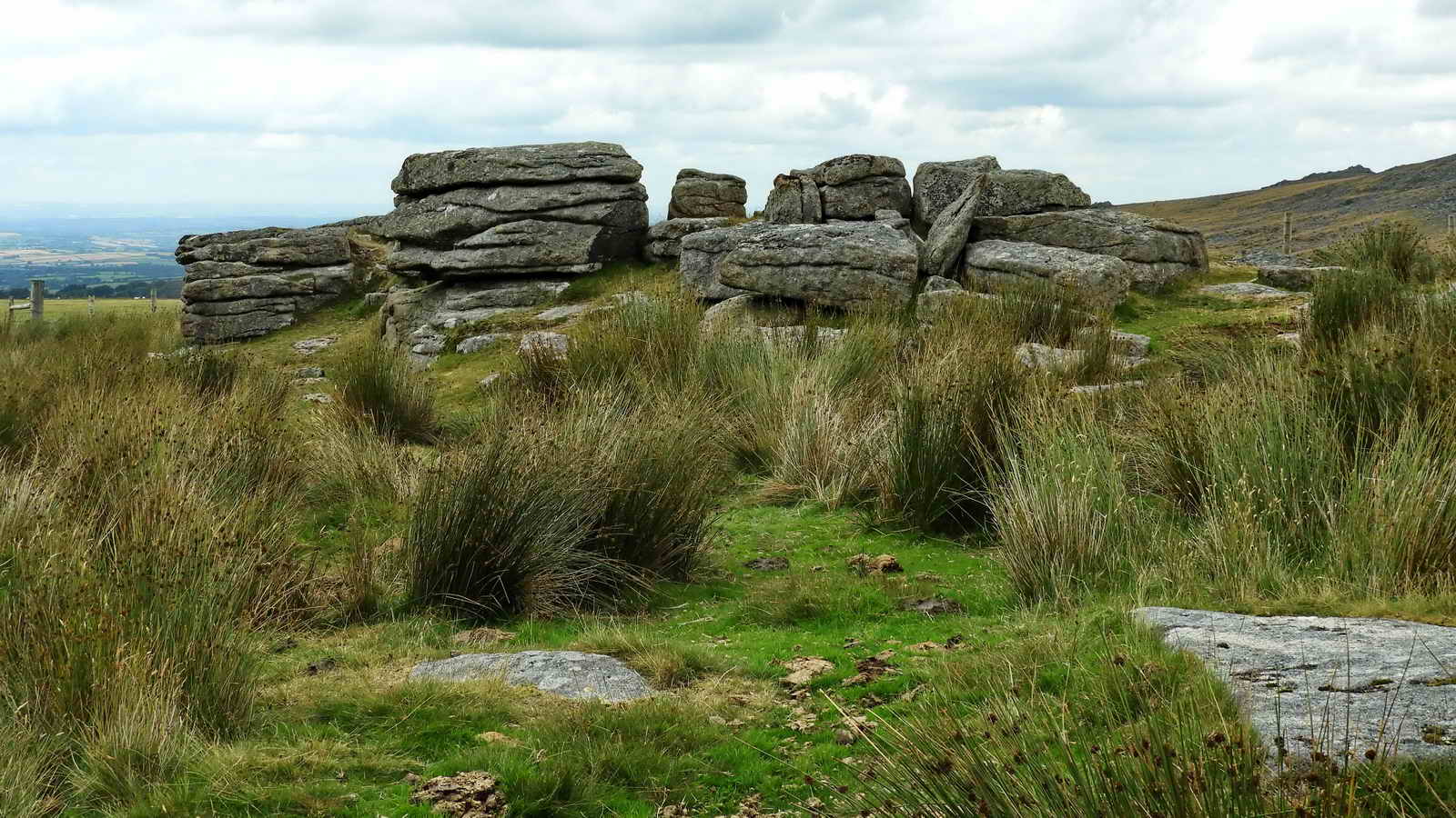
One of many possible views on the top of Rowtor .....
Another rock pile on Rowtor.
Next, "the target railway"
Okehampton Military Range was established in 1876. Three types of target built in 1901 - static, moving and disappearing (not sure if this should be "by 1901", also not sure about all locations). The camp became the HQ for the Army School of Gunnery in the summer months and thereby the county's most important practise camp.
There seem to be records of three separate target railway systems, involving five separate railways:
F-Range - Linear and Curved Target Railways (Alternative
link) - see pages 8-9 for details. Includes "F Range on
Black Down and West Mill Tor was used from the late C19 for
artillery training, and a linear target carrier system was
established here around this time. It is shown on a map
(WO78/3334) as Railway for Moving Target,
which is a copy of an 1892
map
published in 1906."
Black Down / West Mill Tor - three tramways,
two in poor condition -
Google Aerial View - not a lot to see.
There
is a long,
branched railway (according to records) running north
south, centred on SX 58167 91528.
Historic England web page - good map.
OP6 Incline
Target Railway (Alternative
link) - east of East Mill Tor, see page 8 for
details, incl. "a c.1895 inclined target
carrier railway that includes a long, curvilinear cutting that
follows the east slope of East Mill Tor (partly incorporated into
the Loop Road) and terminating at Skit Bottom,175m"
Includes: SX 60383 90820 and SX 60298 89816.
Google AerialView - North end -
Google Aerial View - South end
Historic England web page - good map
Rowtor Anti-Tank Range and Medium
Anti-Tank Range - the "classic" railway, visited on
this walk.
This Report includes: "the Duchy notes that
the engine shed relates to the 1959
railway."
An overview of the area of theTarget Railway and Anti-Tank Weapons Range taken on 13 August 2013. There are two firing points near the camera with a control point in between them. These are now demolished.
Two firing firing bays for army Medium Anti-tank Weapons, with the command point between them and target plate in the distance ..... the bank protects the target railway and the engine shed is seen at the right. The three points were built "around 1969" (HER Record) and rebuilt in the 1990s (pers. comm. Paul Rendell). Demolished in 2019.
Historic England - Advice Report - 22 September 2015
Okehampton Artillery Range: H1 Battalion Anti-Tank Range and Medium Anti-Tank Range - Report
Okehampton Artillery Range: H1 Battalion Anti-Tank Range and Medium Anti-Tank Range - Map

Closer view of a firing point - where Medium Anti-tank Weapons were fired at the steel plate target (behind the pony). The distant building, to the right, is the shed that housed the engine/target for the target railway - it was for anti-tank rifles and maybe early bazooka weapons (much more below) .....
Devon & Dartmoor HER - MDV113528 - Anti-Tank Weapon (H1) Range south of
Rough Tor, Okehampton Hamlets
- this record contains a lot of information, about the steel
target range - not the target railway

Image copyright: Google Earth (2018). The steel plate target is just off this image at top left, above the "Target railway" label.

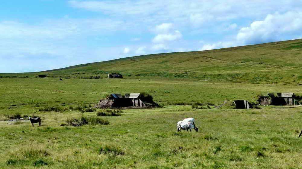
The cows were being rounded up ..... West Mill Tor is to the top right, the track leads to High Willhayes and Yes Tor ..... it goes over the flank of the tor and crosses Red-a-ven Brook on the other side, this runs through the Meldon Quarry area. Not to be confused with Black-a-ven Brook that we encounter later during this walk.
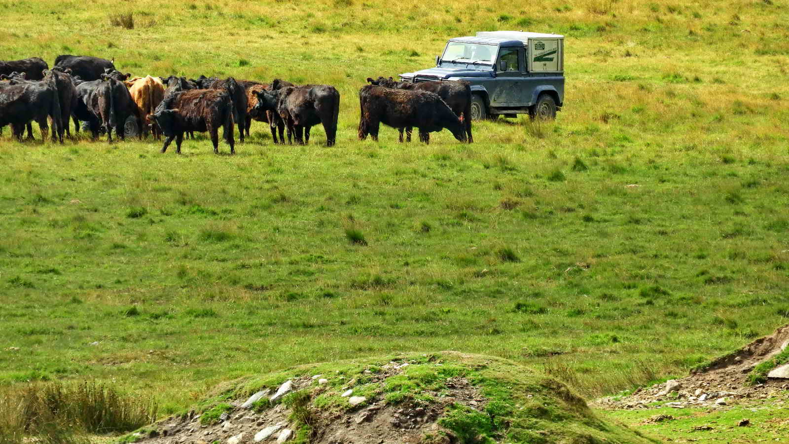
As previous photograph .....

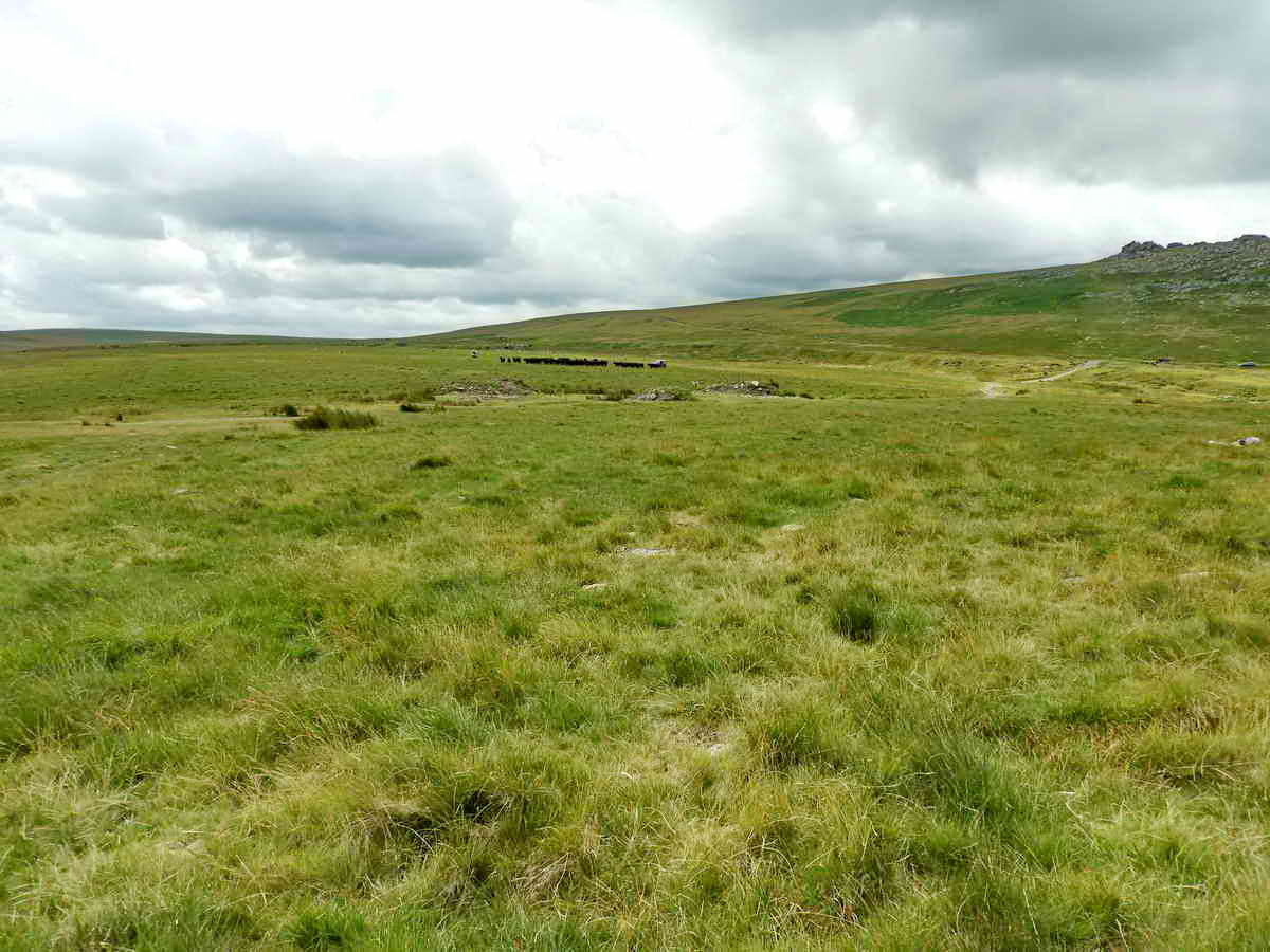
Looking back up at Rowtor .....
Overview of the round-up .....
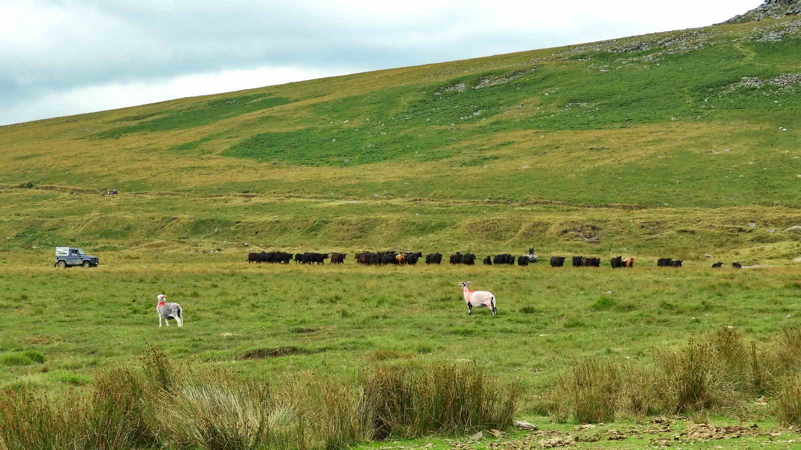
As previous photograph .....

The steel plate target, 309 meters (338 yards) from the firing points .....
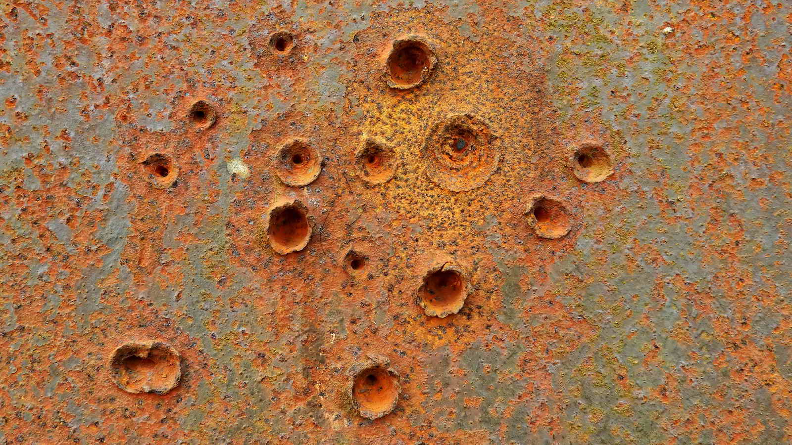
Pock marks from bullet / projectile strikes .....

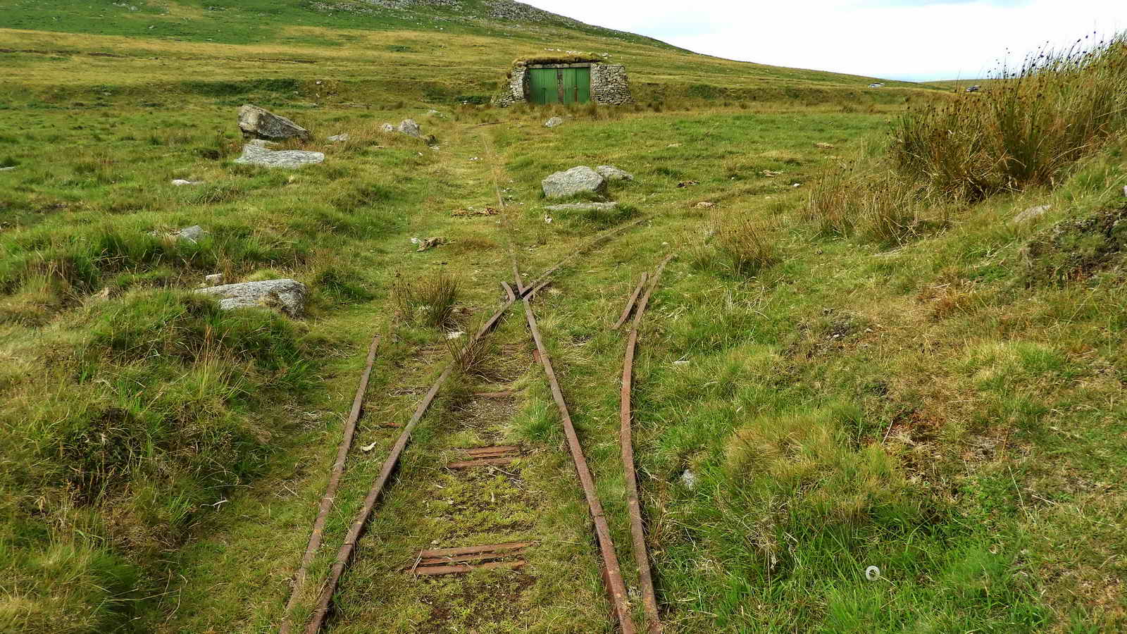
Showing the engine shed of the target railway behind the steel target plate and protective embankment for the railway .....

The engine shed ..... believed built 1959 .....
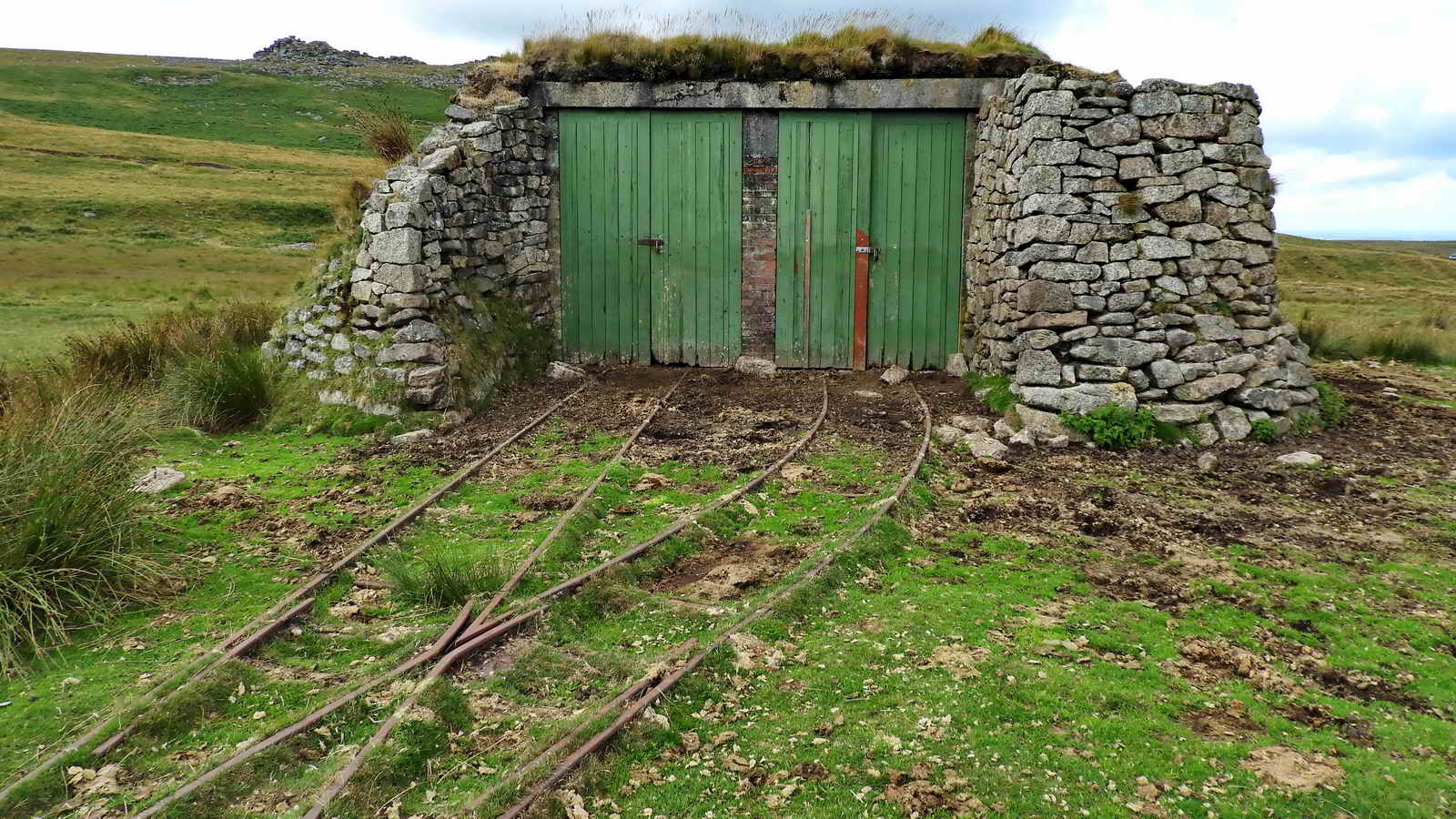
NB - two doors, could accommodate two target trollies.


Engine shed, points and start of the west turning loop .....
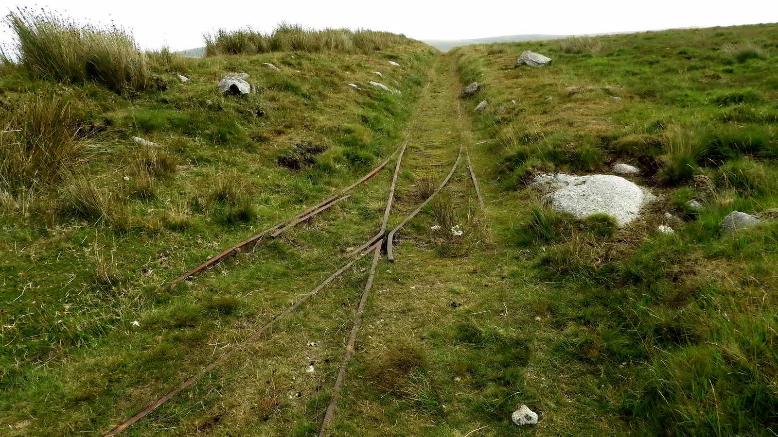
Entry to the straight run of railway with the end of the west turning loop which is behind the camera .....
Wickham Target Trolleys - photographs of various target trolleys
1:11 minute video of a target trolley running.

The straight run of the railway, with the protective bank and firing points to the left .....
Posted 17 Dec 2010, on the National-Preservation.com web site
This Type R1389 Target Trolley was noted on a low loader departing MOD Okehampton Target Ranges in Devon on 9 September (2010?) for an unknown preservation site. The details of this Wickham are as follows:
|
Works No. 3236 Order No. 20190 Type R1389 2w-2 Petrol Mechanical Target Trolley Gauge 2'0" or 600mm Engine - JAP 1323 Special No. DTZ/U 73071/SS Despatched from Wickhams - 7 May 1943 Delivered to Ministry of Supply, Lydd, Kent. |
Does anyone know where this Wickham now is?


It is noted somewhere among the information offered on this web page that a hand grenade caused damage to the rail and it was never used again - stated in a report that is linked below. This is probably the damage site.

Not sure what sheep breed these are, Herdwick, Balwen?

East end turning loop .....

You tell me!

Dartmoor Railway Supporters' Association visit to Rowtor Target Railway (hand grenade damage - mentioned n the last sentence of this report).
Notes on the Rowtor Wickham Trolleys - data from Dartmoor Railway Supporters' Association article. The original trolleys were installed 1943/1944 when the anti-tank weapon of the day was the �Boys� anti-tank rifle, followed by the Projector, Infantry, Anti Tank or PIAT. Removed in the 1960s. Reinstated after foot-and-mouth in 2001 but almost immediately rendered obsolete by a change of weapon system. The Army today uses rocket and guided missile weapons and the Carl Gustav recoilless rifle ("bazooka") against tanks.
ALSO - "By pure good fortune, our visit coincided with that of Nigel Sharpe, Senior Estate Surveyor responsible for MOD estates in the South West, who happened to be there taking photographs. Nigel supplied interesting background information, and subsequently pointed us at this link to the Historic England (successor to English Heritage) report on the railway. Other local ranges of interest are the F Range Target Railway and the OP6 Incline Target Railway."
An aside, a scene from this area during a walk on 2nd April 2009 (when the old 4x3 format 800 x 600 pixel photos used to fill the screen) .....
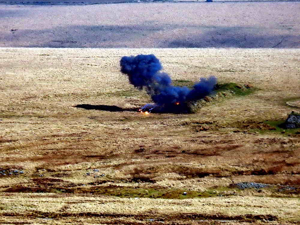
"As we passed this point we were hailed by military lookouts for a demolition team that were about to blow-up some recovered unexploded munitions found during a moor clearance exercise ...."
"The bang was very impressive, this photo catching the end of the initial flash ....."
"As previous photo, as fast as the camera would recycle ....."
..... and again.
The engine shed and near-turning loop of the target railway can be seen in the last two photographs. The explosion was done just to "the left" of the protective bank, that is seen in the first photograph. This is the bank that protected the target railway trolley from being hit from the firing points.
A final note on target railways - there are three more on West Mill Tor, although there is only a vague sign of one of them on Google Earth!
Devon & Dartmoor HER - MDV27370 - Moving Target / Anti-Tank Range
east of West Mill Tor, Okehampton Hamlets
- this record has a lot of information
Devon & Dartmoor HER - MDV27790 - Target tramways on West Mill Tor
The military road here is below the target railway and above Middle Ford (where there is a pair of boundary stones, one old and one more recent). Middle Ford is downhill from OP 22 (Observation Post no. 22), looking north ..... Rowtor is at the top left .....

The same location, looking south. The high ground (left) is East Mill Tor.

Walking south, a single boundary stone comes into view .....

The stone has O-P-B cut into three faces, for Okehampton Parish Bounds. Believed distant Steeperton Tor (left of the stone) and East Mill Tor (right of the stone).

New Bridge, a strengthened clapper bridge, over Black-a-ven Brook .....

Upstream view .....
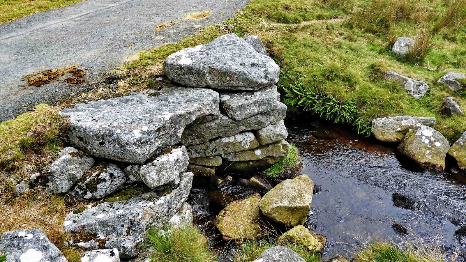
The central pier is built with a "point" on the upstream side against heavy flows of water after cloudbursts on the moor .....
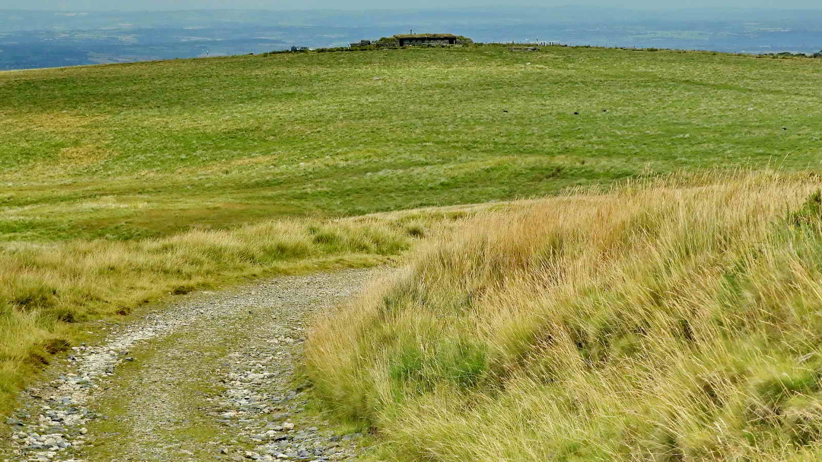
Having turned left after New Bridge and walking north, OP22 comes into view, with a commanding view of the area .....

Zoomed view, Hart Tor can be seen to the left.

Looking over Harter Farm / East Okement Farm towards Higher Tor, with Winter Tor halfway up the slope.
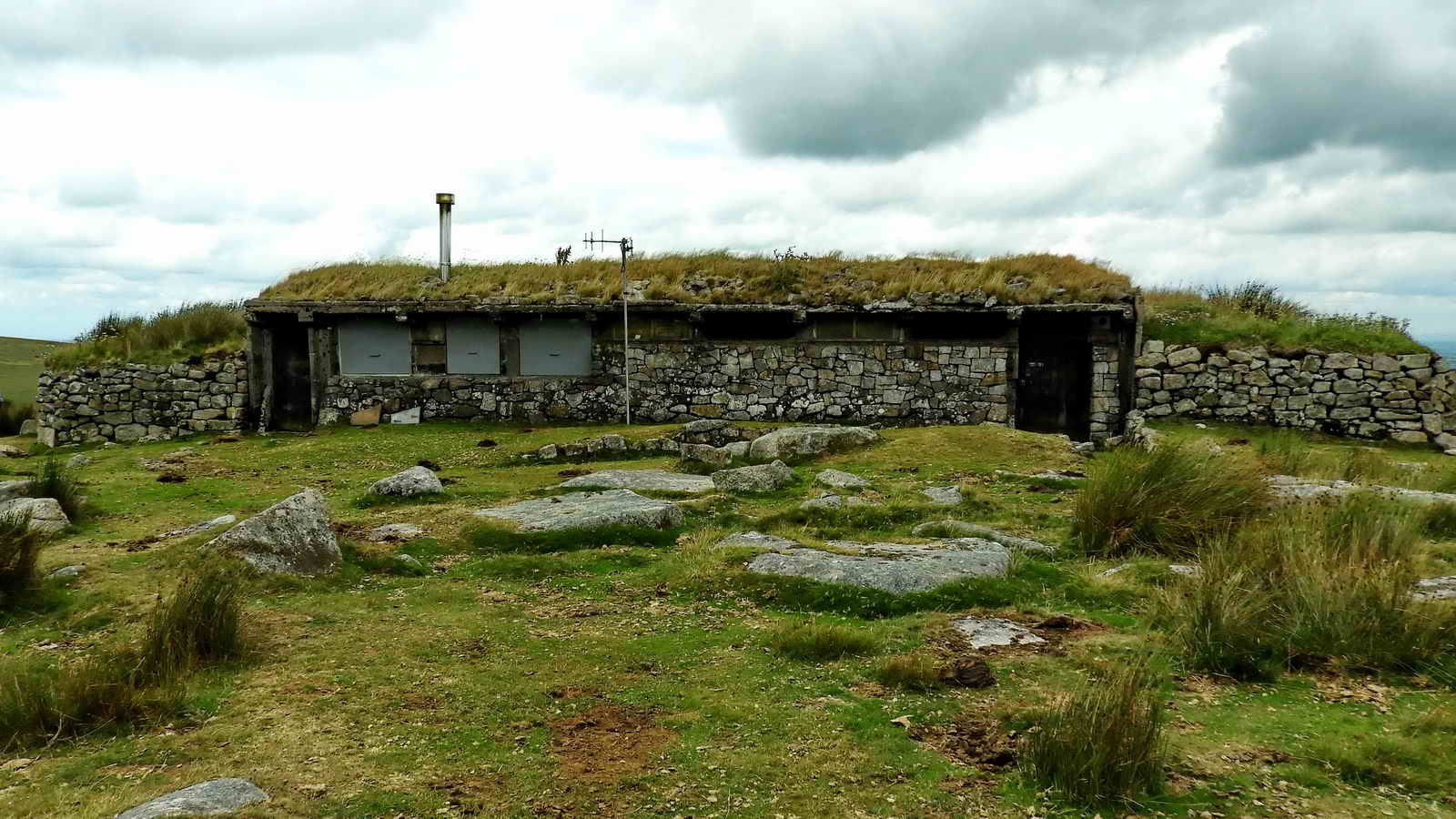
Devon & Dartmoor HER - MDV51208 - Observation Post (22) at East Okement Farm, Okehampton Hamlets - built Sep. 1923 - March 1924. Interestingly, although it was built to house 16 officers under instruction it is now used as range control and stock clearer shelter. As such, with an internal dividing wall to create stable accommodation - it becomes reminiscent of a Dartmoor longhouse!
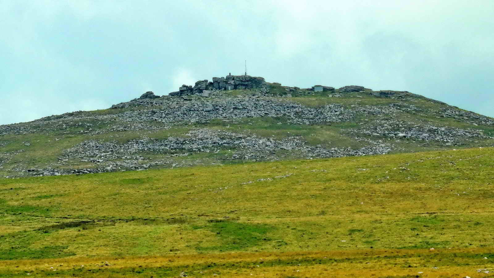
Zoomed view to Yes Tor, SX 580 901, elevation 619 metres (2030 feet), with triangulation pillar (left), flagppole and range officer's stable (the grey square object 1/3rd way in from the right edge).
Hart Tor, Hartor or Harter, SX 601 911, elevation 436 metres (1430 feet), alongside OP22.

Devon & Dartmoor HER - MDV51202 - Boundary stones south of the Black-a-ven Brook, SX 60133 91898.

The shorter, older OPB - Okehampton Parish Bound stone.

Pastscape - Monument No. 1397029 - Lydford parish boundary stone, SX 60020 91915, beside the Black-a-ven Brook, not far from the car park. Yes Tor (left), West Mill Tor and Rowtor on the skyline.
MAP: Red = GPS satellite track of the walk.

� Crown copyright 2016 Ordnance
Survey
Licence number 100047373
Also, Copyright � 2005, Memory-Map Europe, with permission.
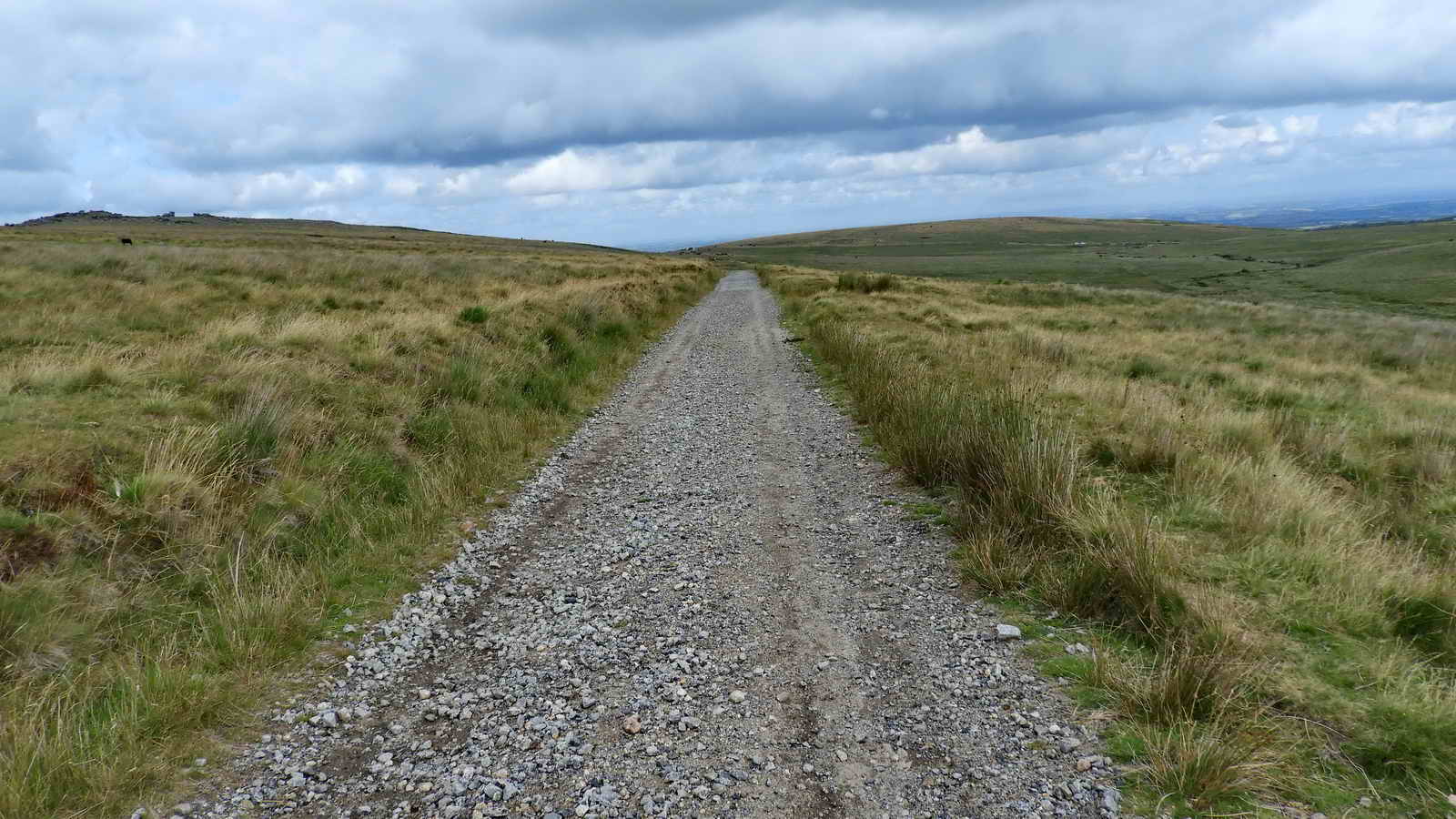
The walk was reached from Tavistock direction by turning right at the traffic lights in Okehampton and driving up Station Road and continuing without turning off over the A38 dual carriageway, passing St Michael's Bungalow, turning left at the end of the road onto the moor over a cattle grid. The road then winds out onto the moor to a large parking area of hard standing next to the road below Rowtor, indicated by the yellow cross.
Statistics
Distance - 5.52 km / 3.43 miles
All photographs on this web site are copyright
© Keith Ryan.
All rights reserved - please
email for permissions