![]()


This walk: 2018-6-25. Cadover Bridge car park, River Plym, Cadover (Cadworthy) Bridge,Cadover Cross, Cad-a-ford, cairn cist, Cadworthy Tor, Dewerstone Rock, Neolithic double-walled structure, Bronze Age single-walled enclosure, hut circle, Dewerstone Hill, plaque, rock inscriptions, L stone (Lopes boundary), summit cairns, BA stone(s), Common cotton grass, kerbed cairn, old china clay lakes, Dartmoor ponies, Hare's-tail cotton grass, C (County) stone.
Walk details below - Information about the route etc.
Previous walks in this area:
26 February 2007,
30 June 2010,
7 January 2015, 13
January 2016,
18 May 2016,
26 May 2016
Also:
Recce-1 : 1st June,
Recce-2 : 6th June 2018
Recce-3 : 14th June 2018
Recce-5 : 21 June 2018
Google Satellite map + GPS track of the walk
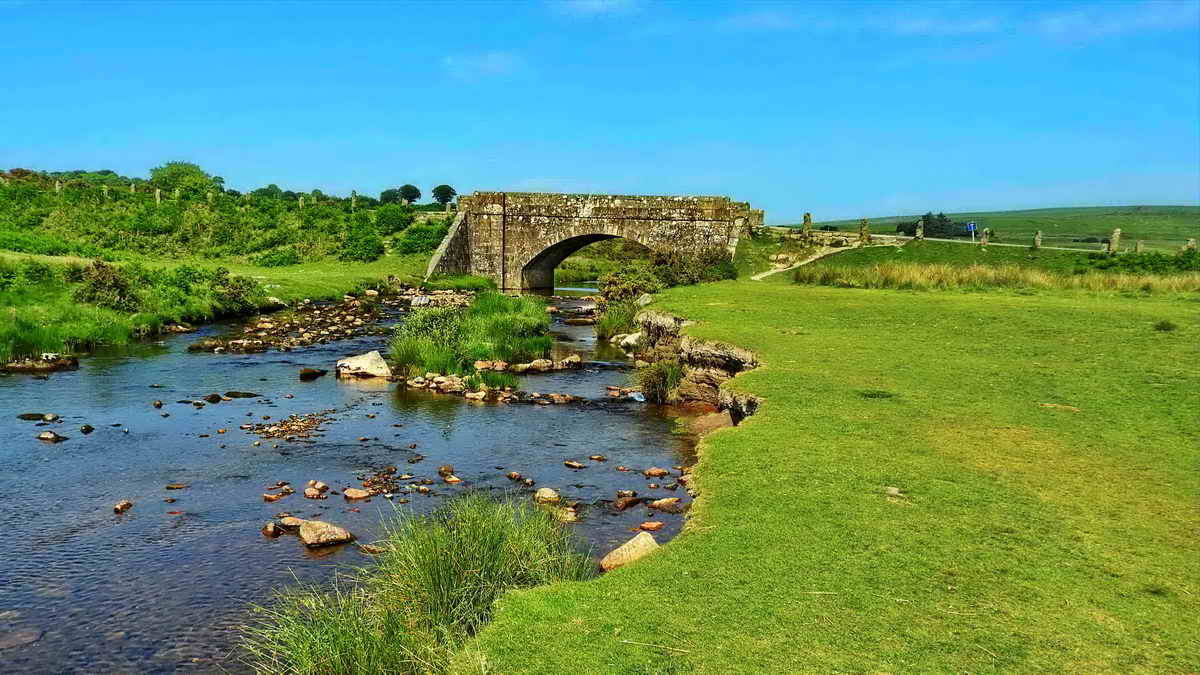
Cadover Bridge, crossing the River Plym, seen approaching from the car park ..... marked as Cadworthy Bridge on the 1840 Meavy Parish Tithe Map. The nearby farm is Lower Cadworthy Farm, where "worthy" is from the Saxon "worthig" meaning a one-family smallholding (in Devon Place Names) and Cad was a name for the River Plym .....
From William Crossing (1912, reprinted 2001) Crossing's Guide to Dartmoor, Peninsula Press, Newton Abbot, page 436:
"In the charter of Isabella de Fortibus, 1291, the river is called Plymma from its source downward, and and the confluence is thus referred to, "locum ubi Mewy cadit in Plymma". The bridge, probably then a clapper, is called in the same charter "ponte de Cadaworth." This name is taken from the Saxon worthig close by now called Cadworthy, and which was apparently formed on the site of a British battle - cad being a Celtic word meaning conflict or strife."

Closer view.

View from Cadover Bridge, looking down the River Plym, with the car park at the far left and the road to Wotter, Shaugh Prior and Plympton at left edge.
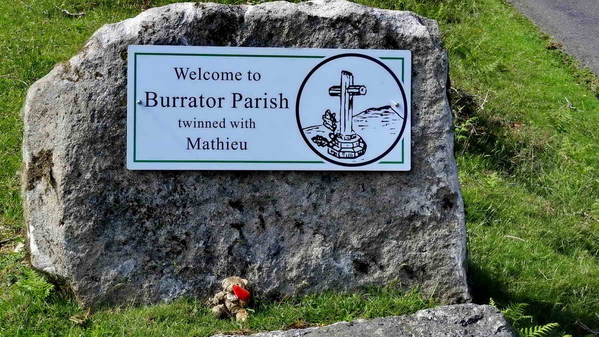
Parish sign just up the road from the bridge where we turned left onto Wigford Down. I nearly woke the pisky.

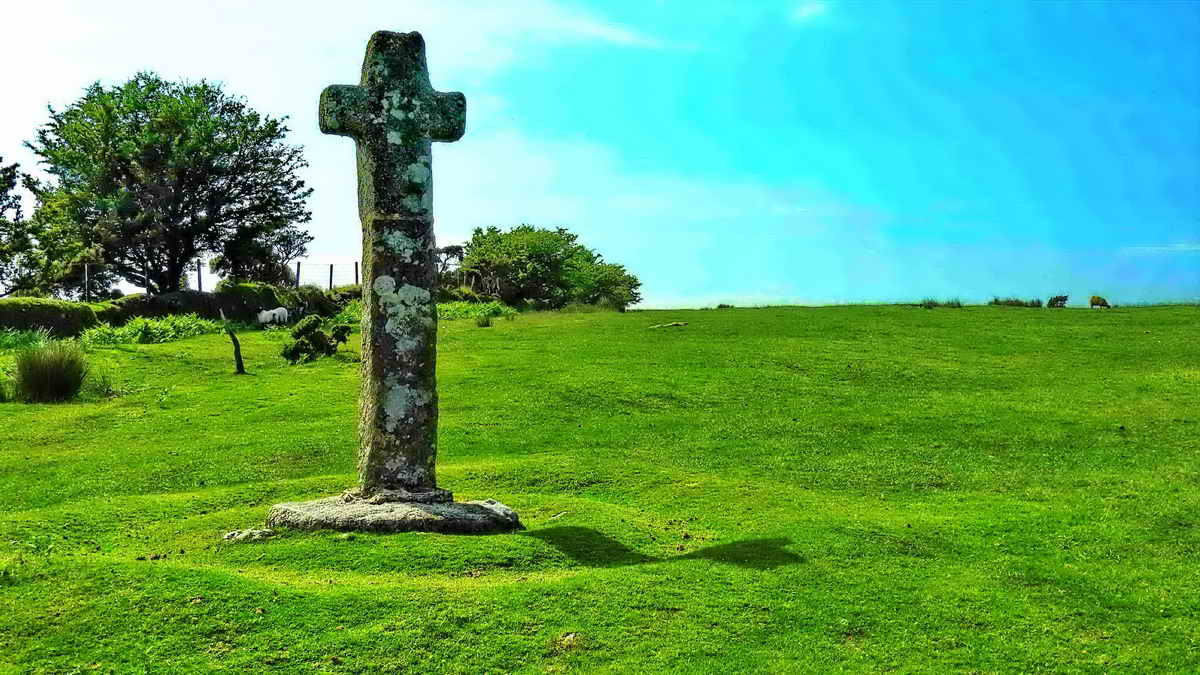
Small ford across a shallow stream: straight ahead is a "large" tree with a tall stone cross to its left .....

Cadover
Cross, a waymarker on the Monastic Way between
Plympton Priory and Tavistock Abbey ..... the track is described in
Eric Hemery (1986), Walking Dartmoor's Ancient Tracks, Robert
Hale, London, pages 165-181 (see pp.171-172). The medieval track ran
from Plympton to
Stony Cross aka Shaden Moor Cross, which is near the summit
of Shaugh Moor on the Plympton-Cadover road, following the line of the
modern road to near Cadover Bridge. Close to the modern bridge was a
ford, Cad-a-ford, (ford over the Cad) perhaps
fifty-metres upstream. From here the track would go straight uphill from
the ford to
Marchant's Cross, for Meavy. A sidebranch turned
left for Wigford Down, up past Cadaford Cross (Cadover Cross, pictured
above) as an alternative route over the Down, with a sidebranch left at
the wall corner (up from the cross) to
Urgles
Cross for Shaugh Prior.

This photograph was taken to try and show the inscribed cross that is centred between the arms of the cross ..... weathering and lichen growth are obscuring it .....
Old photograph from 26th February 2007 .....
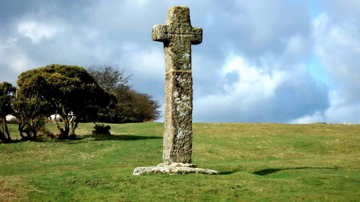
This older photograph shows the inscribed cross, but there are also small crosses inscribed in the centre of each arm according to Rev. Hugh Breton, Vicar of Meavy, around 1915 when he arranged for the re-erection of the cross for a second time: the first was after it was found fallen in 1873. This shows the east face of the cross.
Details from an Historic England description (with my emboldening, Ed.).....
| There is an incised cross between the arms on the western face of the cross, much obscured by lichens. The cut is not visible against the northern arm and down the shaft, as a portion of the west face of the cross has been severely damaged with a thickness of 70mm-90mm split away. The present dimensions of the incised cross are about 0.33m vertically and 0.39m horizontally. The cut is 30mm-40mm wide and about 5mm deep. The top and two arms of the incised cross may well have ended in small crosslets. On the east face of the cross there is a complete incised cross between the arms. It measures about 0.44m vertically by 0.36m horizontally. The tail and head of this cross extend about 100mm above and below the arms respectively. The cut is 30mm wide and has a maximum depth of about 7mm. The top and arms of this cross may well have ended in crosslets, like that on the west face. |
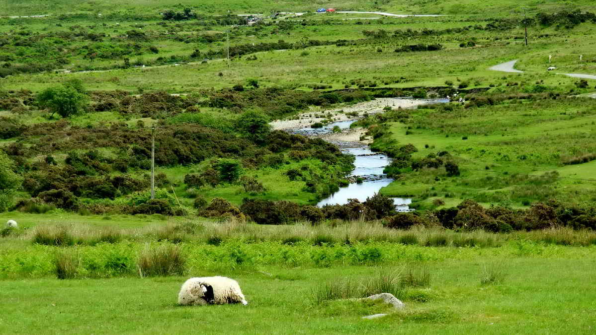
View looking east, up the River Plym, from a point uphill from the cross .....

Zoomed view - the central area in the photograph could be the site of the old ford across the River Plym, or Cad, i.e. this could be Cad-a-ford.

Wigford Down cairn cist at SX 54420 64424 � 3 metres..... described by J. Butler (1994), Dartmoor Atlas of Antiquities III, The South West. 48.1 Wigford Down field system and cairns, and Dewerstone Hill (figs. 48.1, 1.1, 1.2, 2), pages 79-98 .....

While this structure was very obviously a Bronze Age burial site, later Bronze Age farmers built a field division across the eastern half of it .....

Showing the capstone and stone box (cist) .....

Looking directly into the cist, the end stone to the left has "caved in" somewhat so that the "box" is no longer in its original condition.
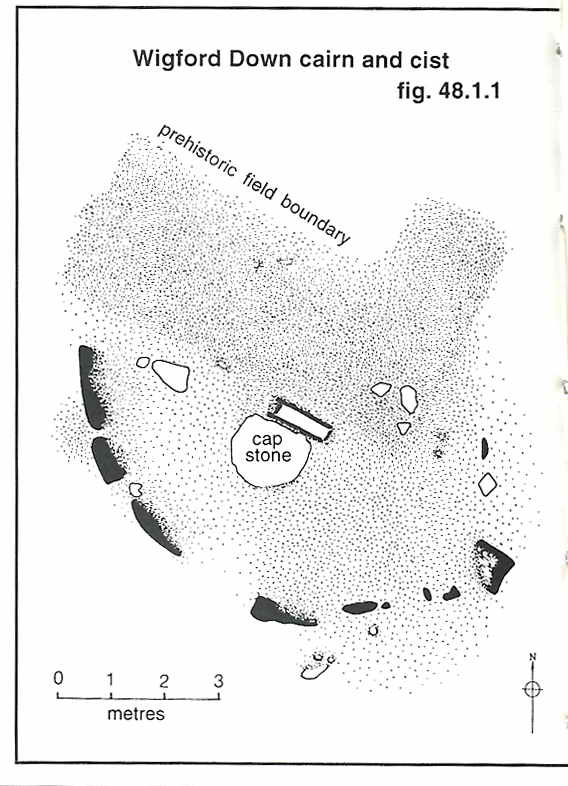
Image � J Butler
1994. Reproduced by kind permission (ref. 29 Sept. 2012).

Cadworthy (Cadover) Tor, SX 54182 64160, elevation 238 metres (780 feet) - marked as Oxen Tor on the 1840 Meavy Parish Tithe Map.

View from Cadworthy Tor to Dewerstone Rock, or The Dewerstone (the cliff face on the left) and Dewerstone Hill on the right, this was marked as Dewerstone Tor on the 1840 Meavy Parish Tithe Map .....

Zoomed view of Dewerstone Rock .....
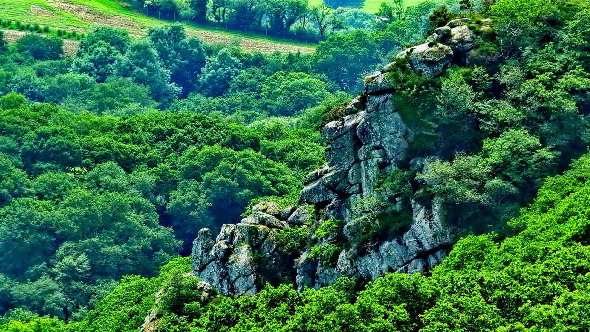
The Dewerstone.

Ruins of a double-walled structure across the end of the Dewerstone promontory, cutting it off from the rest of the countryside, with protecting steep slopes on two sides down to the valleys of the Rivers Meavy (to the west) and Plym (to the south). This is reported to be Neolithic (circa 2,500 BC?), pre-dating the Bronze Age (circa 1,000 BC?). It is the double-lined structure depicted in the figure below. Dates taken from Prehistoric Archaeology - Dartmoor Factsheet (downloadable PDF).
NB - There is a new Introducing Prehistoric Dartmoor Factsheet (downloadable PDF).
Devon & Dartmoor Historic Environment Record - MDV2380 Dewerstone enclosure or hillfort
Devon & Dartmoor Historic Environment Record - MDV63618 Hut circle in enclosure on summit of Dewerstone Hill - this is the "hut?" below .....
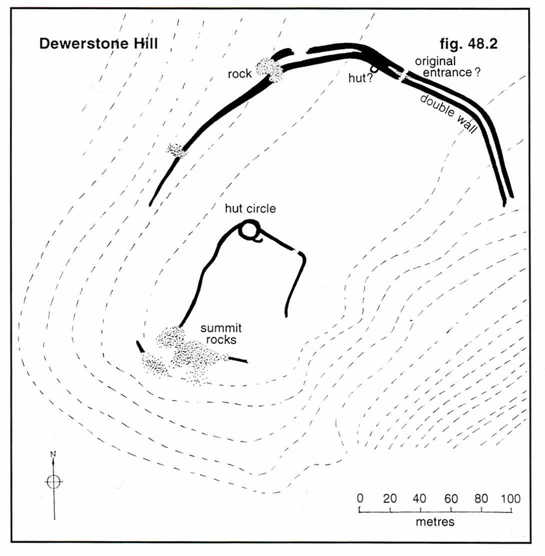
Image � J Butler
1994. Reproduced by kind permission (ref. 29 Sept. 2012).
One of the very few prehistoric fortifications on high moorland - no doubt due to it's promontory location: Jeremy Butler, 1994, Dartmoor Atlas of Antiquities. Vol. 3 - The South West, 1 - Wigford Down field system and cairns, and Dewerstone Hill (figs. 48.1, 1.1, 1.2, 2), pages 78-98.

Looking along the double-walled structure.

Approaching Dewerstone Hill or Dewerstone Tor - the higher flat rocks to the left are incised (see below) .....

Before reaching the hilltop rocks, there are other rocks on the left that bear a small plaque that can be seen above, near the camera .....

At SX 53792 63898, Chinese proverb - Falling Leaves Return to Their Roots. My thought regarding the meaning was that "Travellers Return Home" or something similar.
Five photos of the Dewerstone Hill inscriptions, taken on 13th January 2016, in better lighting .....

Dewerstone Hill, SX 53775 63903, elevation 219 metres (708 feet) - the inscriptions are on the flat rocks up on the left .....

CARRINGTON - OBIT - SEPTEMBRIS MDCCCXXX (1830) .....in memory of Noel Carrington, a local Dartmoor poet, also ......

Variously, W FORD, F WIDGER, F DODRIDGE

F WIDGER ..... Perhaps Widger was a member of the the old shop - "Widgers" by Charles Church in Plymouth that sold glass, paints and wall paper etc. until about 1980.

W FORD. There are at least two other inscriptions nearby but they are very faint.
Link to a panorama movie from this location - MP4 18 MB - 180� panning from left to right, namely north-west to south-east, ending at the inscribed stone above.
Link to a panorama movie from this location - wmv 19 MB - 180� panning from left to right, namely north-west to south-east, ending at the inscribed stone above.

The DPA Short Walks group probably welcomed the usual coffee break at the halfway ppoint, here on Dewerstone Hill, more than usual because it was a glorious, sunny, warm day.
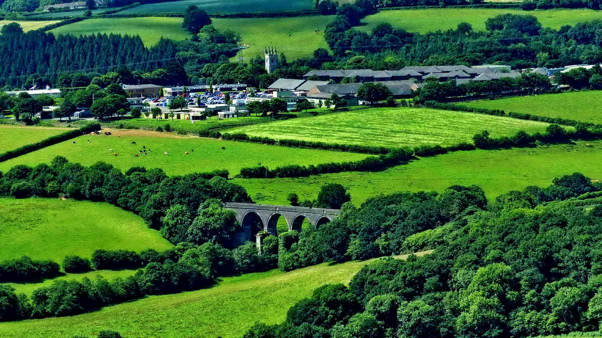
Zoomed view from the hilltop showing Bickleigh Viaduct (with the redundant piers of the original Brunel bridge), the C15th tower of Church of St Mary the Virgin and the much of the village. This link show a Google Satellite View of the area.

An artistic moment - "Grass blowing in the wind", flash and macro together, no sign of motion.

Looking along the inner single wall of the hilltop enclosure. In the north-west corner of the wall is a hut circle ......
Devon & Dartmoor Historic Environment Record - MDV63617 Hut circle in enclosure on Dewerstone Hill

Looking back west at the gap in the single Bronze Age wall, at or near SX 53850 63980, with Dewerstone Hill behind.

The main entrance in the Neolithic double wall indicated in the figure above as "original entrance?"

Zoomed view to Cadworthy Tor; to the right and behind is Cadworthy Wood, in the Plym valley.

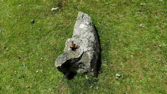
L stone at SX 54415 64550 (140 metres north of the cist). There are perhaps eight of these stones running diagonally (at 45� west of north from the cist) to the far side of the Down. These are boundary stones between the lands of Sir Ralph Lopes (of Maristow Estate, to the north-east) and Mr Scobell (holding inclosed land at Urgles / Goodameavy, to the south-west), settled after a meeting on the Down as described in a letter by the Maristow steward and land agent George Giles. The letter was dated 18th February 1841. The line of posts also follows the boundary (on older OS maps) of the section of land formerly owned on Wigford Down by the National Trust .....
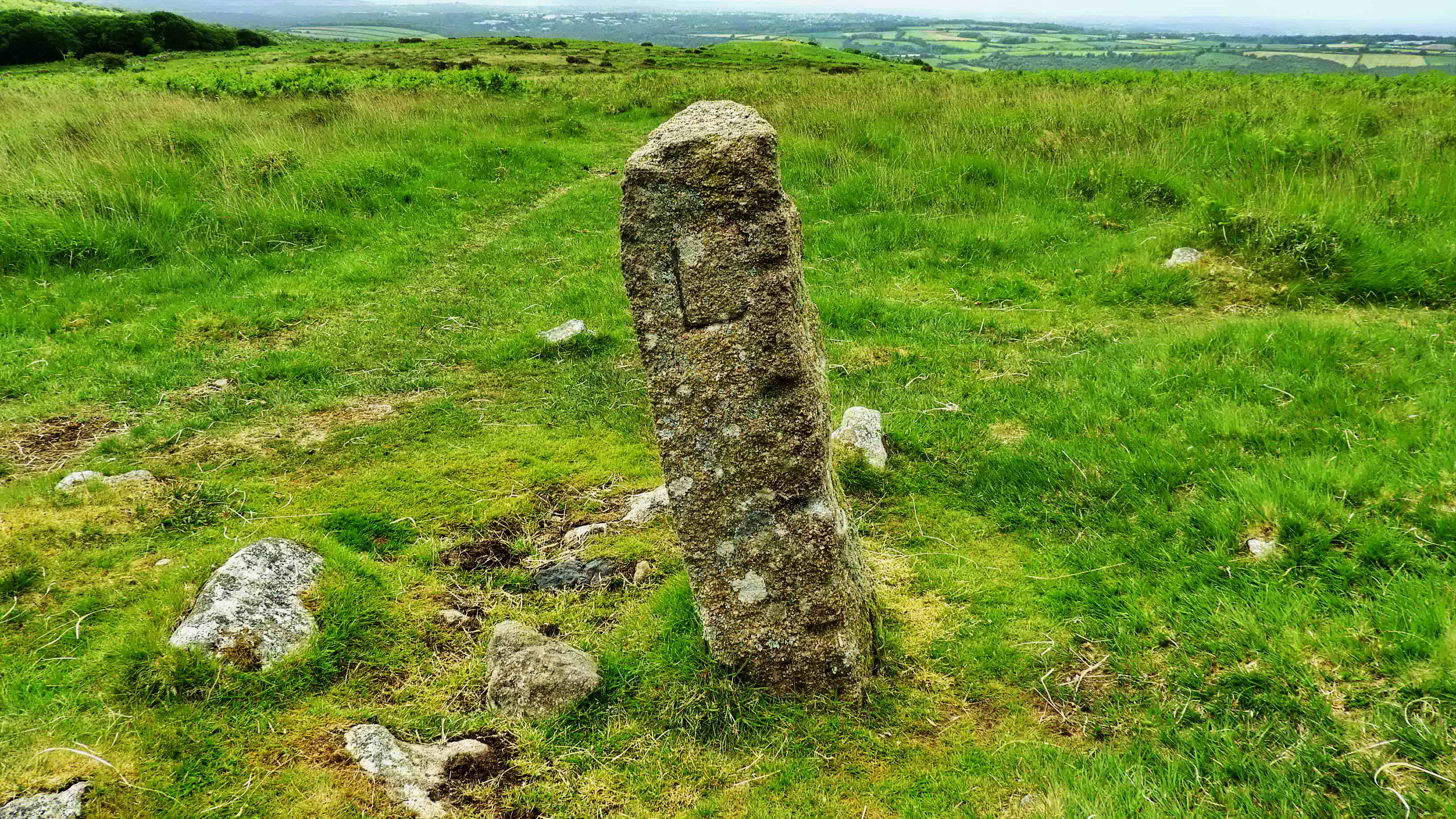
Photograph of the dark face in the photograph above taken during Recce-3 in different lighting to show the "L" - the large lichen near the ground is seen in both photographs.

At waypoint "MAMBA-1", meaning Miles And Miles of Damn All (polite version, not what the Marines say) - just miles of grass, distant gorse bushes and far away hills.

Image � J Butler
1994. Reproduced by kind permission (ref. 29 Sept. 2012)
Figure from: Jeremy Butler, 1994, Dartmoor Atlas of Antiquities, Vol. 3 - The South West, 1 - Wigford Down field system and cairns, and Dewerstone Hill (figs. 48.1, 1.1, 1.2, 2), pages 78-98. The cist photographed above is label "1", near centre-bottom in the figure. The ruined walls are off the figure to the bottom-left. Below, we visit summit cairns 2 & 3 and then cairns 4 & 5.
There is more information on Legendary Dartmoor - Wigford Down.
Two summit cairns, SX 54652 65080, both robbed for road building - the near one is highly robbed, leaving a depression that acts as a dew pond .....

Devon & Dartmoor Historic Environment Record - MDV2311 Damaged cairn on Wigford Down - the cairn beyond has more stones left!

Devon & Dartmoor Historic Environment Record - MDV2312 Large damaged
summit cairn on Wigford Down, Meavy - the small pile
of stones seen today is a modern structure, the centre of the cairn was
once an Observation Post. There is another small cairn immediately on
the south-east side of this one, "Butler's cairn 8" .....
Devon & Dartmoor Historic Environment Record - MDV2313 Small cairn on
Wigford Down

Another view of the present day cairn.

At waypoint "MAMBA-2", meaning Miles And Miles to the BA stone ..... at SX 54780 65155. This is really easy to find if you come this way, right beside the fence corner .....

So, Buckland Abbey or nearby Brisworthy
Arrishes (= fields)? This is not so simple.
Mike Brown (2001) Guide to Dartmoor, CD-ROM, Dartmoor Press, Grid Square
References 5470 6515
Devon & Dartmoor Historic Environment Record - MDV2368 Ring cairn on
Wigford Down - a really "robbed" cairn, not a lot to see today, SX 54688 64964.
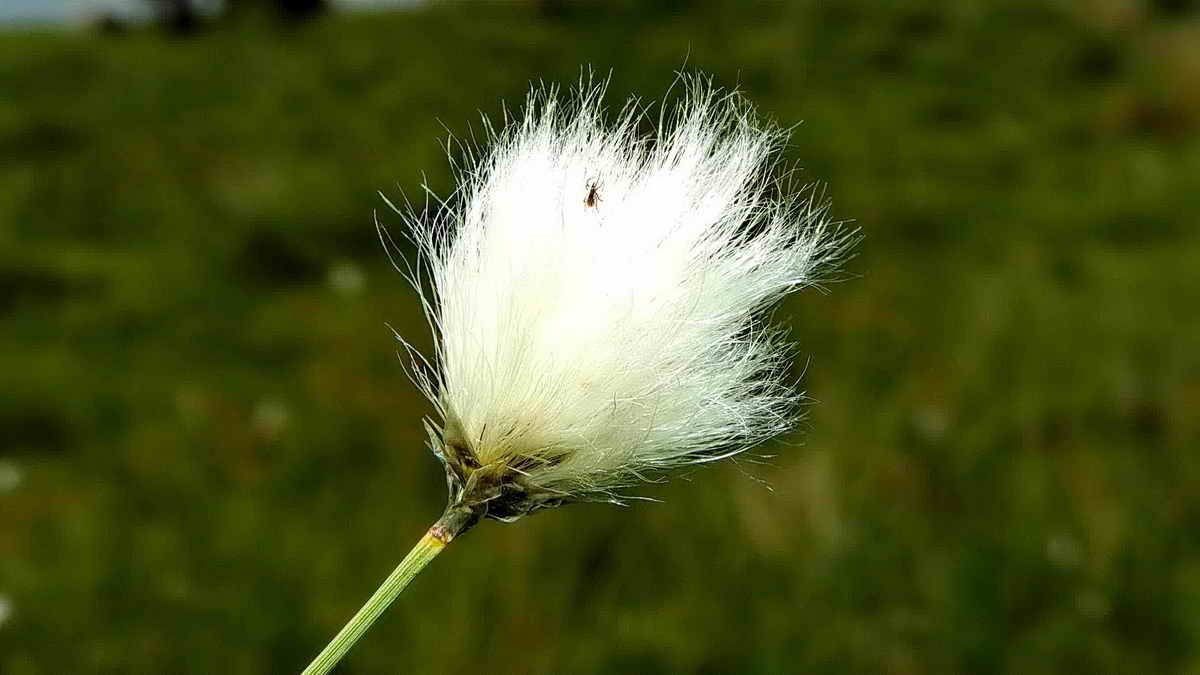
Adjacent, a kerb cairn at SX 54700 64955 and Common
cotton grass .....
Common cotton grass, Eriophorum
angustifolium, has several seed heads on a single
stalk. Below, see that Hare's-tail cotton grass, Eriophorum
vaginatum, has a
single seed head on a stalk.
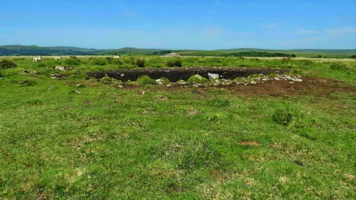
Devon & Dartmoor Historic Environment Record - MDV2367 Kerbed ring cairn
on Wigford Down -
This survives as an oval mound about 10 metres long by 5 metres wide.
The kerb circle has at least five massive stones up to 2.4 metres
long and 0.9 metres high, four of which are still standing and the fifth
is fallen ..... SX 54700 64955 .....
Another view, showing the remains of the
kerb circle .....
The two cairns pictured above, "4" and "5" labels refer to the same
labels on the overview figure of Wigford Down above.
Nearly back down to the cross again .....
An all-white pony .....
A foal.
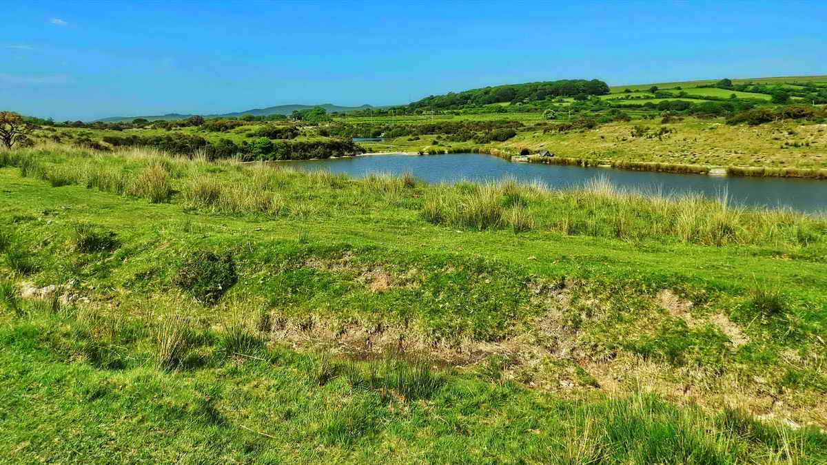
A view of one of the lakes that was once
Wigford Down (later, Brisworthy) China Clay Works; a dry leat runs left
to right near the camera, now
Plymouth & District Coarse Angling Club.
Devon & Dartmoor Historic Environment Record - MDV48959 Wigford Down
China Clay Works
Devon
& Dartmoor Historic Environment Record - MDV49050 Water wheel
-
link to 1883-1910 25-inch OS map, see centre area.
The water wheel is missing from the
1886 single sheet
map but was marked on the
1904 single sheet
map.
A small cairn at SX 55248 64827, getting
down near the cross.
Back to the angling lake again .....
Last look at the lakes.
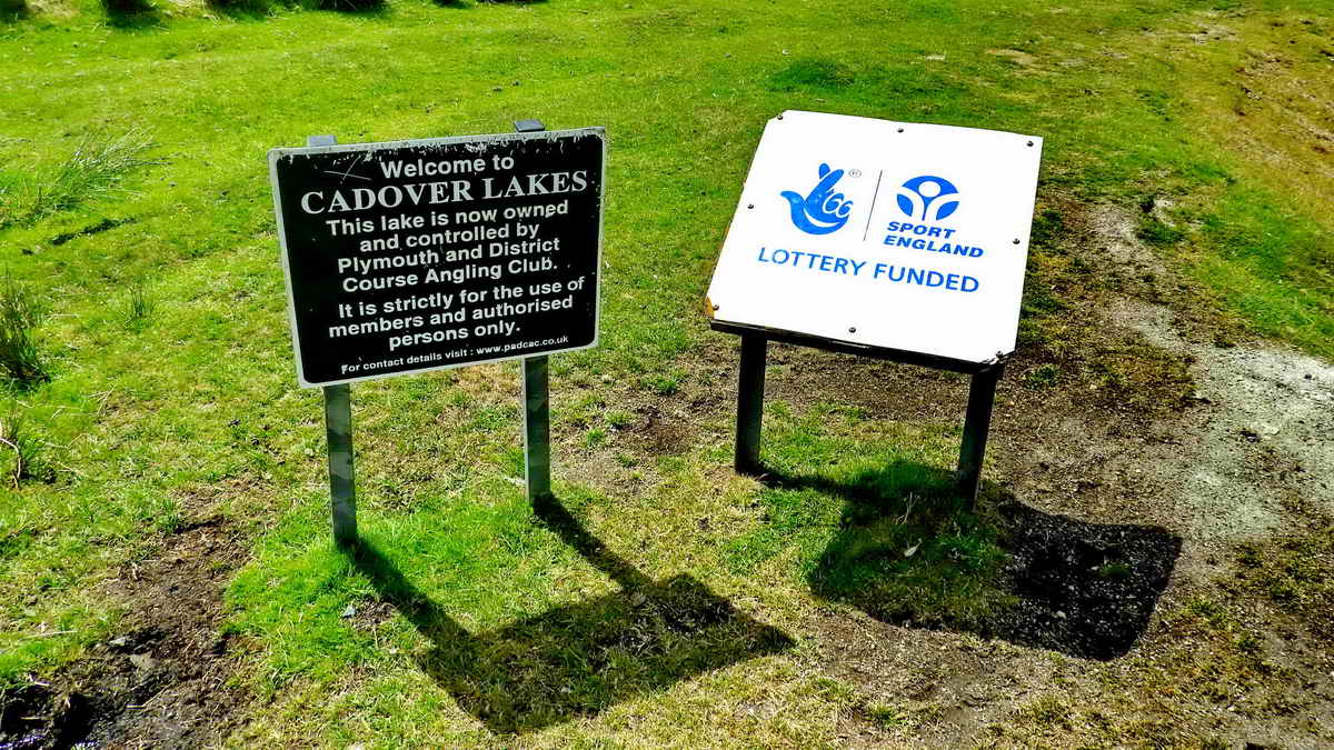
Signs at the end of the lake.
The sun is on "the back" (west
face) of Cadover Cross,
in the afternoon, looking up the River Plym .....
Just another view - why couldn't the sun
shine earlier as given in the weather forecast?
The head of the cross .....
Last look - note the concentric double
earthen banks, believed made during one of the re-erections of the cross
in 1873 or 1905.
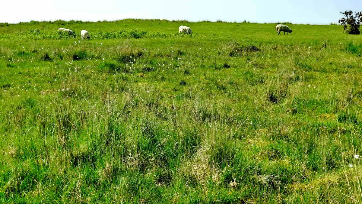
Sheep and Hare's-tail cotton grass .....
Hare's-tail cotton grass, Eriophorum
vaginatum, having a single
seed head.
Close-up.
Looking down across Cadover Bridge.
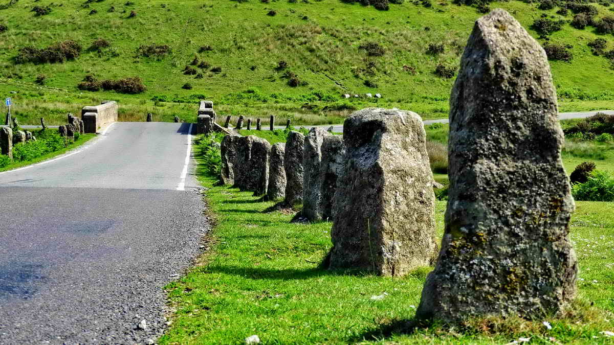
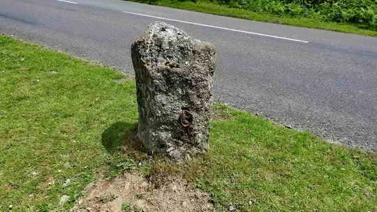
Several of the stones lining the road have
signs of being used for other things - perhaps even for blocking, gating
or chaining this road at some period?
There are two medieval longhouses
on Wigford Down - these were not visited on this walk because
of the risk of ticks - I picked one up during
Recce-1. The longhouses are located at SX 54290 65121 and
SX 54119 64934 (the long longhouse) .....
Devon & Dartmoor Historic Environment Record - MDV15010 Wigford Down deserted medieval farm,
Meavy 12.5 metres long
Devon & Dartmoor Historic Environment Record - MDV15009
Wigford Down medieval site, Meavy
- the longer one.
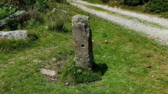
C stone at SX 55598 64601 .....
There is (are or
were) one, two or three C-stones
(County stones) associated with this bridge,
three "Stone" labels are shown on the old 6-inch OS map,
although the northern stone today appears to be a plain pillar. After
the dissolution of the monasteries by King Henry VIII (between
1536 and 1541), bridge maintenance became a duty of the County where no
other authority, owner, Hundred, Riding, City, Borough, Town or
Parish could be held responsible. The C stones are believed to have been
put in place
around 1841. They were erected one on each
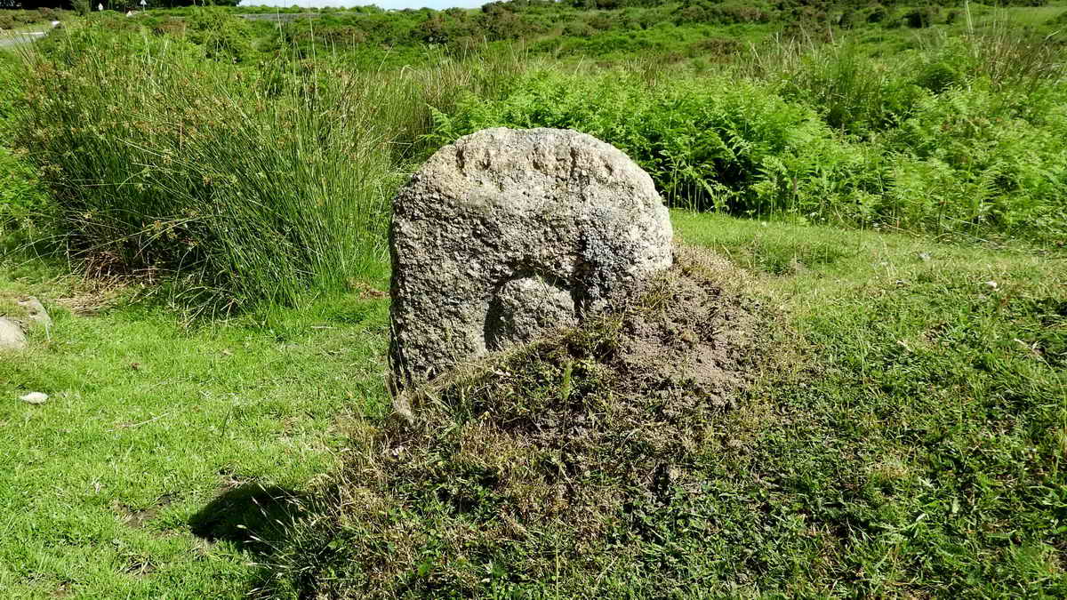
side of the bridge, about 100 yards from its centre. The stone pictured above is
half-buried on the north
side of the road that used to run to Lee Moor and Cornwood before it was
closed due to china clay operations: now it terminates beside Blackaton
Cross - it is 70-metres from the centre of the bridge.
Last photograph, showing the "Stone"
labelled on the old maps north of the bridge - not a typical C stone.
This is taken looking south, from the Meavy direction. The road to the
left after the bridge is the old Cornwood road, the one to the right is
the road to Plympton, Shaugh Prior and Wotter. MAP: Red
= GPS satellite track of the walk.
The walk was reached by taking the PLYMOUTH road off
the Yelverton roundabout and turning LEFT IMMEDIATELY (signposted Meavy,
Cadover Bridge 3), so that you are facing the public toilets. Then BEND
LEFT and BEND RIGHT to pass by the end of the row of shops. This is Meavy
Lane, which becomes Gratton Lane. After 1.5 miles, there is a crossroads
but the "main" road you are on BENDS LEFT (signposted Cadover Bridge 1.5 miles).
At a near-hairpin BEND RIGHT, ignore the small road back left to Sheepstor.
After a long downhill section, you cross Cadover Bridge - use the large car
park on the RIGHT, the
P
symbol on the map.
Statistics
All photographs on this web site are copyright
© Keith Ryan. 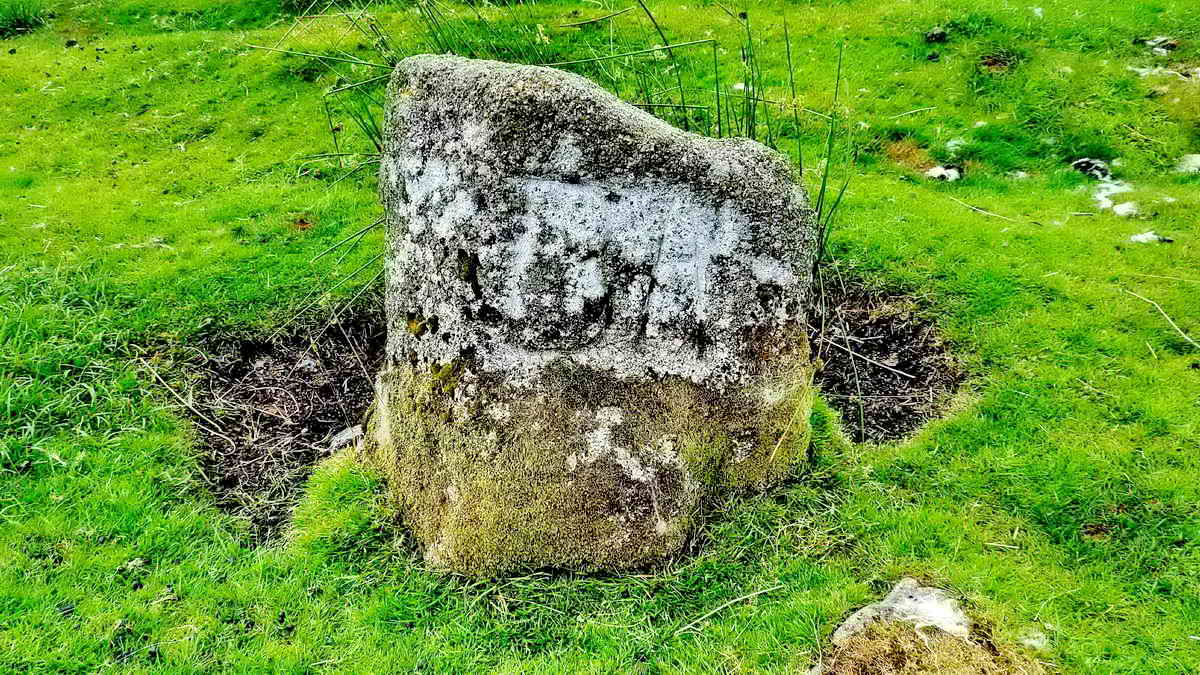
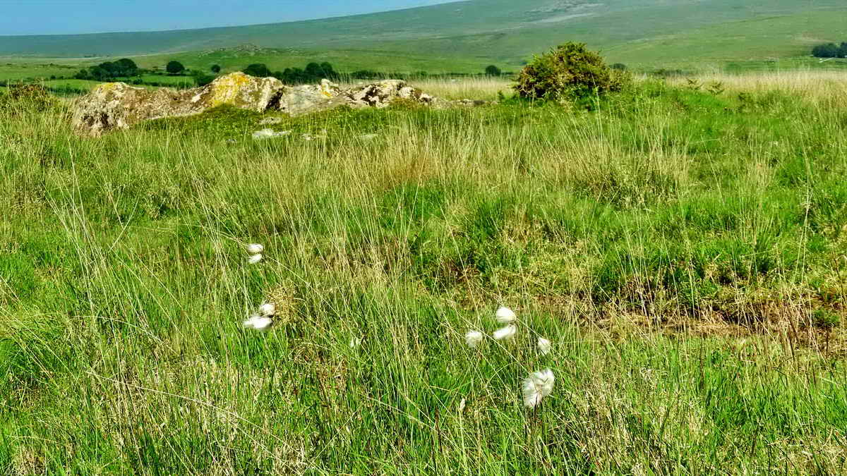


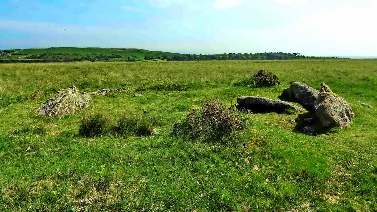

Image �
J Butler 1994. Reproduced by kind permission (ref. 29 Sept. 2012)


� Crown copyright 2018 Ordnance
Survey
Licence number 100047373
Also, Copyright � 2005, Memory-Map Europe, with permission.
Distance - 6.29 km / 3.91 miles
All rights reserved - please
email for permissions