![]()


This walk: 2018-2-25. Kraps Ring Bronze Age enclosure, round house hut circles, ring cairns, cists, stone rows, Lich / Lych Way, marker stones, Bellever Tor / Bellaford Tor (an avenue tor), triangulation pillar.
Walk details below - Information about the route etc.
| Previous walks in this area: |
24th July 2007,
9th June 2008,
18th September 2008,
29th September 2010,
27th June 2011, 6th August 2011, 18th January 2012, 26th March 2014, |
Google Satellite map + GPS track of the walk
Further reading
The Legendary Dartmoor web site has an excellent page entitled
Prehistoric Bellever.
History of forestry on Dartmoor: The building of Tor Royal by Sir Thomas Tyrwhitt at Prince's Town was completed in 1798 and through the first decade of the 1800's there were experimental plantings of coniferous shelterbelts to protect it. The Duchy of Cornwall established a plantation at Brimpts in 1862. Forestry grew after WW1 in an effort to replace the country's greatly depleted timber stock. By 1930, forestry had been established at Fernworthy, Bellever, Brimpts, Bear Down and Frenchbeer (Chagford) and in 1930 these areas were sold to the Forestry Commission (founded in 1919). By 1938, the eastern slopes of Bellever Tor and Lakehead Hill were planted and the western slopes between 1940-1943. Source: The New Forests of Dartmoor (1964), London HMSO, Forestry Commission booklet No. 10, pages 6-10.
During the planning stages for forestry on the moor, Dartmoor Preservation Association campaigned to keep the Bellever area free of trees because it was so rich in antiquities. Eventually it was agreed that planting would leave a clear belt running from Kraps Ring up over Lakehead Hill and down to Bellever Tor so that much of the antiquities would not be lost. Source: Matthew Kelly (2015). Quartz and Feldspar. Jonathan Cape, London, pages 248-260.
Soussons Down was leased, fenced, deep ploughed and planted 1945-1949 and at some point the Forestry Commission also took over management of the Plymouth Corporation plantations at Burrator - these had been started in 1921. Source: Kelly, p. 250.
The tree of choice for planting on Dartmoor is the Sitka spruce, Picea sitchensis, chosen for its high productivity compared to e.g. Douglas fir, Norway spruce, European larch and other fast-growing conifers.
For no particular reason, other than not to lose it - after seeking it for a long time - and that it should not be lost again, I am inserting here an old film that was made in this area .....
Pony postman - an original film from 1949, plus updates:
1949 -
https://www.youtube.com/watch?v=H0EpfGgbZD8
1957 -
https://www.youtube.com/watch?v=7Yzcg0fX61o
1963 -
https://www.youtube.com/watch?v=6JdDS-_xy9s

Twelve ponies of the herd belonging to Dartmoor Pony Heritage Trust that run in Bellever Forest / Bellever Tor for conservation grazing. Photograph taken at the forest road junction just up from the car park by the main road.
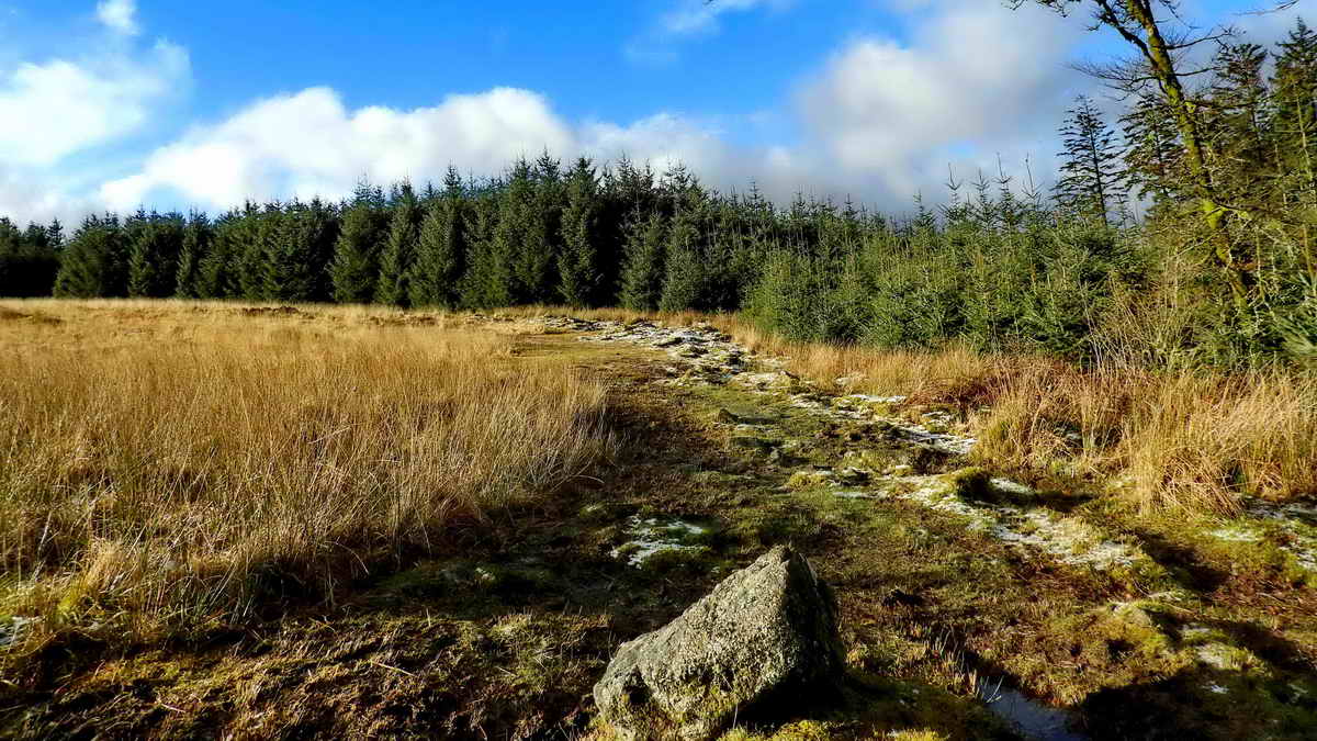
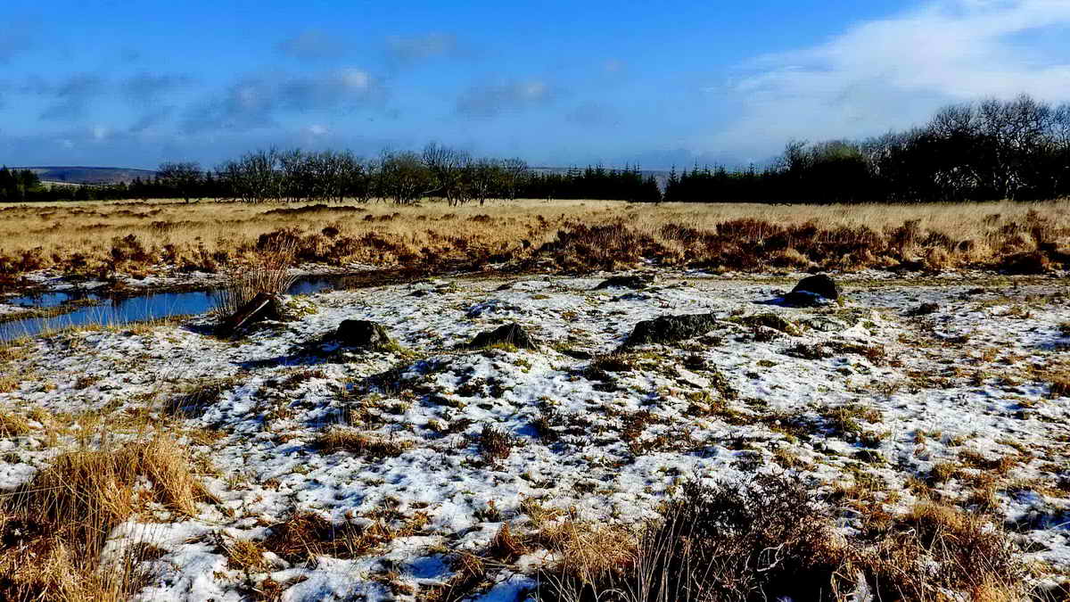
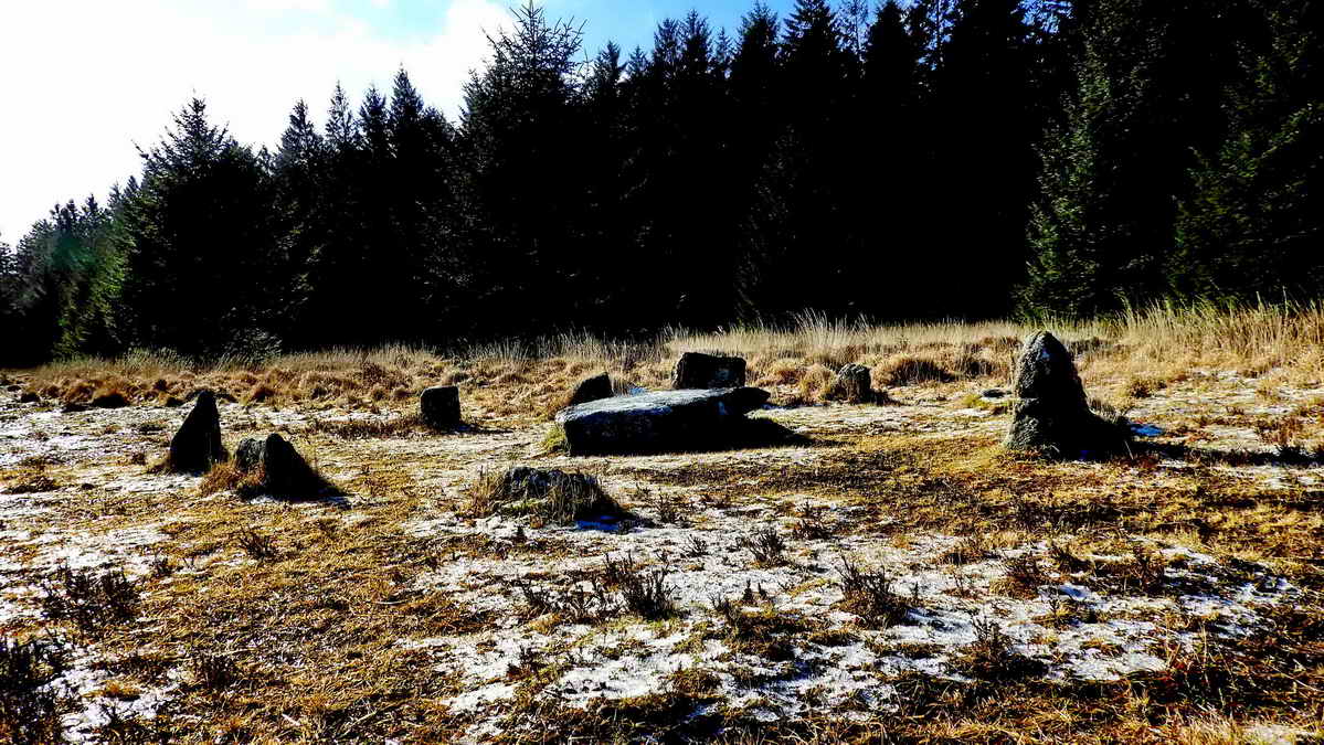
The first Bronze Age artefact encountered is the northern edge of Kraps Ring, an enclosed settlement where there were several round houses - the remains of these are commonly called hut circles. It can be seen in the photograph that the vegetation in the open area here is mostly long Purple Moor Grass, Molinia. The monument was cleared recently by volunteers of Dartmoor Pony Heritage Trust The enclosure is roughly 110 metres across and contains the ruins of eleven round house hut circles. There is now a 12th hut circle identified by Barry & Tanya Welch and confirmed by DNPA Archaeologists and there is possibly a 13th, to be confirmed. The wall was quite massive, being about 2-metres wide where the faces are more obvious and perhaps 1-metre high.
DNPA identifier 5A - Kraps Ring
Devon & Dartmoor Historic Environment Record: MDV5861 - this
record has links to records of 11 hut circles within the enclosure.
Remains of hut circles inside Kraps Ring .....
Climate: the climate has changed repeatedly over the millenia - see HERE for a record of the last 800,000 years. The earth has passed through ice ages to warmer periods than we have today. The last ice age ended about 10,000 years ago. In the Neolithic Period (New Stone Age, 4,500-2,300 BC) and Bronze Age (2,300-700 BC), the climate was warmer than today and Dartmoor was originally mostly wooded. Clearings were made to enable easier hunting and then clearance continued to prepare land for farming. The climate deteriorated during the first millenium BC (1,000-1 BC), becoming colder and wetter, resulting in depopulation of the higher moor. The Medieval Period experienced an improved climate and farming became more widespread again, resulting in the establishment of longhouse settlements. Sources: Farming on Dartmoor - Dartmoor Factsheet, and Prehistoric Archaeology - Dartmoor Factsheet.

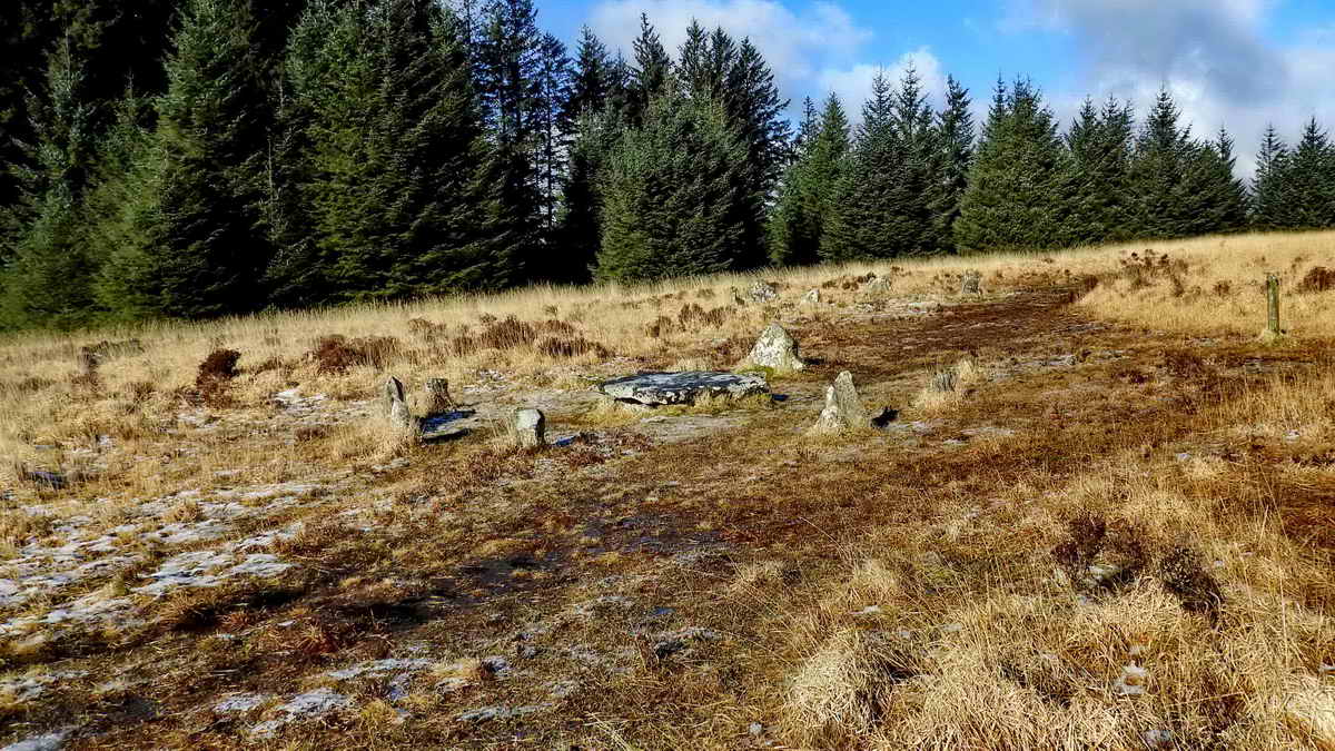
The southern section of the enclosure wall of Kraps Ring .....

A closer view. The enclosure is described in Jeremy Butler (1991), Dartmoor Atlas of Antiquities, Vol. 2 - The North, 27.7,8. Prehistoric settlements on Lakehead Hill (fig.27.6), pages 43-44.

Image � J Butler
1991. Reproduced by kind permission (ref. 29 Sept. 2012).
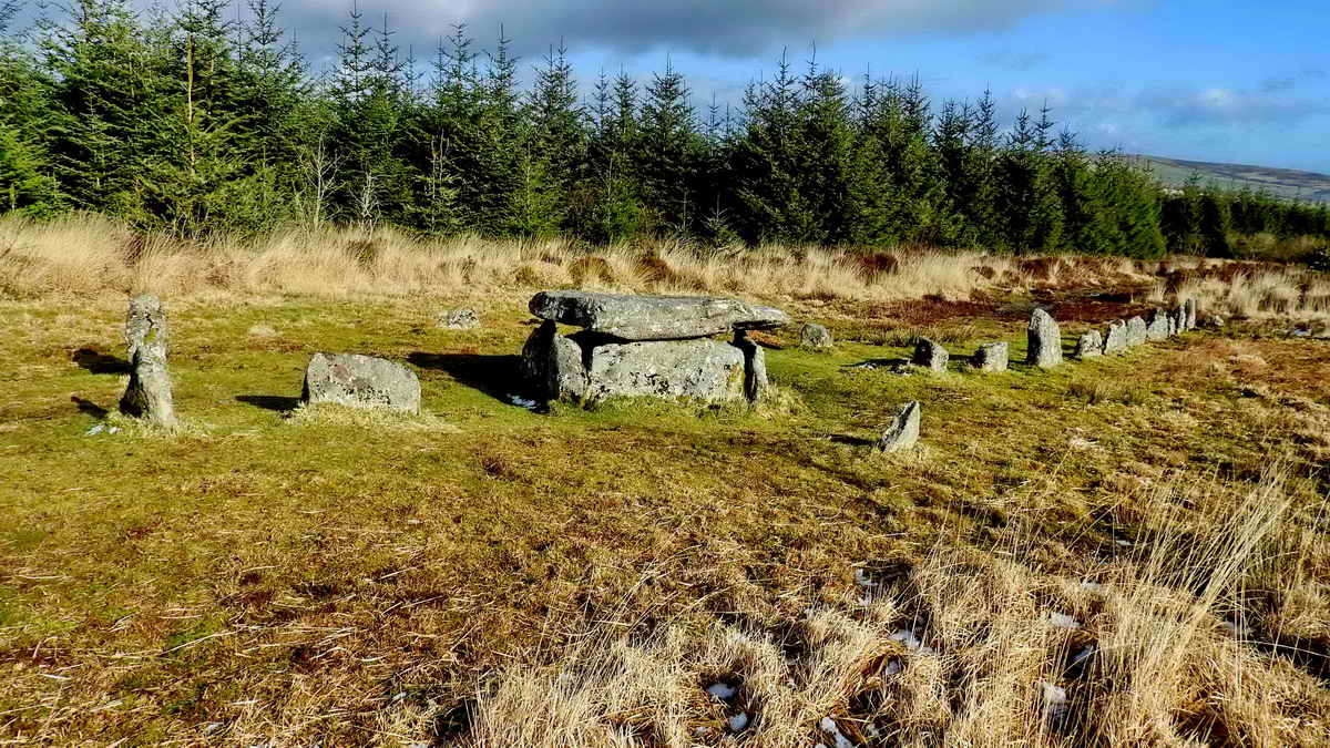
The stone rows, cairns and cists in this area are described in Jeremy Butler (1991), Dartmoor Atlas of Antiquities, Vol. 2 - The North, 27.19. Cairns and stone rows on Lakehead Hill (figs. 27.12, 13), pages 48-52.
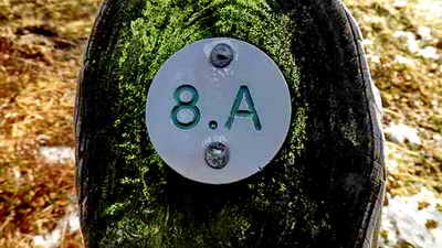
DNPA identifier 8A - Hut circle,
SX 64389 78069. This
is the hut circle shown just south above the "Kraps Ring" label on the
sketch plan above.
Devon & Dartmoor Historic Environment Record: MDV52760
 |
The artefacts on Lakehead Hill are marked by a wooden post bearing a metal identifier. These are recorded on a DNPA list by location, site number, grid reference and a brief description. |

A fallen tree, no doubt a victim of the wind, at SX 64370 77897.

DNPA identifier 10A - Ring cairn at SX
64353 77770, labelled "1" on the sketch plan above .....
Devon & Dartmoor Historic Environment Record: MDV5869
As previous photograph.
CIST - NOT INCLUDED ON THIS WALK, not a lot to see, included here for completeness .....

DNPA identifier 9A - Cairn with cist at SX
64256 77695, labelled "2" on the sketch plan above .....
Devon & Dartmoor Historic Environment Record: MDV5841

DNPA identifier 11A, SX 64367 77656 - Stone row, possibly double, labelled "3" on the sketch plan above, looking west toward Longaford Tor ..... photograph taken from a low angle ..... Devon & Dartmoor Historic Environment Record: MDV5930
It should be noted that many prehistoric monuments were "restored" in Victorian times by enthusiastic antiquaries so that what we see today may be somewhat altered compared to how they were originally, around 3,000 years ago.

DNPA identifier 14A - Ring cairn with kist and 15A
- Stone row, both included in label "4" on the sketch plan above .....
at SX 6449 7760 .....
Devon & Dartmoor Historic Environment Record: MDV5873 .....
Kist - from "kistvaen": A stone box or coffin, from the Celtic cist, a chest, and maen, stone, v being used as a mutation of m. (Source: Crossing's Guide to Dartmoor, 2nd edition 1912, reprinted 1990, page 22).

As previous photograph .....
As previous photograph .....
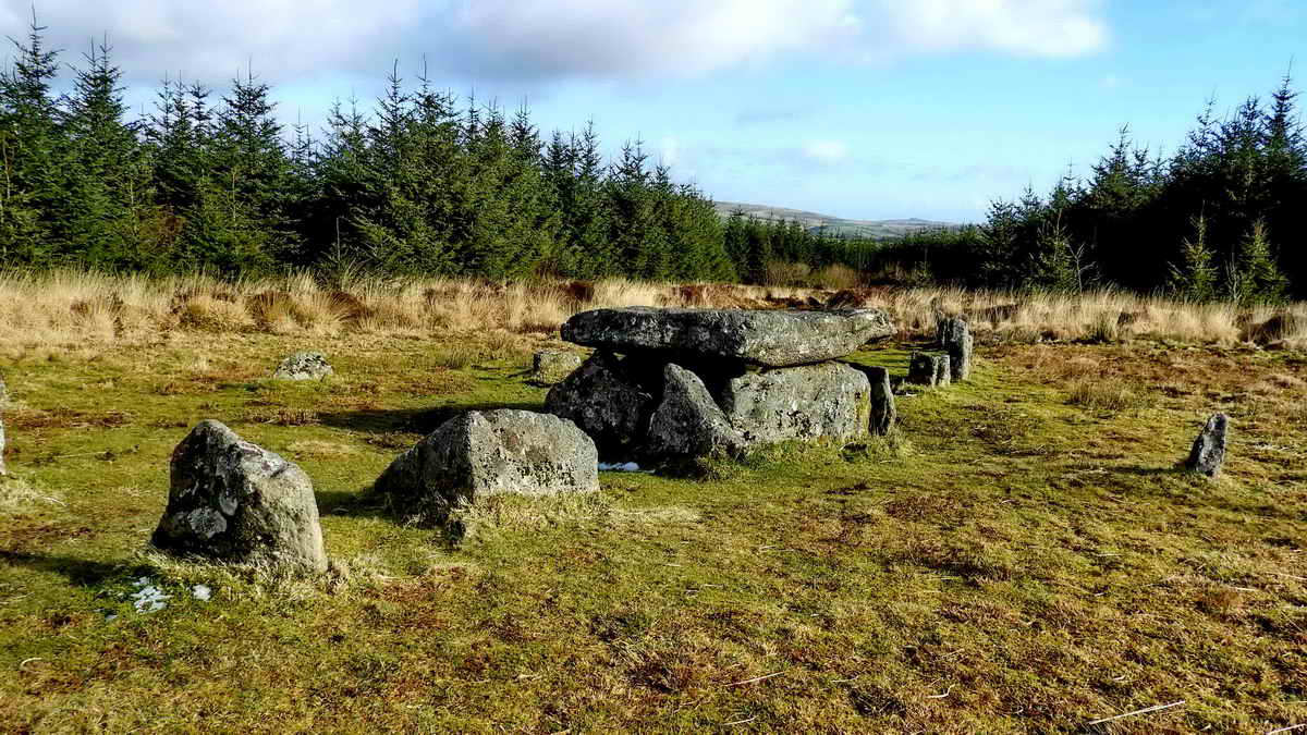
As previous photograph .....

The group at the cist and row.

DNPA identifiers 12A - Ring cairn with 13A
- Ring cairn and kist (behind). These are labelled "5" and "6"
respectively on the sketch plan above.
See separate Devon &
Dartmoor Historic Environment Records below .....
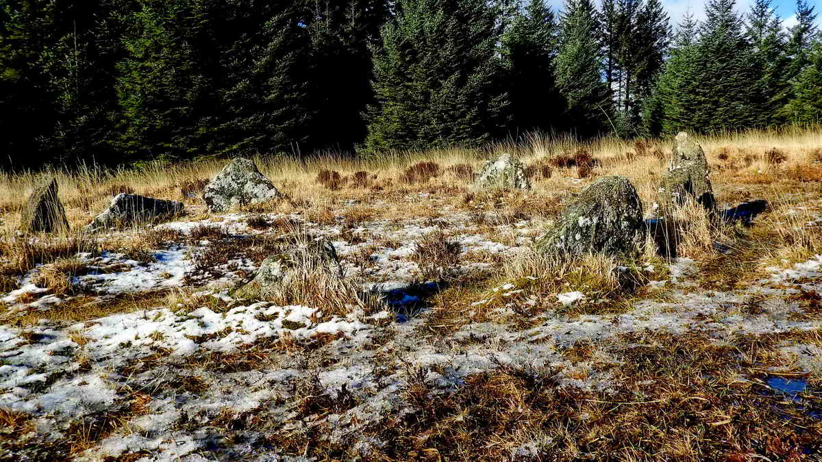
The ring cairn, a ring of retaining kerb
stones for the earth mound that is now all but disappeared ..... these
are at SX 64360 77471, the position probably being recorded between the
two circles ..... (separate grid references: SX 6434 7749 - ring
cairn; SX 6436 7747 - ring cairn with cist) ...
Devon & Dartmoor Historic Environment Record: MDV52762...
The ring cairn and cist ....
Devon & Dartmoor Historic Environment Record: MDV5842
The ring cairn and cist with the simpler ring cairn behind.

View inside the cist.

Looking west along the Lich /
Lych Way
(towards Beardown Tors), there are well-separated, low stones along
here, as markers? ..... This was the track by which the residents of the
local farms (Dartmoor's
ancient tenements) attended church services (especially funerals)
at the parish church at Lydford - the parish of Lydford was large. It was the "Way of the Dead", named
after the corpses who were carried 12 miles to their final resting places at
Lydford. In 1260, the residents petitioned the Bishop of Exeter, Walter
Bronescombe, and were
eventually allowed to attend church at Widecombe, which was closer. The
Lich Way remained in use however because of the need to attend the
Stannary courts until they ceased in the 1800s ..... ecclesiastical
instrument by which this is accomplished can be seen, in Latin, in

Lich Way, looking east (towards Widecombe), again with low marker stones, three of which are seen clearly here.
The Old Lych Way, by Show of Hands, no. 1; The Old Lych Way, by Show of Hands, no. 2
The Old Lych Way, by Show of Hands, no. 3 - at the Minack Theatre, Porthcurno, Cornwall

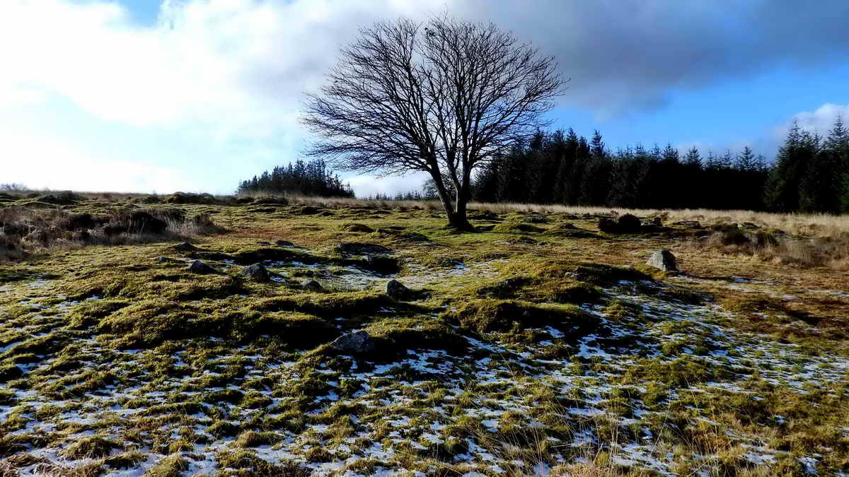
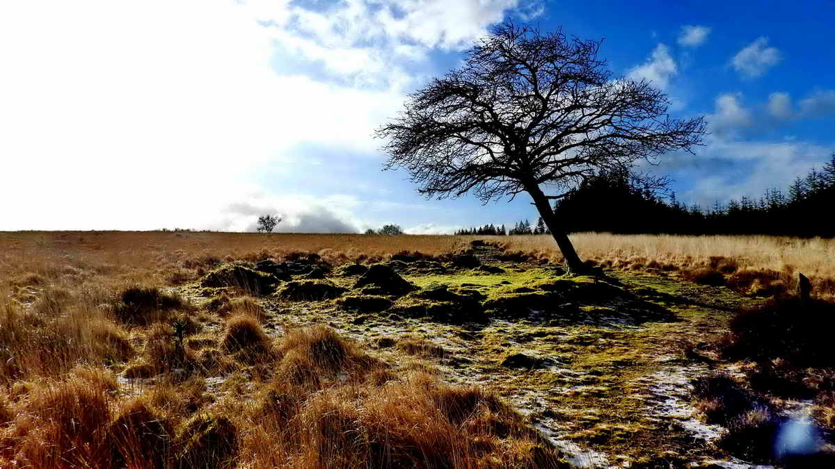
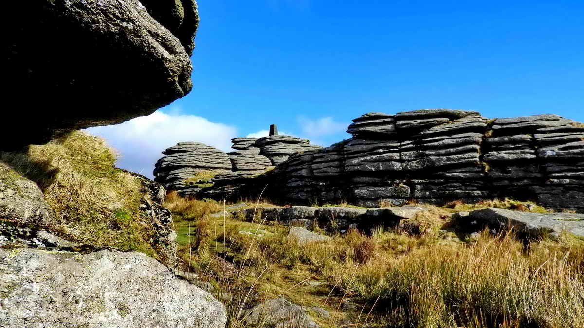
The approach to Bellever Tor ..... previously known as Bellaford Tor .....
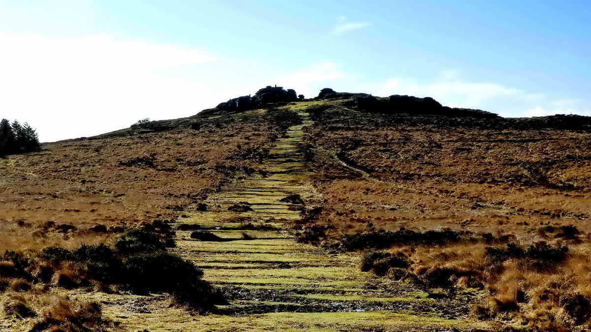
As previous photograph .....

As previous photograph ..... Bellever Tor, at SX 644 764, elevation 443 metres (1453 feet) ..... this is clearly an "avenue tor", where the central portion has been eroded to leave a central avenue running between the remaining piles - other examples are Haytor, Hound Tor and Rippon Tor .....

The triangulation pillar on Bellever Tor, a good diagram of a pillar can be seen here ..... there is an interesting video in the article about halfway down the page .....

The "flush bracket" on the side of the pillar. There is a question from yours truly answered on the Ordnance Survey Blog here. The number is an identifying number and not an indication of height at this point. More about trig. pillars and sighting tubes.
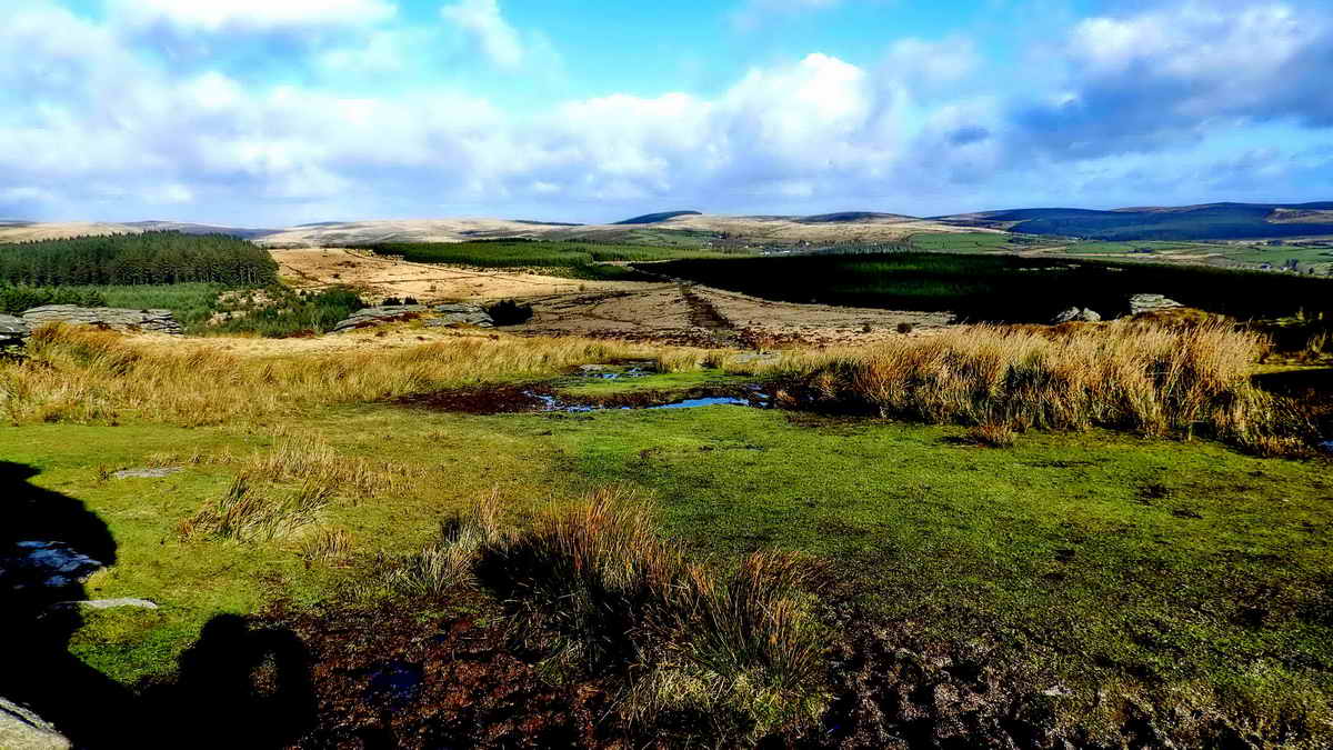
Looking north from Bellever Tor, directly towards Fernworthy Forest.
Another aspect .... showing the cracks or "joints" formed in the rock (horizontal in this case) as the stress of the weight of overlaying rock was relieved as the overburden was eroded away ..... see Dartmoor Granite (.pdf) .....

Looking at the tor from the south, and not photographing into the sun, for a change!

The trig. pillar again.

DNPA identifier 18A - Kist, labelled "8" on
the sketch plan above ..... at SX 64708 77171 .....
Devon & Dartmoor Historic Environment Record: MDV5879

As previous photograph.

DNPA identifier 16A - Cairn with kist,
labelled "7" on the sketch plan above, at SX 64718 77386 .....
Devon & Dartmoor Historic Environment Record: MDV5875.

Light and shade - it actually looked quite magical and ten times better than this!

The forest road back to the car park.

Cairn and cist 3A, at SX 64682 78384,
indicated as "9" on the sketch plan above. There is only one side slab
left of this cist and the cairn is all but disappeared.
Devon & Dartmoor Historic Environment Record: MDV5955

DPHT ponies still loitering in the same area as seen in previously, near the entrance from the north end car park.
MAP: Red = GPS satellite track of the walk.

� Crown copyright 2016 Ordnance
Survey
Licence number 100047373
Also, Copyright � 2005, Memory-Map Europe, with permission.
This walk was reached bu fo;;owing the B3212 road to Postbridge and parking in the main car park with the toilets and Information centre at the top of the map, indicated by the yellow cross.
Statistics
Distance - 5.87 km / 3.65 miles
All photographs on this web site are copyright
© Keith Ryan.
All rights reserved - please
email for permissions