![]()


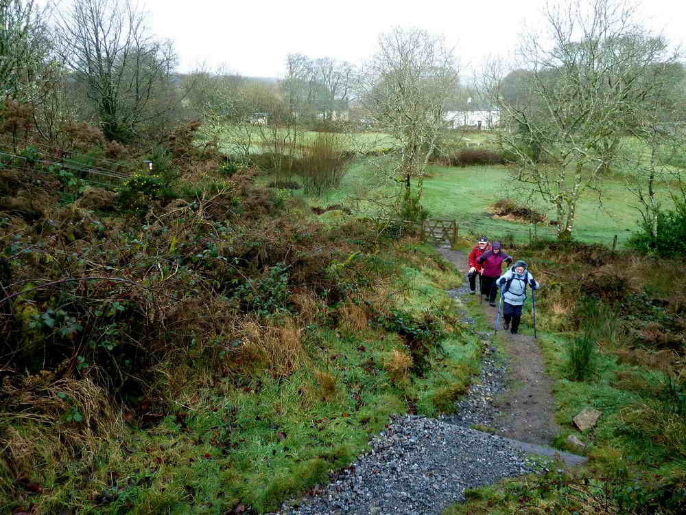
This walk: 2012-1-18. This was a very misty day during which I didn't take very many photos: Postbridge, road bridge, clapper bridge, tin workers mould stone, "The Barracks", Bellever Forest, Lakehead Hill antiquities, possible "sheep creep".
This area has been walked by us before and the following links are generally to group and other walks that had better weather: 9 Jun. 2008, 18 Sep. 2008, 29 Sep. 2010, 27 Jul. 2011 & 6 Aug. 2011, A few captions have been reused from these walks.
Walk details below - Information about the route etc.

Tinners' mould stone, SX 64813 78798, described as used for casting molten tin into ingots prior to assaying at a stannary town .....

The southern edge of the stone, believed to bear incised letters, difficult to make out today.

View from the mould stone to Postbridge road bridge and the old clapper bridge.
View over "The Barracks" area, being where the tinners lived during the working week.

Looking down on the bridges at Postbridge .....
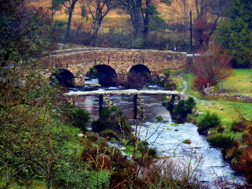
Zoomed view.

A misty scene inside Bellever Forest.
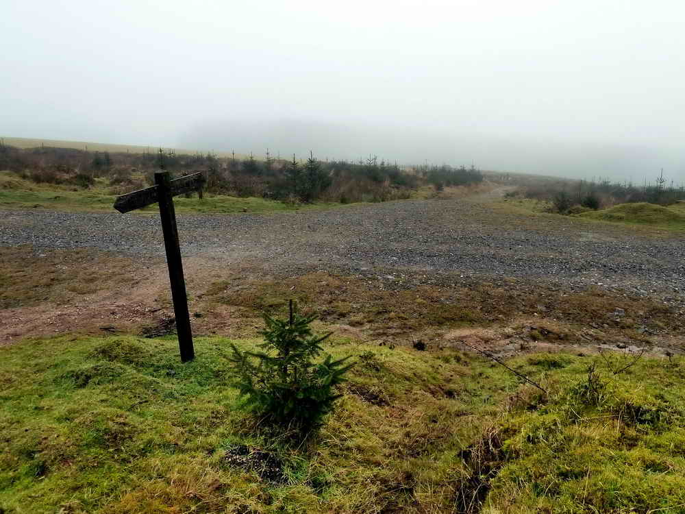
Crossing of forest tracks: the signpost marks the Lych Way, Corpse Way or "Way of the Dead". This was used by the inhabitants of the old tenements of the Forest of Dartmoor who were expected to attend church services and also carry their dead to be buried at Lydford. Later the parish of Widecombe was granted burial rights.

Some baby Sitka spruce, once you have seen one you have seen most of them - and there are acres of them here!

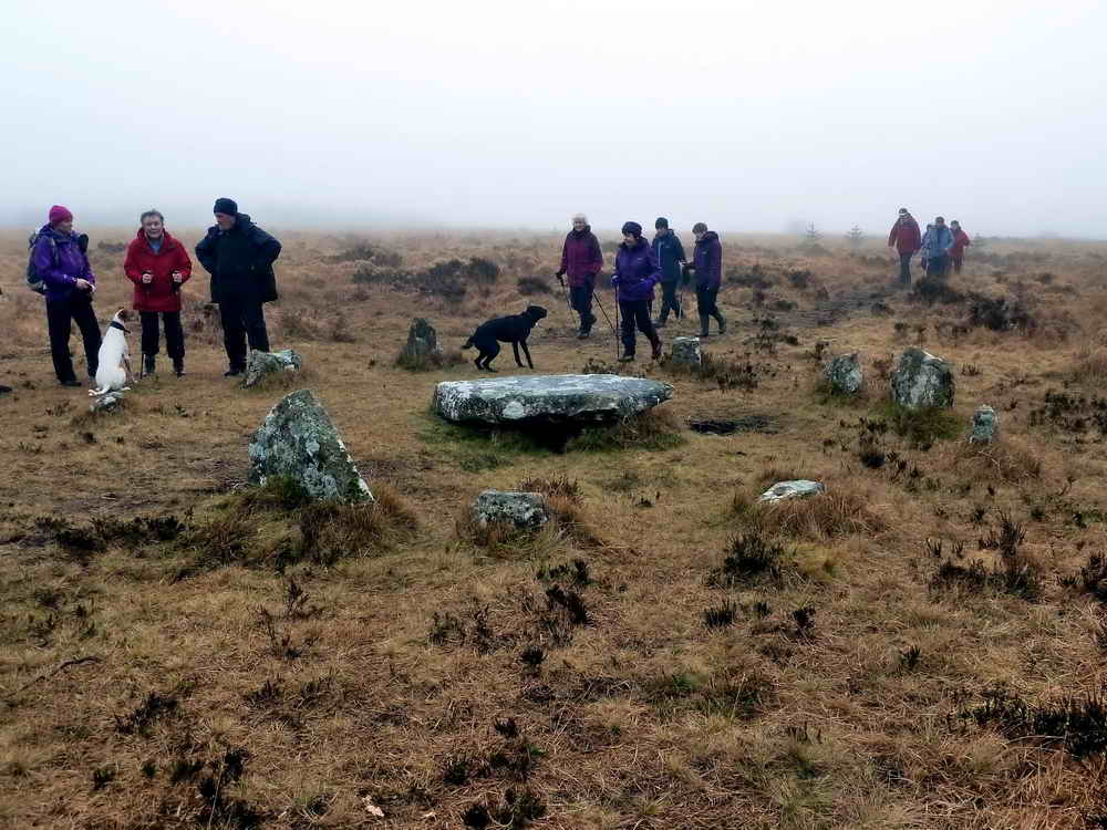
Cairns 12.A and 13.A at SX 64360 77471: details of this feature can be found in Butler J (1991), Vol. II, 27.19 (fig. 27.12, items 5 and 6), pages 49-51. The southern cairn complete with a burial cist in its centre, excavated 1901 by the Dartmoor Exploration Committee .....
General view .....

Preparing to pose .....

Happy Birthday!

Stone row close to the summit of Lakehead Hill, at SX 64381 77653. Details of this feature can be found in Butler J (1991), Vol. II, 27.19 (fig. 27.12, item 3), page 48-51. The row is oriented close to east-west.

Another view.

A possible "sheep creep" in the wall of the car park at Postbridge.
MAP: Red = GPS satellite track of the walk.
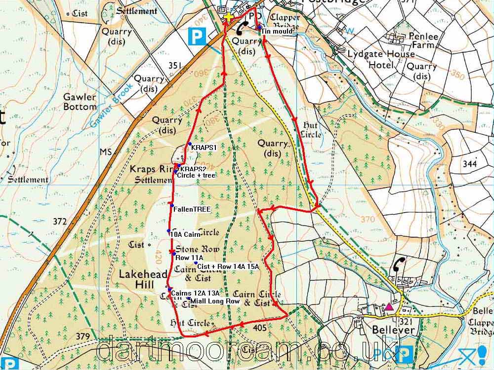
Ordnance Survey © Crown copyright 2005. All rights reserved. Licence number
100047373.
Also, Copyright © 2005, Memory-Map Europe, with permission.
This walk was approached by parking in the main car park at Postbridge, marked by the yellow cross symbol on the map.
Statistics
Distance - 4.80 km / 2.98 miles.
All photographs on this web site are copyright © 2007-2016 Keith Ryan.
All rights reserved - please email for permissions