![]()
77


This walk: 2017-2-25. Abandoned crazing mill stone, hut circles, two double stone rows, blocking stones, Bronze Age solar calendar, cists, cairns, near-midwinter solstice sunset, stone circle, menhir, Long Ash Pits, TA Packhorse Track marker stones, Long Ash Leat, Four Winds - site of Foggintor School.
Walk details below - Information about the route etc.
Previous walks in this area: 6th April 2011, 16th May 2012, 21st May 2014, 12th August 2015 and 1st December 2016.
Google Satellite map + GPS track of the walk
Old map
OS, Six-inch to the mile, - 1888-1913
Sources
Jack Walker, 2005, Dartmoor Sun, Halsgrove
Discover Series, Halsgrove Publishing, Tiverton, Devon.
- mentioning Dartmoor Magazine, 63 (2001), 67 & 69 (2002) and 71 (2003)
SunCalc.org - a simple but powerful solar calculator superimposed on Google Satellite view
Jeremy Butler, 1994, Dartmoor Atlas of Antiquities Vol. 3 - The South-West, 8. Merrivale ceremonial centre (figs. 44.7.to 44.7.10), pages 23-32.
Eric Hemery (1983), High Dartmoor, Robert Hale, London, pages 1046-1049..
Eric Hemery (1986), Walking Dartmoor's Ancient Tracks - A guide to 28 routes, Robert Hale, London, 10: Tavistock-Ashburton Packhorse Track, pages 109-122.
Mike Brown's Guide to Dartmoor, (2001), CD-ROM, Dartrmoor Press.
Mary Stanbrook (1991), Old Dartmoor Schools Remembered, Quay Publications (Brixham), Walkhampton Foggintor, pages 103-110.
Kath Brewer (1997), The Railways, Quarries and Cottages of Foggintor, Orchard Publications, Chudleigh, Newton Abbot, p. 88.
Photographs taken around the winter solstice - CLICK HERE.
Explanation about the how the stone rows work as a sun calendar - CLICK HERE.
Summary photographs - CLICK HERE
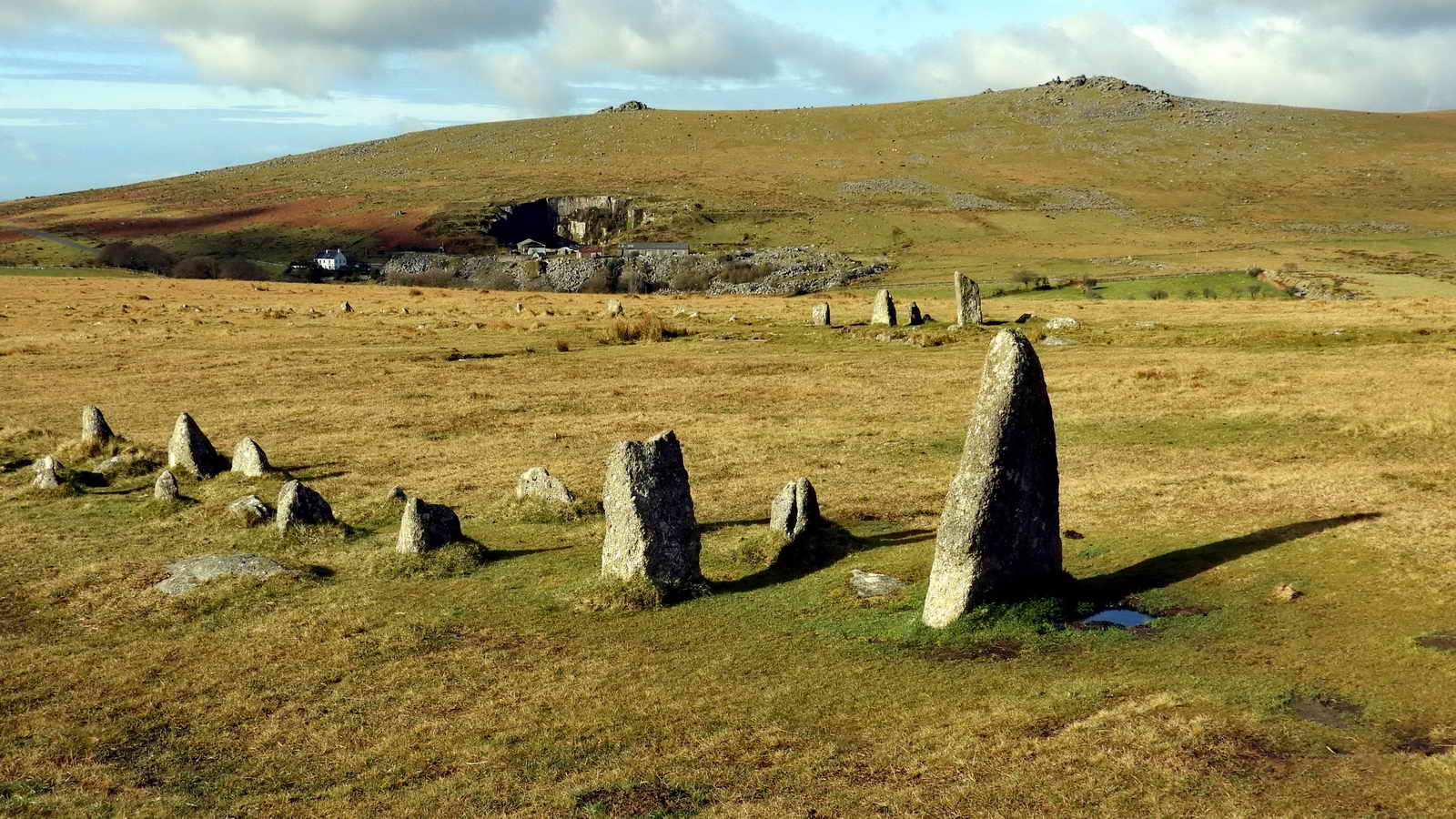
The round object in the left foreground is often described as an abandoned runner, that is, the running wheel, that would be turned on an axle pulled by a horse with the stone running in a circular trough crushing apples for making cider: i.e. an abandoned apple crusher. But .....
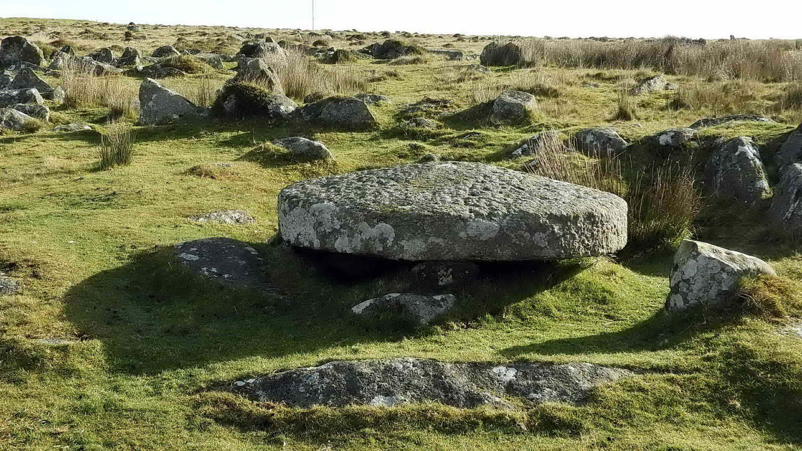
William Crossing (1987), Dartmoor�s Early History & Medieval Remains, in Chap. 12 Rejected by the builder, pages 60-64. This material was first published in the Western Morning News and other newspapers in 1905. There was a big story about a dolmen or quoit with a worked capstone but eventually a man was found before any scientific paper was written who pronounced: �Twadn�t no old man cut thacky stone,� he said, �I cut�n.� This is an abandoned top-stone to a crazing mill, an old way of grinding tin ore.before it was smelted. The perfectly domed upper surface makes it unlike any apple crusher or flour millstone? An example of a crazing mill was at Gobbet Mine (see walk on 27th November 2011. Google Image search results for crazing mills.
Historic England - Monument No. 440035. An unfinished and abandoned cider mill edge runner stone.
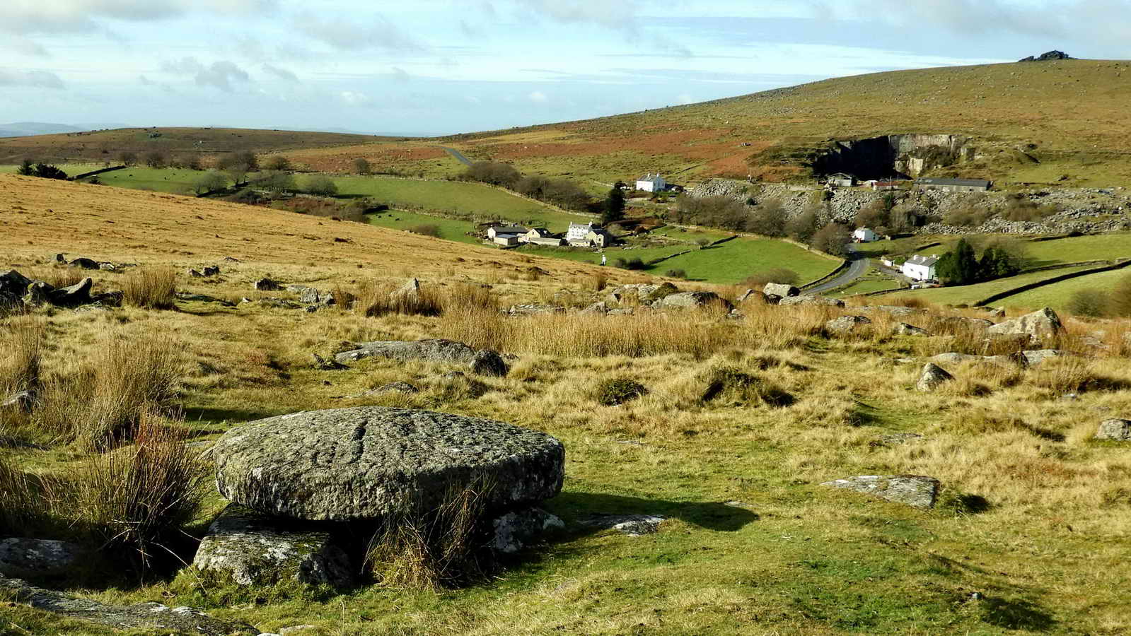
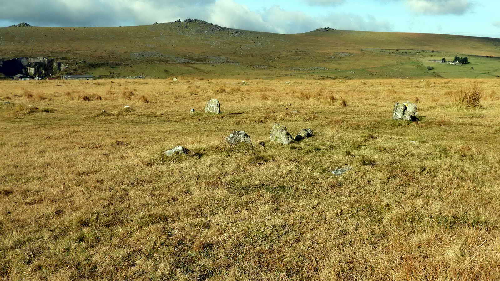
In the distance in the first photo above: Merrivale Quarry William Duke opened this as Tor Quarry in 1876, its operations absorbing the old sett-making craft previously carried out under the Steeple Tors. Gravestones, agricultural rollers. Provided the facing for New Scotland Yard. Finished up dressing imported stone from Norway. Closed 1997.
The name "Merrivale" for this part of Walkhampton Common is said to derive from "mara val" in old Cornish, meaning "plague market". This is thought to have been corrupted from "tin market" although "potato market" has also been suggested. In times of the Black Death (1348-1353: when 50M died in Europe, not to be confused with the Great Plague of London, 1665-1666), farmers left food here for Tavistock people who left coins as payment soaking in vinegar. "Mar val" has also been interpreted as Mirey Vale.

A hut circle near the stone rows; in the distance, Merrivale Quarry.
Links to Historic England and Heritage Gateway archaeological records
Historic England record
Heritage Gateway - Devon & Dartmoor Historic Environment Record
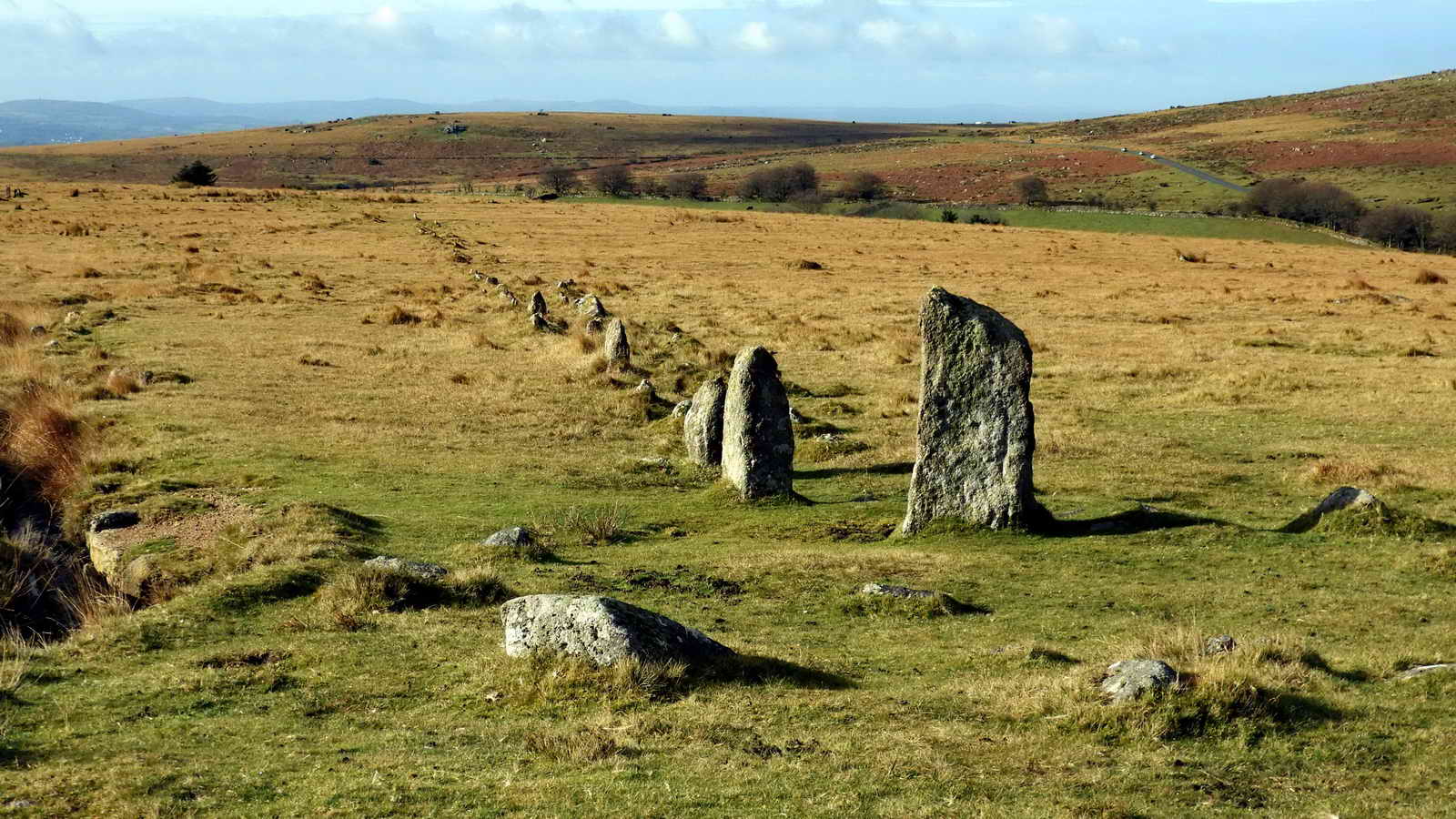
The east end blocking stone of the northern stone row. NB - both stone rows are double, i.e. consist of two rows of stones about a metre apart. This row has the ruins of a cairn or cairn circle associated with this end (the ring of stones): Ring cairn - Wikipedia.
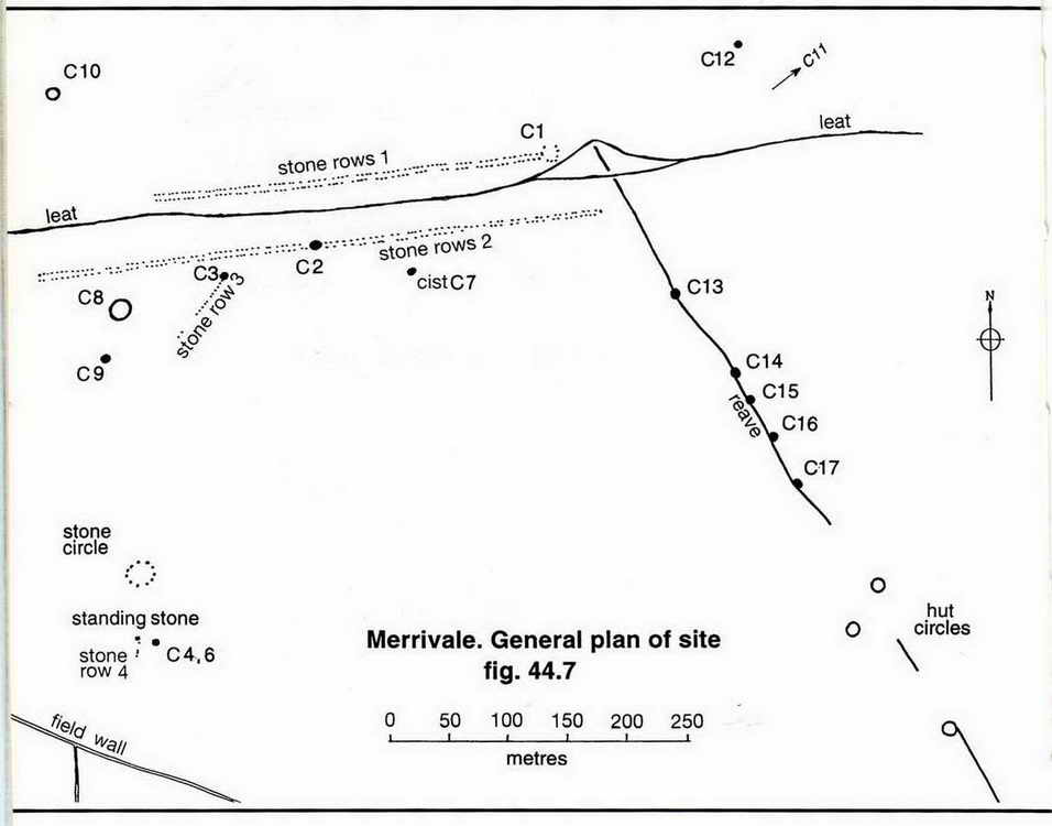
Image � J Butler
1994. Reproduced by kind permission (ref. 29 Sept. 2012).
Nearest the camera, the east blocking stone of the longer southern row. Behind, the blocking stone of the northern row.

A view along the southern row, looking to the west. The double nature of the row is seen well here. The first, larger, stone in the row casts its shadow quite symmatrically onto the blocking stone at mid-winter sunset (solstice).
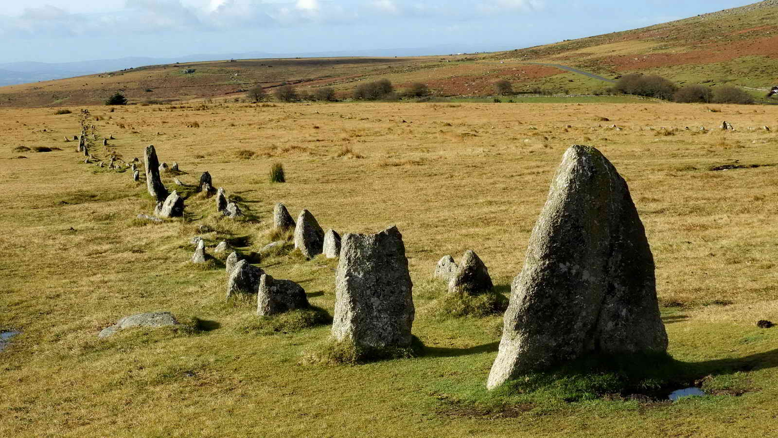
A similar view.

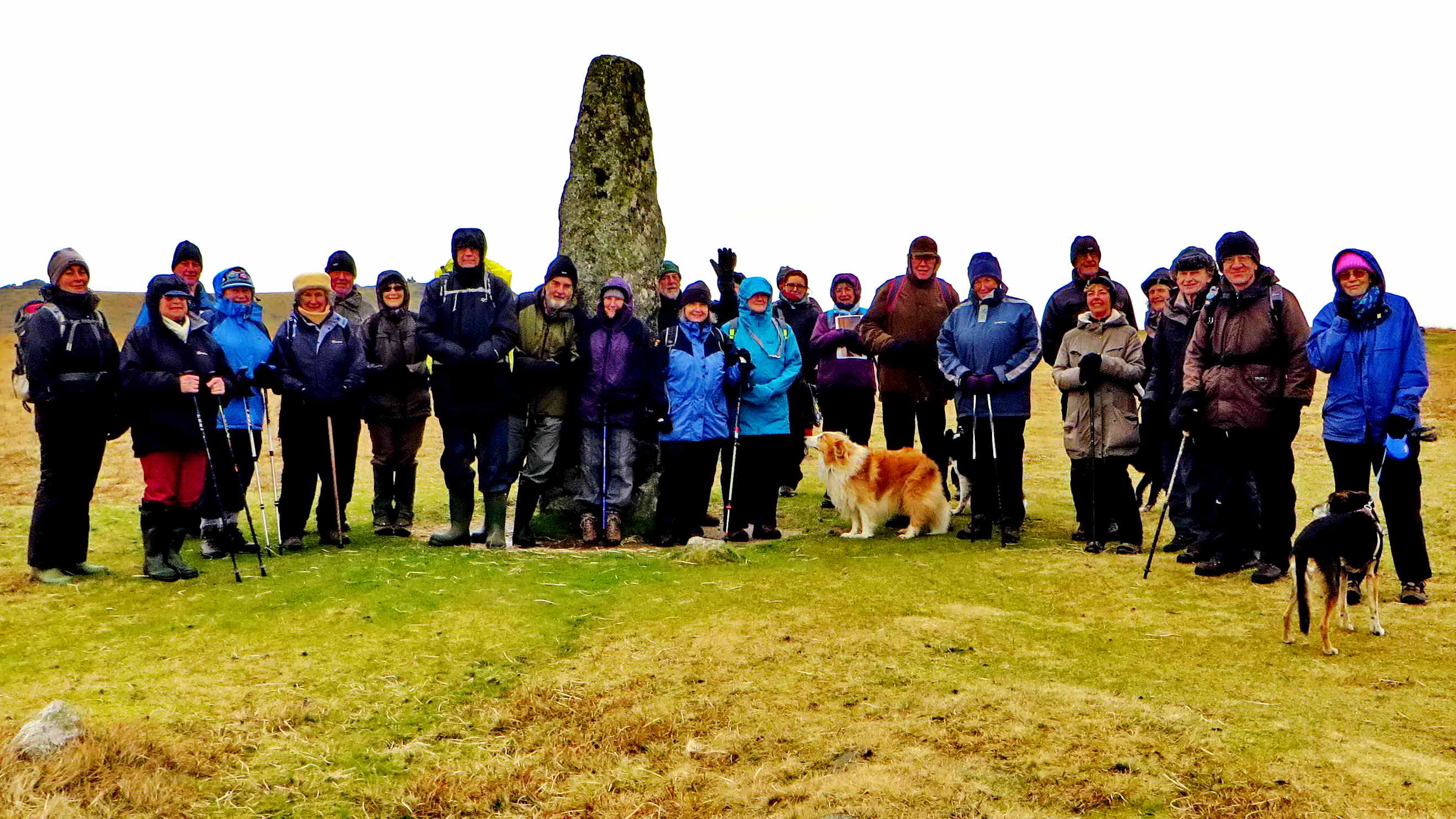
Members of the 29-strong group Dartmoor Preservation Association and friends who walked on 25th February 2017 at the east end of the southern stone row.
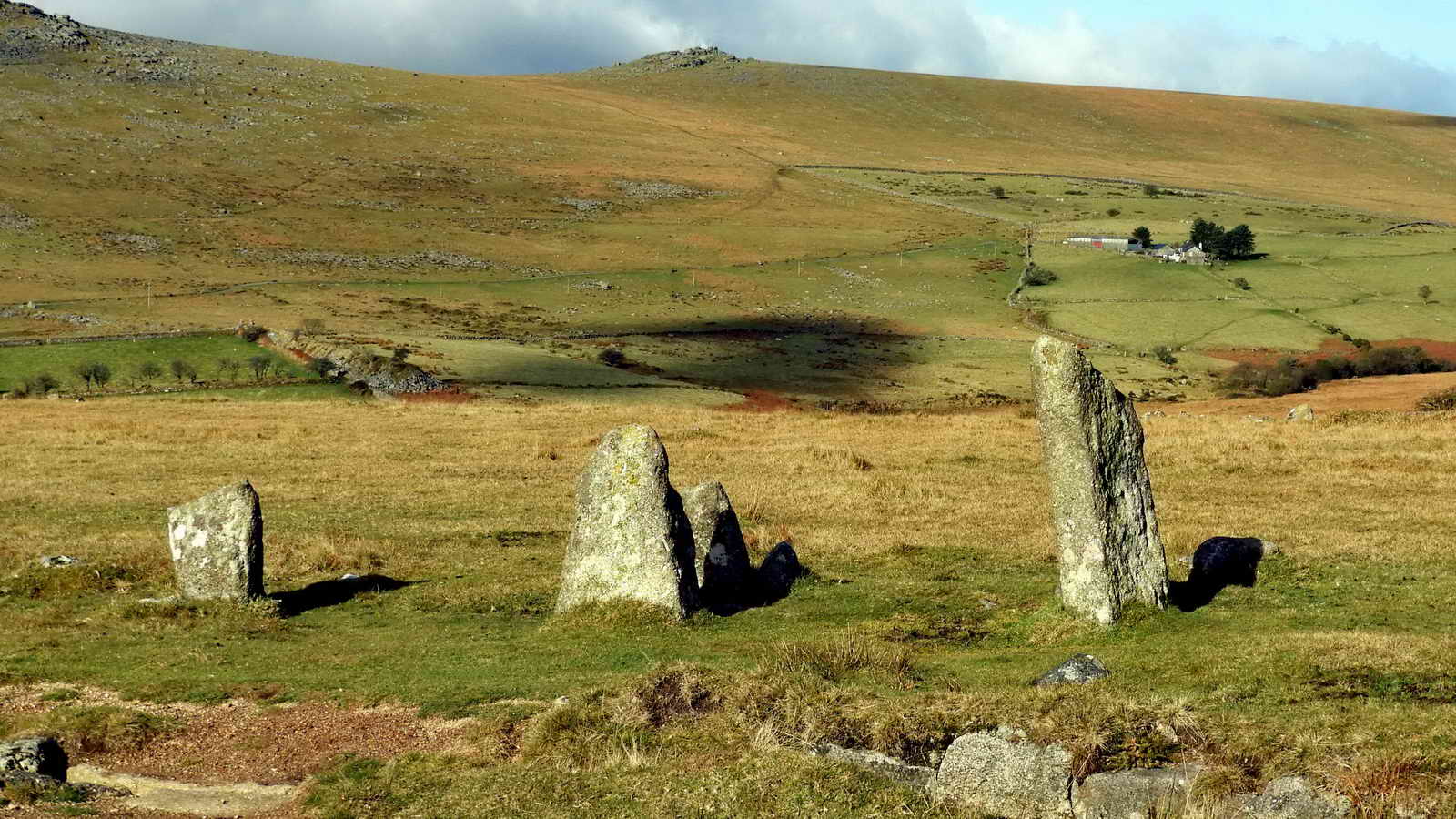
Looking north over the east end of the northern row. Long Ash Leat is seen at the very bottom of the photograph and Roos Tor, SX 543 766, elevation 454 metres (1489 feet) on the skyline. Shillapark Farm is in the middle distance.
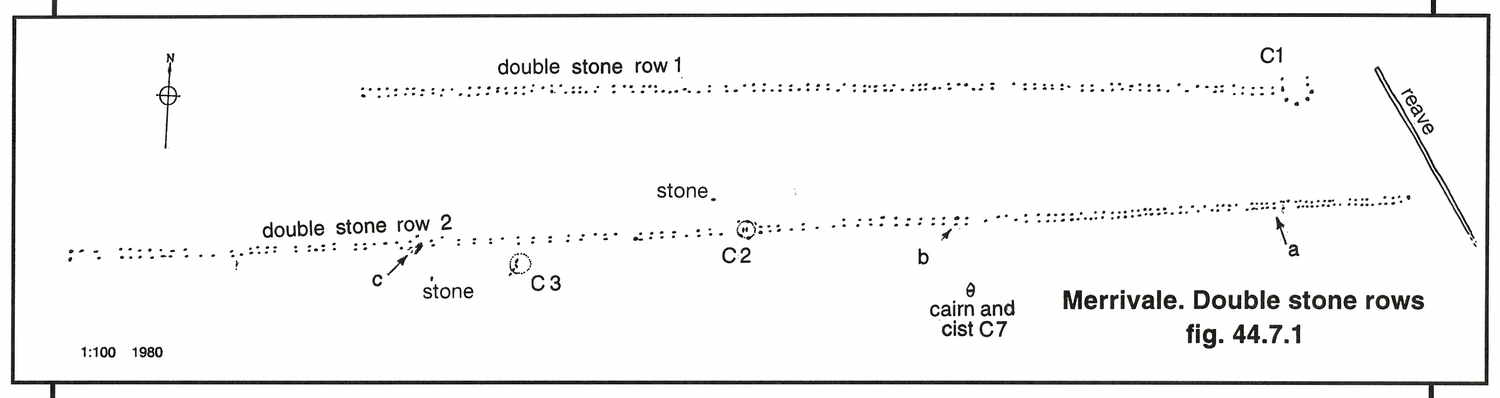
Image � J Butler
1994. Reproduced by kind permission (ref. 29 Sept. 2012).

Looking west along the southern row to the small ring cairn and cist actually sited in the row - someone very important? Perhaps the designer of this Bronze Age masterpiece that enabled choosing the right time for planting crops for food and better survival? The northern row is unseen, over to the right.

The large cist beside the southern row. "Cist" comes from "Kistvaen - a stone coffin, from the Celtic cist, a chest, and maen, stone, 'v' being used as a mutation of 'm'." . (Source: Crossing's Guide to Dartmoor, 2nd edition 1912, reprinted 1990, page 22).
"The cist ......... appears to have been intact until 1870, when the huge cover slab was split across the centre to make a pair of gateposts, 'by the occupants of the neighbouring public house', according to Baring-Gould, and another was cut from the western side slab." Source: Jeremy Butler, 1994, Dartmoor Atlas of Antiquities Vol. 3 - The South-West, 8. Merrivale ceremonial centre (Figs. 44.1-44.10), page 30.

The small cairn/cist in the southern row.
The end of stone row 3, where it joins the southern row - the General Plan sketch above, by Jeremy Butler, shows this to be a cairn (slightly raised earth -covered burial).

The west end of the southern row, looking east. Four Winds (with the trees) can be seen in the distance.

Another view.
Links to Historic England and Heritage Gateway archaeological records
Historic England general description of the monument
Heritage Gateway - Devon & Dartmoor Historic Environment Records - archaeological details
Merrivale Stone Row A, Dartmoor Forest (North) SX 554 748, MDV14797
Merrivale Stone Row B, Dartmoor Forest (South) SX 554 747, MDV14795
Cist and Cairn south of Stone Alignment, Merrivale, SX 554 747, MDV3738
Cairn with cist in middle of stone row, Merrivale, SX 554 747, MDV14796
Cairn associated with stone row, Merrivale, SX553 747, MDV5000
Cairn south of the Stone Row B, Merrivale, SX 553 747, MDV28496

Figure
redrawn with additional information
from Jack Walker's Dartmoor Sun (2005), page 103, Halsgrove
Publishing.
|
Image � J Walker 2005. Reproduced by kind permission of Halsgrove Publishing.
|

Pre-sunrise, 7 days after the winter solstice, looking from the west blocking stone of the northern stone row towards the west blocking stone of the southern row, preparing the scene for the next photograph. The far blocking stone is paired and is confused these days with the clump of soft rush behind it. Note the whereabouts of Pew Tor "on the skyline". Now, see the following photograph .....

Looking from the same west end stone in the northern row towards the west end blocking stone(s) of the southern row - the sun is setting directly over them- this is 28th Dec, 7 days after the solstice date. Note Pew Tor. For more photographs taken around the winter solstice - CLICK HERE.
For an explanation about the how the stone rows work as a sun calendar, CLICK HERE.

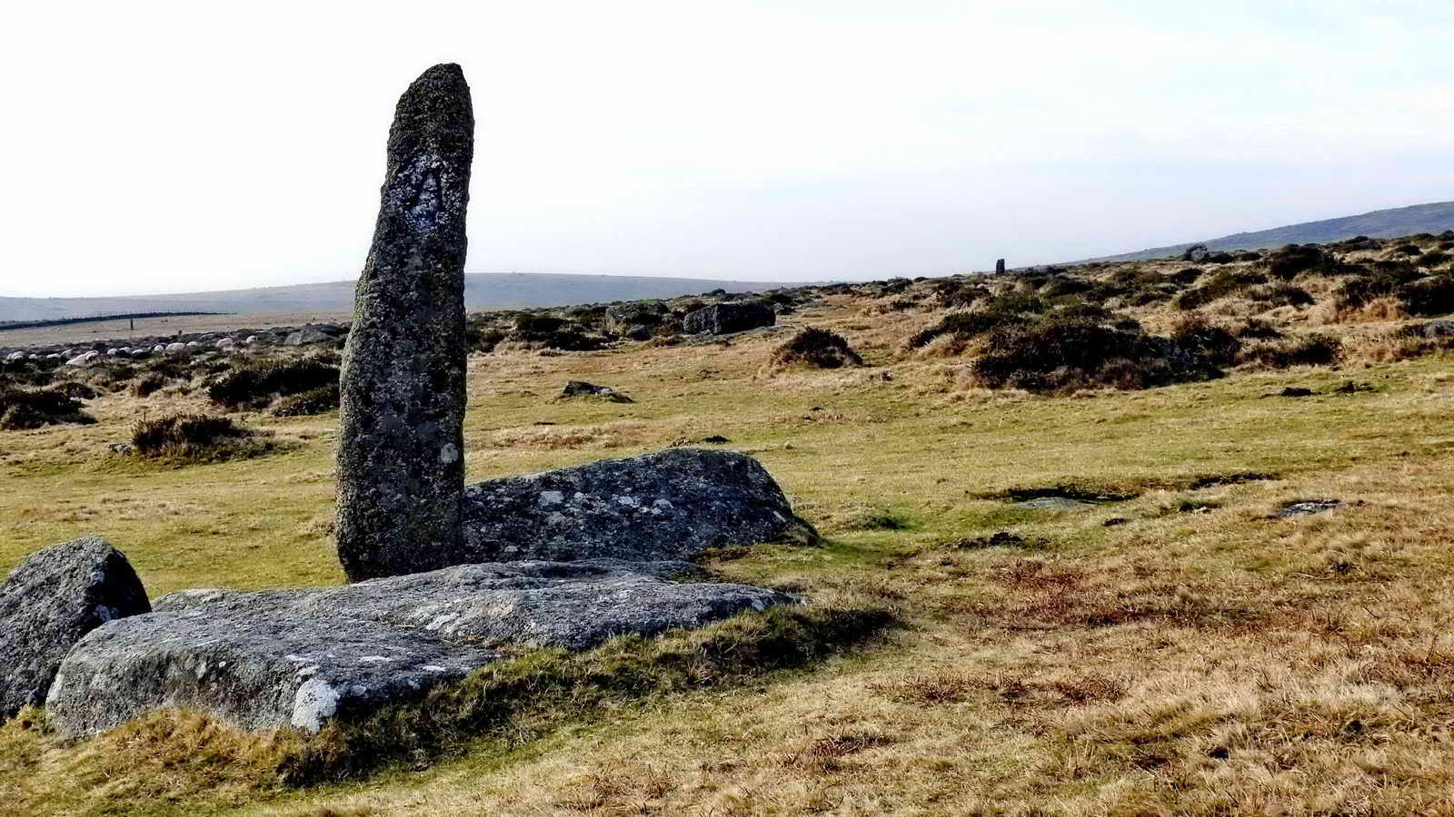
A view of the Merrivale stone circle and menhir ..... midsummer sunset can be from the circle as the sun goes down in the notch of Middle Staple Tor .....
|
|

Menhir and circle ..... looking west/north-west ...... Celtic (maen = stone + hir = long i.e. 'longstone'), at present the function of the stone has been suggested in Dartmoor Sun as a midwinter sunset marker when viewed from a leaning stone at SX 55461 74683. There is a beautiful photograph of this on page 109 .....

Another view, with Great Staple Tor (left) and Roos Tor (right).
Walkers at the menhir.
Links to Historic England and Heritage Gateway archaeological records
Historic England general description of the monument
Heritage Gateway - Devon & Dartmoor Historic Environment Records - archaeological details
Small Cairn near Standing Stone, Merrivale, SX 753 745, MDV3759
Possible stone row near standing stone, Merrivale. SX 553 745, MDV55398
Short stone row south of standing stone, Merrivale, SX 553 745, MDV55697
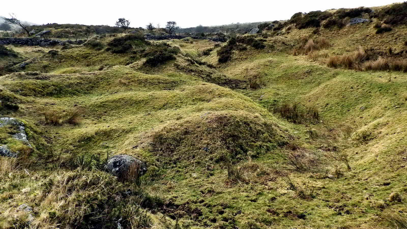
Long Ash Pits - early, possibly medieval or earlier, tin workings where tinners collected alluvial deposits along stream beds. The eroded tin ore could form quite pure tin gravel. The early tinners "leated" water to a trench at the lower end of the ground, called a �tye�, and water was used to wash away the lighter �gangue� gravels. The method left banks of waste. The area is surrounded by a scarp that shows the original level of the land and the depth of the deposits. Tin streaming was often followed by open cast mining to go deeper, into big cuttings called "gerts", but this is not seen here. Wikipedia - Dartmoor tin-mining - Streaming link ......

Another view of the tin workings including Pila Brook. It was presumably this water source that was diverted and used for washing away the lighter sediments etc. so as to leave the heavier tin-bearing gravels and sands for smelting. This would have been among the earliest tin-extraction methods. This photograph also shows the scarp surrounding this area that suggests how much the early tinners changed the look of the landscape.
T-A marker stones along the Ashburton-Tavistock Packhorse Track. In the photograph above, a portion of the pillar has been enhanced to show the "A" more clearly, facing towards Ashburton. In the Middle Ages,this trading route was very important, especially for wool and cloth or yarn, going via Sheepstor - which was famed for its sheep and wool. The track was superseded by the turnpike road in 1792. Strangers to the moor often had to tackle this high lonely route, this section over the Princetown area was the highest part and the most exposed. Princetown, or Thomas Tyrwhitt's "Prince's Town", did not exist in those days. Guide posts were erected along the way and what we see today are possibly the more �modern� (1669) improved series � sponsored by Plymouth Corporation � at the princely sum of �2. This track is described by Eric Hemery (1986), Walking Dartmoor's Ancient Tracks - A guide to 28 routes, Robert Hale, London, 10: Tavistock-Ashburton Packhorse Track, pages 109-122.
From: Historic UK - Wool Trade
Wool became the backbone and driving force of the medieval English economy between the late thirteenth century and late fifteenth century and at the time the trade was described as �the jewel in the realm�! To this day the seat of the Lord High Chancellor in the House of Lords is a large square bag of wool called the �woolsack�, a reminder of the principal source of English wealth in the Middle Ages
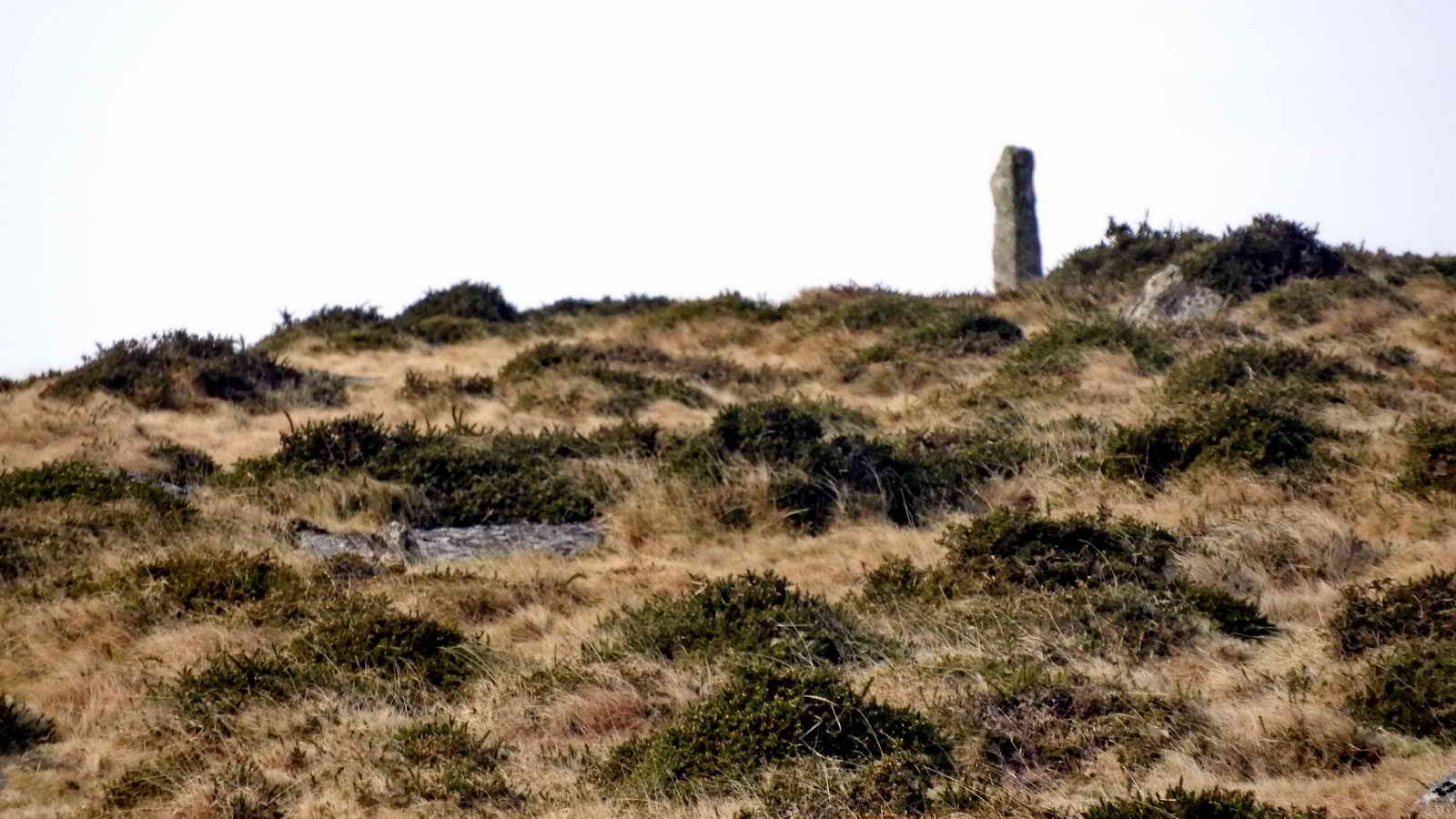
The next marker stone, standing out on the skyline.

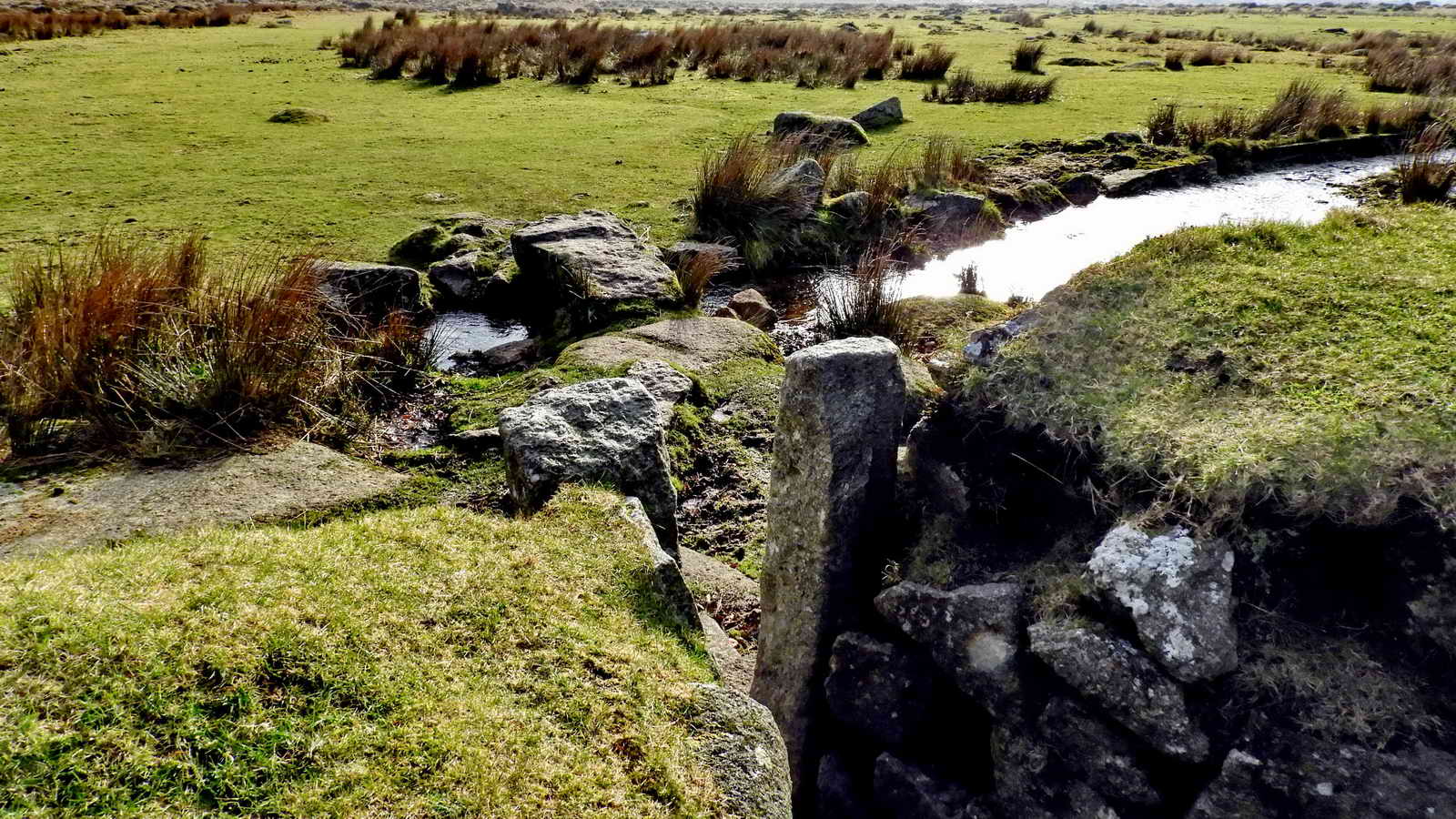
Small clapper bridge over Long Ash Leat at the back of Four Winds car park. In the distance can be seen the fallen Christmas tree at Red Cottages. On the skyline is Hollow Tor and the base of the tv mast .....

Fallen tree at Red Cottages (beside the track to Yellowmead), an old Christmas tree similar to that at Four Winds? Blown down in the 1980s. Source: Kath Brewer (1997), The Railways, Quarries and Cottages of Foggintor, Orchard Publications, Chudleigh, Newton Abbot, p. 88. The blow-down may have occurred during the Great Storm of 1987, when a lot of trees, especially at Burrator, were blown over. Photographed 11th January 2012
Looking over the wall at the back of the Four Winds site, over a "pinch" stile that was to keep sheep out of the old school grounds, onto the Long Ash Leat that runs down between the stone rows and then takes water to Long Ash; built in the 1880's. .
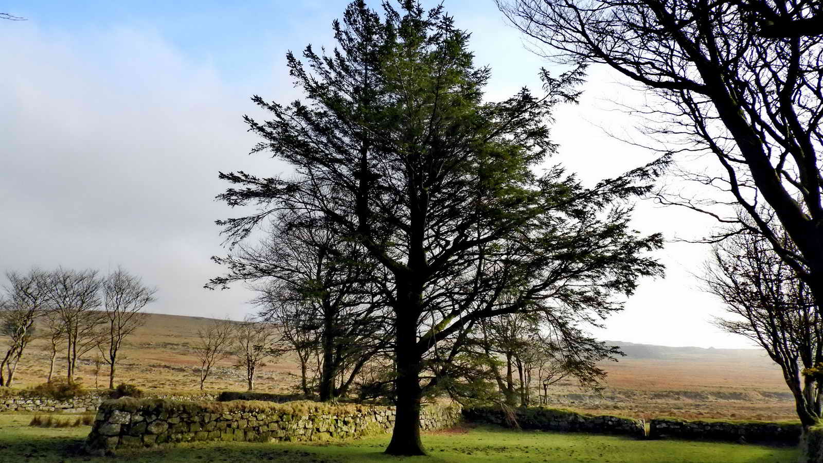
Four Winds was the site of Foggintor School, built 1914, opened April 1915 with 55 children from the nearby cottages associated with Foggintor and other quarries. Mr & Mrs Stoyle were the teachers, it was a spacious building with a wood block floor and central heating - the pipes were used for warming their pasties! There were periods of closure due to snow and whooping cough. The garden had bees, poultry, a goat and rabbits. Besides the school building there was also School House, for the teachers. One section of the enclosure was the playing field. The school was run throughout its history by Fred Stoyle, the youngest head-teacher in the country. Their son, Ivan, planted the Christmas tree from 1924 in the school garden and this is the tree that stands there today - 94 years old, Christmas 2016.. After the school closed in 1936, the teachers' house was renamed "Four Winds". The school buildings were demolished in 1964 and the private house in 1965. Stone from the buildings was used in the road modifications at Devil's Elbow near Princetown. From this, we know that the tree is in the old garden and the other enclosure used to be the play area.
Before Foggintor School was built, there was another school opposite the entrance to the track to Yellowmead. This was in the Foggintor Mission Hall, built in 1887. It served also as a school from Aug. 1896, opening with 41 pupils. It had 95 pupils in 1903 and closed in Sep. 1912. The building was demolished in 1965. The numbers of young children give some idea of the population in the area, associated mainly with the busy quarries.
MAP: Red = GPS satellite track of the walk.
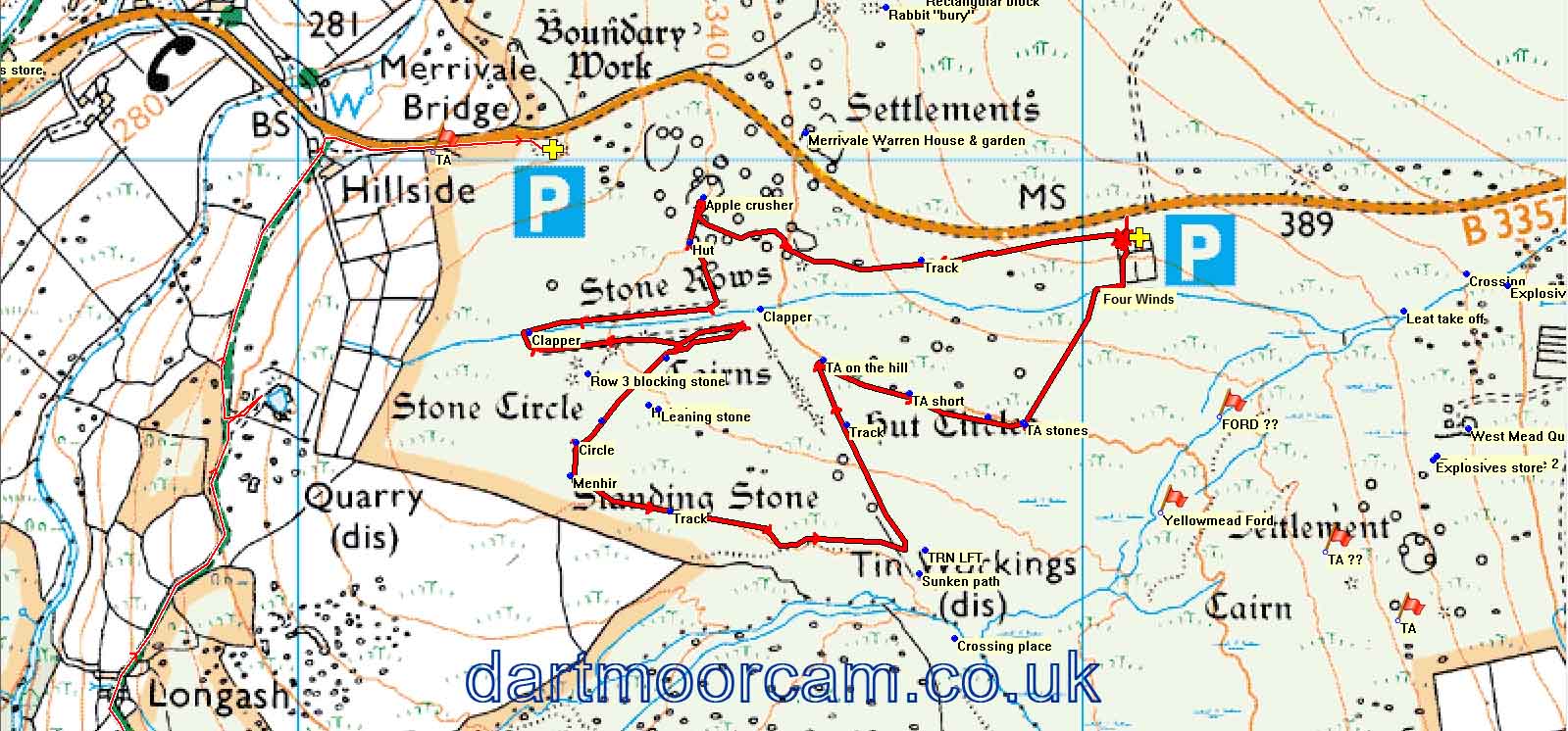
� Crown copyright and database rights 2016 Ordnance
Survey
Licence number 100047373
Also, Copyright � 2005, Memory-Map Europe, with permission.
This walk was reached by parking at Four Winds, SX 560 748, the isolated spot
surrounded by trees on the B3357 road between the Dartmoor Inn, at Merrivale,
and the turnno-off to Primcetown on the road to Two Bridges. This is
marked by the yellow cross and the the
P
symbol on the map.
Statistics
Distance - 3.25 km / 2.02 miles
All photographs on this web site are copyright © Keith Ryan.
All rights reserved - please email for permissions

