![]()


This walk: 2016-12-1. Abandoned stone, Merrivale double stone rows, cairn. cists, menhir, GWR, PDR, stile, clay works boundary stone, Huckentor Farm medieval longhouse.
Walk details below - Information about the route etc.
Previous walks in this area: 6th April 2011, 16th May 2012 and 21st May 2014
Google Satellite map + GPS track of the walk
Old map
Ordnance Survey, Six-inch - 1888-1913

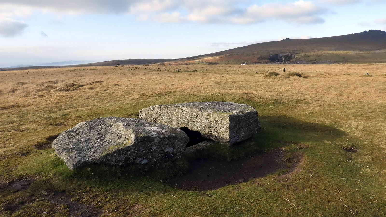
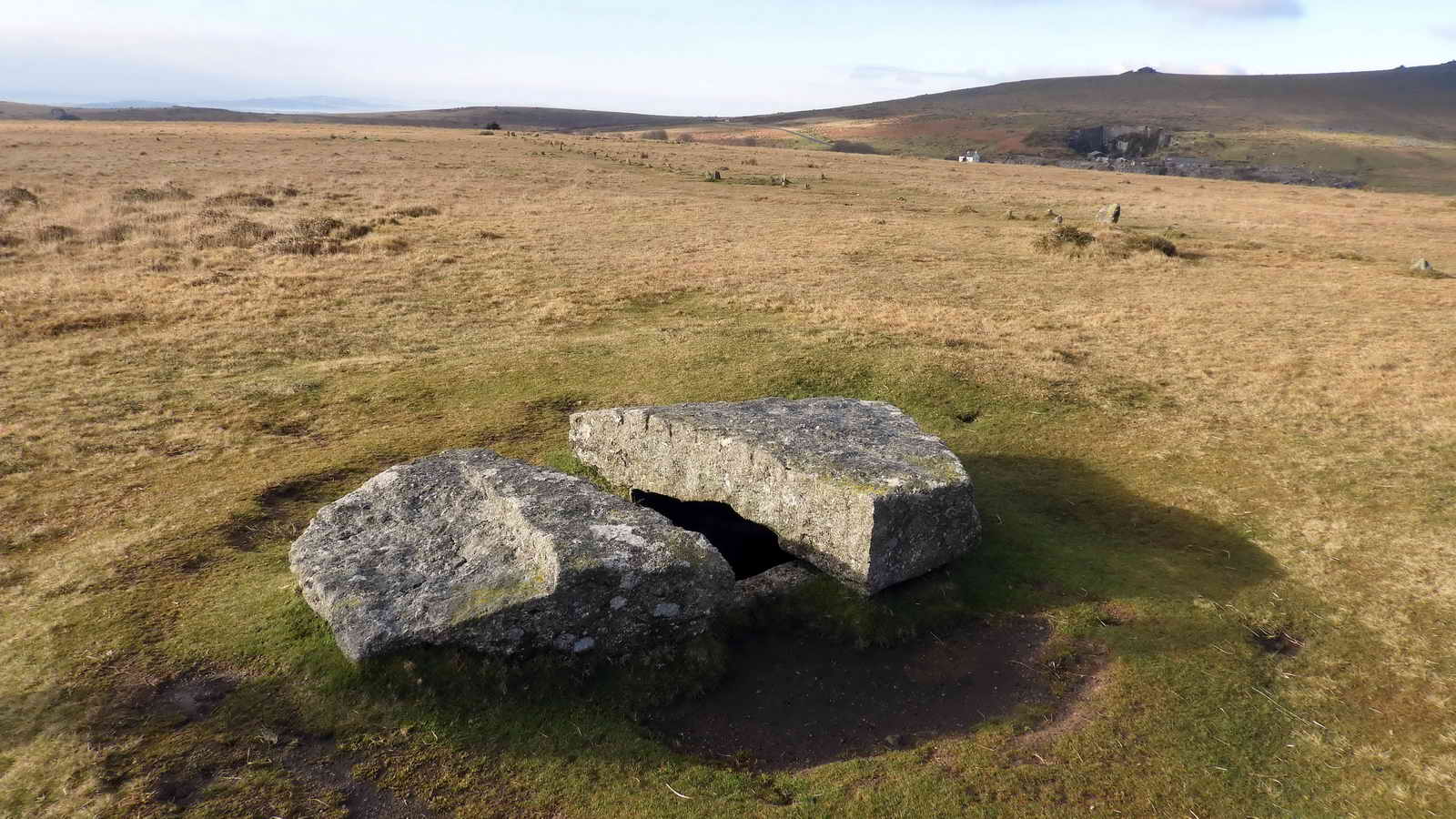
A stone at SX 55519 74953, within the edge of a Bronze Age pound - the wall of which can be seen behind the stone. I have heard this stone described both as an abandoned apple crusher or "pound" stone (for pounding apples in cider-making) and as a mill stone i.e. for a "grist" mill that grinds corn to make flour. Both of these types of stone seem to have two flat surfaces (see images for apple crushers and mill stones). William Crossing (1987), Dartmoor's Early Historic & Medieval Remains, Quay Publications (Brixham), pages 60-62, captions this stone as a rejected crazing mill stone, these seem to have a convex upper surfaces (images of crazing mill stones). Crazing mills were used to grind tin ore, prior to it being smelted. Crossing was born in 1847 and died in 1928. The book cited here appeared as a series of newspaper articles in 1905 and states that this is not part of a dolmen or quoit. This aspect had caused much discussion in the area until a man came forward with the explanation that "Twadn't no old man cut thacky stone ....... I cut'n." "Old men" was the local term for the early tinners and people back to the builders of the hut circles, stone rows, mehirs etc. Eric Hemery (1983), High Dartmoor, Robert Hale, London, p.1050, calls it an apple crusher, as does FH (Harry) Starkey (1980), Exploring Dartmoor, p.110 and again (1981) in Exploring Dartmoor Again, p.39.

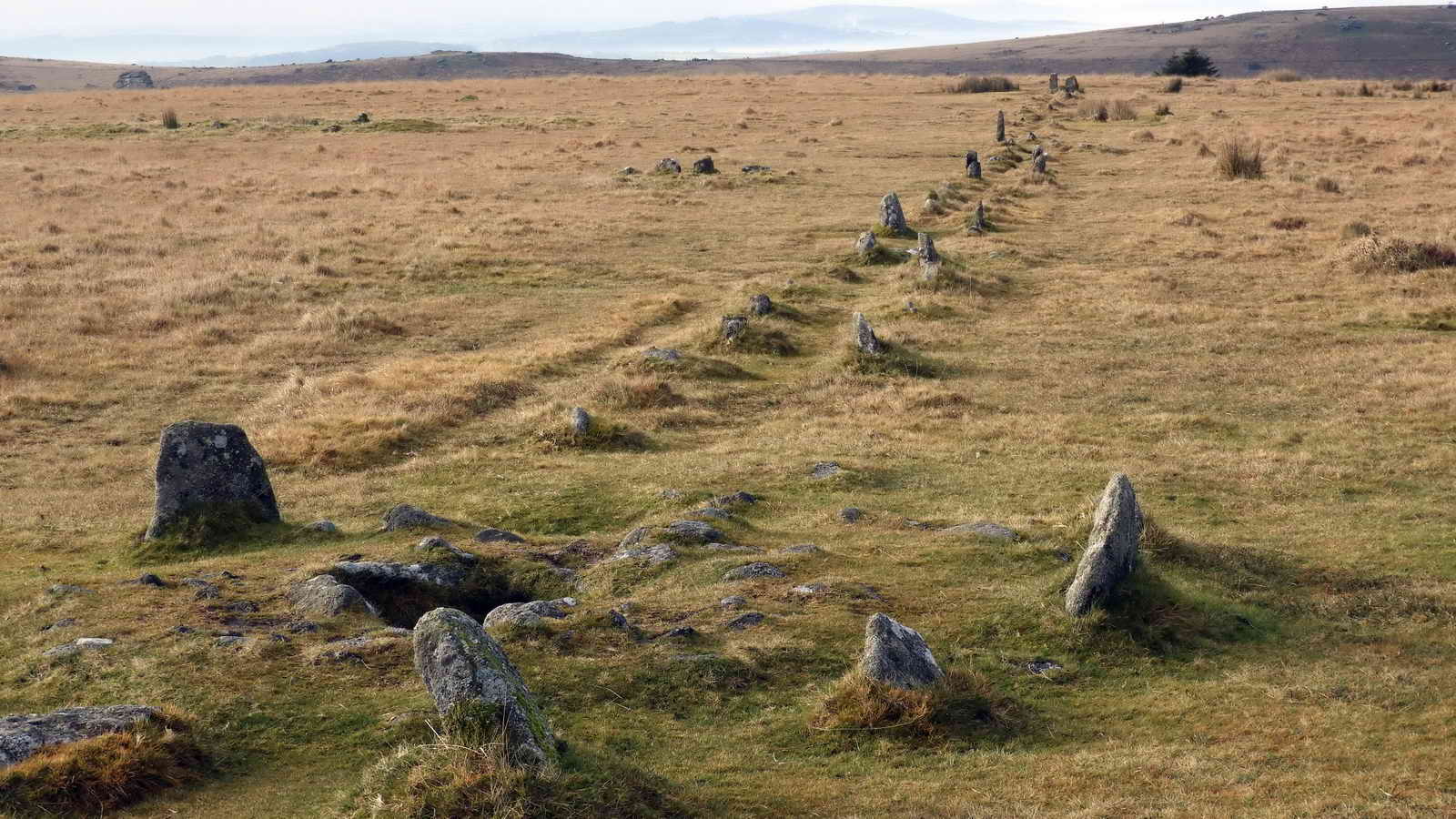
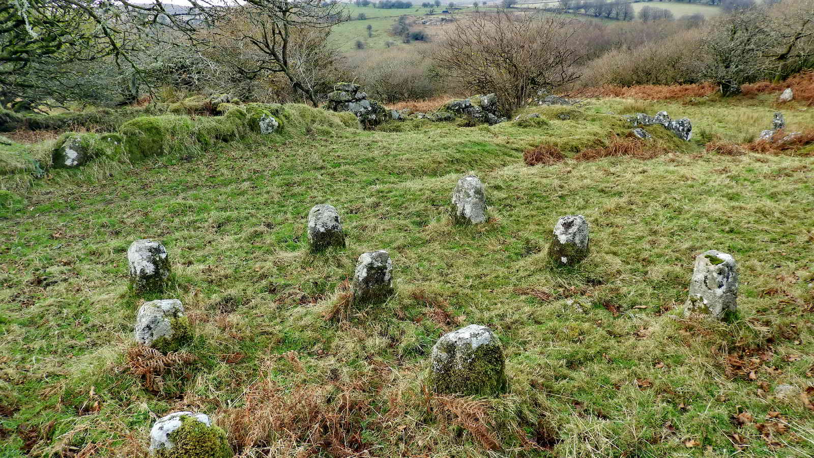
Looking west between the two double stone rows at Merrivale. The Merrivale Bronze Age features are described in Jeremy Butler, 1994, Dartmoor Atlas of Antiquities Vol. 3 - The South West, 8 - Merrivale ceremonial centre, pages 23-32.

Image � J Butler
1994. Reproduced by kind permission (ref. 29 Sept. 2012).
The cist or kistvaen just south of the southern row. Kistvaen: a stone coffin, from from the Celtic cist, a chest, and maen, stone, v being used as a mutation of m. (Source: Crossing's Guide to Dartmoor, 2nd edition 1912, reprinted 1990, page 22) ..... this is cairn 2 (C2) in the diagram above .....
Another view: a gatepost has been cut from the capstone.

The cairn and small cist near the centre of the southern row .....
Another view of the same cairn (C2) and cist .....

Image � J Butler
1994. Reproduced by kind permission (ref. 29 Sept. 2012).

A zoomed view west, to Cornwall, with mist in the Tamar valley. Is that the Caradon TV mast at top right?

The Merrivale menhir or standing stone (in the first diagram above), with Great Staple Tor, SX 542 760, elevation 455 metres (1492 feet) behind.

The track beds of (1) the GWR-Princetown Branch, running left on a more gentle bend, and (2) the PDR (Plymouth & Dartmoor Railway), right, running to a sharper bend that the original horse-drawn wagons could negotiate .....

Clower view, the summit logan stone on Little King's Tor, at SX 55345 73915, elevation 357 metres (1171 feet).

On the PDR looking towards Plymouth.

Looking down the slope towards the stile and the CW2 clay sett boundary stone .....

CW2 stone at SX 55165 73886 .....

"CW 2" - one of a series of china clay sett boundary stones for Yes Tor Bottom china clay works. ....... "granted by Sir Ralph Lopes, to George Stone Baron of Plymouth, a lease dated 19th September 1835, permitting the digging of china clay for twenty-one years 'on certain lands in Walkahampton' ...... another bound stone inscribed CW/2 on the western side of Little Kings Tore" ..... One of two survivors of seven stones. Source: Dave Brewer (2002) Dartmoor Boundary Markers, Halsgrove, pp. 239-241 .....
Showing the proximity of the stone and the stile.

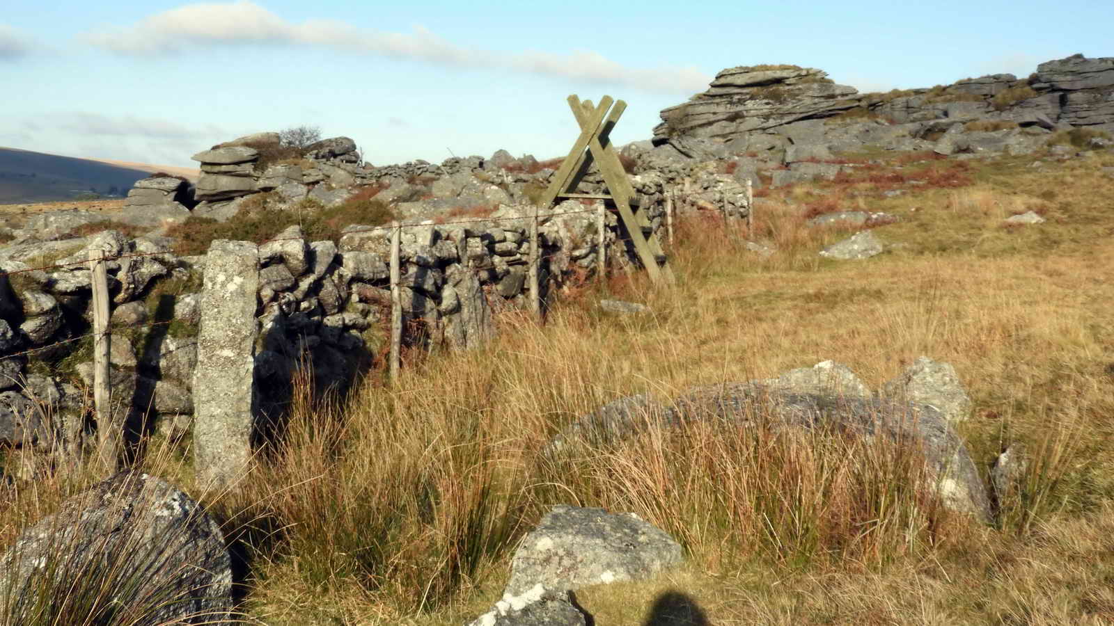
One of the uppermost rocks of Hucken Tor (not photographed on this occasion).

Rick stones at Huckentor Farm, these were covered with faggots and bundles of twigs to keep sheaves of corn off the ground to dry before they were threshed/ Source: Stephen H Woods (1988), Dartmoor Stone. Devon Books, Wheaton Publications Ltd, Exeter, page 168. These are similar to staddle stones (staddle stone images) that were mushroom-shaped stones used to support barns and granaries off the ground away from damp and to prevent access to vermin .....
Another view ..... with part of the Medieval longhouse behind.

Gatehanger stone incorprated into the hedge wall beside Little Wonder Bridge over Pila Brook at SX 54840 74183.
MAP: Blue = GPS satellite track of the walk.

� Crown copyright and database rights 2016 Ordnance
Survey
Licence number 100047373
Also, Copyright � 2005, Memory-Map Europe, with permission.
This walk was reached by driving from Two Bridges towards Tavistock on the B3357 road and parking on the left just before reaching Merrivale and the Dartmoor Inn, at tthe P symbol and the yellow cross on the map.
Statistics
Distance - 5.89 km / 3.66 miles
All photographs on this web site are copyright © 2007-2016 Keith Ryan.
All rights reserved - please email for permissions