f
|
F11 - Full screen F11 - Normal view Home & Contents |
|
"Alt" + � |
This walk: 2015-2-25. Burrator Upper Quarry, Sheeps Tor, Yennadon Crags / Click Tor, Burrator Halt, Leather Tor, memorial benches, dam, waterfall, Devonport leat, Burrator Heritage Centre, Wembley Walk, Lowery Barn, sett makers' bankers.
Walk details below - Information about the route etc.
Previous walk in this area: 19th October 2011.
Google Satellite map + GPS track of the walk.
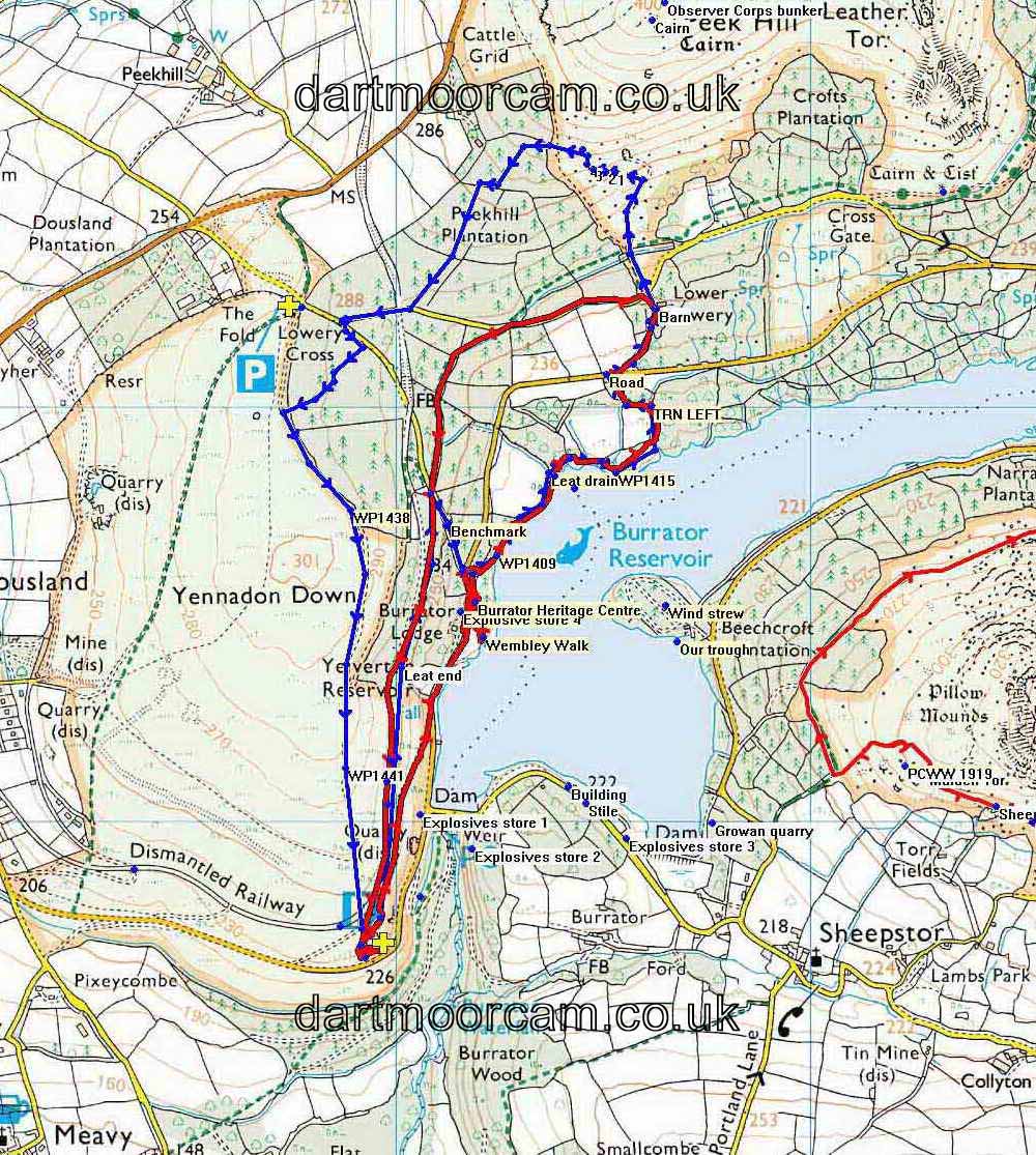
Most photographs below were taken during the "recce" for this walk on 20th February, then, on the actual walk the route was changed because we spent a period in the Burrator Heritage Centre and adjacent Wembley Walk, necessitating a shorter walk. Photographs from both are included below. The routes of both the "recce" (in blue) and today's walk (in the usual red colour) are shown on the map below.
Burrator Upper Quarry car park: I remember 40 years ago (1970 et seq.) that there was a large plaque attached to this rock face saying what it was. From Devon County Council's "Geology in Devon" online publication: Quote - "The Upper Burrator Quarry offers an opportunity to view a rare exposure of the contact between the Dartmoor granite and Devonian rocks. Indeed, veins of pink granite can be seen penetrating these rocks which were once slates resulting from the deep burial and intense deformation of mudstone originally laid down in marine conditions. However, the high temperatures that resulted from the intrusion of the hot granite transformed them into recrystallised rocks known as hornfels. Minerals such as black tourmaline have been formed in the original slate." Dartmoor granite is about 280 million years old, (= Late Paleozoic Era, Permian-Carboniferous Period) the Devonian rocks are about 370 million years old (= same era, Devonian Period).
Addendum: Another reference (from DNPA) has been given to me that states: "This site features rare exposures of the contact between the Permo-Carboniferous Dartmoor Granite and Devonian country rocks of the Kate Brook Formation. The contact is highly irregular and shows evidence of mobilisation of the metasediments and segregation of felsic and mafic constituents. The contact country rocks have been thermally metamorphosed to form hornfels with extensive tourmalinisation."
The area is a SSSI - Site of Special Scientific Interest.
The stone from the quarry was used to raise Burrator dam by 10 ft. in 1923-1928.
For those who are curiious, the Lower Quarry is just around the corner on the road to the dam - blocked off for many years to prevent car parking.
Pink granite - the intrusion into the country rock as referred to above.
An overview .....
Click the image to see a larger version.
Sheeps Tor, SX 566 682, elevation 369 meters (1210 feet) .....
Yennadon Crags / Cleag / Claig / Click Tor, at SX 5498 6794, above the quarry .....
Memorial to Jack Trenerry on the bench .....
The rocks / tor with Sheeps Tor behind .....
Our group in front of the tor .....
View to Leather Tor, SX 563 700, elevation 380 metres (1246 feet) seen along the reservoir .....
Zoomed view .....
As previous photograph.
Another bench near the first one (above).
Steps and kissing gate up to the remains Burrator & Sheepstor Halt railway station, part of a second kissing gate (across the track) is seen at top left .....
Across the railway track bed, the second flight of steps and kissing gate up onto Yennadon Common .....
The first gate, going down to the dam, is difficult to see on the left - it is just behind the concrete nearest to the camera.
Burrator dam and reservoir, opened 1898 .....
On the walk, there was a large amount of overflow following wet weather .....
Looking across at the pier for the suspension bridge (installed as access to Sheepstor village) when the dam was raised by 10 feet over five years starting in December 1923 and finishing in September 1928 .....
The dam.
At SX 54982 68041 .....
As previous photograph.
The view, with Leather Tor near the centre skyline, Sharpitor to the left and Peek Hill, with Down Tor to the right.
At SX 54979 68097 .....
Another bench along the railway track .....
At SX 54986 68150 .....
The plaque.
Looking down to a tree seen against the water of the reservoir.
A discharge pipe .....
This is the pipe at the top of the Burrator waterfall, where excess water is discharged from Devonport Leat .....
This is where the "recce" and the walk on the day went different ways ........
Looking up at the pipe that delivers water from Devonport Leat to form the waterfall .....
The group ..... before walking to Burrator Discovery Centre; no photographs were taken there but there is a separate web page about the opening of the centre on 6th July 2014 .....
In Wembley Walk .....
From SW Lakes Trust web page, Burrator Gardens .....
"The pathway 'Wembley Walk' was named following a celebratory trip to London after the raising of Burrator Dam and was constructed as part of the Empire Exhibition celebrations in 1924. Plymouth City Water Works commissioned the walk, and the archways at each end of the walk were built using granite salvaged from the farms and houses demolished to make way for the reservoir. Wembley Walk was originally a road leading to Sheepstor, the majority of which is now submerged under the Reservoir."
A Dartmoor CAM web page of Wembley Walk photographs taken 5th June 2014 (in poor weather).
Looking at the frogs!
The group at the water's edge where this old road to Sheepstor goes under the water: at this point, a Boat House is marked on the 1888-1913 Series map i.e. after the reservoir was built.
Old maps:
-
1886 Ordnance Survey 6-inch sheet - zoomable - no reservoir
-
1888-1913 Series - showing Burrator Reservoir - zoomable - the water's edge photo above used to house a Boat House, marked on this map
Group in Wembley Walk.
A stone in Wembley Walk, inscribed 1633, WE (Walter Elford) and B (Barbara, his wife).
"Recce" continued" ......
A peth branches off to the left from the old railway track.
The building at the end of today's functioning Devonport Leat .....
The last time I was here was 13th August 2013 with Nick Baker filming Devonport Leat for the BBC Inside Out programme ..... much of this water goes straight to SWW Dousland Treatment Works (some photos of which are shown in the link) .....
Many of the kerb stones are re-used railway setts .....
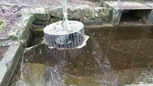
The pipe leading to the waterfall ....
Dartmoor CAM
movie. TIP .....
A panorama taken at the modern, functional end of Devonport Leat. |
Click the photo to download and play the movie File size: 8.7 MB. Length 53 secs |
A new "bridge to nowhere", about two weeks old according to a passer by; probably intended for cleaning debris from the grille.
Beech tree, still bearing its leaves from last year.
The path ahead.
Ditto, with Devonport Leat; we filmed the brown trout, water boatmen, beautiful demoiselle and the egg-laying golden-ringed dragonfly here on the 16th August 2013; I also spent quite a while dropping leaves in the leat to float past the camera for effect!
The leat coming from under the road from Lowery Cross down to Burrator Lodge .....
The leat seen across the road .....
On the day of the walk we came along the leat from across the road .....
Walking by Devonport Leat.
The forestry sign .....
The gate between the road and the leat ..... on the recce, I came out of it, on the walk we entered it .....
Something special on the top-left corner of what is left of this wall .....
Benchmark at SX 55127 68719, recorded as no. 819.7 on Mullicraft Cottage on the old 1886 6-inch maps, Link 1: 1886 map and Link 2: 1888-1913 Series (same links as above).
This where the walk and the "recce" recombined .....
Crossing the road down by the reservoir ....
The notice .....
The sign.
Hardly roadworthy!
Sign on the gate into the Burrator Heritage Centre area.
The path down to the waterside.
General view.
Zoomed view across the lake to Longstone Manor where forestry operations were going on ......
As previous photograph.
Wind-blown tree - a lot of energy waiting to be released if someone were to cut the trunk near the root ball! It seems a surprisingly small amount of root considering the size and weight of the tree.
General view .....
And again.
Slender shoots from a sawn willow(?) stump - effectively coppicing .....
This was so wet that we called it "willow"!
The path ahead.
Looking up a "draining channel" from Devonport Leat, no longer in use .....
Looking in the opposite direction ....
As previous photograph. Strangely, this is in line with where Drake's Plymouth Leat head weir was , now under the reservoir.
On the day of the walk, we saw the "top end" of this channel .....
Sluice on Devonport Leat that would let water into the drainage channel down to the reservoir - the water control system on the Devonport Leat is complicated although this aspect is not used at present.
These trees have taken over the wall they are growing on!
There is no beach here this time, compare with 19th Oct. 2011.
The porous underside of a bracket fungus on a dead birch tree trunk: the Birch Bracket or Birch Polypore, (Piptoporus betulinus) .....
View of the top surface.
Seen along the way.
Lowery Barn, now consolidated and re-roofed .....
Closer view ..... note the four lintels of filled-in doorways .....
The notice.
ML = Sir Massey Lopes, became Baron Roborough of Maristow, 3rd Baronet ......
1873 - when the barn was enovated. The two stones are in the "4th course" of stones down from the top of the wall and can be seen at equal distances in from opposite ends in the photograph below as slightly larger "clean" looking stones ....
Another view .....
Yes, I walked around it!
Photos on the end grating .....
Interior view .....
Some corbels for supporting the tallet (upper floor).
On the day of the walk, we finished by walking along Devonport Leat and back to the car park .....
The new "Bridge to Nowhere" ..... probably to enable easier cleaning of debris from the large grille behind it .....
Miss.
Hazel catkins .....
Zoomed view.
Fence posts beside Devonport Leat .....
Top of a fence post .....
The other side .... there are more of these fence posts outside Burrator Lodge, but more heavily painted and illegible!
Clapper bridge over the leat.
Sett makers' banker at SX 55507 69568 .....
Another view .....
A second banker, at SX 55476 69573, has its own seat ......
Sedum anglicum is normally associated with these bankers, growing on the grit and dust from the sett cutting operations ....
The third banker at SX 55461 69586 .....
Another aspect.
Isobel's challenge!!
Path through the forest.
Substantial gatepost at Lowery Crossing, but in the wrong area for railway crossing gates? ......
Photograph taken along the old railway, the gatepost above is seen as a white object immediately right of the forest gate.
General view.
Walling on Yennadon Down.
Sheeps Tor from high on Yennadon Down
Zoomed view, note the brown area which is the bracken field, slowly taking over the scene.
MAP: Blue = route of the recce, Red = GPS satellite track of the walk.

© Crown copyright and database rights 2014. Ordnance Survey
Use of this data is subject to terms and conditions.
Also, Copyright © 2005, Memory-Map Europe, with permission.
This walk was reached easily from Dousland by parking at Burrator Quarry, marked by the P symbol and the yellow cross on the map.
Statistics
Distance - 4.97 km / 3.09 miles.


