|
F11 - Full screen F11 - Normal view Home |
 Previous walks Full Screen Viewing Links Weather |
"Backspace" to go back pages Contents |
This walk: 2012-10-10. Combestone Tor, mist! Today's walk was too misty and wet for the camera to be taken out and used as is normally done.
Walk details below - Information about the route etc.
Link to Google Satellite view of the area - the car park is just right of the "-" sign at the bottom of the view zoom slider.
3 December 2008 - this was the same walk on a beautiful, blue-sky day.
The intrepid Strollers - in a landscape of Dartmoor mist.
Sarah and Freddie.
Trying to see across the road, picturesque tree with a raindrop on the camera lens.
Back at the car park by Combestone Tor.
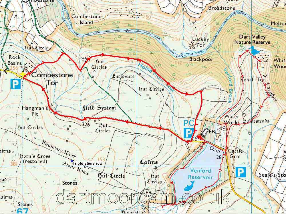
MAP: Red = GPS satellite track of the walk - the thicker track was the walk done today, the thin track is the walk done 17 Aug. 2011 - our 4th anniversary walk.

© Crown copyright and database rights 2012 Ordnance
Survey
Licence number 100047373
Also, Copyright © 2005, Memory-Map Europe, with permission.
This walk was reached via the Two-Bridges to Dartmeet road, turning off for Hexworthy. passing The Forest Inn and continuing to the car park alongside Combestone Tor, marked by the yellow cross on the map.
Statistics
Distance - 4.18 km / 2.6 miles.
All photographs on this web site are copyright ©2007-2016 Keith Ryan.
All rights reserved - please email for permissions
Dartmoor Tick Watch
The Cornish Pasty - The Compleat Pastypaedia