![]()


2021-6-25. Haytor Rocks, Saddle Tor, Low Man, Haytor Upper Car Park, Haytor Main Quarry, two iron rings, crane winding gear, water lilies, tadpoles, feather and tare rock, two spikes in rock, Haytor Granite tramway, granite rail with feather and tare marks, inscribed K rail, Holwell Junction, granite "points", inscribed S rail, abandoned rail, abandoned apple crusher, ruined buildings, Holwell Quarry, quarrymen's hut, Rubble Heap Quarry. D365-K18, L18.
Car park: /CAM/CarParks/Haytor-UpperCarPark.htm
Walk details below - Information about the route etc.
Previous walks in this area: 18 Feb 2008, 31 Aug. 2011, 22 Aug. 2012, 25 Oct. 2012, 29 May 2013,
Reconnaissance walks: 29 May 2020, 15 June 2021
Google Satellite map + GPS track of the walk
Old maps
OS 25-inch sheet, (survey 1885) publ. 1886 - Haytor Rocks, Haytor Quarries and tramway details
OS 25-inch sheet, (survey 1884-85) publ. 1886 - the tramway eastwards with Haytor Vale and Haytor Iron Mine
OS 25-inch England and Wales 1892-1914 zoomable - not so much detail
Heritage Gateway - Devon & Dartmoor Historic Environment Records
| Quarrymen's houses, Haytor Quarry | Ilsington |
| Rubble Heap Quarry part of Haytor Quarries, Ilsington | Ilsington |
| Holwell Quarry part of Haytor Quarries, Ilsington | Ilsington |
| Ilsington, Blacksmith's Shop | Ilsington |
| Quarry north-west of Haytor Quarries, Ilsington |
Ilsington |
| Haytor Reservoir leat, Ilsington | Ilsington |
| Pound north-east of Holwell Tor, Ilsington | Ilsington |
| Haytor Quarries, Ilsington | Ilsington |
| Haytor Granite Tramway, Haytor to Stover Canal | Bovey Tracey; Ilsington |
| Ilsington Poorhouse | Ilsington |
| Quarry west of Haytor Rocks, Ilsington | Ilsington |
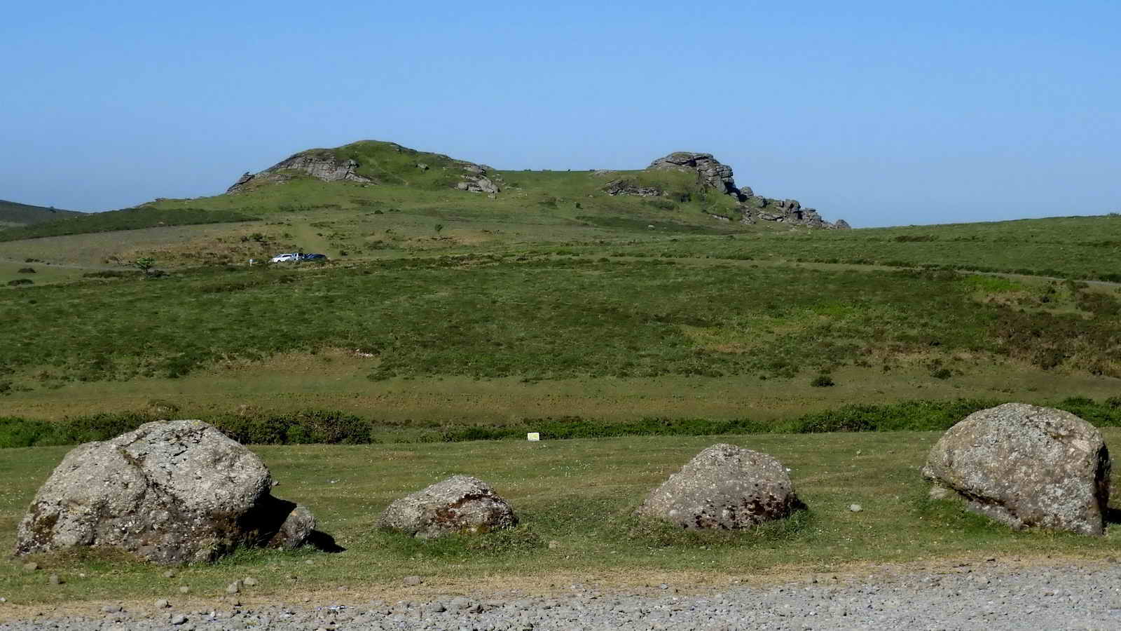
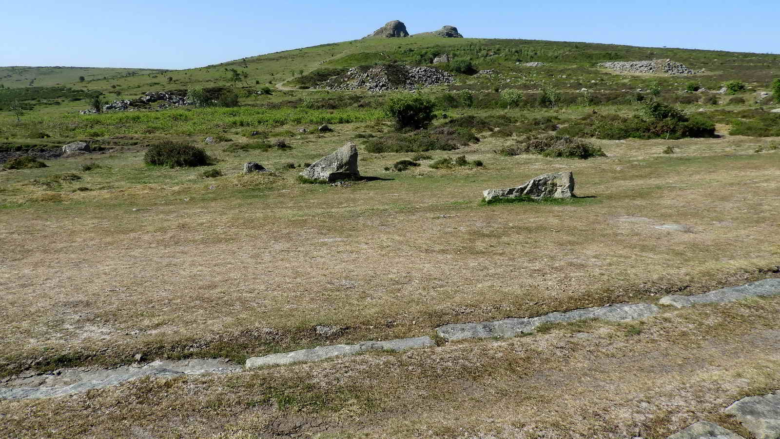
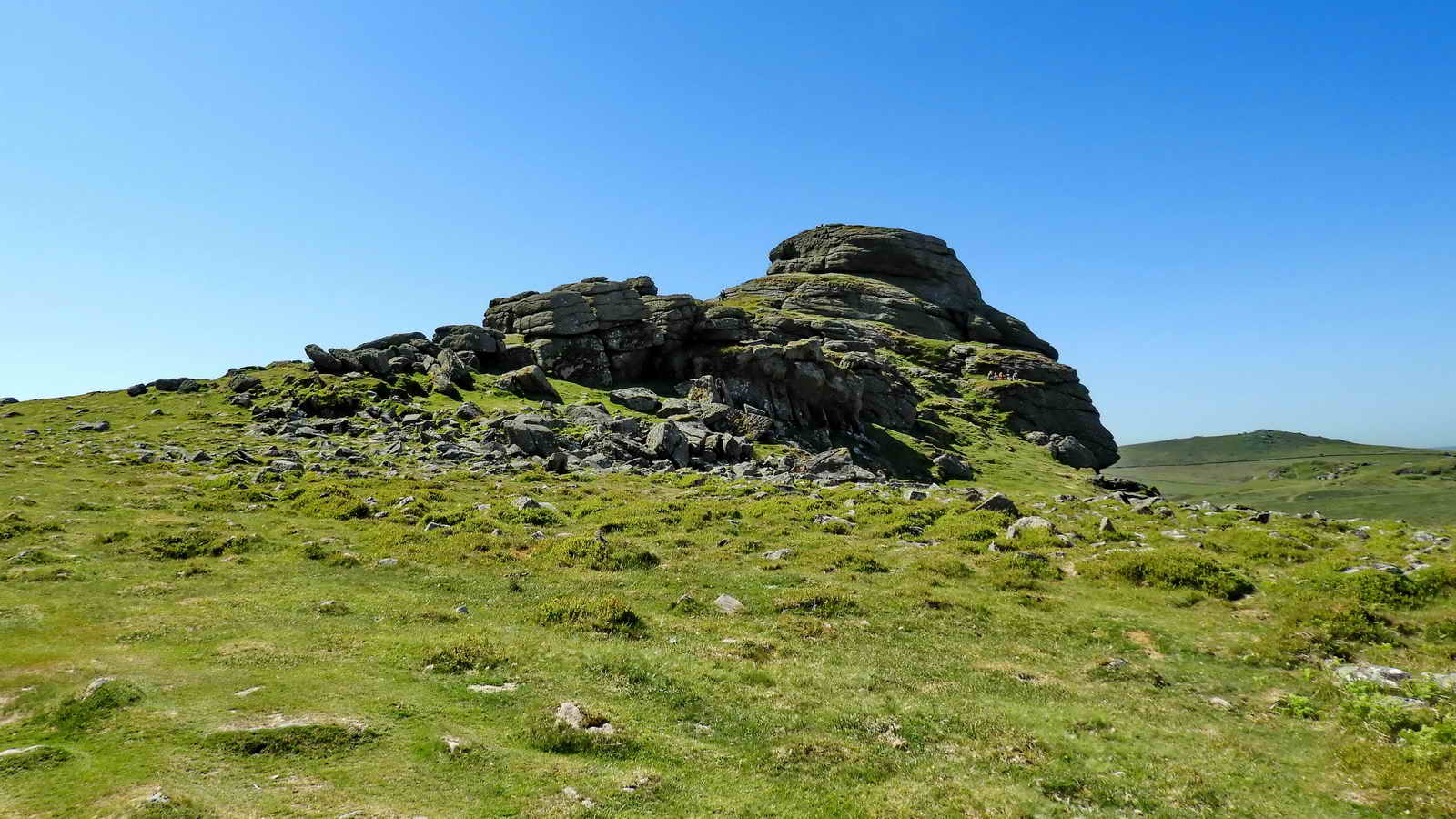
Saddle Tor, SX 751 763, elevation 478 metres (1568 ft), seen from Haytor Upper Car Park. The lower car park is where the Visitor Centre and toilets are, and the middle car park is halfway between.
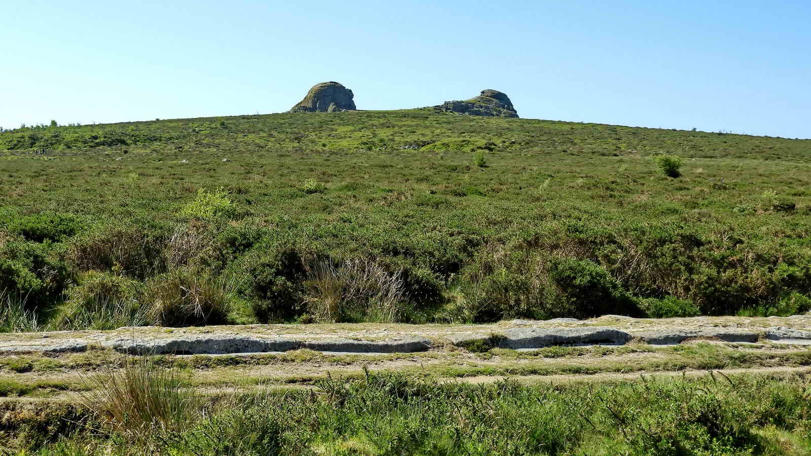
Haytor Rocks, a zoomed view seen from the car park - this is a cartographer's corruption of the local name of High Tor, pronounced in the Dartmoor dialect as "Hey Tor". These are granite intrusions that are seen from a long way off - even in The Channel - and are hence, the "high tor". With rock piles separated by an area of grass, it is also called an "avenue tor", like Bellever (Bellaford) Tor, Hound Tor, Great Staple (or, originally, Steeple) Tor, Rippon Tor and Pew Tor.

Another view, during the walk up to the rocks.

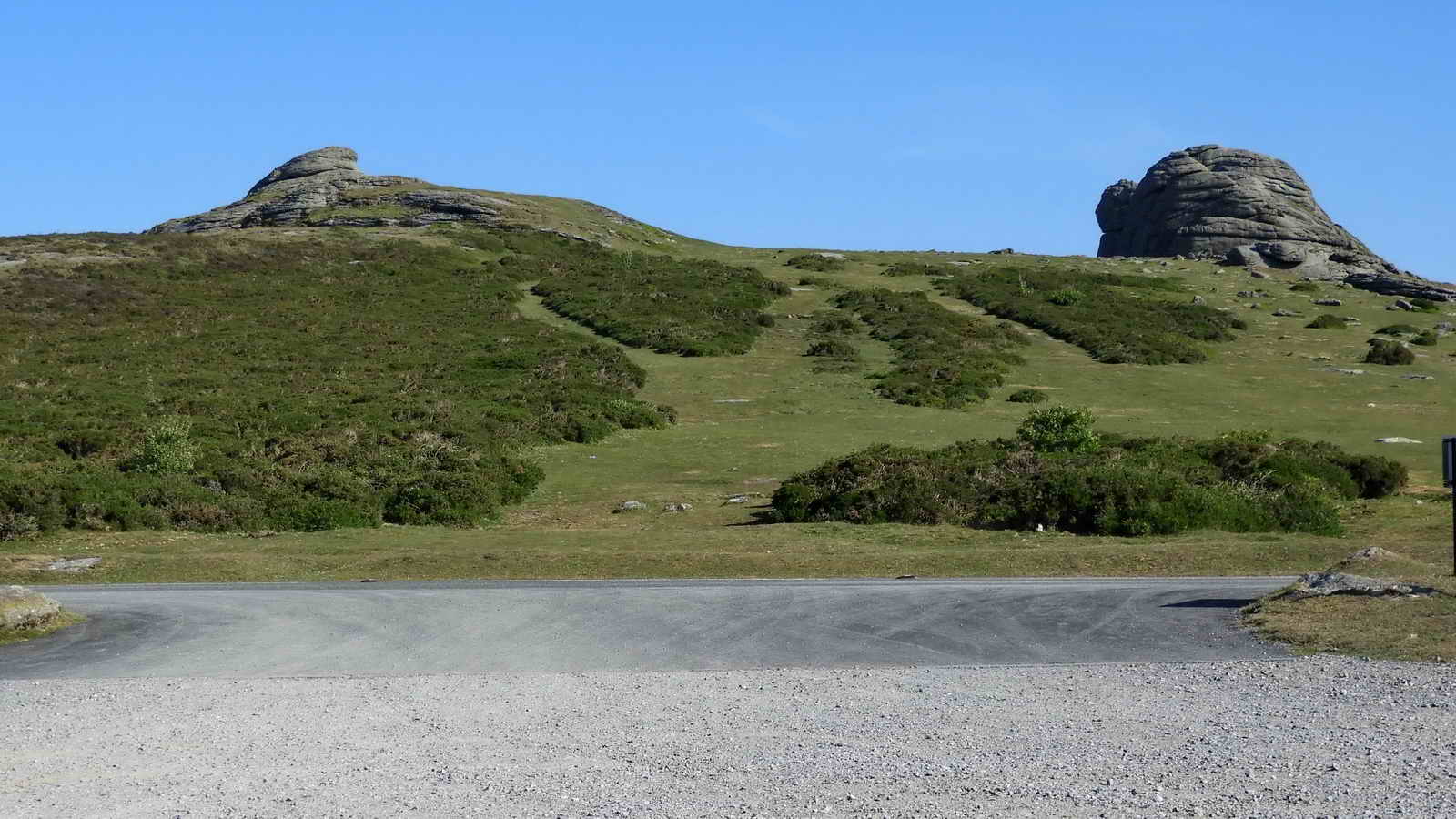
The western pile, known as Low Man, has its own climbing routes.
Approaching the main, eastern, pile. There are many climbing routes here; there are also steps cut into the south and western side for easy ascent, although I would suggest not on a windy day.
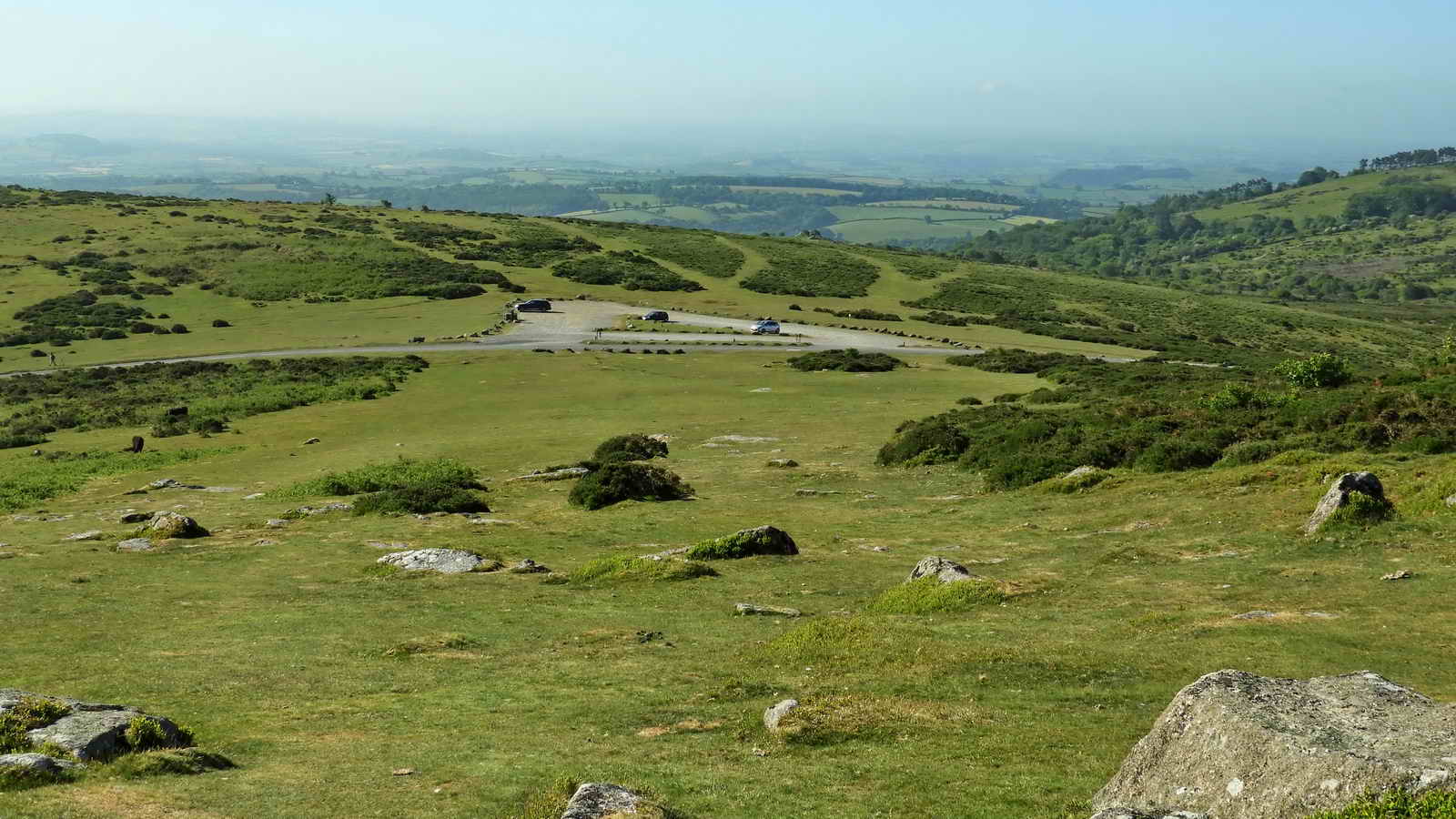
Looking back down on the upper car park .....

Zoomed view to the lower car park and Visitor Centre, against the trees. The middle car park can be seen at the right edge of the photograph.

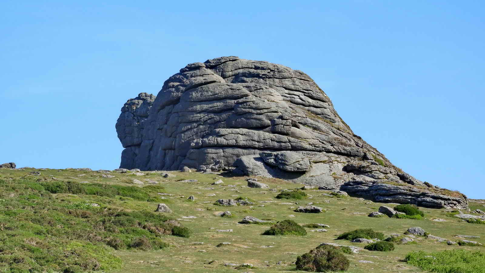
Low Man, there is a hole drilled in the top of the rock - for a flagpole.

This is the eastern pile, where we walk around the end of the rock and head for Haytor Quarry .....

A walking group leaving Hey Tor, seen en route to the main quarry.

A view looking into the quarry from the perimeter fence .....
George Templer (1781�1843) was a landowner in Devon, England, and the builder of the Haytor Granite Tramway, which connected the quarries to the Stover Canal. He started the Haytor Quarries in 1813 (1819?). The granite railway was opened in 1820.
His father was the second James Templer (1748�1813). It may have been the winning of a contract to provide granite for John Rennie's rebuilding of London Bridge that led Templer to develop the tramway: light grey "Devonshire Haytor" granite was specified, along with two Scottish granites, by the Act of Parliament that authorised the new London Bridge. Work on the new London Bridge began in 1824. The tramway was opened on 16 September 1820 with a great celebration at Haytor at which Templer gave a "short and energetic speech, which excited bursts of applause". The tramway and quarries folded in 1858/1860 due to competition from Scotland and Cornwall and the high cost of transportation. Some stone was taken for special requirements: e.g. Exeter War Memorial, 1919.
James Templer (the "first", 1722�1782) of Stover House - which he built between 1776 and 1780 using granite from the quarries at Haytor. He was a self-made magnate, returning from India aged 23 after making a fortune. He was a civil engineer who increased his fortune by building dockyards, including that at Plymouth.
James Templer (the "second", 1748�1813) of Stover House, Teigngrace, Devon, was a Devon landowner. He also built Stover Canal - this was opened in 1792 to carry ball clay to Teignmouth docks for shipment to the potteries, where its quality of producing very white porcelain was sought after by e.g. Josiah Wedgewood. Ball clay was so-named because it was cut as 15-17 kg cubes but during transport the corners became rounded off, leaving round balls of clay.
Later history: In January 1829 he overspent his resources and was forced to sell his entire estate, of Stover House, the Stover Canal and the Haytor Granite Tramway, to Edward St Maur, 11th Duke of Somerset, styled Lord Seymour (1775-1855).
The Johnson Brothers, who leased Foggintor, also leased Haytor Quarries from the Duke of Somerset in 1840 and immediately closed them. They then traded Foggintor stone under the Haytor Granite Company name, which was misleading to customers. Seven years later, the Duke refused to extend their lease!
A good online reference is Legendary Dartmoor - Haytor Quarries
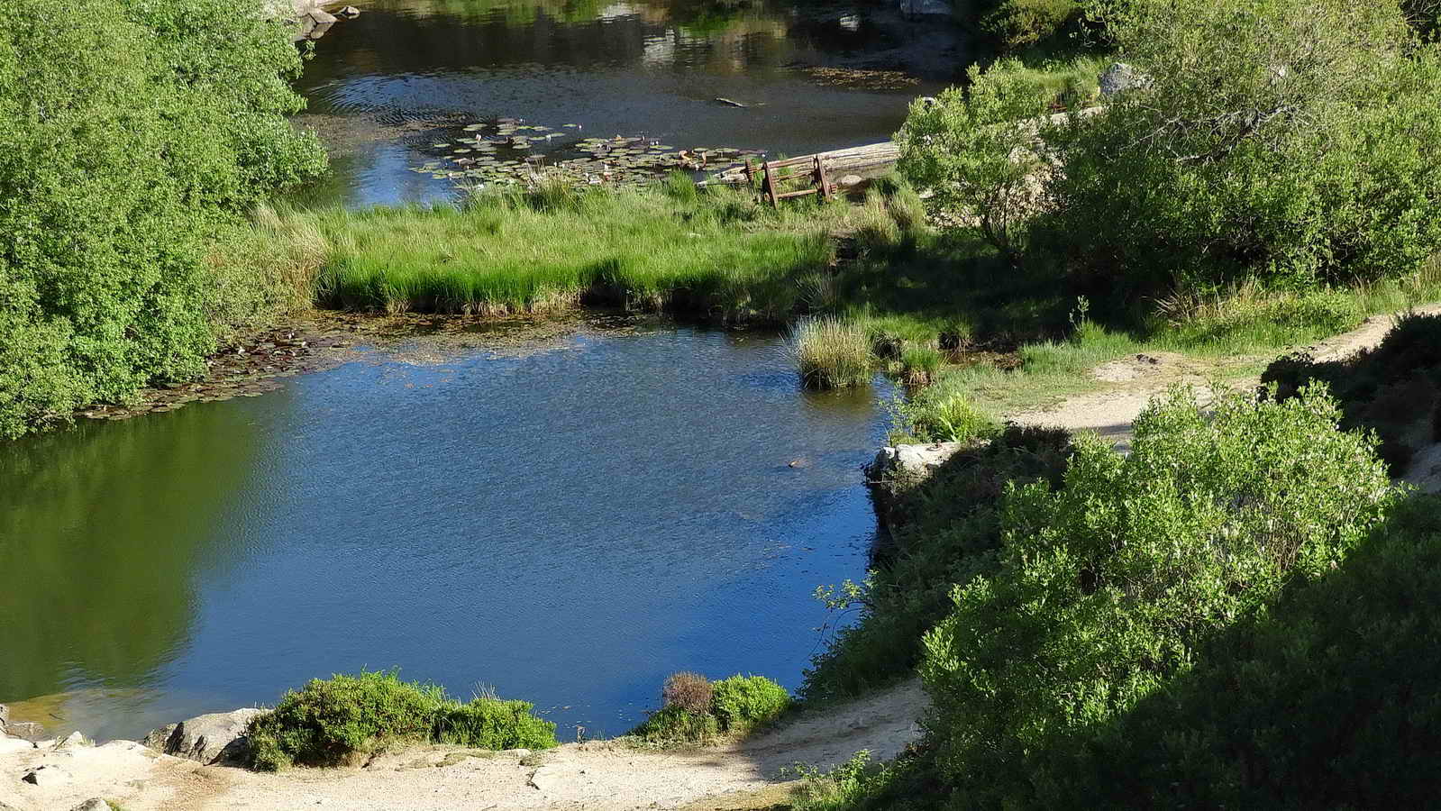
Zoomed view, looking at the old crane winding gear. This Main Quarry, north of Hey Tor, opened in 1819. Now known as to some as Heytor Ponds.
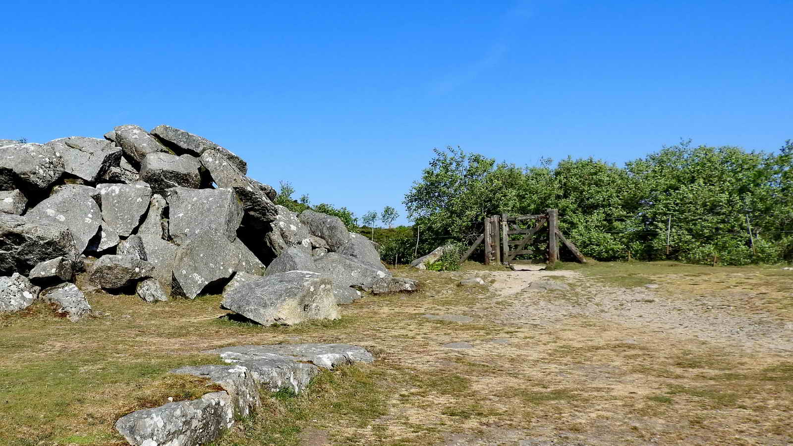
The gate into the quarry .....

First approach to the side of the flooded area. The large "white" rock on the left, at the water's edge, has an iron ring embedded in it (more below) and a similar rock, back from the edge at the extreme right of the photograph has a similar iron ring.
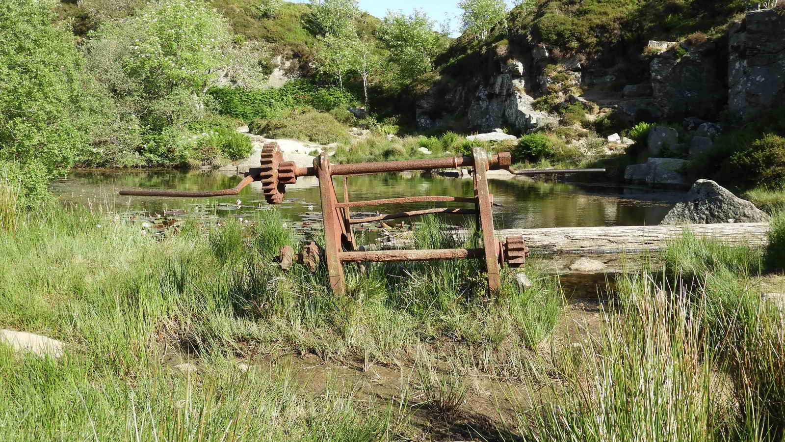
The winding gear of a derrick crane with a timber, with the fallen upright mast, behind it ..... (another link) .....


Another view of the windlass, or "mangle" .....
A sculptured depression beside the winding gear, possibly to house the upright mast of the crane?
 Copyright
- Image reproduced with permission from the
Dartmoor Trust Archive
Copyright
- Image reproduced with permission from the
Dartmoor Trust Archive
See the image online HERE
The item is filed as "Haytor quarry - old print"

Water lilies .....

The White Water Lily, Nymphacea alba, opening bud .....

More detail, showing yellow anthers on the pollen-producing anthers on the stamens.
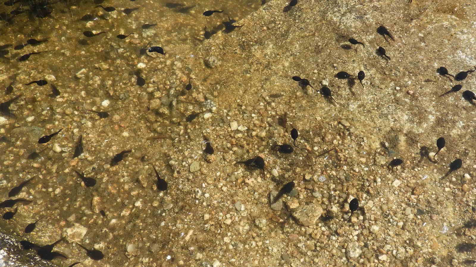
Tadpoles near the water's edge (15 June 2021).

A view across the flooded pit showing the near-side iron ring in the foreground and the second ring on the larger "white" rock straight across the water .....

Close-up of the first ring - these are substantial structures and may have been involved in steadying the crane when lifting / loading heavy granite blocks .....

Halfway around the first "pond", looking across to the crane mechanism.

Looking across the pond from the second iron ring to the first one ..... it is on the higher of the "white" rocks at the waterside .....

The second ring. The rings are positioned such that the guys would come back from the derrick at an angle to prevent left / right movement of the jib when in use.

Rock split by the feather and tare method, up behind the second iron ring - slightly to the right.

View to the second gate, before detouring to the right .....

Two iron spikes left in a rock! We entered the quarry from the top left area .....

The spikes are curiously of different patterns - the left spike is square in cross-section, whereas the spike on the right is more circular in section and is "fluted" i.e. ridged along its length.

Another view .....

Ditto ..... showing part of the quarry wall ..... I looked for Dartefacts' Haytor Quarry Rock Monster but was't sure if I had the imaginati0oon to see it this day!

On the path out to the gate - the two spikes are in the centre of the photograph .....
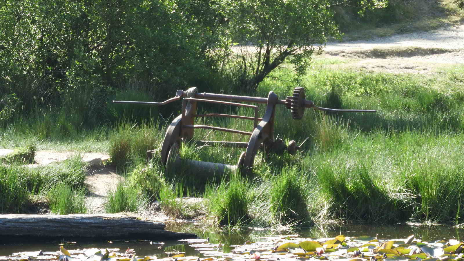
A final view of the crane mechanism.
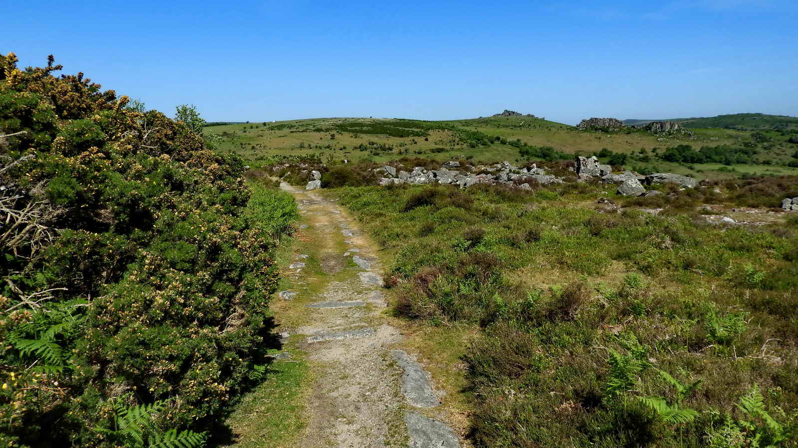
Proceeding down the track from the quarry - where the 1886 OS 25-inch single sheet map shows there was a branch of the Haytor granite tramway - past some quarry waste .....
More waste ..... reminiscent of Big Tip at Foggintor .....
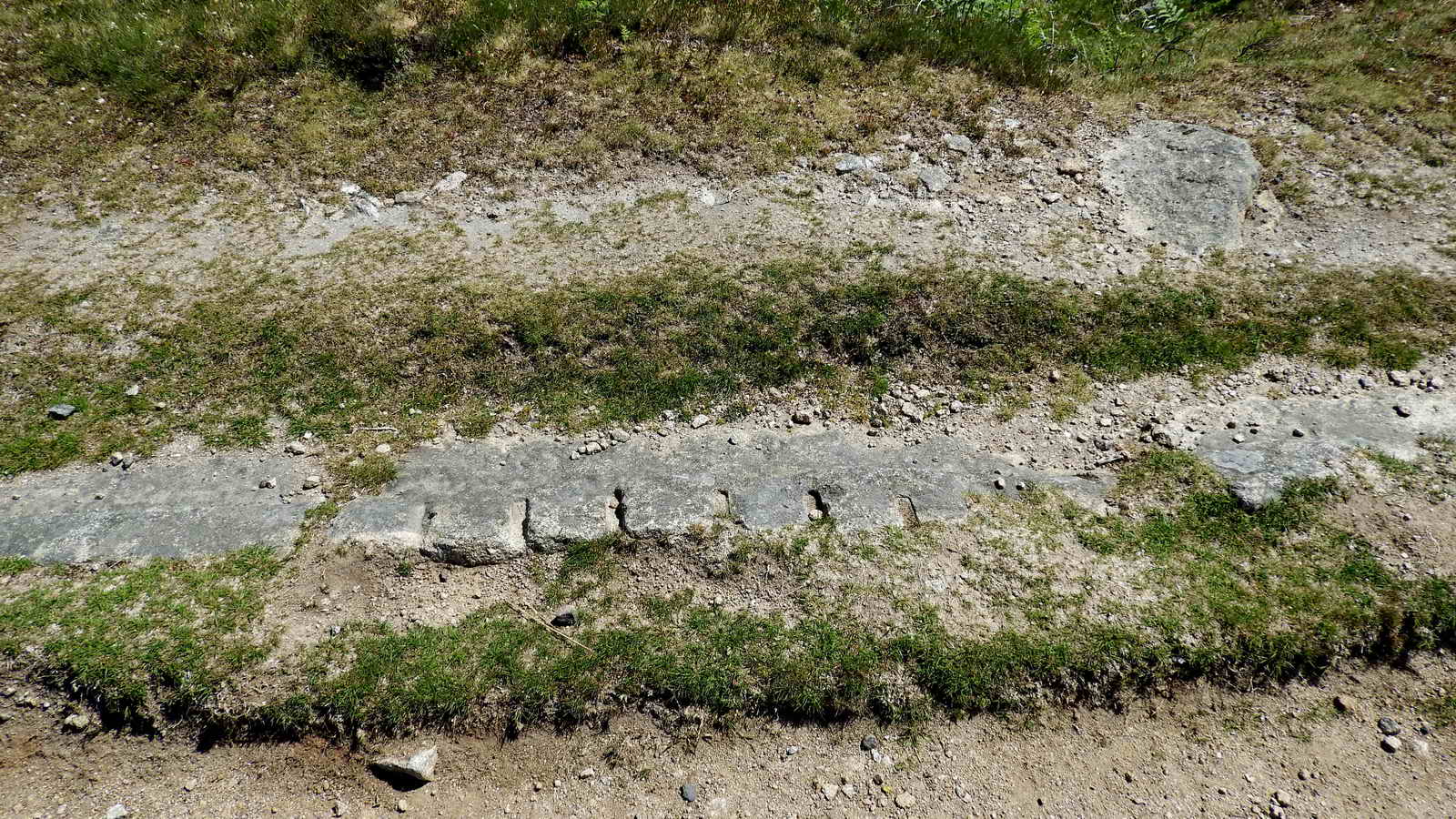
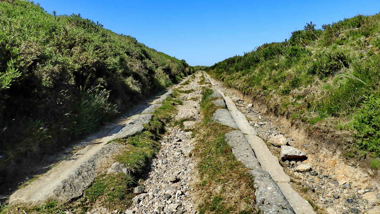
Unusual rail showing feather and tare marks that are usually hidden .....

Overview of the unusual rail, at SX 76097 77576.
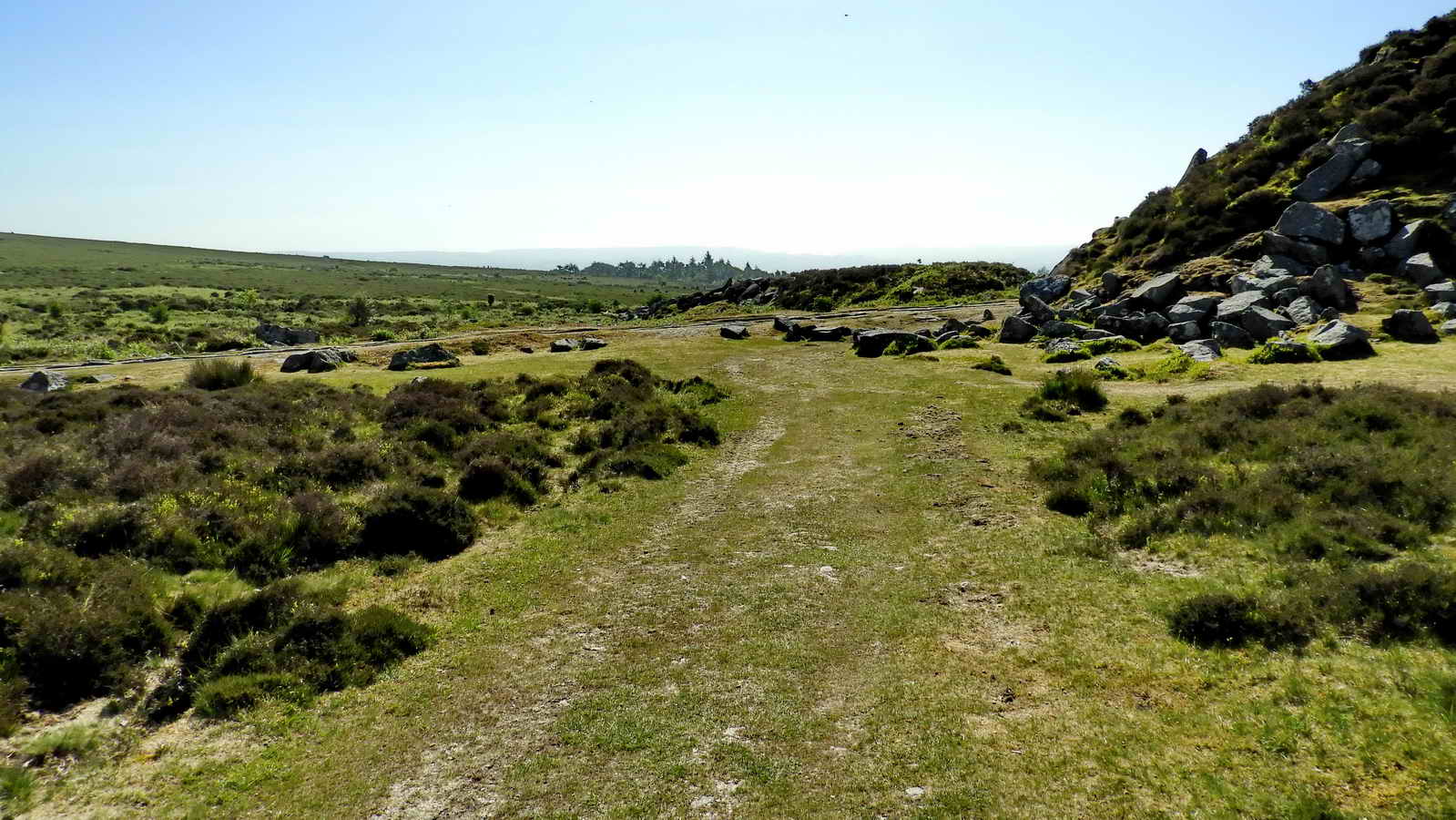
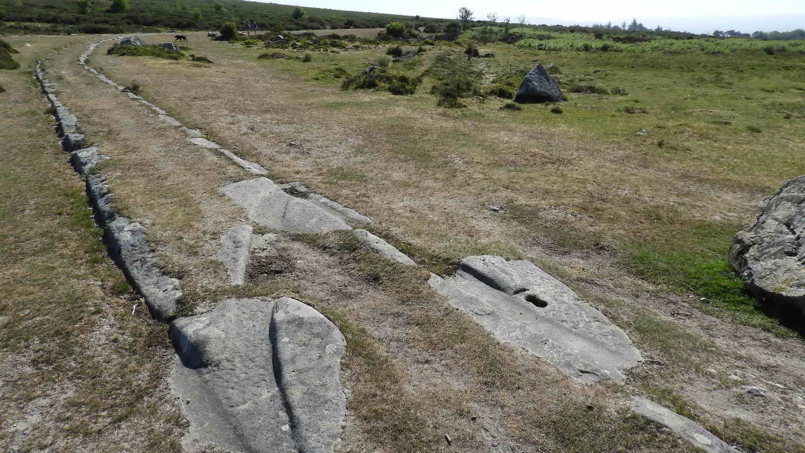
Looking down to Holwell Junction where the tramway runs left towards Holwell Quarry - the granite tramway can be seen running left/right across the photograph. There was tramway on this track/path originally.
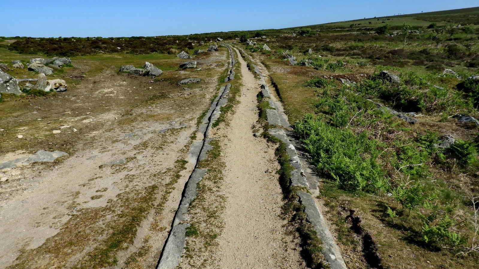
The gauge of the track was 4 ft 3 in (1,295 mm), with the "rails" being shaped granite blocks. The wagons had plain wheels without flanges.
"Bendy" rails!
From Wikipedia .....
The wooden
flat-topped waggons had iron flangeless wheels and ran in trains of
usually twelve waggons drawn by around 18 horses in single file, in
front for the upward journey and at the rear for the downward. An old
sailor called Thomas Taverner wrote a poem which gives us this
information:
"Nineteen stout horses it was known,
From
Holwell Quarry drew the stone,
And mounted on twelve-wheeled car
'Twas safely brought from Holwell Tor"
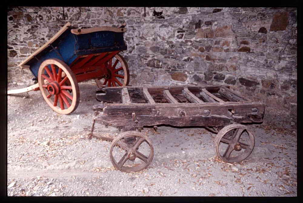
Copyright - Image used by kind permission of the
The Dartmoor Trust Archive
Online
version of the image here
This Haytor tramway wagon is kept in Bovey Tracey at the Dartmoor National Park's Head Office at Parke.

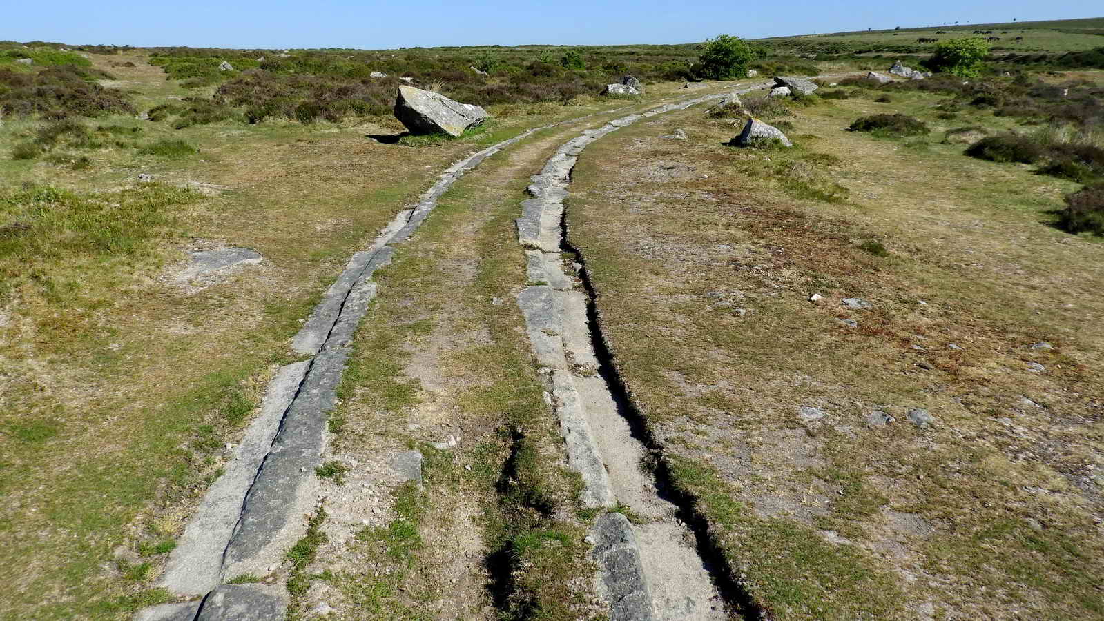
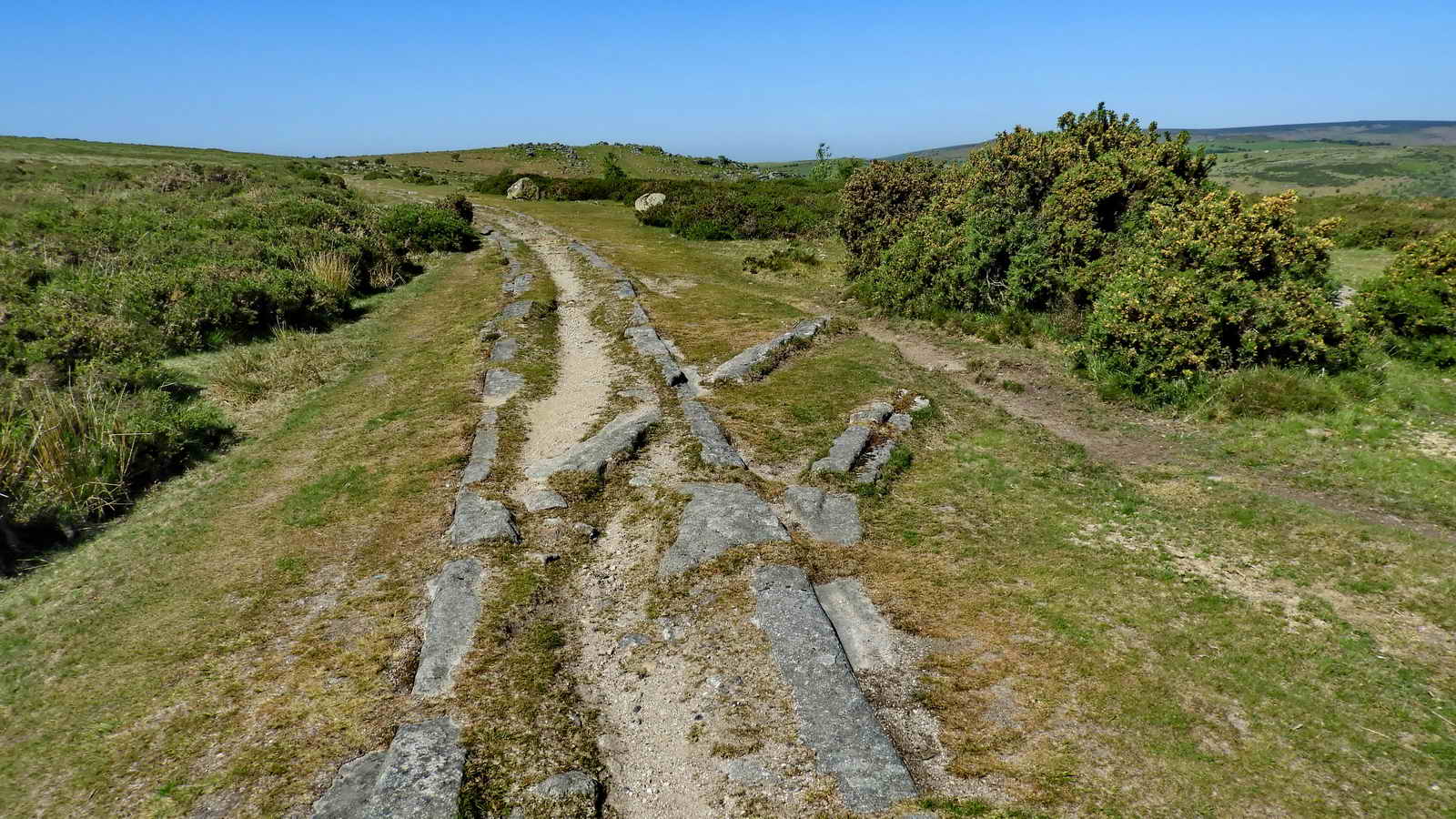
First "points" seen on the walk at SX 76122 77722 .....
SX 76122 77722, at junctions the wheels were guided by 'point tongues', pivoted on the granite-block rails, this could be described as an early form of a railway "switchplate". Authorities differ on whether the point tongues were oak or iron.
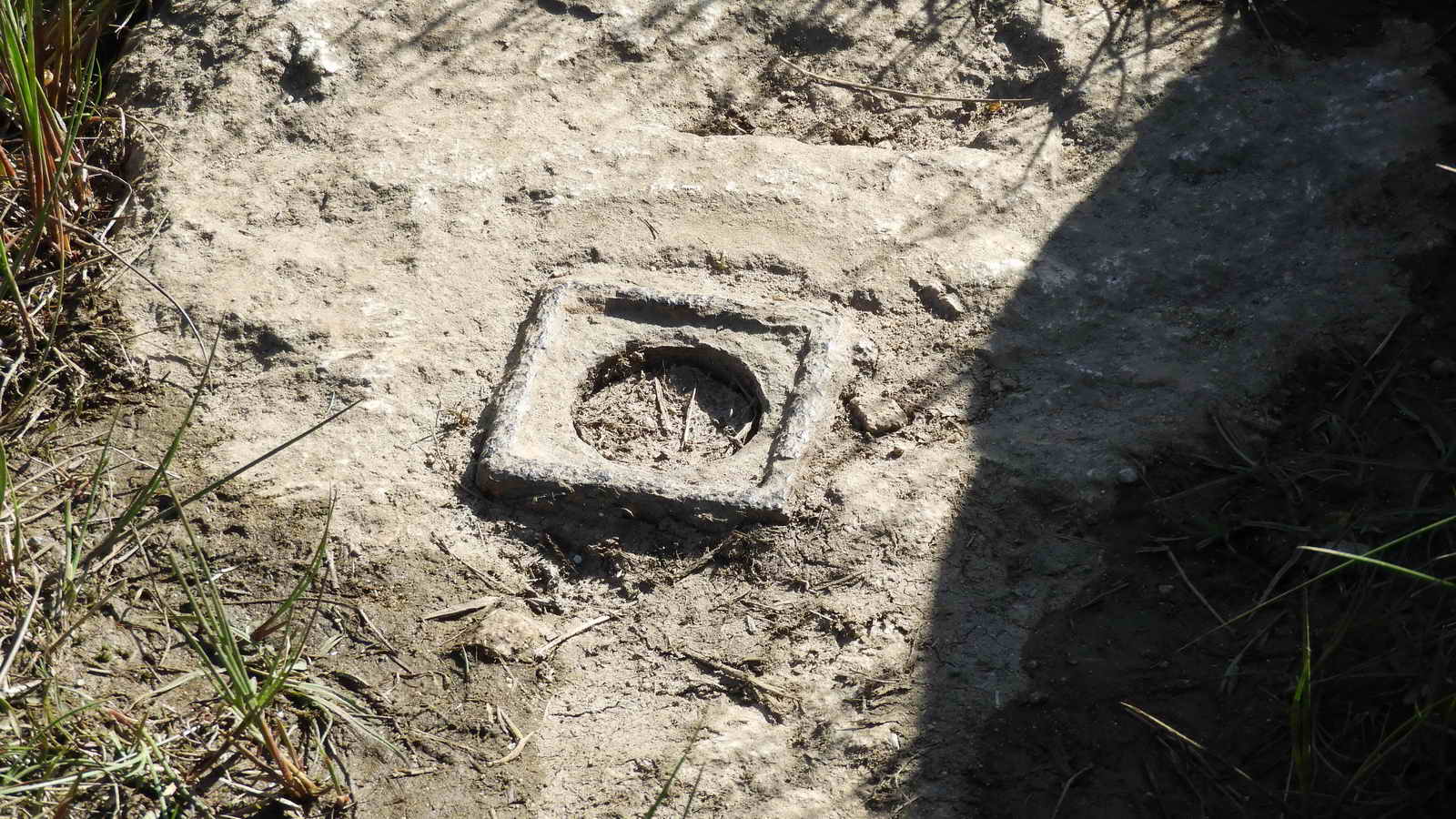
Somewhere here is an unfinished benchmark (SX 76187 77754) and it just might be that another can seen at the extreme right edge, on the rock? Or is it a trick of the light? It needs another visit.
Copyright - Image used by kind permission of the
The Dartmoor Trust Archive
Online
version of the image here
Wagons were switched to a particular direction by use of a switchplate.

Rail with inscribed "K" at SX 76140 77728, a mason's mark .....

Holwell Junction on the tramway, SX 76174 77747, the left branch goes to Haytor Main Quarry and the track going straight ahead runs to Holwell Quarry, Rubble Heap Quarry, Harrow Barrow Quarry and Haytor West Quarry.

Holwell Junction again.

An inscribed"S" on a rail, another mason's mark, not far from Holwell Junction, SX 76248 77713 .....
The "S rail" in the midline of the photograph near the bottom edge, with Haytor Rocks behind.

Ponies en route ....
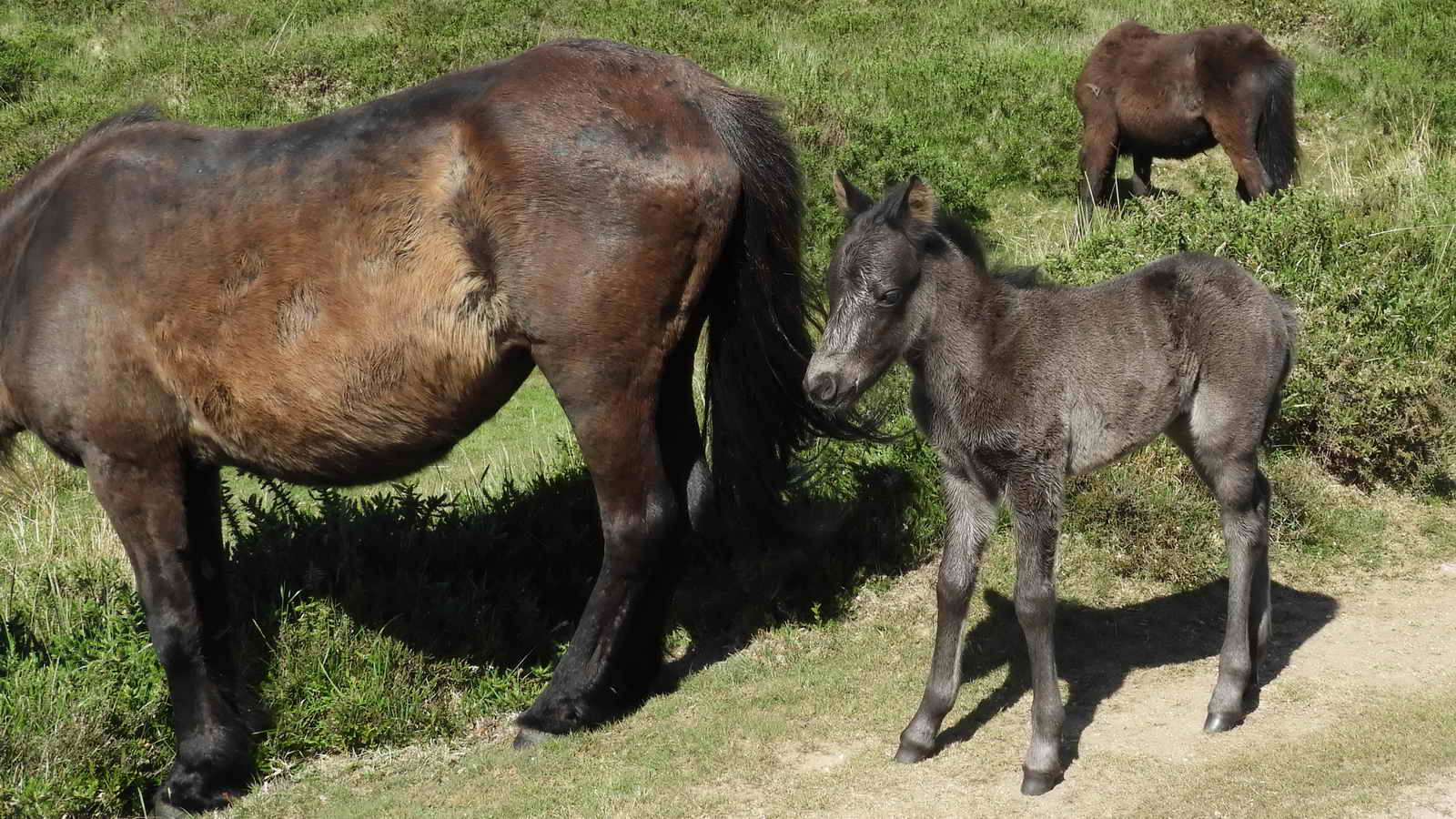
This year's foal.
I've taken this (crouching down) photograph before!
Just a photo. The tramway runs 10 miles from Haytor to the start of the Stover Canal at Ventiford Bridge. It then runs to Jetty Marsh Quay, Newton Abbot, from where loads proceeded at high tide down Whitelake to the River Teign and then to Teignmouth for shipping. Nowadays, the whole route can be walked as the Templer Way (an 18-mile walk). Other Templer Way links.
A set of "going nowhere" points at SX 75795 77772. Some of these branches are not shown on the old 1886 map (surveyed in 1885).

Rubble Heap Junction at SX 75722 77739 - straight on leads to Rubble Heap Quarry, Harrow Barrow and West Quarries; right leads to Holwell Quarry.
Abandoned granite rail, SX 75664 77737.
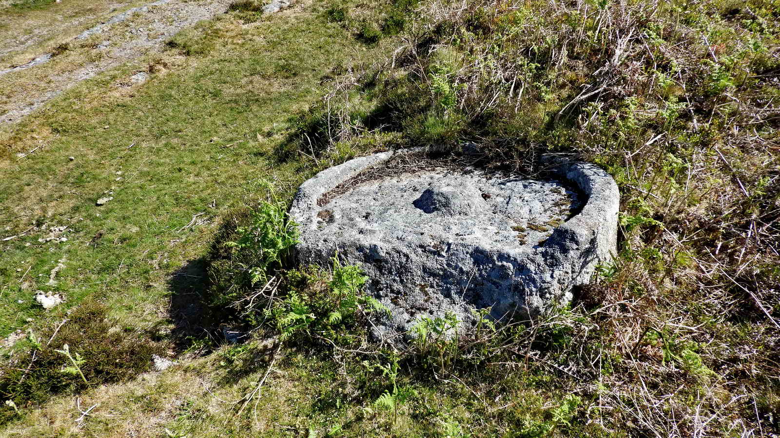
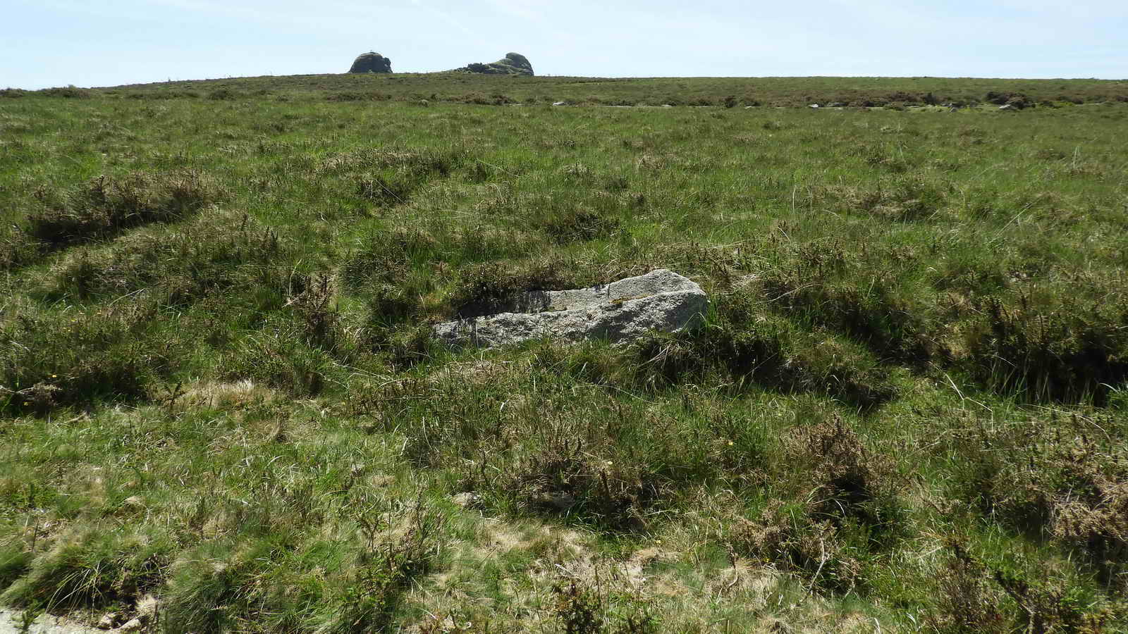
Broken granite apple (cider) mill beside the tramway on the way to Holwell Quarry, SX 75514 77725 .....

Another view.

Ruined building on the left of the track just before reaching Holwell Quarry, at SX 75213 77726.
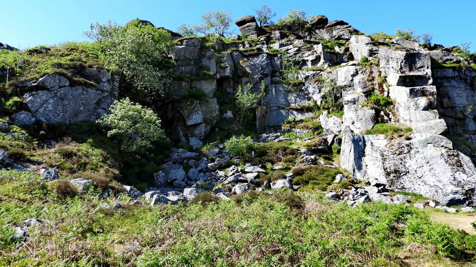
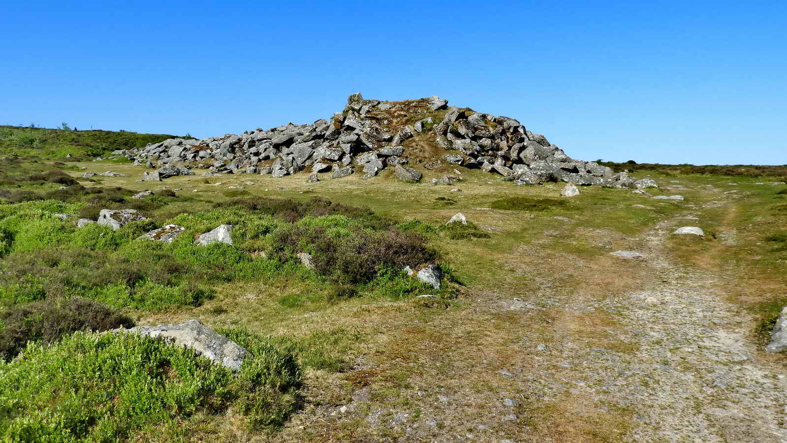
Part of Holwell Quarry, SX 75165 77746. There are five separate quarries on Haytor Down: Haytor (Main) Quarry, Holwell Quarry, Rubble Heap Quarry, Harrow Barrow (Emsworthy East Quarry) and Western Quarry (Emsworthy West Quarry). "Emsworthy" names are sometimes used because of the proximity of Emsworthy Rocks, between Haytor and Saddle Tor.

Ruined building inside Holwell Quarry .....
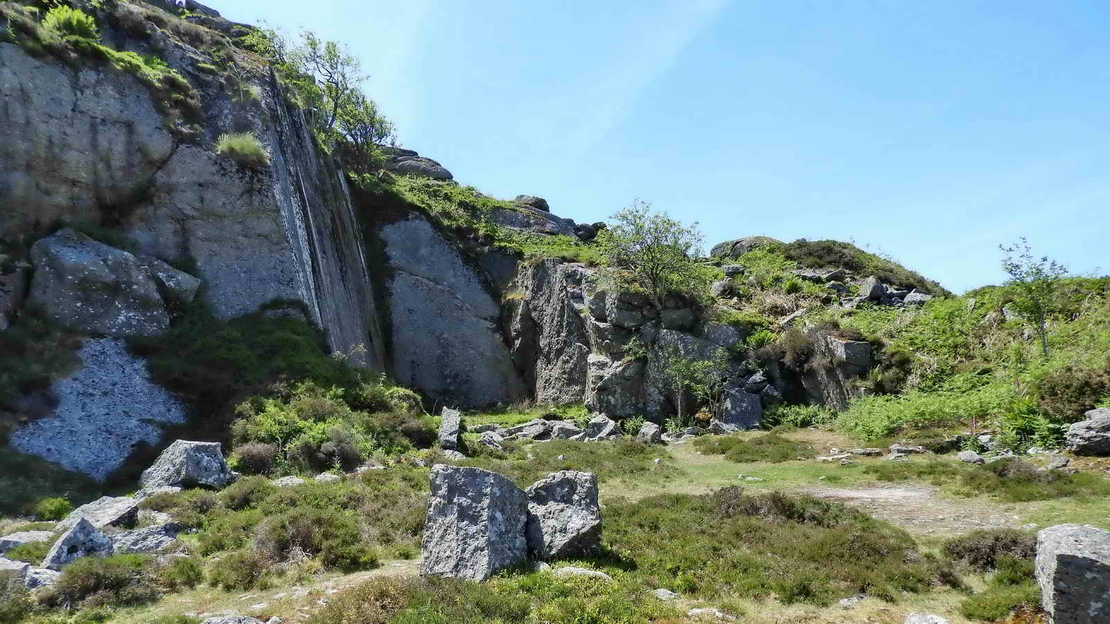
Inside Holwell Qarry.
Track continuing, with the quarrymen's hut down to the right below the rocks .....
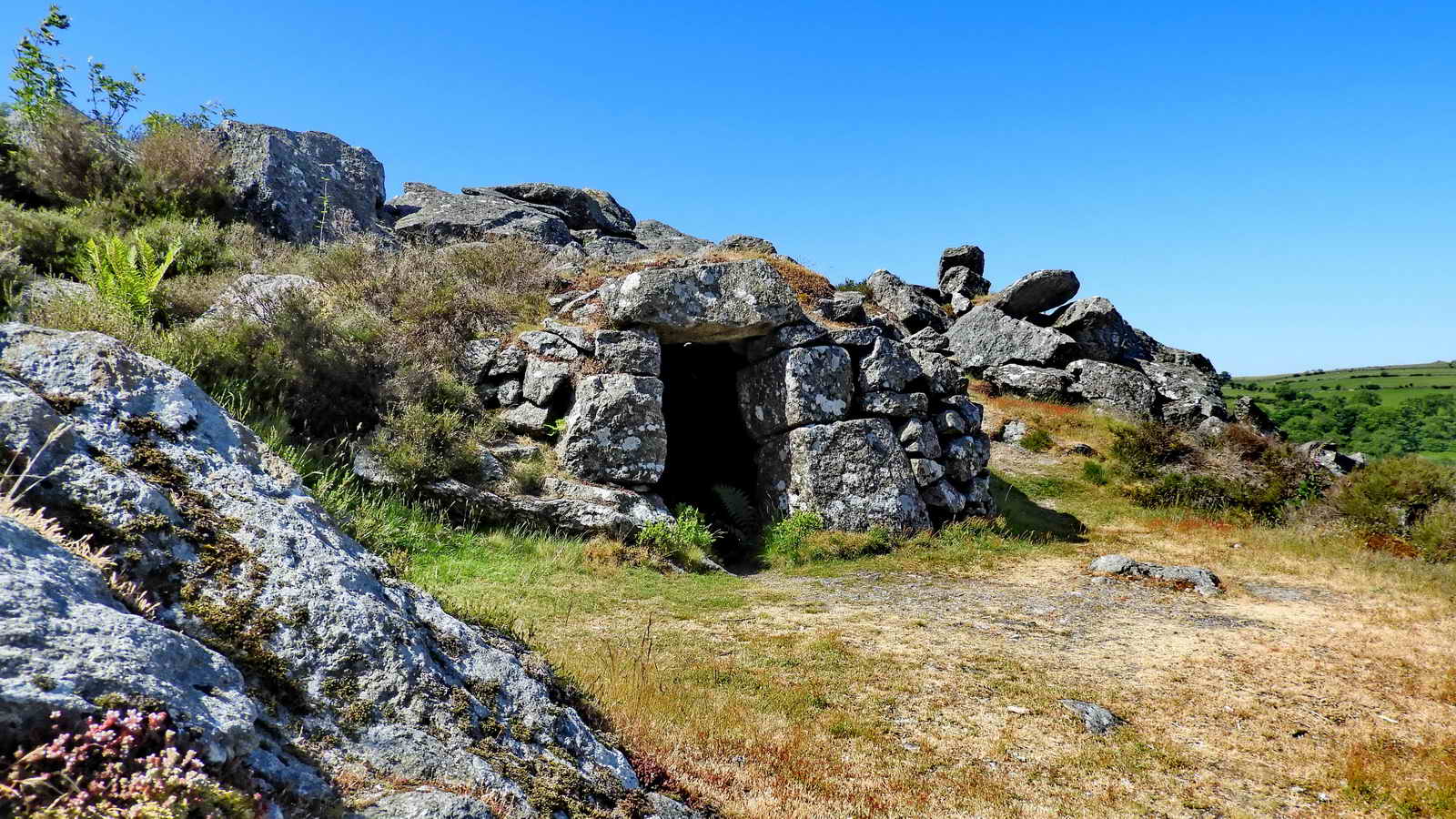
Quarrymen's hut below Holwell Quarry, SX 75073 77784, near the end of the tramway, north of the track ..... possibly used as a shelter during blasting or an explosives store .....

Closer view .....

Internal view of the roof (big slabs) and the wall .....

Final view.
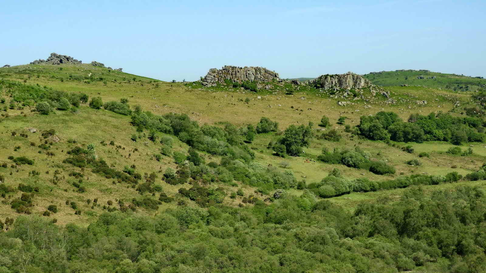
Smallacombe Rocks, north of the tramway

Walking a short distance beyond the quarrymen's hut, the track has drops on each side into quarried areas.

Approach to Rubble Heap Quarry along the rubble heap - this is reminiscent of Big Tip and Foggintor Quarry. The foreground shows one remaining granit rail from the tramway that was used to bring out cut stone and the rubble .....
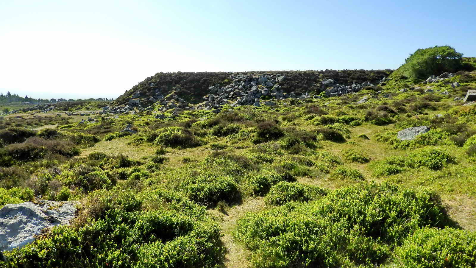
View from the quarry "end" of the rubble heap, looking into the entrance to the quarry - the grassy path, from approx. SX 75453 77366 .....

The secluded path into Rubble Heap Quarry .....

Looking into Rubble Heap Quarry .....

Another view inside quarry.
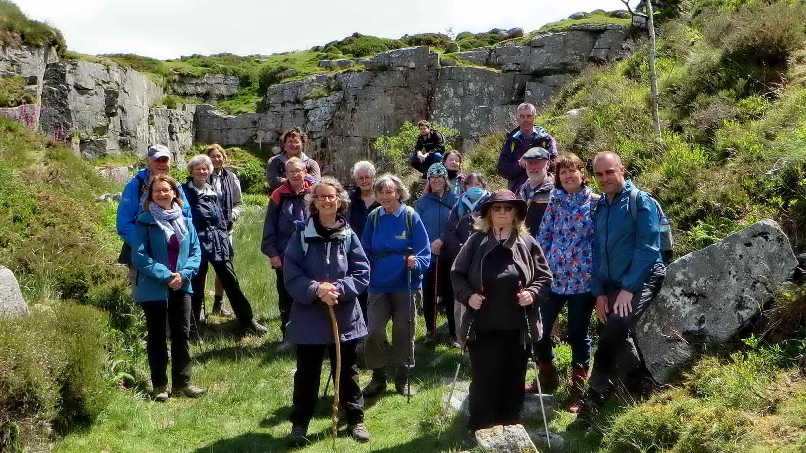
The group inside Rubble Heap Quarry with the rock face as a back drop - and the sun was shining on them!
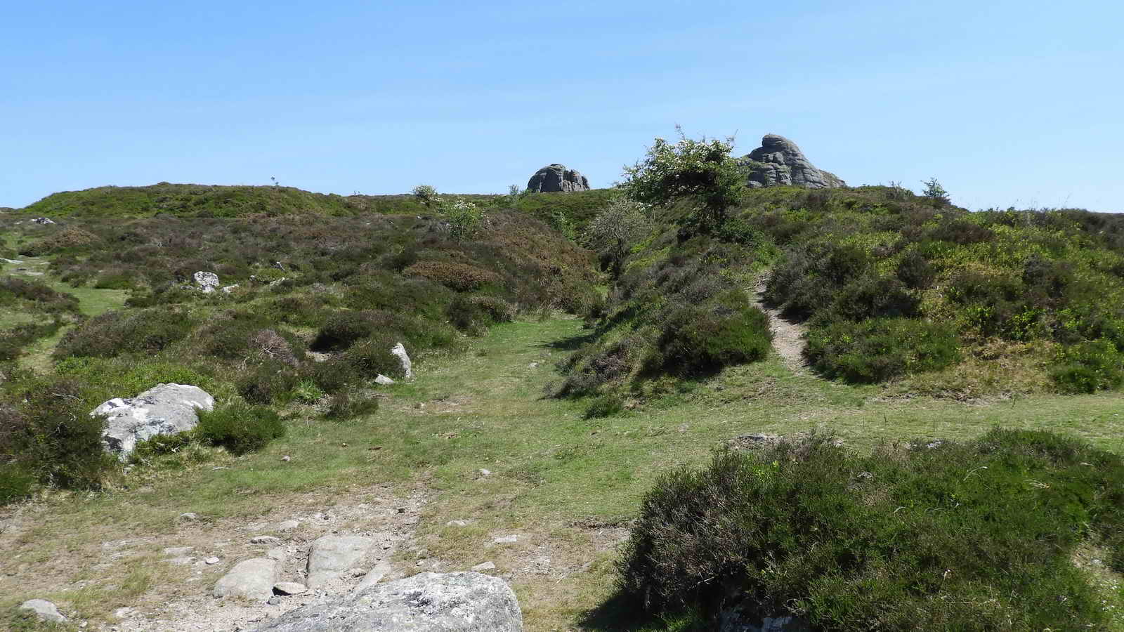
Approaching the back of Low Man.

Approaching the main rock pile of Hey Tor .....

Final view of the main pile at Haytor Rocks.

Sunset cloudscape at Plymstock after the recon walk on 15th June: Altocumulus stratiformis, an intermediate level, mid-altitude cloud form that occurs between 6,500-20,000 feet. When the cloudlets are smaller and more separated they are sometimes called a "mackeral" sky, looking somewhat like fish scales.
MAP: Red = GPS satellite track of the walk.
 � Crown copyright 2016 Ordnance
Survey
Licence number 100047373
� Crown copyright 2016 Ordnance
Survey
Licence number 100047373
Also, Copyright � 2005, Memory-Map Europe, with permission.
This walk was reached from the A38 main road by following the signs for Widecombe/Haytor from the turn-off for Newton Abbot (or Bovey Tracy). After following the road to Cold East Cross crossroads and car park, turn right towards Widecombe / Hound Tor / Haytor (there is no direction plate on the sign). At the next junction, Hemsworthy gate, turn right on the B3387, towards Haytor (this is indicated). Pass Saddle Tor on the left and stop at the first car park on the right. This is Haytor Upper Car Park, indicated by the yellow cross and the P symbol on the map. The walk can also be approached from Widecombe, following the (two) signs for Haytor.
Statistics
Distance - 4.68 km / 2.9 miles
All photographs on this web site are copyright
© Keith Ryan.
All rights reserved - please
email for permissions