![]()


DPA "Virtual" Short Walk. This group walk was cancelled because of the Coronavirus situation - this is a recon walk from 23rd June. 2020-6-25. Venford Reservoir, dam, PUDC /RD-H catchment area boundary stones, overflow area, subsurface coarse bubble aeration upwellings, Water Works, commemorative stones, South Bench Tor, English Stonecrop, River Dart, Middle Bench Tor, North Bench Tor, White Wood, Pipe Track, oak coppice, charcoal burning, foxgloves, Workman's Bridge and Ford, Venford longhouse, River Swincombe inlet, triple mortar stone, mention of Venford Brook flooded tin mill. D365-O14, (P13), P14.
Walk details below - Information about the route etc.
Previous walks in this area: 11 Feb. 2008, 9 Dec. 2009, 26 May 2010, 17 Aug. 2011, 16 Oct. 2013
Reconnaissance walks: 15 June 2020, 23 June 2020
Google Satellite map + GPS track of the walk - this is the 23 June reconnaissance walk (
Venford Reservoir was built between 1901 and 1907 to supply water initially to Paignton but now Brixham, Ashburton and Widecombe-in-the-Moor receive water from here - see commemorative tablets pictured below. The land was bought from Richard Dawson, Lord of Holne Manor. The catchment area bought was 700 acres and is ringed by granite pillars marked "PUDC / RD-H", signifying Paignton Urban District Council / Richard Dawson, Holne - lord of the manor when the stones were erected. There are 52 PUDC Boundary stones (on the Dartefacts web site). The area of the lake is 33 acres. There were some renovations in 2009. Some water is supplied by the Venford Brook that feeds into the reservoir but water is also piped from the Swincombe valley to feed in via pipe near the gate on the west side of the of the lake.
Devon & Dartmoor HER - MDV115706 - Venford Reservoir, Holne
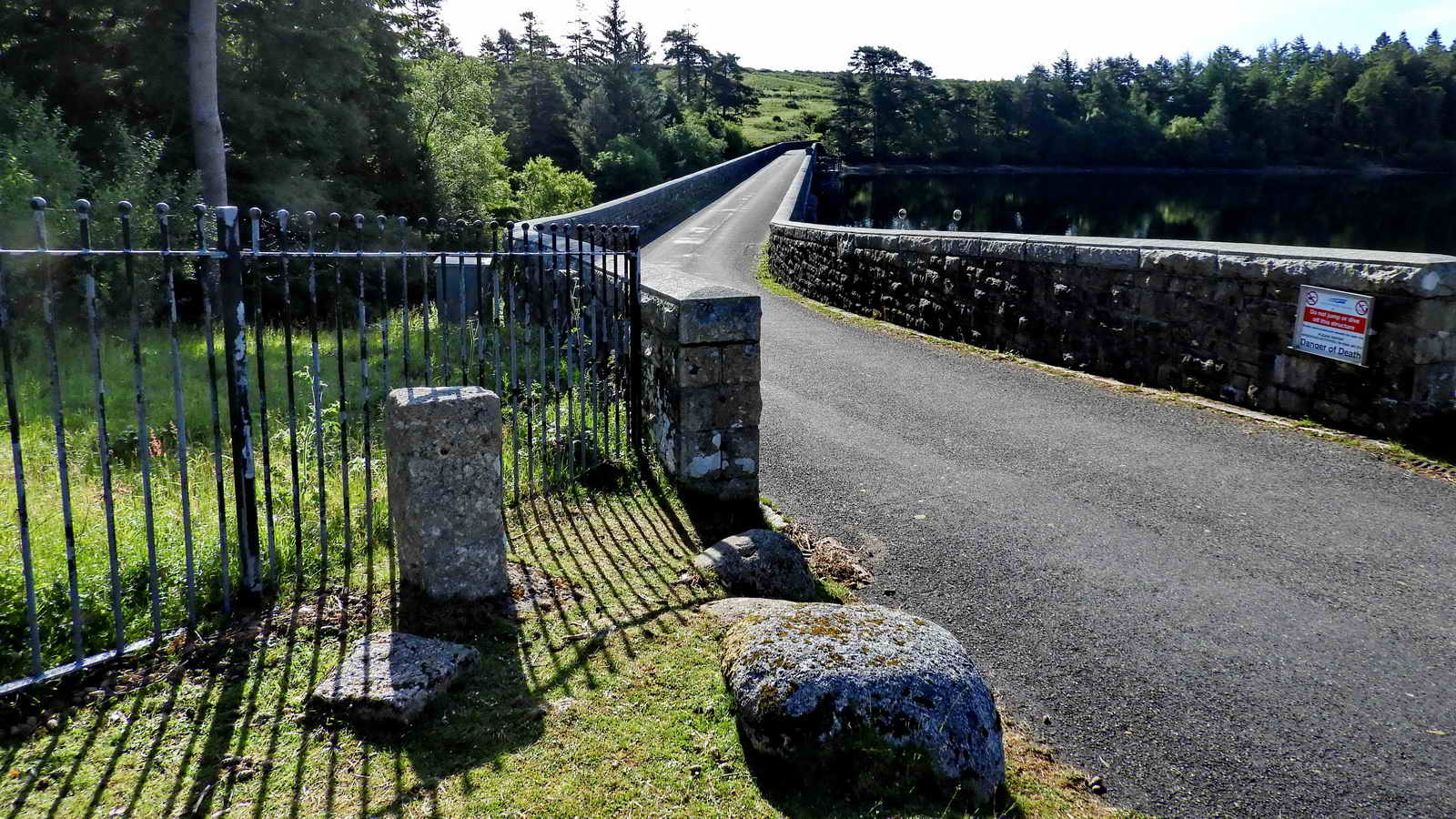
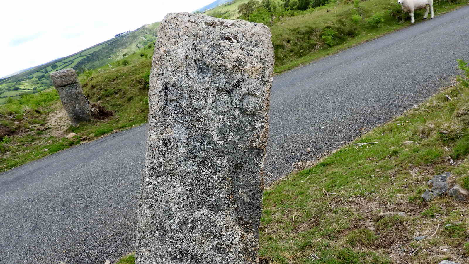
A view along the dam from the west end, near the car park. The stone pillar is one of the granite boundary stones around the catchment area of the reservoir marked "PUDC / RD-H", signifying Paignton Urban District Council / Richard Dawson, Holne - lord of the manor when the stones were erected. There are 52 PUDC Boundary stones (on the Dartefacts web site), this one being Number 1.

Sign located across the road from the above viewpoint.
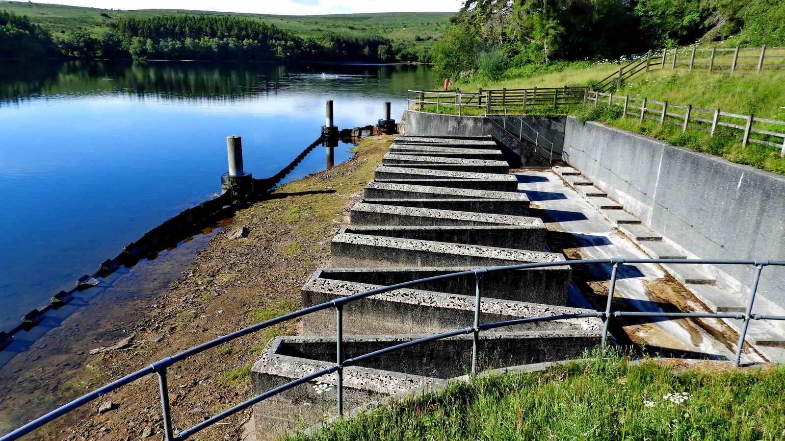
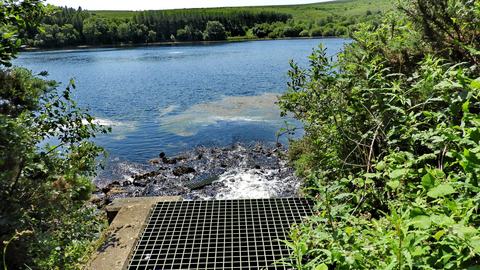
The overflow area ..... the disturbance in the water towards the middle of the lake is where air is piped under the water to aerate it - this is the process of increasing or maintaining the oxygen saturation of water in both natural and artificial environments. Aeration techniques are commonly used in pond, lake, and reservoir management to address low oxygen levels or algal blooms. Wikipedia - subsurface coarse bubble aeration.
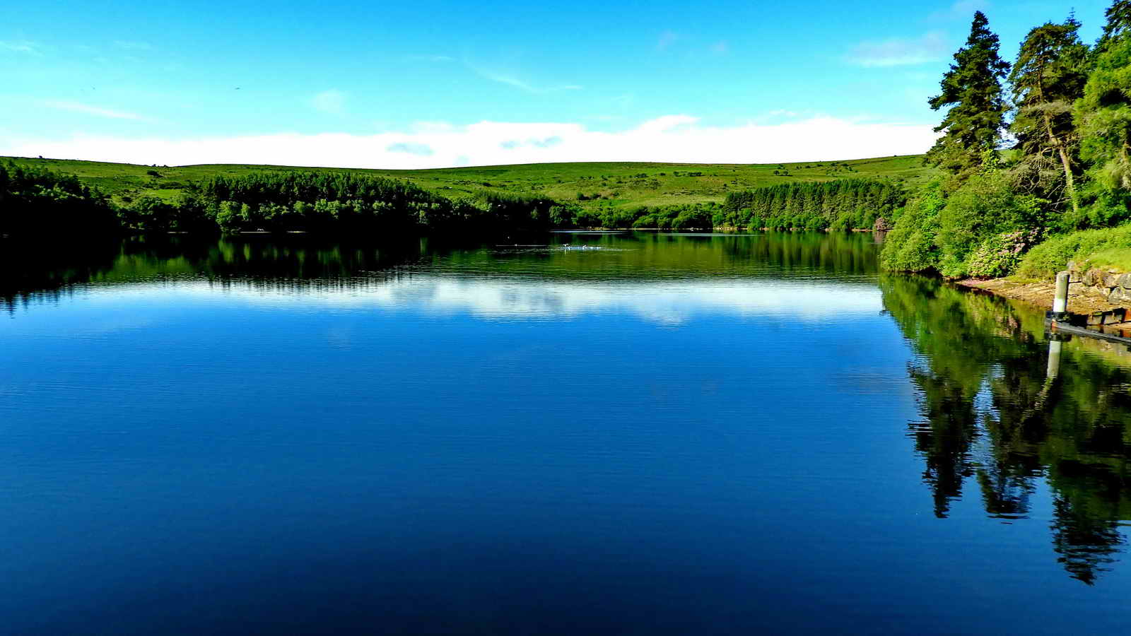
Looking up the lake .....

Water works below the dam .....
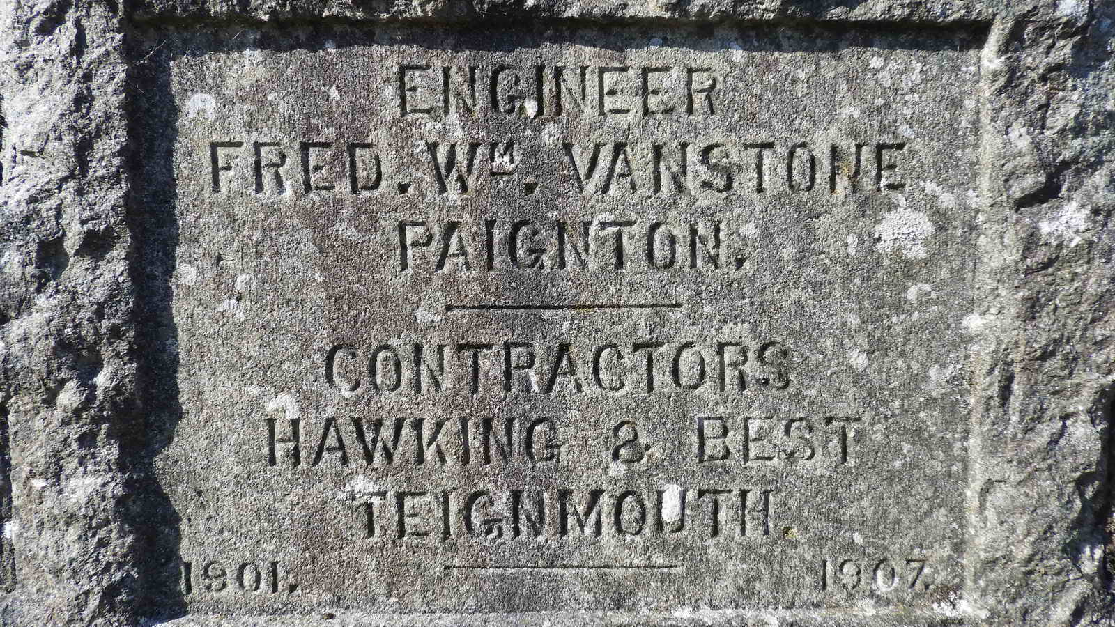
First commemorative stone .....

Don't know, possibly valving, pressure monitors, depth gauges? The commemorative tablet above is to the right when looking at these "valves" .....

Don't know some more - must find out.

The other commemorative stone, to the left of the "valves"..

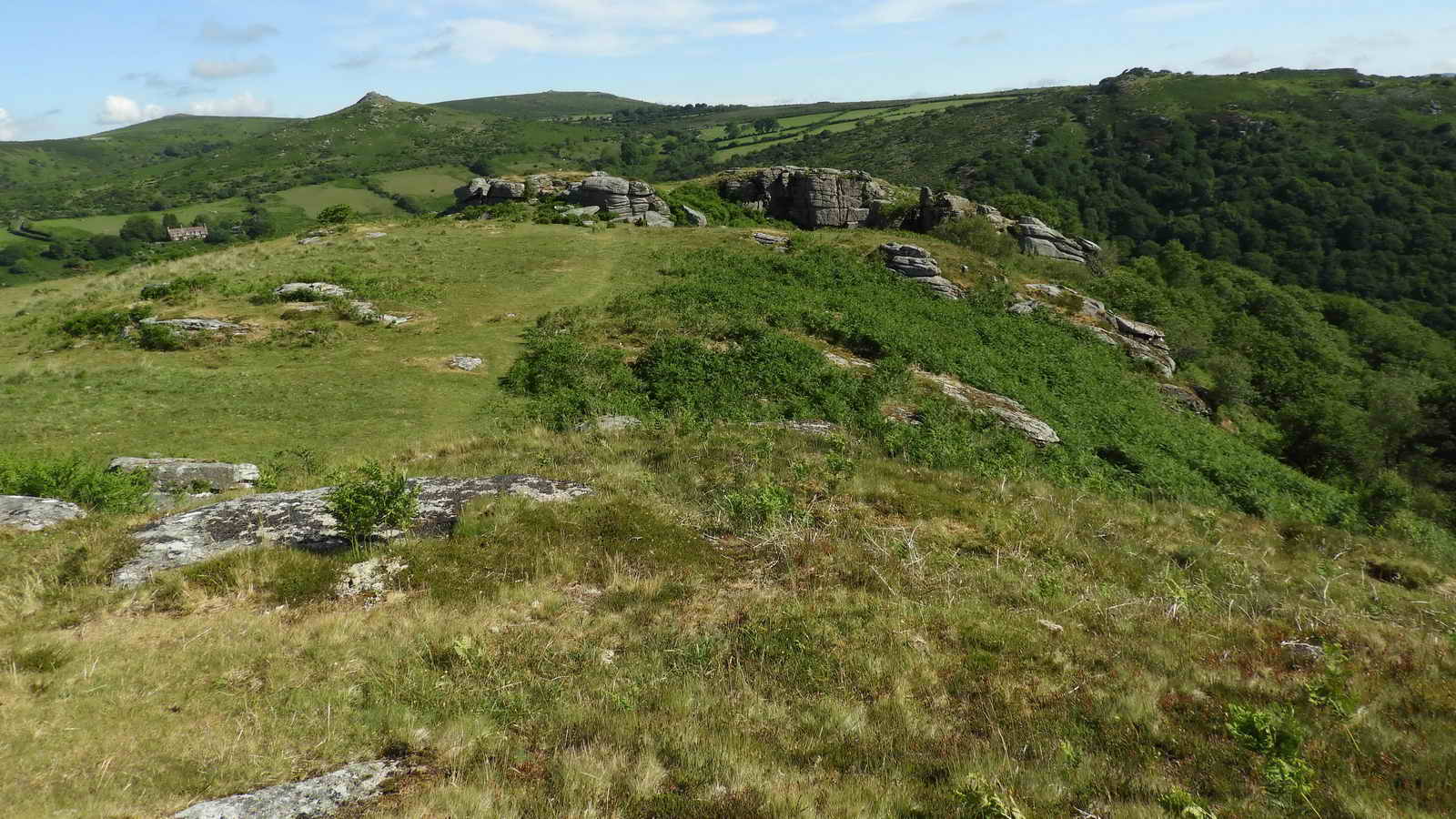
View from the east end of the dam north-east, up towards South Bench Tor, or South Benjy Tor, which is labelled Benchator on the 1839 Holne Tithe Map.

Looking left of north at the pointed Sharp Tor (1.6 km/1 mile) distant, Corndon Tor to the right and Yar Tor towards the left (both at 2.85 km/1.8 miles). Near the centre is Rowbrook House and to the left is Rowbrook .....

Sharp Tor, SX 686 729, elevation 380 metres (1246 feet).

Rowbrook House .....
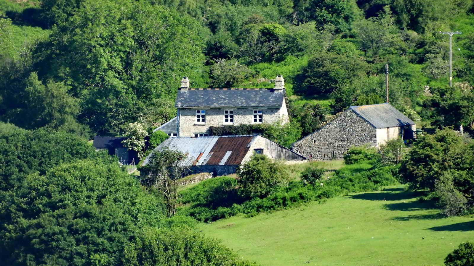
Rowbrook.
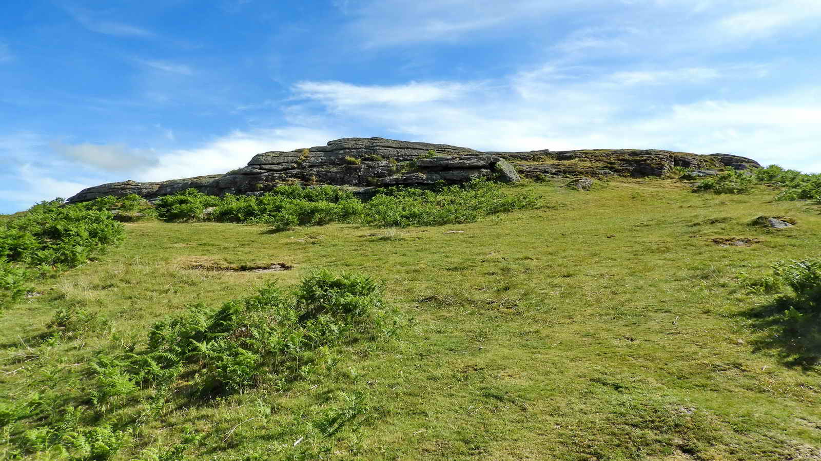
South Bench Tor, SX 691 716 .....
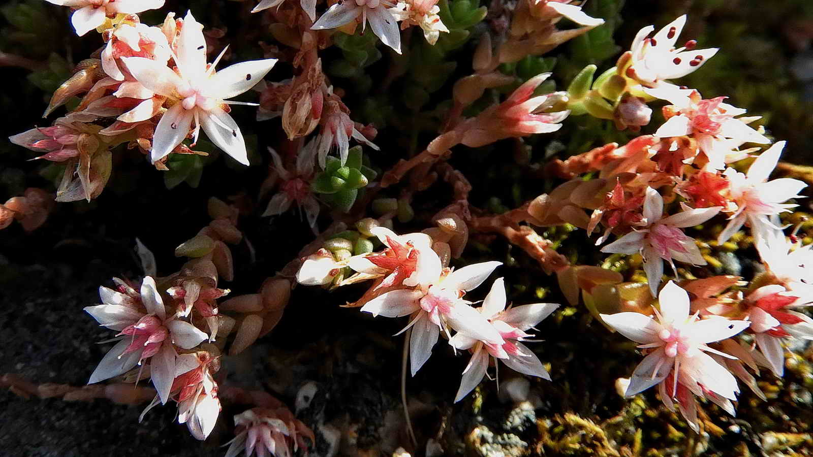
English Stonecrop, Sedum anglicum .....

As previous photograph.
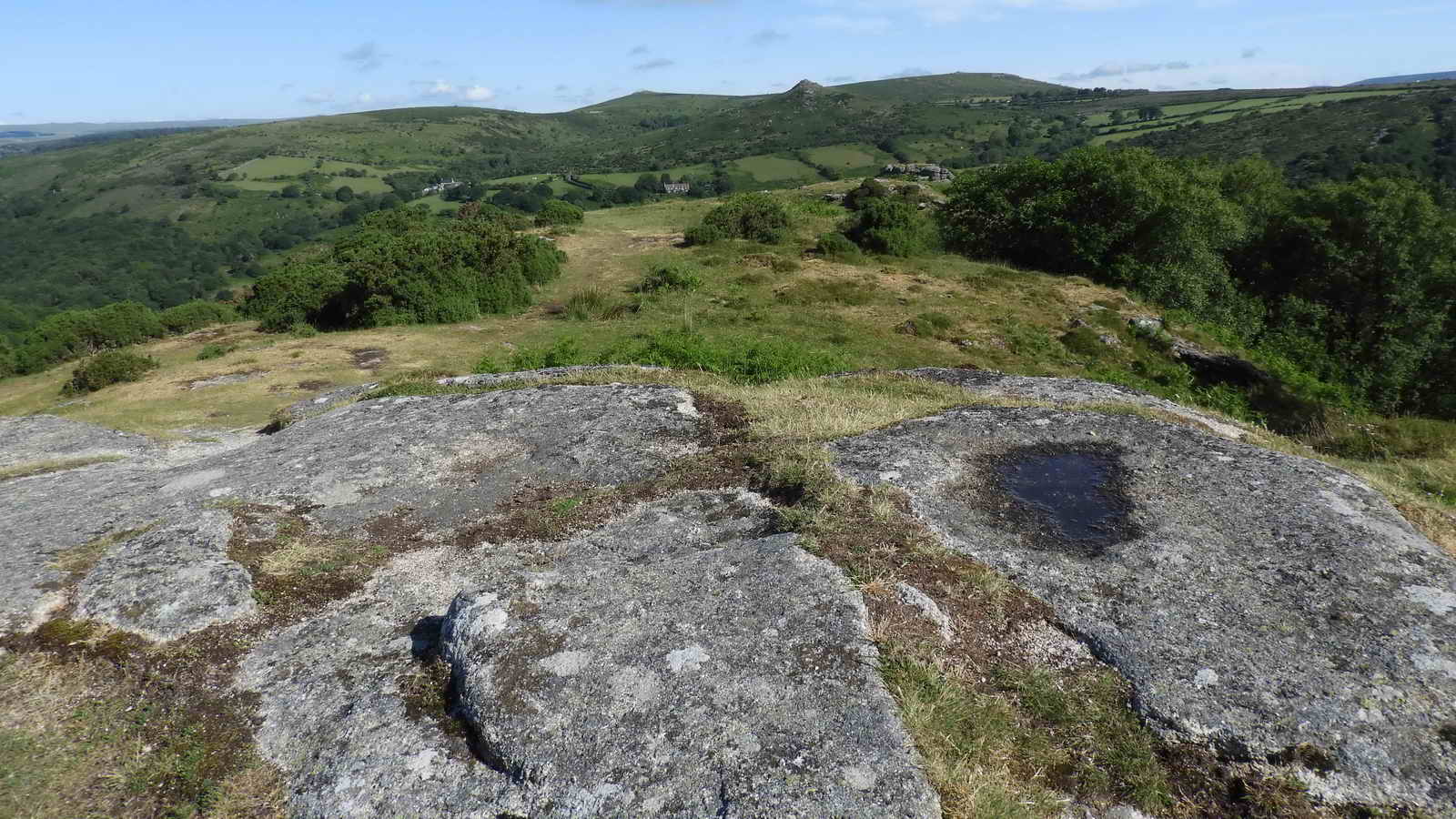
View north from South Bench Tor .....

View across the top of South Bench Tor looking at the area that once had a triangulation pillar. Dartefacts web site: Site of ex-Trig Point on Bench Tor, SX 69160 71628 - see OS 25-inch map England and Wales 1841-1952.

View north-east from South Bench Tor to the Double River Dart (East and West Dart Rivers meet upstream at Dartmeet) .....

Zoomed view of the River Dart.
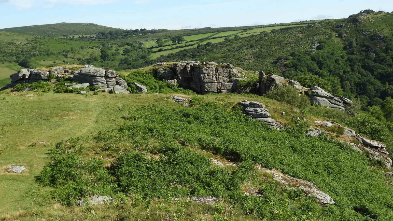
View to North Benchtor ..... with Middle Bench Tor in between .....

Looking north, approaching Middle Bench Tor, at SX 69120 71793 .....
North Bench Tor, SX 690 719, elevation 312 m (1,023 feet) .....

Closer view .....
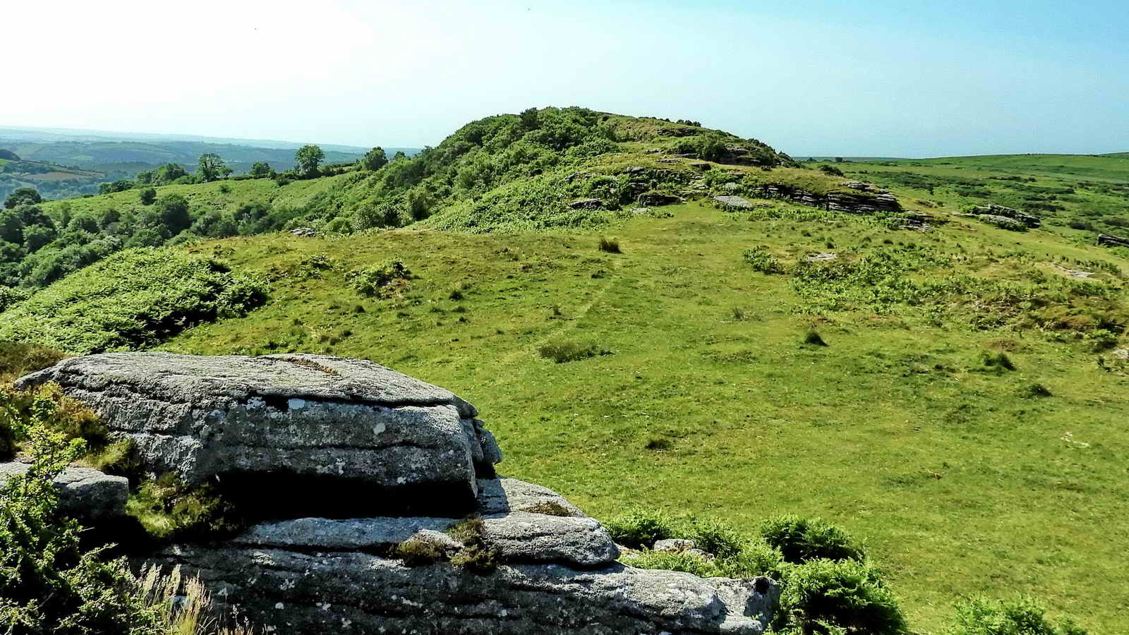
Looking back, south, at Middle Bench Tor from near North Bench Tor.
North Bench Tor .....

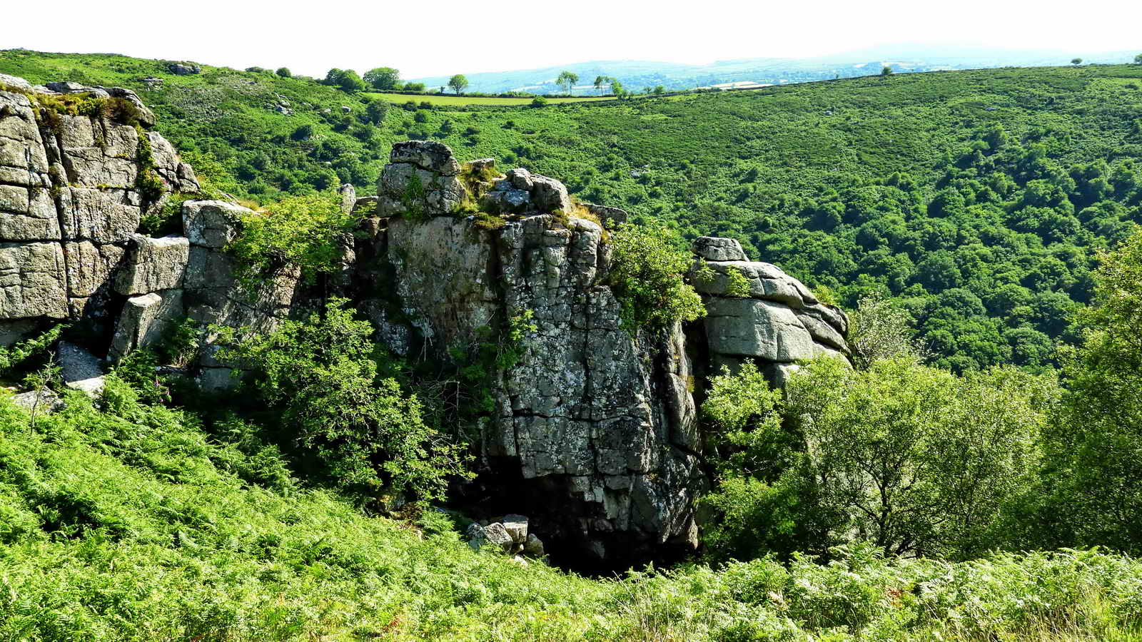
Cleft in North Bench Tor .....
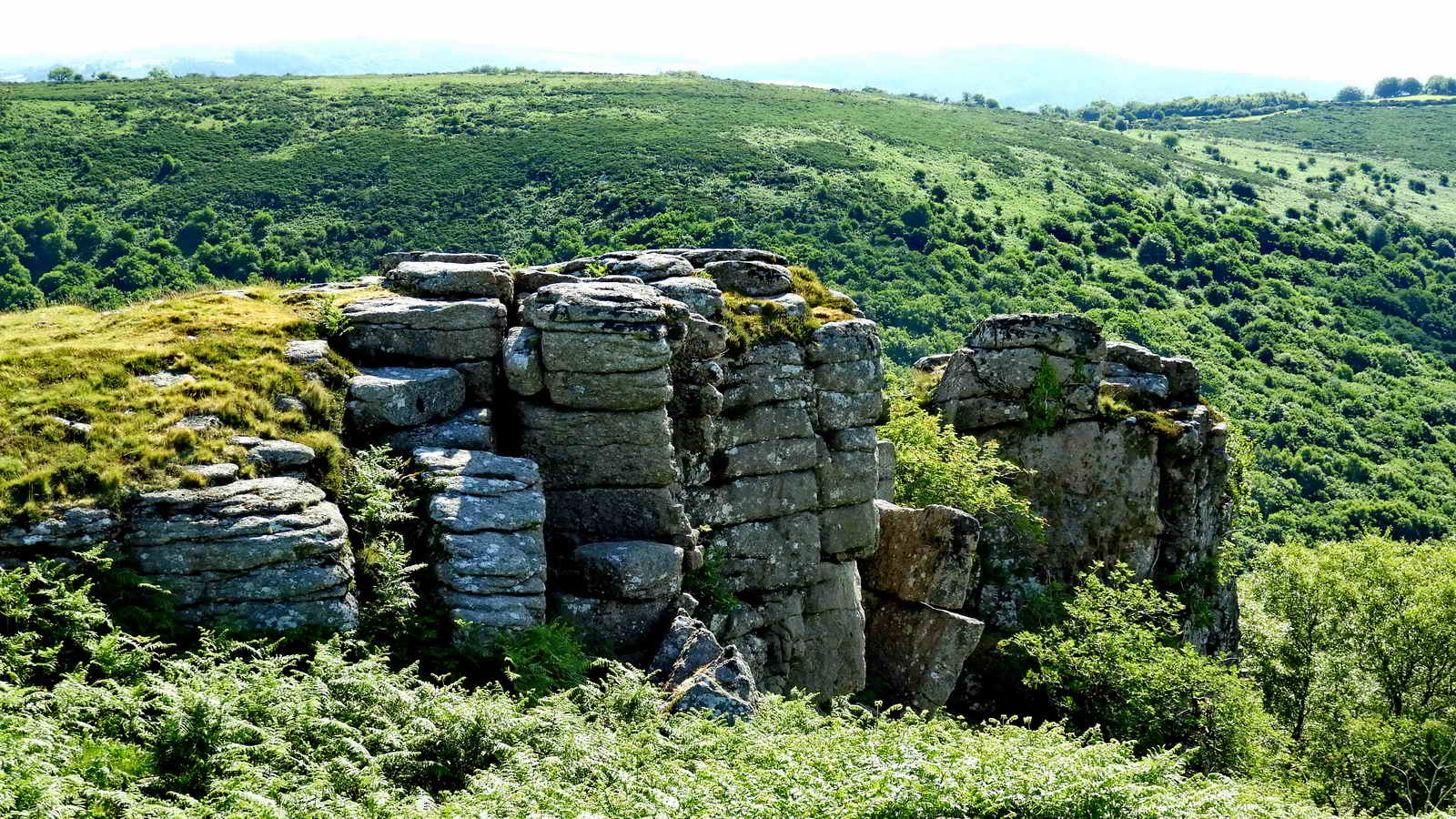
North Bench Tor, north end rocks .....
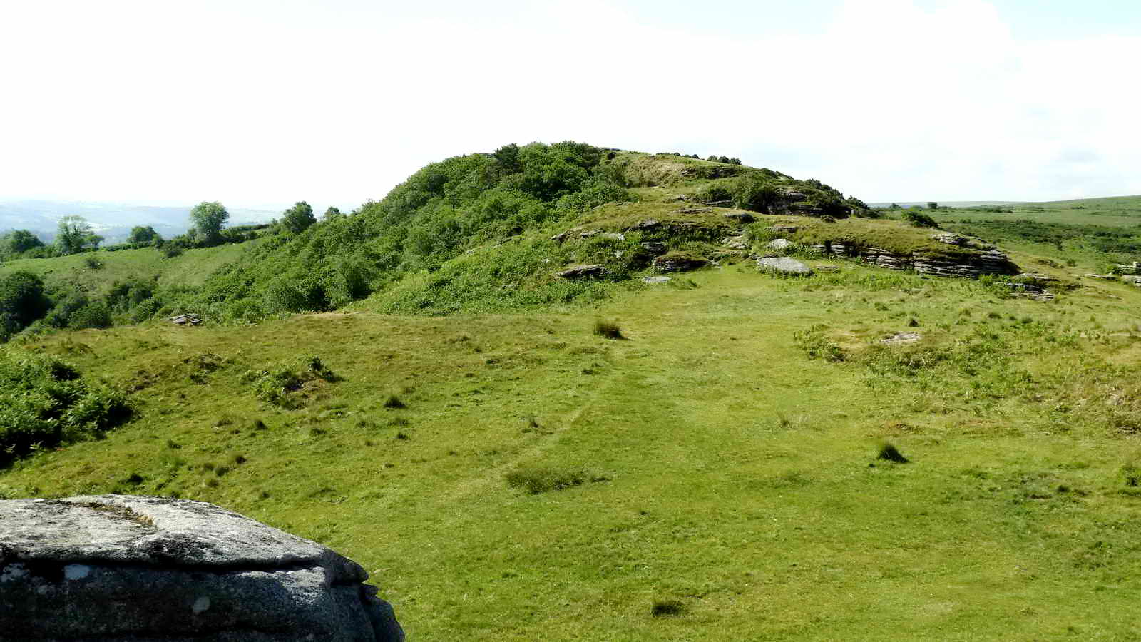
High spot between North and South Bench Tors, i.e. Middle Bench Tor.

Looking back at the reservoir from North Bench Tor.

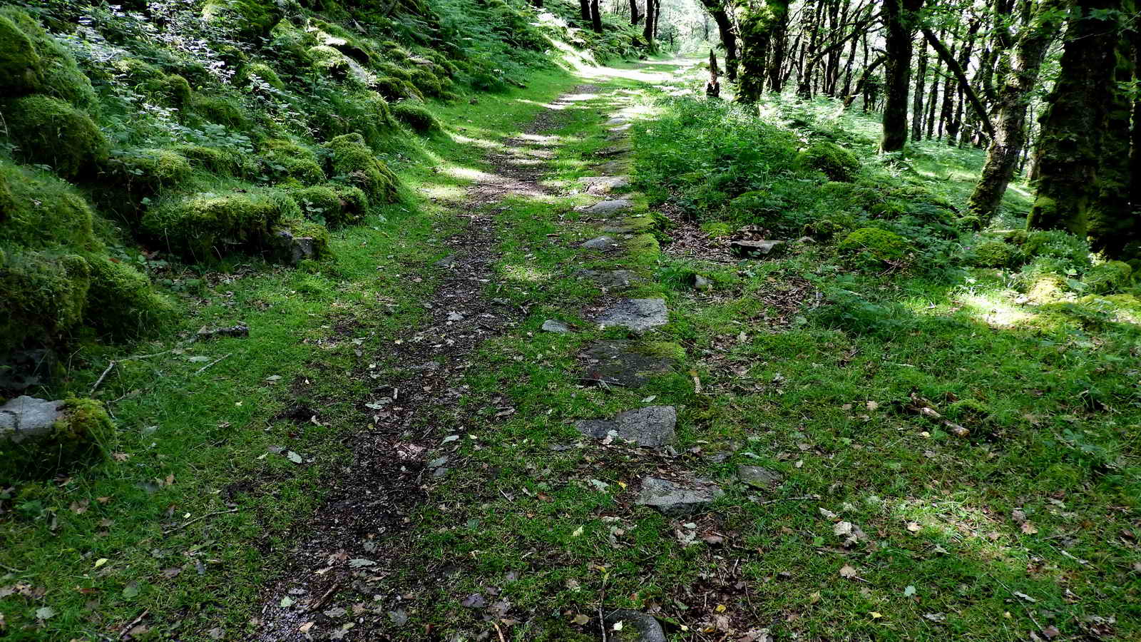
Path running north-west down from North Bench Tor into White Wood.

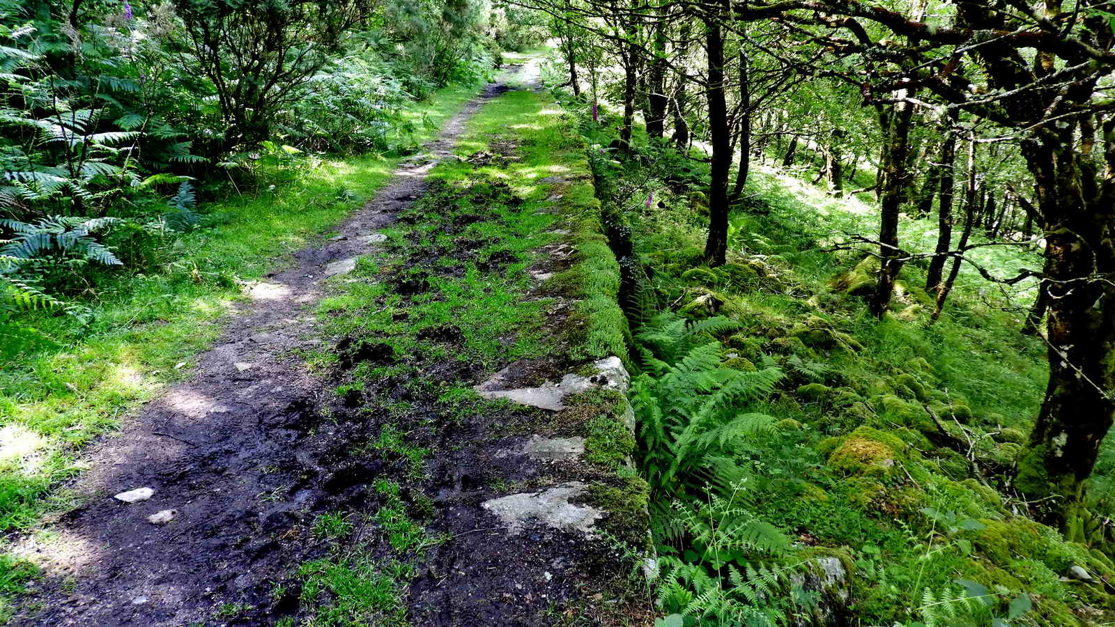
The "Pipe Track" - this is a well built, kerbed and banked track which follows the route of a pipeline from the reservoir around the promontory below Bench Tor, on a ledge above the River Dart. It continues and climbs again towards the Stoke Farm enclosures.

This is an oakwood that was once used for charcoal burning - the trees were probably coppiced i.e. cut back to stumps, known as stools, and left so that many long thin "trunks" grow up suitable for regular cropping. The traditional method in Britain used a clamp. This is essentially a pile of wooden logs (e.g. seasoned oak) leaning in a circle against a chimney. The chimney consists of 4 wooden stakes held up by some rope. The logs are completely covered with soil and straw allowing no air to enter. It must be lit by introducing some burning fuel into the chimney; the logs burn very slowly and transform into charcoal in a period of 5 days' burning. (Wikipedia - charcoal).
There are several ancient clearings , now overgrown, where the ground was levelled to make places for "burning" charcoal, known as "charcoal platforms" (video on Youtube). Here, they tend to be half-moon shaped on a steep slope. Charcoal was an important fuel in the Medieval times particularly where coal was not available, no doubt for blacksmiths' forges. It is essentially carbonised wood burns much hotter than wood minus its water, especially when assisted by forced airflow from bellows.
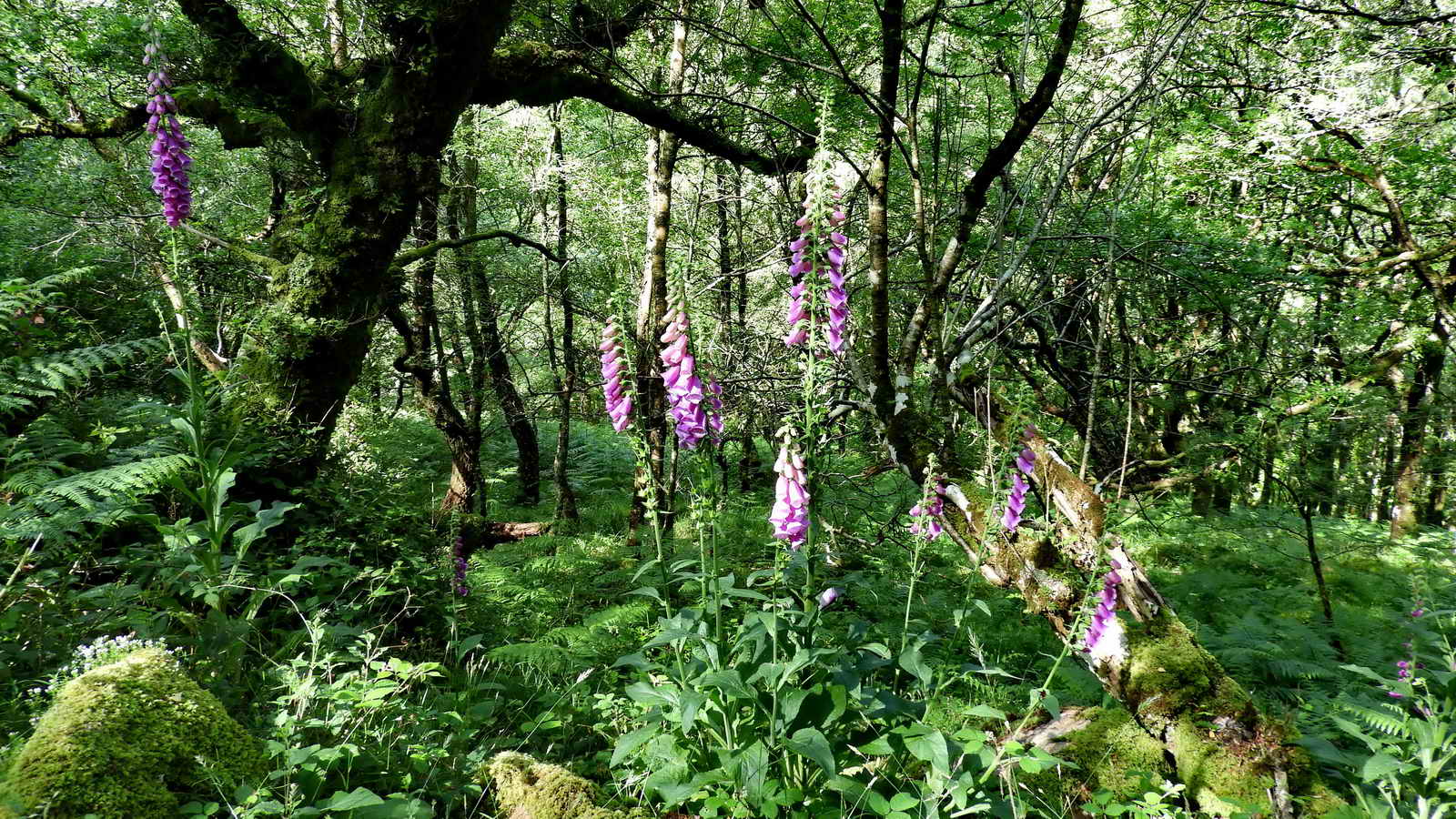
June - foxglove season .....
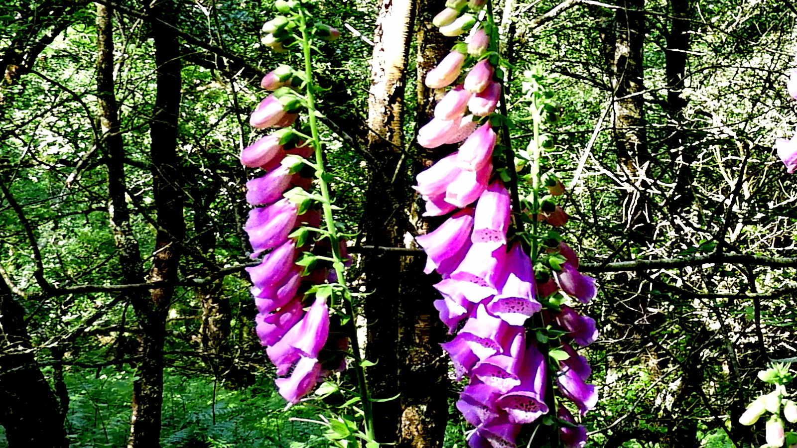
Digitalis purpurea, the foxglove.
The woods also provided a steady supply of bark for tanning. The Hamlyns Mill was situated in Buckfastleigh, being a woollen mill, and next door to it today in Mardle House is the Devonia Sheepskins and Tannery - a video of their processes can be seen HERE. Newton Abbot was a thriving Medieval wool town and associated with the woollen industry was the leather business. Hides left after the fellmongering process were made into leather. Tanners, boot and shoemakers, glovers and saddlers were all in business in Newton Abbot. As with the wool industry, business flourished over 600 years until after the Second World War. Nearby Bovey Tracy and Ashburton wre also involved in the wool trade and that usually involves skins and tanning to make leather which was widely used in the past. An impression of the tanning process may be seen on the web site of the Woodland Tannery, an modern enterprise combining tanning and foretry.

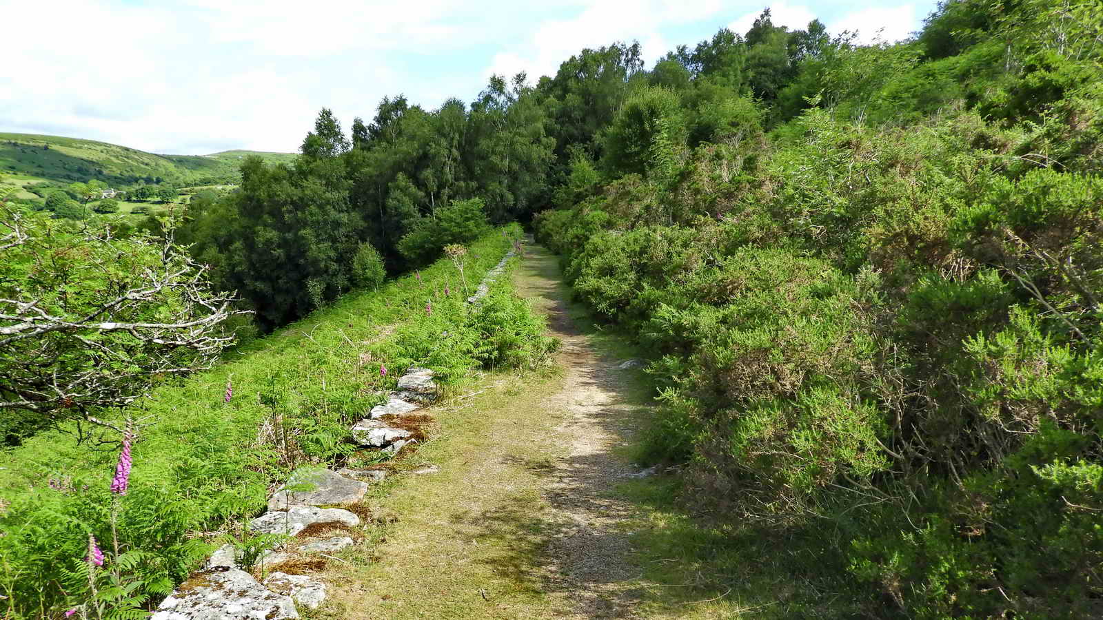
At this point the track has left the wood and proceeds along the Pipe Track above Venford Brook .....
Looking back at the wood .....

If the track is followed for its full length, it reaches a gate at the back of the Water Works. It looks as if the track out of the Works has not been used lately! It is then necessary to retrace a few yards and climb the bank, ending up following the fence to the corner of the enclosed land .....

One of the granite stones around the catchment area of the reservoir marked PUDC / RD-H� boundary stones, signifying Paignton Urban District Council / Richard Dawson, Holne - lord of the manor when the stones were erected. There are 52 PUDC Boundary stones (on the Dartefacts web site), this one being Number 50.
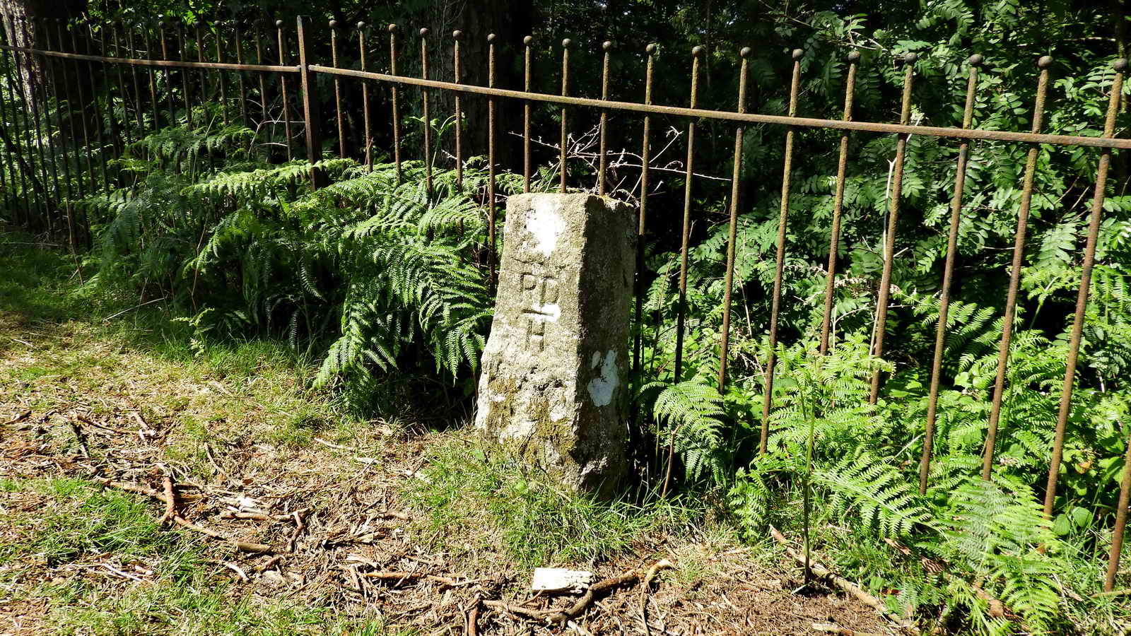
PUDC / RD-H� boundary stones, Number 49 on the Dartefacts web site.

Signs at the gateway into the Water Works at the east end of the dam.

View along the dam, showing the overflow area. There are two PUDC/RD stones either side of the road at the bend that is seen at the top of the hill - Waterwroks Hill, apparently!

The overflow structure.

The dam was
comleted in 1907 to supply local towns.
Holding around 900 million
litres of water, this 13-
hectare reservoir provides water for
Widecombe-in-the-
Moor and Ashburton as well as making a valuable
contribution towards Brixham and Paignton's needs.
The water
comes from Holne Moor, local rivers and
streams. You can see water
from the river Swincombe
pouring in from a pipe near the dam.
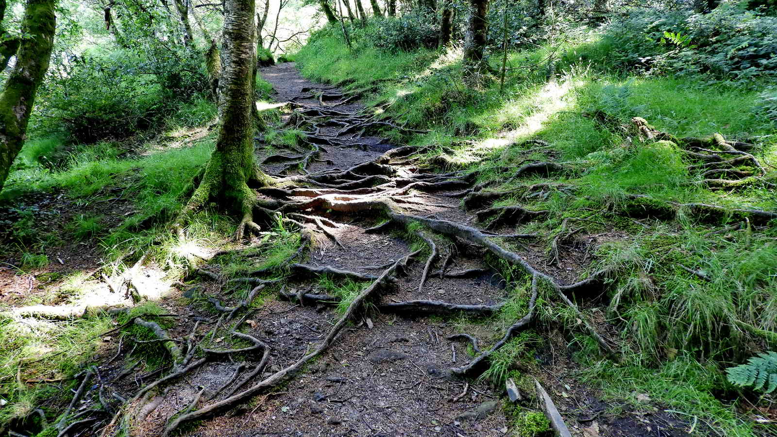
There are tree roots in the path in a few places.

A beautifully balanced logan stone at the top of the hill .......... or a partly submerged rock at the lakeside .....
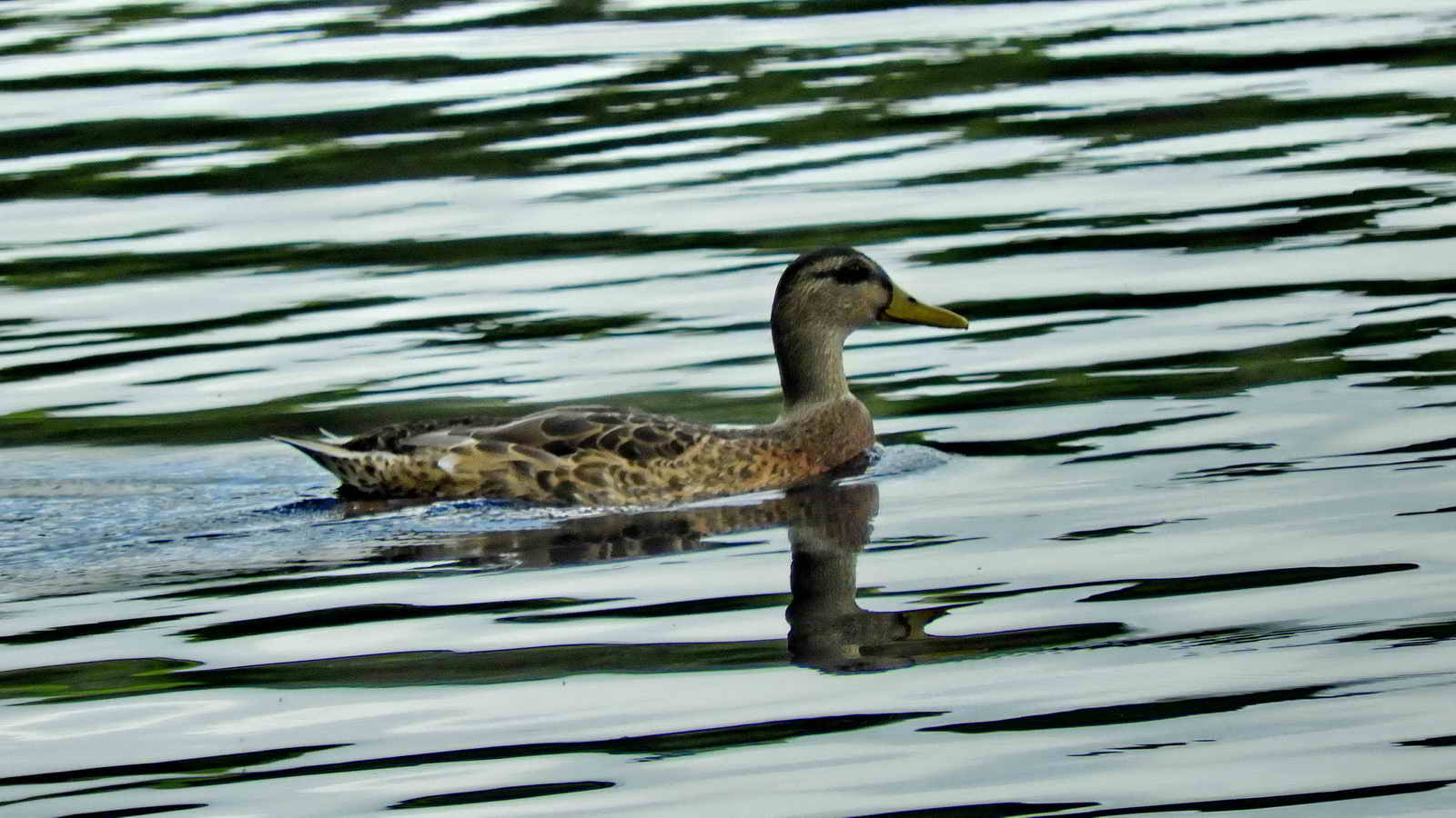
Female Mallard duck.

The head of the lake is around to the left in this view.

Reflections and stones .....

I have no idea what, if anything, these stones are.
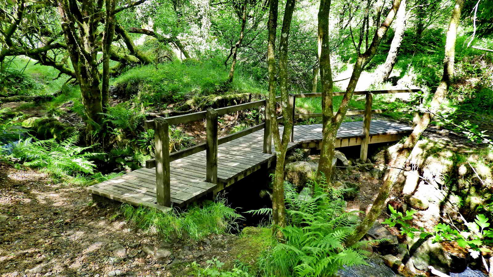
This is the site of the original Workmans Bridge and Ford which were swept away in a violent spate many years ago, now replaced with a modern wooden footbridge over Venford Brook, just where it runs into the reservoir ..... beyond the bridge is a tree (sunlit in this photograph) behind which is a sidepath up to a Medieval longhouse that has been cleared of excess vegetation by the volunteers of Dartmoor Preservation Association .....
The longhouse ruins at
SX 68223 70645. Photograph from August 2011. The site is
indicated on the map below, labelled "LH" west of
Workmans Ford .....
Devon & Dartmoor HER - MDV115702 -
Longhouse south-west of Venford Reservoir, Holne,

Image � J Butler 1993. Reproduced by kind permission (ref. 29 Sept.
2012)
Map reproduced from Jeremy Butler (1994), Dartmoor Atlas of Antiquities, Vol. 4 - The South-East, Map 60, page 128. The yellow-coloured areas indicate tinners' activities. The longhouse is not mentioned in the text.
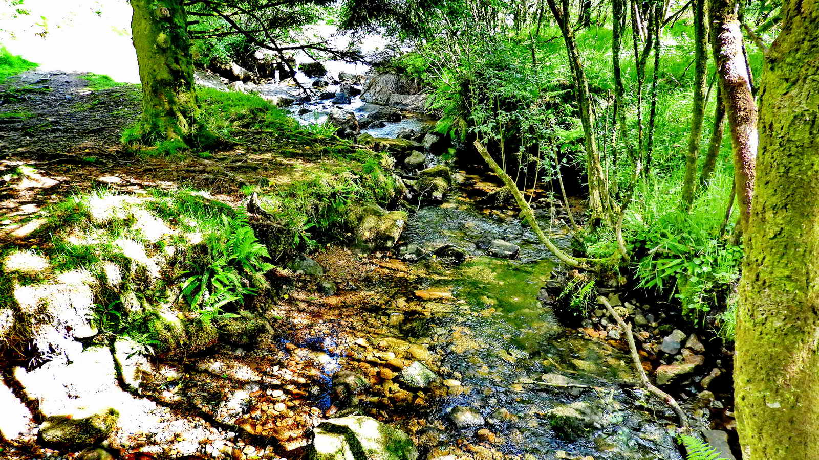
The spot where Venford Brook runs into the reservoir.

"Venford Fall", just above the Workman's Ford, the wooden footbridge - this is not the dramatic fall below the dam.
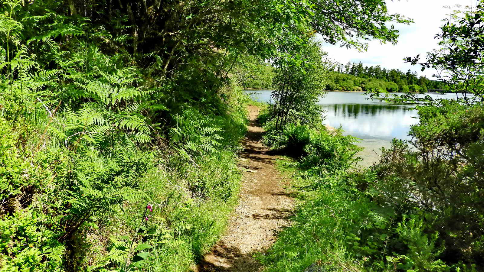
An easy scenic path back to the dam.
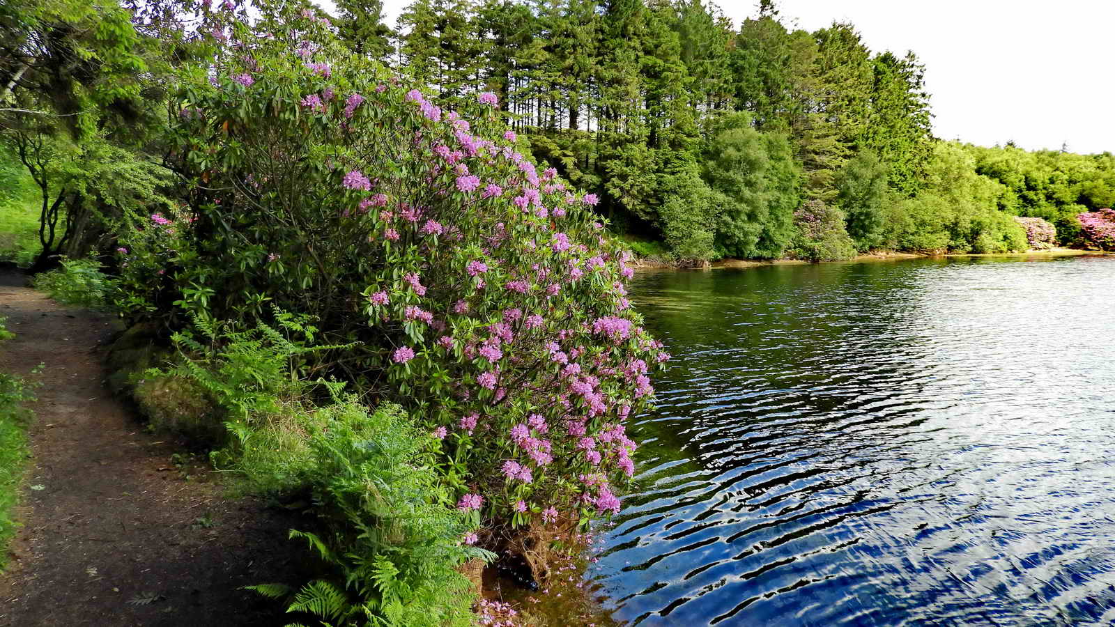
A view with Rhododendrons.
The inlet of water from the River Swincombe. The water level at the Swincombe dam is 318 m (1041 ft), here at Venford it is 285 m (935 ft), a drop of 33 m (36 ft). Out in the middle of the lake is an aeration upwelling. I started off being smart, thinking there was only one of these, so I was going to be clever and geolocate it on a map by taking compass bearings from two GPS'd locations, one each side of the lake. There there were two upwellings! One is out in the middle of the lake and a second one is seen over the far side, at top left.

A triple mortar stone from a nearby tinners' mill ("blowing house") that was under the reservoir, SX 68568 71180 .....
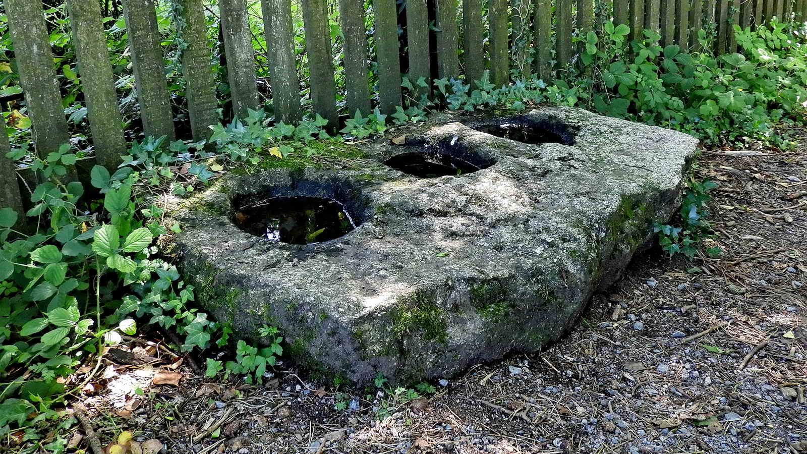
Another view .....
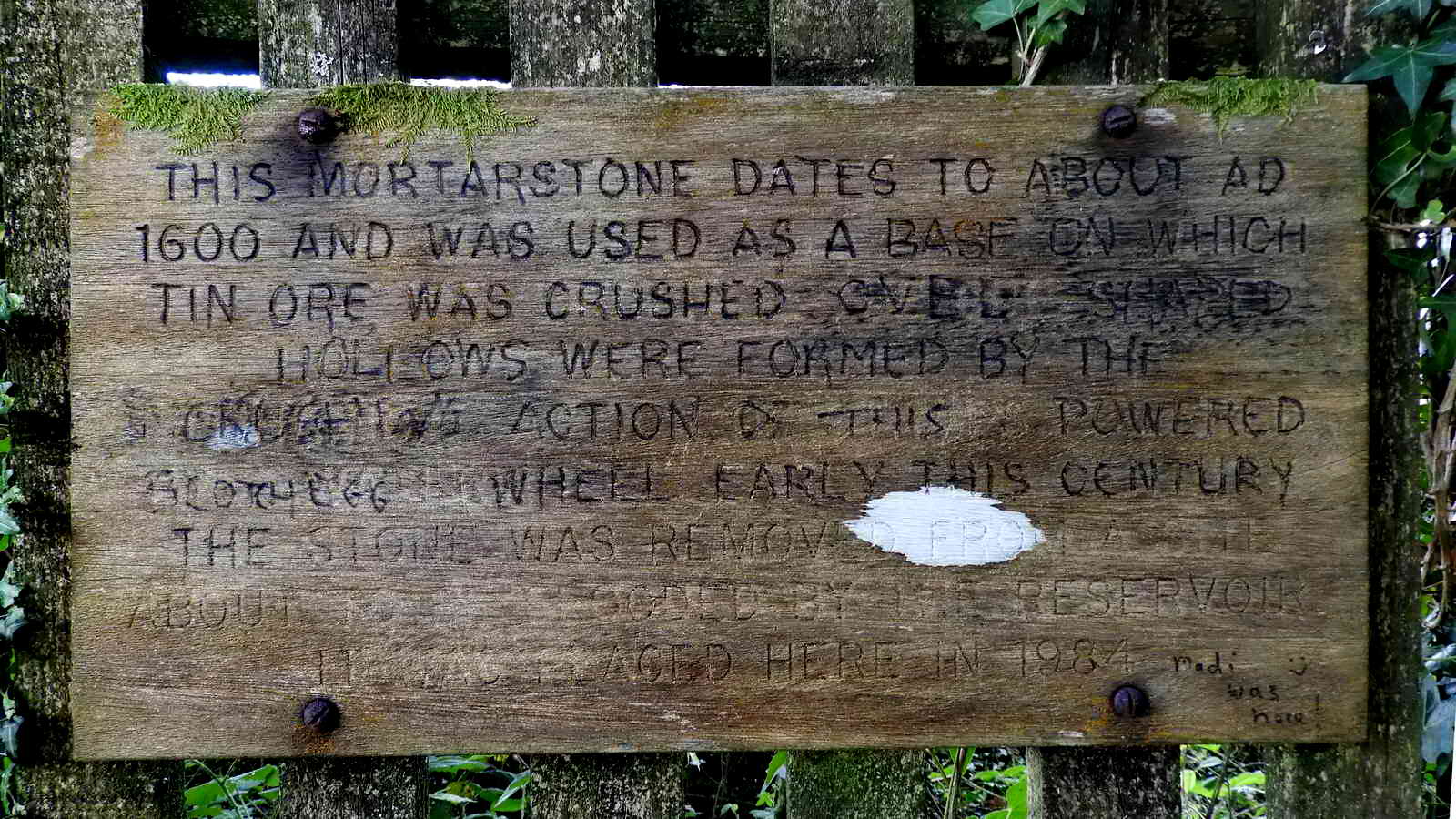
Wooden plaque above the mortar stone, somewhat defaced .....
THIS MORTARSTONE DATES TO ABOUT AD
1600 AND WAS USED AS A BASE ON
WHICH
TIN ORE WAS CRUSHED THE CUP SHAPED
HOLLOWS WERE FORMED BY THE
MECHANICAL ACTION OF STAMPS POWERED
BY A WATERWHEEL EARLY THIS CENTURY
THE STONE WAS REMOVED FROM
A SITE
ABOUT TO BE FLOODED BY THE RESERVOIR
IT WAS PLACED HERE IN 1984
From the Waymarking.com web site .....
The Plaque says: This Mortar stone dates to about AD1600 and was used as a base on which tin ore was crushed; the cup shaped hollows were formed by the mechanical action of stamps powered by a waterwheel early this century. The stone was removed from a site to be flooded by the reservoir and placed here in 1984 (not word-for-word).
OS 25-inch 1886 Single Sheet map - there is possibly a blowing house leat, above the junction of streams to form the double-line drawn Venford Brook. It would take water from the brook, to the mill waterwheel, and then return it to the brook.
OS 25-inch 1905 Single Sheet map - shows "Water Works in course of construction" - completed 1907
OS 25-inch 1892-1914 zoomable map - there is possibly a blowing house leat at SX 68361 70726 on the first map, above the junction of streams to form the double-lined Venford Brook.
No sign of a blowing house on the 1839 Holne Tithe Map - see just above centre of the map - by the patchwork of fields - and slightly left, on the map, along Wenford Brook. Note - North Benchator and South Benchator. Tithe maps rarely showed tinning features because they were meant for " tithing" i.e. taxing one tenth of farming produce originally to support the landlords and clergy. Later, used for recording cash rents.
A tin mill is described by Worth
(p.293) at lat. 50�-31'-20", lon. 3�-51'-26", now flooded. This is
in the region mentioned in the first map above. The lat/long
location equates to SX 68442 70808 - which is by the flooded Venford
Brook.
Devon & Dartmoor HER - MDV12982 -
TIN MILL in the Parish of Holne

Scene with the dam at the left and three upwelling sites in the reservoir and a fourth behind the bush at the right .....

One of the upwelling sites .....
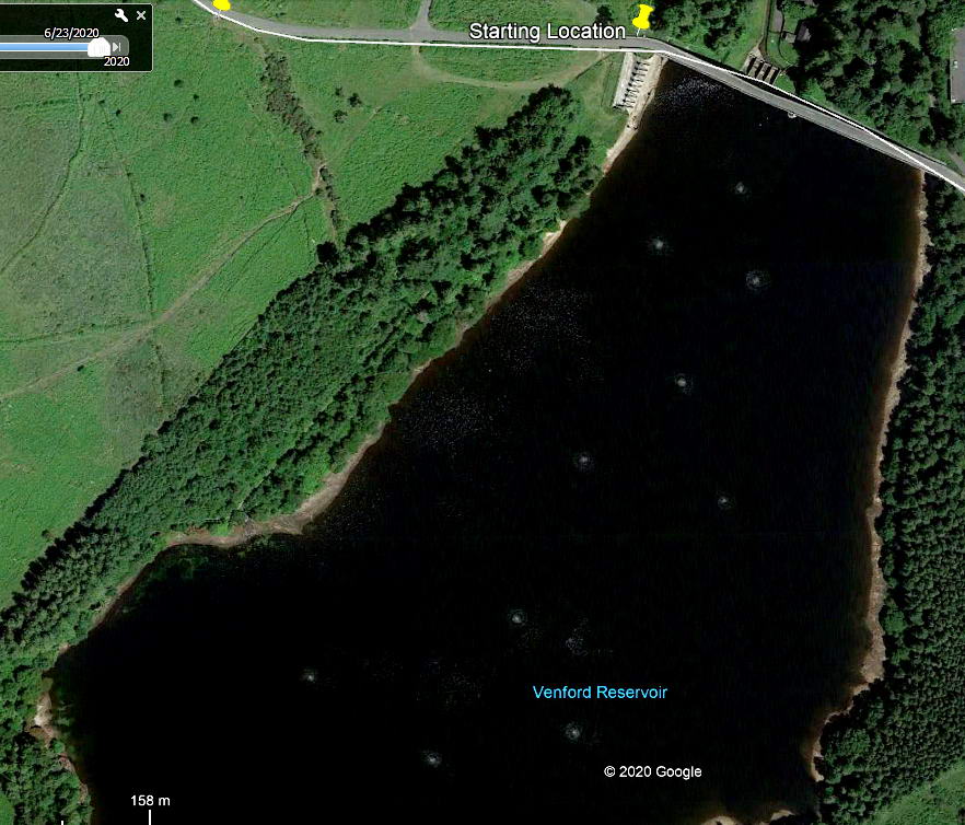
Image from Google Earth (c) 2020
Then I looked at Google Earth - and there are ten aeration sites.
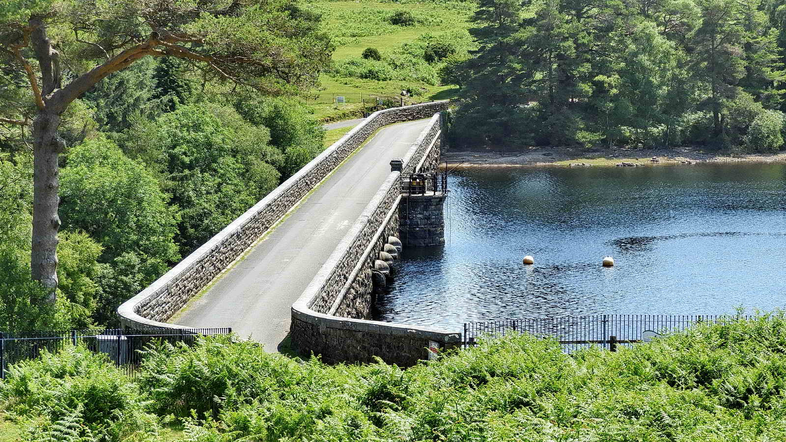
View of the dam from the car park.
Believe it or not, there is a "lost" Ordnance Surveyor's benchmark on this face of the PUDC stone. Now, it is becoming truly lost. For a better view, see the first three photographs of the 11 Feb 2008 walk. This stone is Number 4 in the Dartefacts web site sequence: across the road is Number 3.
MAP: Red = GPS satellite track of the walk.

� Crown copyright 2016 Ordnance
Survey
Licence number 100047373
Also, Copyright � 2005, Memory-Map Europe, with permission.
This walk was reached by driving east from Two Bridges on the Ashburton road, turning right just before Dartmeet to Hexworthy and driving past Combestone Tor to the reservoir car park, marked on the map by the P symbol and the yellow cross.
Statistics
Distance - 4.8 km / 2.98 miles
All photographs on this web site are copyright
© Keith Ryan.
All rights reserved - please
email for permissions