![]()


This walk: 2019-6-25. Drakeford Bridge, Pullabrook Wood, Douglas fir cones, Woodland Trust, Pudding Stone, benchmark, Lustleigh Parish 2000 boundary stone, Hisley Bridge, slotted gate post, pair granite gateposts, Holly Blue butterflies, River Bovey, Hisley Wood, flood plain, Violet Oil Beetle, Rudge Wood, Packsaddle Bridge, 1684 inscribed stone.
Walk details below - Information about the route etc.
Previous walks in this area: 7 November 2012, 17 January 2013, 17 June 2015, 22 October 2015
Reconnaissance walks: 21 May 2019, 23 May 2019, 17 June 2019
Google Satellite map + GPS track of the walk

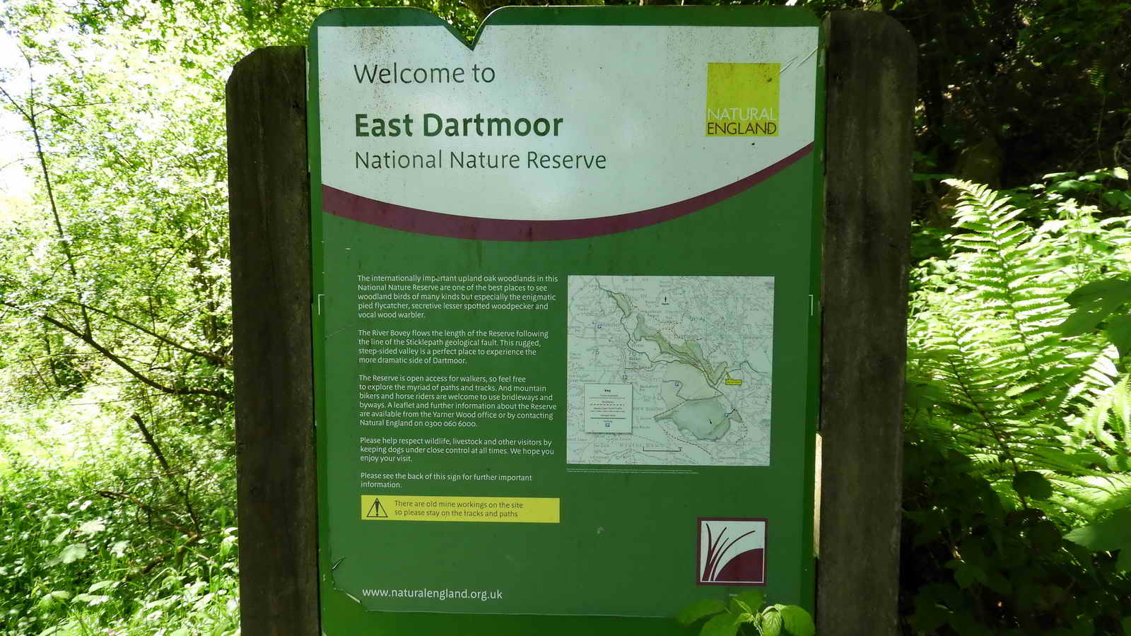
The road junction just before Yarner Wood (the Yarner entrance is just up the slope, around the bend, on the left). The walk today is in part of the Bovey Valley Woods, rich in trees, plants and wildlife as well as history and folklore.

Arriving at Drakeford Bridge car park (on the left). The bridge is just out of sight on the right; it was known as New Bridge in Crossing's time (William Crossing, Crossing's Guide to Dartmoor, 2nd edition 1912, reprinted 1990, page 294) and Letford Bridge.

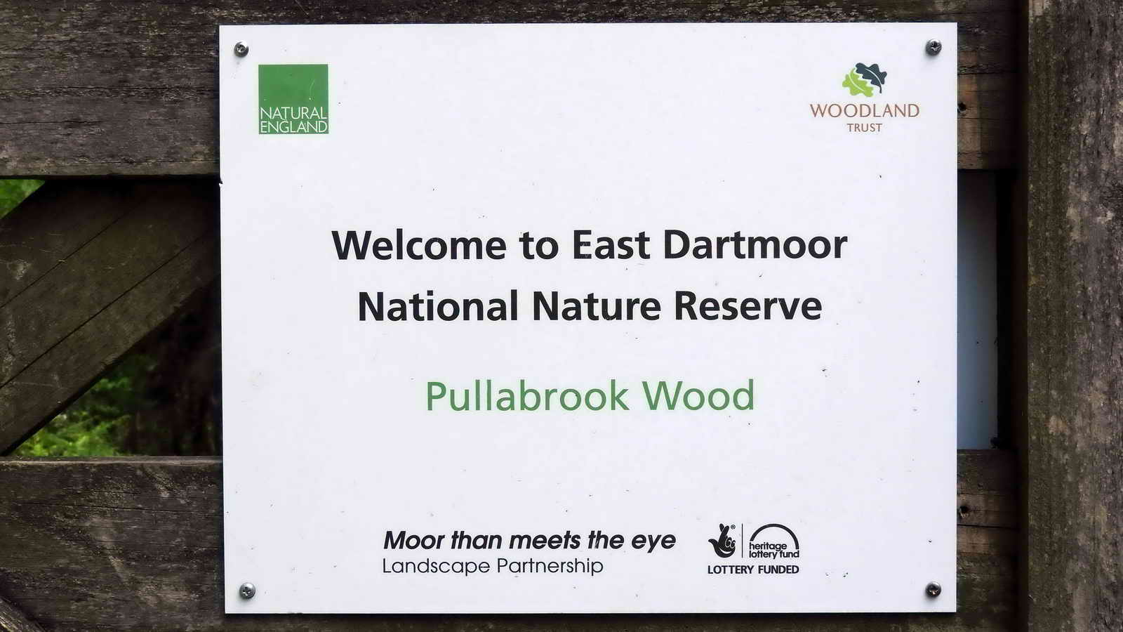
Pullabrook Wood is the wood we start in, this leads to Houndtor Wood except we miss that by descending to Hisley Bridge. We then turn right, thereby missing much of Hisley Wood and we return to the car park through Rudge Wood.
From the Bovey Valley Woods web side .....
"This 19.2 ha (47.5 acre) semi-natural ancient woodland contains oak, beech, birch, sweet chestnut, sycamore, ash, cherry and mixed shrubs. The sweet chestnut and sycamore were planted in 1880 on the high ground along its southern edge. During the 1960s, two-thirds of the wood was planted with conifers."
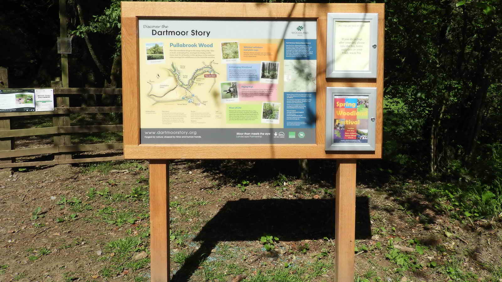
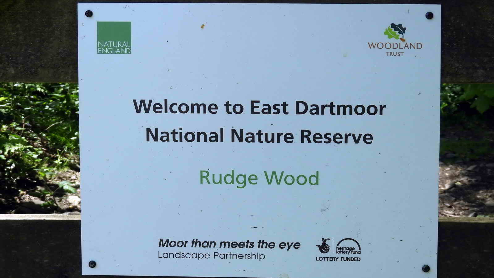
Car park notice. Click on the image to see a larger version.

The back of this notice is seen in the photograph above, through the gate.

Just through the gate - a tree with a small burden of ivy.

Logging work is being done at this time: Japanese larch on the upper slopes of Hisley Wood and Western Red Cedar, Sitka spruce and Douglas fir in Houndtor Wood are being thinned out, according to a notice on a gate.

Some timber is being machined on site, seemingly long stakes and tongue and groove boarding .....

On one visit, the offcuts and waste were being taken away .....

Looking back at one lot of logs, a view of the flood plain of the River Bovey.

Before you know it, more forestry work .....

More logs and bags of sawdust.

A simple view of the track ahead ..... along here can be seen:
beech, sycamore, maple(?), hazel, oak
(pedunculate), sweet chestnut, holly, and rowan (mountain ash)


One of two notices on gate near LP MM stone ..... leading on to Trendlebere Down .....

SX 78322 79547 - this clearing is downhill from a car park outside Yarner Wood. The "two notices on a gate" (in previous caption) are on the gate in the photograph. The track runs from right to left in this photograph (almost behind the camera), going down to Hisley Bridge, and is Old Manataon Road, now part of the Dartmoor Way, a 95 miles cycling route (an equivalent walking route is in progress).
The notice visible in the photograph above, on leaving Pullabrook Wood, on the back of it is the notice two photographs above, re. Trendlebere Down.

On the gate post.

The notice in the clearing above.

The LP MM stone, this was a new boundary stone for Lustleigh Parish, set up in 2000, the millenium year, hence the Roman numerals MM .....

Closer view.

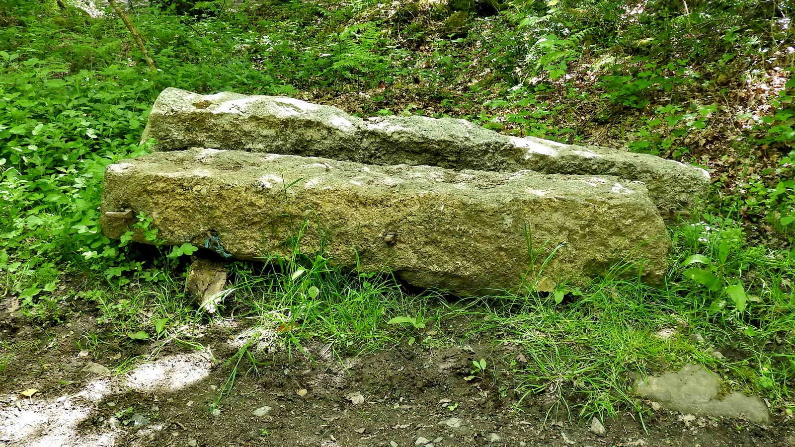
Looking along the track, towards the Pudding Stone .....
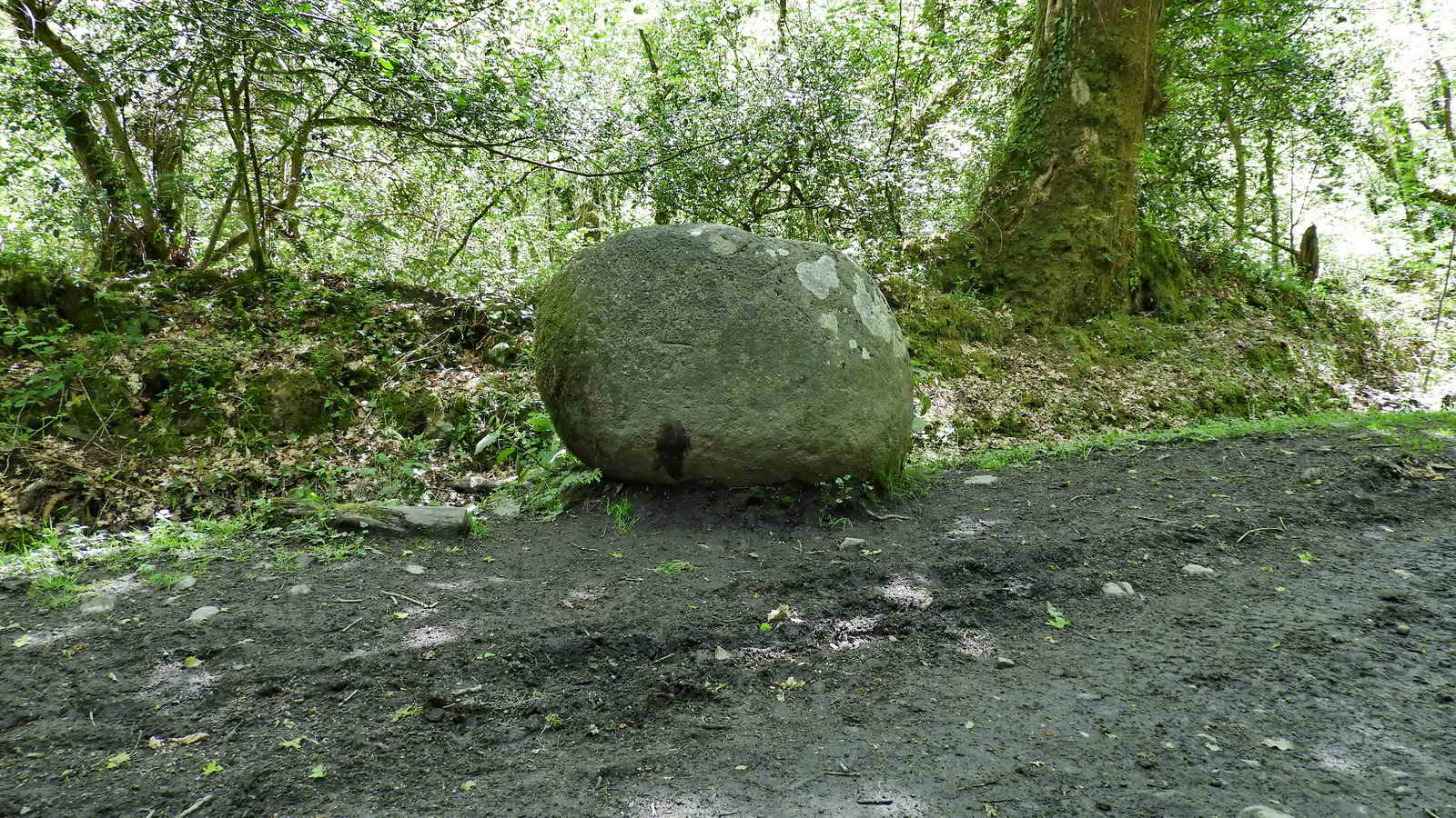
Pudding stone, at SX 77950 79976 .....

Complete with Ordnance Survey benchmark .....

Using a rucksack to show some scale .....
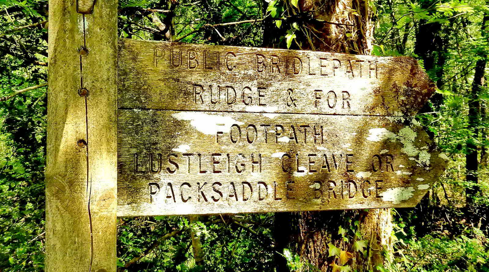
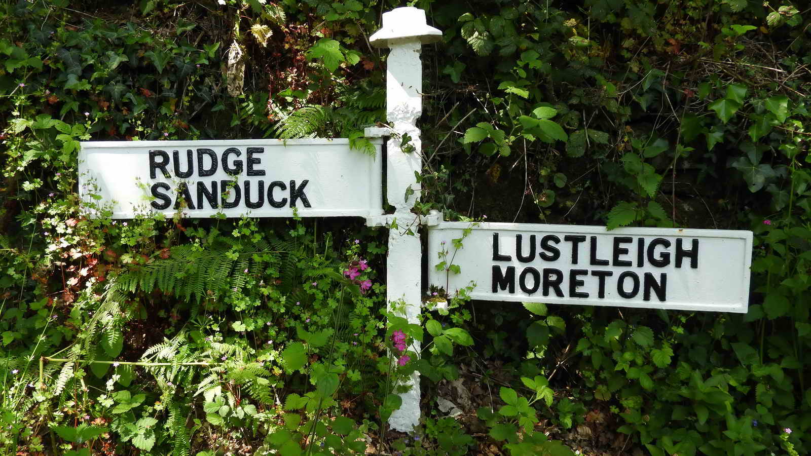
Double finger sign post across the track from the Pudding stone .....
Public bridlepath
Rudge & for
Footpath
Lustleigh
Cleave or
Packsaddle Bridge
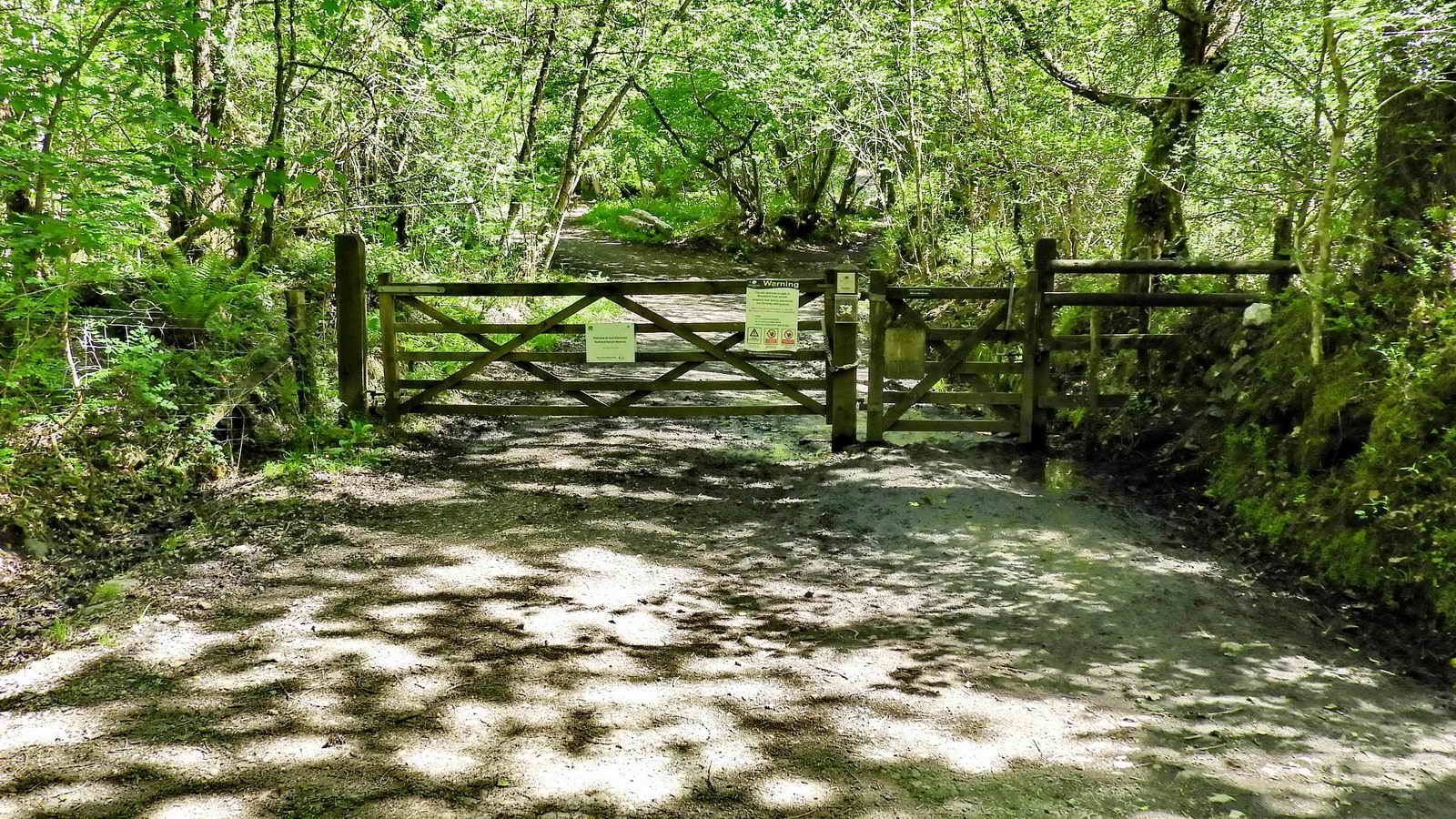
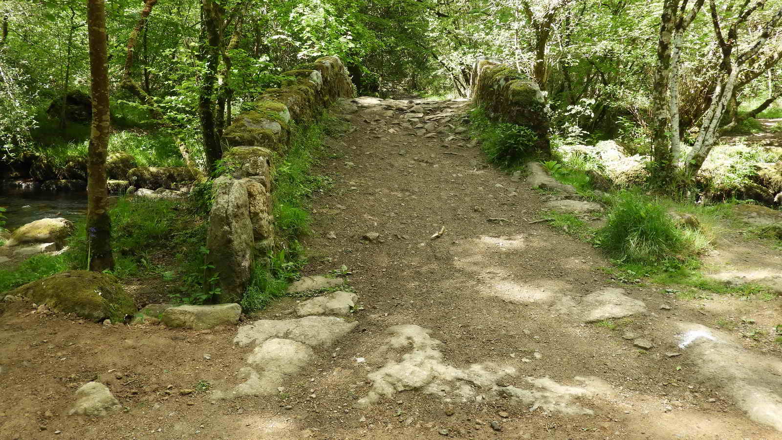
Puddingstone Gate down to Hisley Bridge, SX 77961 79977. The bridge is visible in this photograph, above and beyond the chained gatepost .....

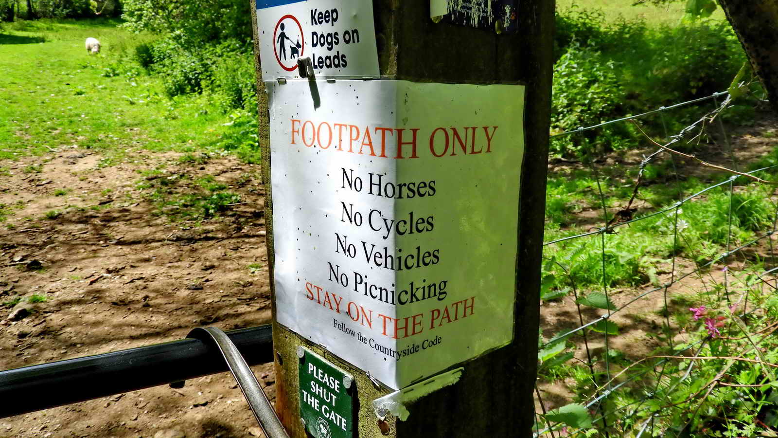
Notice into Hisley Wood, on the gate.

Hisley Ford, the bridge is on the right.

There were twenty-one of us in the group today - including the photographer. I am told Hisley Bridge is known to locals as Fairy Bridge.
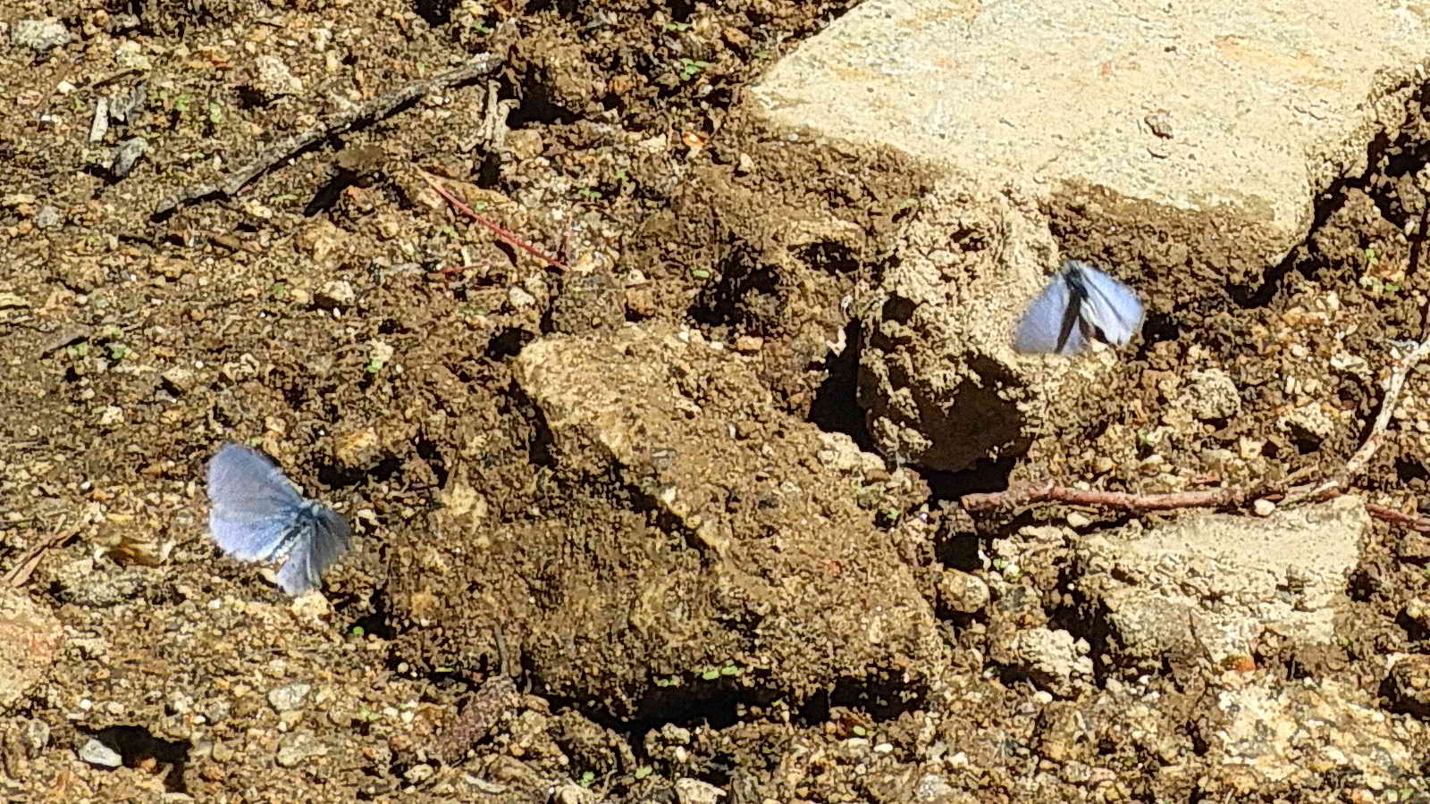 Holly Blue butterflies,
Celastrina
argiolus ..... on the soil by the river .....
Holly Blue butterflies,
Celastrina
argiolus ..... on the soil by the river .....
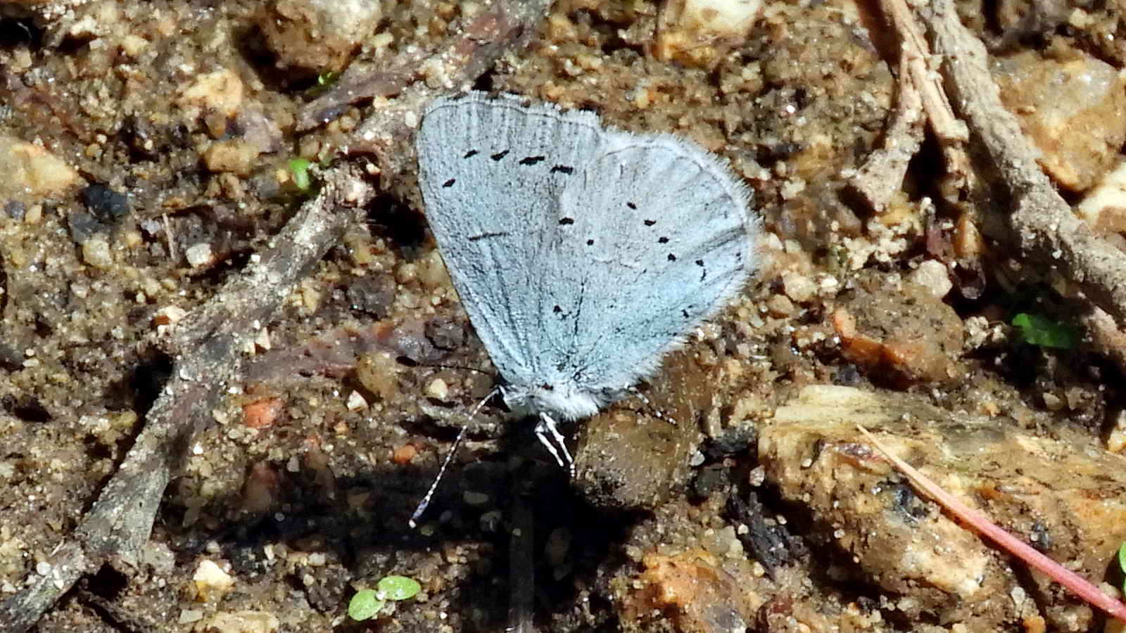
Close-up. There were a number of Holly Blue butterflies seen on the mud by the river at Hisley Bridge. Their caterpillars (and presumably their eggs) are found on Holly (in Spring) and Ivy (in Summer) while the adults feed on Bramble, Forget-me-nots and Holly.
Pair of granite gateposts near the bridge .....
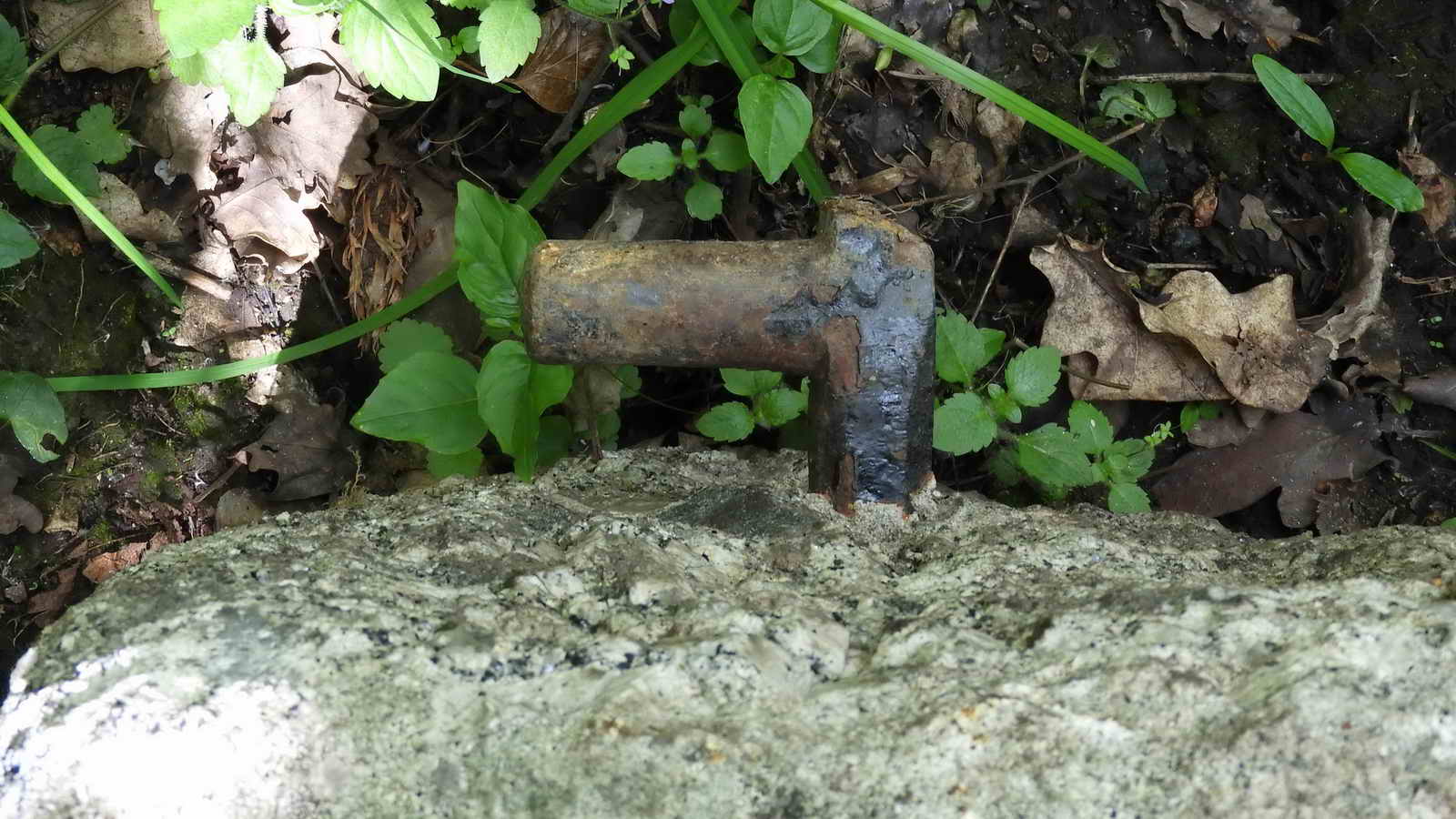
Detail of an iron gate hanger.

Hisley Bridge ..... with a slotted gatepost at one side, presumably to control use by pack horse drivers ..... a toll bridge? The gatepost also has iron gate hangers in the top and bottom slots, so it was a "serious" gate in its time. The pillar in the middle of bridge is a modern addition to stop ejits in off-road vehicles from using the bridge - it wasn't built for their weight, plus they were damaging it by "grounding" on it.
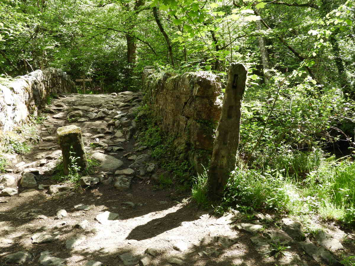
Hisley Bridge .....

The gatepost appears to have been re-used or split, there are a set of grooves down the reverse face that aeem to be split in half?
Hisley Bridge .....

Hisley Bridge .....

Hisley Bridge .....

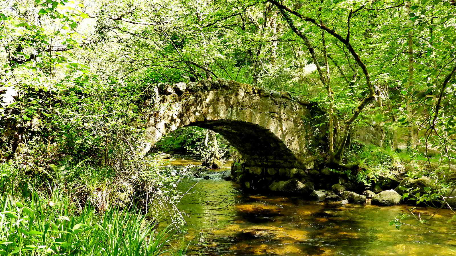
Looking up the River Bovey from Hisley Bridge .....

Across the bridge .....

Memorial plaque.

Just a view of the River Bovey.
Hisley Bridge .....

Hisley Bridge.

This plant was seen near Heaven's Gate high up the valley side on a recon walk ..... Pennywort, Wall pennywort, Penny pies, Navelwort, Umbilicus rupestris, is a perennial, edible member of the Stonecrop family .....

A coppiced hazel tree, or stump or "stool", where the shoots grow after the tree is cut to produce many thinner "sticks". Coppiced hazel was used for maing charcoal by making a special heap and burning it in a controlled, slow manner.

Close-up of the flowering stems,

Greater Stitchwort, Stellaria holostia.

Tree with bat box .....
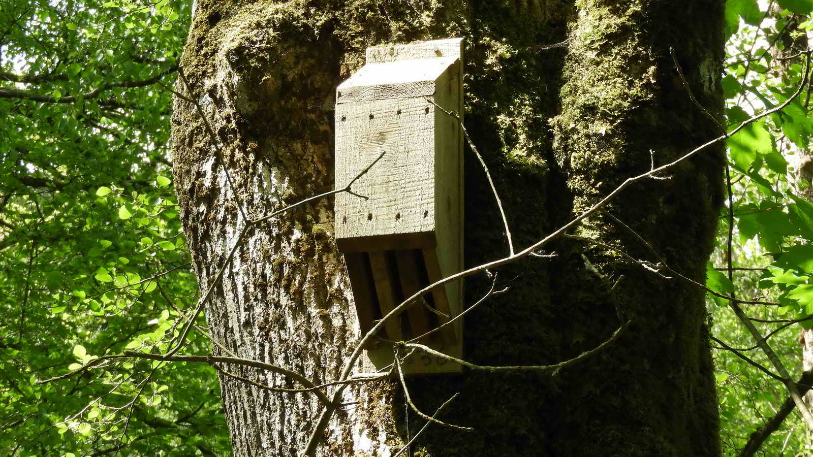
Bat box - this link shows pictures of diffent types of bat box - the bats enter and leave via the slots underneath the box.

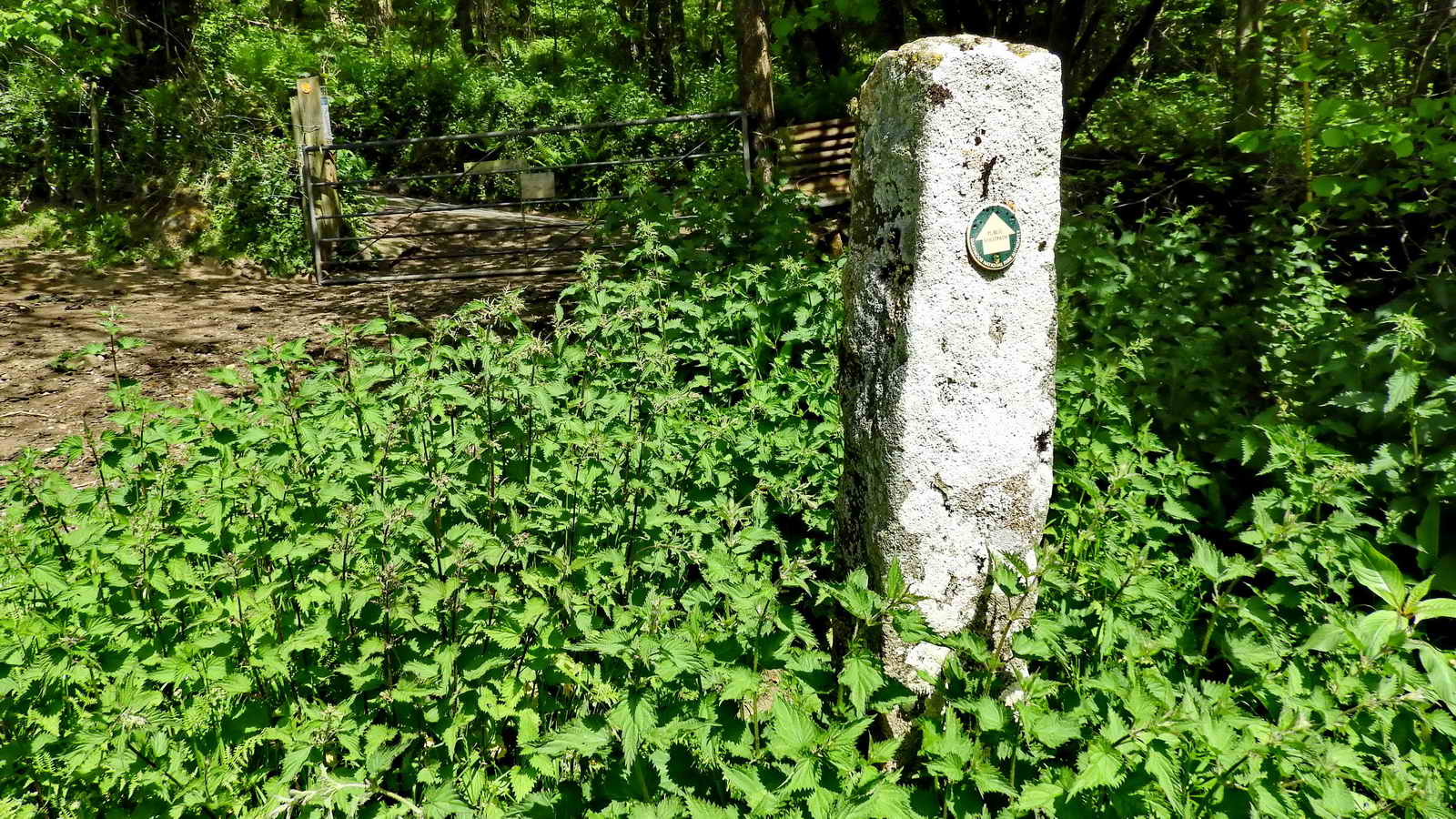
SX 78045 79962 - Gate along the way .....

A large fallen tree forms a natural bridge over the river.

Believed typical shuttlecock form of the Golden-scaled Male Fern aka Golden Shield Fern, Dryopteris affinis. Brown scales up the stem almost to the tip of the frond.

Bluebells among the young bracken.

Another river view.

SX 78136 79767 Notice entering Rudge Wood (and leaving Hisley Wood.

Sunlight on Sycamore, Acer pseudoplanatus, leaves
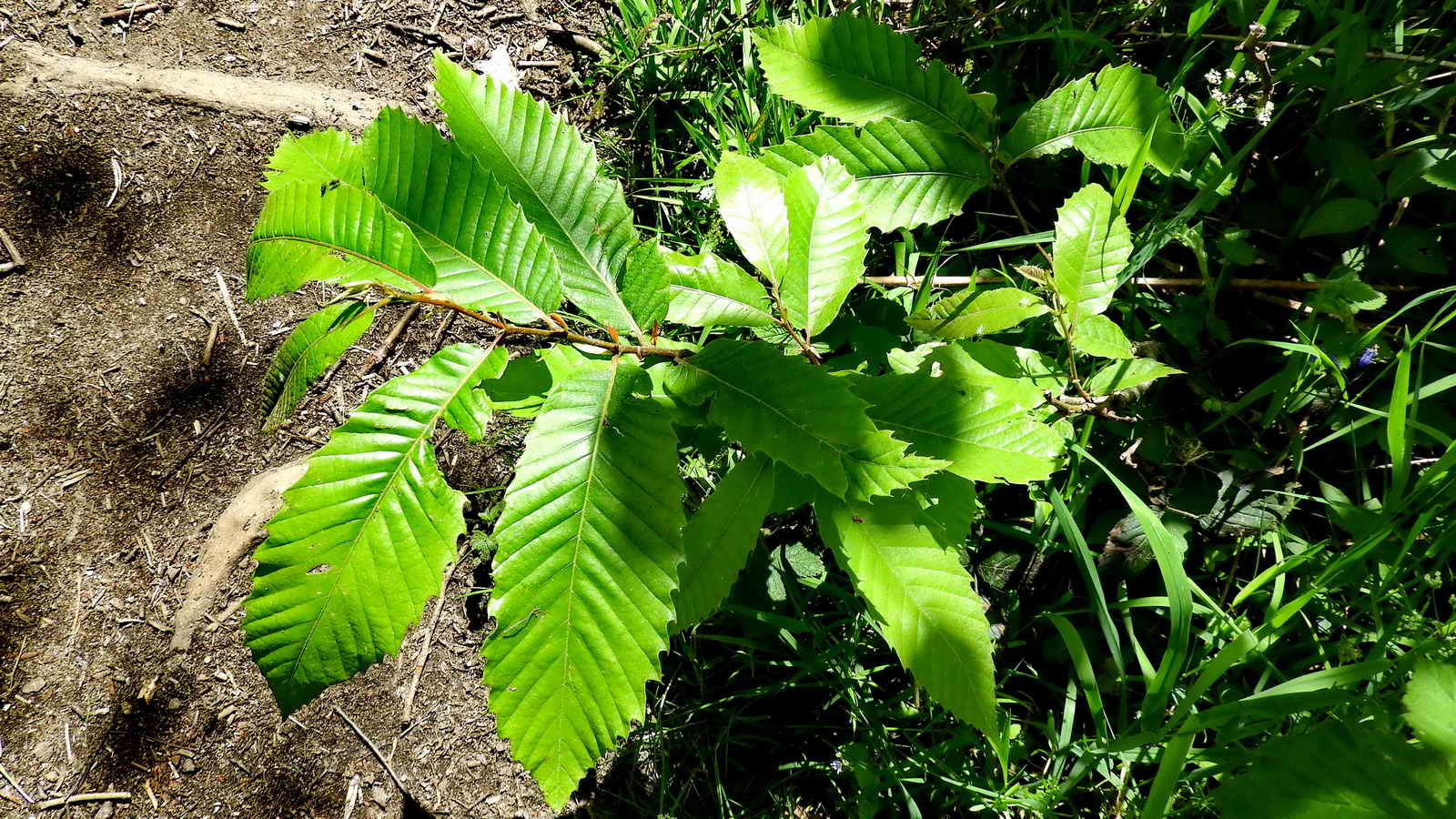
Sweet chestnut, Castanea sativa, leaves.

Pignut, Conopodium majus, also HERE. Wild carrot is similar but the individual flower heads appear to be larger. This is the right season for pignut to flower (May-June) whereas the wild carrot tends to flower June-August.

Another attempt at the believed typical shuttlecock form of the Golden-scaled Male Fern aka Golden Shield Fern, Dryopteris affinis.

River view.

Trees, bird box and thick ivy stemms .....

No. 22 is occupied - a bird flitted in and fed the chick as I prepared to take the photrograp[h but it didn't look like a Pied flycatcher. It was dull brown/grey, could it have been a Spotted flycatcher?

A glade in Rudge Wood ....
Somewhere along here, we measured the girth of two English / Common or pedunculate oak trees, Quercus robur, (at SX 7822 9 79688 and SX 78286 79675). They measured 10 feet 6 inches / 3.20 metres and 11ft 6 inches / 3.50 metres. At an assumed growth rate of 1-inch increase in circumference each year, the trees would be 126 and 138 years old except that the 2nd tree had a number of thick ivy stems growing up the tree, so 130 years would be as fair estimate.

A Devil's coach horse beetle - at first.Then, I had advice this was a Violet Oil Beetle, Meloe violaceous - this was about 30 mm long, and it looked to be a very long beetle, but oil beetles have overlapping wing cases as seen in this link, but another Violet oil beetle link. The wing cases appear to overlap very slightly at the anterior end , also, as it was scurrying and then stopping as I tried to divert it with a twig from crossing the path, it did not offer the typical threat display of the Devil's coach horse beetle where the rear end is arched up over the body, in a scorpion-like pose. Therefore, an oil beetle, advisedly of the violet variety?

Oil beetles have an intimate relationship with solitary bees and are therefore dependant on the health and diversity of wild bees. Source: Woodland Trust Bovey Balley Woods Management Plan 2017-2022, p.16.
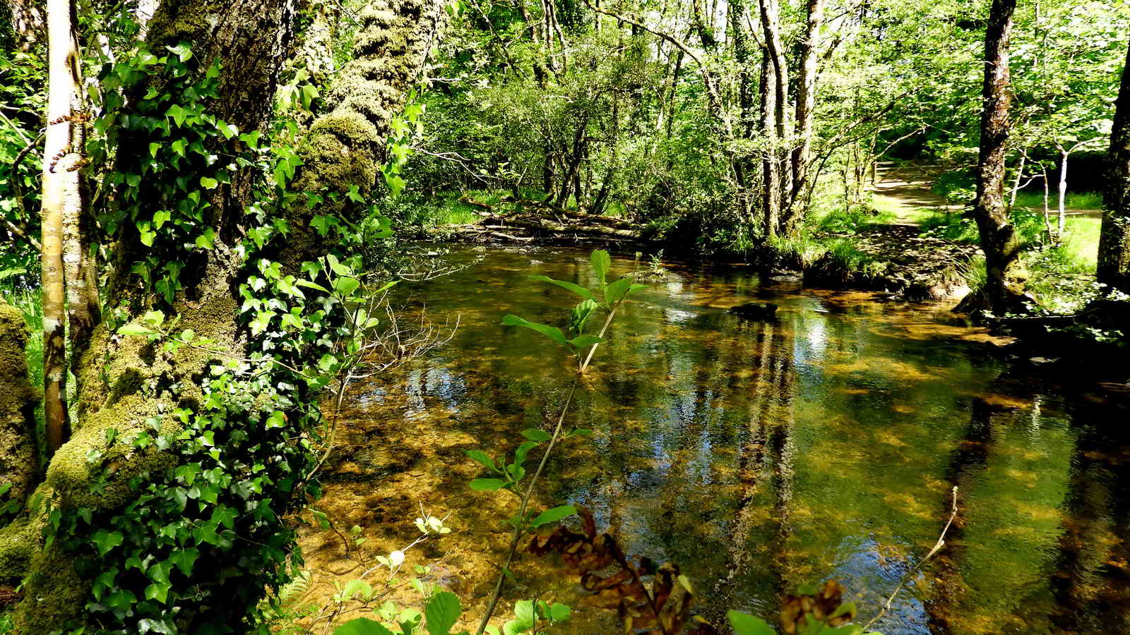
River Bovey view.

Hawthorn ("May") blossom, Cretagus monogyna. Hawthorn flowers after its leaves appear, blackthorn (i.e. sloe) is the opposite.
Click here to see a larger image #1 (Left half) Click here to see a larger image #2 (Right half)
SX 78136 79767 - Gate from Hisley Wood into Rudge Wood (as divided on the map).
Entering Rudge Wood.

In Rudge Wood near "the large oaks by the path" ....

Close-up.
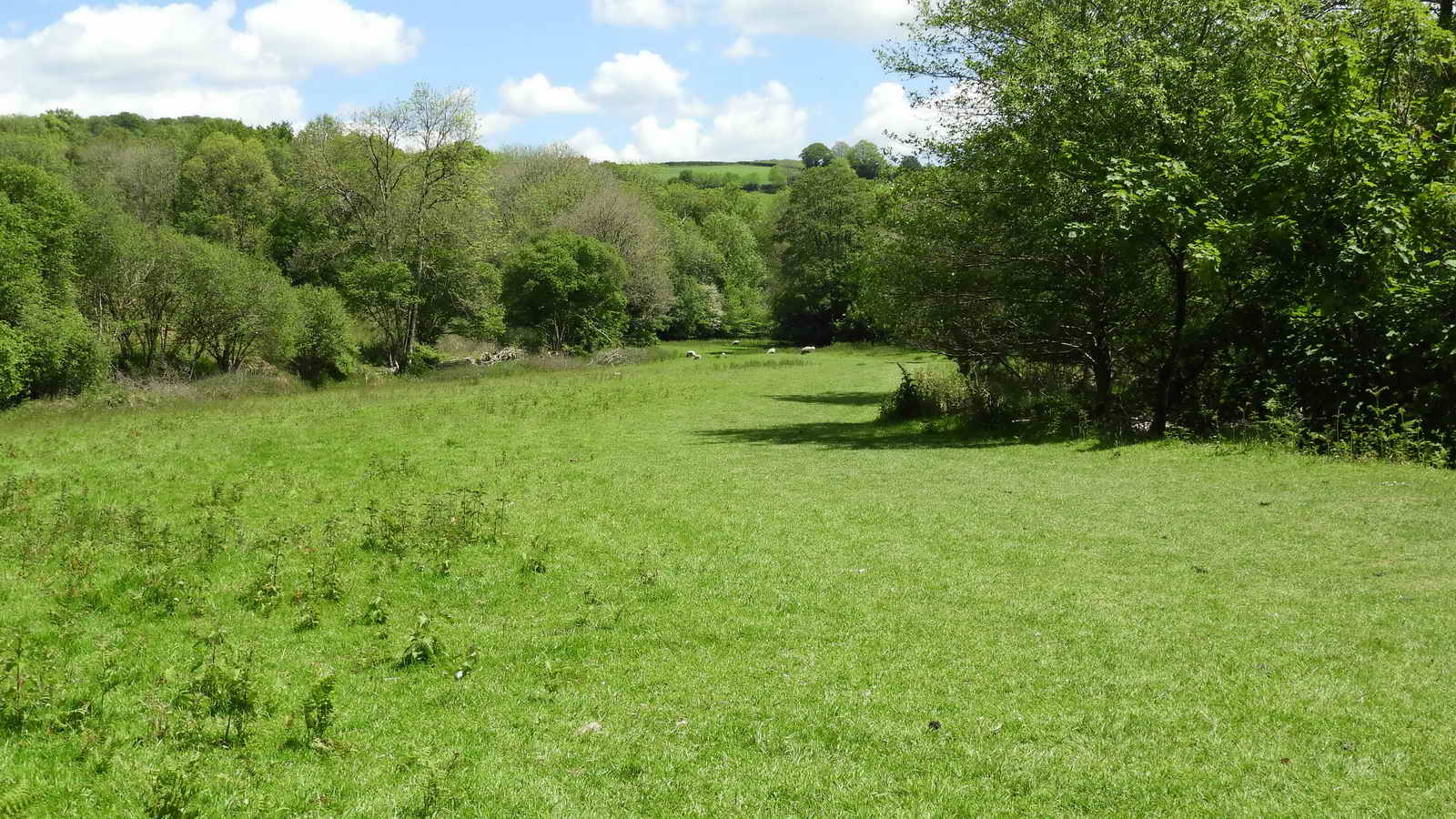
Rudge Meadow, this is "Great Moor" on the Lustleigh Tithe Map, 1838 (in bottom right corner), consisting of Furze (gorse); it has been improved since then.
The "White menhir" marking the exit onto the road, actually a lichen-coated granite pillar .....
At the entrance to the meadow.
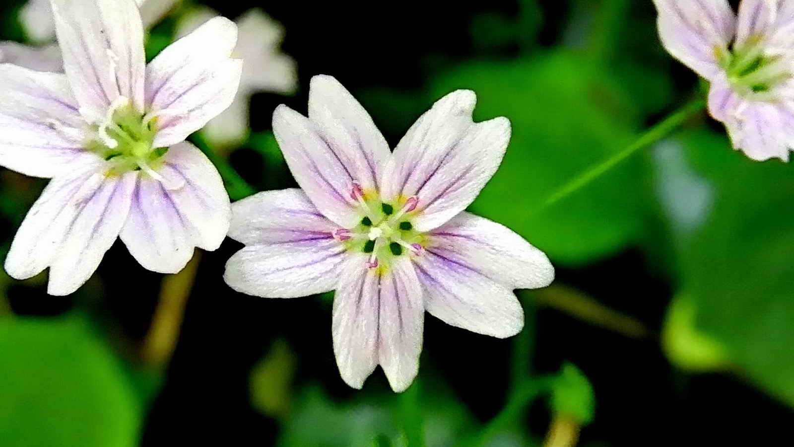
Pink Purslane, Claytonia sibirica, a garden escape.

Red campion, Silene dioica.
An old iron road sign.

Packsaddle Bridge, over Wray Brook. Beyond here can be seen a bridge .....
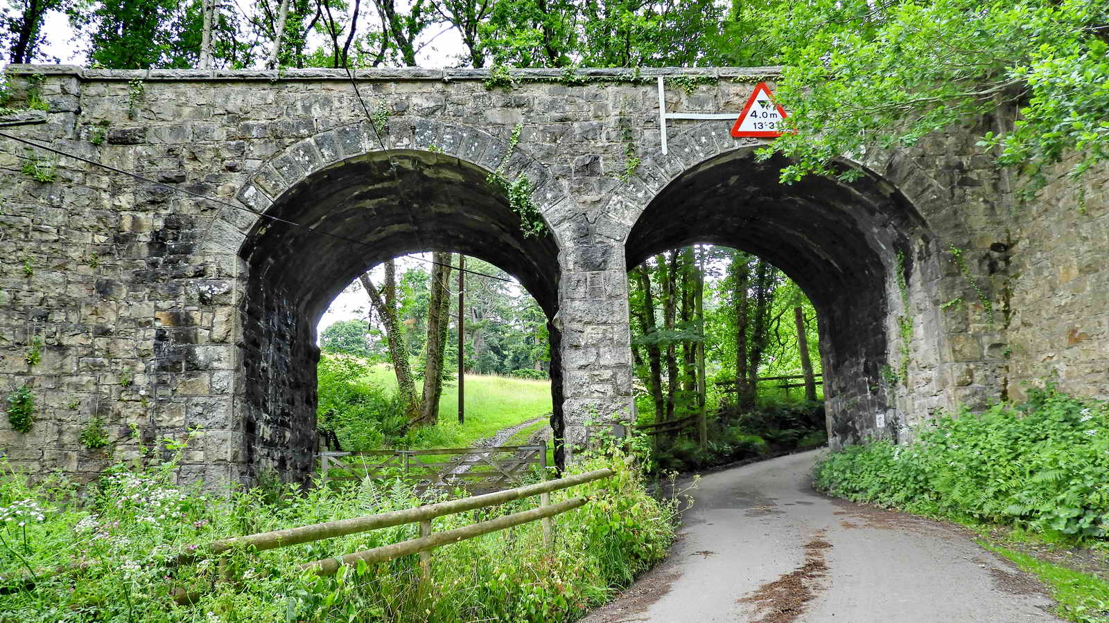
The road after Packsaddle bridge passes under the GWR Moretonhampstead Branch, known originally as the Moretonhampstead & South Devon Railway. The line opened in 1866, amalgamated with the GWR in 1876, nationalised into British Railways in 1948 and closed in 1964. There was a nearby Pullabrook Halt railway stop.

Periwinkle, Vinca major - common names: bigleaf periwinkle, large periwinkle, greater periwinkle and blue periwinkle. This has hairy margins to the larger leaves. V. minor - common names: lesser periwinkle and dwarf periwinkle. This has smooth margins to its smaller leaves. Link to leaves images.

Drakeford Bridge, over the River Bovey, at SX 78935 80133 .....

Green alkanet, Pentaglottis sempervirens, growing on the bridge ..... Pentaglottis means "five tongues" and sempervirens means "always alive" or "evergreen", it keeps its leaves through the winter.

Incised stone in the middle of the downstream bridge parapet .....
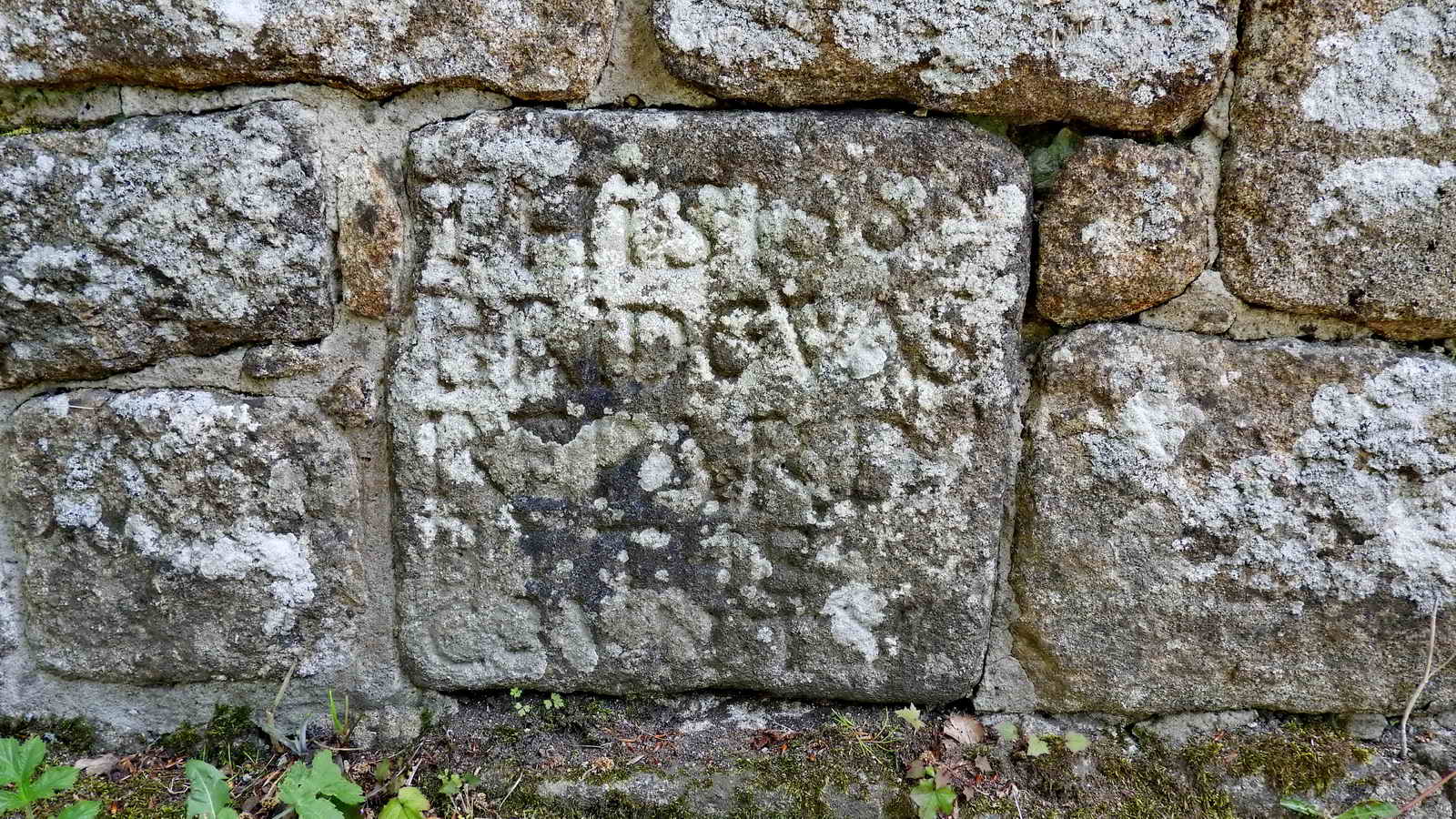
THIS1684
BRIDGEWAS
REPARD
BYTHE
COVNTY
NB - the "4" is
back-to-front
Drakeford and Packsaddle bridges are on the Bovey Tracey Tithe Map, 1841 (top left corner) as well as the Lustleigh Tithe Map, 1838 (in bottom right corner).
MAP: Red = GPS satellite track of the walk.

� Crown copyright 2016 Ordnance
Survey
Licence number 100047373
Also, Copyright � 2005, Memory-Map Europe, with permission.
This walk was reached by travelling from Plymouth, up the A38 to Bovey Tracey, going across the first roundabout, turning left at the second roundabout, driving up past Parke (Natio0nal Park HQ), following the left-hand branch in the road where it is signed "Haytor, Widecombe", turning right at the next junction signed Lower Down, Becky Falls & Manaton, then left at the next junction (unsigmed?), finally turning right at "Reddaford Water"(the right-hand turn before reaching Yarner Wood), and driving to the first bridge (Drakeford Bridge) and turning left into the car park immediately before the bridge, marked by the yellow cross on the map above.
Statistics
Distance - 4.19 km / 2.6 miles
All photographs on this web site are copyright © Keith Ryan.
All rights reserved - please email for permissions