![]()


This walk: 2019-11-1 (delayed by weather). Bedford Bridge, Magpie Bridge, King's Arms Inn, Magpie Inn, spoil tip, clay pit, West Devon Brick Works, Wheal Franco Mine, Magpie Railway Viaduct, mine shaft, hazel nuts, Drake's Trail, hazel catkins, railway sand box, Screw Bridge, Gem Bridge (Walkham / Grenofen Viaduct), picnic area, information board, pier capstones, Route 27 Sustrans cycle route, Gem Cottage.
Walk details below - Information about the route etc.
Previous walks in this area: 26 January 2011, (16 November 2011), 24 May 2012, 6 June 2012, 24 September 2014, 29 July 2015, 27 January 2016
Reconnaissance walks: 30 Sept. 2019, 4 October 2019, 20 October 2019
Google Satellite map + GPS track of the walk
This description of the walk starts with a look at the Buckland Monachorum Tithe Map (1842) to see the buildings at Bedford Bridge - the River Walkham is coloured blue. There are buildings in the same plots today, these being numbered 31 and 32. These are listed in the tithe apportionments as being (31) "Ellis Farm - Kings Arms Inn Etc", currently being "Walkham House" and (32) "Ellis Farm - House Etc." - currently being "The White House". The King's Arms Inn was nearest to the river.
There is some confusion about the names here - Bedford Bridge or Magpie Bridge? They can both be used - there is an area here long-known officially as Magpie - enter magpie yelverton in the Royal Mail Postcode Finder and see what you get - scroll down!

Buckland Monachorum Parish Tithe Map (1842) showing the Bedford Bridge area. Plot 31 is listed in the Tithe Apportionments as "Ellis Farm - Kings Arms Inn Etc" and Plot 32 as "Ellis Farm - House Etc.". Copyright - Devon County Council

This tall, white building is probably the old "King's Arms Inn", right beside the road bridge. It was probably also referred to locally as "Magpie Inn". According to chat on RootsChat.com the inn here was known in the 1841 Census as the London Inn. There is apparent confusion even in the old records - Tithe Apportionments 1842 versus Census 1841! Today it bears the name "Walkham House"......

Walkham House.

Next door, right opposite the car park entrance is today's "The White House" ......
This bears the remains of a sign that, according to a local lady I met on a reconnaissance walk, bore a sign saying it was The Magpie. Apparently it was once a doss house for the miners (convenient, next to the inn)?
Some old 25-inch OS maps - in relative "table" form i.e. the maps are contiguous (join onto each other)
|
https://maps.nls.uk/view/106005356 - colour (1882) 1884 Grenofen Bridge Walkham United Mine (Copper) Elvan Quarry and building Best old mine details |
https://maps.nls.uk/view/106005842 - colour (1882) 1884 Walkham United Mine (Tin) aka West Sortridge = Gem Mine - both sides of river - top right corner Gem Viaduct Westdown Mine (Copper) Chimney Double Waters - Walkham flows into Tavy Virtuous Lady Mine (Copper) |
https://maps.nls.uk/view/136636787 - colour (1883) 1885 See top left for ... Bedford Bridge West Devon Brick Works Walkham Cottages Magpie Viaduct Leats |
|
https://maps.nls.uk/view/106005854 - colour (1882) 1892 Lady Bertha Mine (Copper) - top right corner 2.9 km (1.8 miles) from Grenofen Bridge, 221� |
------- | ------- |
25-inch Ordnance Survey zoomable map, 1888-1913, centred on Gem (Grenofen) Viaduct
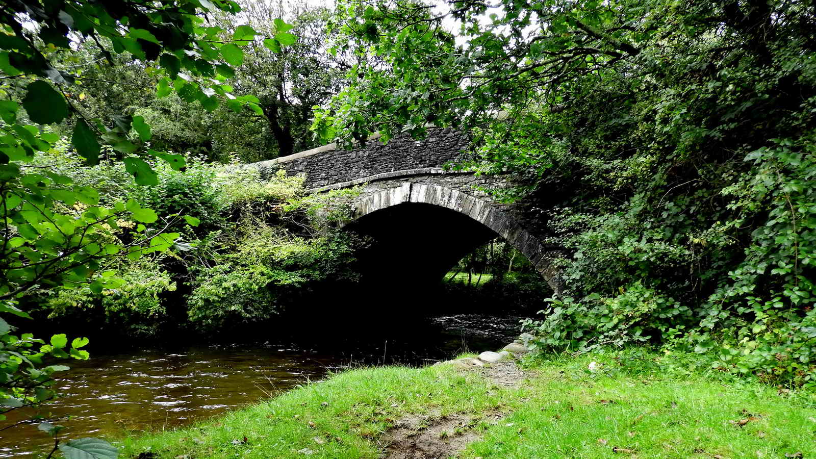
Bedford Bridge - built in 1822 as part of the turnpike toll road from Plymouth to Tavistock. The toll road fell into decline after the railway opened in 1859 and the toll houses at Horrabridge and Grenofen were sold in 1882. Source: Paul Rendell (1996), Exploring the Lower Walkham Valley, Forest Publishing, Newton Abbot, pp.26-27.
The bridge is named after the Duke of Bedford who was a large landowner in the area. The courtesy title of the Duke of Bedford's eldest son and heir is Marquess of Tavistock. Today they are more concerned with the Woburn Abbey Estate (since the 1620s) and much of Bloomsbury, London, with Bedford Square and Russell Square (since 1669).
Near Bedford Bridge is the clay pit area used by the West Devon Brick Works.

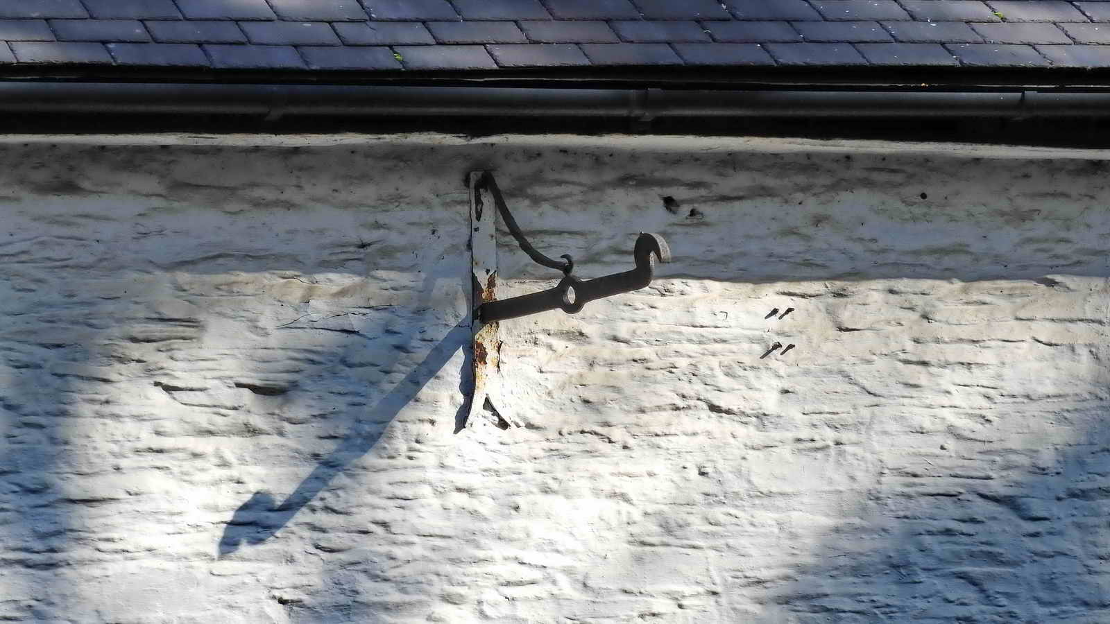
An oddity on the river bank, the three bent-over iron loops were probably anchorage points for a small crane to hoist/lower something through the manhole?
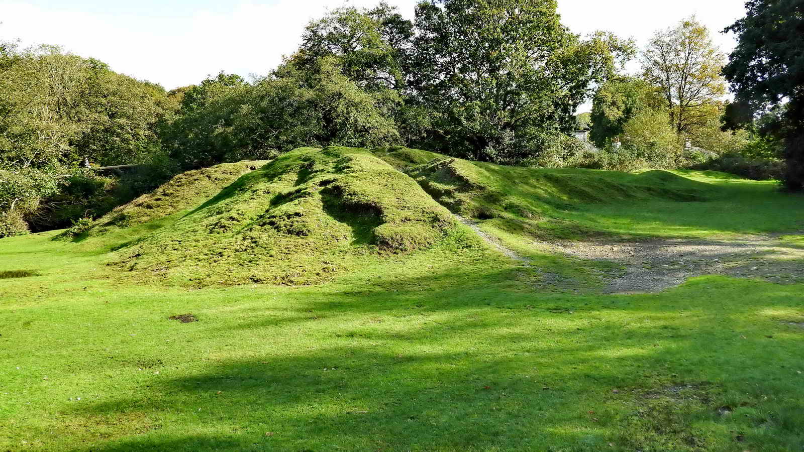
A spoil heap from the Wheal Franco Mine or the West Devon Brick Works - they both worked this area at various times.
Devon & Dartmoor HER - MDV25923 -
Mine in the Parish of Buckland Monachorum
"West
Devon Works (disused)" near Bedford Bridge" - this refers to the
brick works, not a mine!
Information about the local mines is derived from Phil Newman (2011), Mining in the Tavy Valley, West Devon: An Assessment of Archaeological Potential (Site 14) and from the Devon & Dartmoor Historical Environment Records.
Site 14 (page 36) - SX 5091 7010 - Wheal Franco (Sn); Wheal Franco Consols, Wheal Robert. Location: "This is a large sett made up of a southern sett called Old Wheal Franco, on Roborough Down to the west of the Tavistock Road, and Wheal Franco to the north, bounded by the southern bank of the River Walkham." Either side of Bedford Bridge & main road.
The Wheal Franco copper mine (1823-1875) also operated in this area (see the old map link above) although mostly across the main road. It went down to 160 fathoms (960 feet) and employed 130 men. Between 1846-62, operating mainly from the new site on the east (far) side of the main road, 10,333 tons of ore were raised at Wheal Franco, valued at �51,500. The sites were briefly re-opened during the early 1870s, but these later operations were apparently not very successful.
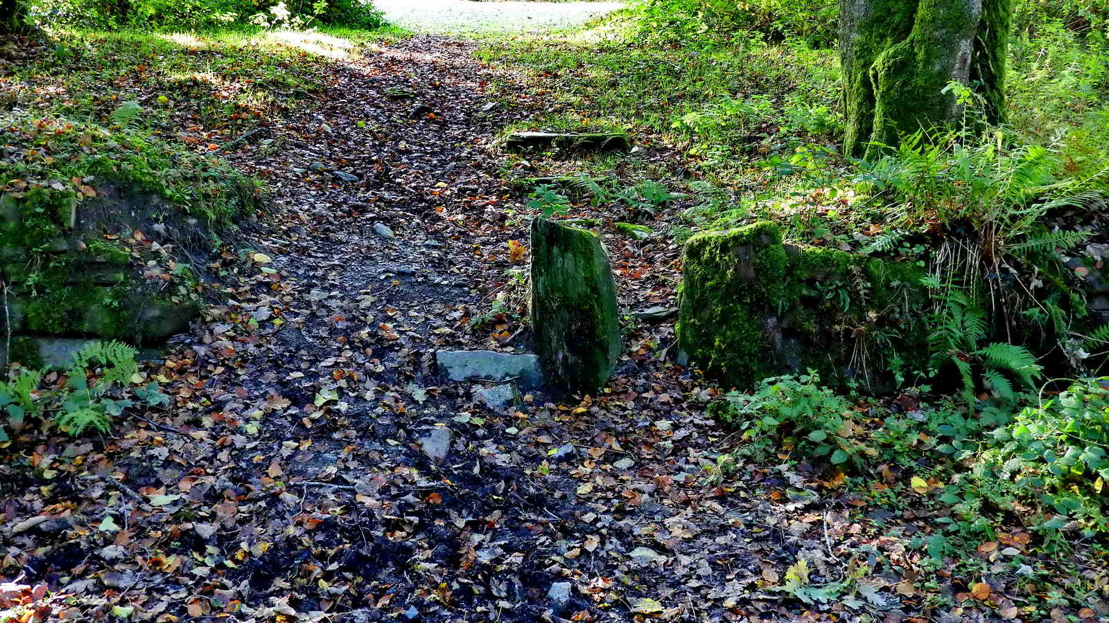
A pair of stones arranged as in an old sluice, right next to the disused toilet block in the car park.

The area uphill from the car park that is possibly marked by the presence of the old clay pit and brick works that is marked as "West Devon Works (brick, disused" disused on the (1883) 1885 OS map. The brick works is not shown at all on the later, zoomable map. This is also the first view of Magpie Railway Viaduct.

Mine shaft at SX 50439 70099, seen on reaching the viaduct and turning left before passing under it.
Devon & Dartmoor HER - MDV63472 -
VIADUCT in the Parish of Buckland Monachorum
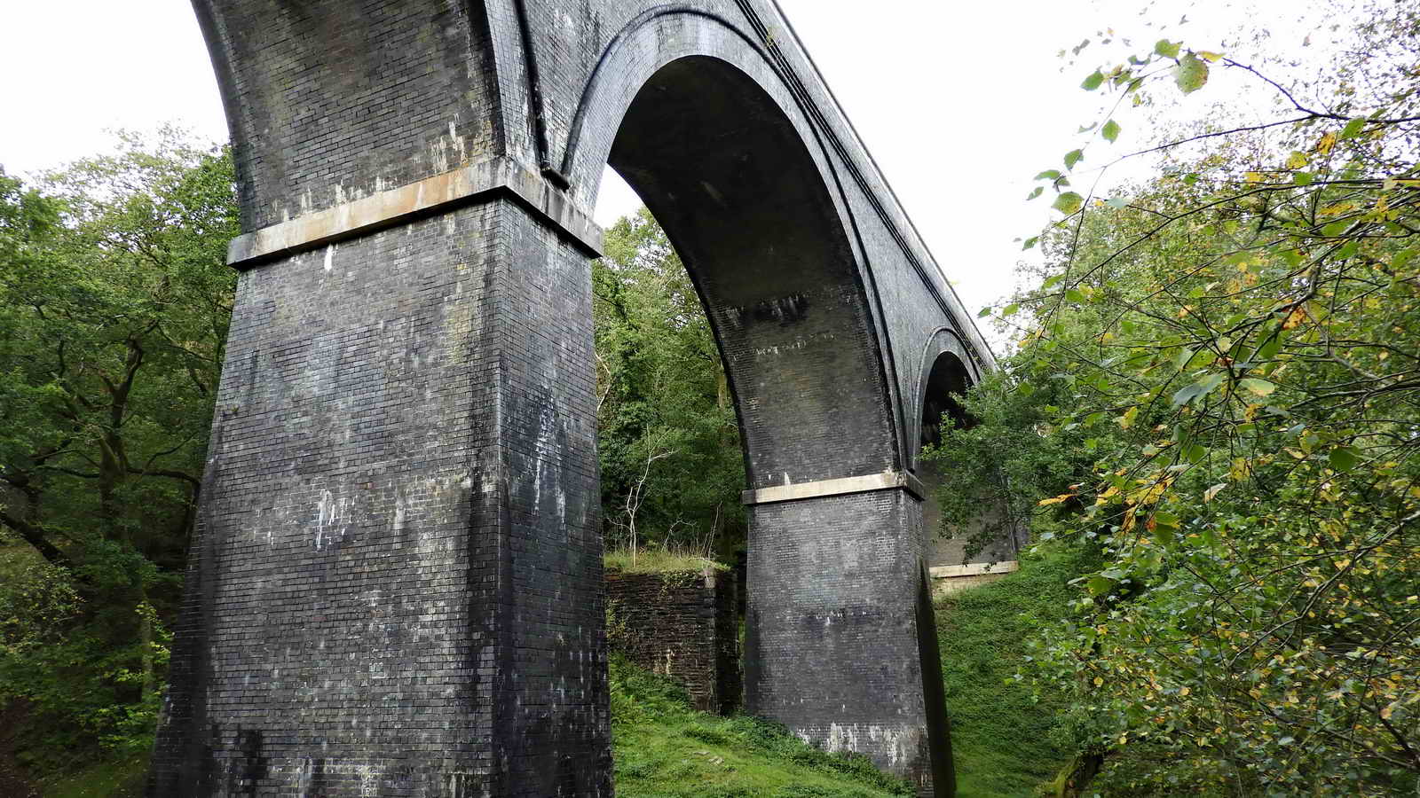
Magpie Viaduct - "Original viaduct built of granite
+ timber in 1859 to design by Brunel. Rebuilt in 1902 in staffordshire
brick. The viaduct is 197.5m long x up to 19m high"

Magpie Viaduct is 216 yards long, 62 feet high, originally built 1856-1859, by Brunel, replaced 1902 with Staffordshire blue brickwork........ 1859 was also the year that Brunel's railway bridge across the Tamar was opened ..... hidden in the trees, to the left i.e. south of the viaduct, are the original brick-built piers that supported Brunel's original wooden trestles that carried the railway trackbed.
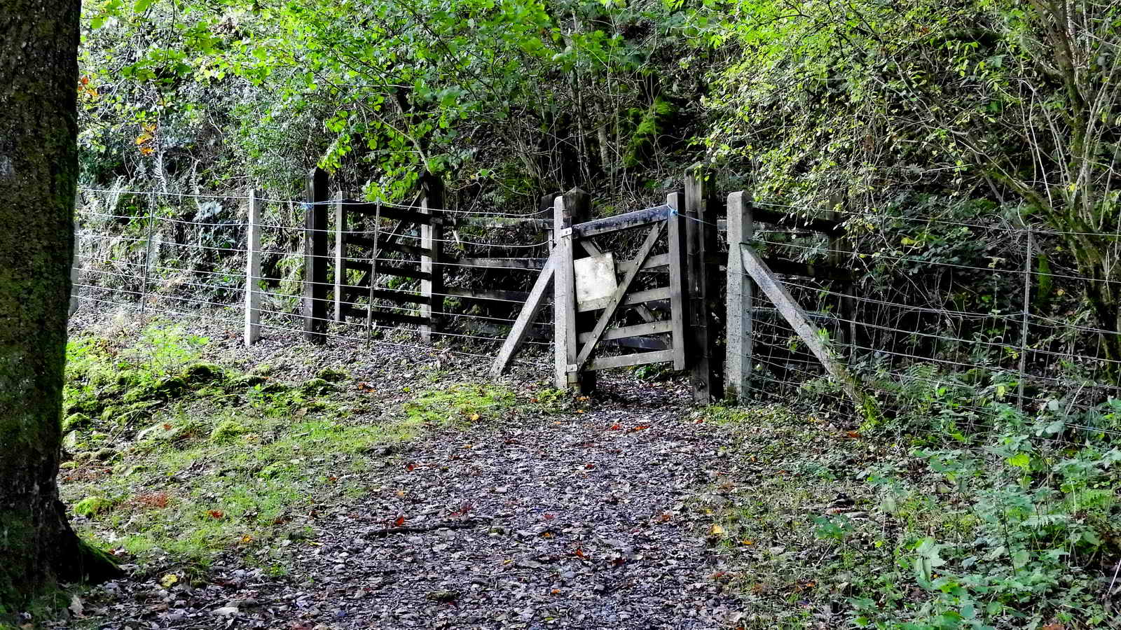
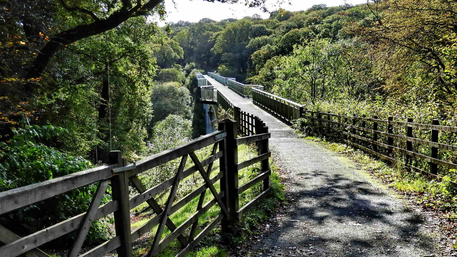
Two gates leading up to the old railway track bed, which is now a cycle and walking track ......

Hazel nuts seen on the path.
Once you reach the old railway track / cycle track / walking track, you are on the 21-mile Drake's Trail from Plymouth to Tavistock. This has a number of walking and cycling routes, including side spur walks to Clearbrook, Burrator, Buckland Abbey and Crowndale, also cycle rides to Burrator and Lopwell. There is more detail in their downloadable PDF leaflet.

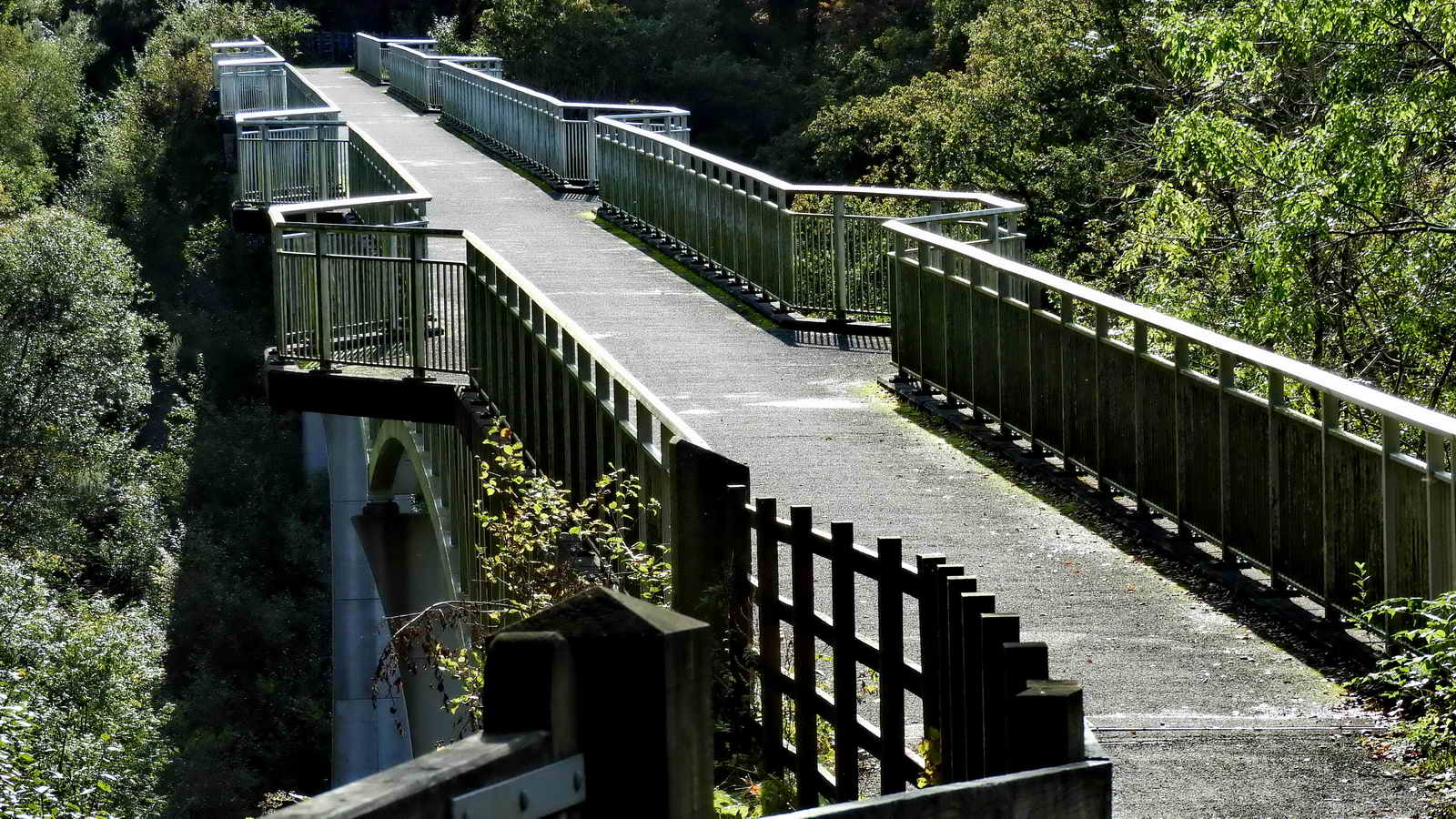
Looking across the viaduct ..... the next two photographs were taken from the viewing point to the left before crossing the viaduct ..... this is/was part of the South Devon and Tavistock Railway .....
South Devon and Tavistock Railway - this linked Plymouth with Tavistock in Devon; it opened in 1859. It was extended by the Launceston and South Devon Railway to Launceston, in Cornwall in 1865. It was a broad gauge line (Brunel's favoured 7ft �ins) but from 1876 also carried the standard gauge (4ft 8�ins; then referred to as narrow gauge) trains of the London and South Western Railway between Lydford and Plymouth: a third rail was provided, making a mixed gauge. In 1892 the whole line was converted to standard gauge only.
The line closed to passengers in 1962 although sections at either end were retained for a while to carry freight traffic. A short section has since been reopened as a preserved line by the Plym Valley Railway.

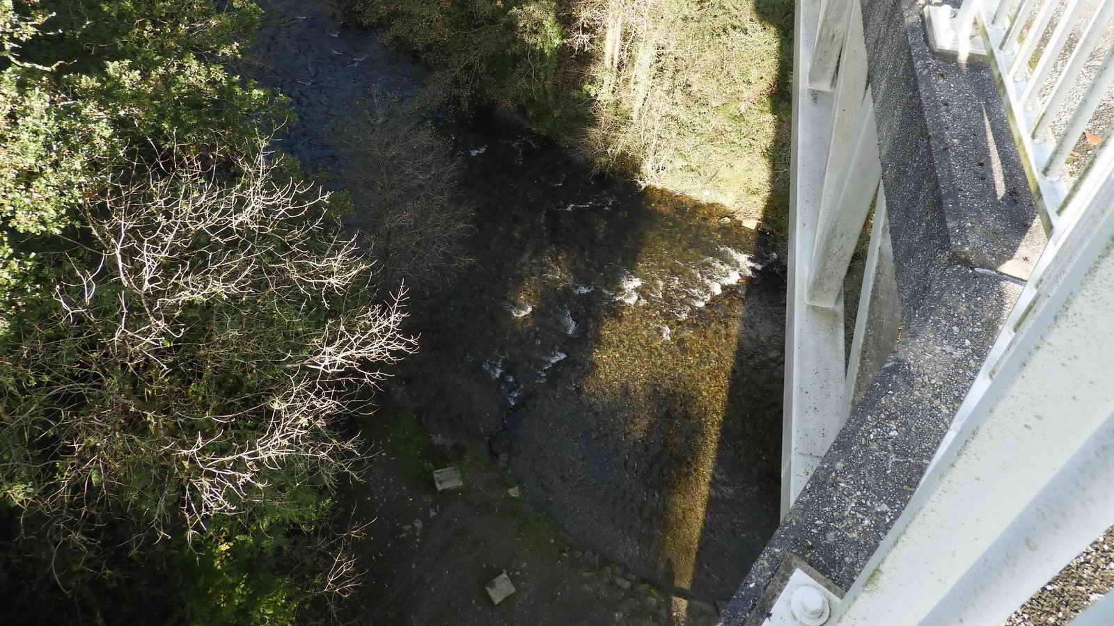
Looking down on one of the old piers built to support the original railway track in 1859. The trackbed was supported on massive timber trusses .....

This is the stream we saw earlier, that passes under the viaduct.
Picnic area at the end of the viaduct .....

Looking back after crossing the viaduct.

The track ahead, after the viaduct.

Hazel catkins growing for next Spring.

An old railway sand box? Seen on the north, or downhill, or river, side of the track at SX 50030 70206, about halfway between Magpie Viaduct and Screw Bridge.

Screw Bridge - probably a corruption of "skew" - it is neither straight across the old railway nor is it level. On our return walk we will cross it: there are quite a number of Skew Bridges in the UK.

Looking back, having passed under the bridge.

A not very inspiring photograph, but about halfway between Screw Bridge and Gem Bridge, at SX 49654 70343, is an exit from the cycle track to footpaths, one of which leads up to Screw Bridge - for our return leg. It is important to take the RIGHT fork in the path, otherwise you end up down beside the river.
Along this section on one of the reconnaissance walks, I met a lady who told me about The Magpie sign at Magpie (Bedford) Bridge and it having been a miners' doss house.

Just before reaching Gem Bridge (Viaduct), there is a small gate to the River Walkham down below.

Looking onto Gem
Bridge (5�-minute
video) at
the site of Brunel's
old Walkham railway viaduct,
now rebuilt for the cycle track
It's a tall bridge
..... officially opened on 22nd May
2012, costing �2.1M, i.e. opened in time for Queen Elizabeth II's
Diamond Jubilee and to coincide with the Summer of Cycling. The previous
bridge (rebuilt 1910 using iron girders) was demolished in the 1960's.
The new bridge was partly funded by a �600,000 EU grant with the aim to
improve cycling links between UK and France. This cycle track runs from
Ilfracombe, on the north Devon coast, to Redon, in
south Brittany.
Brunel's bridge was 40 metres high and over 300 metres
long. The new bridge is 24 metres high and 200 metres long.
In
Imperial units: the old viaduct was 131 ft high x 984 ft long; the new
bridge is 78 ft high x 656 ft long.

As previous photograph .....
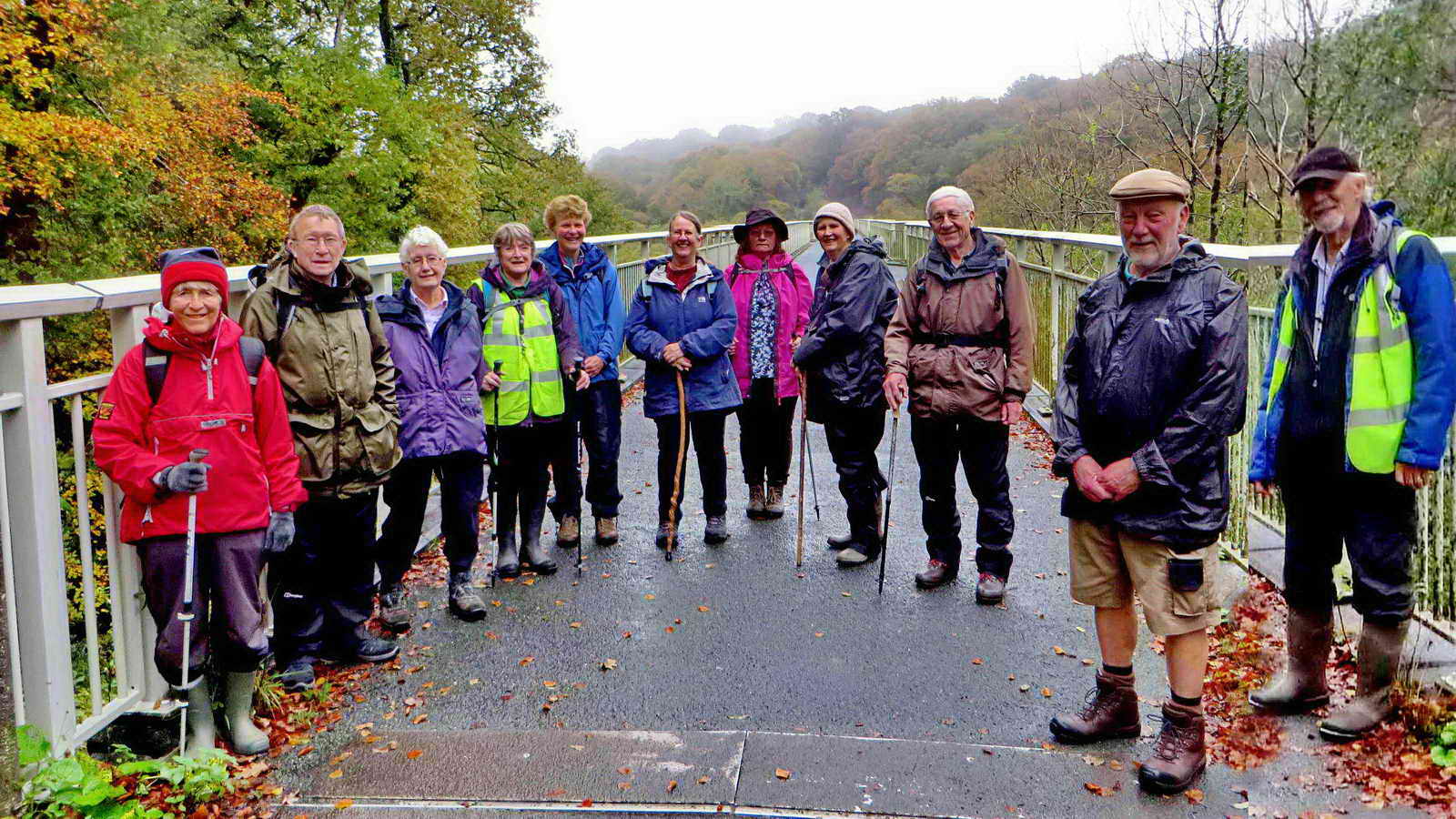
On the day of the walk, the weather was damp and misty .....
Looking over the edge ..... ooooo-er ..... hold onto your hats! Down there are the ruins of the (Little) Gem aka West Sortridge Consols Mine.
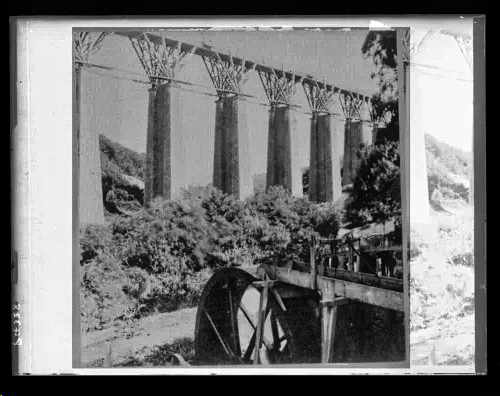
Image
reproduced by kind permission of
Dartmoor Archive.
See the Dartmoor Archive image online
HERE.
| "Before its demolition in 1965,
with the closure of the Plymouth and Launceston railway, the
Grenofen Viaduct was the only surviving Brunel timber viaduct on
the line. It was said to be the finest example of its type and
was 132ft (40m) high and 367 yards (335m) long. This image
possibly shows the viaduct with its timber cantilevers. These
were replaced by iron in 1896." Note the water wheel with its launder bringing water from a leat. |
A view from the far end (Tavistock end) - popular with walkers, runners and cyclists .....
Devon
& Dartmoor HER - MDV117612 - Grenofen Viaduct, Buckland Monachorum
Also known as Gem Viaduct. Much useful detail.
Zoomed view.

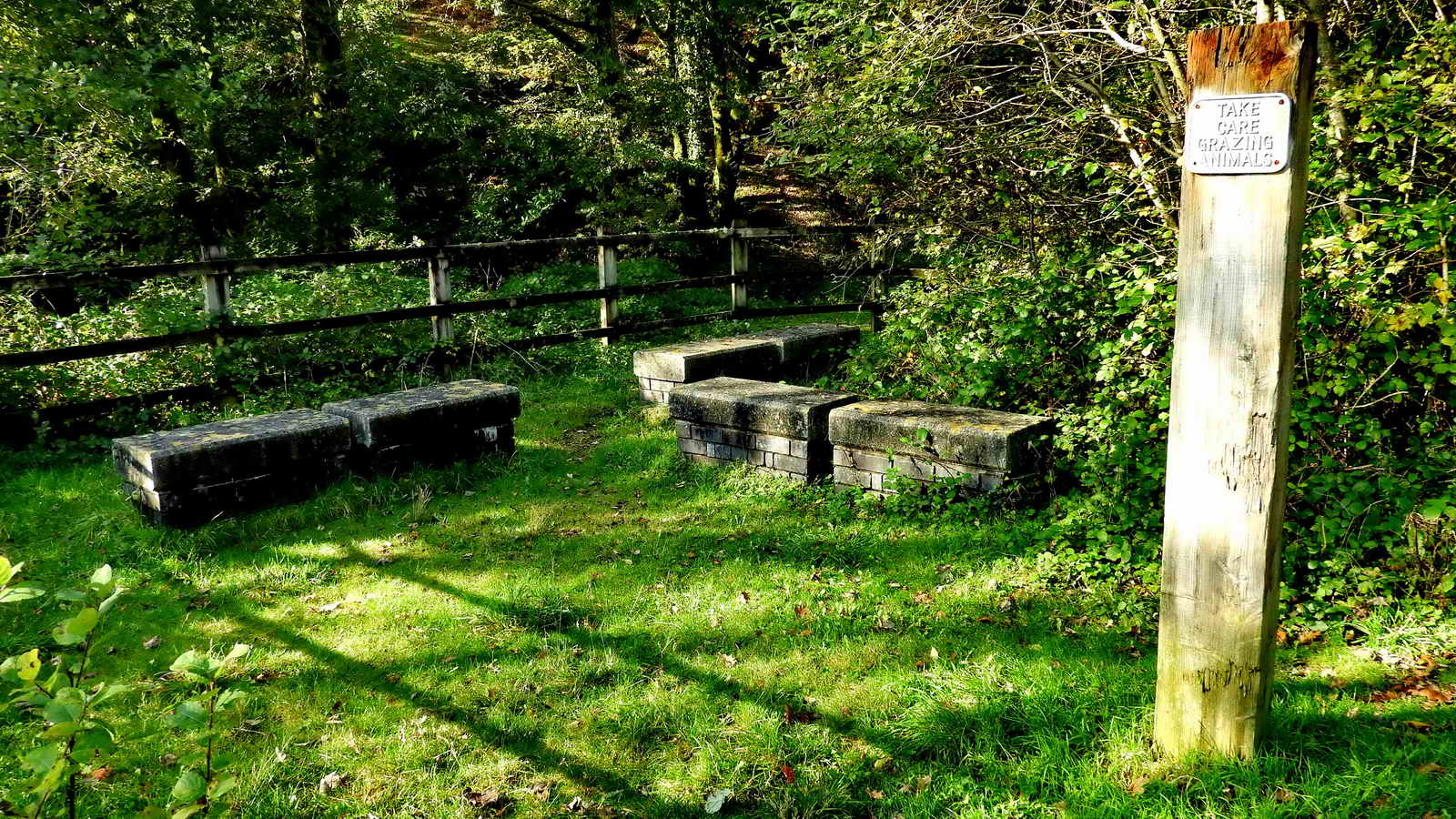
Just off the far end of the bridge is a picnic spot - the remains of one of the original viaduct supporting piers that supported the railway can be seen towards the top left in this photograph ..... these are original pier capping stones and a pier footing stone. The capping stones weigh 6 tons. The great Walkham Viaduct was demolished in 1965, three years after the line closed in 1962. Source: Information Board (see below).
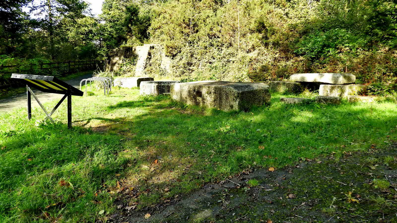
Another view ..... note the plaque on the near plinth, opposite the information board ..... the stone appears to be the biggest and must be the pier footing stone .....

The plaque .....
| To mark the completion of Gem Bridge a time capsule was buried beneath this granite plinth on 22nd May 2012 in the Diamond Jubilee year of Queen Elizabeth II |

Leycesteria formosa, also known as Himalayan honeysuckle, flowering nutmeg, Himalaya nutmeg, granny's curls or pheasant berry, growing between the granite stones, believed to be a garden escape, possibly a fuschia .....

Stones arranged in the picnic area .....

Information board in the picnic area. Click the image for a larger version.
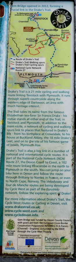
Side panel to the information board in the picnic area.
Some re-worked photographs from 26th January 2011 and 16th November 2011

Jan. 2011 - zoomed view, looking down on the location where Gem Bridge was built across the River Walkham, completed in May 2012. There seemed to be no sign of construction here in Jan. 2011 ..... It was near-completion by 16th November 2011 ..... ..... are those granite stones on the far side the same ones as are in the picnic area today?

Jan. 2011 - the old wooden footbridge.

Nov. 2011 - the new bridge takes shape ..... looking across towards Gem Cottage (somewhere to the upper right area) .....
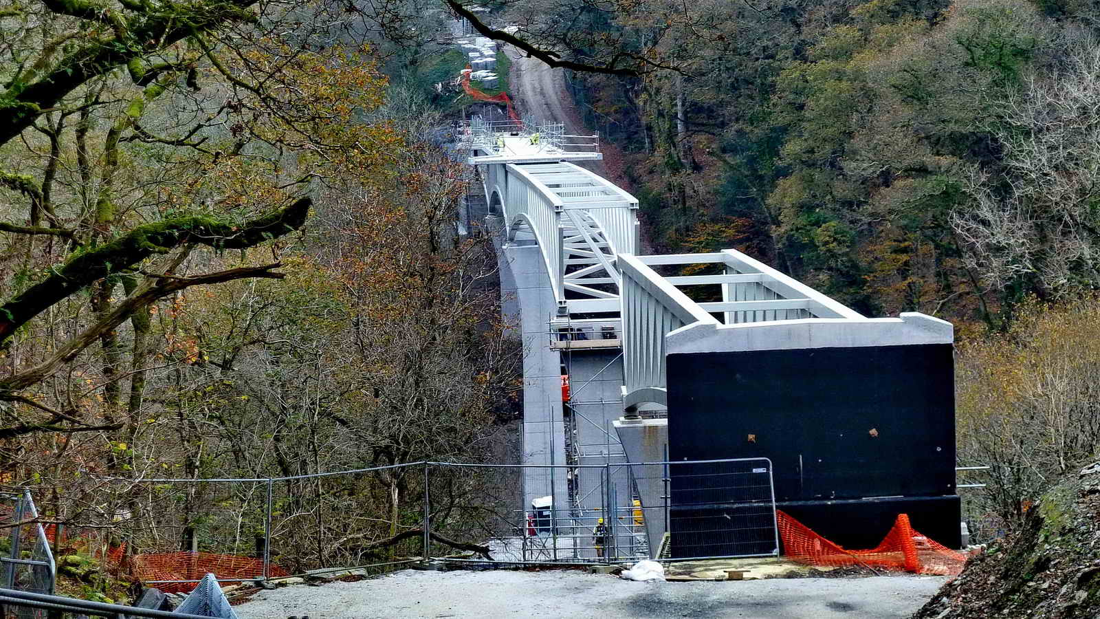
Nov. 2011 - a large fabrication .....

Nov. 2011 - not fit for crossing here!
Back to today's walk .....

This photograph shows the footpath joining the track where it emerges almost onto Screw Bridge .....
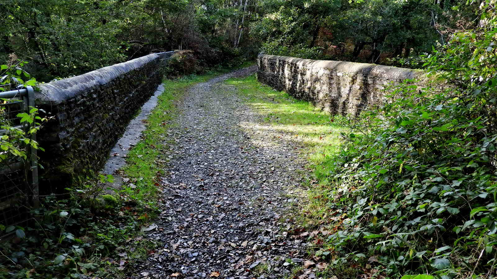
The view on emerging from the footpath and turning right - looking "up" Screw Bridge .....

Looking north and down on part of the 99-mile Route 27 Sustrans cycle track from Screw Bridge - a corruption of "skew" because it is neither straight across the old railway nor is it level? The name corrupted from "Skew Bridge", where a bridge runs obliquely across an obstacle? In this instance, it is an unusually sloped bridge. This is over the South Devon & Tavistock Railway (1859) which closed in 1962.

Looking down the sloping bridge ..... the footpath from the track below is hidden in the vegetation on the far left side.
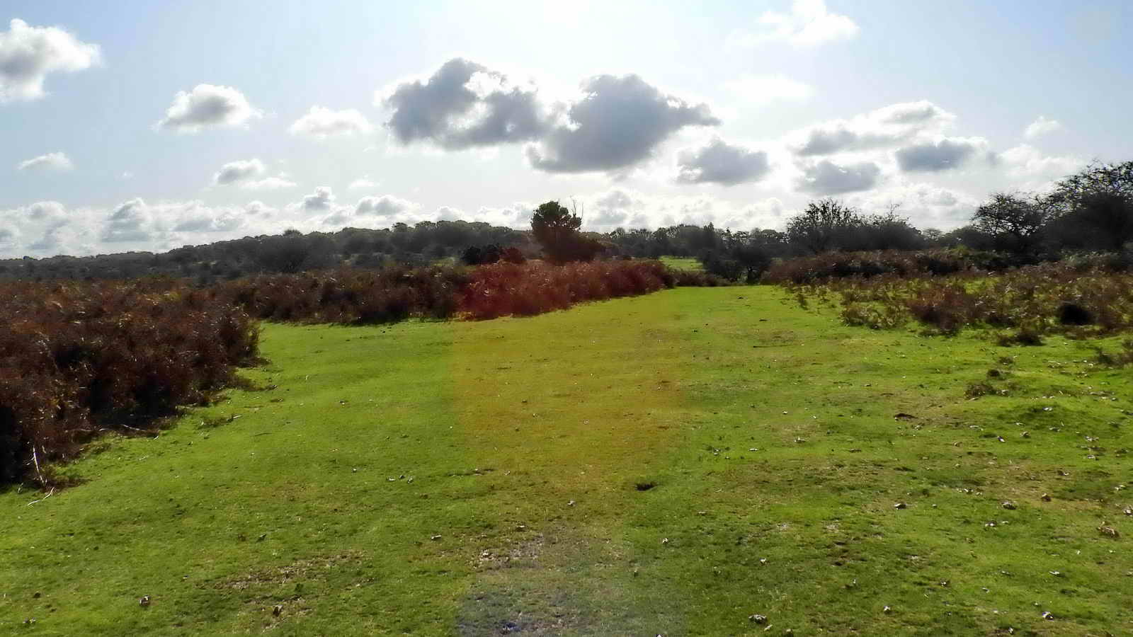
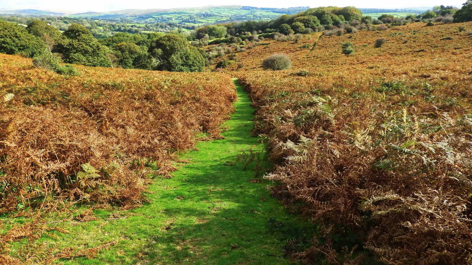
The view ahead after crossing Screw Bridge, leading up onto North Roborough (aka Buckland) Down.

Beside the track up to the Down, at SX 49549 70239, are the locally famous "Three Witches" group of entwined trees, long dead. A lady dog-walker told me you have to cross your fingers as you pass by them!

Gem Cottage seen from SX 49629 70113 on a bearing of 345� 700 metres (765 yards) distant. Seen in more detail on the walk dated 24 May 2012.
Devon & Dartmoor HER - MDV7380 -
Counting House in the Parish of Whitchurch
"SX 494 708 - Gem Cottage was the former count house, where ore was
weighed in the presence of the bailiff, who took due of one shilling for
every ton of ore, he saw weighed from West Sortridge mine".
| Tavistock Times Gazette, Weds. 27 January 2010. Angela Rippon: "For many years I lived at Gem Cottage, Grenofen. The house was, I understand, the former mine captain�s house for Gem Mine, remnants of which can still be found along the banks of the River Walkham, so naming this new bridge Gem Bridge is wholly appropriate." |

Approaching the oak tree and bench at SX 49940 69911 ..... this bears some memorial plaques, as told to me by a lady walking her dog .....
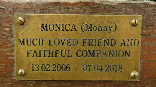 |
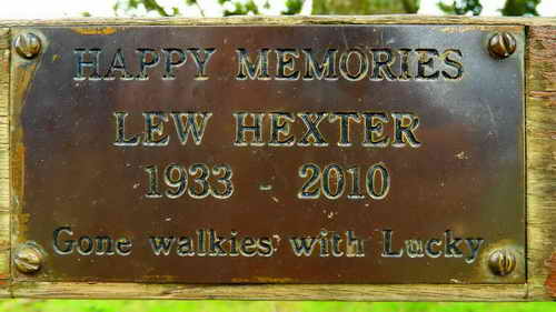 |
 |
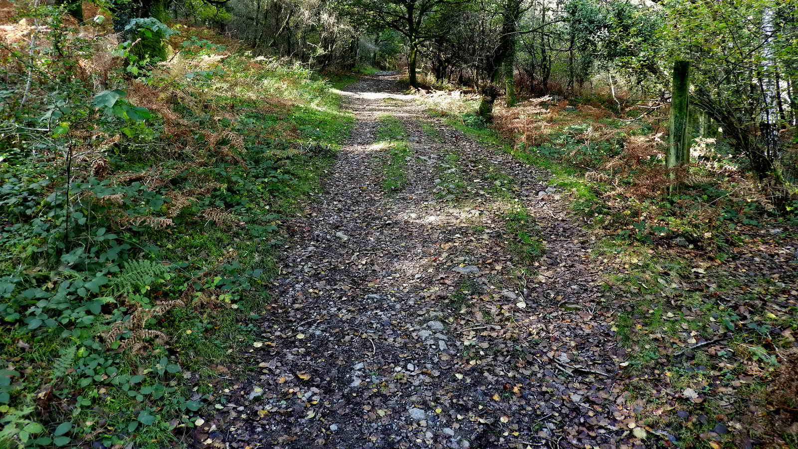
The track ahead, very wide .....
As previous photograph .....

Turning in down to the left .....

Straight down the middle now, for a while .....
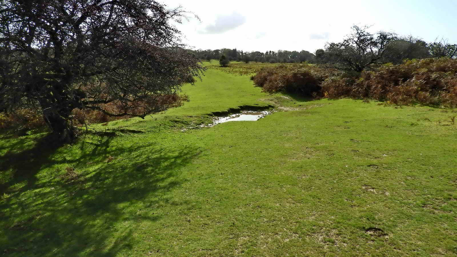
Looking down the "valley", where we turn left, down in the dip, finding ourselves above Magpie Viaduct.
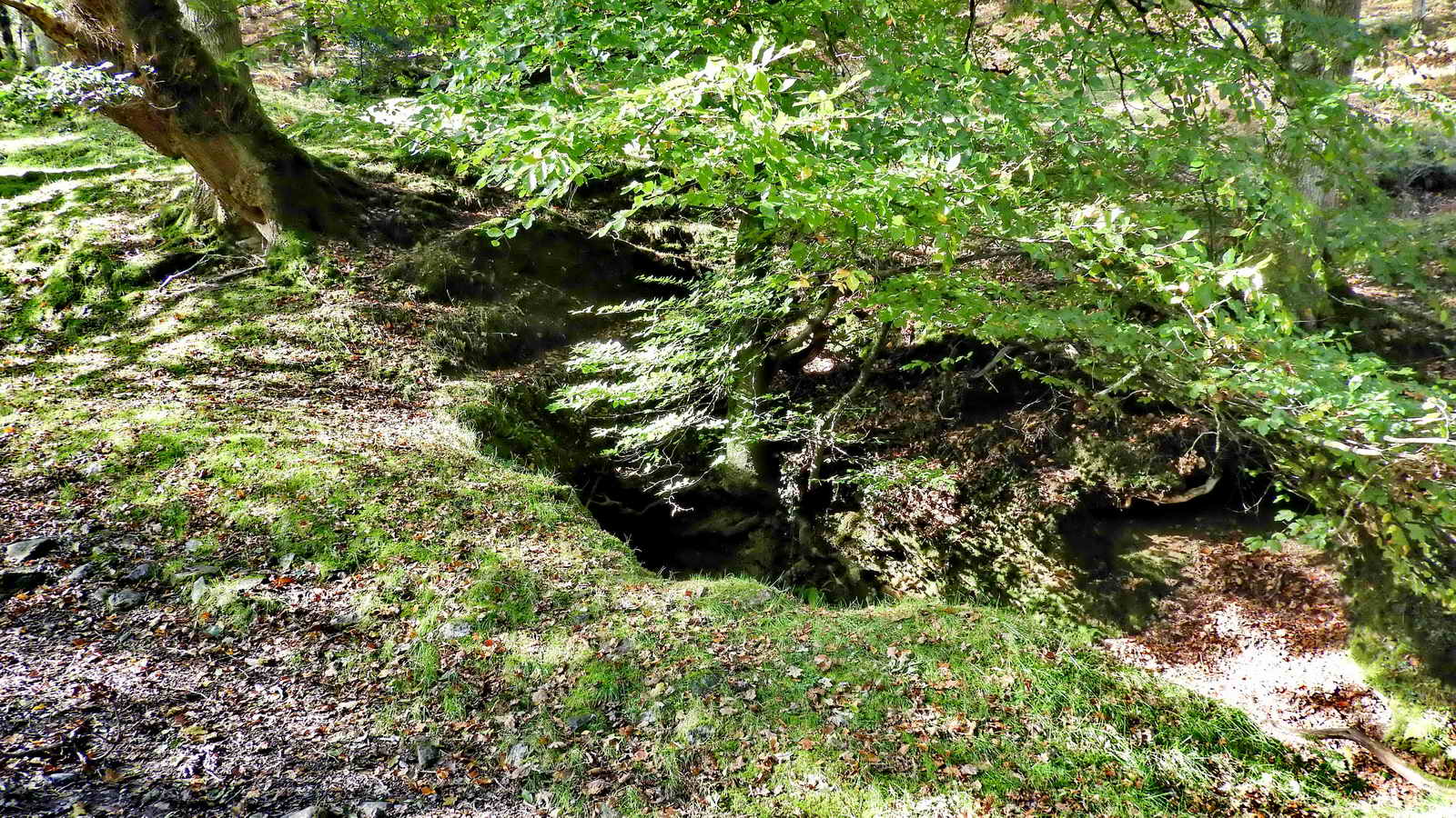
The black hole area in the middle of this photograph is the cutting into a good example of an adit. It is draining a lot of water down to a stream that goes under the viaduct .....

Another view into the adit .....

Walking up the stream, almost into the adit.

Another view approaching the viaduct ..... taken from where the adit stream joins the other one from higher up the vally ..... three piers of the viaduct are visible in the photograph .....
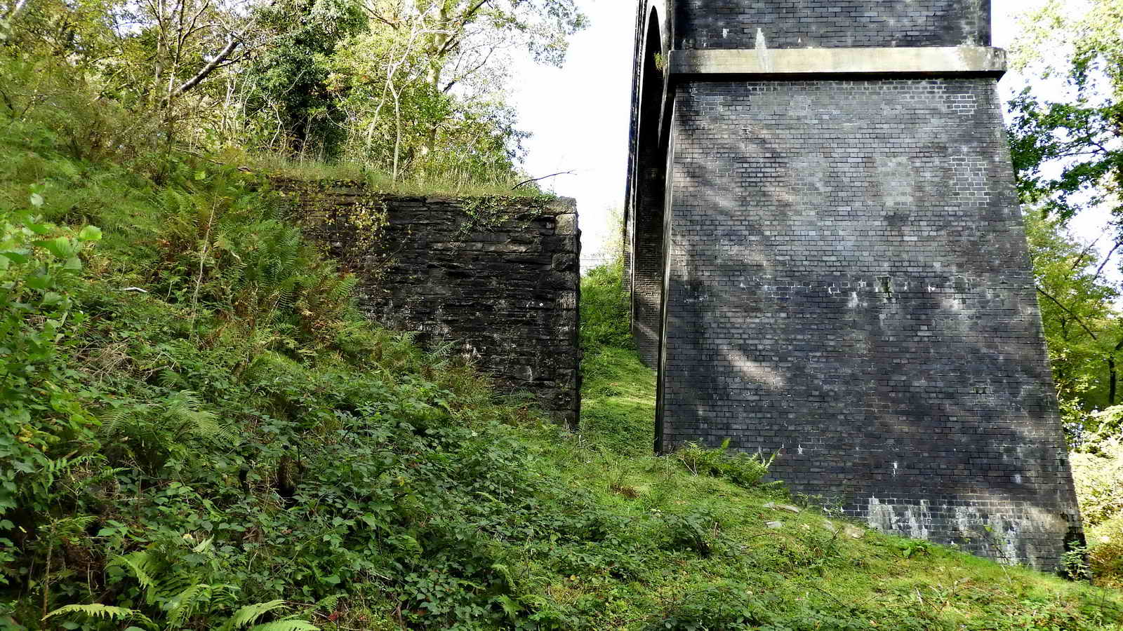
One of the old Brunel piers (left) that supported the 1859 railway and part of the replacement Magpie Viaduct, built in Staffordshire blue brick in 1902 ..... when all the viaducts were rebuilt .....

Staffordshire blue brick up close: the bricks were made in the Black Country using a local red clay, Etruria marl, which when fired at a high temperature in a low-oxygen reducing atmosphere takes on a deep blue colour and attains a very hard, impervious surface with high crushing strength and low water absorption.

Almost back down to the car park, at its narrowest (above the centre of the photograph), you can step across this stream.
MAP: Red = GPS satellite track of the walk.
 � Crown copyright 2016 Ordnance
Survey
Licence number 100047373
� Crown copyright 2016 Ordnance
Survey
Licence number 100047373
Also, Copyright � 2005, Memory-Map Europe, with permission.
The car park is marked by the the P symbol and the yellow cross on the map at the bottom of the hill, on the LEFT, after going through Horrabridge, before crossing the bridge over the River Walkham. Coming from Tavistock, the car park is on the RIGHT, immediately after crossing the bridge over the River Walkham. A long white house is immediately opposite the entrance to the car park.
Statistics
Distance - 4.85 km / 3.01 miles.
All photographs on this web site are copyright
© Keith Ryan.
All rights reserved - please
email for permissions