![]()


This walk: 2018-4-21. Disused track of the Omen Beam Peat Tramway / Naphtha Railway, The Touch Stone, Blacka Brook, clapper bridges, dry-stone walling, iron tramway rails, Prison Leat, Fice's Well.
Walk details below - Information about the route etc.
Previous walks in this area: This page should be looked at in conjunction with 2018-2 Naphtha Tramway, covering the section from the prison to the B3357 near Rundlestone. Also see: 30th March 2011..
Google Satellite map + GPS track of the walk
Further reading: Eric Hemery (1983), Walking the Dartmoor Railroads, David & Charles, Newton Abbot, pages 39-46.
The aim of this walk was to see another part of the old horse-drawn Omen Beam Tramway, also known as the Naphtha Peat Railway, that operated from 1846. It ran from a site inside today's prison, north-west onto the moor to a terminus midway between Great Mis Tor and Holming Beam. There were exensive peat ties extending towards Greena Ball (which was known as Yearlick Ball) and Black Dunghill. A side branch ran to Holming Beam - then known as Omen Beam. This was a period when the original prison was closed after it had been built (1806-1809) to house French prisoners from the Napoleonic War (1803-1814) and, later, American POWs from the War of 1812.
Naphtha? This is a volatile product that was obtained by heating peat in a distillation process where volatile vapours are driven off, collected and condensed into liquids again. Peat contains about 65% volatile matter - see Legendary Dartmoor - Peat. The British Patent Naphtha Company was founded in 1844 and rented the old prison space in 1846 when they built the gas plant, converting the old infirmary into a gas house i.e. gas works (Devon & Dartmoor HER - MDV 114496) and tramroad. The company operated for perhaps ten years, when a gas works opened in 1875 in Princetown that supplied the prison as well as the town. Naphtha was used as a gas for lighting and as a flammable solvent similar to heptane and lighter fluid. Candles and mothballs were also produced from naphtha. Source: Helen Harris (1968 & 1986), Industrial Archaeology of Dartmoor, David & Charles, Newton Abbor, p. 106. The solvent is still used today e.g. for cleaning electric guitars!
Snippets from 1806 newspapers and gazettes.

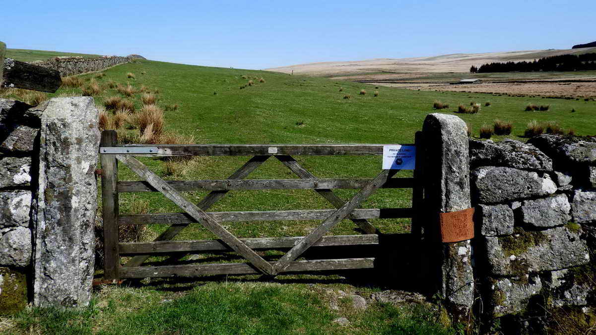
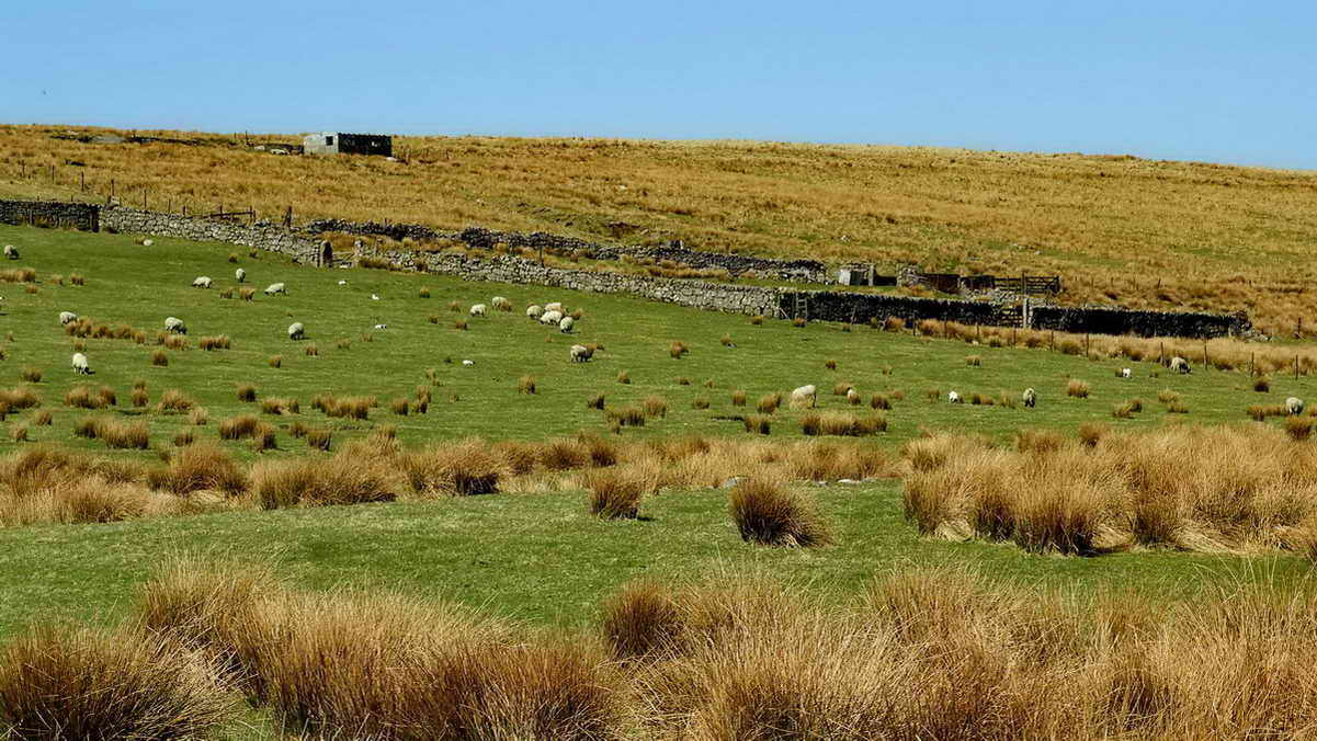
The gate on the B3357, at SX 57847 74983, near Rundlestone, looking back along the disused track of the Omen Beam Peat Tramway towards the prison.
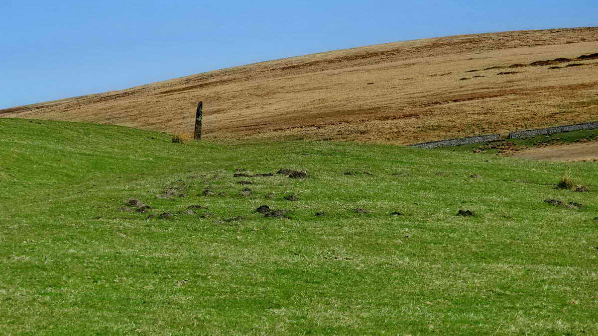
The gate across the road, looking along the disused tramway out onto the open moor - The Touchstone can be seen approximately im the midline of the photograph, where the greeb grass meets the old yellow grass of the far hill .....
A closer view of The Touchstone .....
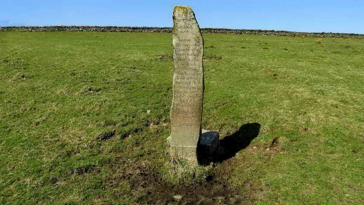
The Touchstone, SX 57847 75101,
Click the
image to see a larger version.
THE
TOUCHSTONE
millennium
menhir
Inspiring
This stone touching
Open moor and sky
Granite landmark
Raised to stand
For all times
As one time
Now then and ever
In love and beauty
Our story is a book
Always open
At the centre
Half of experiences
Half of
Un-named (hopes)
JOHN POWLS
poet
AD 2000
John Powls was a governor of HM Prison Dartmoor and the stone came from the prison quarry, Herne Hole. It was set up during the summer solstice, 1999. Source: Dartmoor News, 160, p.23. I do not know why the poem ends as it does on the stone.

View from the Touch Stone roughly north-east to a field building on the prison farm ..... with Long Plantation and Holming (formerly Omen) Beam behind .....

Zoomed view. It is possible to see the old peat ties where peat was dug for transport by the Omen Beam Tramroad back to the site of the prison where the old naphtha works was established to distiil the peat to produce liquid naphtha solvent and flammable gas for lighting.

For the story of the Touch Stone, see Legendary Dartmoor - Touch Stone. NB - This is a low-angle photograph.

Gate 2.

Looking back at Gate 2 after turning right through the gateway, looking for signs of the old horse-drawn tramway: at this point there are some kerbstones visible, near the wall.

On continuing down from Gate 2 (this is off the permitted path), the track was somewhat flooded .....

A clearly blocked gateway, with the track beyond running up to Holming (Omen) Beam. This point is an area of gateways, flooded, so, turning left .....

White Gate in the distance, with a large, double-span clapper bridge over the Blacka brook .....

Zoomed view back to the track up to Holming Beam .....

Back to the present bridge, looking towards Holming Beam .....
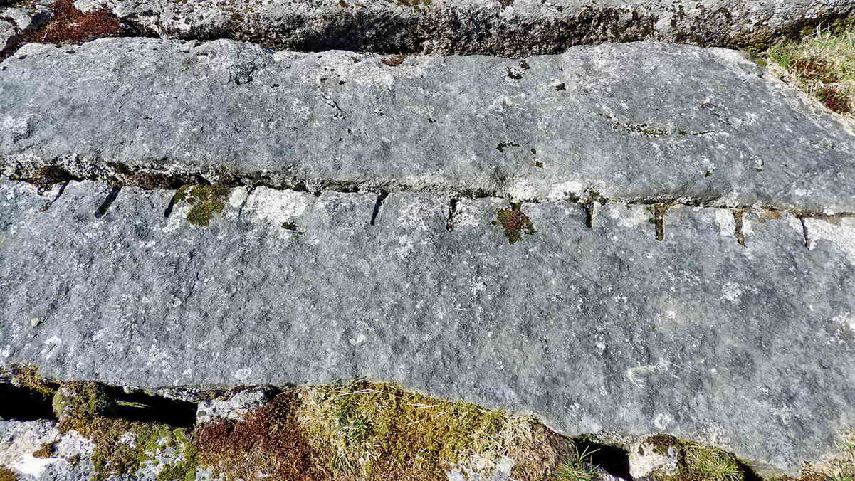
Feather and tare marks in the clapper imposts .....

Another view east .....

Looking north-west towards Fice's Well and other features .....
The enclosure between Gates 4 & 5 where tramway horses would have been housed, complete with stables and linhay (now all ruined) .....

Impressive dry-stone walling near White Gate .....

Fice's Well (lower left), the old tramroad enclosure, and the ruined Prison Leat building (top right) .....

Zoomed view to Fice's Well.

White Gate, SX 57837 75946.
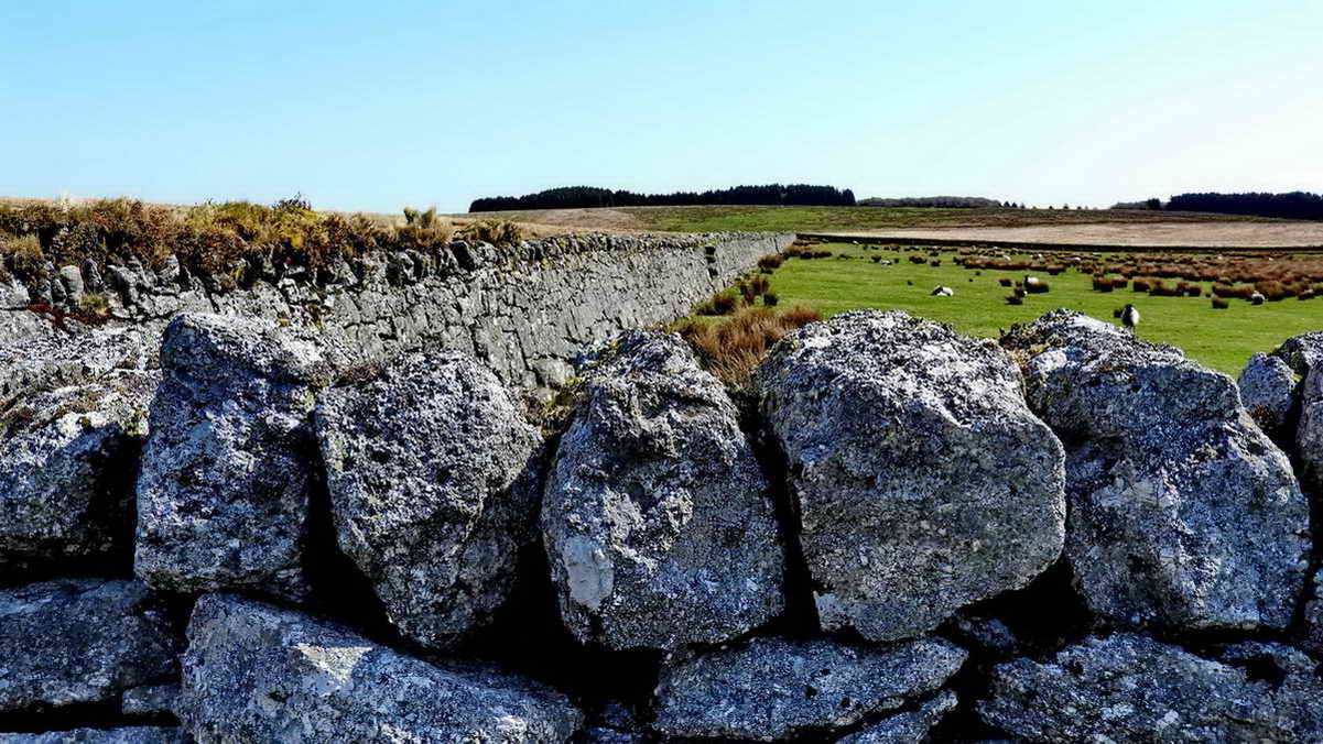
Walling beside White Gate .....

A step stile? The first step is very high.
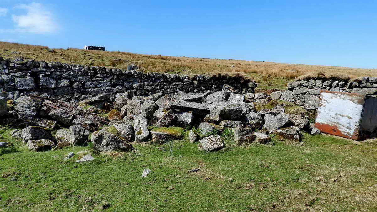
The corner of the enclosure where there are ruins sufficient to suggest this was the stables ..... two remnants of tramway iron rails can be seen near the left edge .....
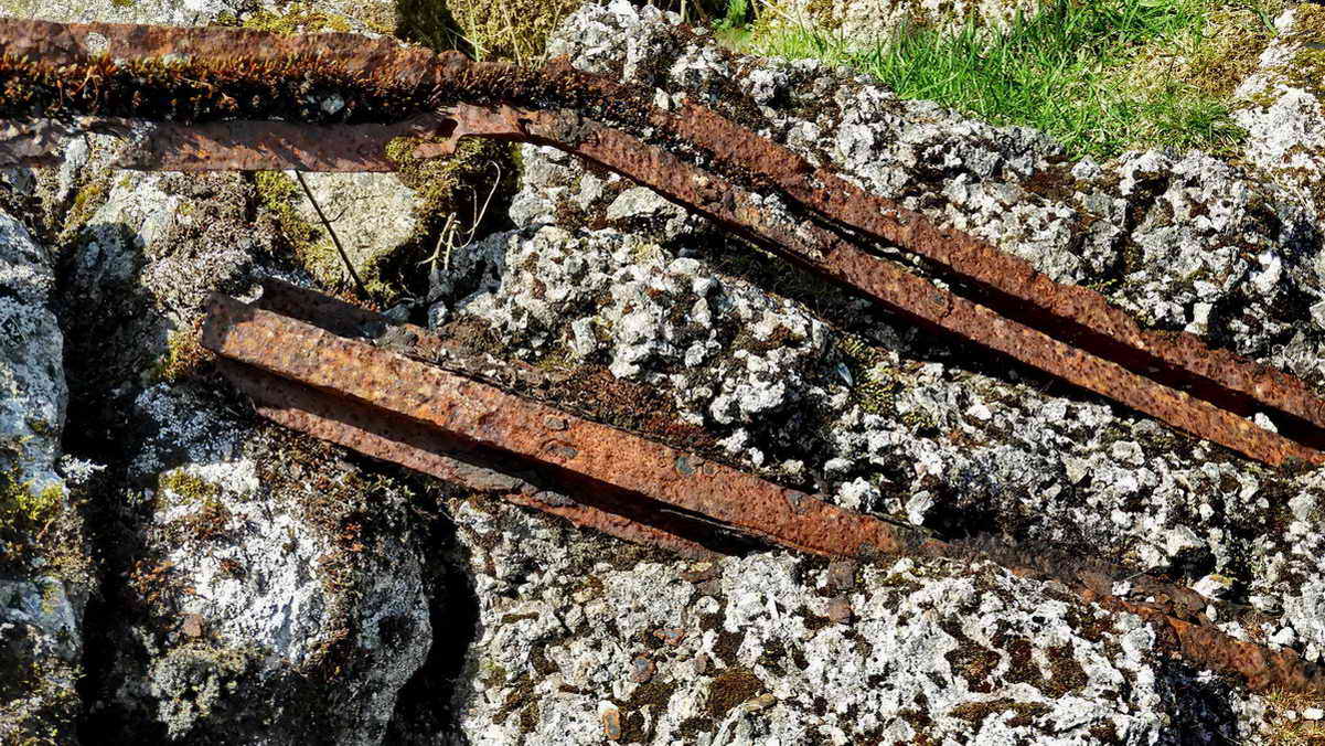
Closer view of the tramway rails - the lower one is the right way up while the upper on is upside down.

View across the enclosure looking south-east, vaguely towards Princetown.
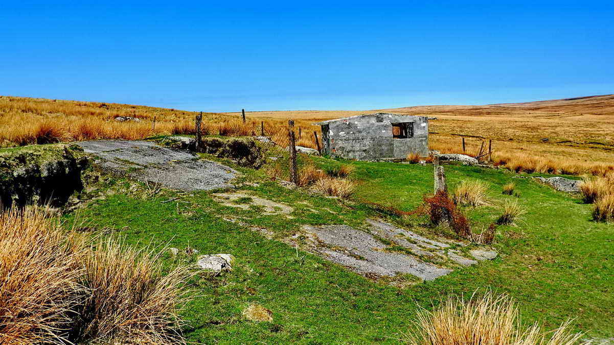
A concrete ramp leading up to a wide bridge over the Prison Leat, with a building used formerly for maintenance and storage of tools etc. There is also a disused WC inside, so it may surmised that prison life was fairly civilised ..... the Prison Leat was taken off the river near Walkham Head, at SX 57480 79506 and rab for 6.5 km (4 miles) to the prison. .
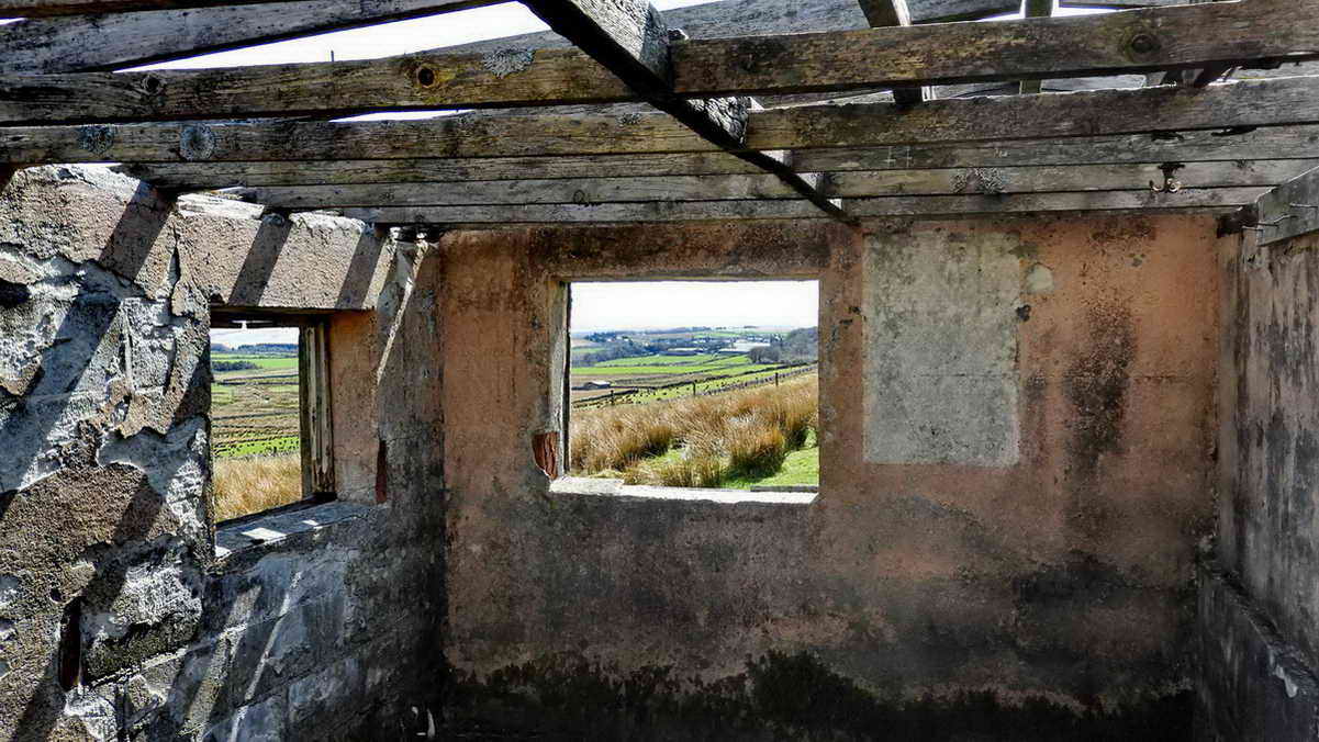
Looking from the hut towards the prison.

Decoration on the end wall.

Steps up to the leat.

Looking over the hut to Holming (Omen) Beam and Beardown Tors .....

Zoomed view: the dark area of the slope was used for peat ties where peat was cut, they showed up recently with a dusting of snow on the ground .....

View from the slope of Great Mis Tor on 25th March 2018, showing the old naphtha works peat ties. The tors, from the left, are (I believe) Lydford, Higher White and Beardown (right edge).

Another scene.

Looking down, along the path of any overflow or run-off from the sluice on the Prison Leat .....

The Prison Leat is a section where stone lining is still in place. About 245 metres (270 yards) south of the clapper bridge, there is a small cross at SX 57580 75623, to commemorate Mr Cyril Sinclair, a leatman, who died here after being struck by lightning in a violent thunderstorm on 6th July 1983. The cross was made by a colleague, Mr Ron Joy. Sources: Sinclair Memorial Cross and FH (Harry) Starkey (1987) Dartmoor's Crosses and Some Ancient Tracks, Revised Edition. Prison Enclosures, Princetown, page 158.

Looking upslope at the sluics, the drainage channel is to the right in this photograph .....

Another view from further down this very "bumpy" slope, it appears well-worled, like tinners' workings, but it was probably a source of stones and the pits are simply stone pits.

Looking downhill again, towards Fice's Well and Long Plantation on Holming (Omen) Beam.

Gate 4 in the sequence from the road, Gate 5 being behind .....
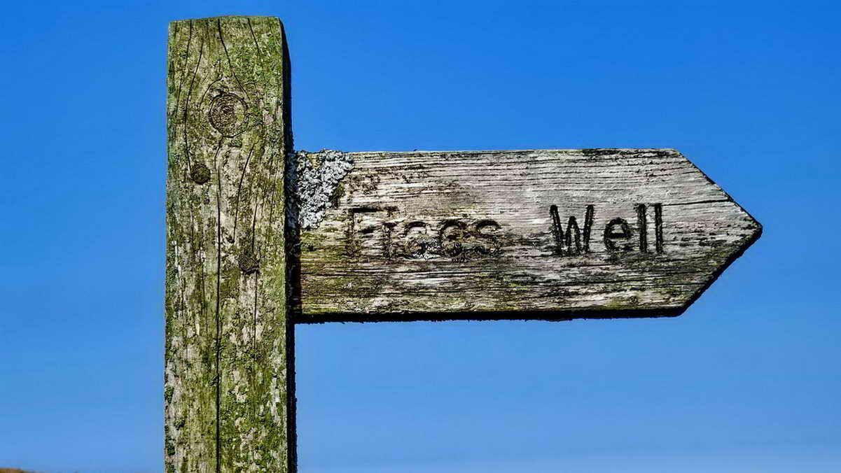
Self-explanatory signpost .....

Approaching Fice's Well, still marvelling at the high quality dry-stone walling in the area .....

Inside the circular wall around Fice's Well .....

"IF 1568" - the letters signify John Fice, in the year 1568 - this is believed to be the oldest dated stone on Dartmoor. In that time, the name John was written as Iohn. The story that is told is that the well was built as a mark of gratitude by John Fitz who was lost on the moor after being pixy-led with his lady and his sense returning only after drinking from a spring at this spot. This would have been an arrea of absolute isolation in 1568 because there would have been no walls or buildings in this part of the moor - Princetown did not exist then. This is a similar story to that told about Fitz's Well near Okehampton Camp.

Last photograph.
MAP: Red = GPS satellite track of the walk.

� Crown copyright 2016 Ordnance
Survey
Licence number 100047373
This walk was reached by parking on the verge at SX 57850 75001. This can be rerached by driving past the prison from Princetown, turning right at the tee junction at Rundlestone and parking just uphill of the second gaye on the left. There is a corresponding gate across the road. The Touch Stone can be seen from the gateway.
Statistics
Distance - 3.56 km / 2.21 miles
All photographs on this web site are copyright
© Keith Ryan.
All rights reserved - please
email for permissions