![]()


This walk: 2017-9-25. Grenofen Bridge, gate piers, gate hanger, River Walkham, leat, quarry entrance, retaining wall, sett maker's banker, elvan, slate, unknown rock, dikes, ruined building, Westdown Mine chimney and building, waterfall, tin stream-works, ore processing complex, chute, flue and square base, (flue tower), West Down.
Walk details below - Information about the route etc.
Previous walks in this area: 10th June 2009, 11th September 2013, 29th October 2014 and 18th March 2015
Google Satellite map + GPS track of the walk
Further reading
Paul Rendell (1996),
Exploring The Lower Walkham Valley, Forest Publishing, Newton Abbot, page
12.
Old maps
Ordnance Survey 25-inch sheet - Lower Grenofen, 1884
- Grenofen, Grenofen Bridge, quarry.
Next
sheet south, 1884 - Westdown Mine chimney and building, ore processing
complex.
Ordnance Survey 25-inch map,
1890s-1920s, seamless, zoomable

Looking at Grenofen Bridge from the car park, which is surrounded by remains of an old quarry and the Walkham & Poldice Mine / Walkham United Mine. This can be seen on this old map but we are not looking at this today.

Invasive, introduced, annual wild flower - Himalayan Balsam, Impatiens glandulifera, in the car park. If it is not removed before it sets seed, it will eventually invade the whole valley, spreading by explosive seed dispersal (flying up to 4-metres) and by seeds floating in water: this means it can spread up river as well as down .....

A few of the flowers, including a white variant .....

Side view of a flower .....

Front view of flowers, including a busy bee collecting nectar.

View of Grenofen Bridge from the up-river side.

Looking back at Grenofen Bridge after crossing it, the two piers on either side of the road (near the camera) are gateposts, the road was once gated .....

Iron gate hanger in the right-hand pier in the photograph above.
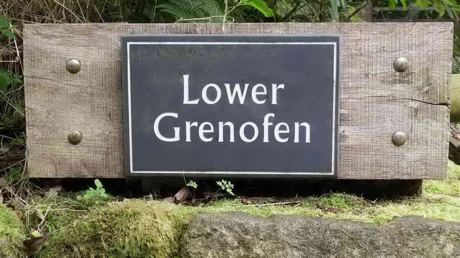
A property nameplate, I always seem to take this photograph on walks to this area.
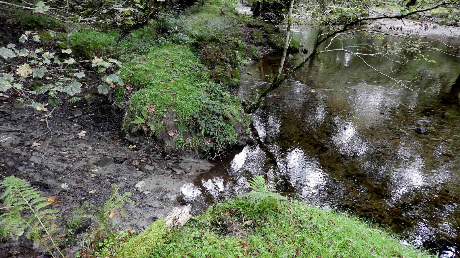
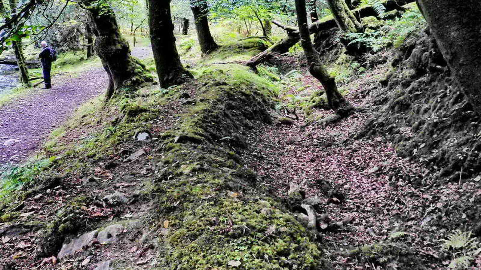
A breach in the river bank, at SX 48799 70893, where a leat was taken off from the river. This becomes a major item that is not shown on maps but was very important further down the valley where there is an extensive area of tin-streaming as well as tin mine operations. .
Almost first view of the River Walkham, note the leat running across the foreground. A little further down the river, the large leat appears on the other side of the track and is still not shown on maps.
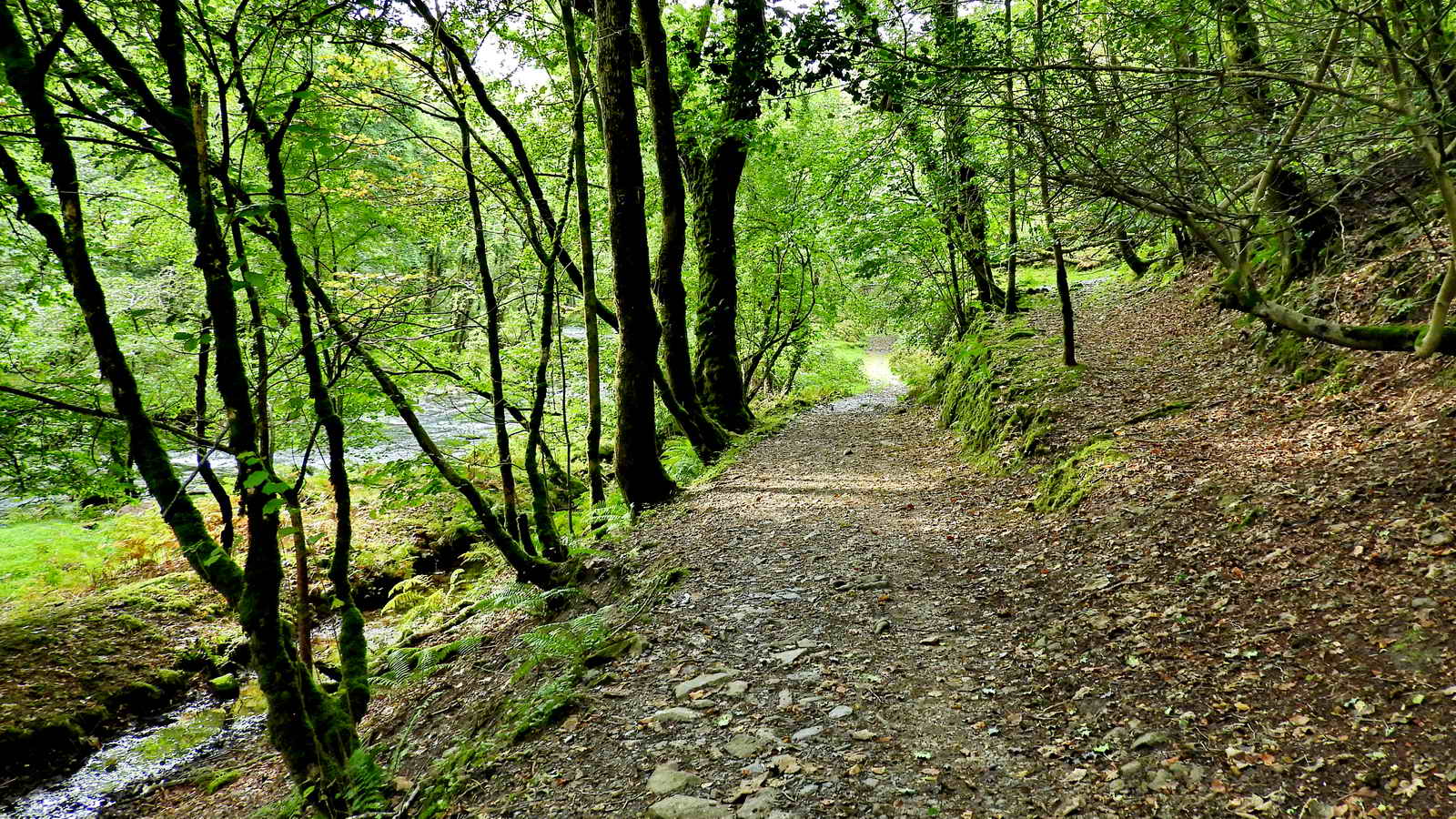
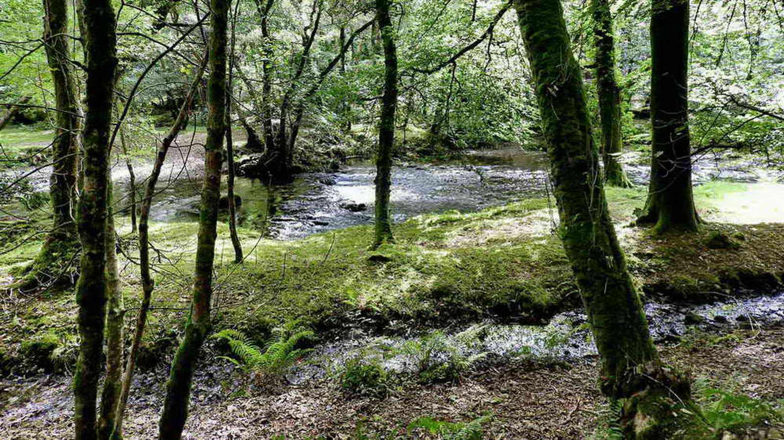
From the left: the River Walkham (behind the trees), the beginnings of a leat (bottom left, the narrow waterway), the main track (centre), and, right, the ascending path into a quarry. In the distance, there is a high retaining wall along past the quarry (see photo further below).

Disused quarry at SX 48750 70783, on the right of the track.
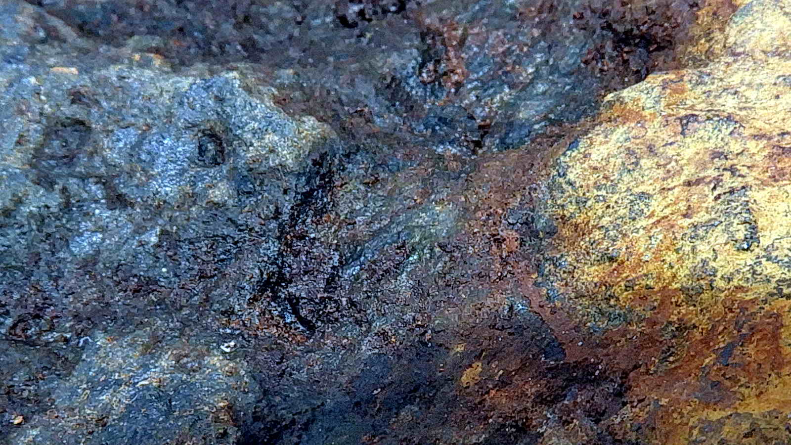
According to the British Geological Survey's Geology of Britain Viewer, the bedrock in this region is the Tavy Slate Formation, which was formed 359-385 million years ago in the Devonian Period. It would have formed on the ocean floor in open seas away from land and are often composed of the remains of microscopic pelagic (i.e. open water) organisms i.e. pelagic sediment. Slate is a metamorphic rock, meaning it has been altered by pressure or extreme heat, such as when the molten granite came up from deep in the earth to form the Dartmoor massif.
However, there are dikes in the area. These are usually small intruded bodies of rock that form as a magma (molten rock) and are forced into fractures that are already present in the local rock, where they (the dikes) cool and crystallise. The intruded rock here, in the quarry, is either a felsite (if very fine grained) or a quartz porphry if many quartz crystals (named "phenocrysts") are present - photos below show it is a quartz porphyry. "Elvan" is another name for these rocks is used by quarrymen and miners; the rock is related to granite.
There are several narrow east-west dikes running across the River Walkham in this area. As it is a harder rock, it protrudes from the river bed forming, in effect, low ridges across the shallow river causing small areas of "white water" and low waterfalls.

Another aspect of the old quarry face, note the extremely flat surface on the left that looks as if it was cut using a cheese-wire.

One of three set makers' bankers: these are known to have been used for making "setts" or cobble stones in road-making. Note the stone chippings still remaining. These were in use from about 1870 on the flanks of the Staple Tors until Tor, later called Merrivale, Quarry was opened in 1876: see the 25th July walk.
Rocks found in this quarry

|
 |

|
Elvan - a chipping from the sett maker's banker. This type is a quartz porphyry, where the quartz crystals are arranged in a "porphyritic texture". Scale: in millimetres. |
Slate - showing horizontal bedding planes. This particular rock is soft and easily scratched, unlike a hard metamorphosed rock (changed by heat or pressure) in which case they would be horizontal cleavage planes. Might be bedrock or fallen off a building structure or a wall. Found on the ground. | Unidentified heavy rock - probably igneous or possibly metamorphic. Probably forming the back wall of the quarry. Brown colouring could be from weathering, possibly of feldspars. The weight suggests iron, with the colouring being limonite i.e. "rust". |
Acknowledgement: I am grateful to John and Elaine Viant for their guidance on the geology above.

Another view of the banker, with the river down below. The other two bankers are just to the right of this one but they are now well-hidden under moss and debris, one can be seen as a green hump. .
|
The composition of granite gives it a distinctive appearance. The proportion of the minerals that make up the granite varies from location to location. The main constituents of granite are feldspar, quartz, biotite and muscovite. Also commonly found are pieces of other rock that fell into the granite before it cooled. These are xenoliths. |
|
Feldspar (Orthoclase, colourless) |
KAlSi3O8 |
Good examples of these crystals can seen in some granites. They can be the largest crystals by far. |
|
Quartz (white crystals) |
SiO2 |
A very common mineral, the main constituent of granite. |
|
Biotite (dark mica) |
K(Mg,Fe)3AlSi3O 10(OH,F)2 |
A black to brown mica, found in nearly all granites. |
|
Muscovite (light mica) |
KAl2(AlSi3O10)(OH,F) 2 |
A lighter coloured mica found in granite. |
Wikipedia: Feldspar (an Orthoclase, generally colourless), Quartz (generally white crystals), Biotite (dark mica), Muscovite (common, lighter mica).
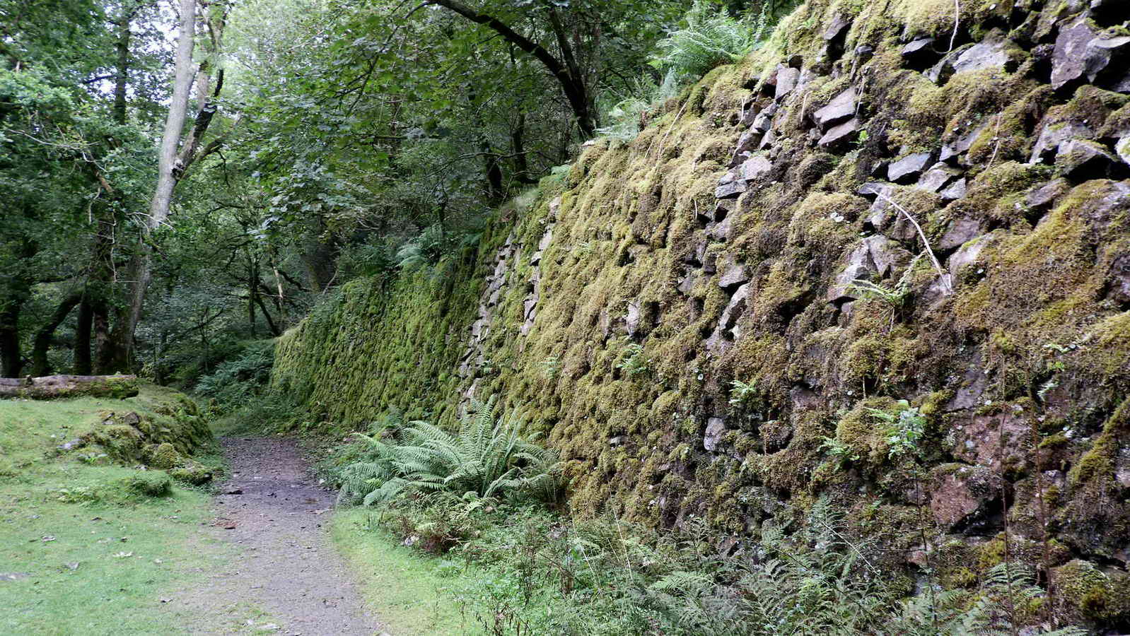
The high retaining wall, or revetment, running past the quarry, which is up on the right. The leat seen in photos above (to the left of the track) disappears in this area and appears on the right side of the track just at the end of this wall. The leat runs beside the extensive tin-streaming area further down the valley and terminates at Buckator - a long way down the valley. It was possibly used in tin-streaming and perhaps also by the Westdown Mine and the ore-processing complex, both further down the valley and most likely to drive a 30-foot water-wheel near Buckator (Source: Stephen Holley, Dartmoor Tinworking Research Group,
pers. comm.). As the mine closed in 1857 (details below), it can be surmised that the wall was built and the quarry started operating after this date. The sett makers' bankers at the Staple tors were operating from about 1870 until the quarry at Merrivale opened as Tor Quarry in 1876, where setts were made in sheds.

Looking back along the River Walkham. The small "waterfall" is caused by one of the dikes of elvan (a harder rock) running across the river - about four dikes can be seen in the background (on the large, 9 MB file of this image).
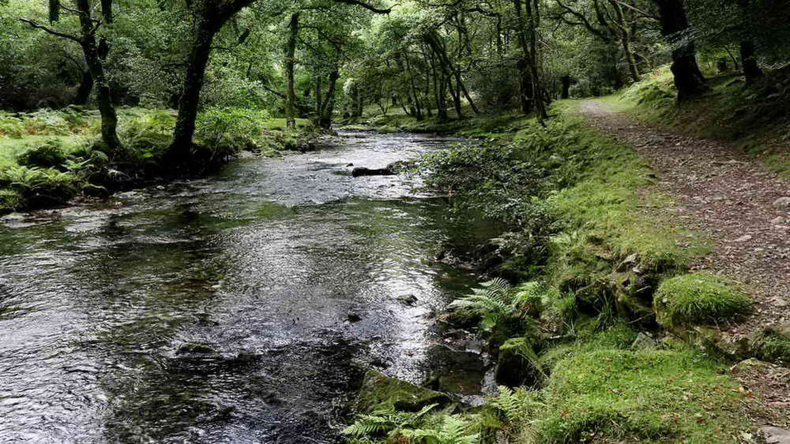
Looking down the river, right beside the track.
The leat (mentioned earlier, as being on the other side of the track) here on the right side of the track, with a glimpse of the river at top left. The leat runs down-river to the tin-streaming area, terminating at Buckator.

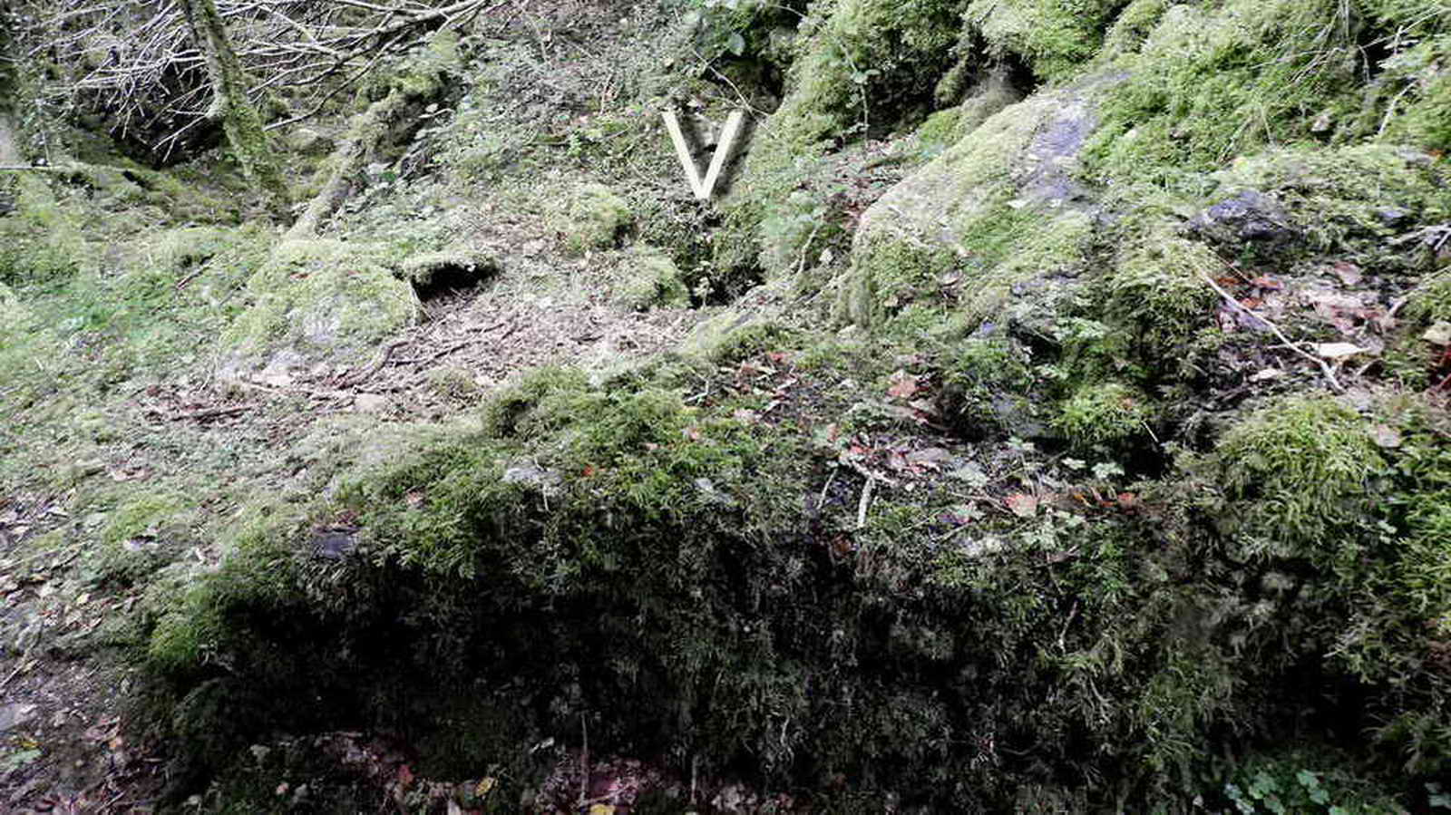
A long-abandoned building at SX 48765 70708, about 75 metres further on from the quarry and a long way before reaching the mine chimney further down the valley. It is across the leat from the track and is not easy to access, although there is an easy path starting at SX 48788 70711, a few metres before you are level with the building ..... looking at the 1884 25-inch Ordnance Survey map, see HERE.
|
MDV63694 BUILDING in the Parish of Whitchurch |
Greeves, T. A. P., Untitled Source (Worksheet). SDV69961. Possible building 4m x 4m with two possible entrances on a stony mound which may be c19 + associated with upstream quarrying activity (Greeves). Information from the Devon & Dartmoor Historic Environment Record |

Base for anchoring some sort of machinery, with four iron studs still in situ.

An external view of the building; the leat and track are down to the right.

View of the building from the track, with the leat in the foreground.

Chimney of the disused Westdown Mine at SX 48791 70540. The old maps indicate that this was a copper mine, but there seems to be evidence that further along the track, at a building complex, tin was handled. In the centre of the photograph is an associated building that is shown on the 25-inch 1884 Ordnance Survey map. There is a large spoil heap on the map, to the right of this photograph. Nearby, between the spoil heap and the leat is a filled-in shaft, presumably using material from the spoil heap. With all the tree growth etc, it is hardly photogenic. A question arises as to the purpose of the chimney, if a steam engine was housed in the ruined building A photograph below shows the interior; it is not smoke blackened,, at least not now?
Devon & Dartmoor Historic Environment Record
MDV79944 - Chimney at Westdown Mine, Whitchurch
Newman, P., 2011, Mining in the Tavy Valley, West Devon. An Assessment of Archaeological Potential, 44-45(Report - Assessment). SDV347105.
Surviving remains at Westdown Mine include a chimney base and associated buildings and other features
Information from the Devon & Dartmoor Historic Environment Record
The mine was set up by the West Downs Consolidated Mining Company in 1847, to work a 2 x 1 mile sett, with a shaft that suffered from water seepage. In 1850, a new shaft was dug down to 20 fathoms (120 feet). This shaft also suffered from water and a small steam engine was installed in the building. It is recorded that a burning house was damaged when equipment was removed in compensation for unpaid mineral dues in 1850. The venture failed and closed down by early-1852. Source: Stephen Holley, Dartmoor Tinworking Research Group Newsletter No. 52, May 2017, page 8.

A view of the chimney base and associated ruined building, beyond which is the heap.

Zoomed view of the top of the chimney, carrying a fern, Common Polypody.

The base of the chimney has two narrow openings, opposite each other - the photograph is a view right through the chimney to the engine house ....

Looking up the inside of the chimney - what is the colouration?

Another view, showing one of the openings in the base of the chimney, the building behind, and the heap behind that. The two openings are roughly in line with the building that housed the steam engine? The track is on the right.
Devon & Dartmoor Historic Environment Record
MDV4082 - Westdown Copper Mine, Whitchurch
Newman, P., 2011, Mining in the Tavy Valley, West Devon. An Assessment of Archaeological Potential, 44-45(Report - Assessment). SDV347105.
West Downs Consolidated Mining Company started work at the site in 1847 although there is evidence of earlier trial pits in the area. The sett was re-launched at Sortridge and Bedford Mine from November 1854. A stamping mill, dressing floor, account house, smithy and burning house or calciner were said to be in existence. The mine closed in 1857. The Ordnance Survey 25th inch map of 1884 shows a large spoil heap on the south-west slopes of the Down and a roofless building and adjacent chimney. The dressing floors and the site of the burning house are to the south. The mining remains are spread along the southern slopes of West Down and include ruined buildings and a spoil heap. Other details: No. 21.
| MDV63813 | Parent of: ADIT in the Parish of Buckland Monachorum (Monument) |
| MDV79944 | Parent of: Chimney at Westdown Mine, Whitchurch (Monument) |
| MDV79966 | Part of: Shaft and Spoil Heap on West Down, Whitchurch (Monument) |
| MDV63694 | Related to: BUILDING in the Parish of Whitchurch (Monument) |
| MDV63693 | Related to: Ore Processing Site on West Down, Whitchurch (Monument) |
| MDV79963 | Related to: Shaft and Spoil Heap on West Down, Whitchurch (Monument) |
| MDV52885 | Related to: SHAFT in the Parish of Buckland Monachorum (Monument) |
| MDV79959 | Related to: Shaft north of Buckator, Whitchurch (Monument) |
| MDV21889 | Related to: TRIAL PIT in the Parish of Buckland Monachorum, Whitchurch (Monument) |
Information from the Devon & Dartmoor Historic Environment Record
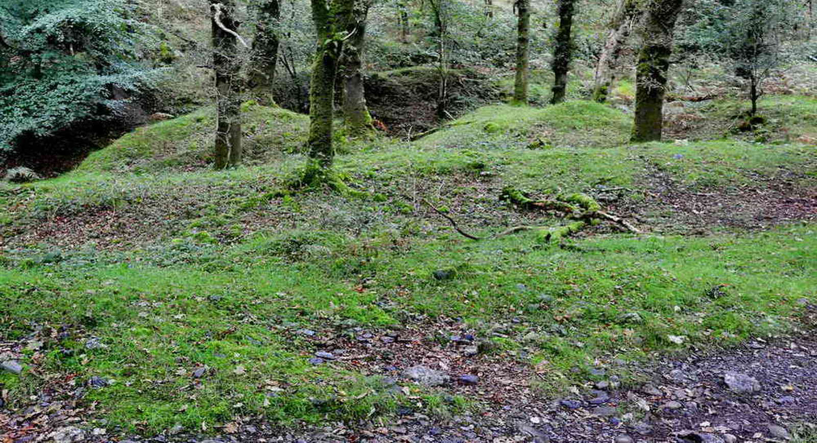
There are extensive areas of bumps in the ground that usually means tinners' activities, most probably older than the mine, sometimes medieval. These would result from tin streaming, whereby miners would bring water by leat (hence, the large leat in the area?), to wash away lighter sediments and leave tin gravel. The leat, which is back behind the area in the photograph, seems to extend down the valley to Buckator. The process is briefly mentioned as being first recorded from the 12th Century in DNPA's Dartmoor Tin Industry Factsheet. It cannot be emphasised enough how much of the valley floor alongside the river has been transformed by tin-streaming - it is an extensive area.
|
MDV63696 STREAMWORKS in the Parish of Whitchurch |
Greeves, T. A. P., Untitled Source (Worksheet). SDV69961. Parallel ridges of waste heaps from early alluvial streamwork between the track + the River Walkham (Greeves) Information from the Devon & Dartmoor Historic Environment Record
|
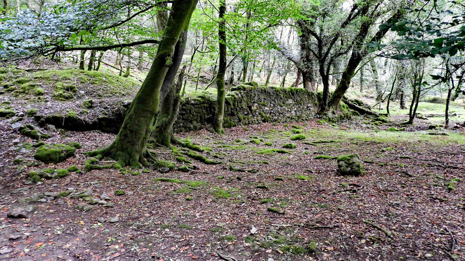
An apparent retaining wall that is seen just before reaching the ruined building of the ore-processing complex.; function unknown.

One end of the ore-processing complex. It is difficult to photograph this complex because of the trees now growing on the site .....

Reproduced with the permission of the National Library of Scotland.
Mine building complex at SX 4859 7029: the blue colour indicates the proximity of the River Walkham. Slightly rotated clockwise and over-drawn, from the 1884 25-inch Ordnance Survey map, Devon CXI.4.
Devon & Dartmoor Historic Environment Record
MDV63693 -
Ore processing site on West Down, Whitchurch
Greeves, T. A. P., 1997, Survey Weekends, 8-9 (Article in
Serial). SDV347155.
Survey undertaken in May 1997 of extensive area of tinworking in the
lower Walkham valley. Masonry remains had been assumed to be connected
with 19th century copper mining. However a spread of dark red tin slimes
suggests that this was the site of a tin dressing floor. As there are no
buddles the floor may date to pre 1850. Other buildings and a flue form
part of the complex and may have been used for roasting/burning tin ore
to remove arsenical and other impurities.
Also
Greeves, T. + Passmore, A., 1999, Report on the Recent Work in the
Walkham Valley, 3-5 (Article in Serial). SDV347156.
Building complex comprising an enclosure with a six-room building at the
east end. Two possible chutes emerge from openings in rear wall of
building. An open-fronted chamber with arched roof has a flue which can
be traced up hill to the square base of a presumed stack. The east end
of complex has a long retaining wall with a levelled terrace. The
discoloration of tin slimes suggesting tin dressing.
Information from the Devon & Dartmoor Historic Environment Record
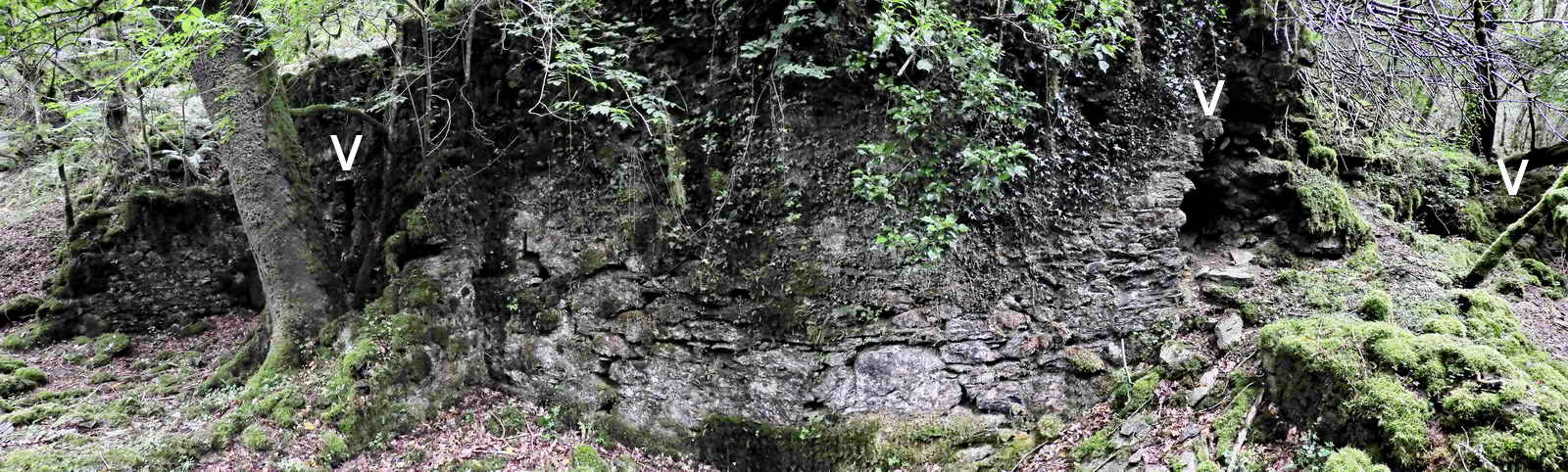
Part of the rear wall of the building showing possibly three features, indicated by the white markers: these are shown immediately below .....
 Vertical slit at the bottom of a chute at the rear of the building. |
 Another possible slit from a chute, although the ground above is high and bears trees. |
 The top of a "fireplace" with an arched "lintel" of stones: the kiln or furnace. |

Looking from up-slope, down on the building, showing the remains of the base of a square construction that was possibly once a tower to remove noxious fumes from smelting? Arsenic (poisonous) was usually a byproduct of the process. This was no doubt superseded by the tower up the slope from the building (see photographs further below of items not visited during the group walk).

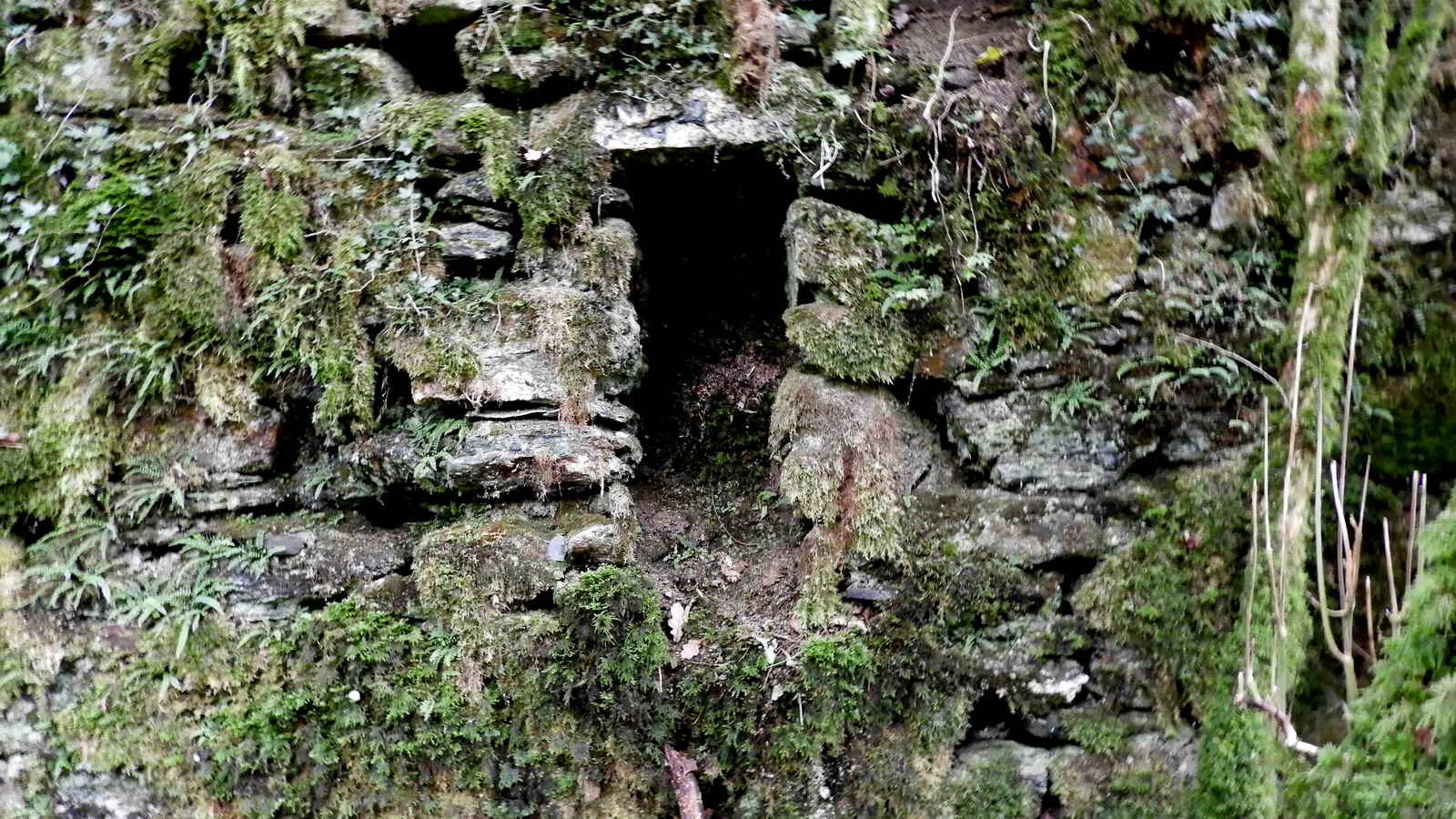
A chute (are there two?) in the rear of the building .....

One of a pair of exposed openings into a "tunnel" in the ground, part of the flue, behind the building that led up the hill to a "distant" tower .....
The opening indicated under the marker is the top of a vertical shaft (the flue?) at least 6-feet deep that is inside the outline of a square base, perhaps the original base of a chimney or stack for venting noxious fumes away from the workers below. This is not at the top of the slope, only a few metres from the building complex ..... the flue was extended to the tower further up the slope.

Closer view of the open shaft, it must be at least six feet deep, according to my walking pole.
A new company, the East Wheal Bedford Mining Company, started in Feb. 1853 with a shaft that was up on West Down but it closed down in Feb. 1854. This was followed in Oct. in the same year by the Sortridge & Bedford Mine whose shaft reached 300 feet in depth, only to close again in 1857/1858. This series of operations seems to have used a lot of money from investors for little or no return. Source: Dartmoor Tinworking Research Group Newsletter No. 52, May 2017, page 9.
|
Dartmoor CAM movie. TIPS .....
A movie of some fool clambering about the slippery slope above the ore-processing complex, looking at a flue from the smelting kiln. The video was made on an early reconnaissance walk. |
|
Click the photo to download |
The following photographs were taken on Recce-6 and the items were not seen on the actual walk, however, they are included here for completeness of the story .....

An 8-foot high square tower is located at SX 48557 70277, about 40 metres from the building. This is not far but the access is very steep and slippery when wet. This was to takes the poisonous arsenic fumes, produced in smelting the tin ore, further away from the workers .....

A closer view of the very substantial tower .....

Looking down on the tower, in dappled sunlight.

A little further down the valley, the leat mentioned earlier can be seen again. It runs a long way, down to Buckator. The photograph above shows the leat at the left edge, and just above it is an adit at SX 48446 70191 .....
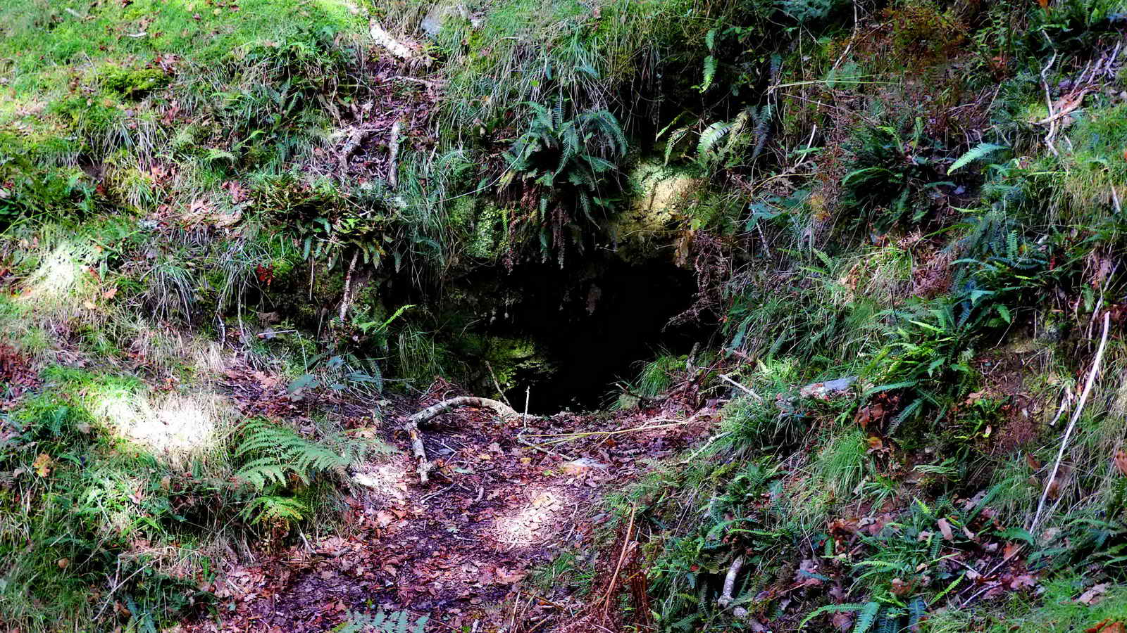
Closer view of the adit .....

Just a few yards further along is another adit, this time just below the leat, which is just above the top edge of this photograph. This adit has water running from it as a small stream.

Another view from further along the leat - this tree has been growing here for a long time.

The leat terminates near the property known as Buckator - the mine captain's house for the Bedford & Sortridge mine. It is believed that the East Wheal Bedford Mining Company extended the leat in 1853 to drive a 30-foot water-wheel that in turn drove flat-rods to pump water from their shaft up on West Down. The sale of the mine equipment in May 1858 included a 30-foot water-wheel, rods, pump, tools and launders. Source: Stephen Holley, Dartmoor Tinworking Research Group, pers. comm.
Back to photographs from the walk .....
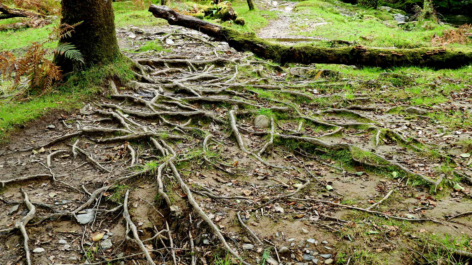
Exposed beech tree roots beside the river, near where the slate bedrock is exposed on the track.

The Walkham Waterfall, SX 48311 70075, down-river at the top of the "gorge" .....
|
Dartmoor CAM movie. TIPS .....
A movie of the "Walkham Waterfall". |
|
Click the photo to download |

The Group by the waterfall. Photo: Ron Quilter.
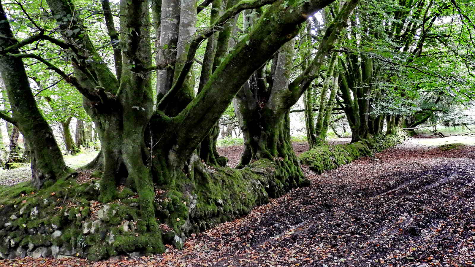
An old wall on which a few beech seeds germinated .....

It is amazing that the tremendous weight of these crowded-together trees has not destroyed the wall.

There is a little known tor in there, at approx SX 4801 7016, near the property called Buckator. Need to come back after the leaves have fallen, for a clearer view.

Pointing back to Buckator. It should be noted that there are tors, and properties named after both Buckator and Buck Tor - they are on opposite sides of the river. Buckator was the mine captain's house for the Sortridge & Bedford Mine .....

� Crown copyright 2016 Ordnance
Survey
Licence number 100047373
Also, Copyright � 2005, Memory-Map Europe, with permission.

This rock, at at SX 4772 7013, probably has an old name but I can't find it .....

The rock / tor is composed of quite soft country rock slate; it is easily scratched with another stone.

Coffee break at The Rock ..... (hurry up, folks!) .....

Group photo at The Rock .....

"By popular demand", someone wants me in a photo, too ........ Photo: Ron Quilter.

Looking back down the track ascending onto West Down, with the area of Double Waters, or Watersmeet, where the River Walkham flows into the River Tavy, roughly in the centre of the photograph.

Looking across to the tracks on the western part of West Down, between "fields" of bracken that is now invading much of lower Dartmoor since the reduction of livestock grazing and trampling since farming policy etc. has followed EU policy (!)

A wide, open track through a sea of bracken, which we could have followed but for the extra ascent after the descending section.

One of several shelter trees, either beside the path or some distance from it in the bracken, where animals probably seek shelter from bad weather or from heat.

Going back into Bymore(?) Wood from the open Down.

Sheep by long-fallen trees.

The long path that "contours" along the top edge of the wood, the slope down to the track beside the River Walkham is about 45� or "1 in 1". That is apparently 100% - Wikipedia - Grade (slope).

There are a few spectacular old trees in the wood.

Fallen tree at the top of the public path back down to the River Walkham, near the start of the walk.
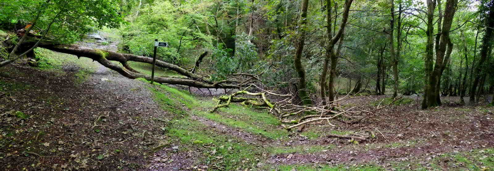
Wider view of the scene - the footpath cab be seen running down beside the tree from the signpost. Click the image to see a larger version.

Champagne Reception at the London Inn, Horrabridge, for Berni's landmark Big Birthday. A big "Thank you" to Sue of the London Inn staff for her attentiveness - we had a really good lunch with Champagne all the way through! Actually, it was a good Champagne, Piper-Heidsieck (Brut, non-Vintage) Luckily, there was some left over .....
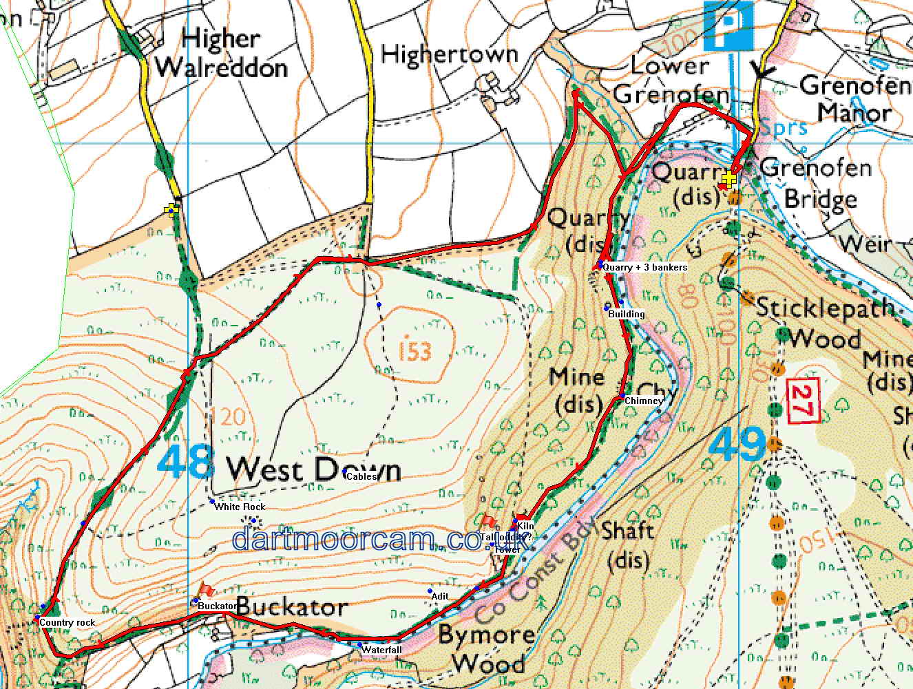
MAP: Red = GPS satellite track of the walk.
� Crown copyright 2016 Ordnance
Survey
Licence number 100047373
Also, Copyright � 2005, Memory-Map Europe, with permission.
This walk was reached via the road almost opposite Drake's Caf�, at Halfway House, in Grenofen, passing the driveway into Grenofen Manor and then turning left at the next road, to park at the yellow cross on the map.
Statistics
Distance - 4.8 km / 2.98 miles
All photographs on this web site are copyright © Keith Ryan.
All rights reserved - please email for permissions