![]()


This walk: 2017-3-17. Hut circles, Sharpitor, Leather Tor, Leeden Tor, Hart Tor, Black Tor, cist, Ingra Tor, quarry, crane bases, tramway granite setts.
Walk details below - Information about the route etc.
Previous walks in this area: 25th February 2009, 15th September 2010. and 12 November 2014.
Google Satellite map + GPS track of the walk

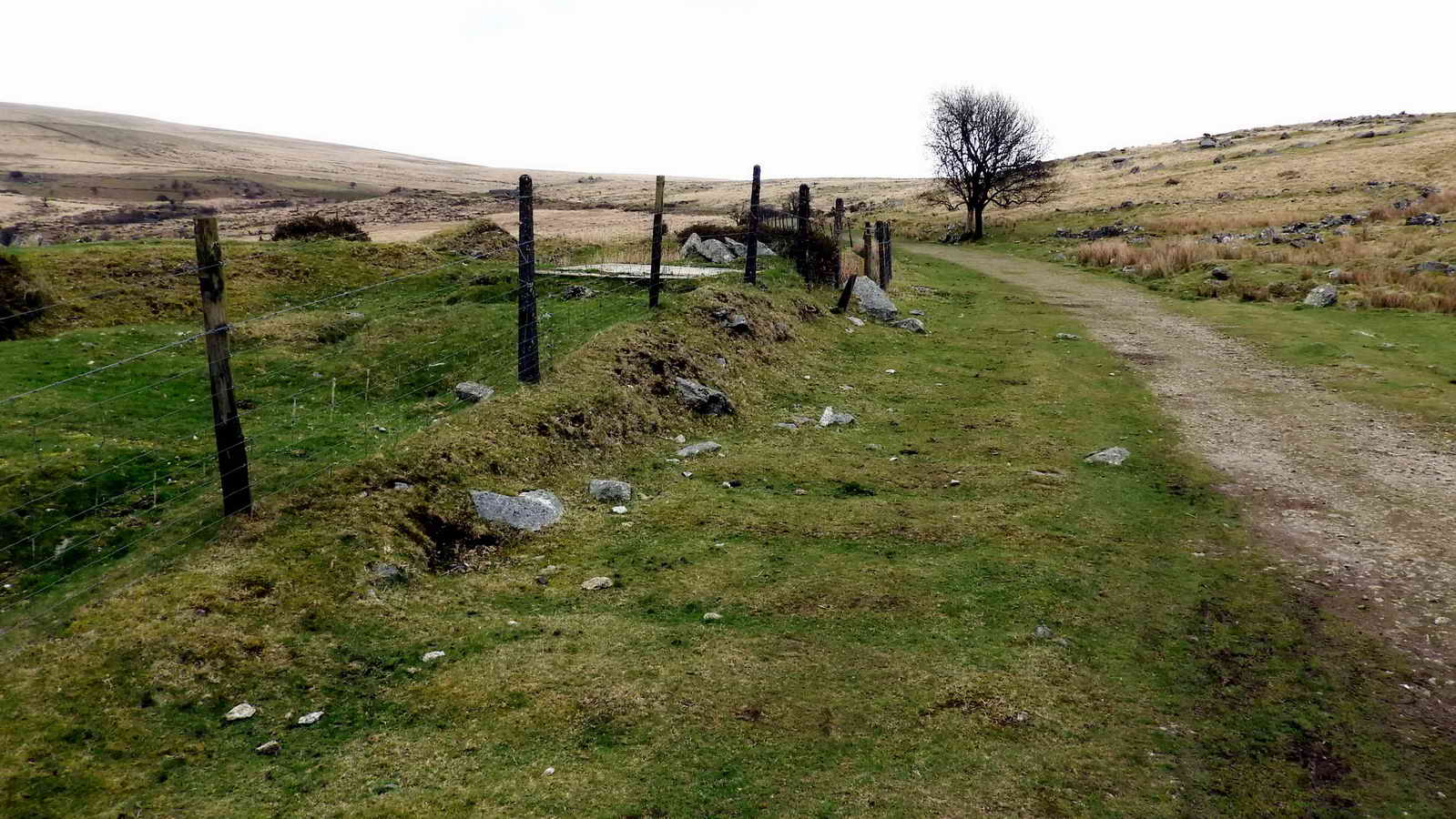
Centre - one of three hut circles, looking across to Sharpitor (right) and Leather Tor (left of centre) .....

Closer view; Sharpitor (right, SX 560 703, elevation 410 metres / 1345 feet) and Leather Tor (left, SX 563 700, elevation 380 metres / 1246 feet).
These artefacts are described by Jeremy Butler, 1994, Dartmoor Atlas of Antiquities Vol. 3 - The South-West, 45.1: Leeden Tor South (fig. 45.1), page 38. The hut above is no. 2 in the figure below .....

Image � J Butler
1994. Reproduced by kind permission (ref. 29 Sept. 2012).

Large hut circle, SX 56225 71108, this is no. 4 in the figure above.
Leeden Tor, SX 5633 7183, elevation 379 metres (1243 feet) .....

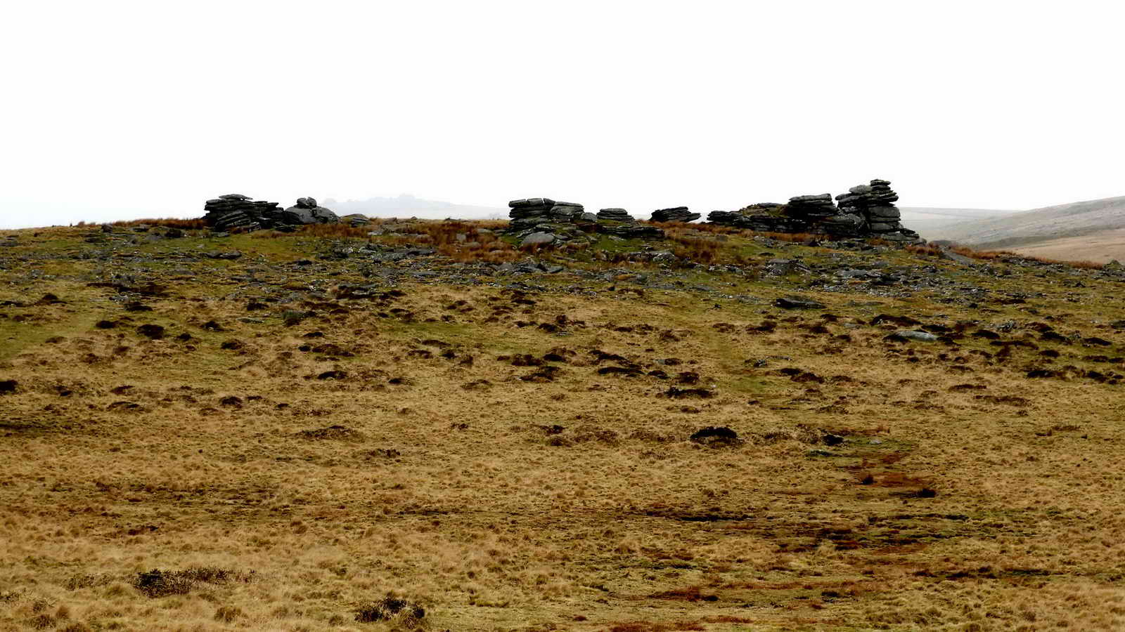
Leeden Tor rock formation .....

Leeden Tor rock formation .....

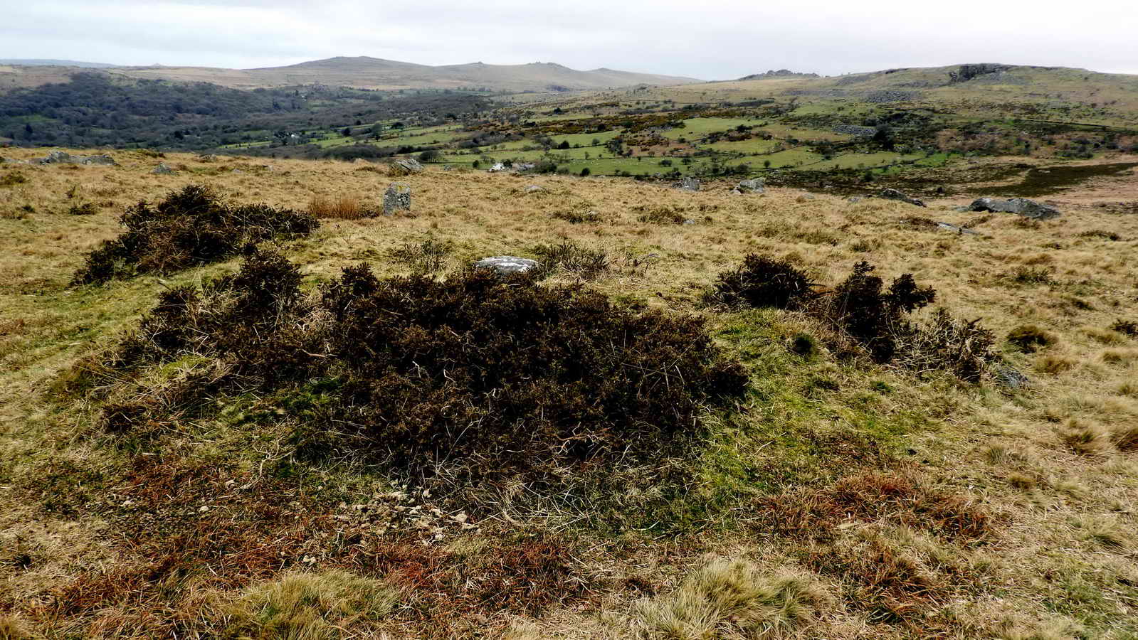
Extreme left horizon - South Hessary Tor; left - Hart Tor; right - Black Tor.

Leeden Tor rock formation .....

Leeden Tor rock formation .....
Ingra Tor cairn and cist, SX 55871 72084 ..... looking north .....

Another view, looking east ..... the cist is described by Jeremy Butler, 1994, Dartmoor Atlas of Antiquities Vol. 3 - The South-West, 45.16: Ingra Tor cairn and cist (fig. 45.16), page 51 .....

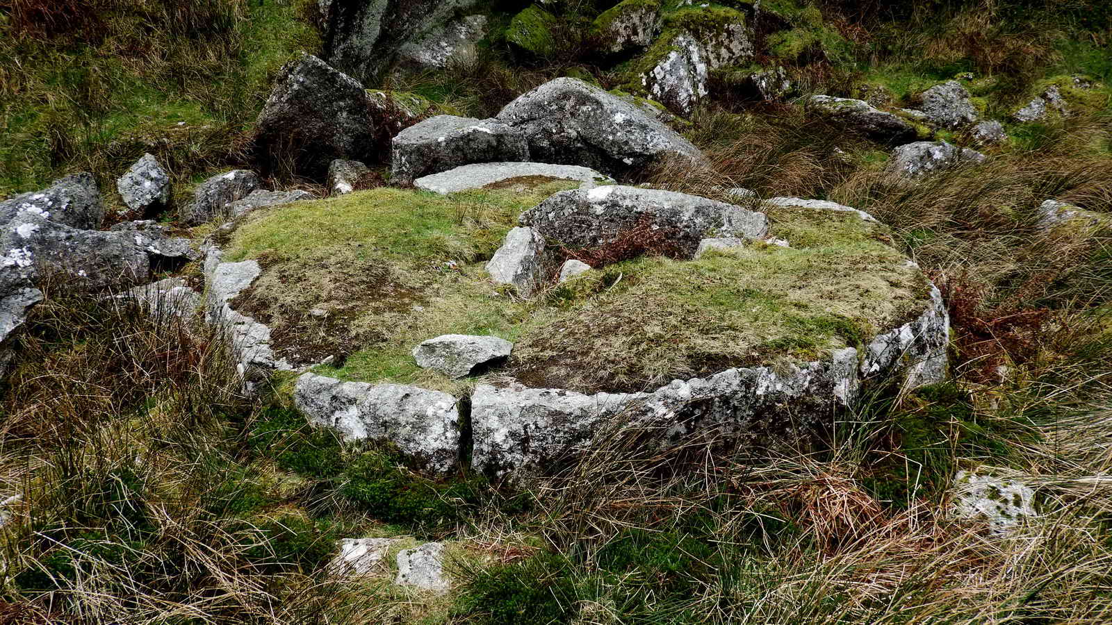
The displaced capstone .....

An internal view of the cist, beneath the capstone ..... a stone box of granite slabs......
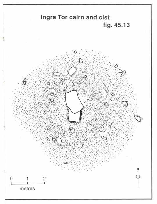
Image � J Butler
1994. Reproduced by kind permission (ref. 29 Sept. 2012).

Ingra Tor, SX 555 721, elevation 339 metres (1112 feet) .....

Looking down into the quarry at the two crane bases .....

Similar view showing the entrance into the quarry .....
A crane base.
The old GWR railway track bed outside Ingra Tor quarry.

One of three old horse-drawn tramway granite setts that once held the rails, in the tunnel that is the cattle creep under the old railway.
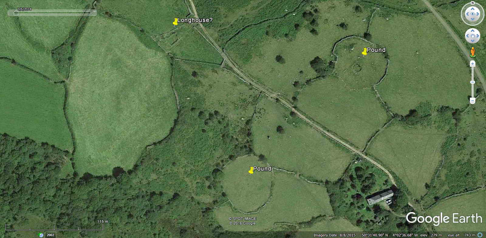
Google Earth image showing the two Bronze Age pounds at Routrundle and the ruins that might have been a longhouse (long, divided and running down a slope?)
MAP: Red = GPS satellite track of the walk. Blue = original planned route.
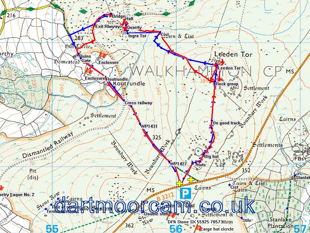
� Crown copyright and database rights 2016 Ordnance
Survey
Licence number 100047373
Also, Copyright � 2005, Memory-Map Europe, with permission.
This walk was reached by parking on the B3212 below Sharpitor at either of the two car parks marked by yellow crosses or the the P symbol on the map
Statistics
Distance - 5.06 km / 3.14 miles
All photographs on this web site are copyright
� Keith Ryan.
All rights reserved - please email for permissions