![]()


This walk: 2017-12-11. Plymouth Leat (aka Drake's Leat), Sheep's Tor, parish boundary stone, Crymes' Leat, Roborough Common, old quarry dumps, Shaugh Prior, Bronze Age enclosure with hut circles (distant), cycle track (on old SD&TR and GWR railway line), Shaugh Bridge Platform, Wheal Lopes Leat, Leighbeer Tunnel, Bickleigh Vale Phoenix Mine, cycle track signs, Golden-scaled Male Fern (Dryopteris affinis), Clearbrook.
Walk details below - Information about the route etc.
Previous walks in this area: 24th June 2015
Google Satellite map + GPS track of the walk
Old maps
OS 25-inch, 2nd and later editions - 1892-1905

Bridge over Plymouth Leat (aka Drake's Leat) on the road from the A386 down to Clearbrook, seen from near the car park. It was originally 17�-miles long. It was dug starting in Dec. 1590 and inaugurated 24th April 1591, under the aegis of Sir Francis Drake. It originated at a head weir on the River Meavy (now under Burrator Reservoir) and was designed to run into Sutton Pool in Plymouth. It was diverted to discharge into Millbay (contrary to the Act of Parliament), via six new mills that Drake leased from the Corporation.
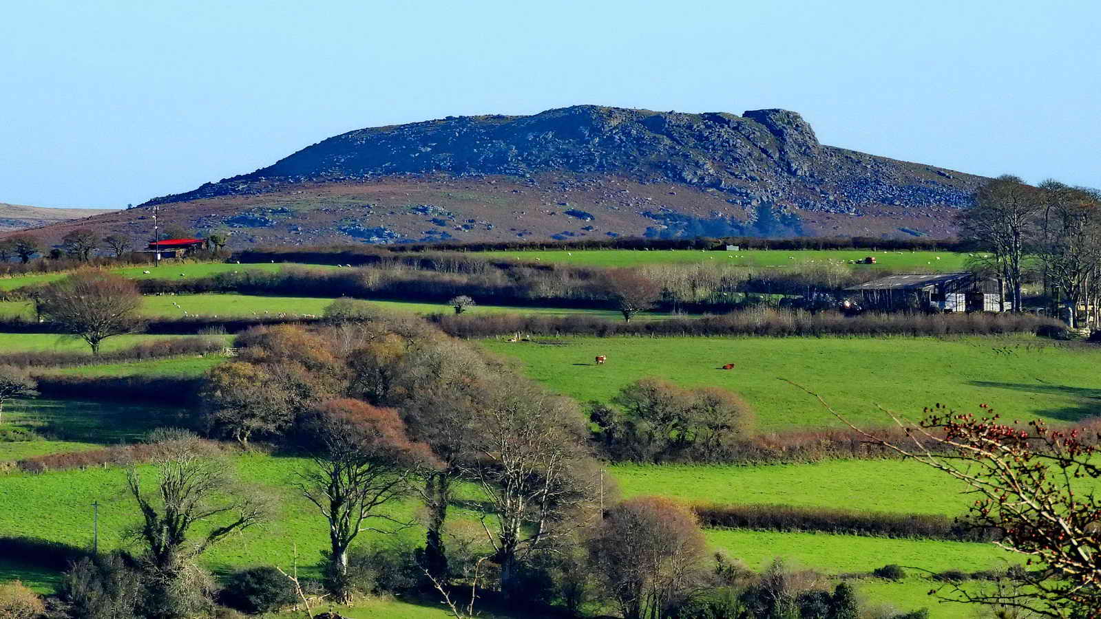
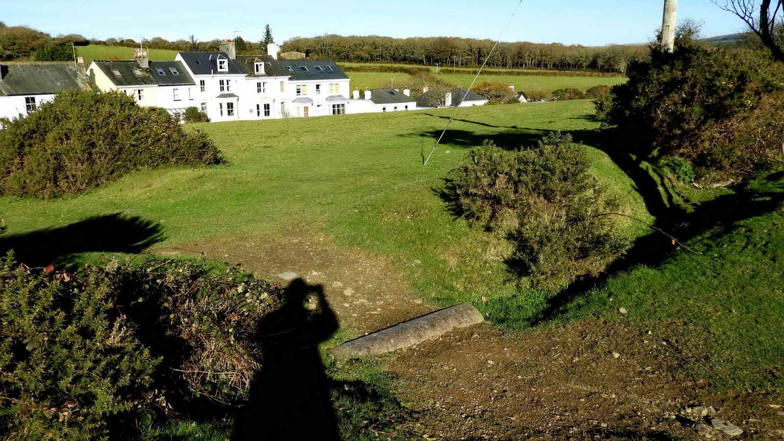
View from near the car park of Sheep's Tor, SX 566 682, elevation 369 meters (1210 feet).
Plymouth (Drake's) Leat that was Plymouth's water supply, disused since Burrator Reservoir was inaugurated in 1898. It was lined with granite in 1871 and further improved during WW2 as a precaution in case Burrator Reservoir was bombed.
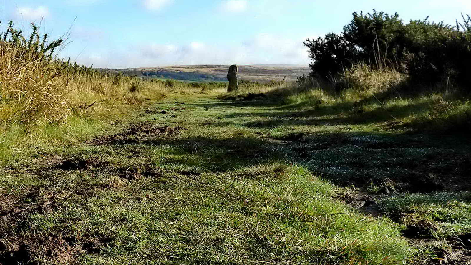
A bond mark on the Bickleigh / Buckland Monachorum parish boundary, at SX 52105 64983, a natural rock with no markings.....

Side view .....
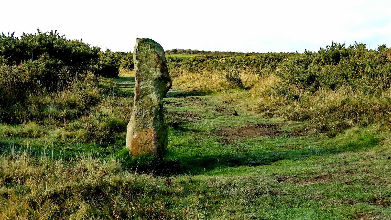
Looking back.

Plymouth Leat again, showing the breach at SX 52242 64913 made by William Crymes, a local land owner and tinner, around 1599, to form Crymes' Leat that ran to Clearbrook. This diverting of some of Plymouth's water supply started a dispute with Plymouth Corporation, incl. with Sir Thomas Drake (elder brother of the then-late Sir Francis). This was resolved in the Star Chamber court at Parliament in 1603, with him being granted rights to take water to power two tin mills. He was supported in his exercising of "tinners' rights" by Sir Walter Raleigh, then Lord Warden of the Stannaries.
"Tinners' rights" - Tinners became so important to the Crown that they were allowed to have their own Parliament. Stannary law took precedence over Common Law and thus the tinners' parliament was able to ignore some of the laws of the land.

Another view, showing the clapper bridge and the earth dam in Plymouth Leat that nowadays diverts flood water from the old WW2 RAF Harrowbeer airfield at Yelverton, in a system maintained by South West Water as a flood prevention scheme. The water is fed through other breaches in Crymes' Leat to run downhill to the River Meavy.

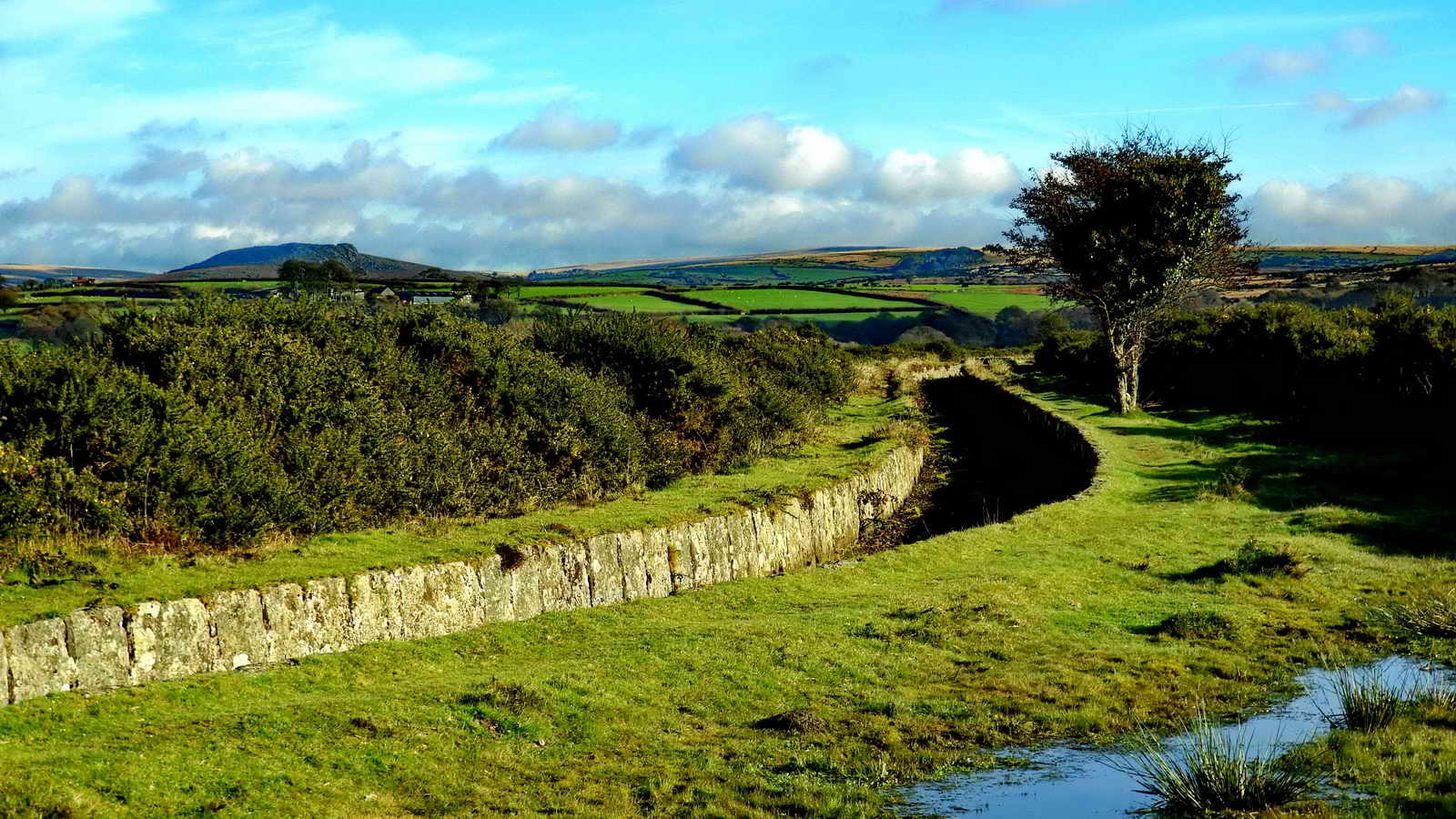
A view of what much of Roborough Common looks like. It had been thought that the WW2 decoy airfield was in this area but a recently-found map shows that it was further west, alongside the A386 road.

Another general view of the Common.

"Bumps" at SX 5248 6409 in an area marked as "Quarry" on old maps. Perhaps these are spoil tips from small quarries that are now lost under the nearby gorse, at least one of which seems to be a pit. Quite possibly the quarries were actually sand pits .....
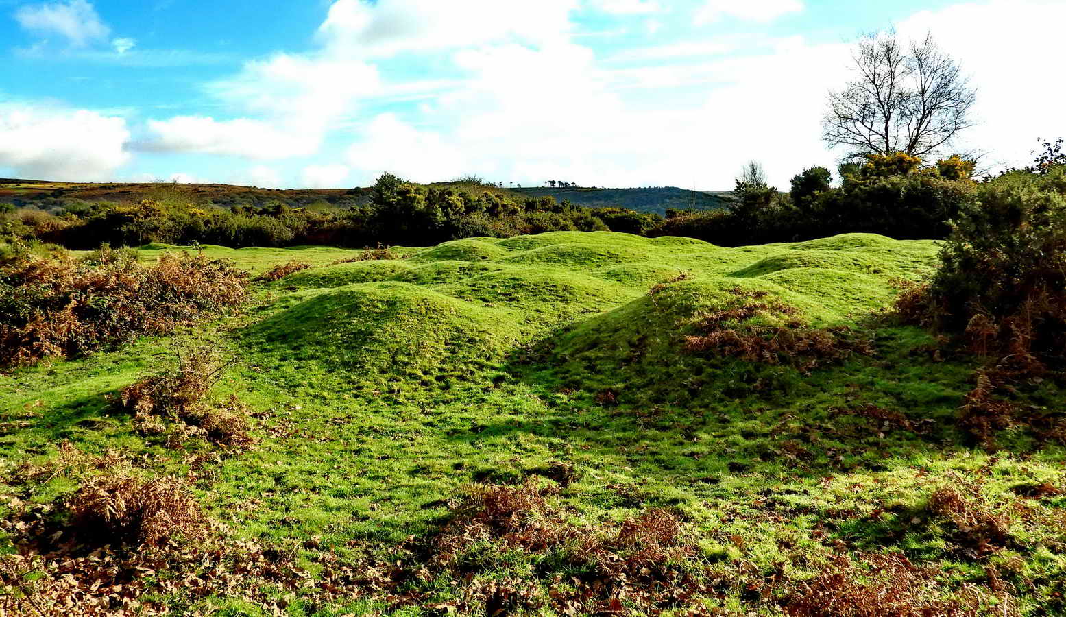
Another view .....
Addendum: After posting this photograph on Facebook, a Dartmoor Ranger explained that these were loads of earth dumped here many years ago in readiness for jobs that involved building earth banks locally, such as those seen around some car parks.

Google Satellite view of the area with the bumps in the centre. Image from Google Earth (c) 2017 .....
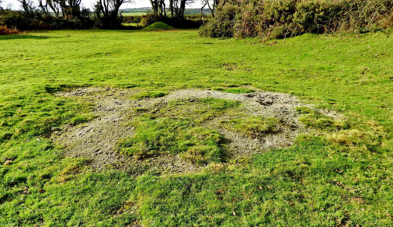
Exposed sand (or discarded sand) near the "bumps".

View of Shaugh Prior village from SX 52485 63580. Note the Bronze Age enclosure with hut circles just above and to the left of the church tower, on Shaugh Moor in the distance. This is described by Jeremy Butler, 1994, Dartmoor Atlas of Antiquities Vol. 3 - The South-West, 4: Shaugh Moor field system (fig. 48.1), pages 102-105.
 |
Image � J Butler 1994. Reproduced by kind permission (ref. 29 Sept. 2012)
The enclosure seen in the preceding photograph is labelled "A" in the figure above and is viewed in the photograph from the direction of the top left corner of the figure.
On the Hele Lane Bridge at SX 52745 63625 where the road crosses over the old South Devon & Tavistock Railway, and later the Great Western Railway, now the cycle track, looking south ...... Eric Hemery (1983), Walking the Dartmoor Railroads, David & Charles, Newton Abbot, page 90 .....

Shaugh Bridge Platform, on the right of the track, seen from the bridge looking north ..... more about this, and Youtube videos below .....

The road bridge, having just left it behind us.

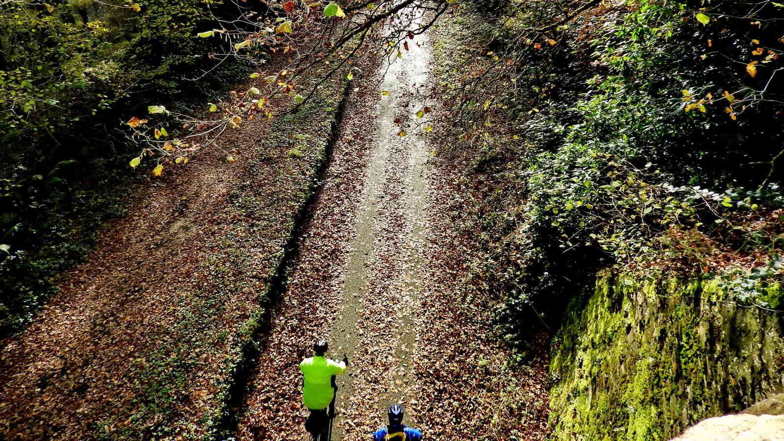
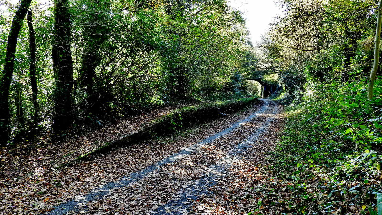
Down the hill, on the left, enter the cycle track / old railway .....
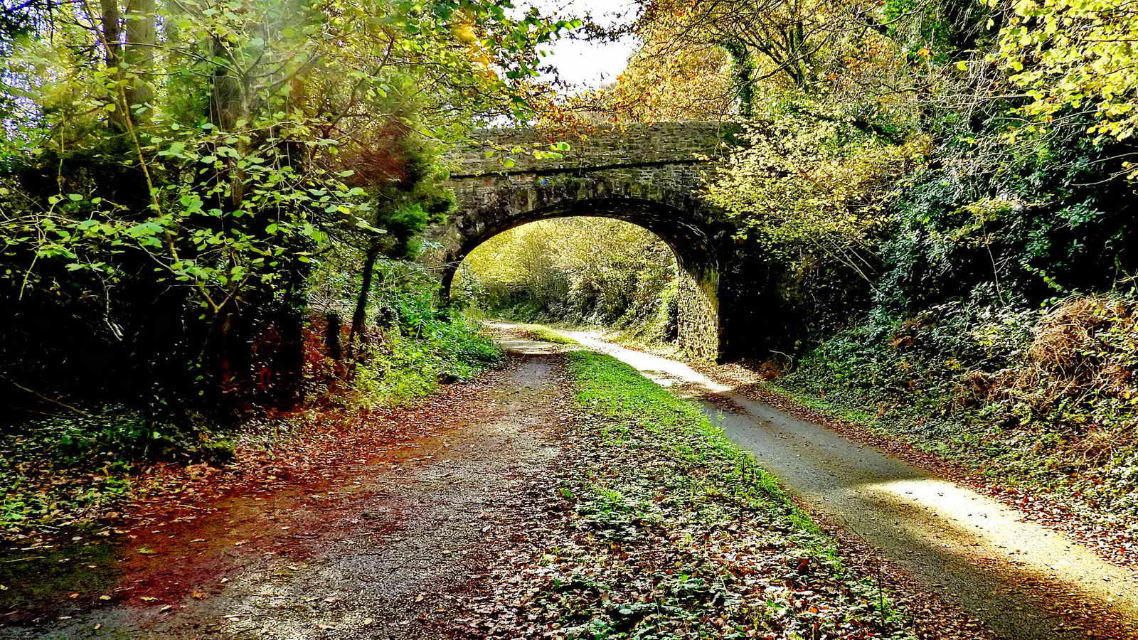
Hele Lane Bridge that we were on .....
The railways that once ran on this line .....
1. South Devon and Tavistock Railway Company - backed by landowner the Earl of Morley. Work started 24th September 1856, under engineer Mr Bampton, who died in 1857. Isambard Kingdom Brunel then engaged but was busy with the Royal Albert Bridge so his chief assistant, Mr RP Brereton, and two Assistant Engineers, Grose and Glennie completed the project. Opened 21st June 1859. The stations were Bickleigh, Horrabridge and Tavistock - which opened the following day. A northern extension to Launceston was opened on 1st June 1865. The other stations on the line were Mary Tavy & Blackdown, Lydford, Coryton and Lifton.
2. Great Western Railway - the SD&TR was amalgamated with the GWR in 1878. It was converted from broad gauge (7 ft 0¼ in) to standard gauge (4 ft 8½ in) in May 1892. Before this, there was a mixture of three-rails to accommodate both gauges.
Sources:
Eric Hemery (1983), The Dartmoor Railroads, David & Charles, Newton Abbot, pages 84-97.
Brian Moseley - The Encyclopaedia of Plymouth History > Contents > Railways > South Devon and Tavistock Railway
Shaugh Bridge Platform - what remains of this
little branch line railway station .....
Youtube video -
Steam train passing
through Shaugh Bridge Platform 1962 (2:13 minutes) - I see no train, but
very informative old cine film
Youtube video -
Shaugh Prior & Shaugh
Bridge, a video tour (11:10 minutes) - a tour of the village and surrounding
area - the station comes in at 8:40 minutes. .

Some of the group during the coffee break on the platform.

Bench near the south end of Leighbeer Tunnel.
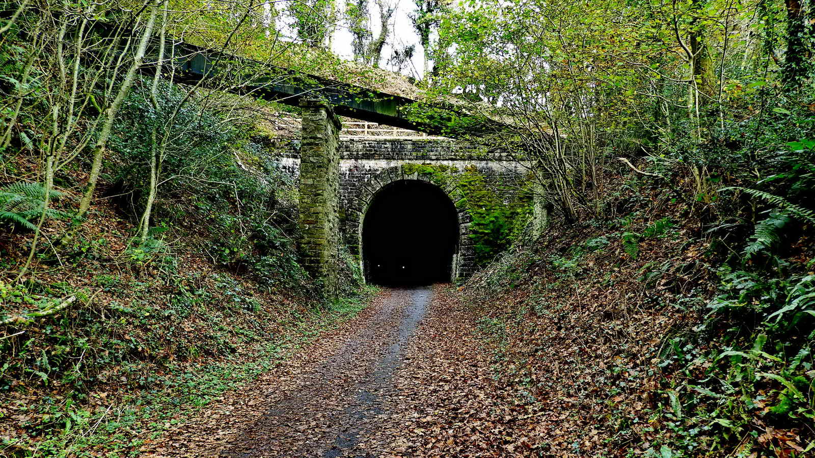
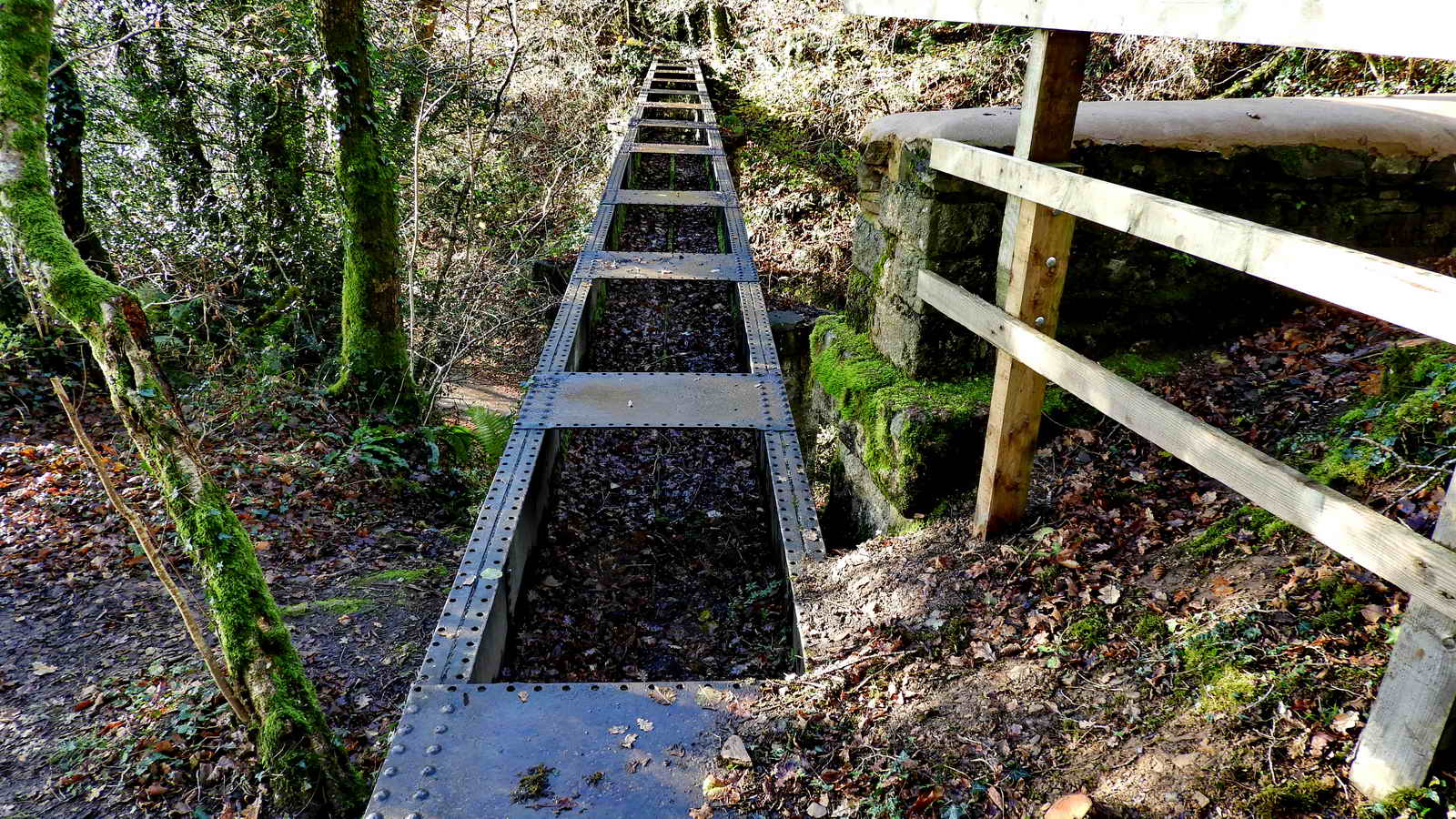
South entrance to the 308 yard-long Leighbeer Tunnel, aka Shaugh Tunnel or Smokey's Tunnel with the overhead Wheal Lopes Mine leat - this flowed from right to left as we see it in this photograph ..... seemingly uphill? .....
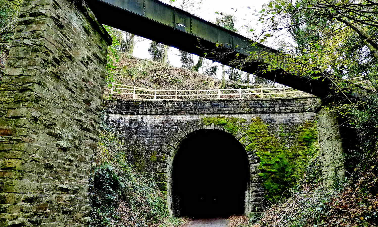
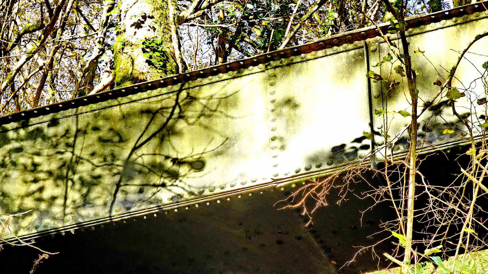
Wheal Lopes Leat Aqueduct, marked "Aqueduct" on the map. It is very dark in the tunnel although there are permanent lights at intervals to show the way through ..... two can be seen in this photograph .....
"Wheal Lopes Leat" marked on the 1:25-inch map .... a zoomed view ....
Wheal Lopes Leat seen from above, on reconnaissance walk no. 3 (28th Nov)
Looking down on the leat after scrambling down a slippery slope from the road ..... the cycle track can JUST be seen halfway down the photograph to the left of the leat chute .....

Another view from higher up the slope - note the heavy, round stone, about 3� feet across with a 6-inch hole through it .....

Final view from above, taken from the road.
Back to the walk .....

Flash photograph taken just inside the entrance to the tunnel, digitally enhanced to show detail.
A refuge for railway men to seek safety in when trains came through the tunnel .....
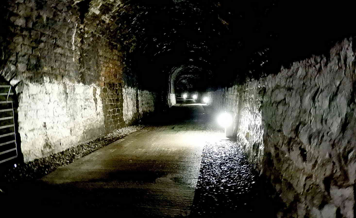
Another view inside the tunnel, digitally enhanced .....

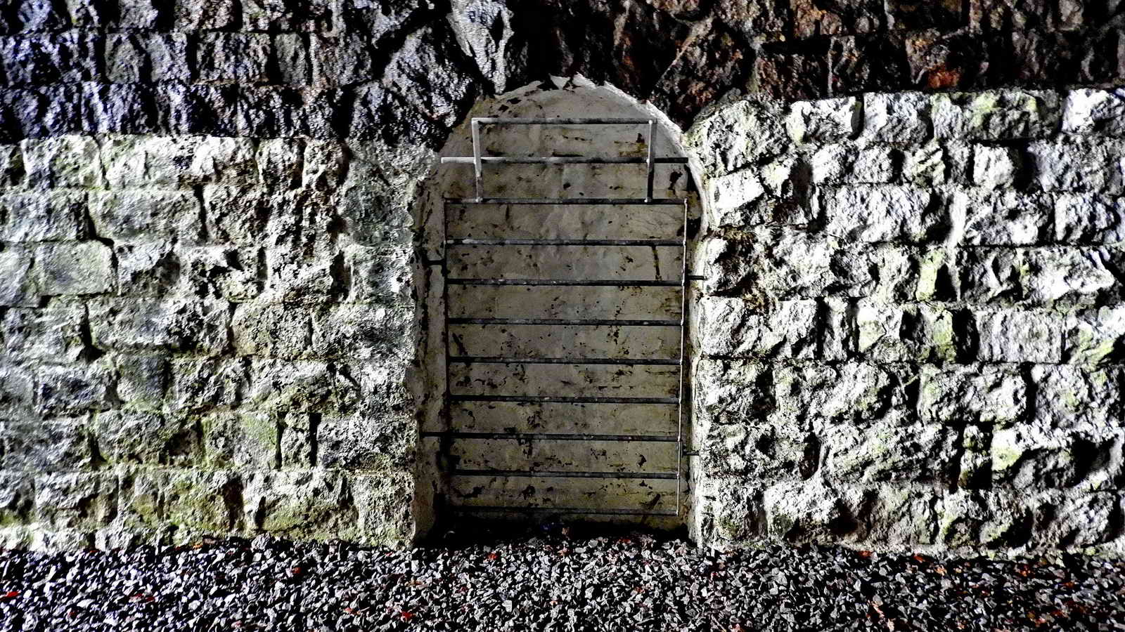
The gated entrance to Bickleigh Vale Phoenix Mine. - a copper lode was discovered during the digging of the tunnel and was exploited for a short period .....

A photograph taken through the bars of the gate .....
Leebeer Mine Bickleigh - a Heritage Gateway official archaeological record of the mine
28DL Urban Exploration web site: Report - Bickleigh Vale Mine / Leighbeer Tunnel - a report with photographs going into the mine tunnel
https 28DL Urban Exploration web site: Report - Bickleigh Vale Phoenix Mine - July 02
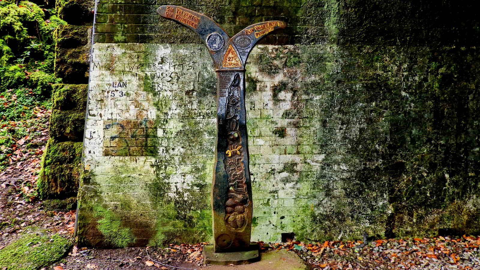
Signpost on the Sustrans No. 27 Devon Coast to Coast Drake's Way cycle track at the north end of the tunnel.
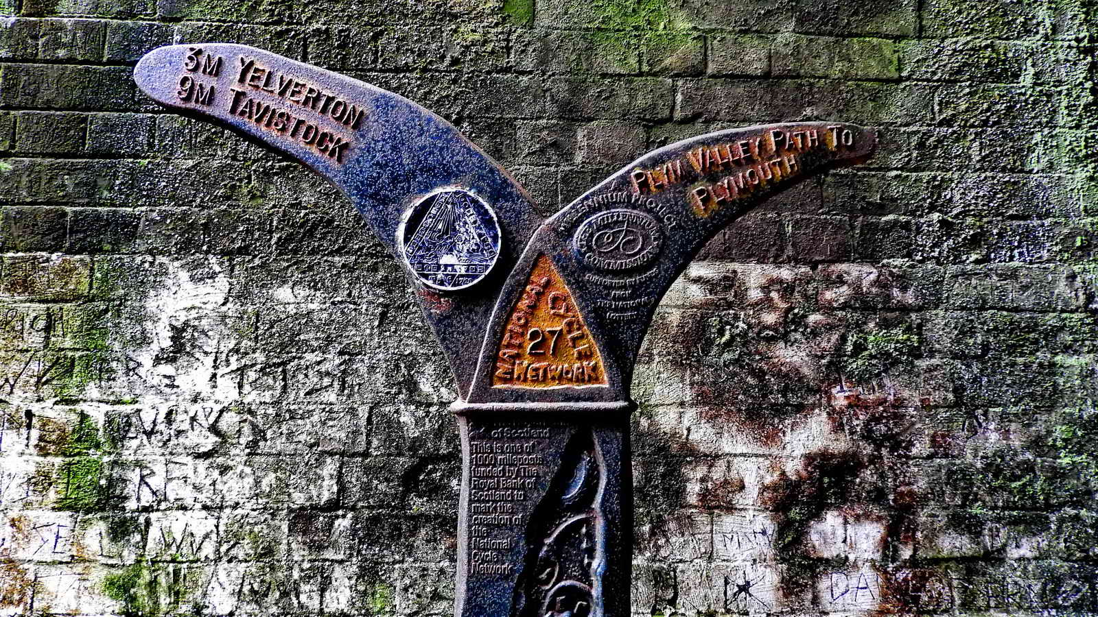
Another view .....

Detail .....
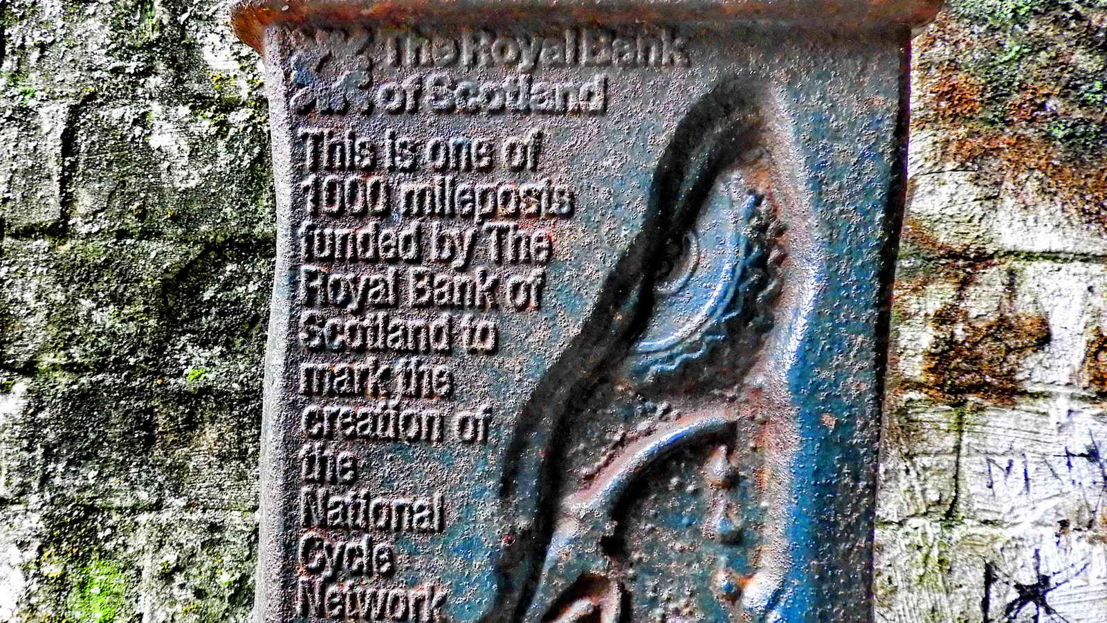
Detail .....

Detail.

Typical shuttlecock form of the Golden-scaled Male Fern aka Golden Shield Fern, Dryopteris affinis .....

Under surface view of the bipinnate frond showing the appearance of the spore-bearing sori with their indusia (covers) that split radially as their sporangia mature.

Wheal Lopes Leat seen from the road at SX 52977 64423, looking south ..... the mine is described in the British Mining Journal - Memoirs 1993 .....
Wheal Lopes Leat looking north ..... the leat emerges from crossing the road at the far end of this view ..... a sluice valve can be seen in the right bank .....

Wheal Lopes Leat sluice valve - see zoomed photograph following ..... (seen from acroos the river, see 25 January 2019)

In the background is the termination of a railway embankment that was intended to connect with the "main " railway (now the cycle track) but which was never completed ..... this was a "white elephant" that was built as part of the Dewerstone Quarry Branch (Mineral Line) that moved granite from the nearby Dewerstone quarries. Unfortunately, Sir Massey Lopes witheld permission for a bridge to be built at this location to join up with the SD&TR railway that opened in 1859. Instead, the stone was carried in wagons to Goodameavy Gate. The Dewerstone quarries worked for about 20 years before closing.
See also: Cann Quarry Canal - built by John Smeaton for quarry owner John Parker to carry slate to Marsh Mills (outside Plymouth). It was planned to join up by tramway to the Plymouth & Dartmoor Railway in 1821, but this was never done.

Where the leat emerges from under the road .....

Signage ..... Note the signs for Cycle Route 27, part of the Sustrans National Cycle Network.
From the Route 27 web page .....
"Between Tavistock and Plymouth the Devon Coast to Coast route is known as Drake's Trail. This has recently been developed into a fully traffic-free stretch of National Cycle Route with the addition of the dizzying Gem Bridge"
Also .....
"..... between Okehampton and Lydford is largely traffic-free and is known locally as the Granite Way. This section is mostly built along the course of the former Southern Region railway line. It's 11 miles between Okehampton and Lydford travelling past Meldon Quarry. At Meldon Viaduct there is a railway station, visitor centre and café in the former buffet carriage all run by Dartmoor Railway.
This former Southern Railway was the South Devon & Tavistock Railway. The Dartmoor Railway is a modern concern.
Sustrans is also working on a 95-mile circular Dartmoor Way Cycle Route.

Signage .....

Where the leat emerges after running under the railway embankment: Link to 25-inch 1892-1905 Series OS map where this tunnel is centred on the map.

Signpost seen on the road to the west of the cycle track at SX 52877 64588.

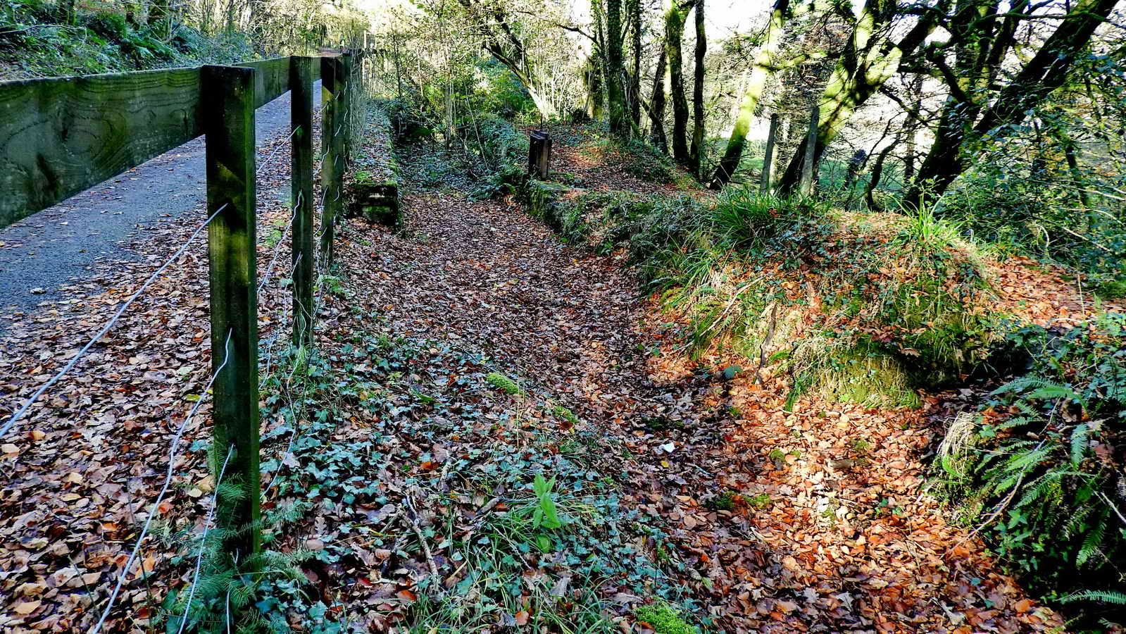
Scene along the way.
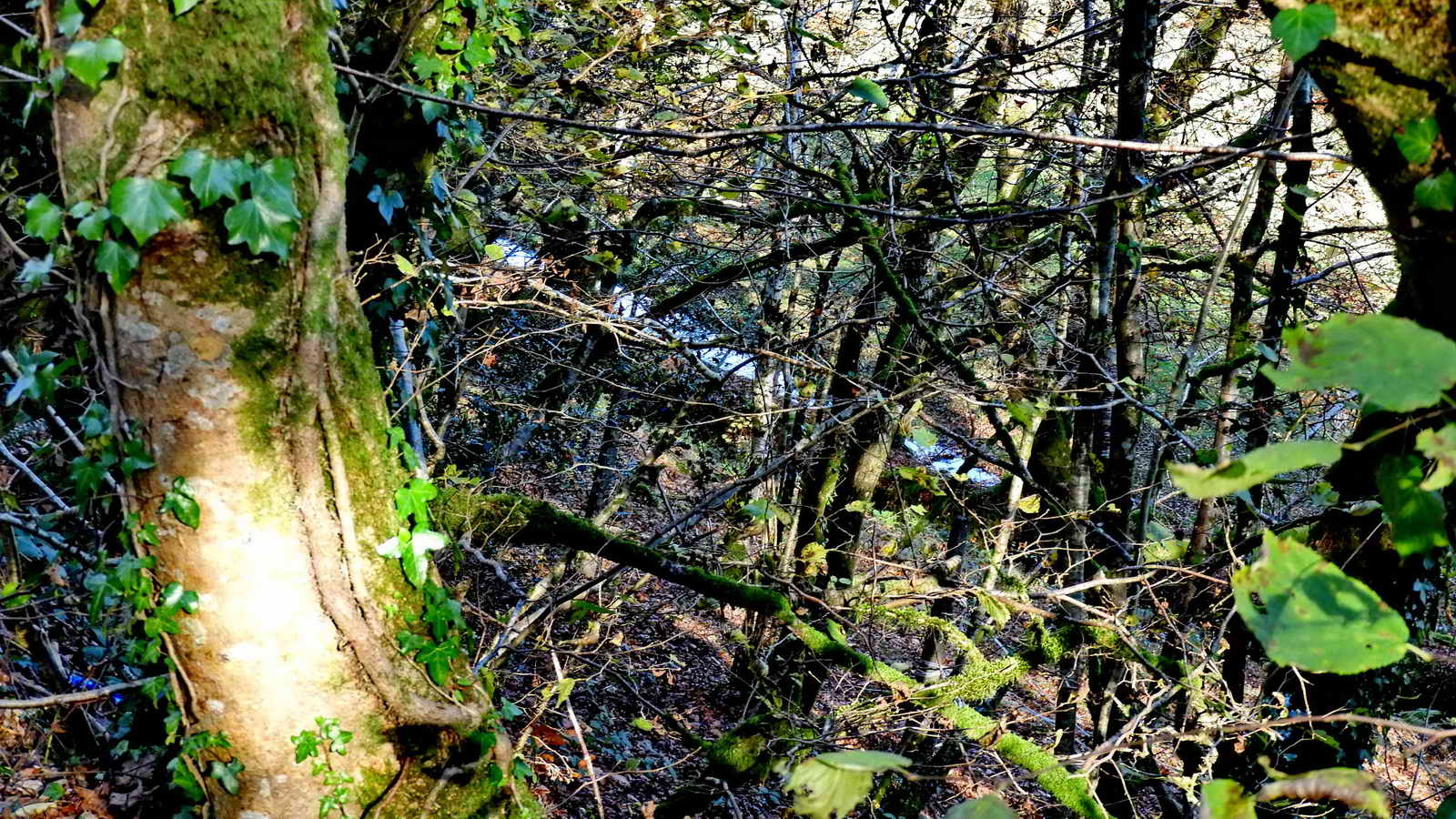
Looking down east of the cycle track near the take-off point of the Wheal Lopes Leat from the River Meavy, somewhere near SX 52517 65411. Water can be seen glinting in the leat at this point.

Approaching Clearbrook - the old railway embankment continues to the right while the modern cycle track climbs to the left to emerge at Clearbrook.

Crymes' Leat near its termination beside the west end of the houses at Clearbrook .....
Another view - Crymes' Leat and Clearbrook: There are 51 houses, the hamlet being about 200 years old, inhabited originally by miners and labourers, started by a syndicate that included George Frean who was also the builder of the Powder Mills. Either Frean or the syndicate supplied biscuits to the Royal Navy. George Frean went into business with James Peek in 1857 in Bermondsey to form Peek, Frean & Co., biscuit makers whose products included the Garibaldi and Custard Cream biscuits, now known as the Bourbon custard cream biscuit. They amalgamated in 1921 with Huntley & Palmers although each kept their own brands and identities etc.

Some of the group by Crymes' Leat (mostly under gorse) with the Skylark Inn behind .....

Where still more of the group were already hiding! As for that Lesley - how did she escape the camera!

"The Wharf" near the Clearbrook car park. This was a stables where horses were changed on the Plymouth & Dartmoor Railway after they had pulled from Plymouth . The next team then continued the journey to Princes Town. On opening day, 26th September 1823, Sir Thomas hosted a breakfast at the wharf or station on Roborough Down, where horses were stabled. After the breakfast, a steady procession of wagons proceeded down towards Plymouth, carrying granite and people. They passed through the tunnel at Leigham and received a rousing welcome when they arrived at the goods station on the shore of Sutton Pool. Source: Plymouth Data - The Encyclopaedia of Plympouth History > Railways > Plymouth & Dartmoor Railway.
Also ...... "North Wharf" - where breakfast for 1,000 people was served on the opening day of the Plymouth & Dartmoor Railway. Still known as "Tyrwhitt's Wharf", this is where the tramway horses were changed, fed and stabled. (Source: Eric Hemery, Walking the Dartmoor Railroads, 1983, David & Charles, page 17)

Final photograph, taken standing in Plymouth Leat by the car park, showing The Wharf in the background.
MAP: Red = GPS satellite track of the walk.
![]()
� Crown copyright 2016 Ordnance
Survey
Licence number 100047373
Also, Copyright � 2005, Memory-Map Europe, with permission.
This walk was reached by following the Clearbrook sign on the A386 Roborough / Yelverton road and turning right, into the car park just BEFORE the "Left bend" road sign by the small bridge over the leat. The park is marked by the the P symbol and the yellow cross on the map.
The bootprints on the map mark the edge of the WW" decoy airfield for RAF Harrowbeer.
Statistics
Distance - 5.58 km / 3.47 miles
All photographs on this web site are copyright © Keith Ryan.
All rights reserved - please email for permissions