![]()


This walk: 2017-11-25. Yellowmeade Track car park, Foggintor Mission Hall, leat to Red Cottages and beyond, Great Mis Tor, Old Pump House, Hill 60 Quarry, Hollow Tor Quarry, Rundlestone Tor, rock pans, loading ramp?, Four Winds car park, TV transmitting station, North Hessary Tor, trig. pillar, prison boundary stone, DCP boundary stone, PCWW 1917 catchment bond mark, mystery "TOR" mark, Albert Cole's granite shed and quarry, tramway bed, TA stone gatepost, Cake stone, Bronze Age enclosure and hut circles, explosives store, West Mead Quarry, Red Cottages.
Walk details below - Information about the route etc.
Previous walks in this area: 16th March 2011, 11th January 2012, 5th October 2012 and 19th January 2014 (partly, includes across the road),
Google Satellite map + GPS track of the walk - the planned walk is shown with the actual walk on the day (see red markers) - this was curtailed due to parking issues, snow and running out of time.
Old map
Ordnance Survey 25-inch 1892-1905 - shows the old "School" in the
Foggintor Mission Hall (across the road from our car park, before the new "Four
Winds school was built)
Ordnance Survey 6-inch 1888-1913 - as above.
Further reading
Eric Hemery (1983), High
Dartmoor,
Robert Hale, London, pages 1024-1027.
Kath Brewer (1998), The Railways, Quarries and Cottages of
Foggintor. Orchard Publications, Newton Abbot, page 73.
The photographs below were taken mostly on three
reconnaissance walks on sunny days, on 30th October and 2nd & 16th November. On
the day of the walk, while there was patches of blue sky, there was also a
little snow - as seen below in two photographs of the group.

The ruins of Dartmoor (aka Foggintor) Mission Hall, opposite the entrance to the Yellowmeade track, built 1887 for non-denominational worship and demolished in 1965. It was used as a school from Aug. 1896 after Foggintor Quarry school closed. It had 95 pupils in 1903 and closed on 27th Sept. 1912. The new Walkhampton Foggintor School opened in 1915 (at what is now Four Winds car park).
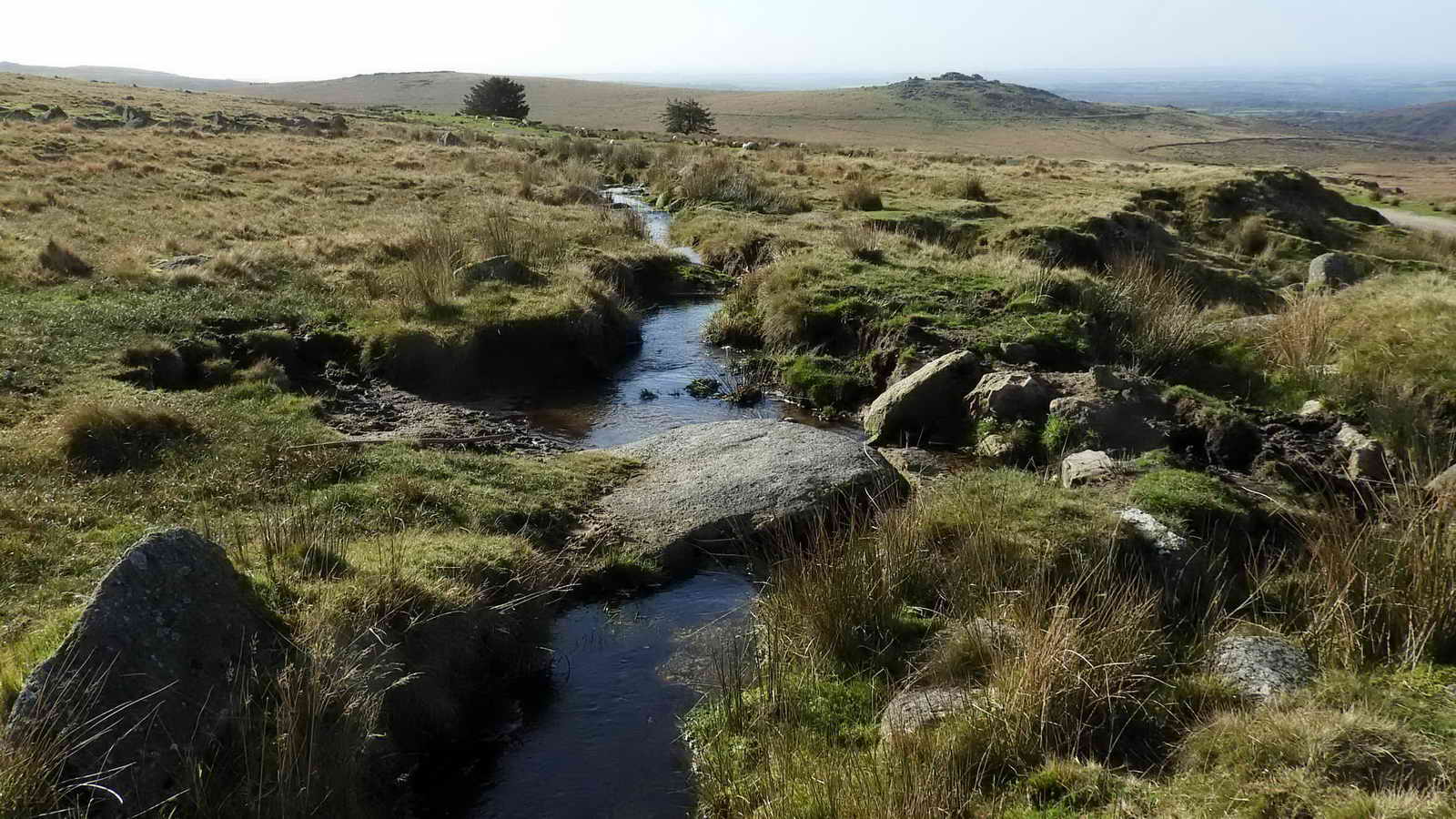
The leat from Mistor Marsh (not to be confused with Mis Tor Marsh re. the Blacka Brook) above the Yellowmeade Farm track and its car park, supplied Red Cottages. It runs to Yellowmeade and then on to the Hill Cottages at Foggintor Quarries, although it is now disused beyond Yellowmeade. Source: Hemery, page 1024-1025.

Zoomed view to the old pump-house beside the B3357 main road - originally to do with "raw water", according to the sign.
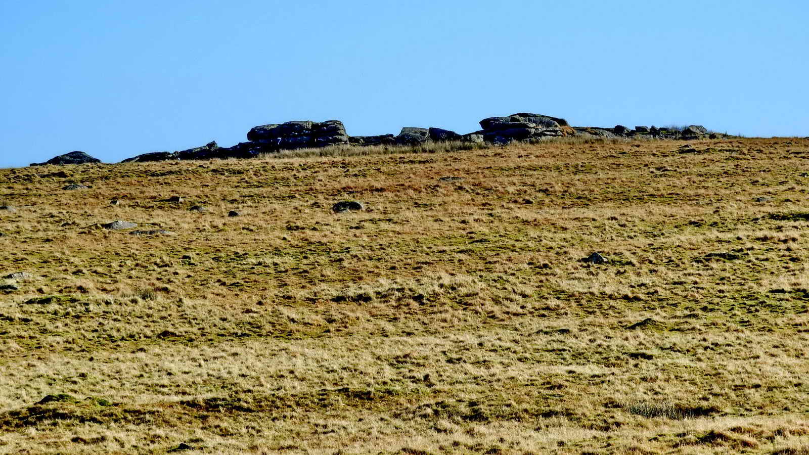
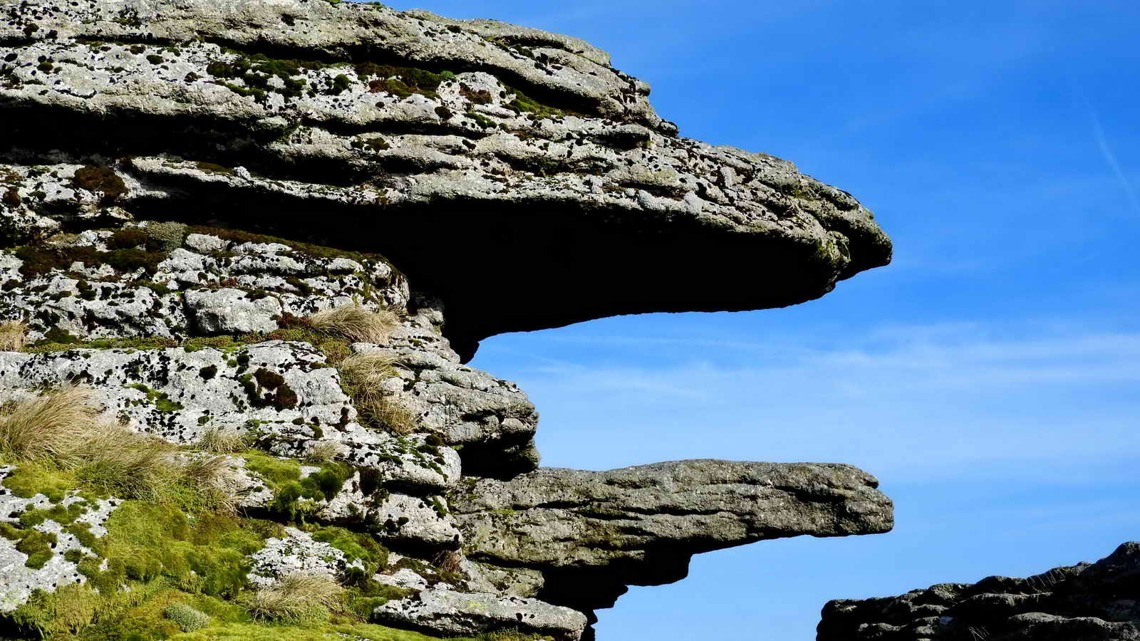
Hill 60 and Hollow Tor quarries
In researching this walk, there is not a lot to be found in the usual reference or other books nor on the internet.
Hemery (page 1024) mentions Hollow Tor and its quarry but not Hill 60 quarry. He describes the three tors south of the road, these being Rundlestone Tor, N. Hessary Tor and, "the largest, Hollow Tor (1,550 feet). This is shown on the 1840 Tithes Map as 'Stone Tor' which suggests quarry-workings to have been of early nineteenth century origin". This is seems to be an error because the 'Stone Tor' on the Tithes map is actually Rundlestone Tor, Hollow Tor is shown separately.
Hemery does go on to say that "During the last war a look-out shelter stood on the tor, which was then in consequence known as 'Hill 60'. Presumably, this was in reference to the tor he was describing, Hollow Tor, or was he misled and the lookout was at Hill 60 - although there is no tor at this quarry? It is confusing although perhaps the tor was quarried away, like Foggintor.

Walkhampton 1840 Tithes Map, showing Hollow Tor, Stone Tor and North Hisworthy Tor. Image: Devon County Council.
Kath Brewer (page 73) cites a third party saying "in 1936 Hill 60 (Hollow Tor) Quarry was opened" (by thee named individuals), querying if the quarry was opened in 1919 at Hollow Tor and wondering where these three individuals went until 1936 when Hollow Tor was reopened? She could not say how long Hollow Tor remained operating. There is ambiguity. She does, however, report the closure of nearby West Mead Quarry in 1966, the lease having been held by her uncles and, at its closure, by her cousins. (also page 73).
Kath Brewer is cited several times in this web page due to her book and the fact that her father's family lived at Mount Pleasant (also recorded in Censuses as West View and later Red Cottages) and later at Hill Cottages at Foggintor Quarry until just before they were demolished. In records, there were twelve dwellings at Red Cottages and 15 at Hill Cottages, at Foggintor (pages 97 and 101). Hill Cottages were demolished in 1953. In 1841, there were "about 300" men working at Foggintor (page 94).
Another aspect of this discussion is that the name, Billy's Tor, is on record regarding an unidentified feature in this area. Hemery (page 1027) describes it as the gentle slope where the TA track emerges from the south-east corner of the Yellowmeade enclosure. It is also mentioned, questioningly, in a description of Hollow Tor as being an alternative name for the tor: see Ken Ringwood (2013), Dartmoor's Tors and Rocks. University of Plymouth Press, Plymouth, page 99. It is possible this was a name for Hill 60 quarry. The evidence being that the three named individuals who opened Hill 60 (Hollow Tor) in 1936 were Billy Easterbrook, Claude Rook and Alf Brown - hence, "Billy's Tor"?

Hill 60 Quarry at SX 56985 74773, with the transmitter mast at North Hessary Tor in the background ..... quarry believed opened in 1919, although both Hill 60 and Hollow Tor quarries are shown on the 1892-1905 25-inch map, therefore they must be older. Hollow Tor is shown on the 1884 single sheet map, and Hill 60 is shown on the 1885 single sheet map (just) - its presence can be confirmed on the general "Old map" links above by sliding the blue circle icon LEFT to reveal the modern satellite image which reveals the the lake in the quarry.

Ruins of a building at Hill 60 quarry .....

This quarry was perhaps never a tor but was quarried by digging into the hillside ..... Dartfact - Hill 60 Quarry .....
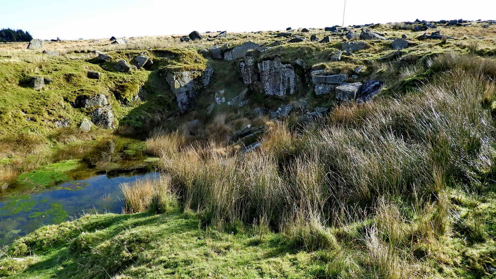
A view of the rock face .....

Looking west-ish from above Hill 60 quarry, with the old pump house and Great Mis Tor in the background .....
From Johnie's Meanderings .....
"Hill 60 Quarry .......... It is rumoured that the quarry was named Hill 60 after men who worked there after World War 1, having served in Hill 60 near Ypres during the Great War. Having visited on a bitterly cold December day, these must have been hard men indeed. To survive the horrors of WW1, only to end up working in a wet quarry on a north facing hillside high on Dartmoor to earn money to support their families" (Webmaster's emboldening).
The WW1 connection has also been written about by Simon Dell, reporting something he was told by a walker, and ended saying: "I guess we will never know for sure if 'Hill 60 Quarry' is named after 'Hill 60' at Ypres ...... " Source: Dartmoor Magazine, Spring 2012, Issue 102, page 20. My thanks to Mark Fenlon for this information/
World War 1 Hill 60 video etc
Hill 60 - An Authentic Great War Site in the Ypres
Links to
Beneath 60 Introduction
Hill 60, Ieper (Ypres) Belgium - home-made video walking the site today
The Keep Military Museum - Home of the Regiments of Devon and Dorset
The Devonshire Regiment and the Dorsetshire at Hill 60 - April / May 1915
- an account of what happened, ending with .....
"History
is said to repeat itself; twenty three years later, in May 1940, Hill 60 again
saw the same armies fight for its occupation."
Rundlestone Tor, SX 577 746.
Not seen on the walk - some details relating to the tor .....

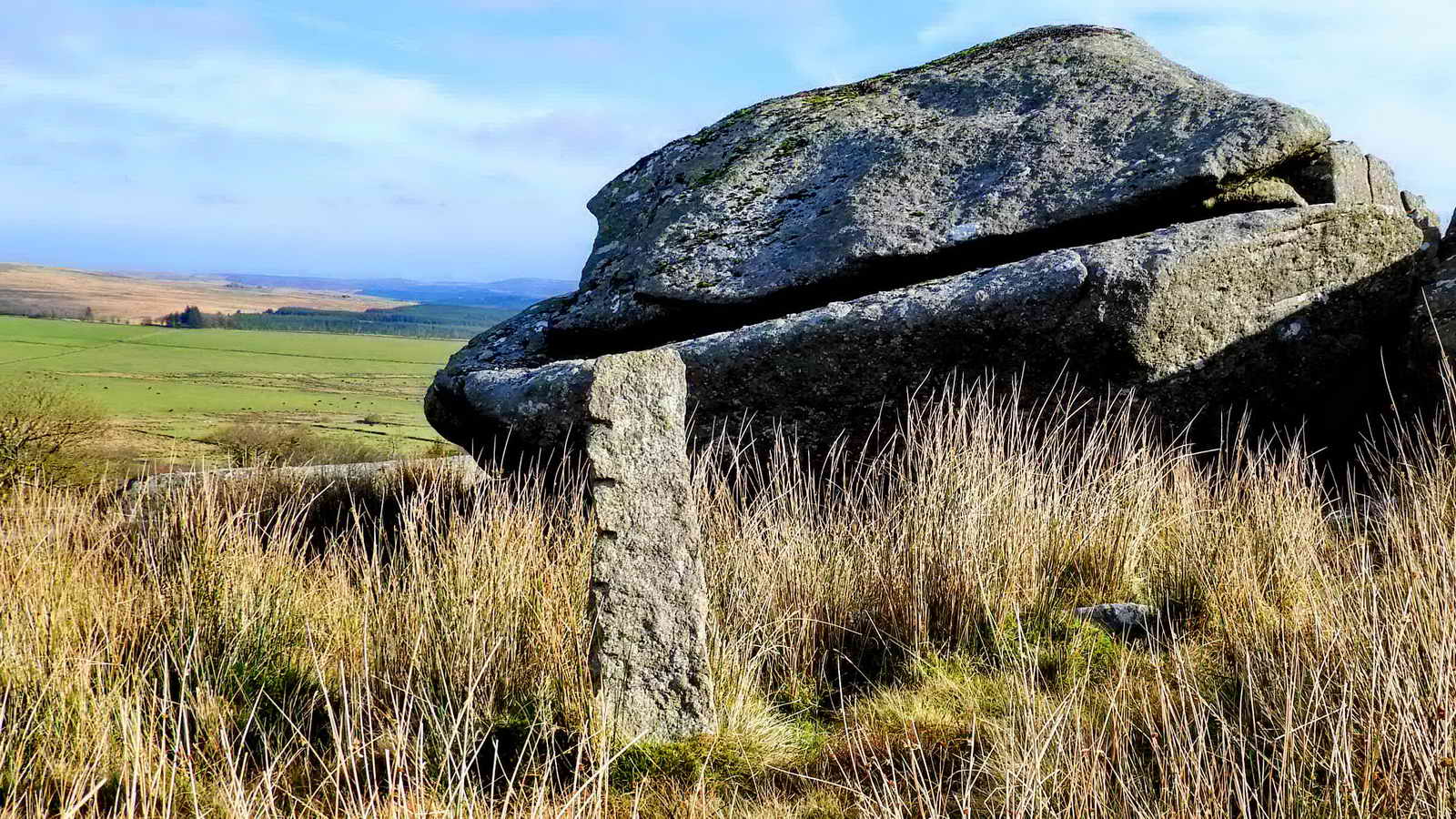
The "round" or "roundel" stone at Rundlestone Tor, SX 57645 74571, seen from the other side. This has tilted and over time rock basins have formed on its upper edge.
An ancient boundary marker of the Forest of Dartmoor, called The Rundle Stone, is the subject of discussion. It was not named as a bond mark in surveys but it was recognised as such in 1702. It used to be on the road, opposite the "modern" marker between the parishes of Walkhampton and Lydford. It was marked on a mark in 1720 as "The Great Stone call'd Roundle". It stood 7 feet tall and some 4 feet in girth. Unfortunately it was broken up when a nearby wall was being built. Source: William Crossing (1912, reprinted 2001) Crossing's Guide to Dartmoor, Peninsula Press, Newton Abbot, pages 96-97.

Another small mystery is the description of a Forest plain marker close to the tor. The stone above is in amongst the rocks, behind the "roundel" rock above, obviously set to stand up as something. It is somewhat small and unusually placed for a livestock scratching post and .....
Devon & Dartmoor HER - MDV15307 - Boundary
stone at Rundlestone Tor
- there are nine granite
boundary posts in a straight line between North Hessary Tor and Great
Mis Tor.
This stone is obviously post-1800 with its feather and tare markings, so is it an old Forest boundary stone. It seems to be i n the right place.
Back to the walk .....

Approaching Hollow Tor Quarry, SX 5710 7455, elevation 470 metres (1541 feet) ..... worked for its granite after re-opening in 1936 (Source: Kath Brewer, p.73, she could not remember when it closed) ..... Dartefact - Hollow Tor .....

A possible loading ramp, at the back of the quarry .....

Hollow Tor, from the sunny side!
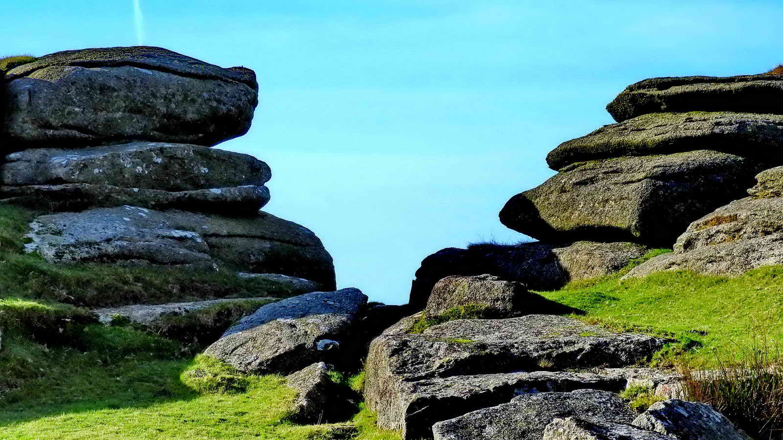
The "Hollow" in Hollow Tor.
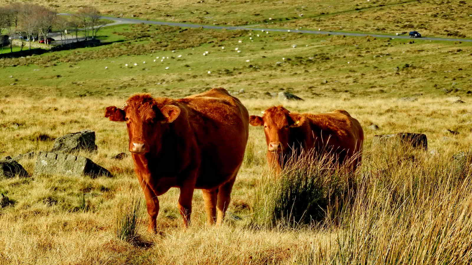
Cows (Devon Red Ruby's?) at Hollow Tor, with the Four Winds car park, the B3212 road and the track up to Great Mis Tor in the background.

Hollow Tor with the trees at Rundlestone behind, left.
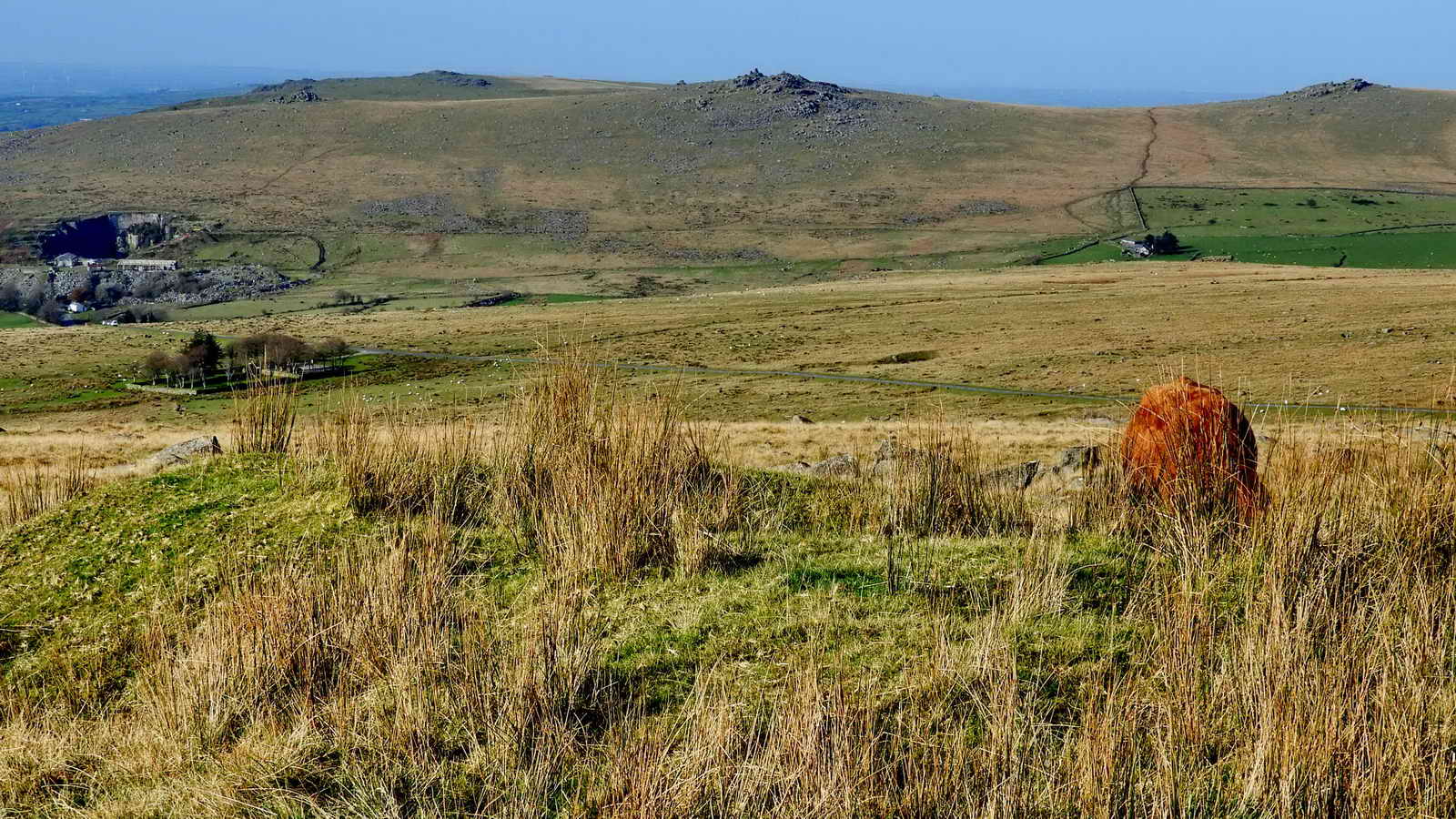
A view from near Hollow TYor with Four Winds car park (left), Mrrivale Quarry (beyond), Cox Tor, Great Staple Tor (centre) and Great Mis Tor (right) .....
Four Winds was the site of Walkhampton Foggintor School, built 1914 (closed 1936), with up to 55 children from the nearby cottages associated with Foggintor and other nearby quarries. Mr & Mrs Stoyle were the teachers, it was a spacious building with a wood block floor and central heating - the pipes were used for warming their pasties! There were periods of closure due to drifting snow and whooping cough. The curriculum had to be approved by by His Majesty's Inspectors (HMI). At one time the garden had bees, poultry, a goat and rabbits. The Great War brought special lessons in food economy and about ration books. Besides the school building there was also the School House, for the teachers. One section of the enclosure was the playing field. The school was run throughout its history by Fred Stoyle, the youngest head-teacher in the country. Their son, Ivan, planted the Christmas tree from 1924 in the school garden and this is the tree that stands there today. After the school closed in 1936, the house was renamed "Four Winds". The building was demolished in 1965. Sources: Mary Stanbrook (1991), Old Dartmoor Schools Remembered, Quay Publications, Brixham,103-110; Kath Brewer, pages 109-114; Johnie's Meanderings 9th May 2013 and Tavistock Times article online.

Great Mis Tor, SX 563 769, elevation 538 metres (1765 feet) .....
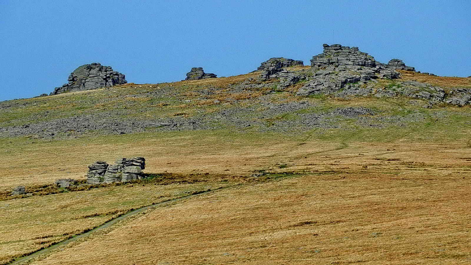
Great Mis Tor, zoomed, with Little Mis Tor at lower left.

North Hessary Tor transmitting station, built originally as tv transmitter, now used for other communications. This is a 196 metres (643 ft) high guyed mast, erected 1955.

The building beside North Hessary Tor and its trig (triangulation) pillar.

Zoomed view.

Old Dartmoor prison boundary stone at SX 57731 74452. The stone bears a broad government arrow head, very near the top of the stone. These were erected around prison land when after building started during 1806-1809, enclosing 390 acres. The first prisoners, French POWs from the Napoleonic wars arrived in 1809. They were joined by Americans from the War of 1812. The prison closed after the war, in 1816, until 1851 when it became a convict prison. From 1917 it was a facility for holding conscientious objectors during WW1. It re-opened as a convict prison in 1921.
"There are two bound stones of coarse red granite ..... that are of interest, showing the grooves of feather and tare; one to the south of North Hessary Tor at SX 5834 7372, the other to the north between the tor and Rundlestone Tor at SX 577 745. Each has an incised six inch arrow on its east-facing side. ...... Both are, however, on the Forest bounds and are thus misplaced as the original bounds granted to the prison did not extend that far westward ...... " Source: Dave Brewer, Dartmoor Boundary Markers, Halsgrove (2002), p. 260.

The prison stone, stile, North Hessary Tor and the transmitter station.

A closer view, showing a DCP stone .....
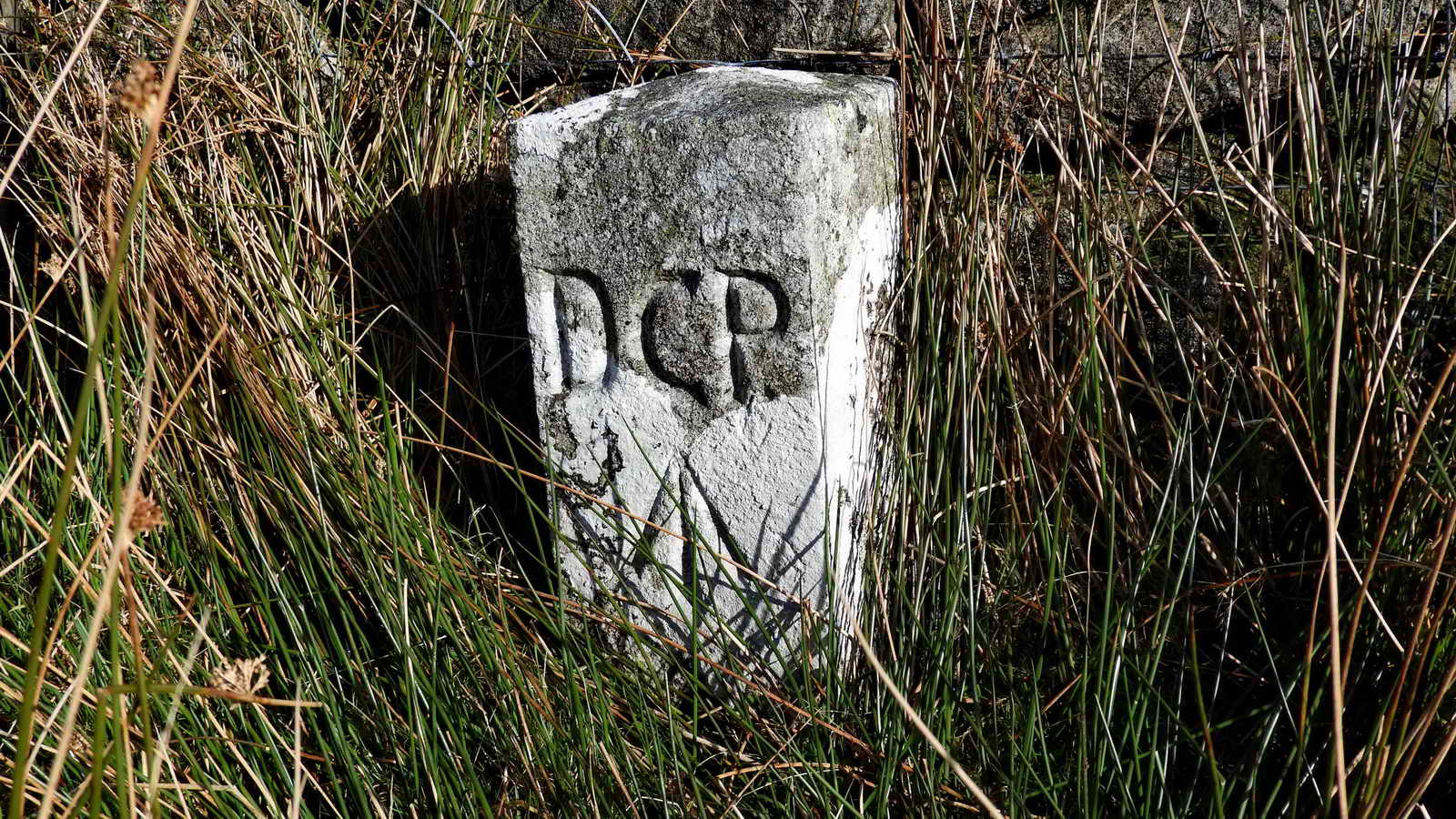
A Directors of Convict Prisons prison boundary stone at SX 57828 74308. Originally, the prison had 390 acres granted but this was extended by 1,000 acres in 1867 when the whole area was marked by these boundary stones. The Directors of Convict Prisons was a body founded in 1850 following the ending of transportation from 1840 and the phasing out of prison hulks in Plymouth, Portsmouth and other places. Source: Dave Brewer, Dartmoor Boundary Markers, Halsgrove (2002), pp. 260-262.
From the hyperlink above .....
In 1802 an inspector of the hulk establishment was appointed to be responsible to the Home Secretary for the management of hulks on the Thames, at Portsmouth, Plymouth and elsewhere. The hulks served as prisons for convicts awaiting transportation ...............
The gradual abolition of transportation to various parts of Australia from 1840 led to increasing pressure on the convict prisons, and in 1850 a body of directors of convict prisons was appointed to take over their management from earlier separate boards of commissioners and to take control of the hulk establishment; the office of superintendent had disappeared in 1847. The directors' responsibilities included the new prisons for public works at Portland, opened in 1849, and Dartmoor, reopened in 1850.
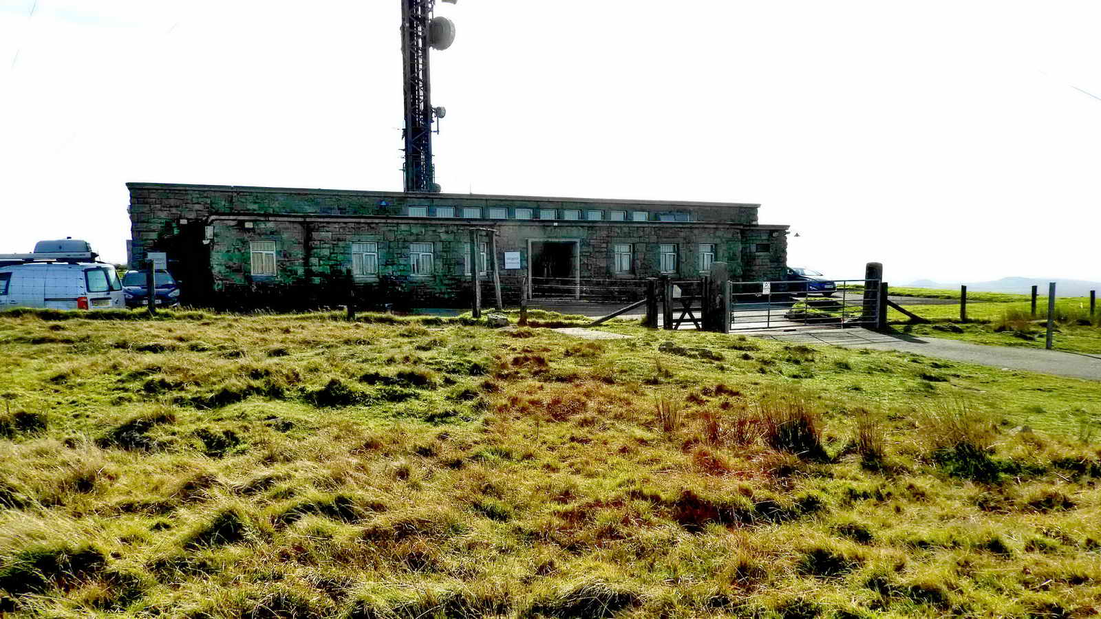
The front entrance, at the end of the private road, from the north side .....
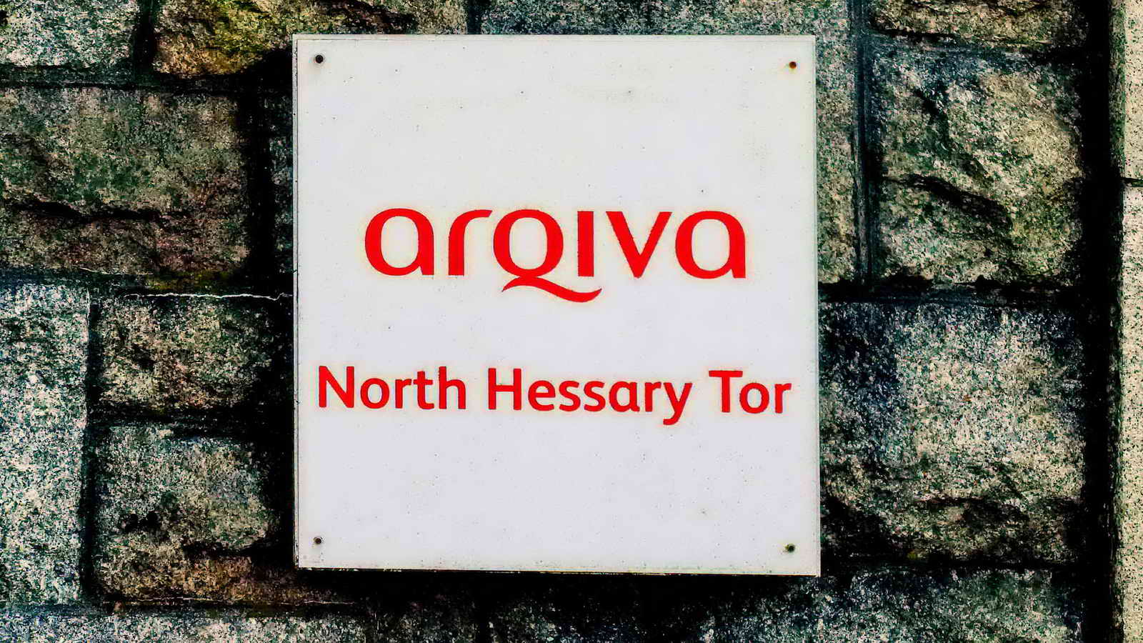
Sign by the door, see arqiva.
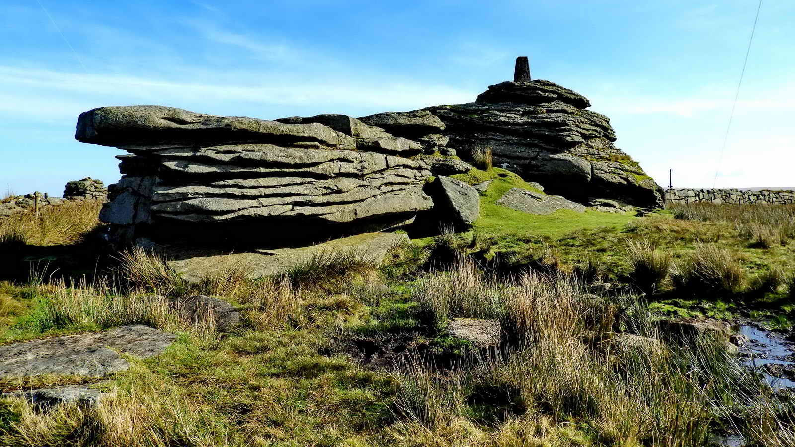
North Hessary Tor, SX 578 742, elevation 517 metres (1696 feet), with trig. pillar .....

Zoomed view .....
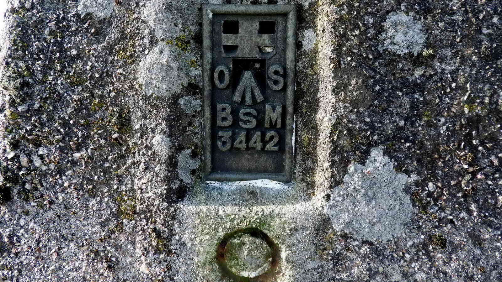
Trig. pillar base plate.

Just a "pretty" .....

A rare PCWW 1917 mark that delimits the Burrator Reservoir water catchment area .....

Closer view - the mark is becoming somewhat difficult to see after exactly 100 years.

Old tor, new technology ...... There is a triangulation pillar on the summit of North Hessary Tor (elevation 517 metres/1696 feet). These date from the Ordnance Survey's Retriangulation of Britain which started with the completion of the first pillar on 18th April 1936. This updated the original Principal Triangulation of Great Britain, 1791-1853. Also, see Benchmarks.

Zoomed view of a small section of the mast .....

A highly zoomed photograph.

Another view.

The ground anchorage points for the guy cables .....

Another view.

The building from the south side.
From Johnie's Meanderings blog:
"Hessary Tor - or Hisworthy Tor in the foreground- or is it? Sir Thomas Tyrwhitt produced a booklet with a map showing the Boundary of the Forest of Dartmoor running through here - instead of the true North Hessary Tor approx. 1/2 mile distant. The 'tor' at this point had been inscribed with some wording. The first name(s) have been chiselled out (Sir Thomas reflects this in his map), leaving the word 'Tor' cut into the rock. It could be seen as an attempt by a landowner to move the boundary of the Forest of Dartmoor by a considerable distance - to the betterment of the landowner. Dave Brewer's always excellent book "Dartmoor Boundary Markers" pages 207 and 208 give the full story.
To the right centre of the photo can be seen 'TOR' cut in the granite. SX57455 74253. The 'tor' is easiest found by those without a GPS by walking from the gate into North Hessary Aerial Building in a straight line to King's Tor. After approx. 1/2 mile a small group of scattered granite boulders will be seen - the inscribed stone is the most prominent of the group."
Brewer notes that the Duchy had disputes with neighbouring landowners in the early 18th to mid-19 centuries and the "TOR" rock suggests that they were trying to extend their boundary to this location. The name i.e. letters preceding "TOR" have been professionally chiselled away, having been N. Hisworthy or N. Hessary. This mark was on a straight line section of Forest of Dartmoor boundary, as shown on a map produced for a booklet by Sir Thomas Tyrwhitt. Source: Dave Brewer (2002), Dartmoor Boundary Markers, Halsgrove, p. 208. An up-to-date explanation appears in Dartmoor News, Issue 159, November / December 2017, page 6, where it is reported that the chiselling was done in WW2 when a lot of signs and names were removed so as to make it difficult for possible invaders.
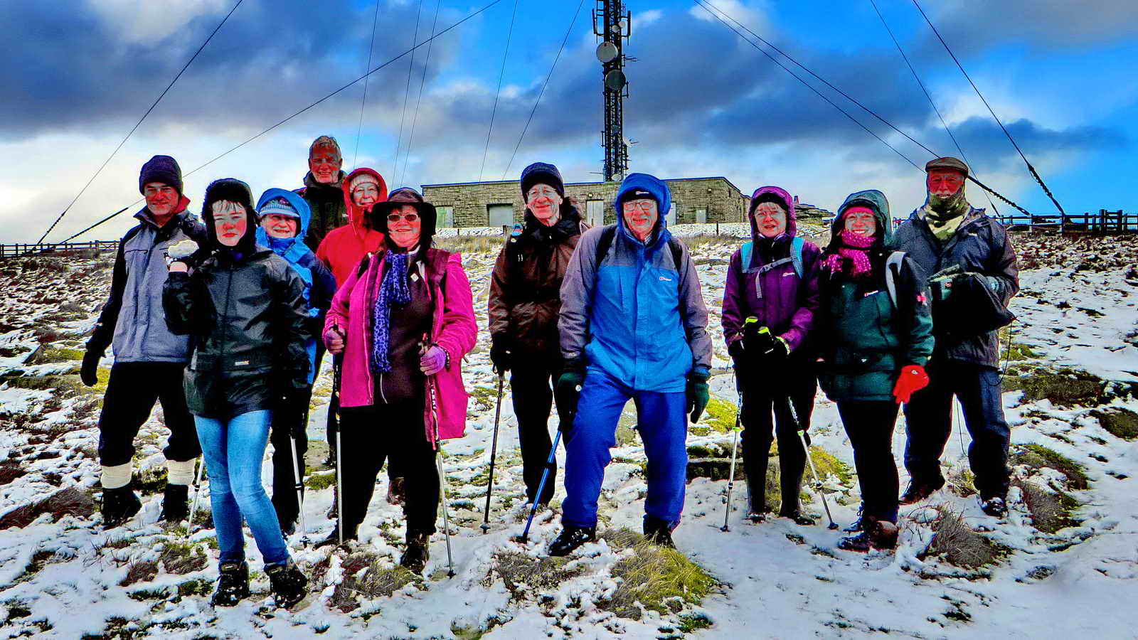
The group after leaving North Hessary Tor and the tv transmitting station: two people had turned back before this point.
There is a "TOR" at SX 57455 74253, inscribed on the top-most slab ..... Is this Billy's Tor, mentioned by Hemery (p.1027)? .....

"TOR"
Another view.
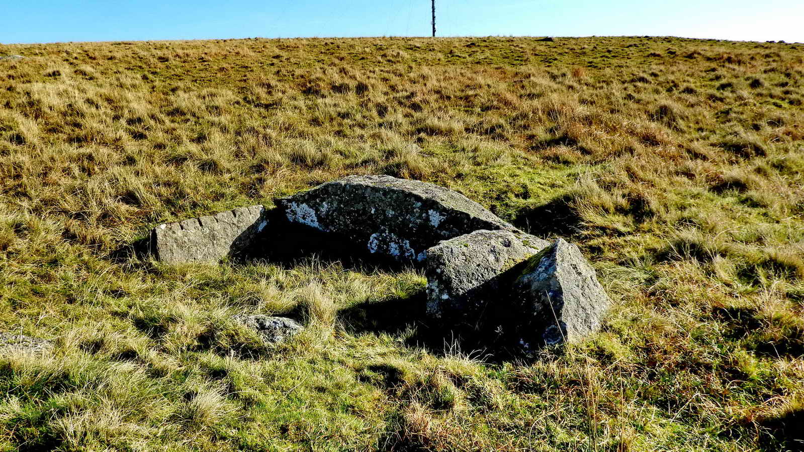
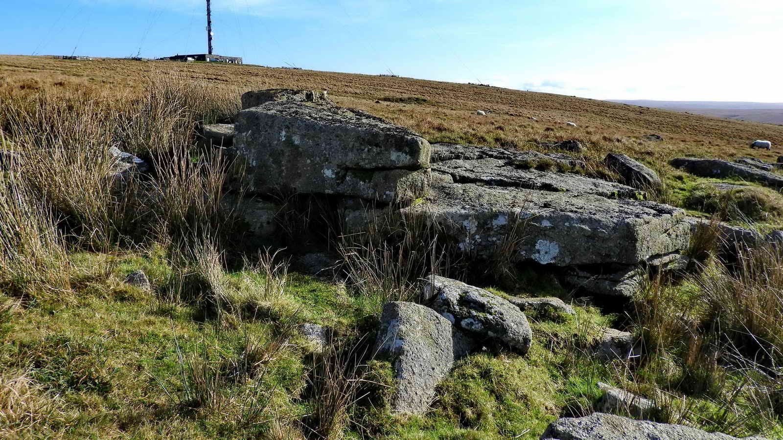
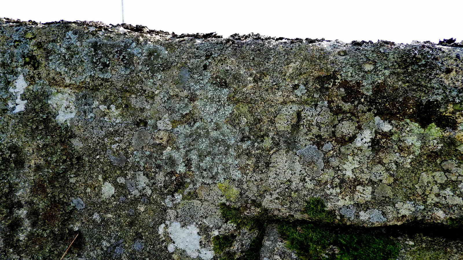
A three-sided structure, at SX 57313 74316, reminiscent of a burial cist except that it has feather and tare marks, therefore post-1800 in origin. This is probably what was left after the quarryman took what he wanted.

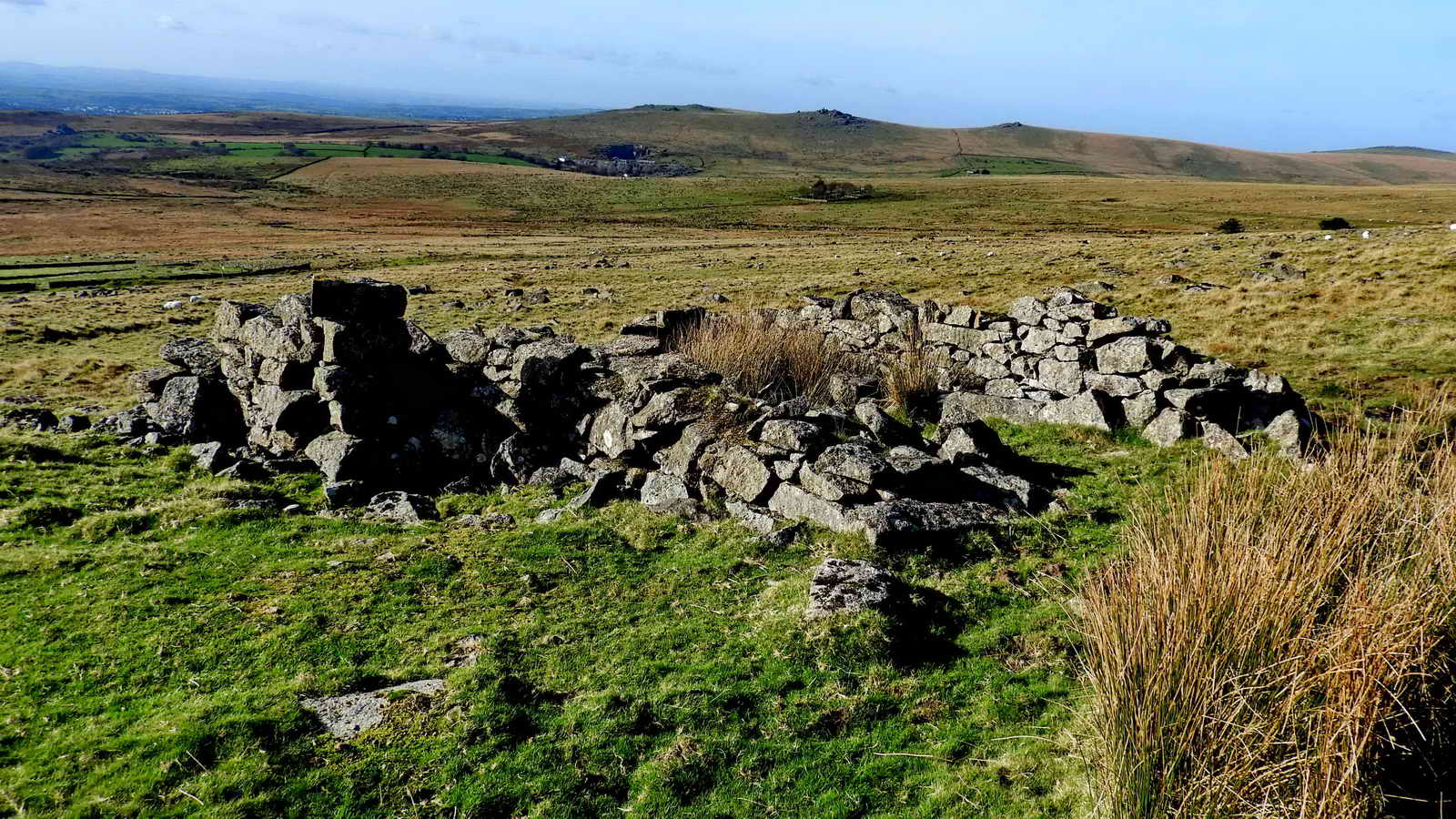
Approaching Albert Cole's quarry and granite shed .....

Another view, probably just a spoil heap .....

Albert Cole's quarry, at SX 5694 7436 .....

Another view .....

Albert Cole's granite shed. Source: Hemery, page 1027 .....
Another view, with Cox Tor, Great Staple and Roos Tors in the distance.

The group at the ruins of the granite shed .....

Last view looking over the shed and back at the quarry.

Google Earth image showing Albert Cole's granite shed and quarry. Image from Google Earth (c) 2017.
Not seen on the walk .....

Granite railway setts set in the track passing by Yellowmeade Farm. The origin of these is somewhat obscure - while they are reminiscent of Sir Thomas Tyrwhitt's horse-drawn Plymouth & Dartmoor Railway, this section is a side branch off the Plymouth to Princetown railway. Also, the setts are less regular than those on the P&DR. It is likely that this section was built by the Johnson brothers / Johnson & Brice after they took over the P&DR and that the track was an extension of the Foggintor quarry railway. It was either to take granite from the quarries seen on this walk or, to link up with the aborted Merrivale Quarry railway. That was a plan of William Duke after he opened Tor (Merrivale) Quarry in 1875/1876. It was to run across Long Ash to link with the Plymouth & Dartmoor Railway at Swell Tor Quarry, thereby linking with Plymouth, the railway and the docks. The railway was started at the quarry, where the embankment is still seen extending towards the River Walkham but it became known as "Duke's Folly". If it was to go to Swell Tor Quarry, then this piece of line is probably not part of that plan and this would suggest that it was to serve the small quarries visited today and that they are much older than e.g. 1919. perhaps mid-1800s.
Note: Sir Thomas Tyrwhitt's horse-drawn tramway, the Plymouth & Dartmoor Railway, opened 1823, mentioned above, was overlain by the 1883 Princetown Railway. This, in turn, became part of the GWR in 1922. Closed in 1956.

Blocked gateway in the wall corner of the Yellowmeade enclosure, at SX 56660 74031: the gatepost left of centre bears an iron gate-hanger, the right gatepost, hidden in the shadow of the wooden fencepost is actually a TA stone, marking the course of the old Tavistock / Ashburton track .....

Close-up, showing the "A" facing the Ashburton direction.

The Cake Stone, at SX 56712 74116. This is right beside the track, which is a few inches below the bottom of the photograph. The stone was probably split to make granite setts for the railway but which were not used ....

The Cake Stone from above, showing the proximity of the track.

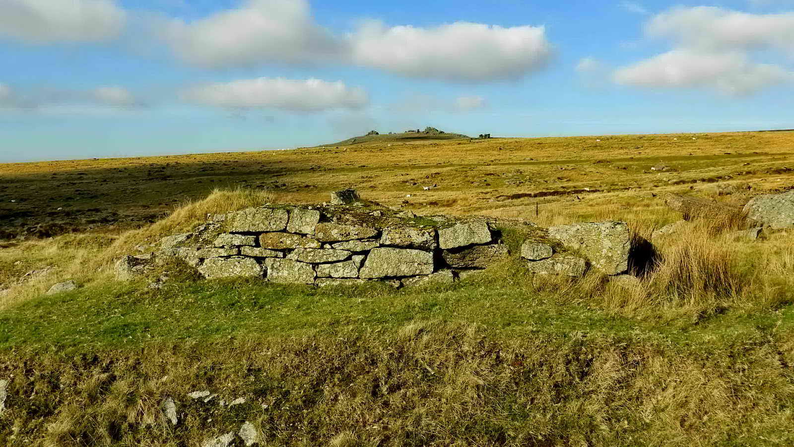
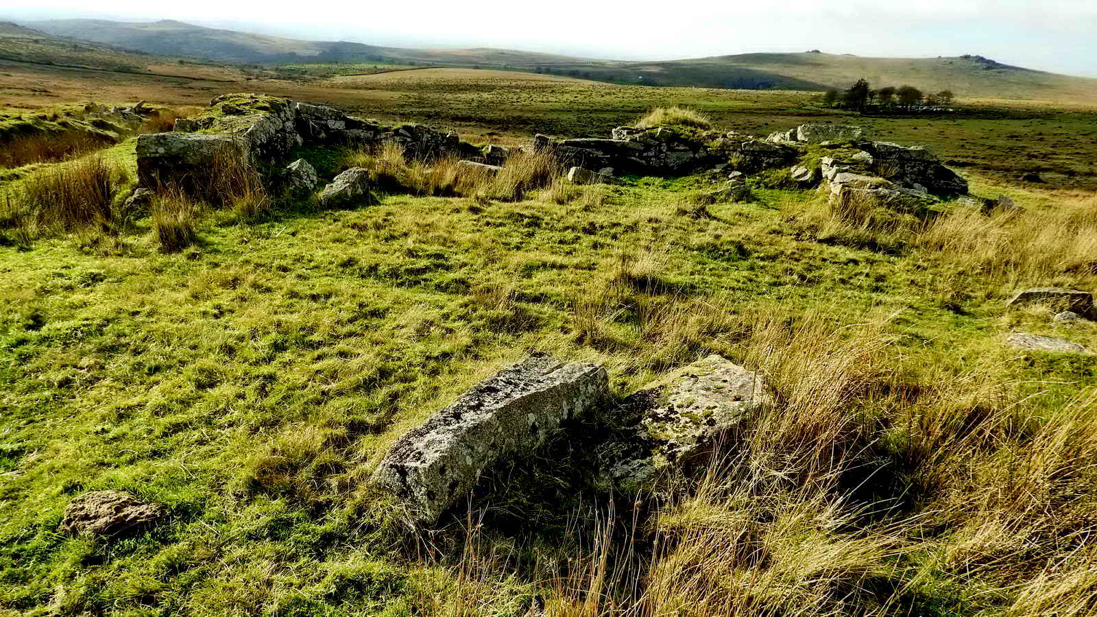
One of three hut circles built against the wal of a Bronze Age enclosure at SX 5642 7448, with Four Winds in the distance. Described by Jeremy Butler (1994), Dartmoor Atlas of Antiquities Vol. 3 - The South West, 1 Yellowmeade (figs. 44.1. - 44.1.1), pages 14-17
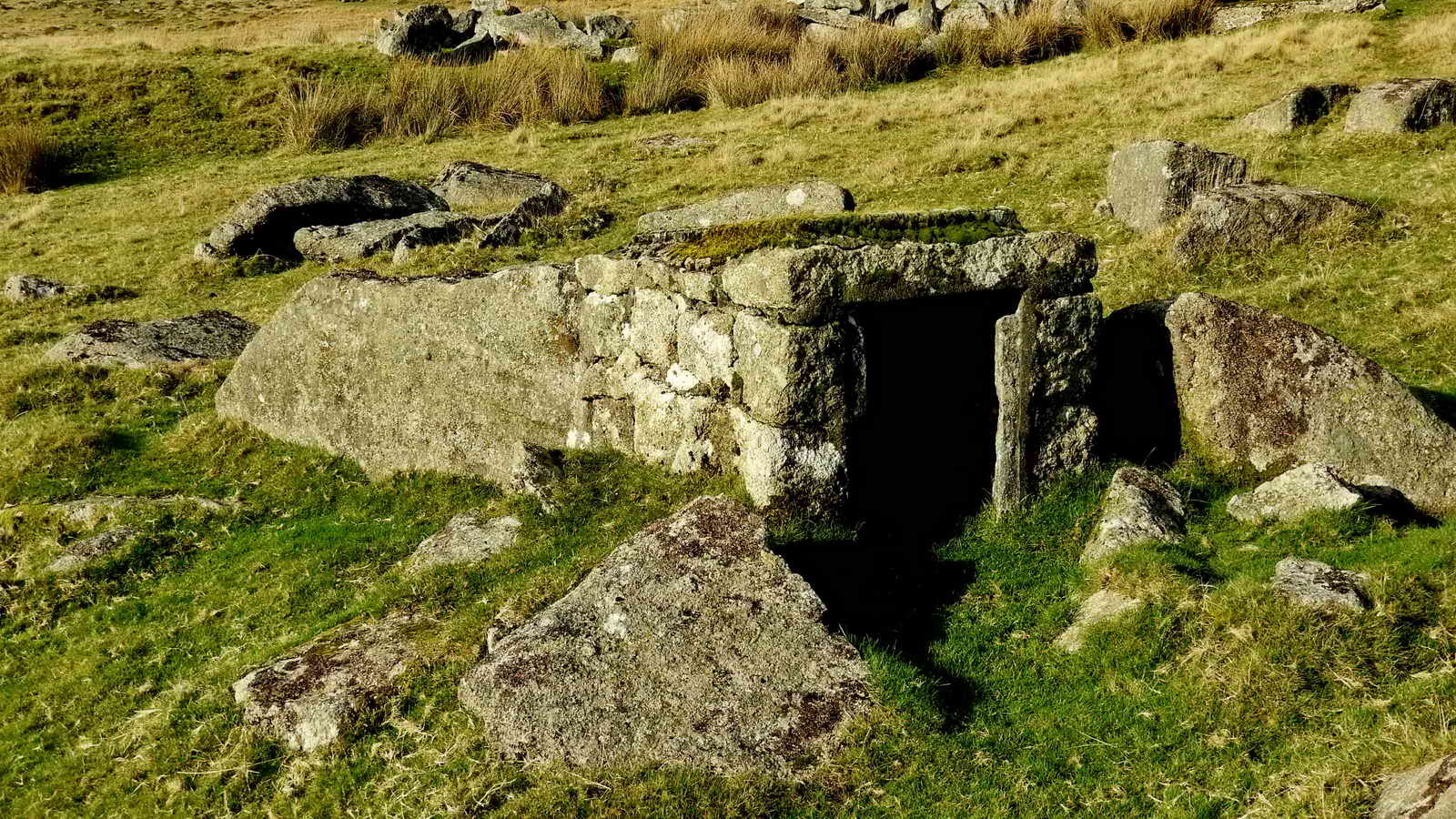
Explosives store by West Mead Quarry - SX 56454 74621, almost behind Red Cottages (see below) .....

Front view of the store, with the door now removed. This may have been non-ferrous to prevent sparks, as a safety measure.

West Mead Quarry - SX 56505 74653 with the trees at Red Cottages in the background. The quarry was owned and worked by uncles, and later by cousins, of Kath Brewer from 1941, when they left Ingra Tor, until it closed in 1966. The quarry had its own blacksmith's shop. Source: (Kath Brewer (1997), The Railways, Quarries and Cottages of Foggintor, Orchard Publications, Chudleigh, Newton Abbot, page 73) .....

Another view in the autumn sunshine .....

Reflections .....
Looking across the entrance to the ruins of the blacksmith's shop .....
Another view of the ruins of the "smithy" .....

An anchorage point for the crane and jib platform - see Kath Brewer photo, page 79, which also shows Dave German, one of the final lessees.
Back to the walk "on the day" .....

The southern edge of Red Cottages, built probably in April 1847, with plans dating from July 1846 (Kath Brewer, pages 94-95). According to various Censuses, they were originally known as Mount Pleasant Cottages, then West View Cottages, and after that, Red Cottages. They were built with cob and by 1871 the weather got into them so badly they were "covered with corrugated iron" and painted with red lead, thus becoming known as Red Cottages - this appears in the 1871 Census. Kath Brewer writes that in later years they were actually black, having been covered with pitch , again against the weather, thus becoming black cottages! There were six cottages but with twelve dwellings - with "one up, one down". In the 1861 Census, there were thirteen families with 50 adults and 38 children at West View, as the cottages were known at that time! This reflects the importance of quarrying in the area - at one time there were approximately 600 men employed in all the quarries in the area Source: Stephen Woods (1988), Dartmoor Stone, Devon Books, Exeter, page 283. The cottages were probably demolished the same time as Hill Cottages, in 1953.
The trees were blown over in the 1980's (Kath Brewer, page 88) - probably the Great Storm of 1987.
Cob - a natural building material made from subsoil, water, fibrous organic material (typically straw), and sometimes lime. The contents of subsoil naturally vary, and if it does not contain the right mixture it can be modified with sand or clay. Cob is fireproof and inexpensive.
Note: Quarrying in this area: surface moorstone has been used since the Bronze Age. Quarrying was under way in 1805-1809 with the building of Princetown Prison. Tyrwhitt's tramway served Swelltor, Foggintor, Ingra Tor and Great and Little King Tor quarries. In the 1830s-1840s, quarrying provided work in the area for up to 600 men . Source: Stephen Woods (1988), Dartmoor Stone, Devon Books, Exeter, page 283. See also Legendary Dartmoor - Foggintor.

The northern-most plot at Red Cottages .....

A cement base from a chimney pot.

Google Earth image showing Red Cottages (top tight) and the proximity of West Mead Quarry (lower left). Image from Google Earth (c) 2017.
MAP: Blue = Planned route; Green - Complete reconnaissance walk; Red = GPS satellite track of the walk on the day.

� Crown copyright 2016 Ordnance
Survey
Licence number 100047373
Also, Copyright � 2005, Memory-Map Europe, with permission.
This walk was reached using the B3357 and between Tavistock and Two Bridges. Car parking was at the small quarry seen on turning into the track to Yellowmeade Farm the P symbol on the map and across the road from there, by the ruins of Foggintor Mission Hall. There is also some space up the hill at the old Pump House.
Statistics
Distance - 4.09 km / 2.54 miles
All photographs on this web site are copyright © Keith Ryan.
All rights reserved - please email for permissions