

This walk: 2016-5-18. Cadover Bridge, River Plym, Pipe Track, pipeline, North Wood, bluebells, West Down, corn ditch, hut circle.
Walk details below - Information about the route etc.
Where we walked: Google Satellite view of the area - including the GPS track of the walk (compare with the Ordnance Survey map plus track below).
try zooming in with the mouse thumbwheel and "dragging" the map to see points of interest
click on the red place-markers to read their label - they are most accurate at the highest zoom level
try "mousing" over the list of placemarks on the left of the screen, highlights their place on the map
use browser back arrow or Alt key and left-arrow cursor key together to return to normal web page.
Previous walk in this area: 2007-2-26 and 2013-2-6
Cadover (or old-name Cadaford) Bridge over the River Plym, which used to be known as the Cad.
The bridge.
The River Plym is quite a torrent here today, and noisy.
The path into North Wood.
The noisy river.
This walk follows the "Pipe Track" under which is the old pipeline, made of clay, earthenware or cloam, that brought china clay from the early workings (e.g. Brisworthy) in slurry form to the drying works at Shaugh Bridge.
A bit of a maelstrom.
Another view of the pipeline .....
A low-level view to exaggerate the construction.
A few bluebells.
An iron section of pipe.
Bluebells, in the old oak wood.
Bluebells on the bank of the River Plym.
As previous photograph.
Bluebells everywhere you look.
Ditto.
As previous photograph.
Bluebell, Hycinthoides non-scripta, particularly associated with ancient woodland where it may dominate the understorey to produce carpets of violet�blue flowers in "bluebell woods, but also occurs in more open habitats in western regions. It is protected under UK law, and in some other parts of its range. A related species, H. hispanica has also been introduced to the British Isles and hybridises with H.non-scripta to produce intermediates known as H. � massartiana
Bluebell.
Bluebell.
Bluebell.
Bluebell.
Signs that the pipe was double in at least some of its "run".
Double pipes.
Looking back into North Wood .....
Looking forward to West Down .....
The fate between the two locations.
A quick view of West Down without going far into it. At this ppoint, I walked up the hill .....
A view over the hedge into North Wood, a sunny dell with more bluebells.
The hedge has the structure of a corn ditch: these originate from the time when Dartmoor was a royal hunting area and there was a need to keep the King�s deer out of the cultivated land. A stone revetted wall and external ditch faced onto the open moor which deterred deer and other animals from jumping over, whilst the sloping grassy bank on the inner face allowed those animals which had entered to exit again without difficulty. Source: http://www.dartmoor-npa.gov.uk/aboutus/news/au-geninterestnews/au_crosspr10
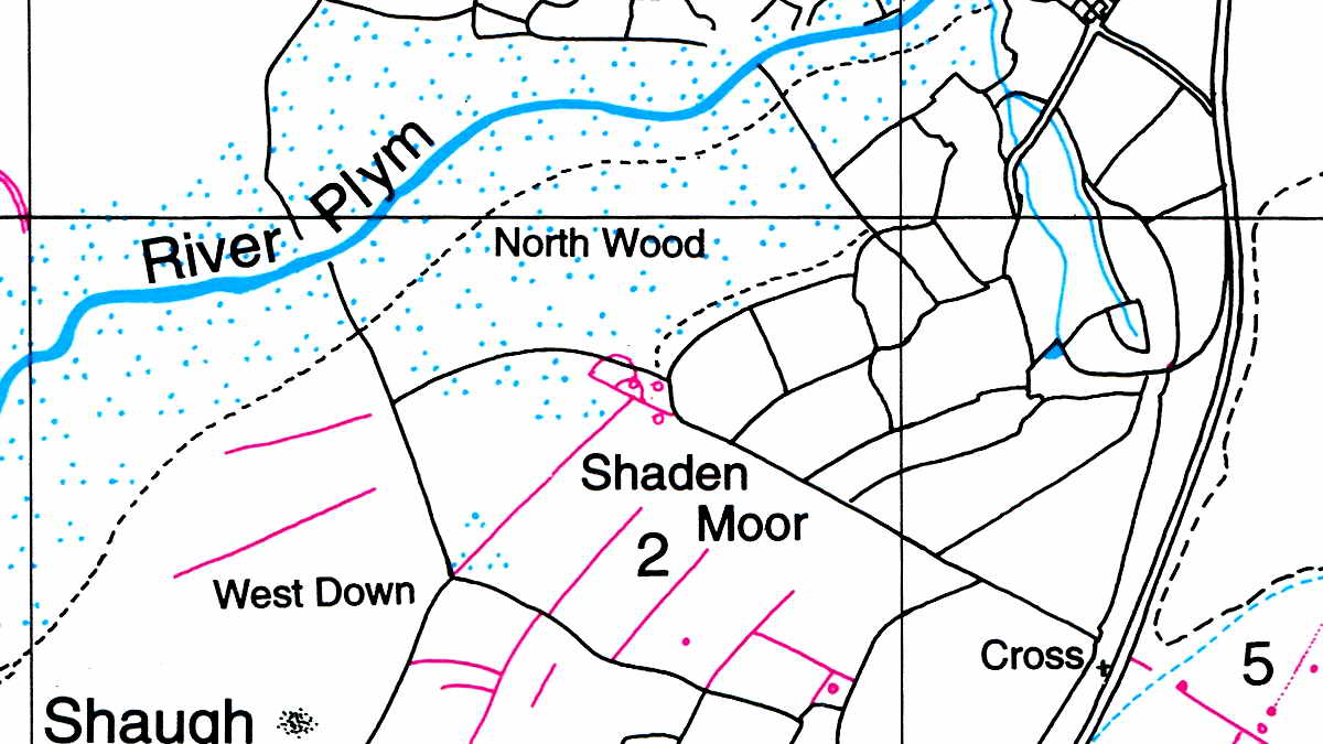
Hut circle at SX 54671 63805 (one of three here) mentioned by Jeremy Butler, 1994, Dartmoor Atlas of Antiquities Vol. 3 - The South West, 48.3 Shaden Moor Field System, pages 58-59, shown (in red) in the centre of the figure below. This must be the one in the semi-circular enclosure. There is a modern wire fence between the hut and the southern edge of the enclosure? This is outside the wall around North Wood and is therefore on Shaden Moor.

A lone Scots pine that caught my eye, this was going to be "Life and Death" but I moved too far forward to separate the dead stump from the living tree and didn't have the oomph to go back again.
Seen along the pipe track.
What appears to be an inspection pit in the pipeline, at SX 55154 64434.
A pair of iron spikes driven into a stone near the pipe at SX 55204 64459 .....
I have no idea as to the purpose of these.
Cadover Bridge again, in slightly better light.
MAP: Red = GPS satellite track of the walk.

© Crown copyright and database rights 2015. Ordnance Survey
Licence number 100047373
Use of this data is subject to terms and conditions.
Also, Copyright © 2005, Memory-Map Europe, with permission.
The walk can be accessed easily from Yelverton via Meavy or from Plympton by going past the Elfordleigh Hotel. The large car park is a popular tourist (and locals) spot, the car park is at the yellow cross and P symbol on the map. There are also other approaches.
Statistics
Distance - 3.54 km / 2.20 miles.
All photographs on this web site are copyright © 2007-2016 Keith Ryan.
All rights reserved - please email for permissions