![]()


This walk: 2016-3-17. Pew Tor (Pu Tor), 1847 and 1896 markers, Pew Tor Quarry.
This was a fruitless search for the "missing" north-east marker from 1896.
Walk details below - Information about the route etc.
Old maps .....
Ordnance Survey, Six-inch to the mile, 1st edition - 1888-1913
Previous walks in this area: 7th April 2010, 8th April 2010, 28th December 2011 (incl. data) & 8th February 2012 (KR led walk)

Approaching Pew Tor, aka Pu Tor, from the south-west.

Pew Tor, SX 532 734, elevation 318 metres (1043 feet).

White pony, backlit by bright sunlight.

Pu Tor.

A view showing a SS P = Sampford Spiney Parish boundary stone .....

Closer view .....
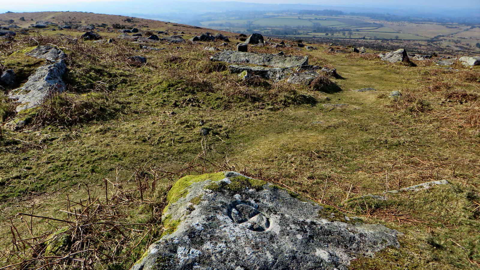
An 1847 "hot cross bun" marker of which there are nine around the tor: these served as a boundary within which stone was not to be taken by the busy stone masons. This protected zone was extended in 1896 with other markers (see below). The "square" shape of the Sampford Spiney Parish boundary stone can be seen right of centre beyond.

Closer view of the 1847 marker.

The 1896 south-east outer marker at SX 53350 73444 � 3 metres: a quadrant circle with 1-inch holes drilled into it .....

Closer view .....

Showing the marker with respect to the tor .....
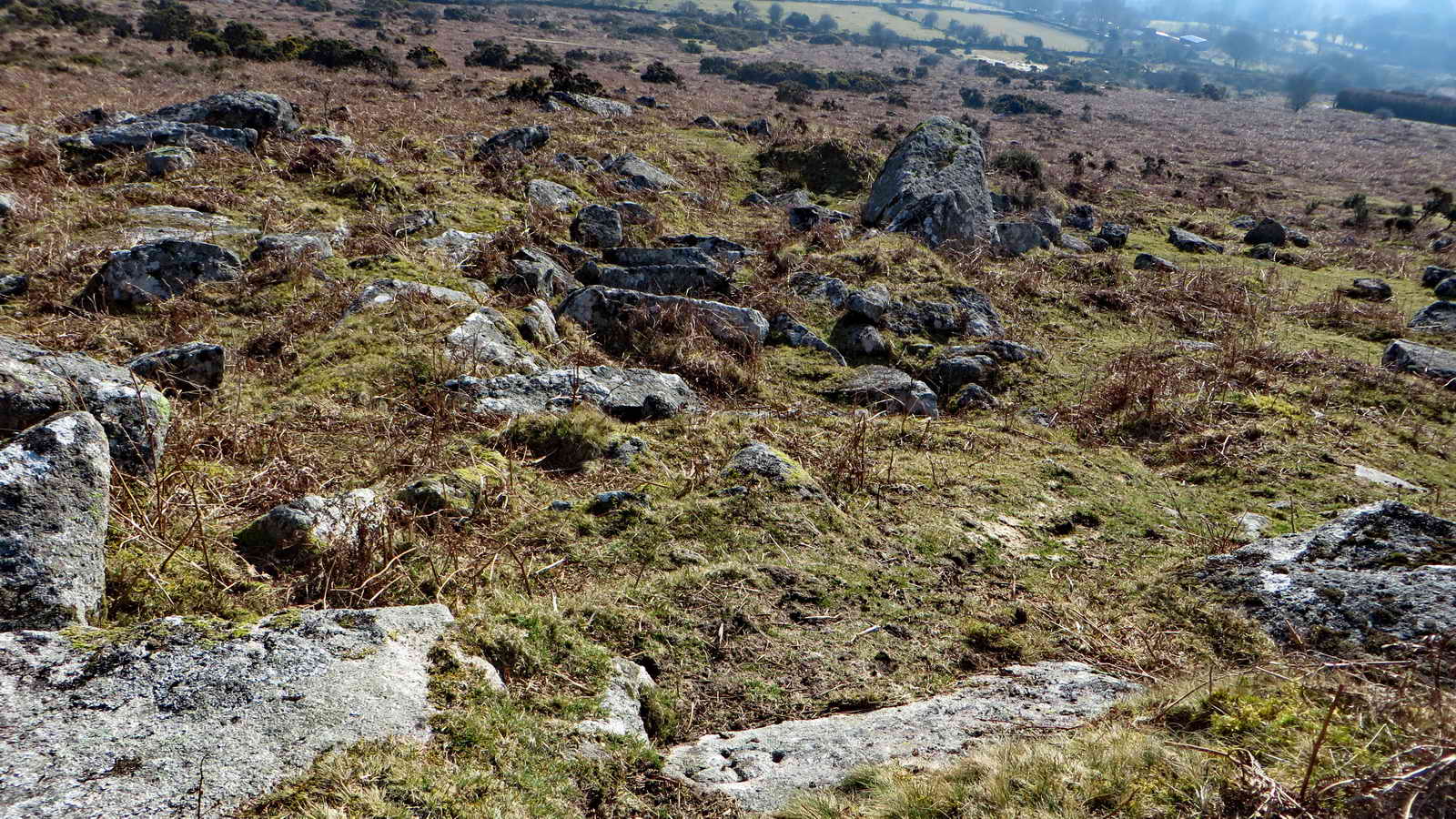
Showing the marker (at bottom, just right of centre) with respect to a near-by rock reminiscent of a smaller Cuckoo Rock (right of centre).

A rock formation.
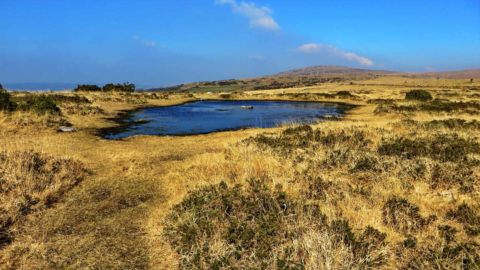
The nearby dew pond.

Rock formation at Pew Tor.

A nearby granite pile showing horizontal bedding and off-vertical jointing: the second SS P stone is visible at the right.

Another view of the rocks.

Beating a retreat.

Pew Tor Quarry, at SX 5310 7315 .....

Another view.
MAP: Red = GPS satellite track of the walk.

© Crown copyright and database rights 2015. Ordnance Survey. Licence number 100047373. Use of this data is subject to terms and conditions.
Also, Copyright © 2005, Memory-Map Europe, with permission.
The walk is probably most easily approached via the road from the church in Whitchurch (the south-eastern area of Tavistock), following signs to Moortown but parking before getting there on the roadside below Pew Tor. There is roadside parking in the area of the yellow cross on the map, which is located at SX 52527 73058.
All photographs on this web site are copyright © 2007-2016 Keith Ryan.
All rights reserved - please email for permissions