![]()


This walk: 2015-7-8. Dartmoor Brewery, Meavy Head, GWR track bridges, water drainage channels, North Hessary Tor TV mast, Dartmoor ponies, hut circles, cotton grass, Foggintor Quarry, Eva's Farm. Hill Cottages, Manager's House, Big Tip, Stables, Gibb's Cottage, Smithy and Princetown Smithy.
Most photos were taken on a blue sky 'recce' on Tues. 30th June; others were taken around the quarry area on a grey day on Mon. 6th July, the walkers were taken on a grey, damp Weds 8th July..
Walk details below - Information about the route etc.
Ordnance Survey, Six-inch to the mile, 1888-1913
Where we walked: Google Satellite view of the area - including the GPS track of the walk (compare with the Ordnance Survey map plus track below)
2nd recce on Mon 6th July with Matthew.
Previous walks in this area: 10th March 2010 and 11th May 2011.
A second walk on 16th July went through the quarry and provided some extra photographs.

Dartmoor Brewery passed along the way from the car park on the first 'recce' ......

Area marked on the map as "Meavy Head" - but perhaps we have just crossed it in the previous photograph?
Sheepstor (left), Burrator plantations, Leather Tor (right of centre) and Sharpitor (right).

North Hessary Tor TV transmitter.

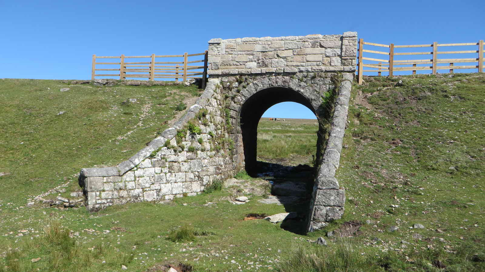
Bridge no. 1 at SX 58167 73276, with a covered drainage channel in the foreground that runs right under the bridge ......
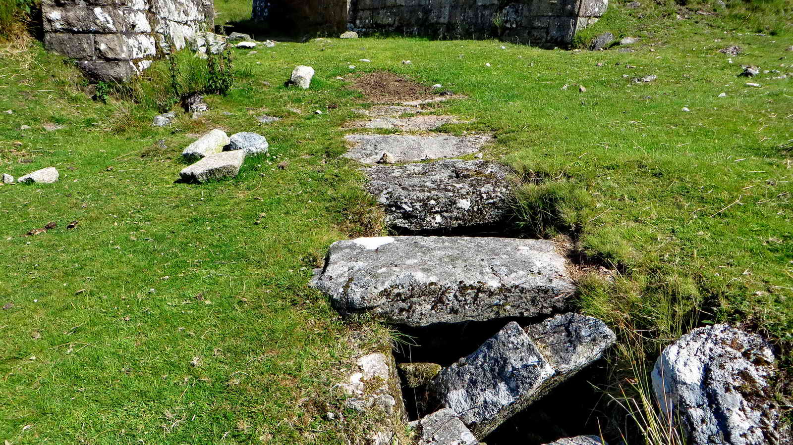
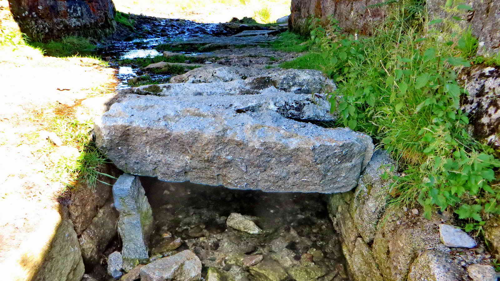
Detail of the drainage channel .....

Unidentified - possible juvenile or female whinchat judging by the white rump seen in flight.
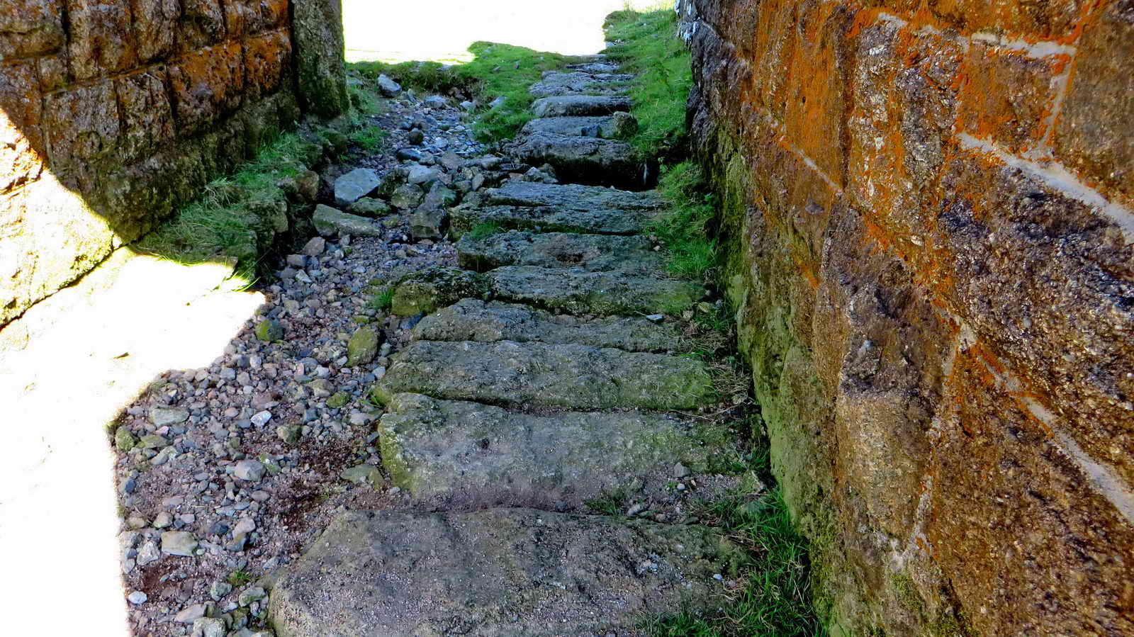
The drain under the bridge looks like a very wide clapper bridge!
The drain above the bridge .....
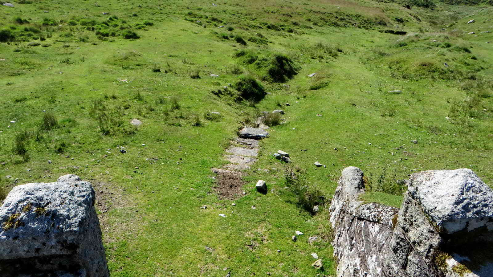
View from the bridge.

Track bed of the old GWR Plymouth to Princetown railway, (opened 1823, closed 1956), with Leather Tor (left) and Sharpitor (right).

Livestock .....

Dartmoor ponies.

Looking over a Bronze Age settlement at SX 577 730 .....

Hut circle, looking back at the ponies .....

Zoomed view .....

Hut circle .....

Hut circle, looking rowards Plymouth.

Remains of a platelayers' hut at SX 5755 7313 ......
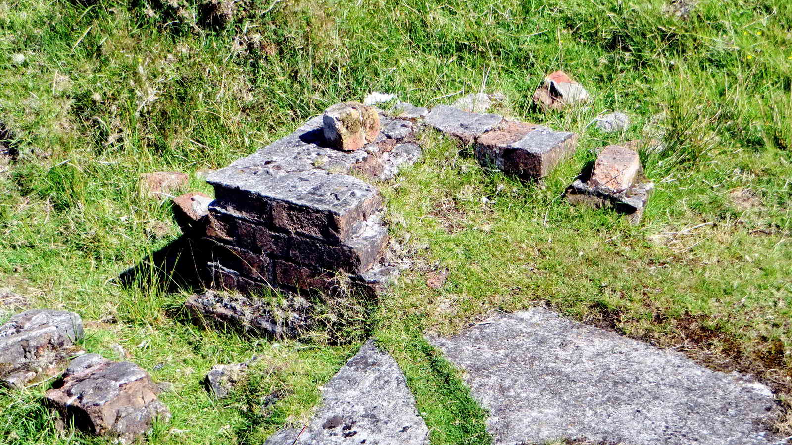
Remains of the fireplace.

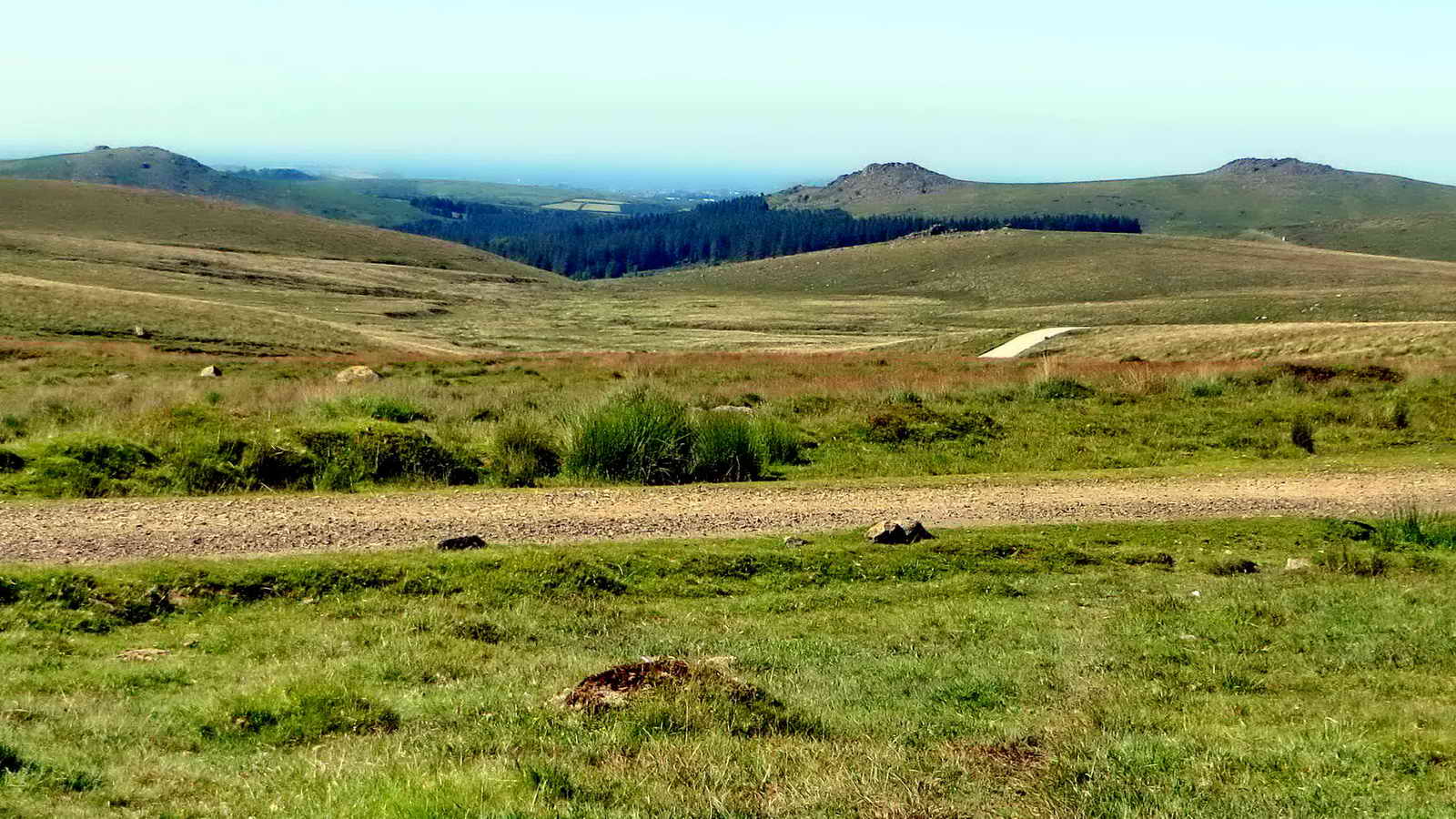
View towards Ingra Tor quarry .....
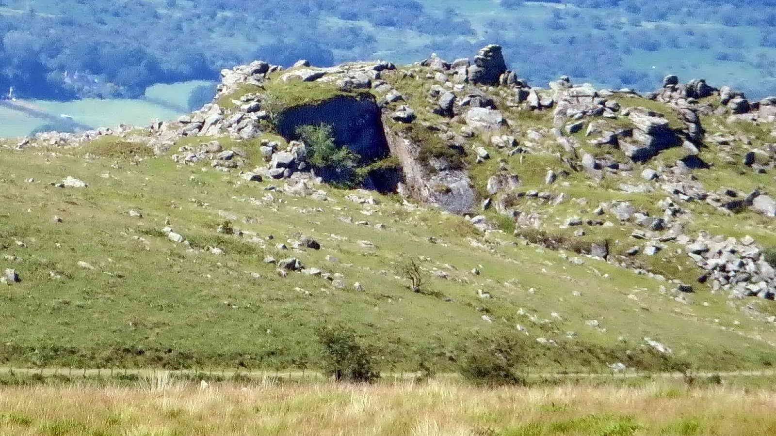
Slightly closer view.

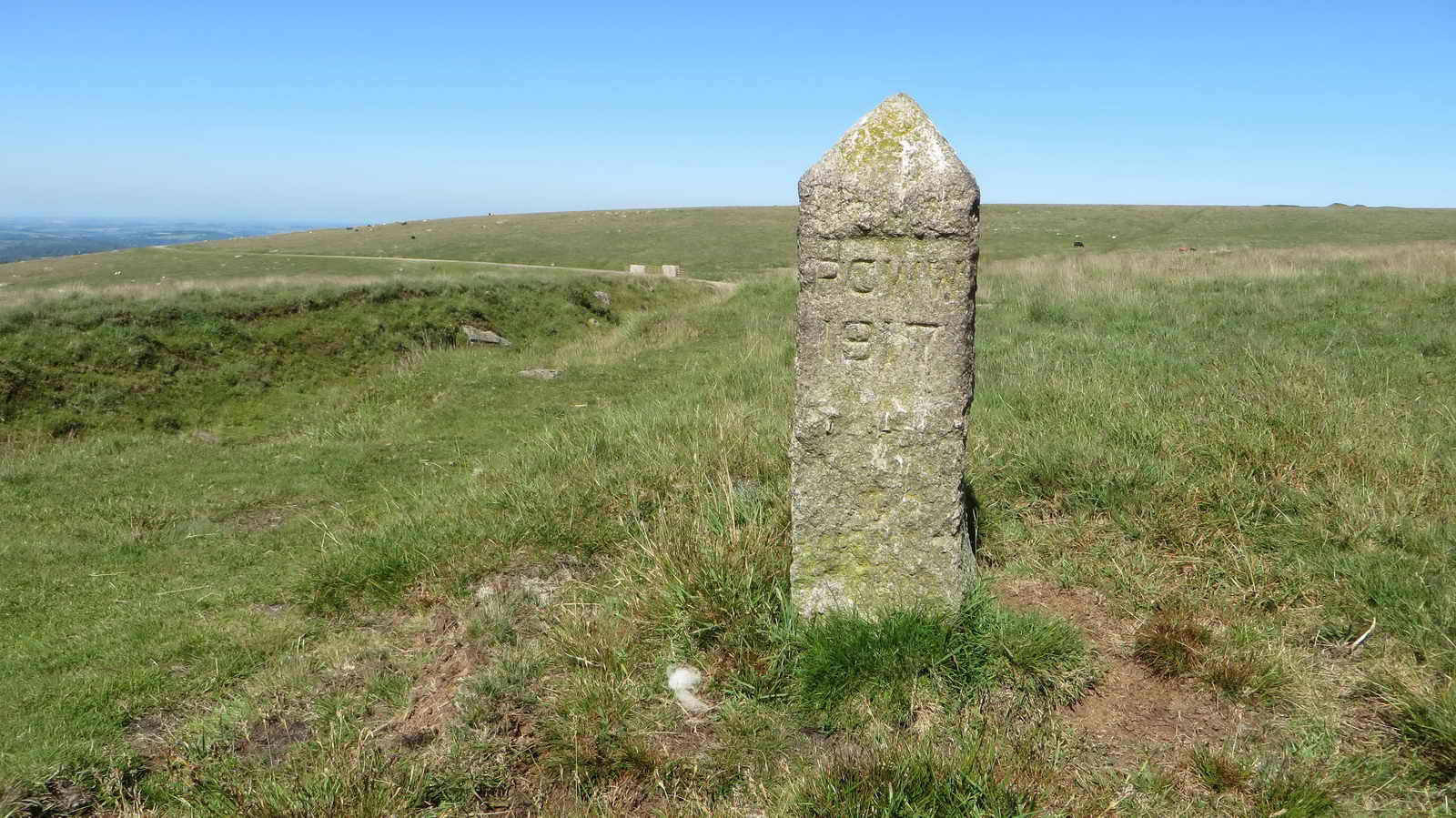
PCWW 1917 stones (Plymouth Corporation WaterWorks) either side of the railway track ......

Friendly sheep.

Self explanatory .....

As previous photograph .....
Ditto.

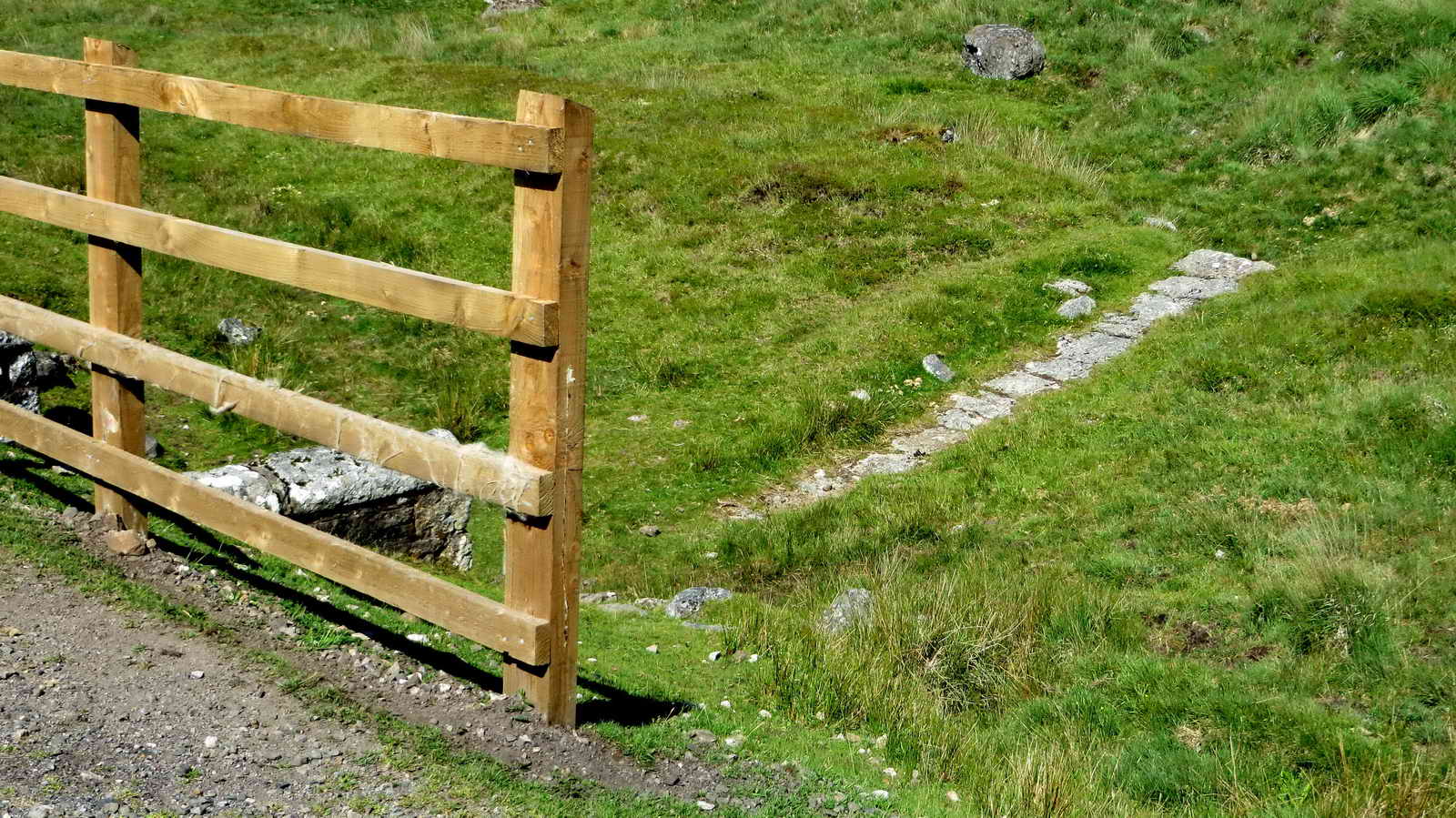
A second bridge at SX 5705 7318 .....

Common cotton grass, Eriophorum angustifolium, with three flowers/seed heads here. The alternative is Hare's-tail Cotton-grass (Eriophorum vaginatum) with a single seed head .....

Close-up view.
Under the second bridge .....

Detail of the covered water channel .....

As previous photograph .....
As previous photograph .....

View from the bridge .....

Zoomed view.

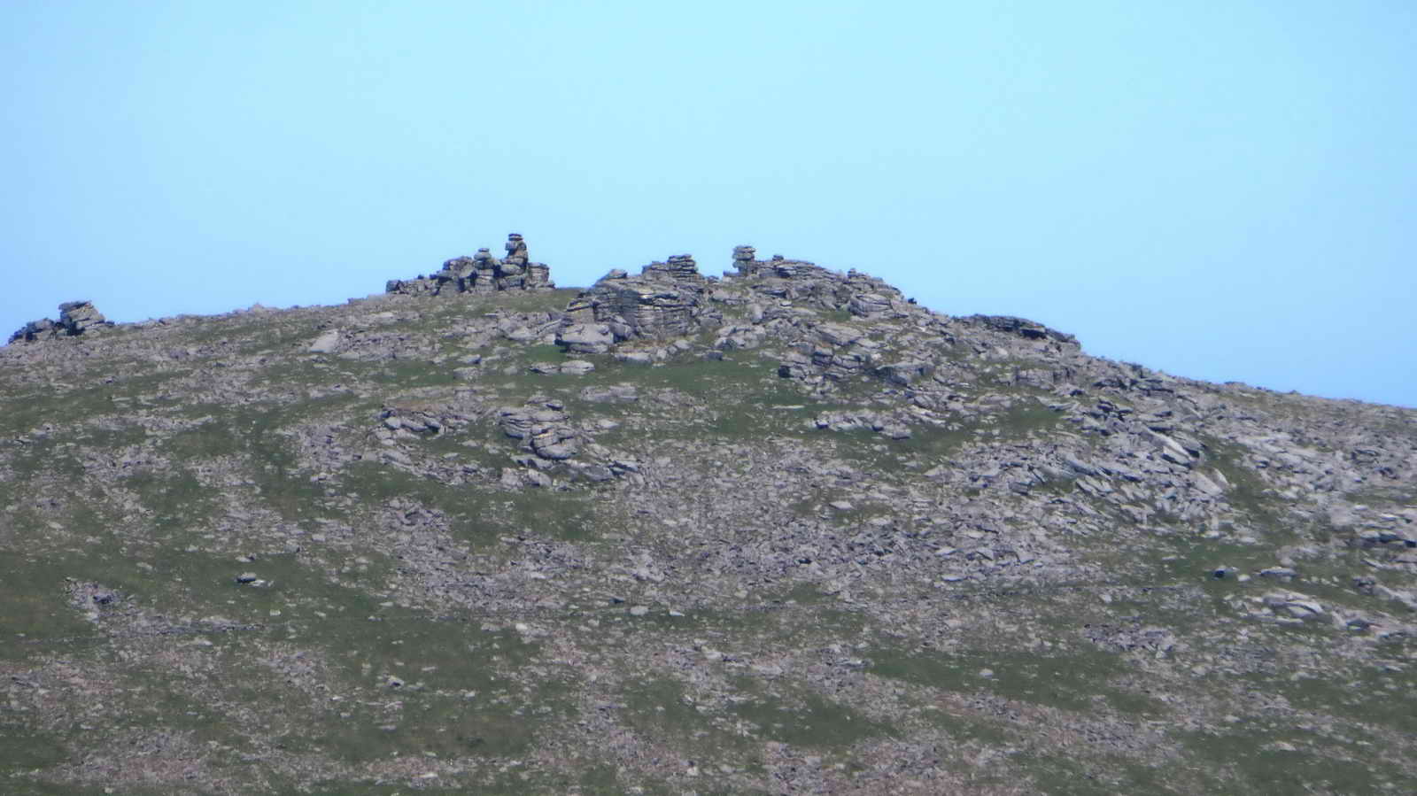
North Hessary Tor transmitter mast .....

The building, dwarfing North Hessary Tor adjacent with its triangulation pillar.

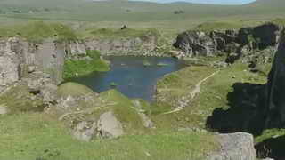
Foggintor Quarry, also known as Hill Quarry and Royal Oak Quarry, opened in (1785?) 1820s and worked intermittently until closed at Michaelmas 1906 (work was concentrated on the more modern Swell Tor Quarry) ..... in its 1850's heyday, around 600 men worked here with a whole community involved, with a farm, school, chapel etc. Eventually the enterprise became uneconomic as cheaper building materials were found.

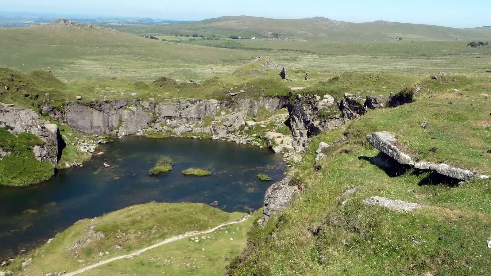
A flooded area .....
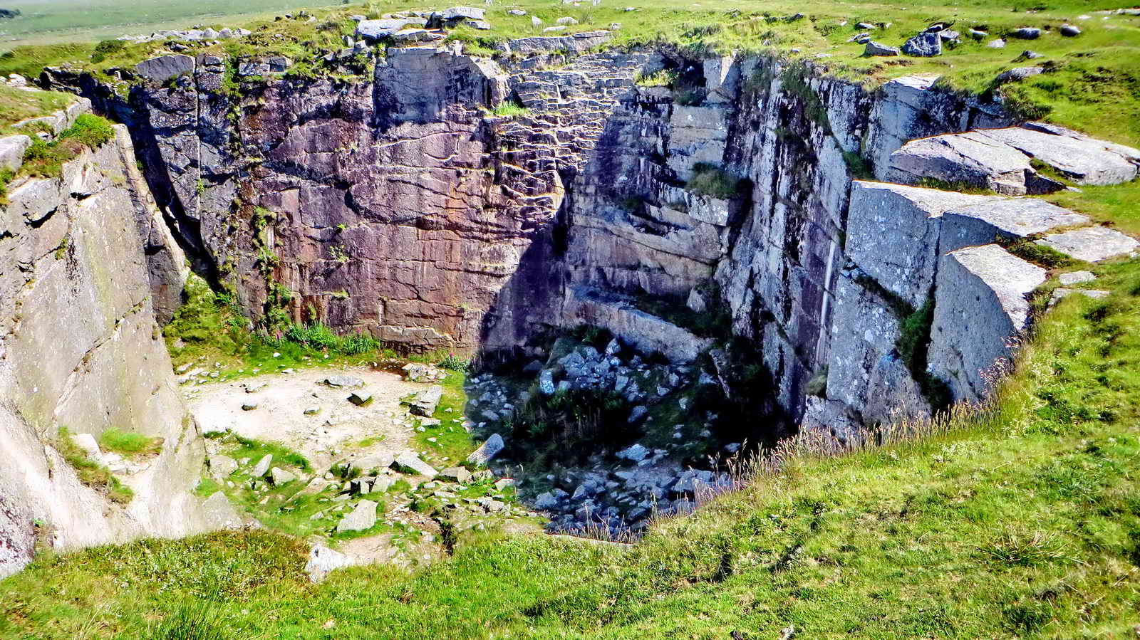
Looking at apparent planes and joints in the rock .....

When the Services go abseiling, they are a lot more confident these days!

A labelled belay.

A general view towards the entrance .....

As previous photograph ......

The entrance .....
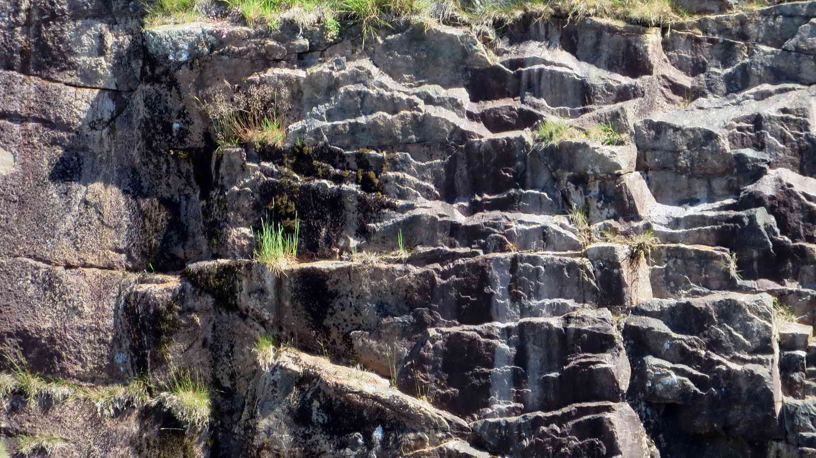
Zoomed view of features of the granite quarry face .....
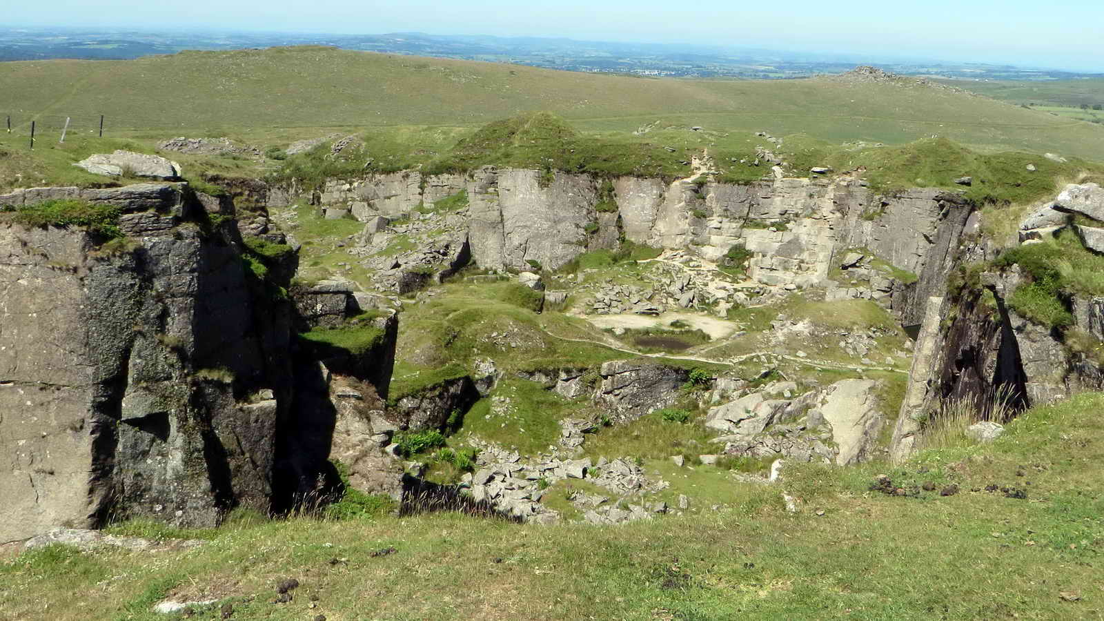
General view of an unflooded area .....
Another view .....
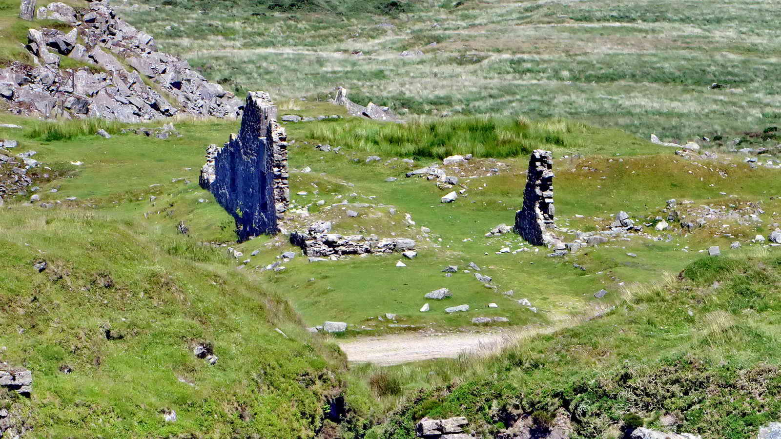
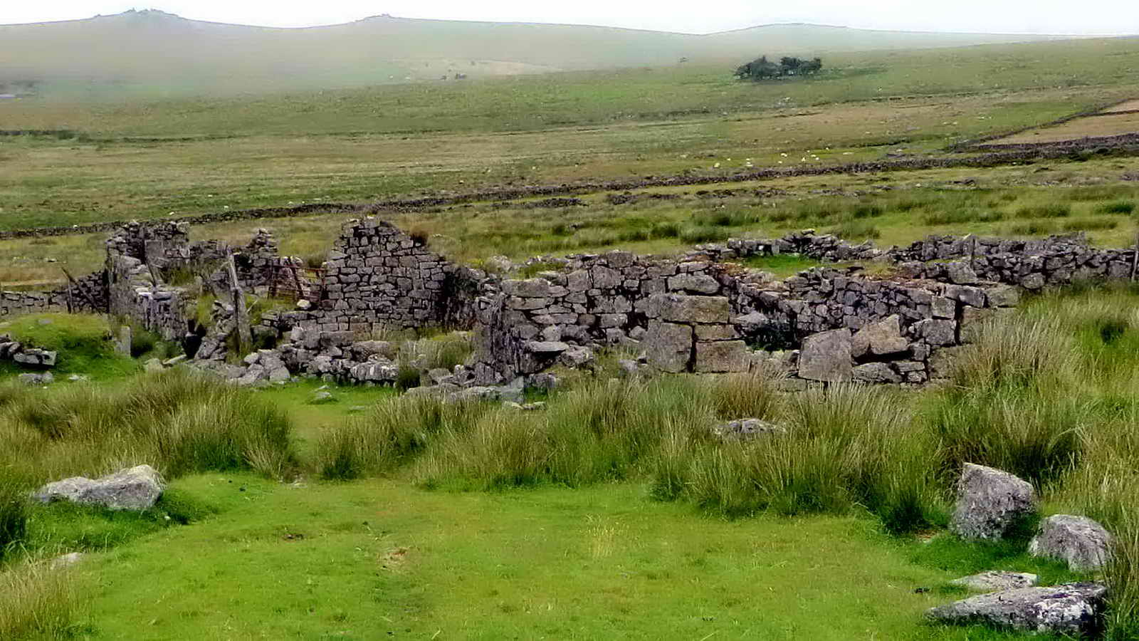
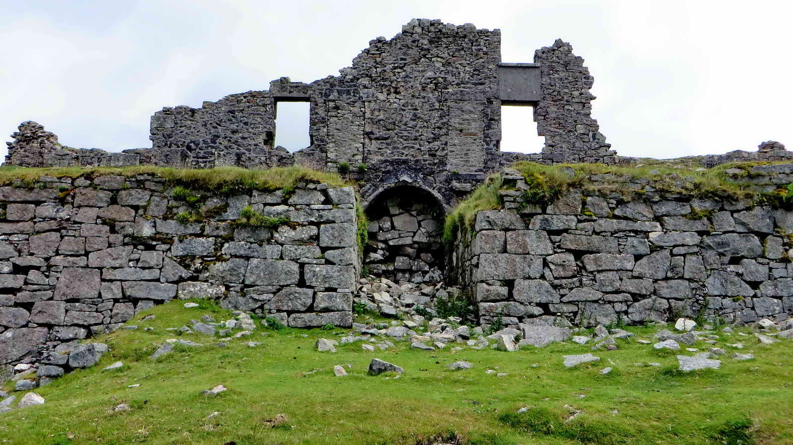
Ruins of Hill Cottages .....
Dartmoor CAM
movie. TIP .....
A video panorama of the quarry |
|
Click the photo to download File size: 5.4 MB. Length 32 secs |
Zoomed view to Great Staple Tor.

Looking down from the west end ......

Down at ground level near the entrance to the quarry .....

In the entrance to the quarry .....

As previous photograph.

Ruins of Hill Cottages ..... by the 1850s there were 10 dwellings with productive gardens, washing lines and privies on Big Top .....

Another angle .....
The weather was not so good at this point ..... interestingly, this was Kath Brewer's house, over the filled-in arch. Source: Kath Brewer (1997), The Railways, Quarries and Cottages of Foggintor. Orchard Publications, Newton Abbot. 130 pages. ISBN 1 898964 30 0.

Another attampt .....

Ruins of the chapel, that also served as a school for the young children at one stage .....

Chapel (foreground), Hill Cottages behind and to the right .....

Eva's Farm seen through the gate posts beside the track .....
Eva's Farm, with Four Winds in the background .....

Looking down on the Manager's House .....

Looking back along the Big Tip, there was once a small gauge railway/tramway out here .....
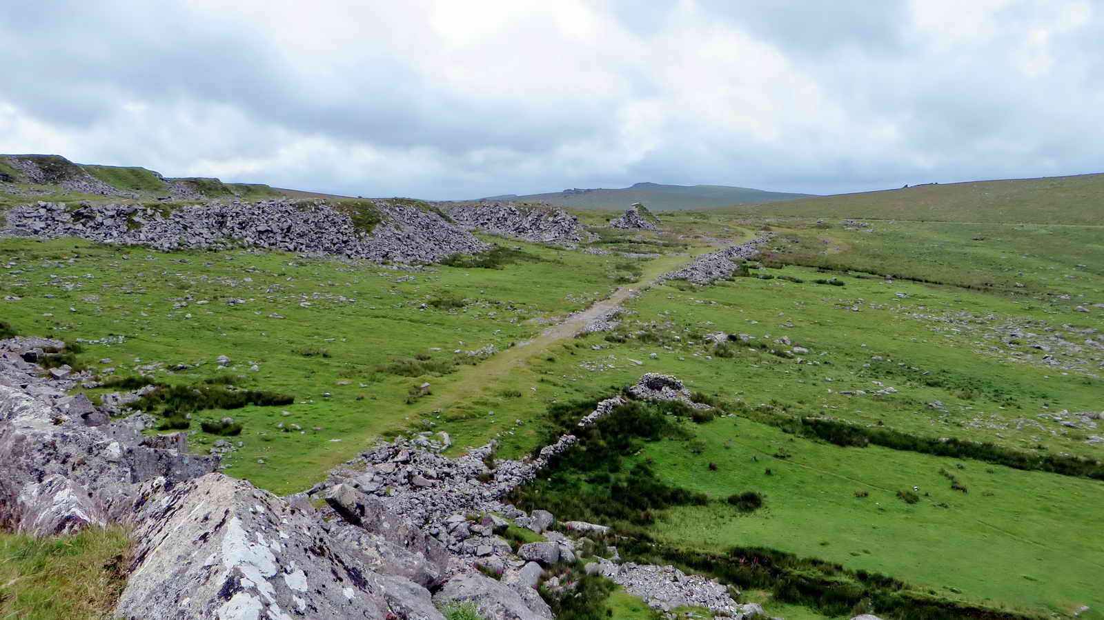
Looking from Big Tip down onto the path of the Royal Oak Siding of the railway ..... a lesser branch was over to the right but not reaching this far .....

Zoomed view to Yellowmeade from Big Tip .....

Strange structure under Hill Cottages .....
What was possibly once a leat-driven water wheel site ...... a leat once came through here .....

Ruins of the Stables .....

Another view of the Stables .....

A loading area for the railway .....

Ruins of Gibb's Cottage, formerly the railway weighbridge .....

Smithy (centre and left of centre) at the south entrance into the quarry.

The nearby site of King Tor Halt, Foggintor is at the upper right, the GWR railway ran left / right near the bottom of the photograph.
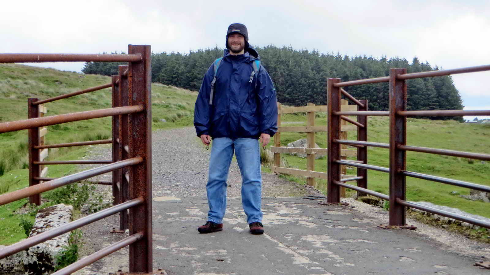
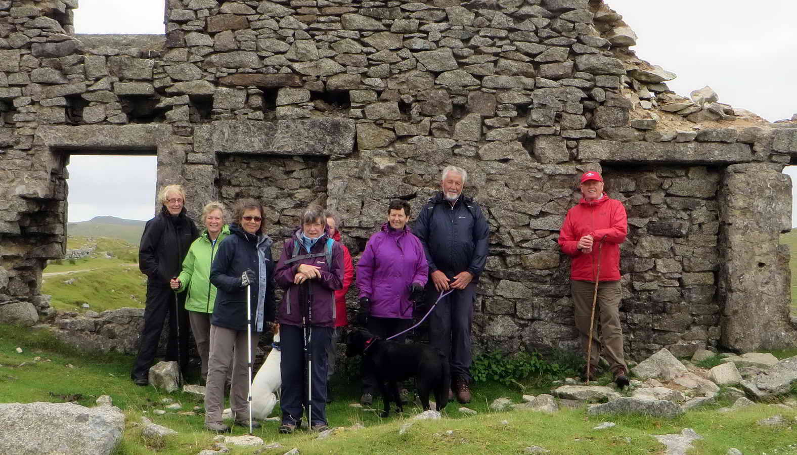
Matthew on the grey day 'recce'.
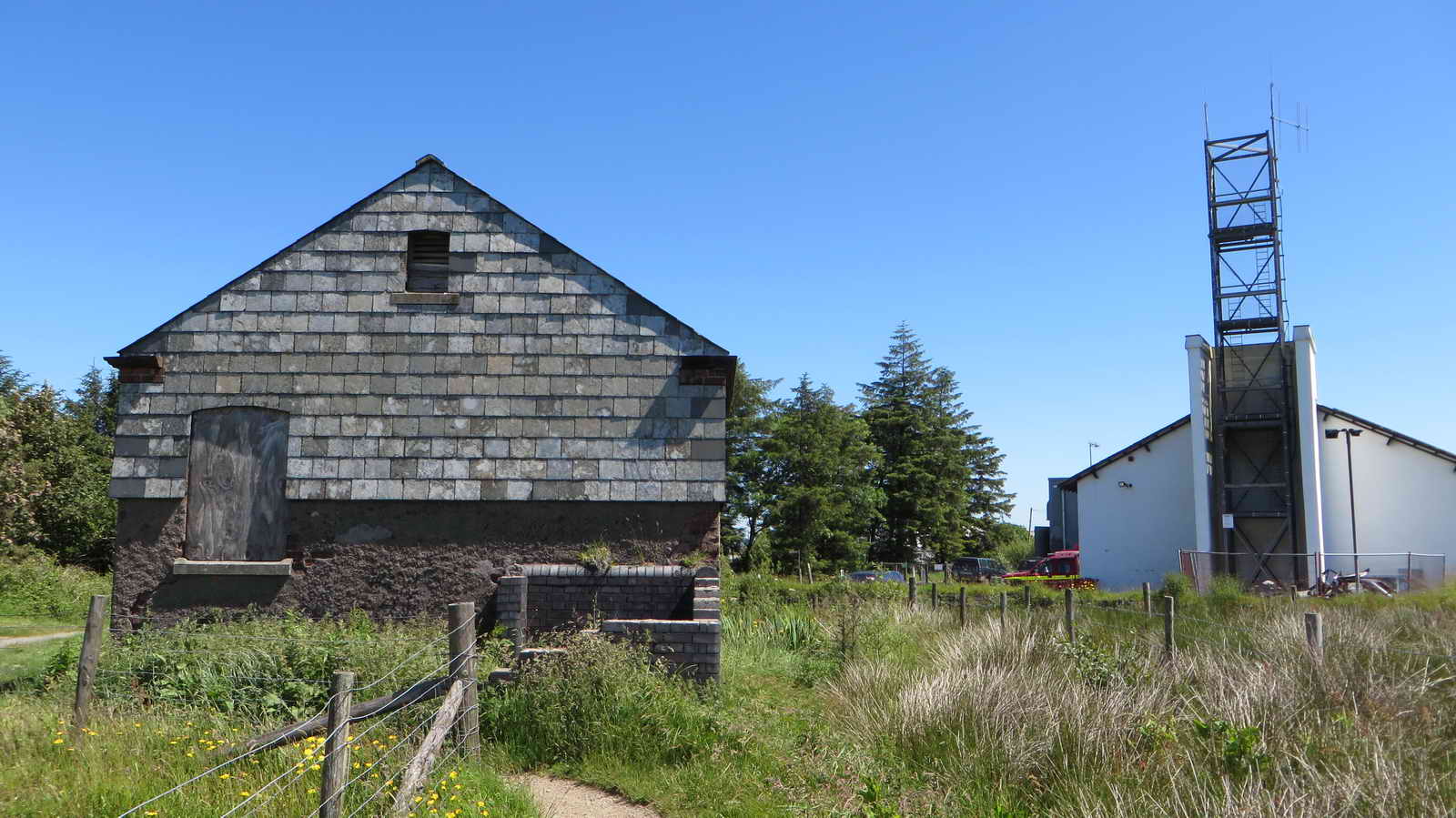
Back at Princetown, the building just left-of-centre is thge old GWR stable for the carthorses that delivered goods from the railway to houses in the area ..... the tall structure is part of the fire station .....
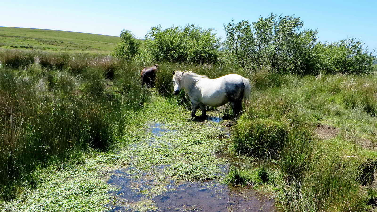
Just paddling .....

And sampling the tasty water weed.

The detached house (centre) used to be the station master's house.
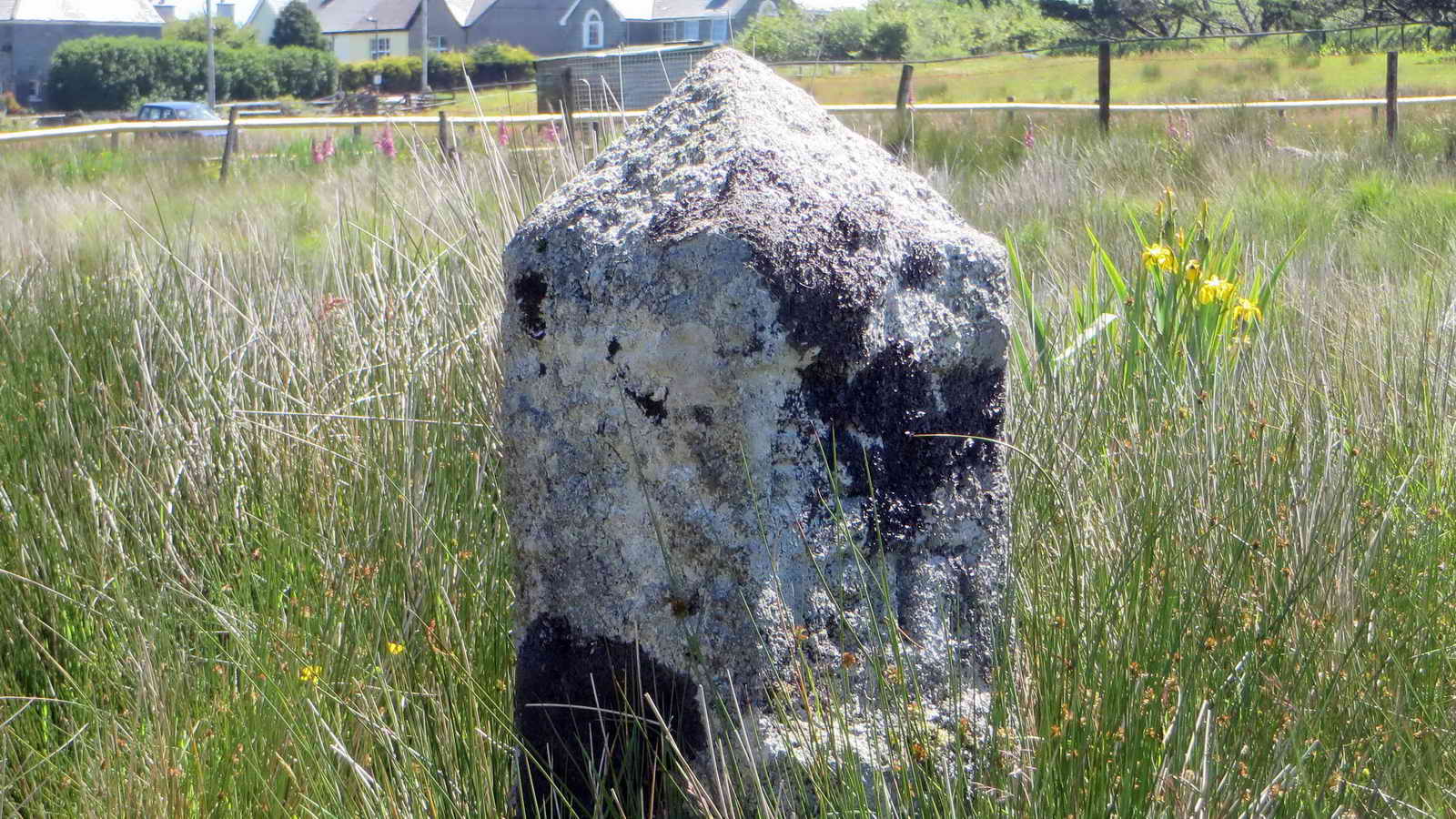
A 1917 PCWW stones .....

This is a 1932 stone, seen much more clearly in the 10th March 2010 walk. This dates from when Burrator Dam was raised and the water catchment area extended. There are also two "BTC" (British Transport Commission) stones in this marshy piece of land.

Still there!

Like father, like son!
The GWR stable .....

The notice on the door. Click the image to see a larger map.

Another view.

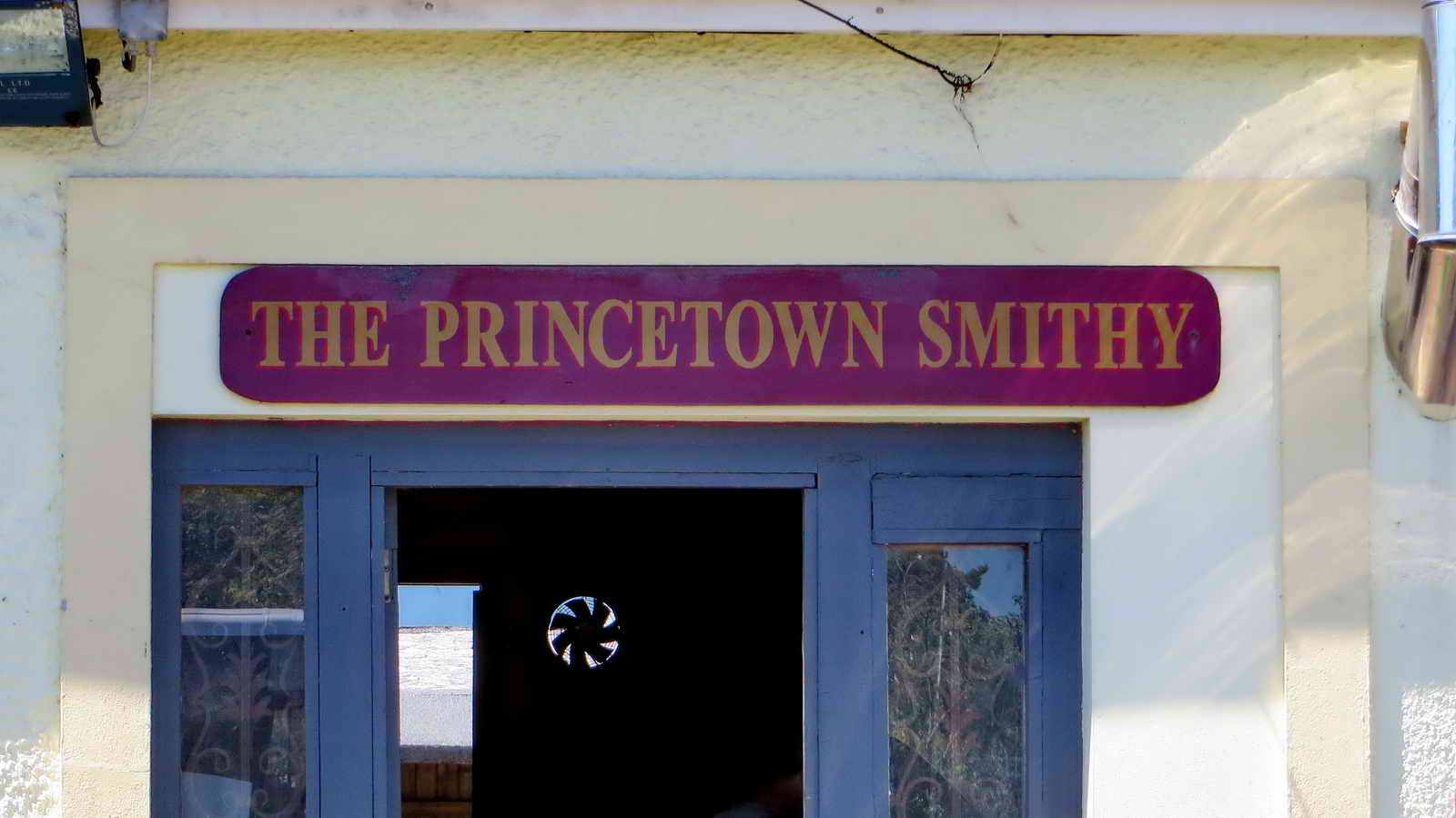
Princetown Smithy .....
See!
MAP: Red = GPS satellite track of the walk.

© Crown copyright and database rights 2015. Ordnance Survey
This walk was reached from the central car park in Princetown by exiting northwards, near The Smithy, turning left towards the Fire Station and then right onto a footpath through the trees, after which turning left on Station Road and passing Dartmoor Brewery on your left. The car park is marked by the yellow cross on the map.
Statistics
Distance - 7.19 km / 4.47 miles.
All photographs on this web site are copyright © 2007-2016 Keith Ryan.
All rights reserved - please email for permissions