![]()


Old map .....
Ordnance Survey, Six-inch to the mile, 1st edition - 1888-1913
 A wander up the track before anyone
else arrived .....
A wander up the track before anyone
else arrived .....
 Zoomed view to Gutter Tor, SX 578 668, elevation 340 metres (1115 feet).
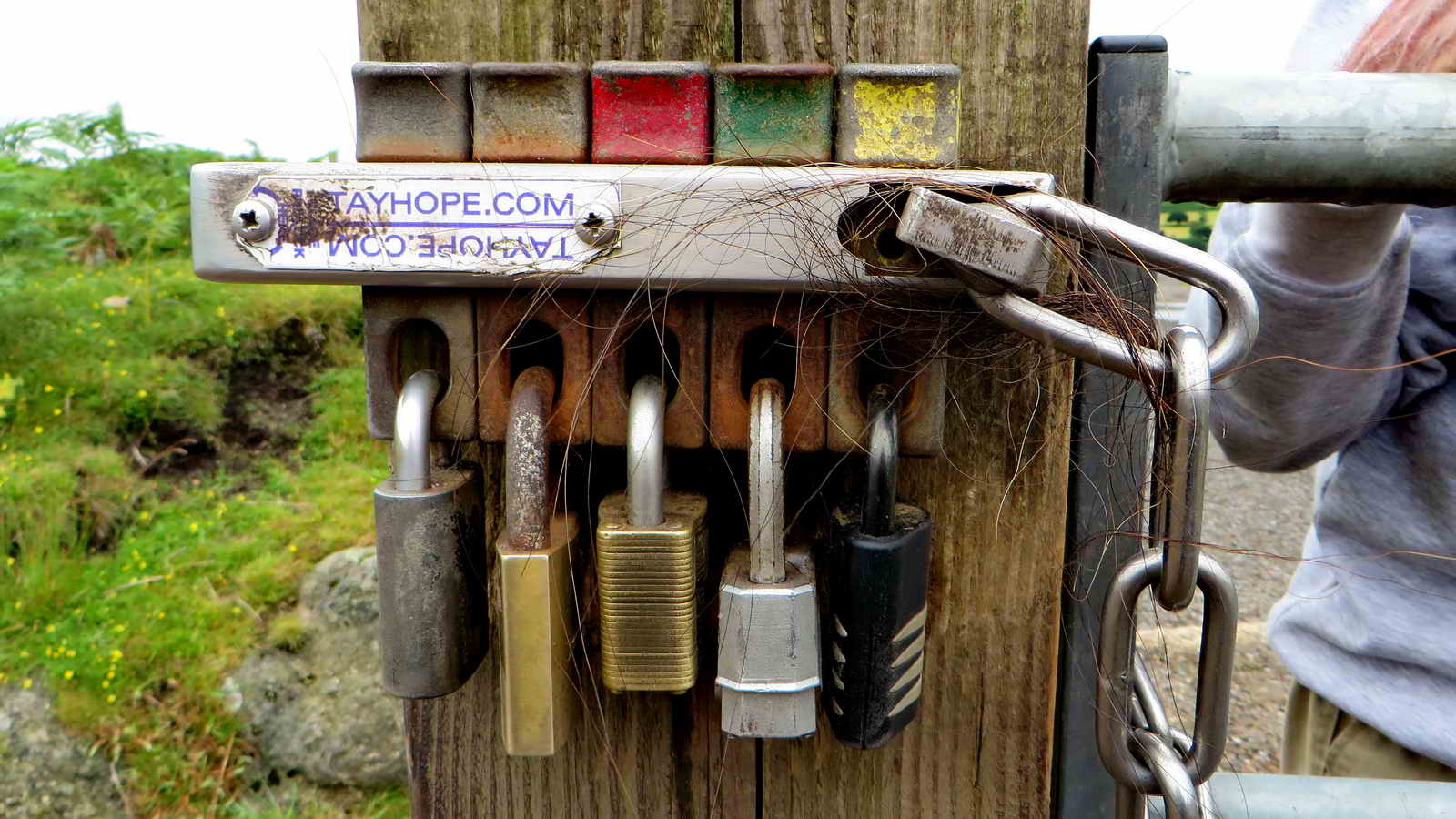 A multiple lock system where several
partners can gain access through a gate across the track near the car park:
partners include the commoners, Dartmoor National Park Authority. It works by
unlocking a padlock and removing the bar that it secures, then the chain
securing the gate can be removed and the gate can be opened.
A multiple lock system where several
partners can gain access through a gate across the track near the car park:
partners include the commoners, Dartmoor National Park Authority. It works by
unlocking a padlock and removing the bar that it secures, then the chain
securing the gate can be removed and the gate can be opened.
 "This'll fool them!"
 Gutter Tor again.
 Looking right (south-east) as the
track crossed Gutter Tor Mire ..... into Gutter Tor or Ditsworthy Gert .....
Looking right (south-east) as the
track crossed Gutter Tor Mire ..... into Gutter Tor or Ditsworthy Gert .....
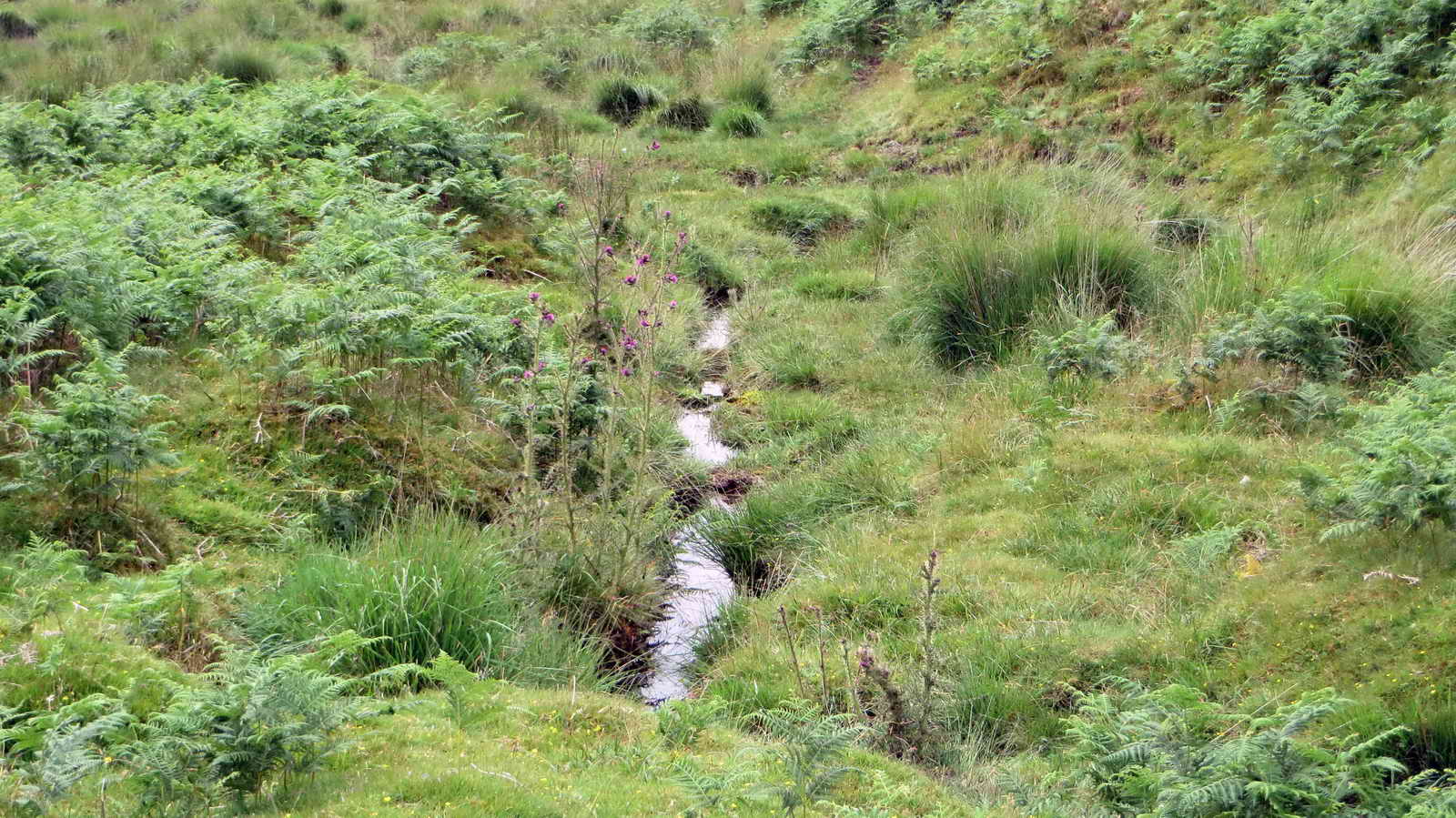
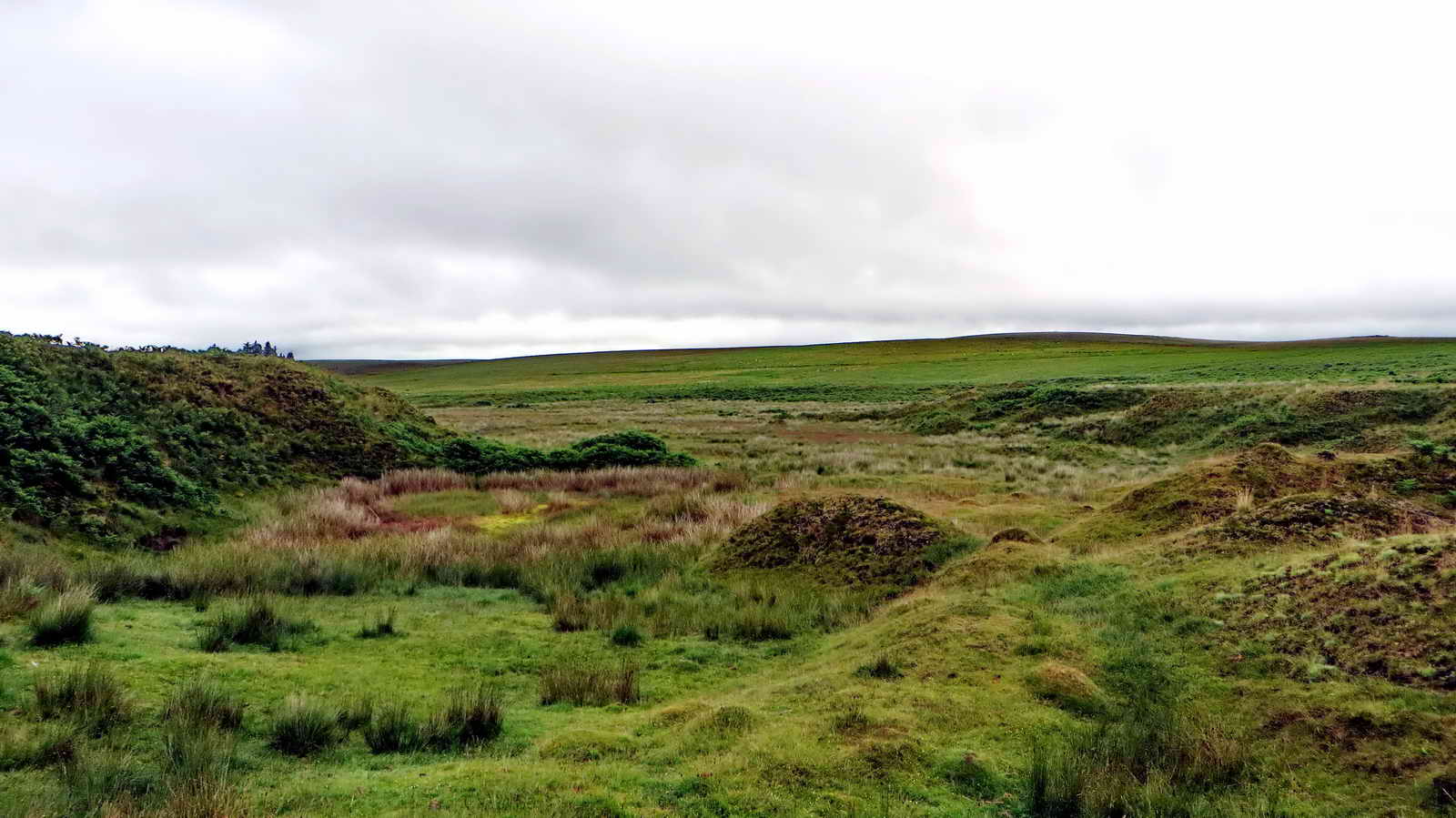 And ..... looking left (north-west)
at Gutter Tor Mire; this is probably a man-made landscape from tinning
activities.
And ..... looking left (north-west)
at Gutter Tor Mire; this is probably a man-made landscape from tinning
activities.
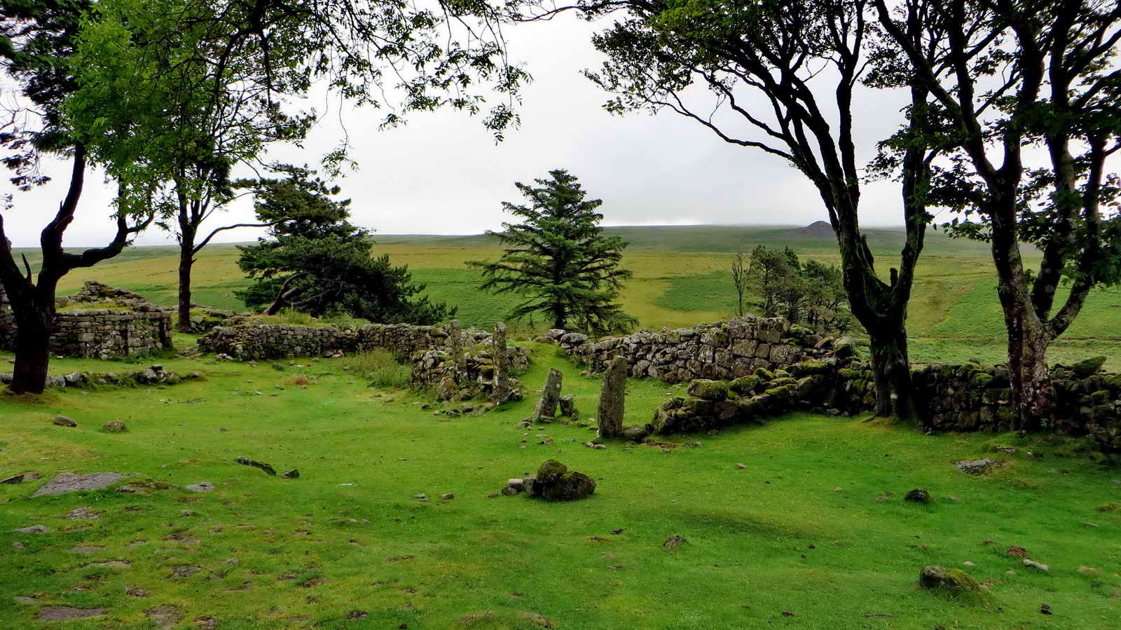
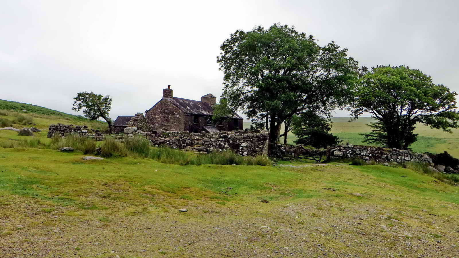 Ditsworthy Warren House where the
warrener lived, last lived in in the 1940s by Granny Ware who is buried in
Sheepstor churchyard (Source: Mike Brown's CD-ROM Guide to Dartmoor).
Ditsworthy Warren House where the
warrener lived, last lived in in the 1940s by Granny Ware who is buried in
Sheepstor churchyard (Source: Mike Brown's CD-ROM Guide to Dartmoor).
 A photograph of what?
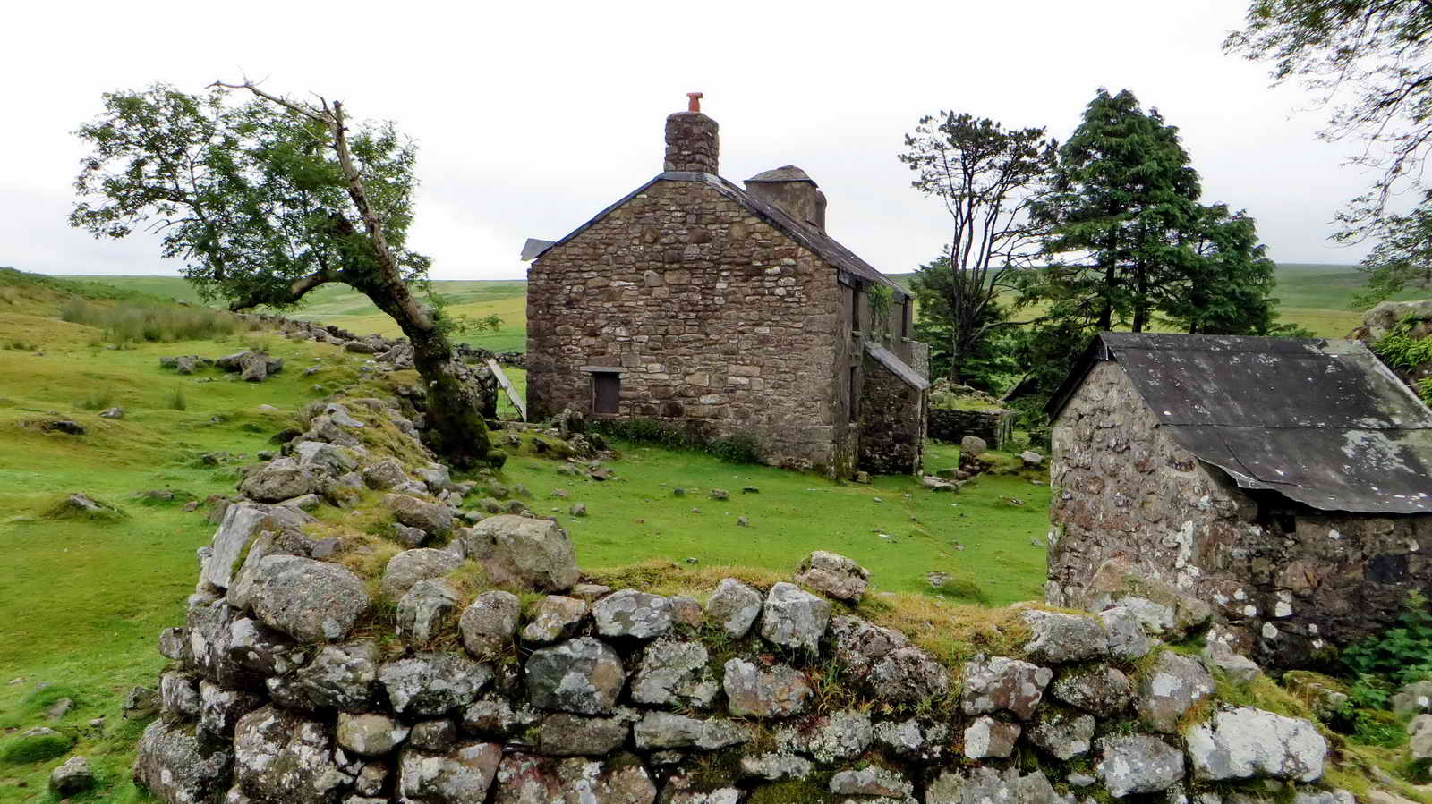
 Ditswworthy Warren House. From Dartmoor
& West Devon Accommodation:
"Ditsworthy Warren was once the largest commercial rabbit warren on Dartmoor,
at one time taking up nearly 1,100 acres. Rabbit farming was banned in the
1950's, but Ditsworthy Warren House, built in the sixteenth
century, can still be seen" .....
Ditswworthy Warren House. From Dartmoor
& West Devon Accommodation:
"Ditsworthy Warren was once the largest commercial rabbit warren on Dartmoor,
at one time taking up nearly 1,100 acres. Rabbit farming was banned in the
1950's, but Ditsworthy Warren House, built in the sixteenth
century, can still be seen" .....
 Another view of the cottage that
featured in the film War Horse .....
Another view of the cottage that
featured in the film War Horse .....
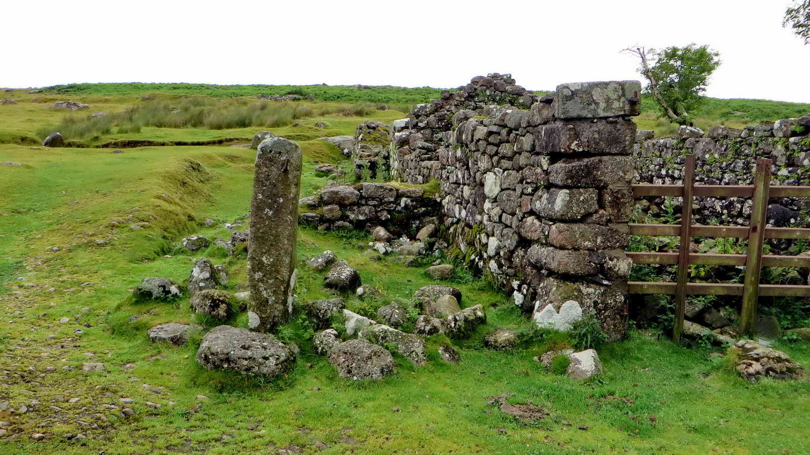
 Ruins in the garden, a former peat
store(?) - there are slit windows in an outbuilding, indicating it was once a
Medieval longhouse.
Ruins in the garden, a former peat
store(?) - there are slit windows in an outbuilding, indicating it was once a
Medieval longhouse.
 The Big Shed, used as a paunching house - for gutting and skinning rabbits .....
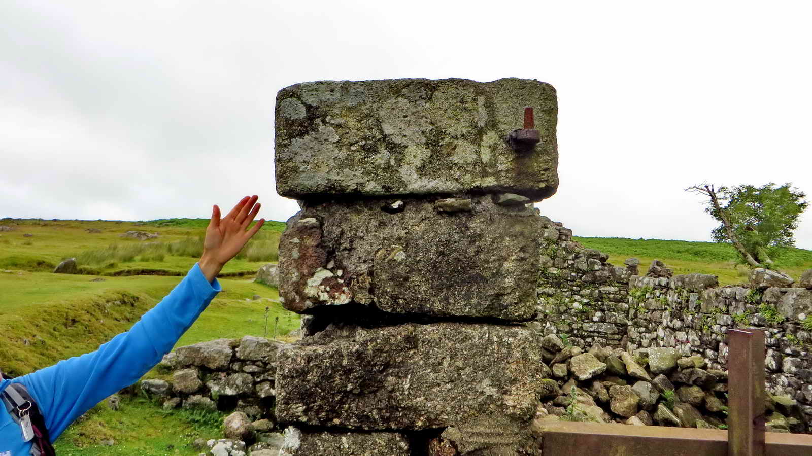 This stone was once part of a vermin
trap, judging by the slotted groove that could have housed one of the trap's
slate shutters .....
This stone was once part of a vermin
trap, judging by the slotted groove that could have housed one of the trap's
slate shutters .....
 A covered length of the leat that
supplied the concern .....
A covered length of the leat that
supplied the concern .....
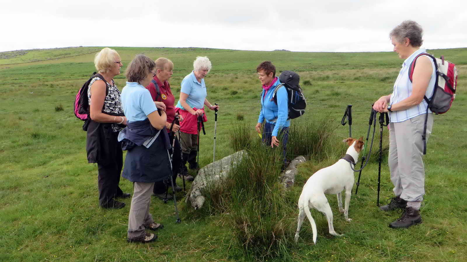
 Group photograph .......
 Behind the Disneyesque tree,
a building known as The Trough, water
from a branch of the leat ran into it from behind (now blocked). The grooved
stones would have held a sluice-type mechanism. A pipe leads from the trough and
probably conveyed water into the kitchen where it flowed directly onto a stone
slab. The building has unusually slotted entrance posts ......
Behind the Disneyesque tree,
a building known as The Trough, water
from a branch of the leat ran into it from behind (now blocked). The grooved
stones would have held a sluice-type mechanism. A pipe leads from the trough and
probably conveyed water into the kitchen where it flowed directly onto a stone
slab. The building has unusually slotted entrance posts ......
 Zoomed view.
 One of three dog kennels in the
enclosed Kennel Field behind the house .....
One of three dog kennels in the
enclosed Kennel Field behind the house .....
 Zoomed view to the River Plym and the
head weir of Lee Moor Leat (also know earlier as Bottle Hill Mine Leat, where it
once fed workshops); it now feeds Great Pond where water is stored for the clay
extraction monitors in the clay pits.
Zoomed view to the River Plym and the
head weir of Lee Moor Leat (also know earlier as Bottle Hill Mine Leat, where it
once fed workshops); it now feeds Great Pond where water is stored for the clay
extraction monitors in the clay pits.
 A mighty river crossing at SX 58910
66593.
A mighty river crossing at SX 58910
66593.
|
|
A plan of the Drizzlecombe, Drusselcombe, Thrusselcombe area where there are three stone rows and associated cairns. Features 22, 13 and 21 are kistvaens (cists) - we visited 22 and 13 on this walk.
 Cist "22" at SX 59029 66719 .....
 Ditto, the capstone has disappeared.
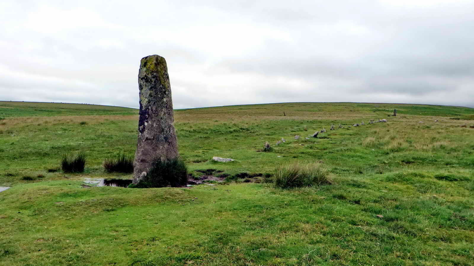 Menhir and stone row no. 1 (of
three), restored and the stone is now oriented in line with the row whereas it
was probably originally across the row.
Menhir and stone row no. 1 (of
three), restored and the stone is now oriented in line with the row whereas it
was probably originally across the row.
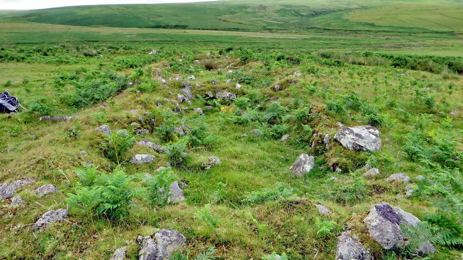
 The walls of Hentor Warren.
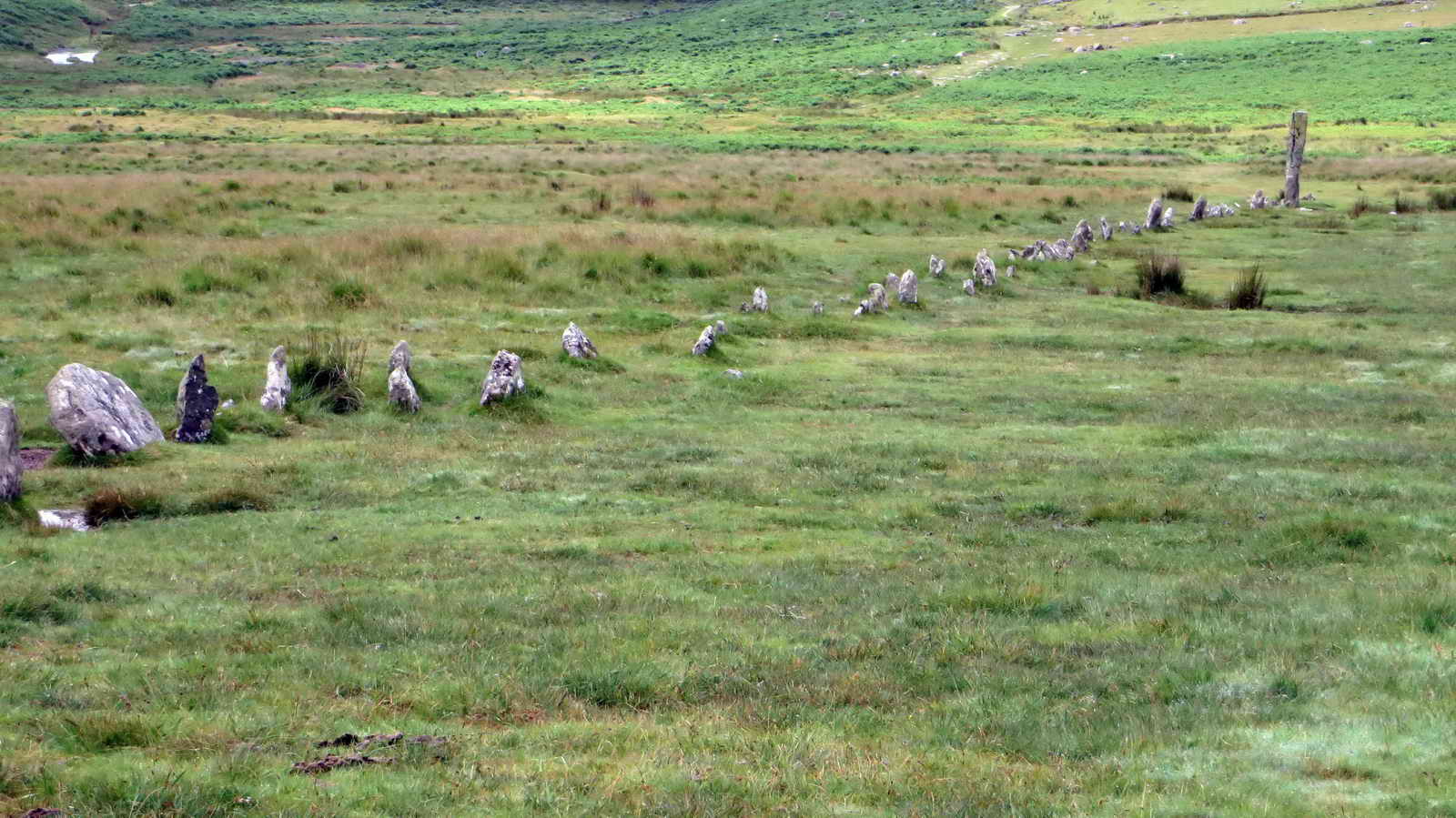 Stone row no. 1 .....
 Giant's Basin Palaeolithic burial
cairn, unusual in not being somewhere high and prominent .....
Giant's Basin Palaeolithic burial
cairn, unusual in not being somewhere high and prominent .....
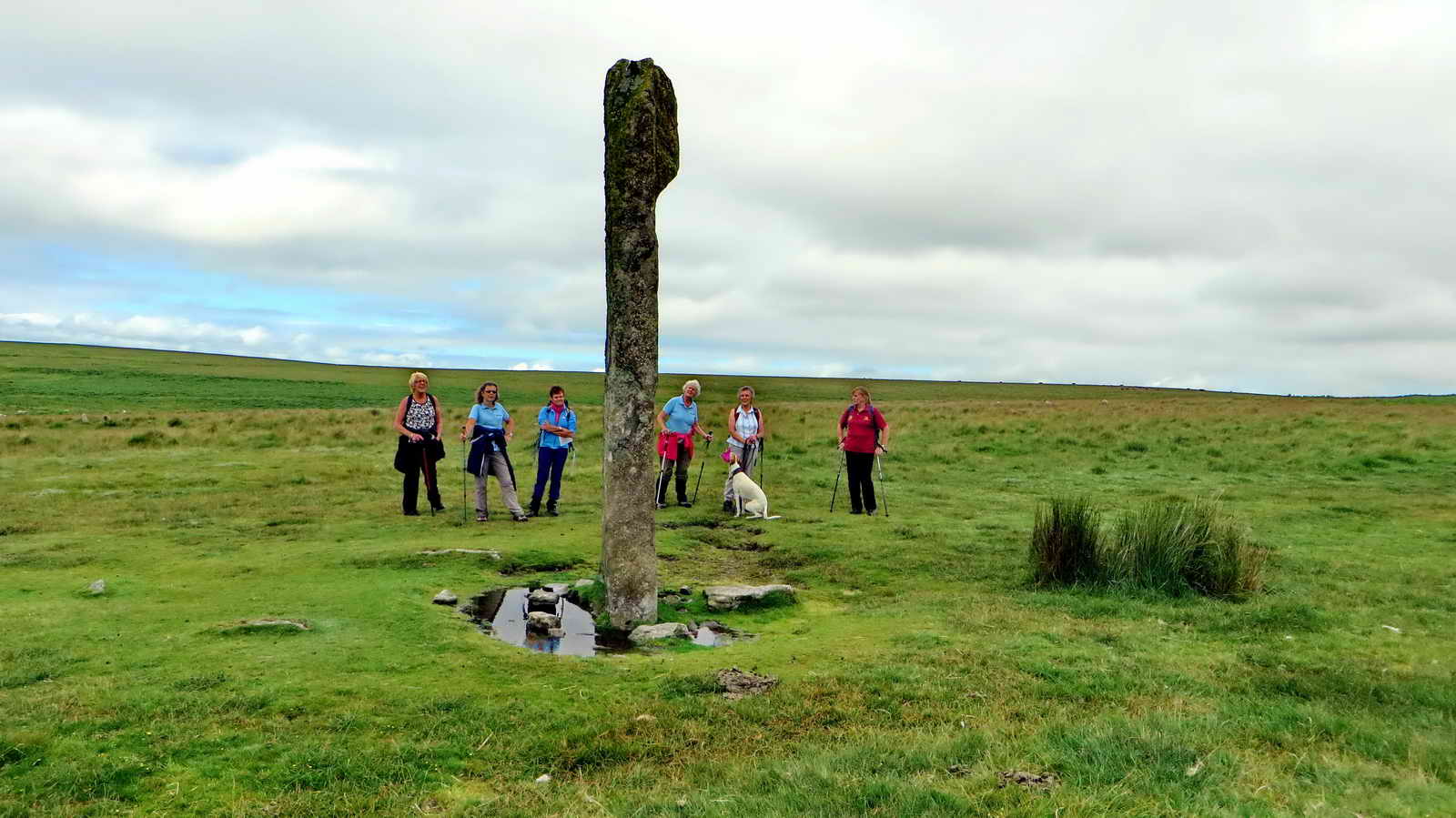 The menhir of Stone row no. 2 .....
 Terminal cairn of stone row no. 2
.....
Terminal cairn of stone row no. 2
.....
 Standing on the terminal cairn at the
end of stone row no. 3 .....
Standing on the terminal cairn at the
end of stone row no. 3 .....
|
|
 Cist no. 2 today ("13" on the
overview sketch map above) .....
Cist no. 2 today ("13" on the
overview sketch map above) .....
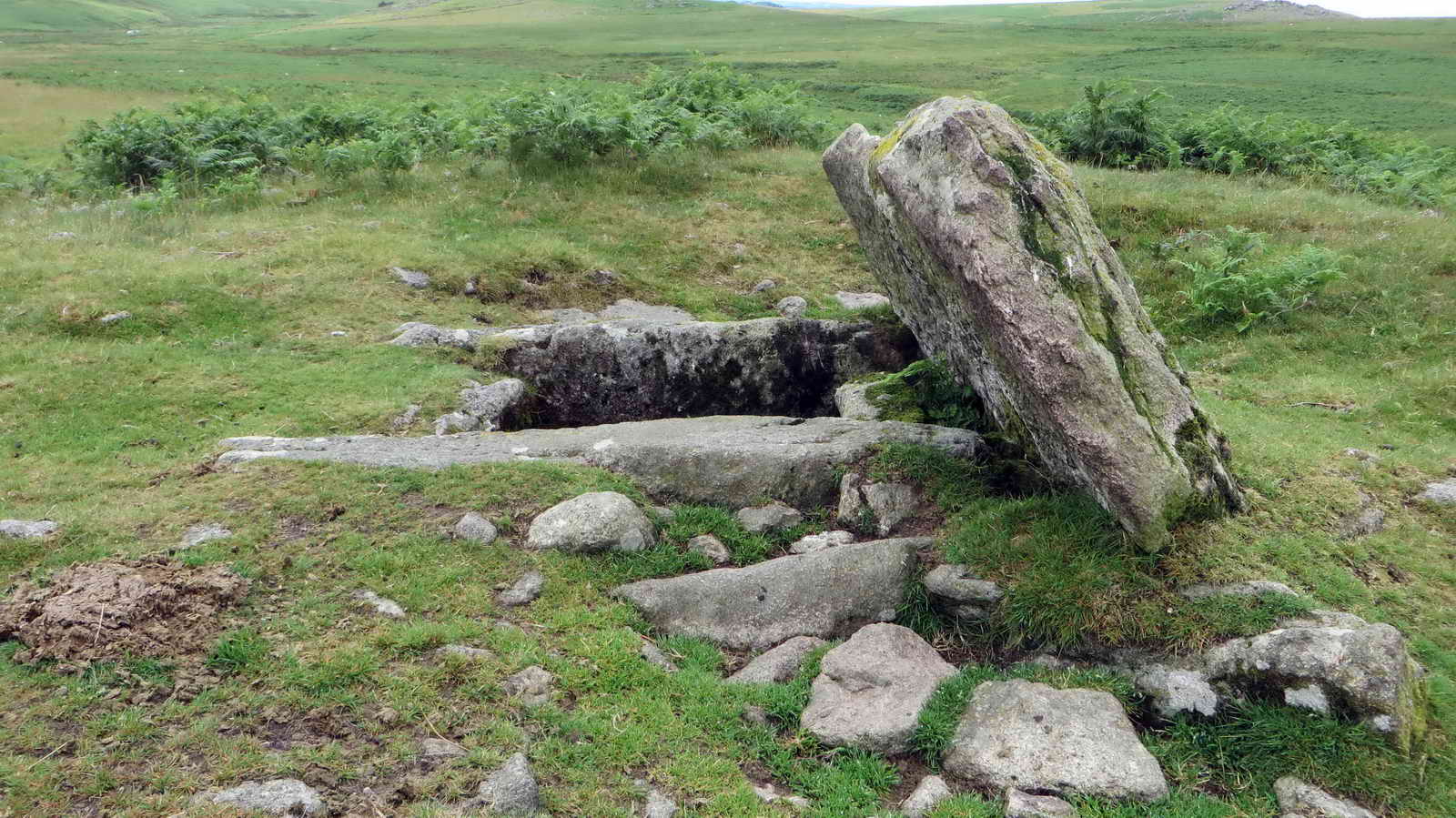
 An impressive structure, complete
with its capstone .....
An impressive structure, complete
with its capstone .....
 Closer examination reveals that it is
quite deep .....
Closer examination reveals that it is
quite deep .....
 Side view .....
 Hardly a Jack-in-the-box!
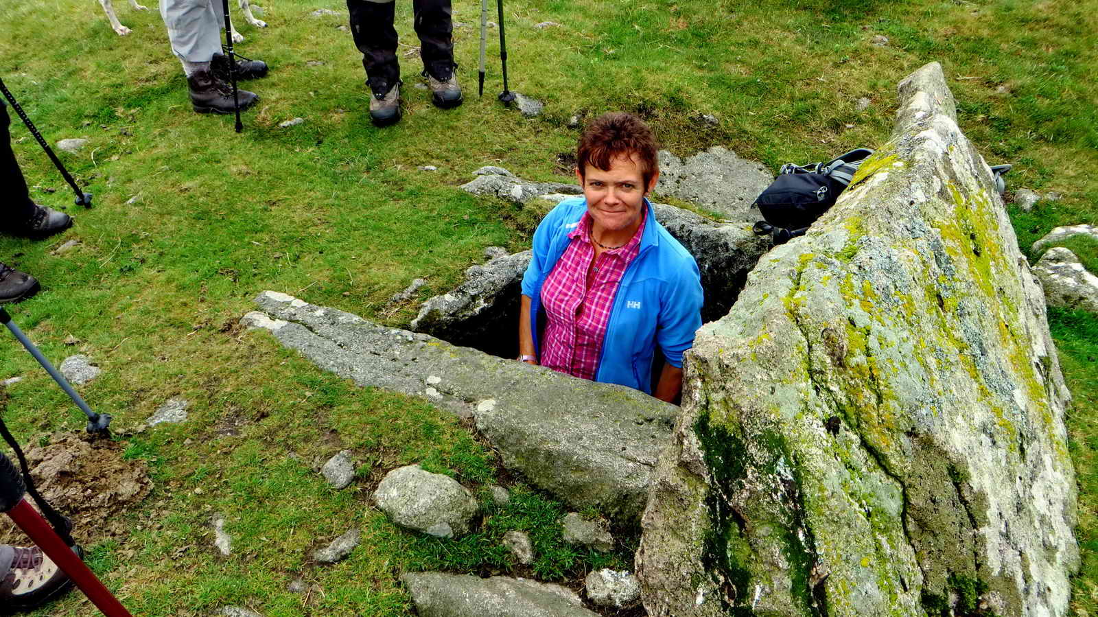 See!
See!
 The mighty Drizzle, at SX 5902 6723
.....
The mighty Drizzle, at SX 5902 6723
.....
 Longstone Leat, SX 5874 6721.
|
|
 Long longhouse at SX 58641 67013
.....
Long longhouse at SX 58641 67013
.....
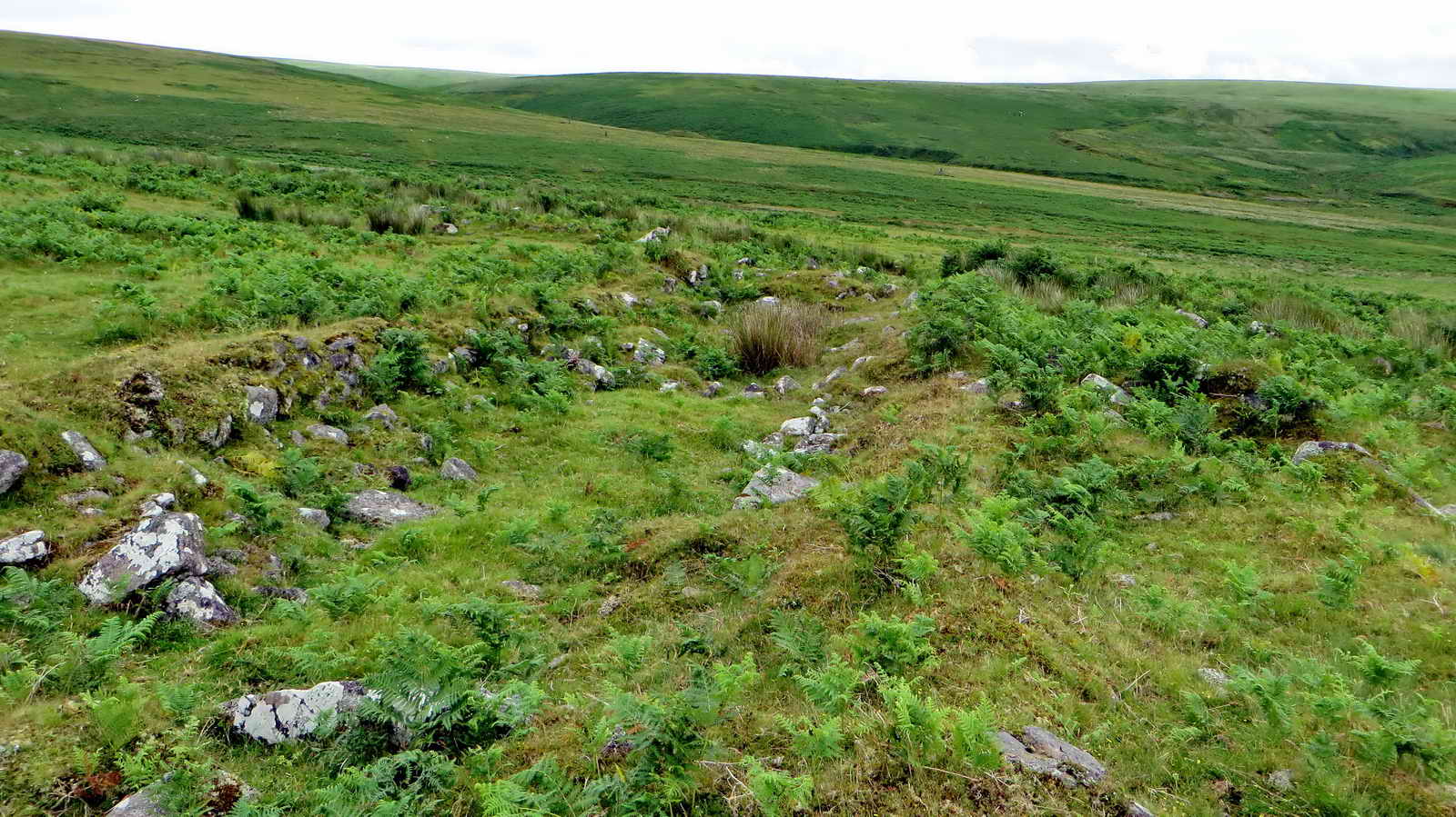 Another view .....
Dartmoor CAM
movie. TIP .....
A movie of the Whittenknowles longhouse. |
 |
Click the photo to download File size: 3.4 MB. Length 20 secs |
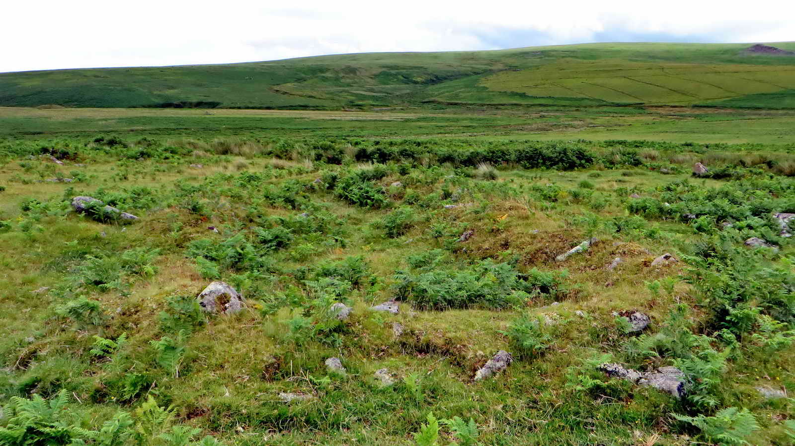 Nearby ruins of another building
.....
Nearby ruins of another building
.....
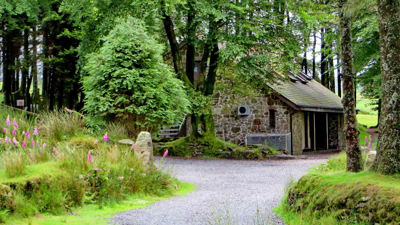
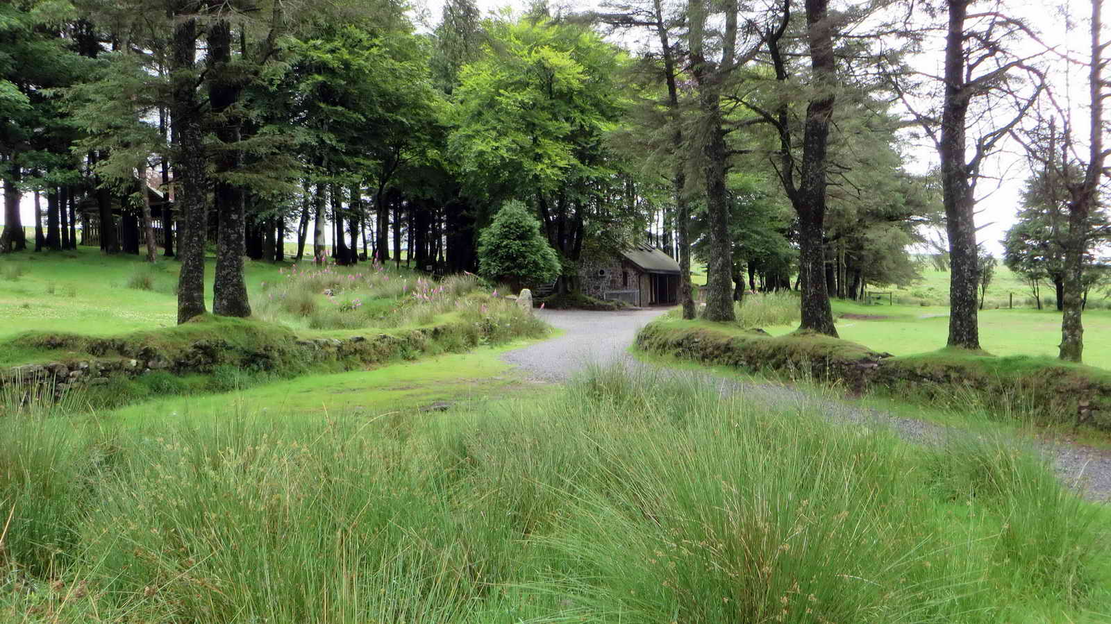 The Scout Hut .....
 There is a metal cage for depositing
any military debris found in the area.
There is a metal cage for depositing
any military debris found in the area.
 THAT photograph again.
MAP: Red = GPS satellite track of the walk.

© Crown copyright and database rights 2015. Ordnance Survey. Licence number 100047373. Use of this data is subject to terms and conditions.
Also, Copyright © 2005, Memory-Map Europe, with permission.
The walk is most easily approached by driving over Burrator Dam, through Sheepstor, until reaching a left turn to Nattor. Parking is at the P symbol on the map, marked more precisely by the yellow cross..
Statistics
Distance - 5.14 km / 3.19 miles.
All photographs on this web site are copyright © Keith Ryan.
All rights reserved - please email for permissions
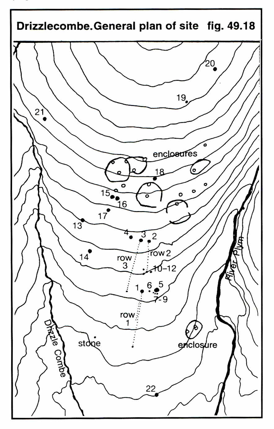

 Image © J Butler
1994. Reproduced by kind permission (ref. 29 Sept. 2012).
Image © J Butler
1994. Reproduced by kind permission (ref. 29 Sept. 2012).