Dartmoor photos from across the National Park
This walk: 2015-10-7.
Fernworthy Forest, Sittaford Tor, Grey Wethers stone circles, Sittaford Circle.
Walk details below -
Information about the route etc.
Ordnance Survey, Six-inch to the mile, 1st edition - 1888-1913
- centred on Grey Wethers.
Where we walked: Google Satellite view of the area - including the GPS track of the walk (compare with the Ordnance Survey map plus track below)
- try zooming in with the mouse thumbwheel and
"dragging" the map to see points of interest
- click on the place-markers to read their label - they
are most accurate at the highest zoom level
- try "mousing" over the list of placemarks on the left of
the screen, highlights their place on the map
- use browser back arrow or Alt key and left-arrow
cursor key together to return to normal web page.
Previous walk in this area: no previous walk in this
area with this group but there was a walk to Grey Wethers (on Dartmoor CAM) on
14th Dec. 2007.

Gathered at the forest gate on the
dge of Fernworthy Forest, at SX
6440 8342.

Pixie snot, star jelly or "White stuff" ..... something to do with a female
frog's egg-laying system going wrong or regurgitated frog spawn material from a
bird or mammal. There is a explanation in a
radio interviewrecorded
on the
BBC Radio 4 : Saving Species programme
(from
Series 1 Episode 36 broadcast 4 January 2011).

Sitaford Tor, SX 6331 8304, elevation
538 metres (1765 feet).
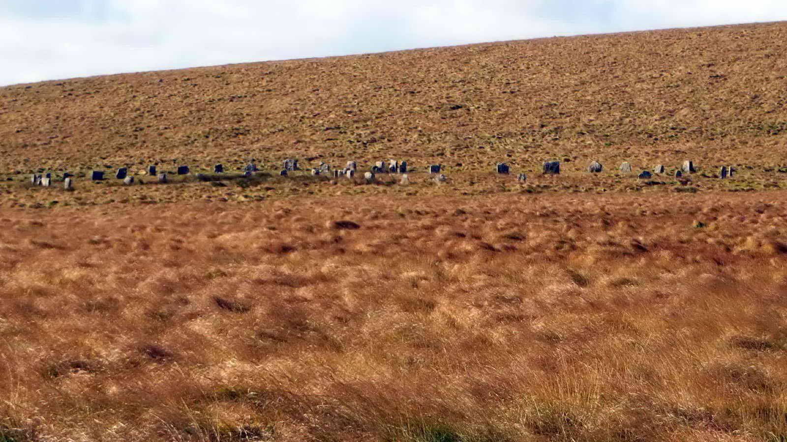
Grey Wethers stone circles, at SX
6387 8314: prior to 1909 and restoration by Burnard, only nine stones stood in
the north circle and seven in the south circle. The circles each had thirty
stones, arranged with the help of still-remaining packing stones. There
arehallow pits within the circles that result from trial excavations by the
Dartmoor Exploration Committee of the Devonshire Association. Source: J. Butler (1991), Dartmoor Atlas of Antiquities II, The North. 35.16-18 Grey Wethers stone circles, enclosures and cairns (fig.
35.9), pages 164-16.

Zoomed view of the south circle.
Link to the
Megalithic Portal (the panoramas do not work on the Chrome browser because
it does not support Java: Internet Explorer should be alright).

Zoomed view north to Teignhead Farm,
at
SX 6352 8435, established after 1551 acres were leased from the Duchy in
September 1808. The lease allowed for two farms to be established within ten
years by enclosing land as fields and newtakes. The second farm was Manga Farm
(sometimes known as "Mandles")
at SX 6391 8486, some 630 metres away to the north, on a bearing of 34�. A
letter from 1877 implies that Manga Farm had been uninhabitable for some time
and it was probably never lived in again. Sometime in Sept. 1876, notice to quit
was served on George Endacott at Teignhead Farm, and on 25th March 1876 John
Gemmell took on the tenancy. He subsequently travelled to Scotland and
returned on 27th May 1877 with 1,300 Scottish Blackface sheep, thus
introducing them to Dartmoor. The War Department requisitioned the
land in November 1942, with it being de-requisitioned in Sep. 1950. Between 1950
and 1984 when the lease ran out, it was not lived in. The roof slates fell in in
1970 and it was demolished in 1971. Manga Farm was in ruins for decades before
1971 but had a squatter who left at the end of February 1988. Source: Elizabeth
Stanbrook (1994) Dartmoor Forest Farms, Devon Books, Halsgrove House,
Tiverton, pages 11-46.

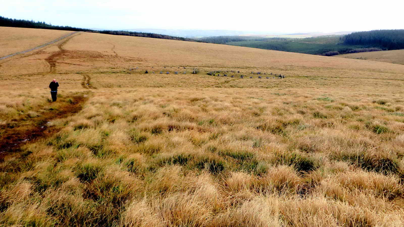
Closer approach to the northern
circle at Grey Wethers (a "wether" is a castrated male sheep).

Panorama of the two stone circles at
Grey Wethers.
Click the image to see a larger version.

A detail photograph at Grey Wethers.
Looking back while climbing to
Sittaford Tor: incongruous visions - Bronze Age stone circles and man on a
smartphone!

Helping hands over the ladder stile
at Sittaford Tor.

Sittaford Tor again.
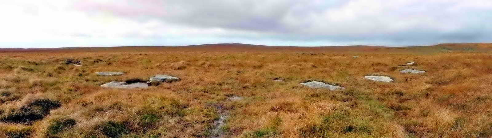
Panorama of Sittaford Circle, at
least 4,300 years old (dated by peat analysis of material underneath the
stones). The circle consists of thirty markers (as do the Grey Wethers circles)
in a ring of 104 ft. diameter.
Click on the image to see a
larger version.
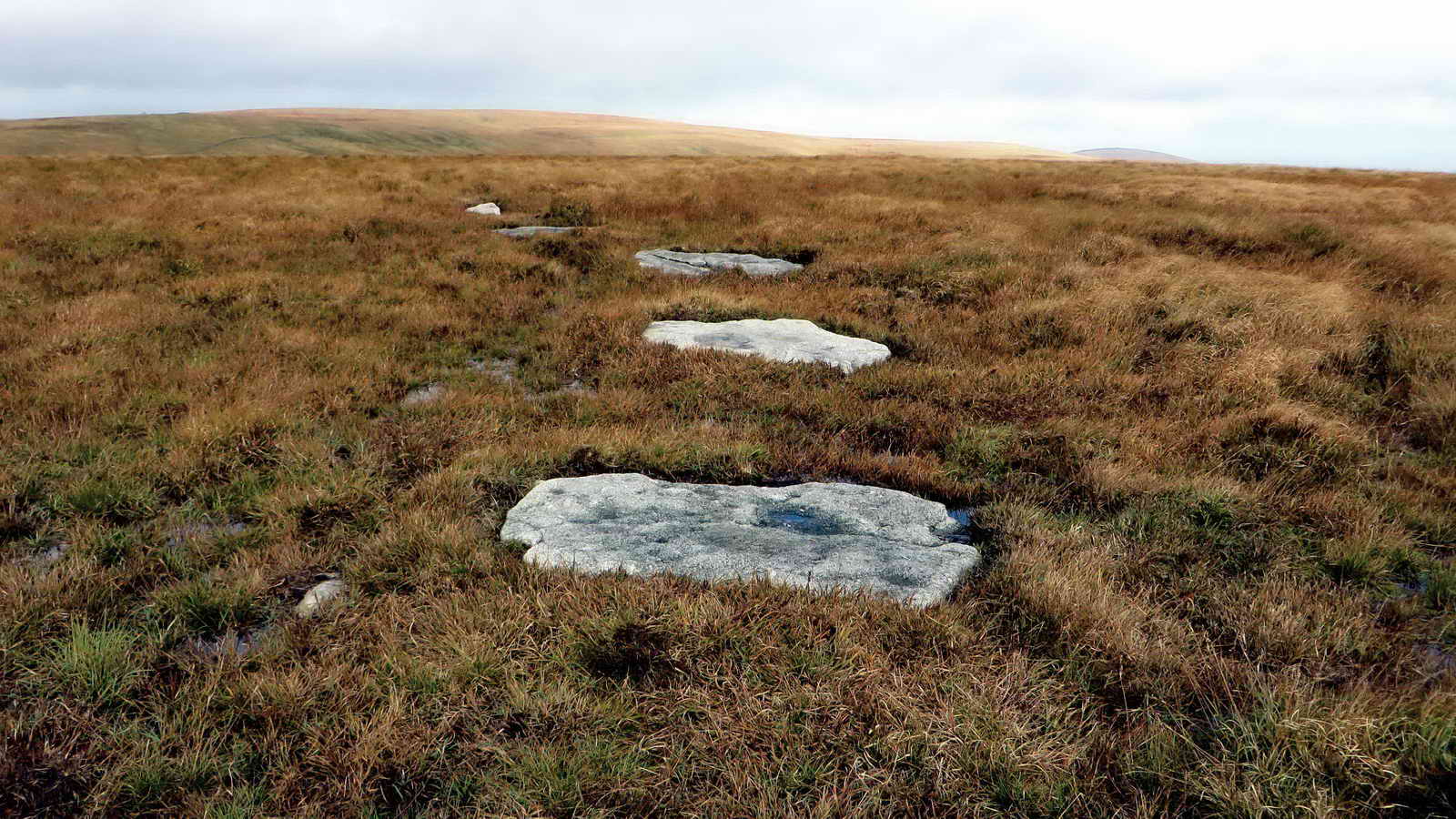
Detail of some of the stones: it has
been postulated that the stones may have been deliberately toppled because they
all face into the centre of the circle.

A leaning stone that may be
associated with the circle.

Sittaford Tor is conquered .....
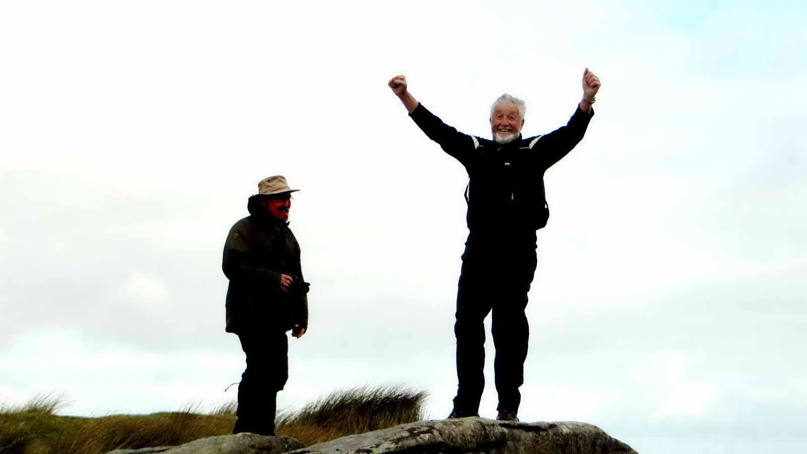
See?!

Returning towards Grey Wethers, this
photograph showing somewhat their context in the landscape.

Zoomed view.

Passing the circles.
Walk details
MAP: Red = GPS satellite track of the walk.
 © Crown copyright and database rights 2015. Ordnance Survey. Licence number 100047373. Use of this data is subject to terms and conditions.
Also, Copyright © 2005, Memory-Map Europe, with permission.
This walk was reached by driving to the end of the
road around Fernworthy Reservoir and parking at the yellow cross symbol on the
map.
Statistics
Distance - 6.40 km / 3.98 miles.
All photographs on this web site are copyright © 2007-2016 Keith Ryan.
All rights reserved - please email for permissions
Sister web sites
Dartmoor Tick Watch
The Cornish Pasty - The Compleat Pastypaedia


