


This walk: 2015-1-7. River Plym, Cadover Bridge, Cadover Cross, cist, Dartmoor ponies, Cadworthy Tor, The Dewer Stone, Dewerstone Rocks, inscriptions, large hut circle, Wigford Down longhouses (x2), summit cairns, pond, Hen Tor, Trowlesworthy Tor. Mount Batten, Fort Stamford.
Walk details below - Information about the route etc. Previous walk in this area: 30th June 2010.Most photographs were taken on a 'recce' on Sunday 30th November - a glorious, sunny day.
Some extra photographs and videos were taken on the following day: 8th January 2015.
River Plym, beside the car park.
Cadover Bridge, near the car park.
Zoomed view up the Plym from Cadover Cross .....
Cadover Cross (restored), note the circular trench dug around it by the soldiers who found it and re-erected it in 1873. It fell again in 1901 and was re-erecrted again in 1915.
View to the River Plym, also showing the road going out to Blackaton Cross; once it ran through to Lee Moor village, when I was young!
Cairn cist at SX 54420 64424, described by J. Butler (1994), Dartmoor Atlas of Antiquities III, The South West. 48.1 Wighord Down field system and cairns, and Dewerstone Hill (figs. 48.1, 1.1, 1.2,2, pages 79-98.
Looking down into the cist - it is quite a narrow kistvaen (stone box) .....
Another view .....
Some retaining kerb stones remain that once held the earthen cairn in place .....
A final view, showing the extent of the cairn .....
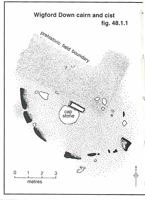 Image © J Butler 1994. Reproduced by kind permission (ref. 29 Sept. 2012). |
A pony encountered along the way.
Cadworthy Tor, SX 54182 64160, elevation 238 metres (780 feet) - quite a low tor ....
Cadworthy Tor climbed!
Another view .....
The top of the Dewerstone from Cadworthy Tor .....
Zoomed view .....
Showing the locationm below Derwerstone Rocks, on top of the hill.
View along the way, over Cadworthy Wood across to North Wood; the trees down there in the sheltered valley still have their leaves.
Zoomed view to Cadworthy Tor .....
From this vantage point along the way, the tor is near the midline and just below the skyline - just left of the trees on the skyline.
Dewerstone Rocks on the ancient Iron Age hilltop farmstead .....
Closer view .....
There are several inscriptions on the rocks, here: CARRINGTON - OBIT - SEPTEMBRIS MDCCCXXX (1830) ..... in memory of Noel Carrington, a local Dartmoor poet, and ......
Variously, W FORD, F WIDGER, F DODRIDGE.
Looing down towards the Dewerstone from near the top.
Large hut circle at SX 54130 64548.
Hawthorn tree near "LH2" on the Butler map below, a very long longhouse .....
The long, longhouse at SX 54119 64934 - while much is said of the Bronze Age remains here on Wigford Down, the Medieval longhouses while mentioned by Butler are not described by either Butler. Hemery (High Dartmoor) or in Crossing's Guide to Dartmoor ..... and nothing on Pastscape (Search results within 1 km of the longhouse's grid reference) ..... the numbers "2" and "1" are those used on the butler map .....
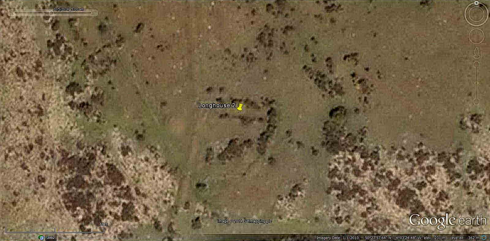
Google Earth image of "LH2" = Longhouse 2 on the Butler map below - note that this longhouse abuts onto a reave (embankment) running roughly up-and-down the image (also seen on the Butler map below).
Another Wigmore Down pony.
The second longhouse, SX 54294 65121, "LH1" on the Butler map below .....
Strollers showing the scale of this 60/61 paces long longhouse .....
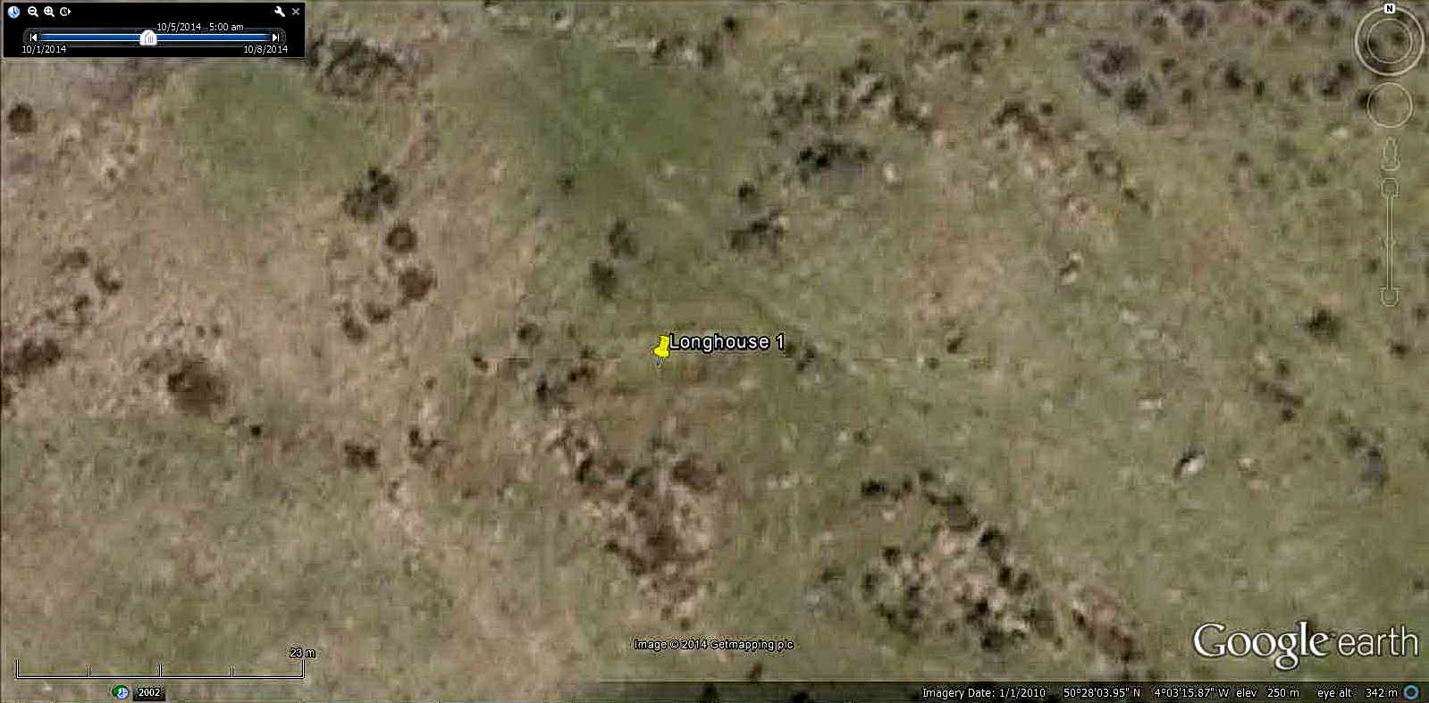
"LH1" = Longhouse 1 has a wall running from upper left to lower right diagonally almost touching it's top right corner, also seen on the Butler map below.
Another large hut circle, just up the slope from the second longhouse .....
A large hwathorn tree is almost part of the circle today .....
Another view .....
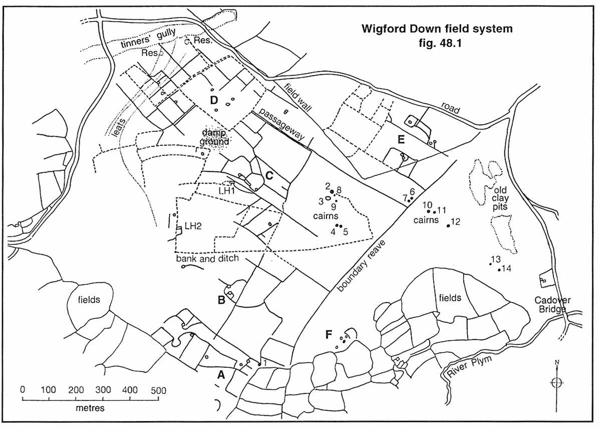 Image © J Butler 1994. Reproduced by kind permission (ref. 29 Sept. 2012). |
The area is described by J. Butler (1994), Dartmoor Atlas of Antiquities III, The South West. 48.1 Wigford Down field system and cairns, and Dewerstone Hill (figs. 48.1, 1.1, 1.2,2, pages 79-98).
Approaching the summit of the Down .....
What appeared to be a robbed out cairn, with Hen Tor behind .......
A dew pond on the summit!
Zoomed view across the pond to Hen Tor, distance 4.67 Km (2.90 miles) .....
Another view across the pond, to the Mount Batten, Fort Stamford area on the coast of Plymouth Sound ..... 13.4 km (8.33 miles) distant ..... the day was clounding over .....
Zoomed view: I think it is possible to see the Mount Batten breakwater / quay?
Cairn 2 on the area map shown above, at SX 54655 65093, robbed out ..... the cairn is the large green area, topped by a modern 'cairn' i.e. a pile of small stones .....
Zoomed view, Hen Tor (left), Great Trowlesworthy Tor (right), with Trowlesworthy Warren House (with trees) 3.39 km (2.11 miles) distant.
A final look at Cadover Cross as the sun became covered by a cloud, although there is still a faint shadow.
MAP: Red = GPS satellite track of the walk.
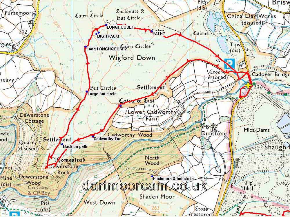
The walk can be accessed easily from Yelverton via Meavy or from Plympton by going past the Elfordleigh hotel. The large car park is a popular tourist (and locals) spot, the car park is at the yellow cross and P symbol on the map. There are also other approaches.
Statistics
Distance - 6.00 km / 3.73 miles.
All photographs on this web site are copyright © 2007-2016 Keith Ryan.
All rights reserved - please email for permissions