![]()


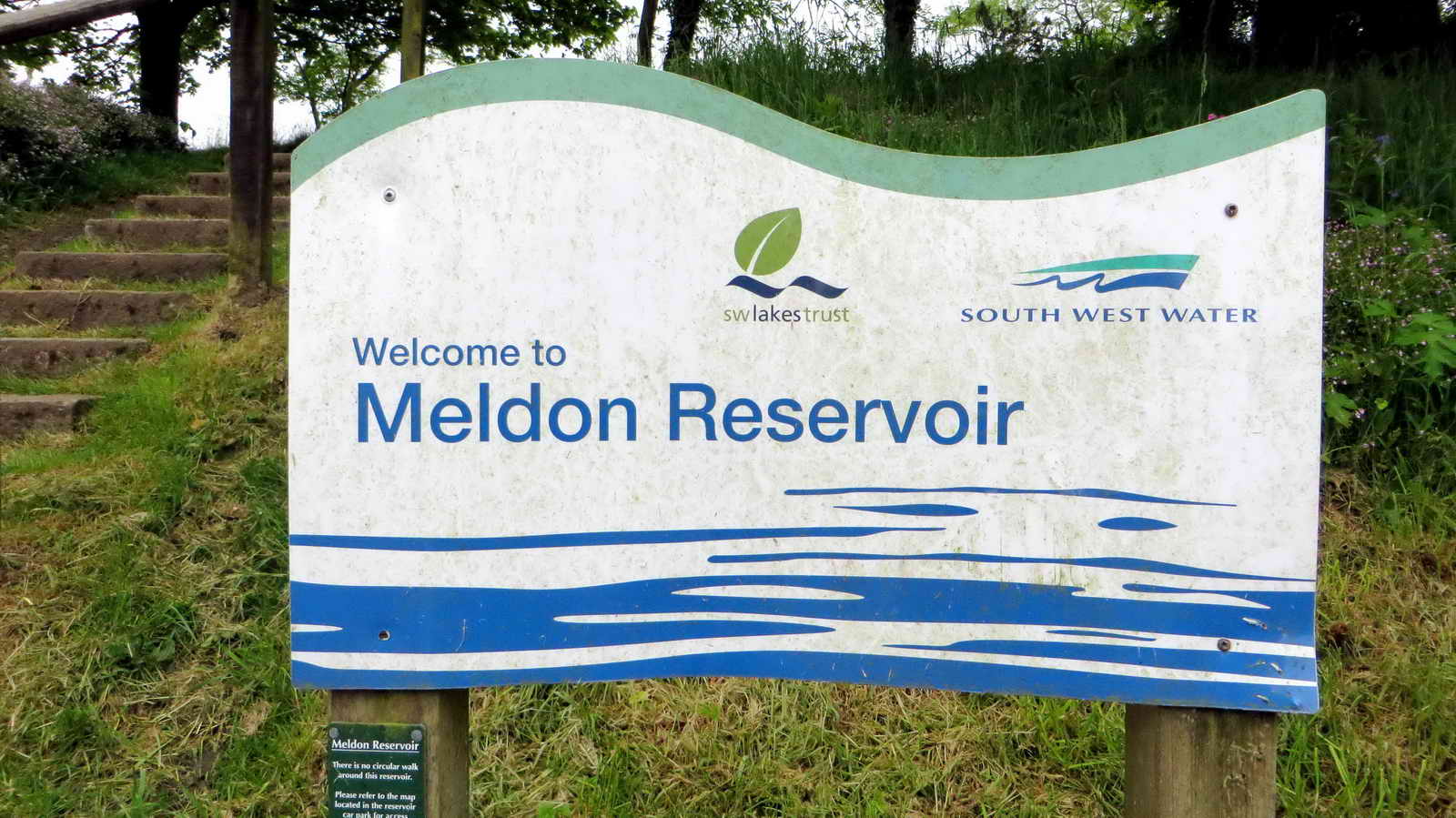
This walk: 2014-5-29. Meldon Reservoir, hawthorn, beech, adit, footbridges, Meldon Pool, limestone, Meldon Viaduct, weighbridge, lime kiln, pignut, bugle, bluebells, Meldon Quarry Station, Dartmoor Railway, aplite quarry, Redaven Brook, copper mine, Meldon Dam.
Walk details below - Information about the route etc.
Link to Google Satellite view of the area - including the GPS track of the walk (compare with the Ordnance Survey map plus GPS track below).
Previous walks in this area: 25th Apr. 2012, 21st Aug. 2013.
Some information was obtained from Exploring a Dartmoor Valley - The Meldon Beneath our Feet, Peter Keene, 2007, Dartmoor National Park Authority and Devon County Council. ISBN 978 0 905981 40 6. Obtainable at DNPA Visitor Centres/Information Offices.
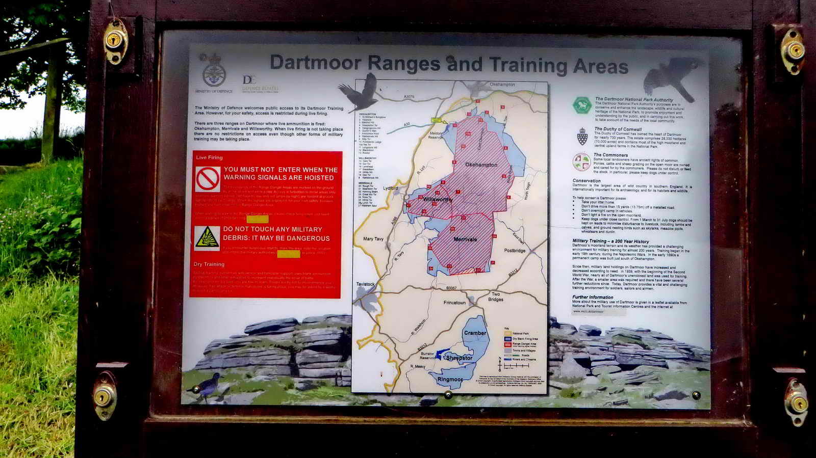
Meldon Reservoir car park firing notice.
Self-explanatory.
![]()
Click the image to see a larger version.

This was "May blossom" season, with many hawthorn trees in flower.

Beech tree cowl enveloping the end of a hedge .....

Hedge of beech trees.

May blossom (hawthorn) complete with pollen beetles if you look closely).

Adit, SX 56378 92007 or SX 56375 92041 (more than one) .....

Internal view, with "flash" illumination.
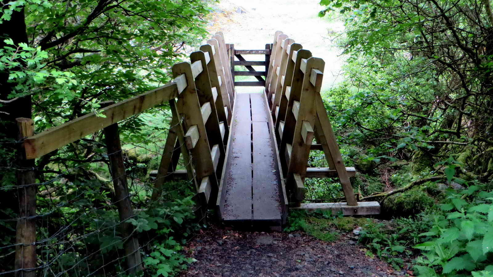
First footbridge, at SX 56427 92083 (not crossed, but there are wheelpits and "finger dumps" to be seen on the other bank of the river i.e. West Okement River) .....

Looking upstream.
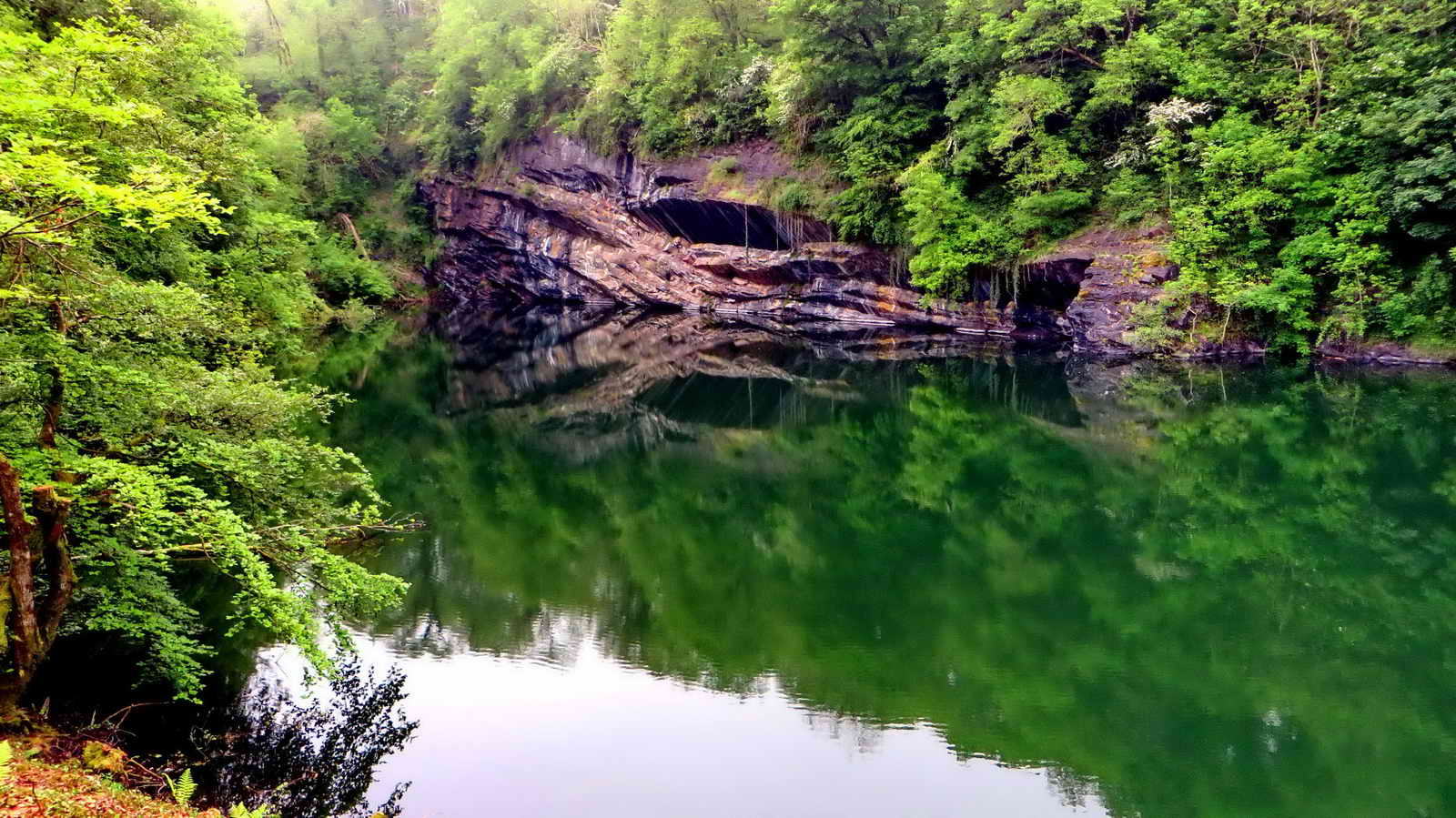
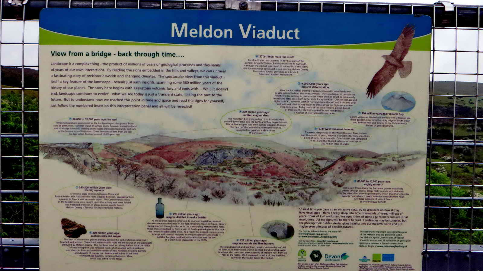
Meldon Pool, an old limestone quarry, now flooded. This was a special Carbonifereous period limestone, not found anywhere else on Dartmoor; laid down 350 million years ago by living coral reefs. The rock was treated in nearby lime kilns with alternate layers of limestone and charcoal, which was lit at the bottom and burned at high temperature for three days. Used for treating fields and soils in farming to "sweeten" the land. The pool is deeper than the nearby Meldon Viaduct is high: the pool is around 40 metres (130 feet), the tallest viaduct span is 120 feet .....
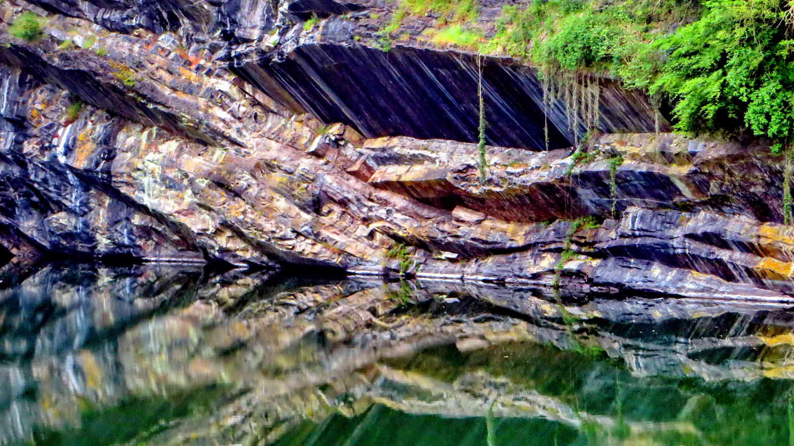
View across Meldon Pool. Early in the Carboniferous Period, around 350 million years ago, the Variscan Orogeny occurred, when the African tectonic plate collided with the European plate. This climaxed with the intrusion of the molten magma of the Dartmoor granite. Oceanic sediments were pushed up, folded and baked with the tremendous heat of the process. The rocks around the granite were changed and are referred to as the metamorphic aureole - Meldon is entirely within this region. Super-heated fluids leaked from the granite into the metamorphosed rocks of the surrounding country rock to form new minerals .....

Zoomed view .....

View from further along the pool, showing the reflections in the water.
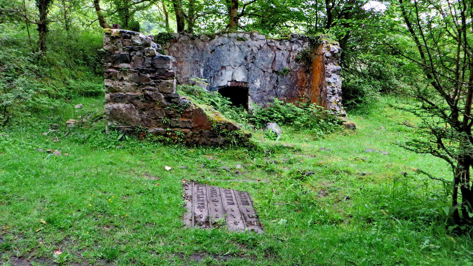
The ruins of a building associated with a weighbridge that is almost hidden nearby, for weighing cartloads of lime from the nearby kiln .....
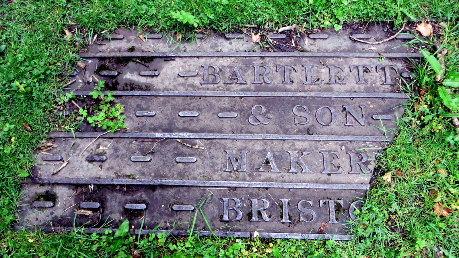
Remains of the weighbridge, made by Bartlett & Son, Bristol.
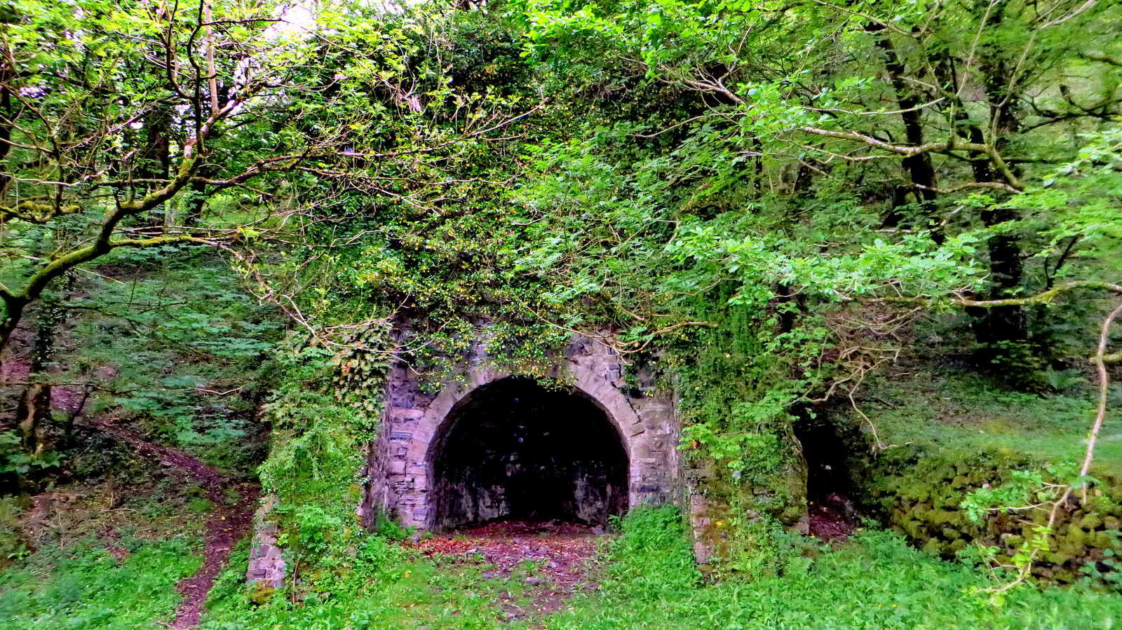
The west lime kiln ..... built 1880-1885, charcoal was made here from the surrounding woodlands as well until the train came with cheaper fuel, coal. The limestone was roasted in alternate layers using charcoal to convert it fom calcium carbonate into quicklime, calcium oxide. This would be slaked with water and then powdered to form slaked lime (calcium hydroxide) to put on land to raise the pH and increase its fertility. The stone and charcoal were lifted to a loading platform at the top of the kiln using an inclined tramway. The charge was lit through the grate at the back of the kiln and after three days, the lime was shovelled out through the same grate into waiting carts. The limekiln was disused by 1905. Source: "Exploring a Dartmoor Valley", Peter Keene, DNPA & Devon County Council, 2007, page 17 .....
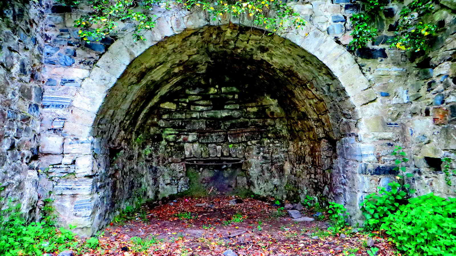
Closer view .....

The kindling grate.
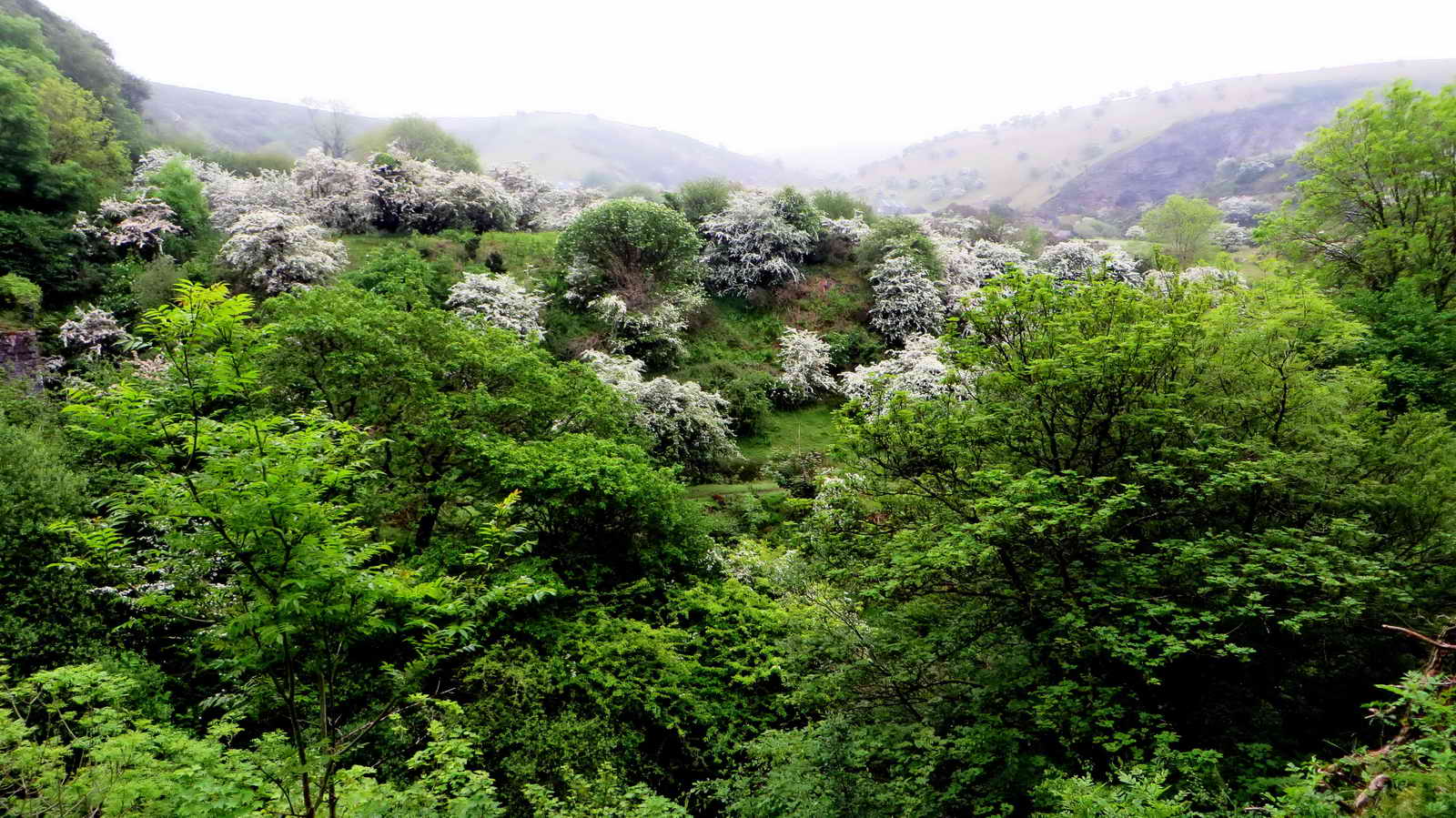
View across the valley at hawthorn trees in blossom.
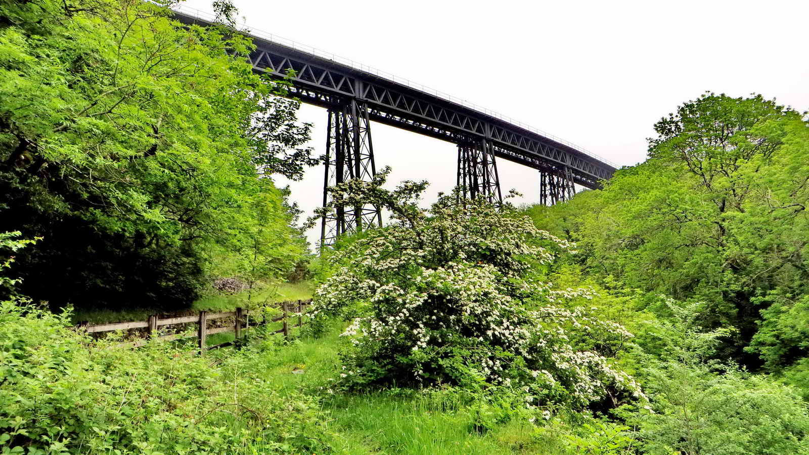
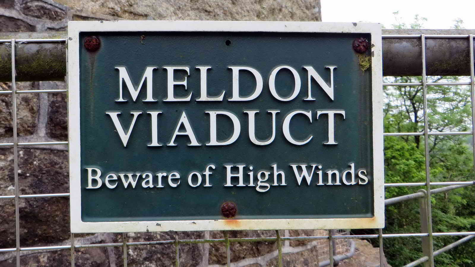
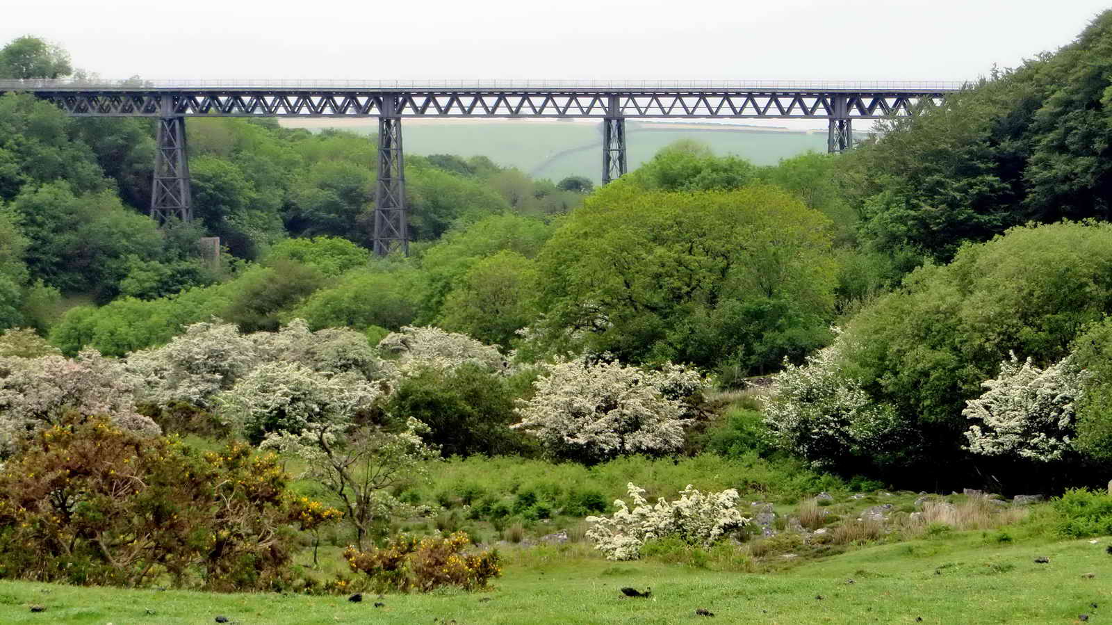
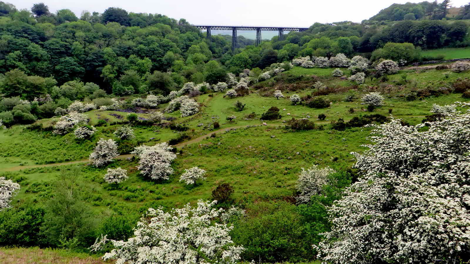
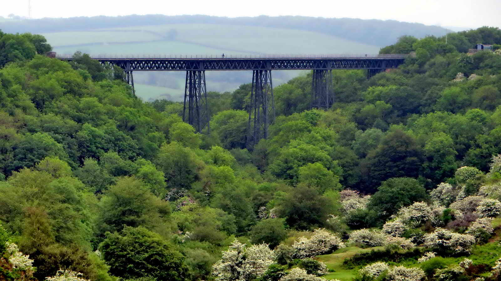
First view of the Meldon Viaduct, with a more modern description .....
From the oroiginal Meldon Viaduct web site .....
"Meldon Viaduct, a Scheduled Ancient Monument, is a superb example of Victorian Engineering and is one of only two in the country of this type of construction. Built in 1874 for the London and South Western Railway main line between Waterloo and Plymouth, it was widened to double track in 1878 and closed to trains in the late 1960s.
The widening was achieved by constructing a second viaduct along side the first, using an almost exact copy of the original design. Over the years the two structures have been tied together in an effort to reduce sway when trains crossed the viaduct. The structure underwent a major refurbishment in 1996. Although the trains have long gone it is still a significant landscape feature that it is now available to walkers and cyclists."

Originally this was a single track viaduct (opened 1874), with a second track added in 1878 ....
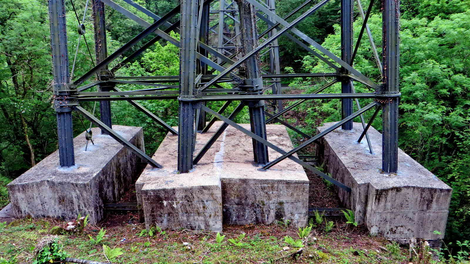
Concrete bases to the pillar supports .....

Another view.

Believed pignut, Conopodium majus, also HERE. Wild carrot is similar but the individual flower heads appear to be larger. This is the right season for pignut to flower (May-June) whereas the wild carrot tends to flower June-August.
There is a river, way down below us!

This is probably Bugle (Ajuga reptans), with quite long spikes of flowers flowering April-June rather than Self Heal (Prunella vulgaris) which flowers June-October.

Footbridge no. 2 at SX 56470 92731 .....

Another view ....

Looking upstream .....
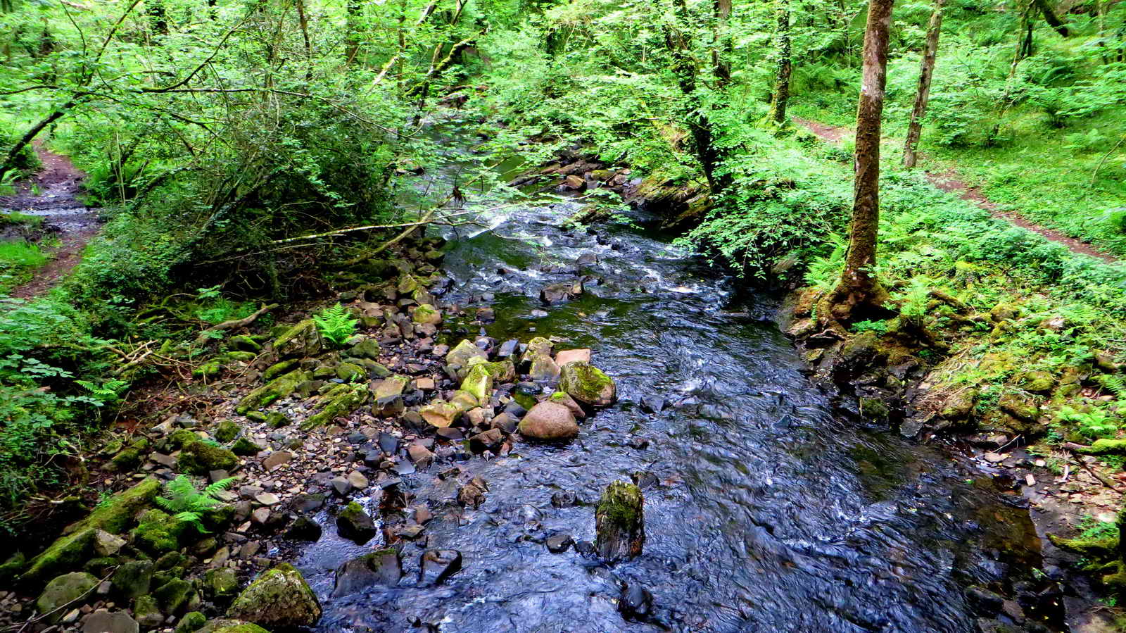
Looking downstream.
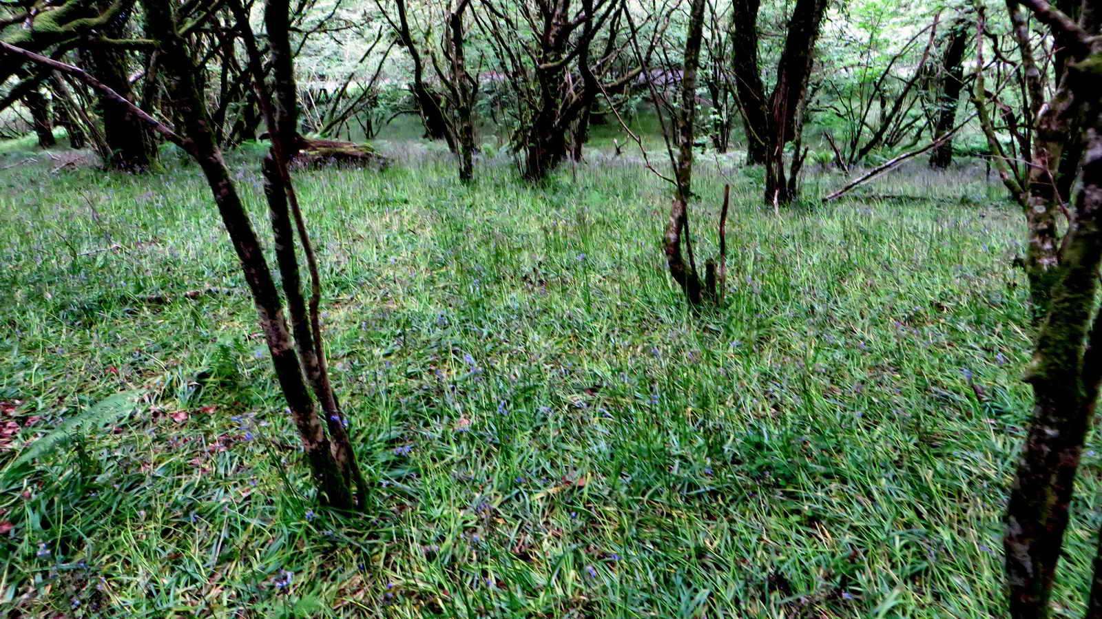
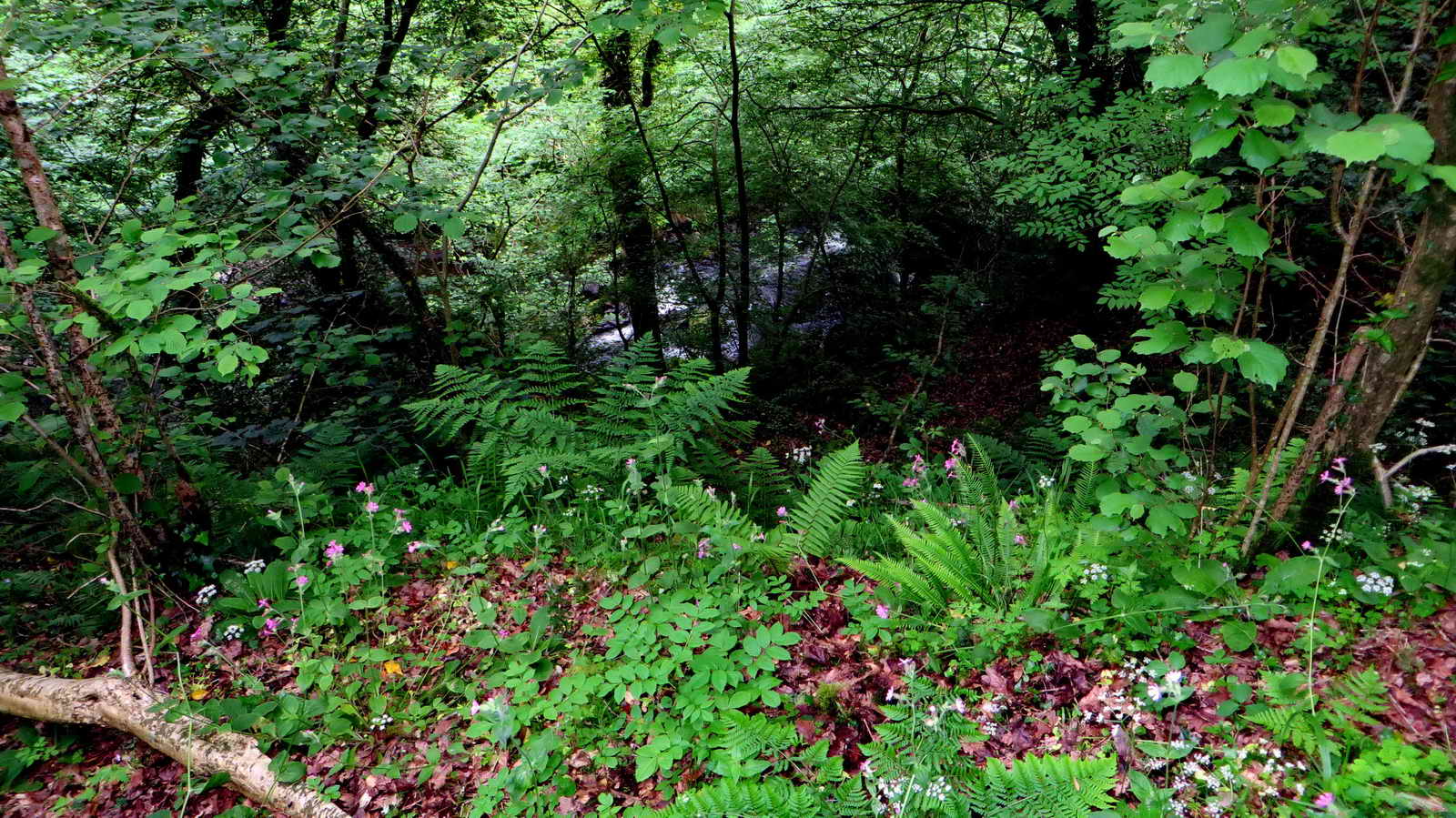
This area obviously has a very dense population of bluebells, that we had missed!
On climbing the path up to the viaduct, we found Meldon Station .....
From Dartmoor Railway Supporters Association web site .....
"The quarry at Meldon, 2.5 miles beyond Okehampton, was purchased by the London & South Western Railway in 1897 to provide track ballast. A small station at Meldon Quarry Halt was constructed during the 1920s but the larger station that exists today has been in use since 2000. Meldon Quarry signal box, now no longer present, opened in 1903 and closed in 1970. A unique feature was the steel mesh over the windows to protect the box from flying debris during blasting in the quarry. Stone trains continued to operate to Meldon until the closure of the quarry in 2011.
Meldon is also the location of the Dartmoor Railway rolling stock workshop. The official name of the station is in the process of being changed from Meldon Quarry to Meldon Viaduct."

A self-explanatory notice .....

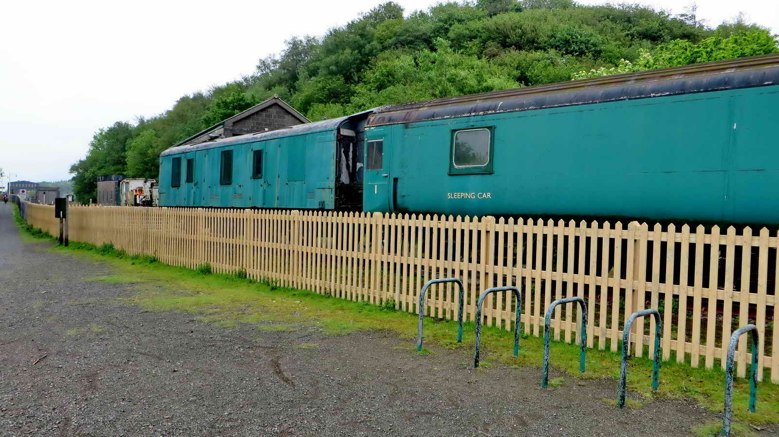
A view of some sleeping cars ....

Station buildings ....
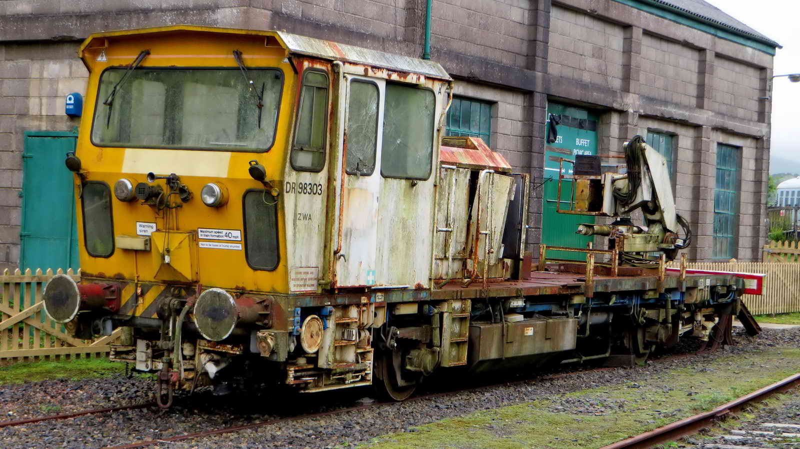
What exactly is this?

Sign. .....
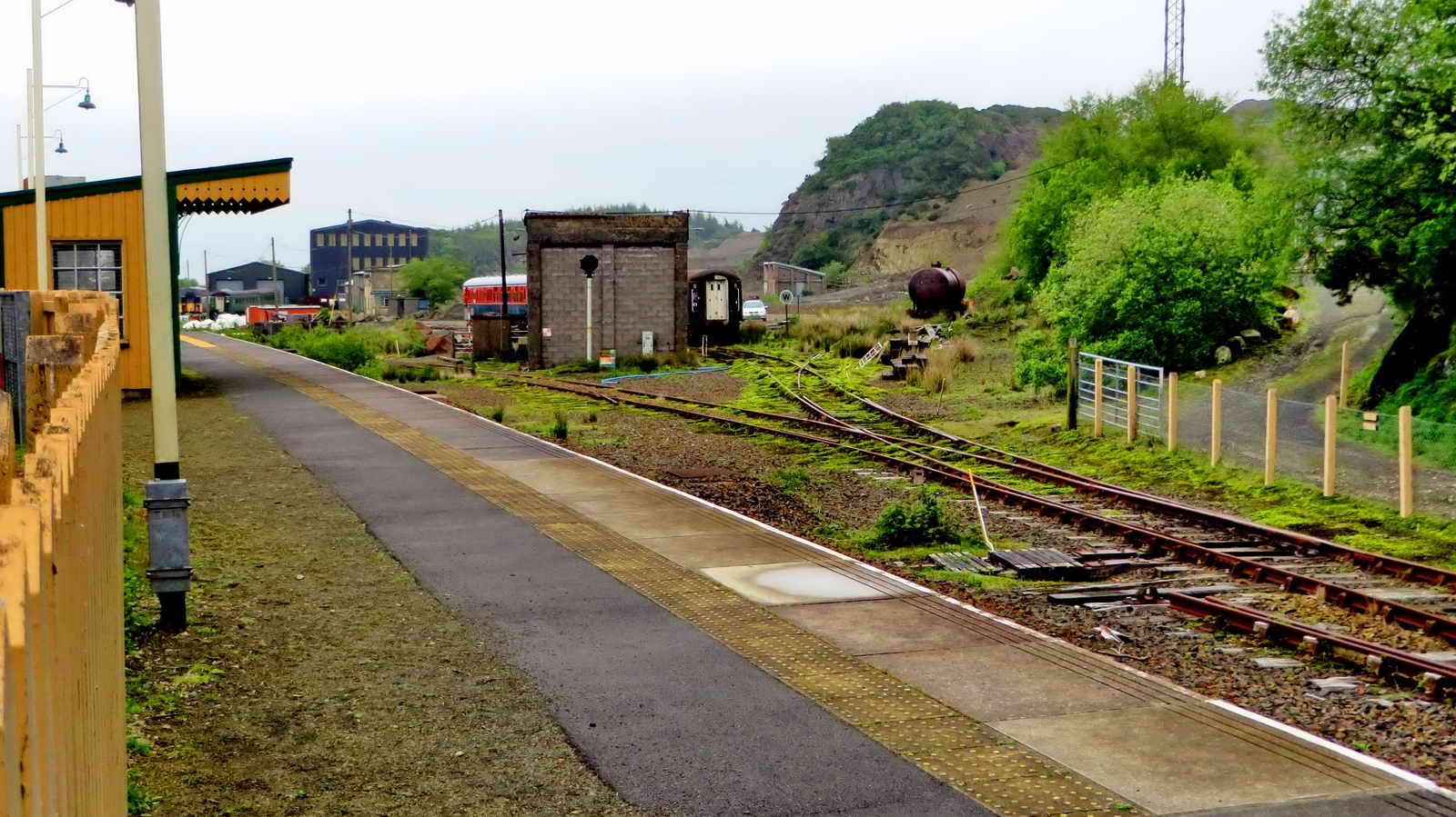
Station facilities .....

Looking across to Meldon Quarry ..... Youtube film .....
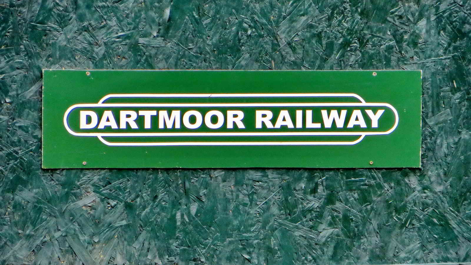
Dartmoor Railway sign ......

Looking along to the viaduct .....
You bet!
Click the image to see a larger version.

Back under the viaduct .....

More of a side view.

The south aplite quarry ......
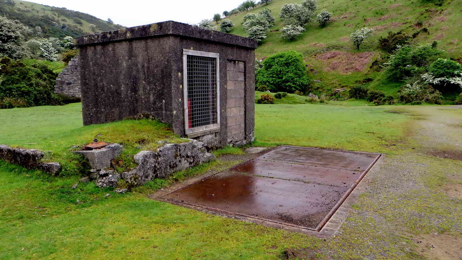
The old weighbridge .....

Remains of the old scales.

Redaven brook .....

Zoomed view, up the brook.

Close-up view of hawthorn blossom.
Hawthorn trees in "May blossom" above Meldon Viaduct.

Closer view of the rock face .....
Another view towards the viaduct.

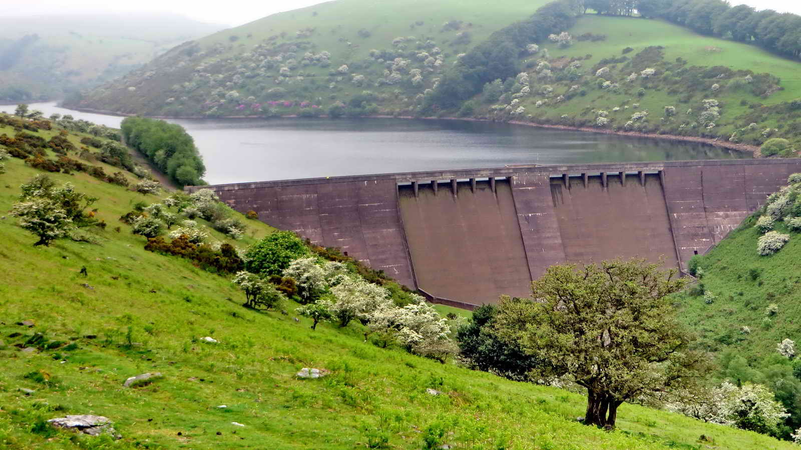
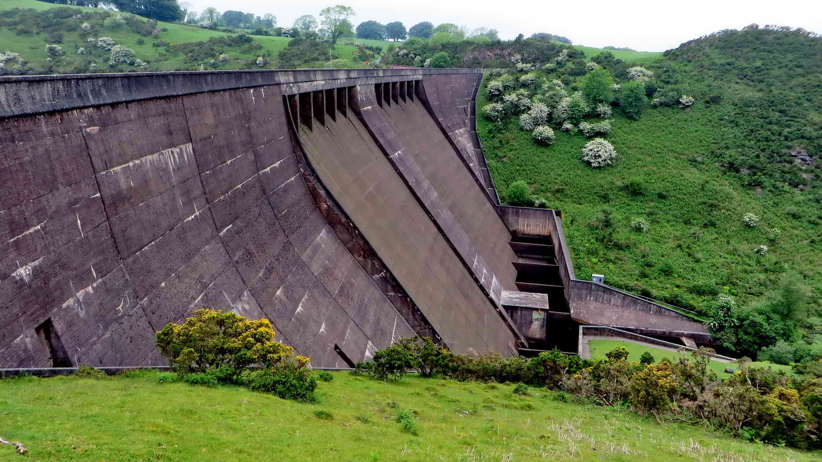
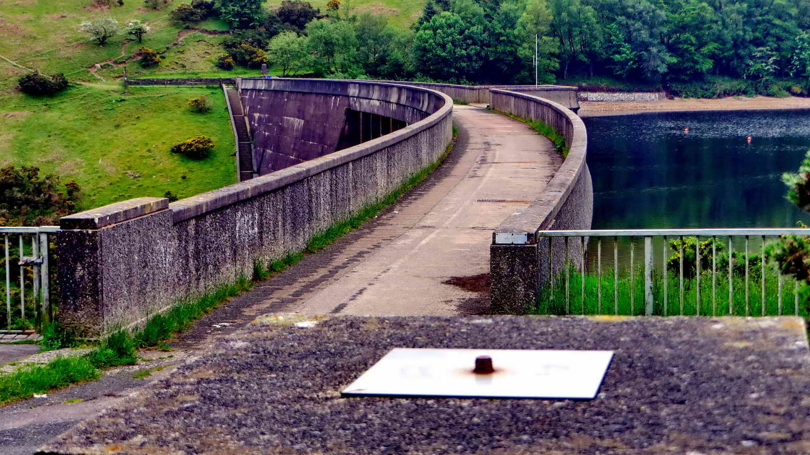
Meldon Dam ..... inaugurated 1972 .....
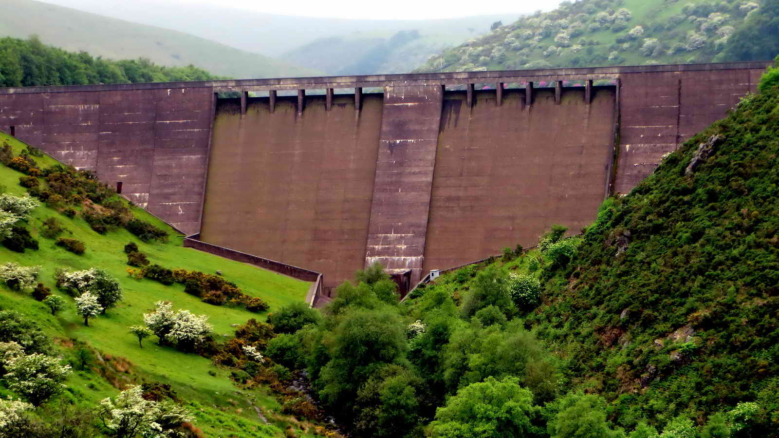
Closer view.

Part of Red-a-Ven Copper Mine, Okehampton Wheal Maria, Blackdown Copper Mine, Meldon Mine or Devon Copper Mine (alternative names for the same mine, see the link - which says that the experts do not agree as to where some of the names were applicable?). There is an area of dressing floor to the left.
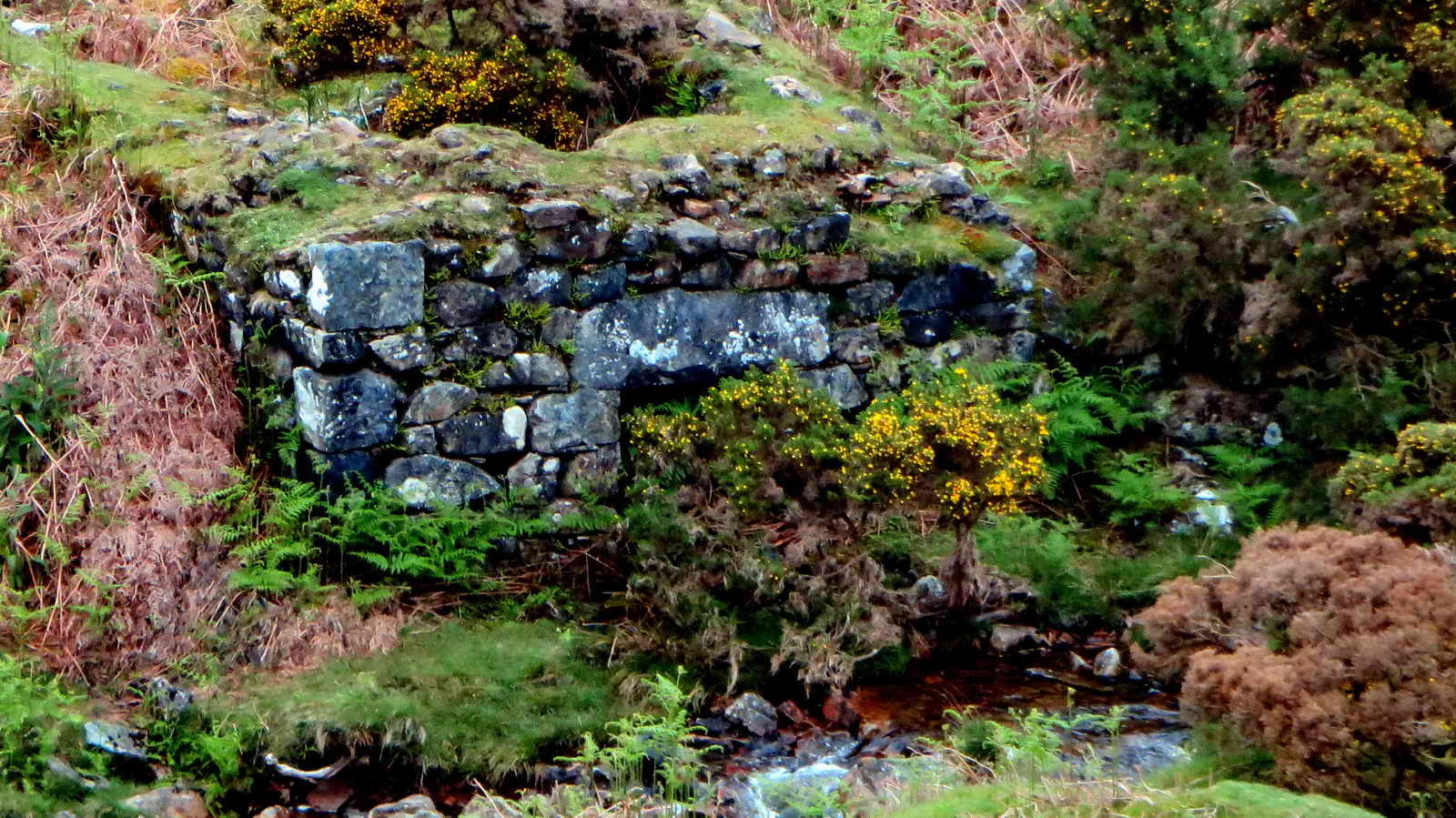
Zoomed view to the wheel pit .....

Zoomed view to the hole in the ground .....
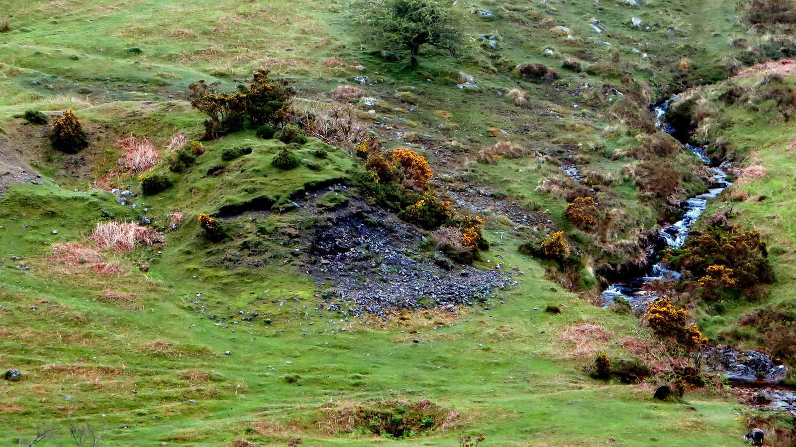
A "dump" area?

Getting near the dam ....
As previous .....
Looking along the front of the dam .....
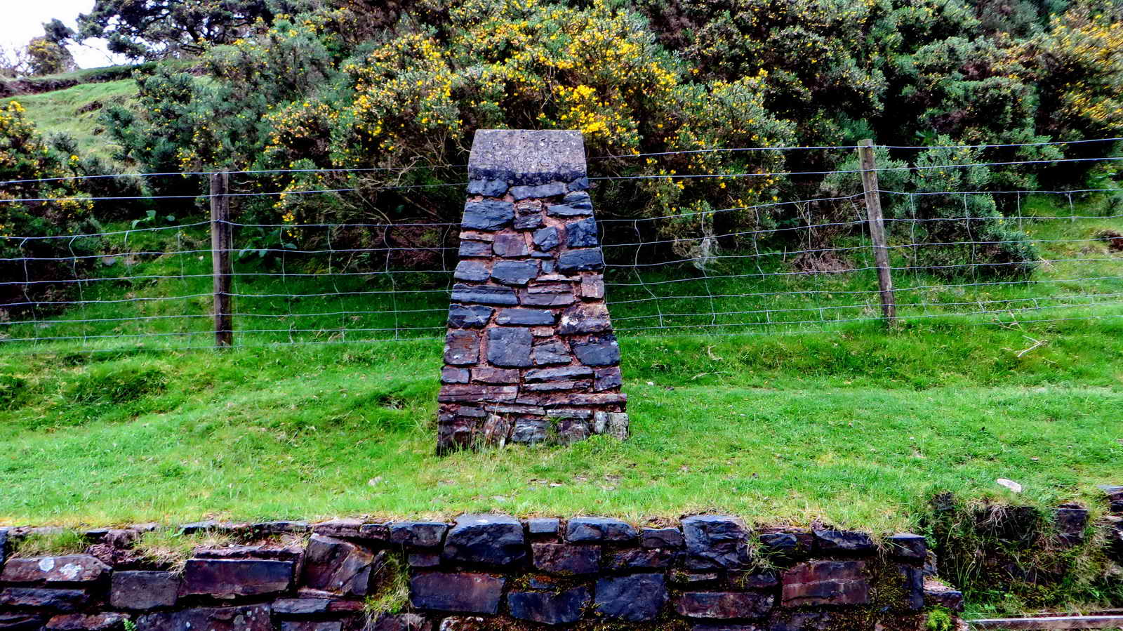
A surveying post on the southern side of the valley .....
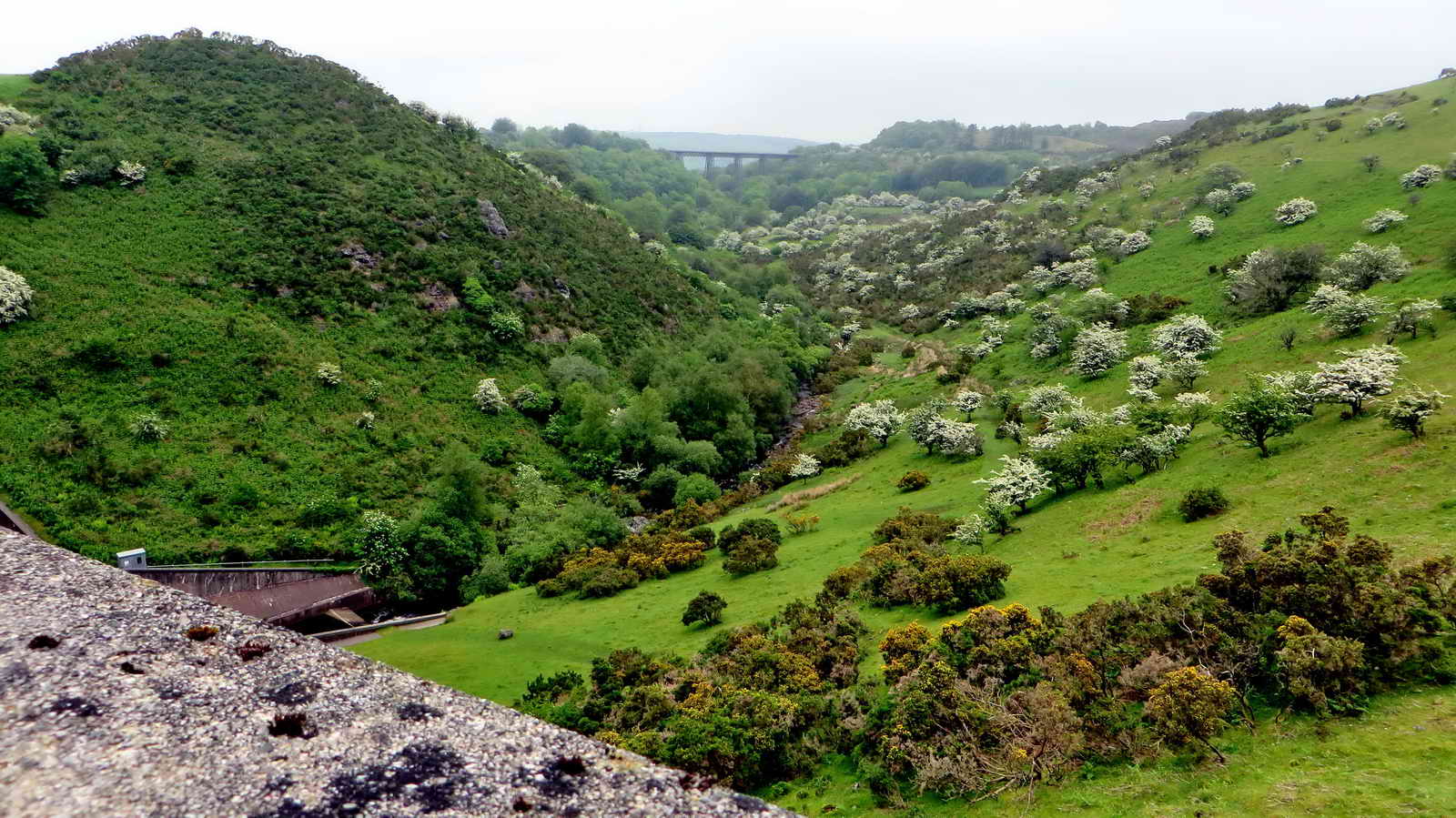
Looking from the dam to the old railway viaduct .....
As previous photo .....

A view of the reservoir lake .....

Looking over the dam parapet .....

Looking along the front face of the dam from the north side of the valley .....

Looking back from the second surveying pillar .....
Ditto.


A sea of red campion ..... Silene dioica .....

A single red campion flower.
MAP: Red = GPS satellite track of the walk.

© Crown copyright and database rights 2012 Ordnance
Survey
Licence number 100047373
Also, Copyright © 2005, Memory-Map Europe, with permission.
This walk was reached by turning off the A30 approaching Okehampton from the west, and following the signs to "Meldon" and "Reservoir Car Park". The park is at the yellow cross symbol on the map above. The placement of the Ordnance Survey P parking symbol etc. on the map is incorrect.
Statistics
Distance - 5.38 km / 3.34 milesrmissions missions
All photographs on this web site are copyright © Keith Ryan.
All rights reserved - please email for permissions
Sister web sites