![]()


This walk: 2014-10-1. Burrator Upper Quarry, Drake's Plymouth Leat, cobwebs, grey squirrel, explosives stores (x4), Burrator Dam, commemorative plaques, Burra Tor, anchorage points, Sheepstor Dam, ducks, memorial benches, Longstone Manor.
Walk details below - Information about the route etc.
Google Satellite view of the area - including the GPS track of the walk (compare with the Ordnance Survey map plus track below)Previous walk in this area: 18th March 2009, 17th March 2010 & 18 May 2011.
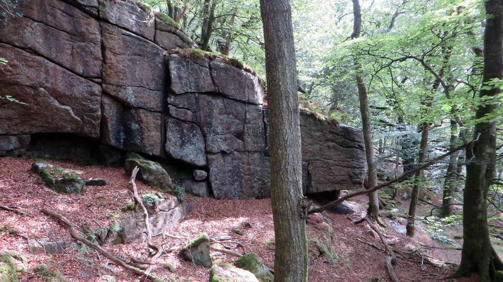
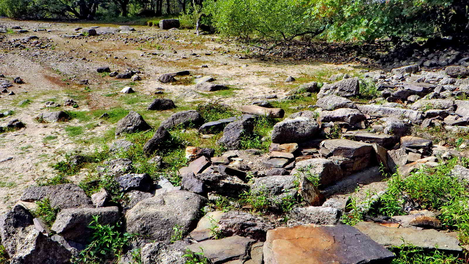
NB - Most photos were taken during the "recce" on 15th Sept.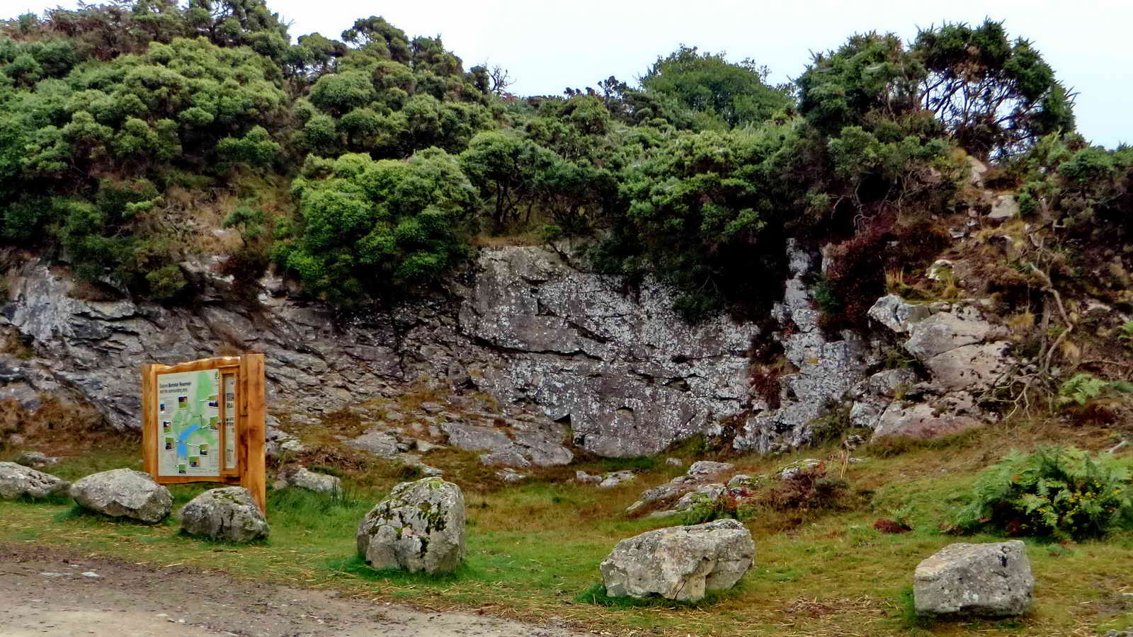 Rock exposure at Burrator Upper Quarry - the lower
quarry is just around the corner towards the dam and has been blocked off for
car parking for many years .....
Rock exposure at Burrator Upper Quarry - the lower
quarry is just around the corner towards the dam and has been blocked off for
car parking for many years .....
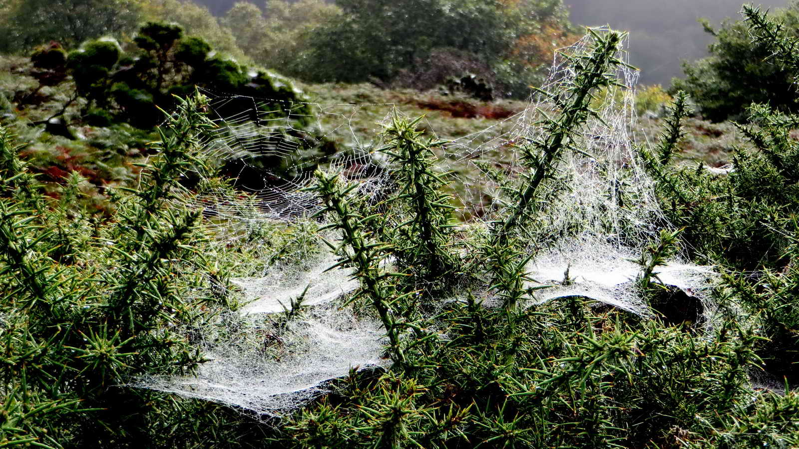
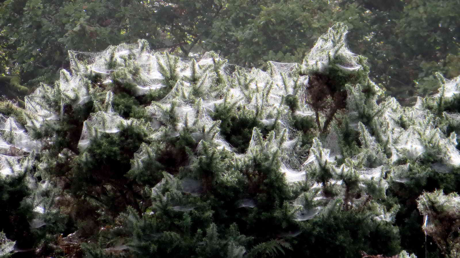 Dew-laden cobwebs on gorse .....
 Dew-laden cobwebs on gorse .....
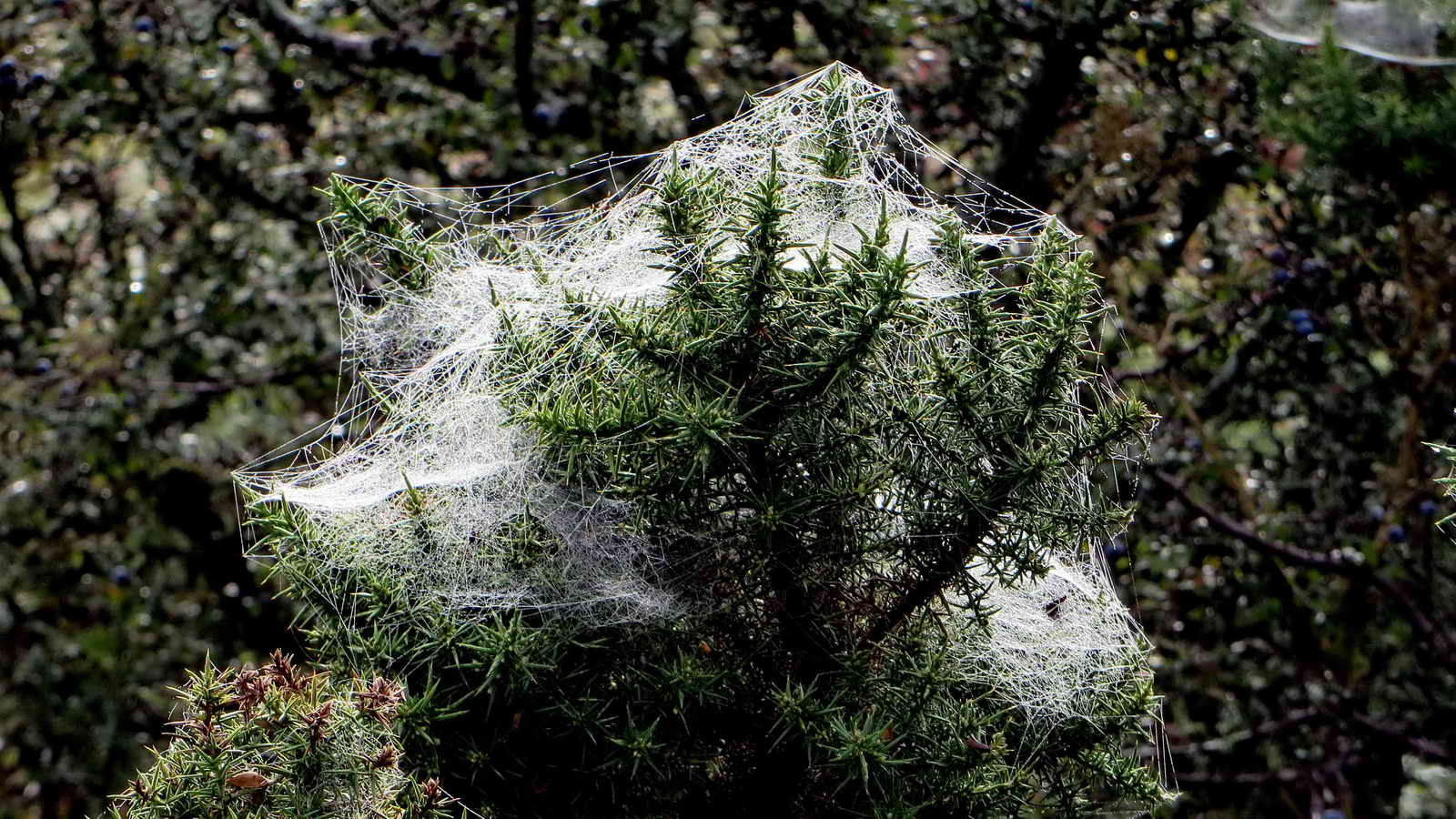
 Dew-laden cobwebs on gorse ..... note the common orb
web at upper left quadrant.
Dew-laden cobwebs on gorse ..... note the common orb
web at upper left quadrant.

Click the image to see a larger version.

The real point of interest in the quarry .....


A close-up of the interface between the granite and the Devonian rocks, with the Devonian on the left.

Numerous granite posts edging the road, some still show the brackets that once held iron chains used for safety - life was different once.

Drake's Leat, that took water to Plymouth .....

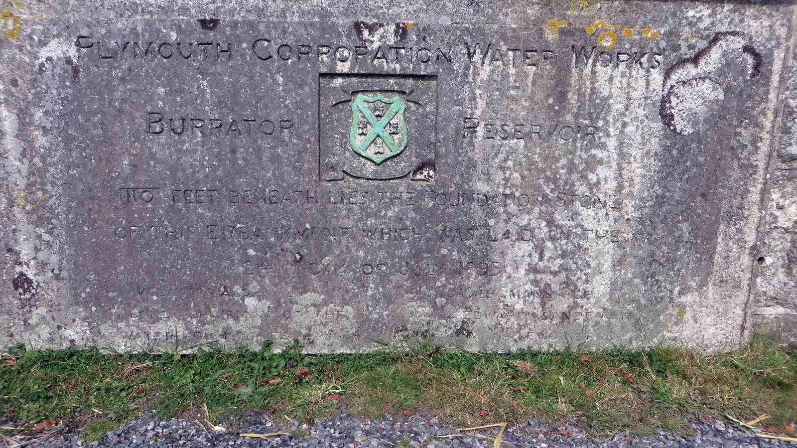
A 1917 Plymouth Corporation Water Works catchment boundary stone .....
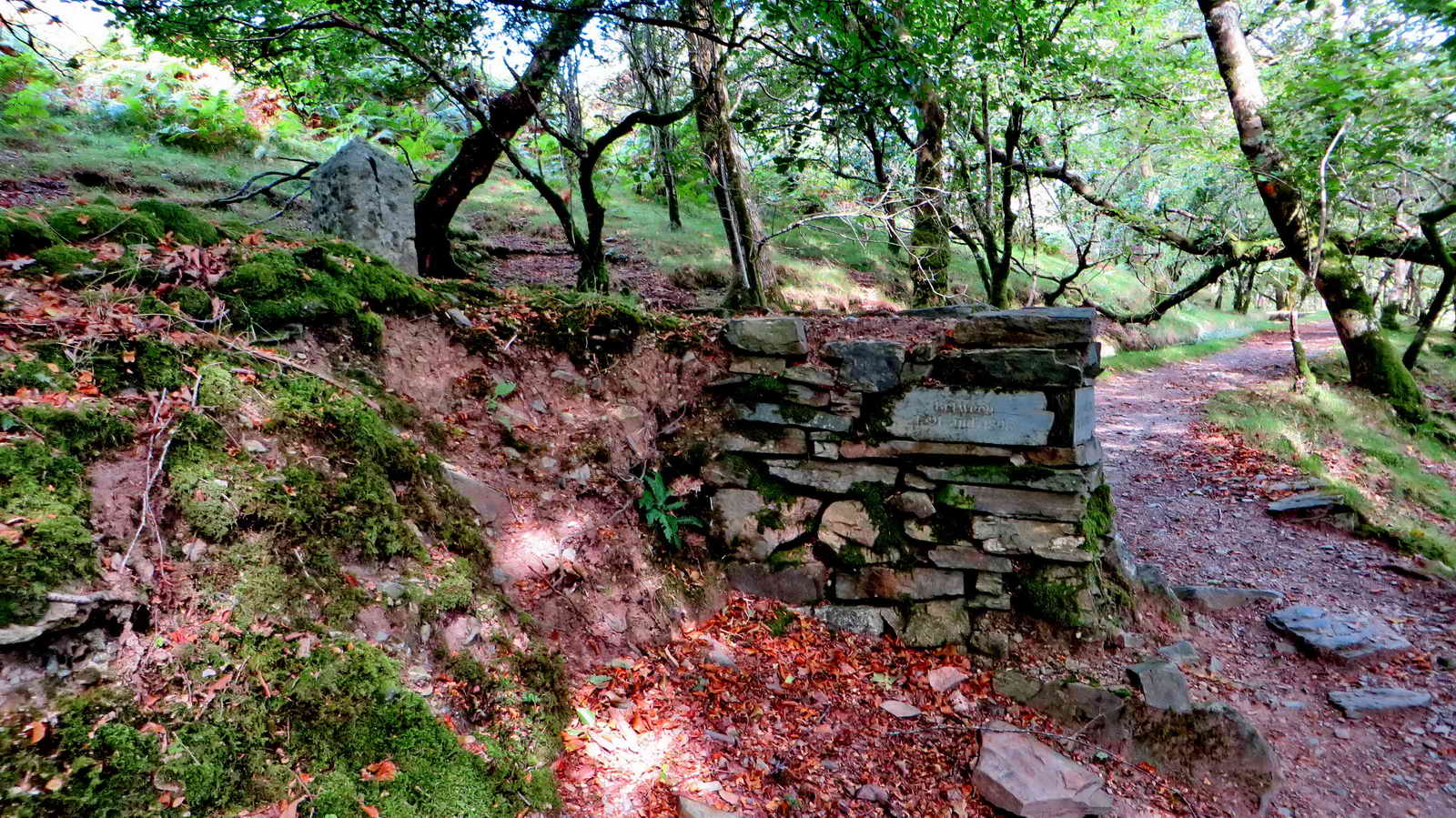
Looking in the opposite direction, towards the dam, and looking at inscribed stones in the wall ....
 Between 1591 and 1898
|
 fresh water from the River Meavy
|
||
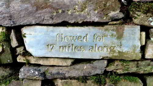 flowed for 17 miles along |
 Drakes Leat |
 to Plymouth. |
|

General view walking towards the dam, mind your heads!

Common polypody, Polypodium vulgare.
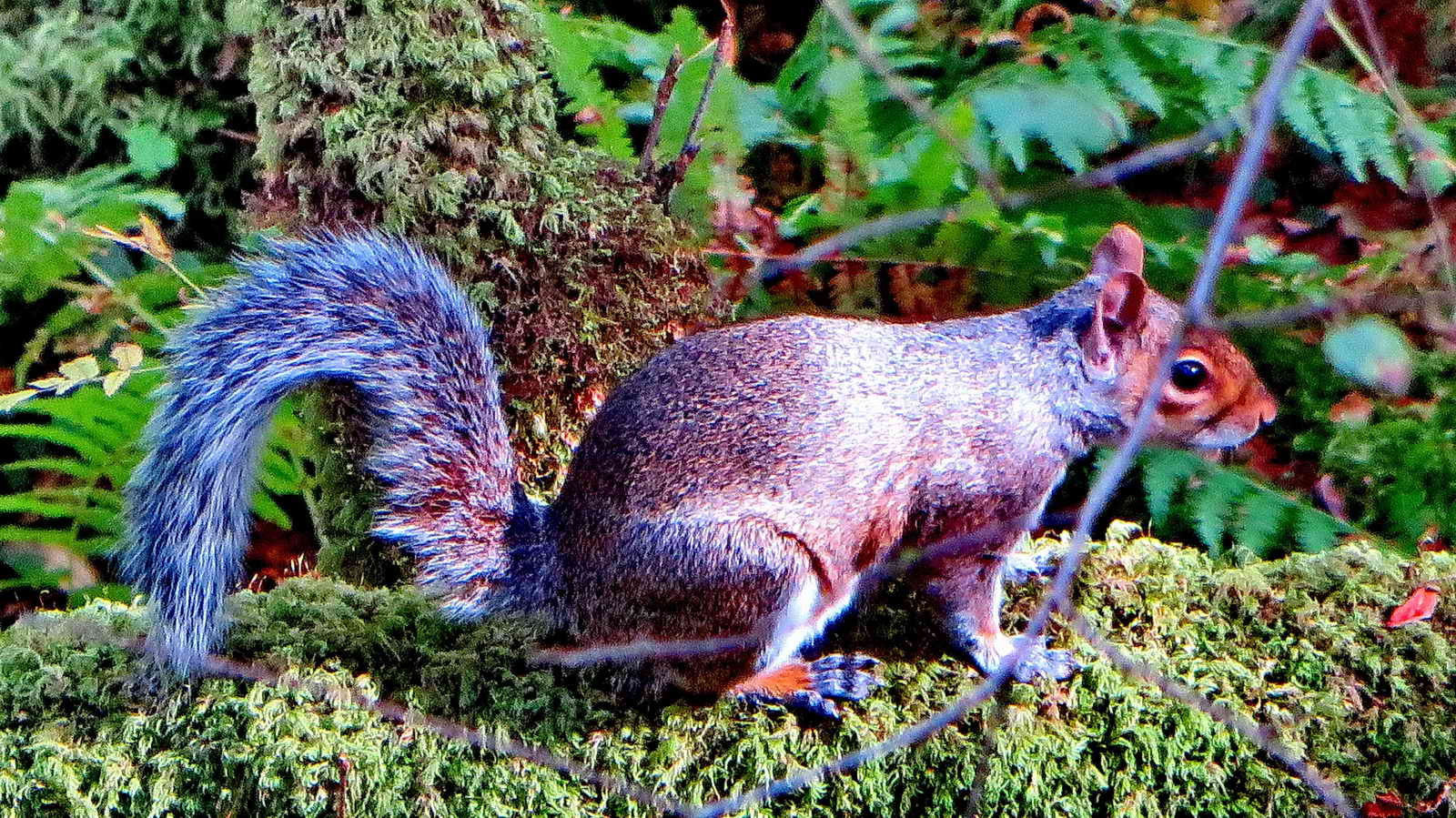
Grey squirrel.

Sign along the way - the top left "Public footpath" leads to the base of the dam, although access is barred.

The track junction, down to the dam, up to the old public toilets on the road.

The end i.e. the part of the leat nearest to the dam.
About as close to the dam as you can get at this low level.
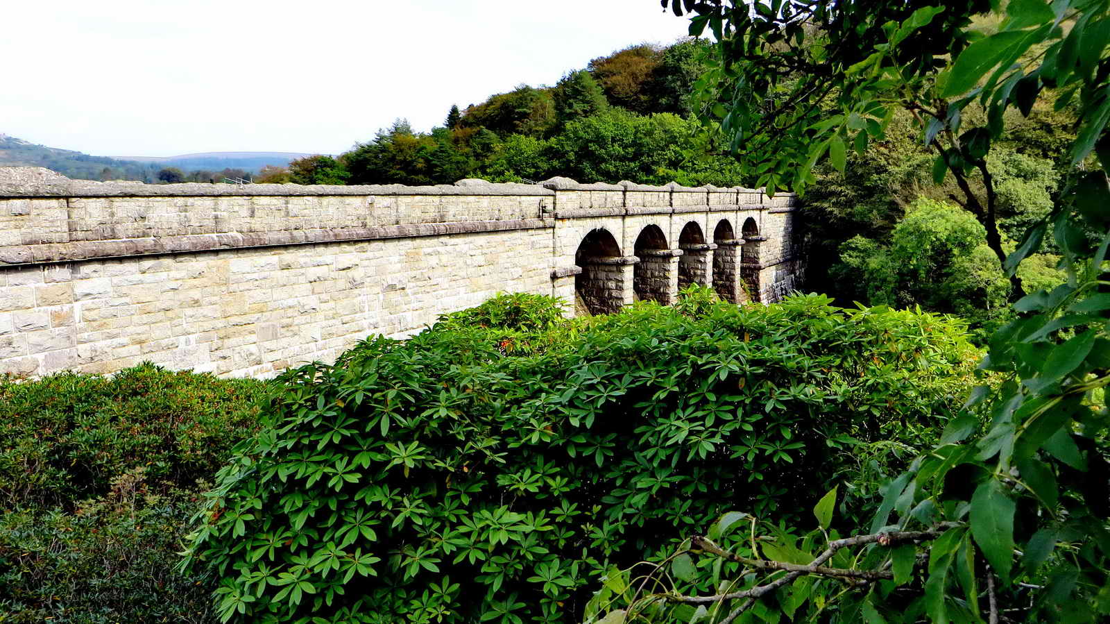
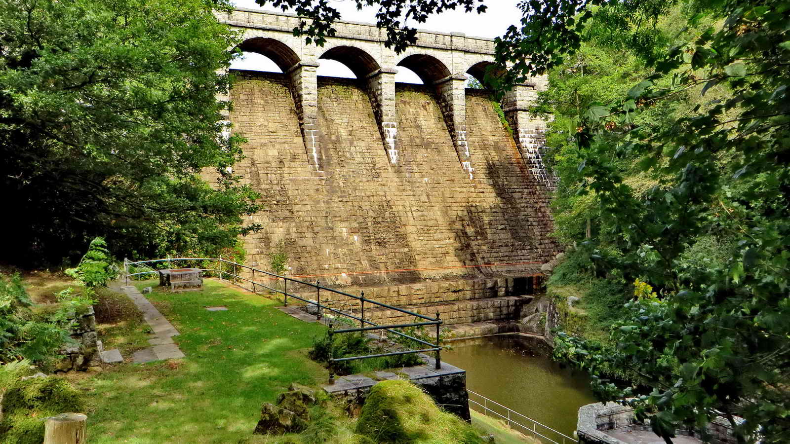
Burrator Dam .....

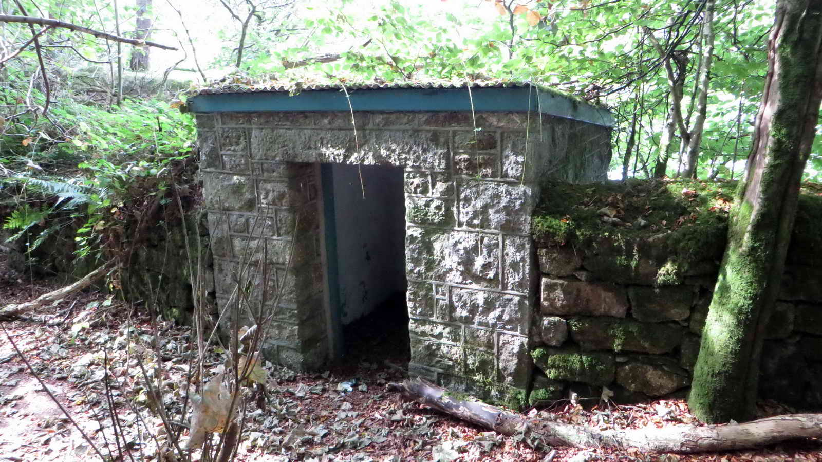
Explosives store (no. 1 of 4 recorded on this walk and its 'recce'): features include a cement/concrete door and roof with probably non-ferrous door fittings to prevent sparks that might set off an explosion. There are also vents to prevent the build-up of flammable gases as fumes from explosives.
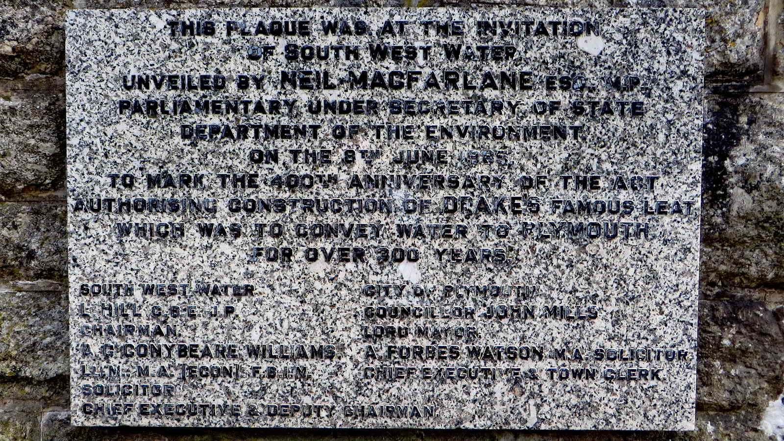
1985 commemorative plaque to mark the 400th anniversary of the Act of Parliament authorising the building of Drake's Leat to bring water to Plymouth.

|
Borough of Plymouth Burrator Reservoir |
|
|
Commenced 1892 James Manserch Edward Sandeman Engineers |
Completed 1898 JT Bond Mayor and Chairman of the Water Committee 1891-1898 |
 Plaque to commemorate the enlargement of the dam
during 1923-1928.
Plaque to commemorate the enlargement of the dam
during 1923-1928.|
Borough of Plymouth 1923-1928 Burrator Reservoir This stone commemorates the enlargement of the reservoir from a capacity of 668 to 1026 million gallons. Alderman RW WinnicottJP Mayor Chairman of the Water Committee |
||
| F Howarth | Councillor JE Fillar Vice Chairman | RJ Fittal |

View to Leather Tor.

Depth indicator to estimate the reservoir's remaining water.
Looking down away from the water - by holding the camera out at arm's length.

Looking across the dam from the Sheepstor end ......

A two-level drinking trough below the belvedere(?) - low level for sheep and dogs, high level for ponies and cattle.

Looking down on the dam.

On the flank of Berra Tor .....
As previous photograph .....
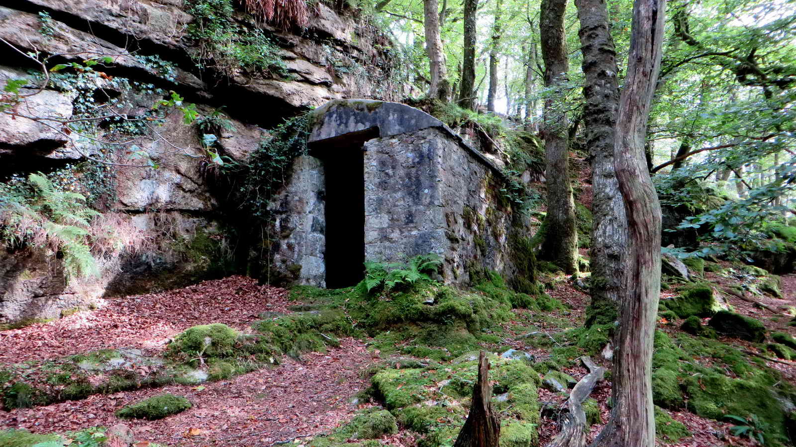
Explosives hut number 2 (seen on the recce) at SX 55184 67933, below the tor .....
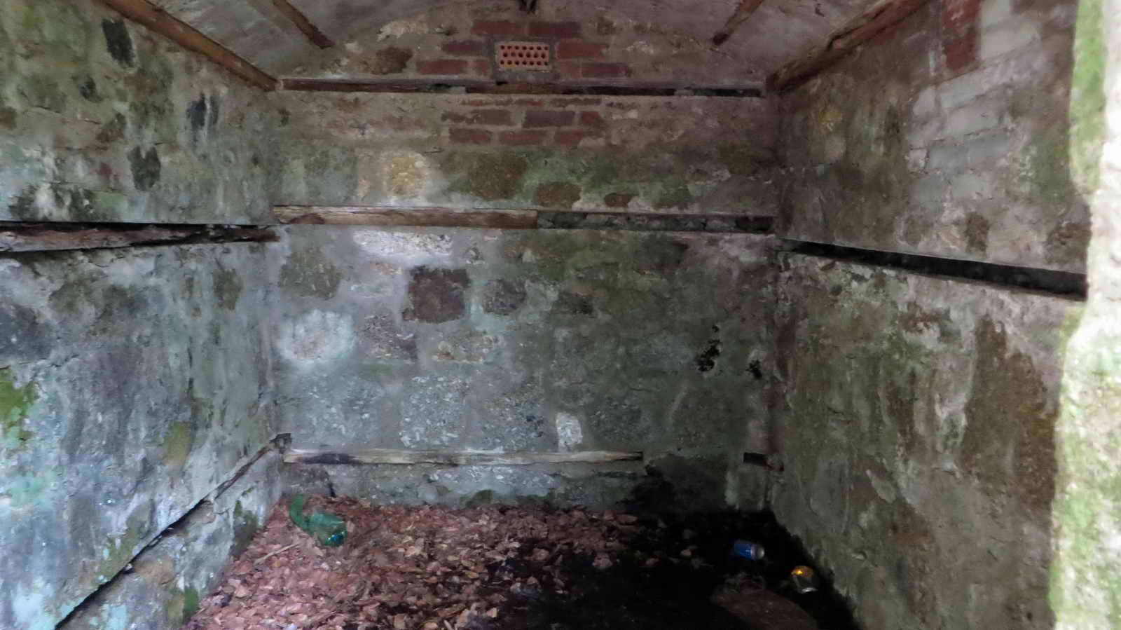
Interior.

Moss with spore bearing capsules.
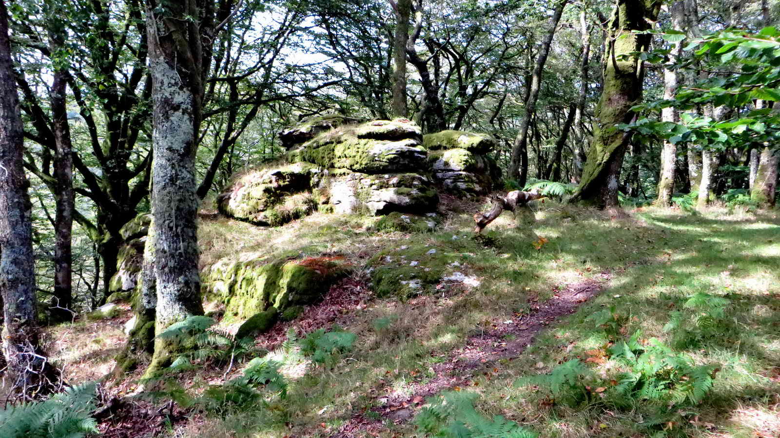
Burra, Berra or Beara Tor, SX 55241 67930, on a large granite outcrop above the steep-sided gorge of the River Meavy.....

Close-up: there are said to be rock pans now covered with moss .....

Conquered!

A wall near the back of the tor.

Sign by a stile at SX 55287 68103, which allows entry to the lake-side.

Anchorage points for the old suspension bridge that was used while the dam was being raised between 1923-1928.
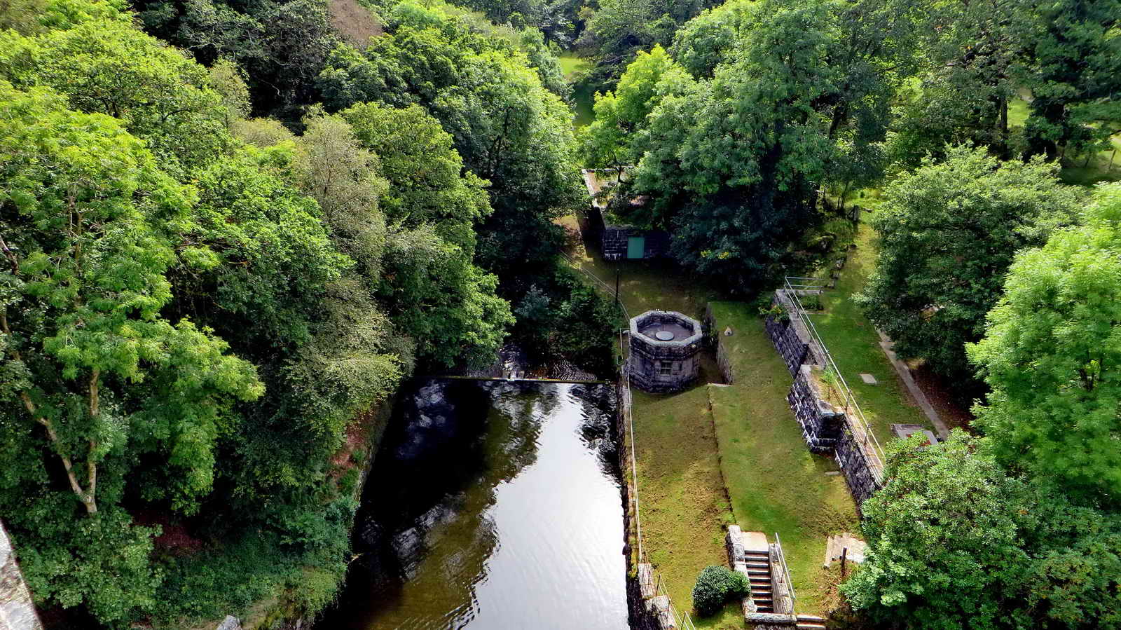
Unusual feature beside the lake .....

Inside the 'shed' was some equipment for what purpose? It seemed to go down to the water - for depth measurement?
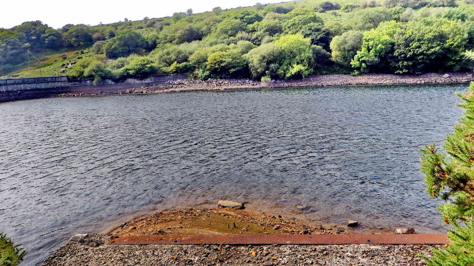
Looking across the reservoir from one pier area of the old suspension bridge - no sign of anything similar across the water from here .....
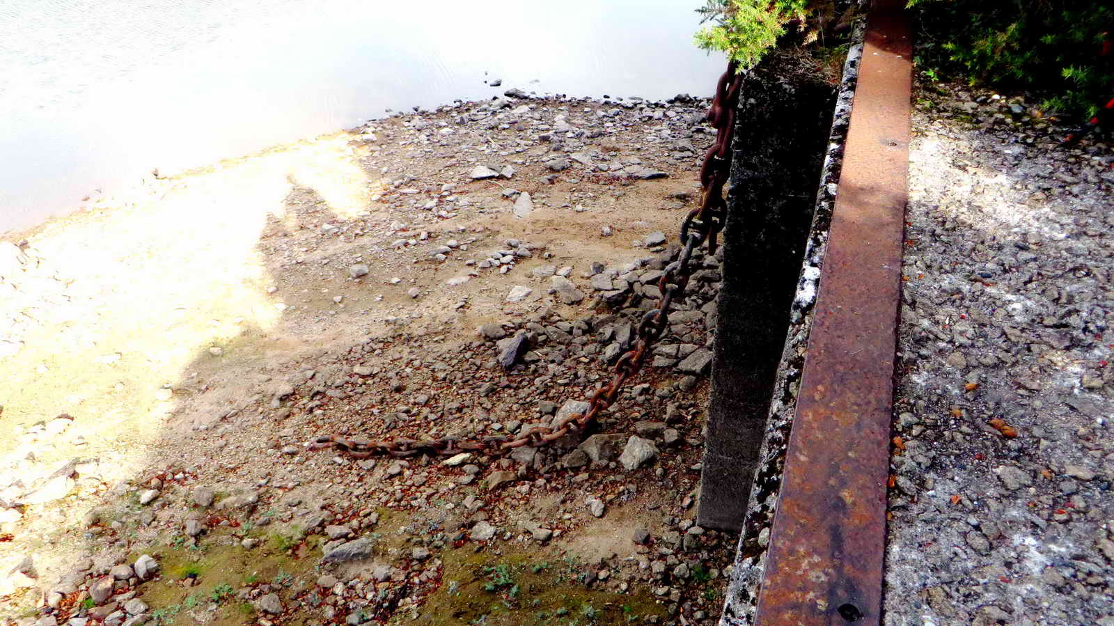
A piece of old (and quite substantial) chain.
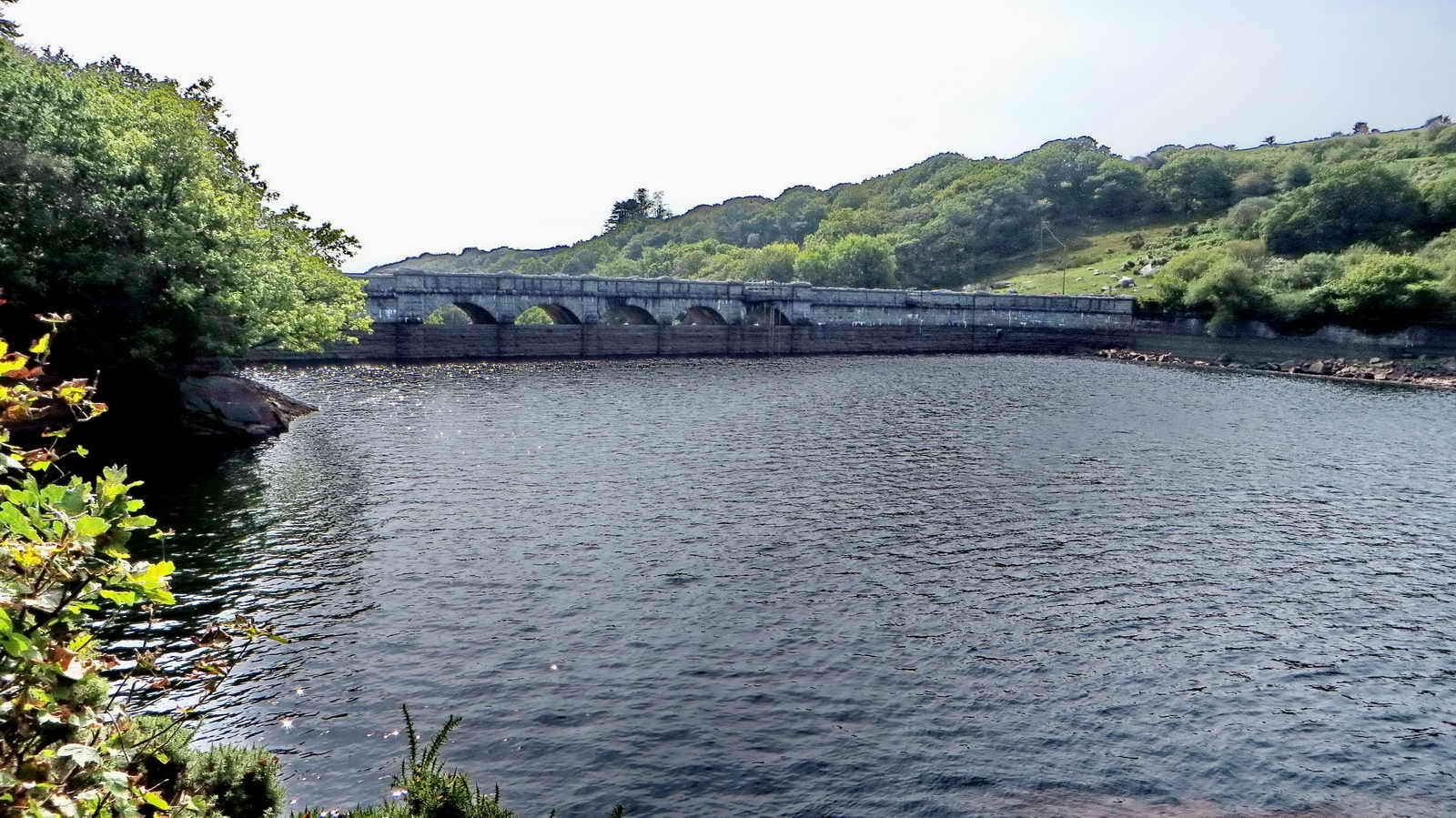
The dam.

Large block along the lakeside walk .....
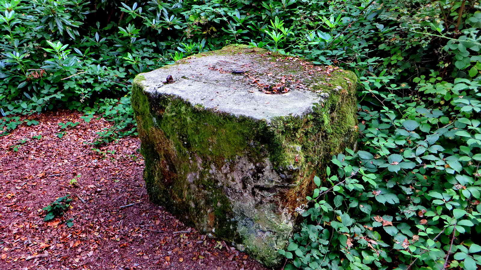
There is some old ironwork in the top of the block.

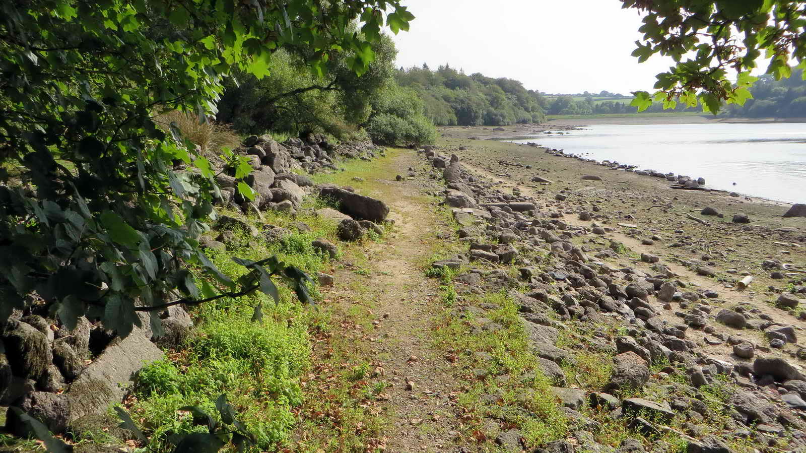
Scene along the way .....

Lakeside beach .....

A construction of unknown function ....


That's them today - a happy troupe!

View to Peek Hill (left) and Leather Tor (right) with a bit of the summit of Sharpitor (centre).
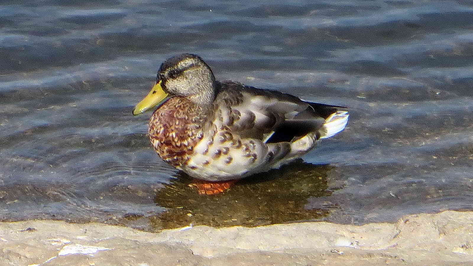
Mallard.

A farm scene - Muscovy and mallard ducks with white geese .....

Later .....

Muscovy .....
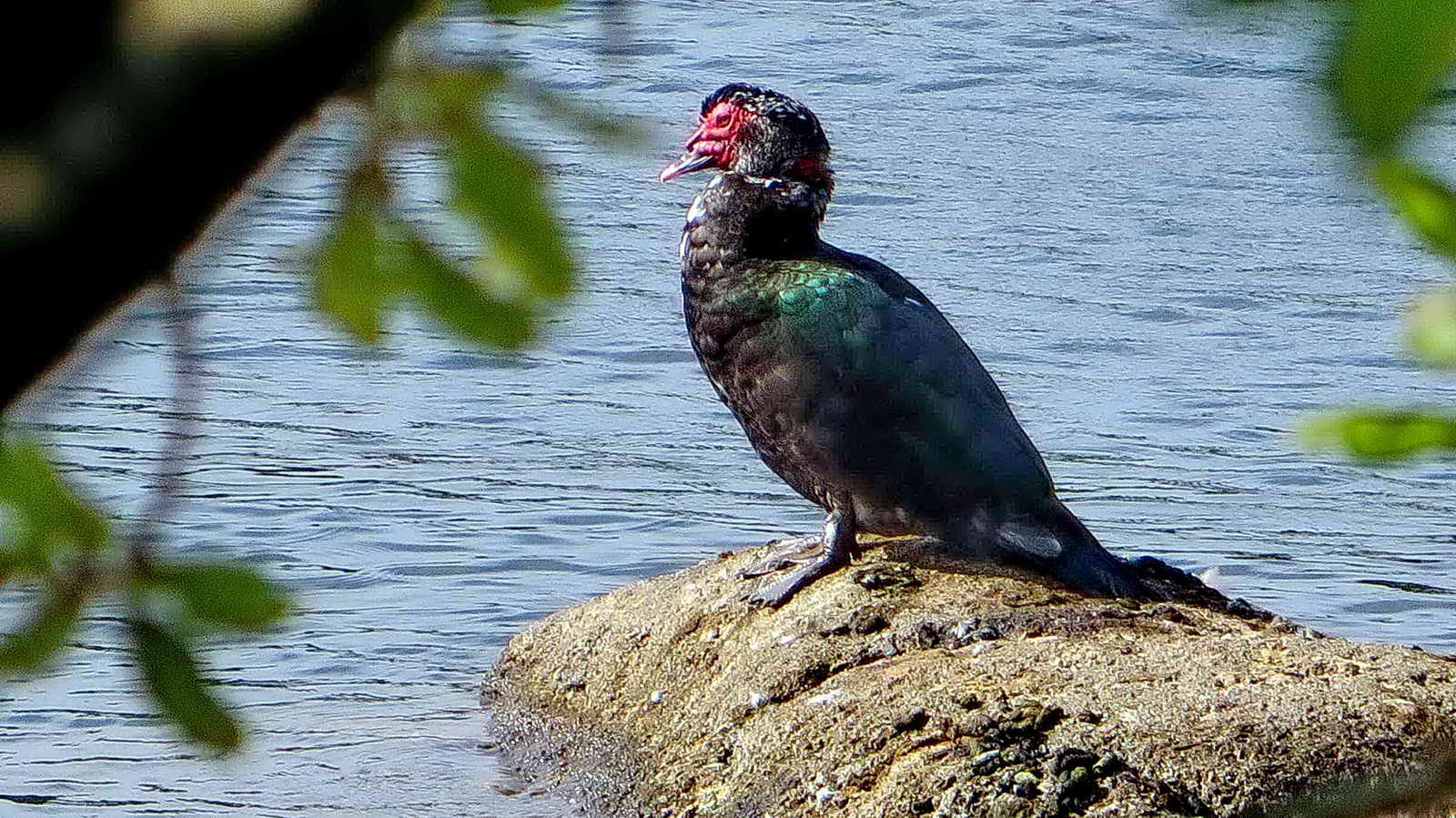
Muscovy srake.
Somewhere nearby, at approx. SX 5576 6799, is the growan quarry - being a dump of material from the excavation for the foundations of the nearby earth dam that are bedded about 32 metres down, going down some 30 metres through growan and then another 2 metres into solid granite.

Memorial bench .....

As previous photograph .....

As previous.
Old road following down from Longstone Manor .....

The consolidated Longstone Manor .....

An old gatepost exposed by the low water level .....

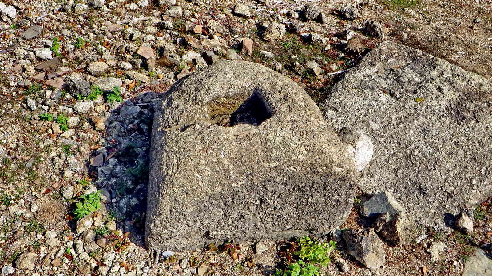
"Our" trough found on 18 May 2011 at SX 55679 68435 ..... apparently one of two on 1879 plans of the farm, this being part of a piggery .....
Landmarking the trough, near the end of a cobbled walk and with a loose trough in view (at the top of the beach), about 35 paces away.

The second trough .....
A square hole, of the type used as a socket for a granite cross.

The possible socket stone and the exposed gatepost, seen together.

The raised threshing floor or "windstrew", the last left in the country? Located at SX 55650 68520. With its raised position, the wind was used for blowing away the chaff as corn was beaten .....

Nearby sign .....

Steps i n the sidewall .....

Another view .....

View to Leather Tor .....

Sign .....

Notice board. Click the image to see a larger version.
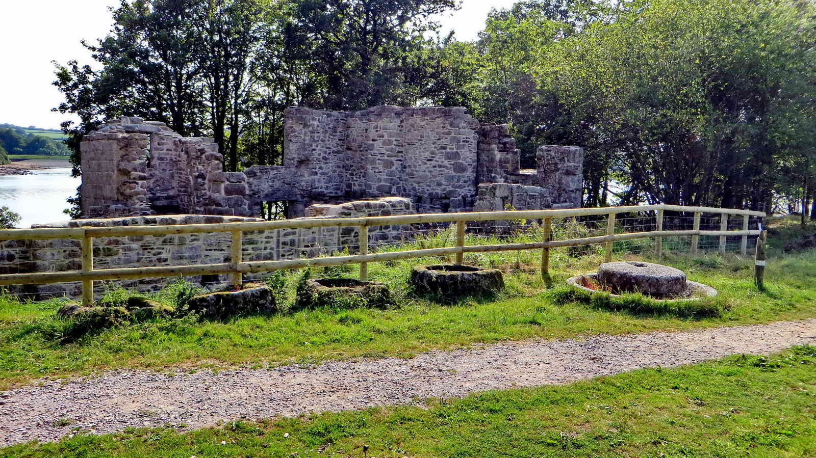
Longstone Manor .....

Longstone Manor .....

Keeves for apple juice for making cyder .....

Apple crucher where the top wheel was pulled around the cicrular trough by a horse to crush the apples.

Recently mortared wall top, for consolidation of the ruins and to prevent future deterioration.

A view of the Sheepstor Dam.
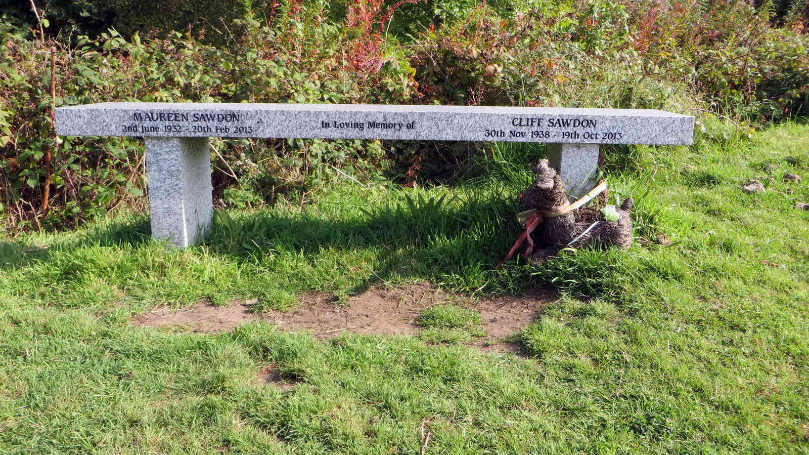
Memorial bench.


Explosives store number 3, SX 55557 67960, right beside the road at the entry gate into the Sheepstor Dam, quite overgrown at present.

Almost back at the quarry.

Column of unknown function in the quarry - possibly a crane base?
Two photographs taken on the 'recce' walk - completing the four explosives stores in the area .....

Explosives store number 4, completely hidden under rhododendrons beside the drive of Burrator Lodge leading to the new Burrator Heritage Centre, nearly halfway along.
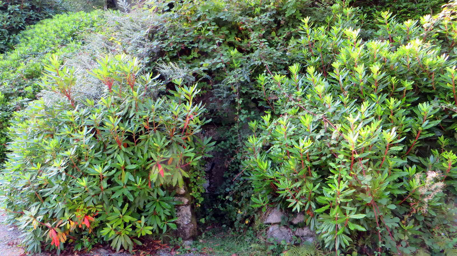
Well camouflaged!
MAP: Red = GPS satellite track of the walk.

The walk was accessed very easily via the road from Yelverton and Dousland, with parking at the P symbol near the bottom of the map below the Quarry (dis) markings near the Dam.
Statistics
Distance - 4.72 km / 2.93 miles.
All photographs on this web site are copyright ©2007-2016 Keith Ryan.
All rights reserved - please email for permissions