![]()


This walk: 2013-5-1. Reave, Horn's Cross, Stacombe Telling Place, PUDC Venford reservoir catchment boundary stone, RD / H, cairn, Ryder's Hill, trig. pillar, Petre's Boundstone, Petre on the Mount, Redlake china clay waste heap, Combestone Tor.
Walk details below - Information about the route etc.
Link to Google Satellite view of the area - the car park is the white dot near the top edge of the map (right of centre). Ryder's Hill is � the way up from the bottom edge of the image, above the "I" of "Imagery" where close examination reveals a 90� bend in a track. Good luck with the rest of the featureless area!

A reave, this being a Bronze Age (2500-600 BC) field boundary that runs uphill to a terminal reave. Google Earth link showing this area, the vague white streak from top to bottom is a track that follows almost the exact route that we walked from the car park to Ryder's Hill, except that the track then turns 90� left and continues easterly to Snowdon and beyond. Various Bronze Age reaves run from the top of the image to the south-east/north-west terminal reave. The Dartmoor reaves are described on the Legendary Dartmoor web site, HERE.
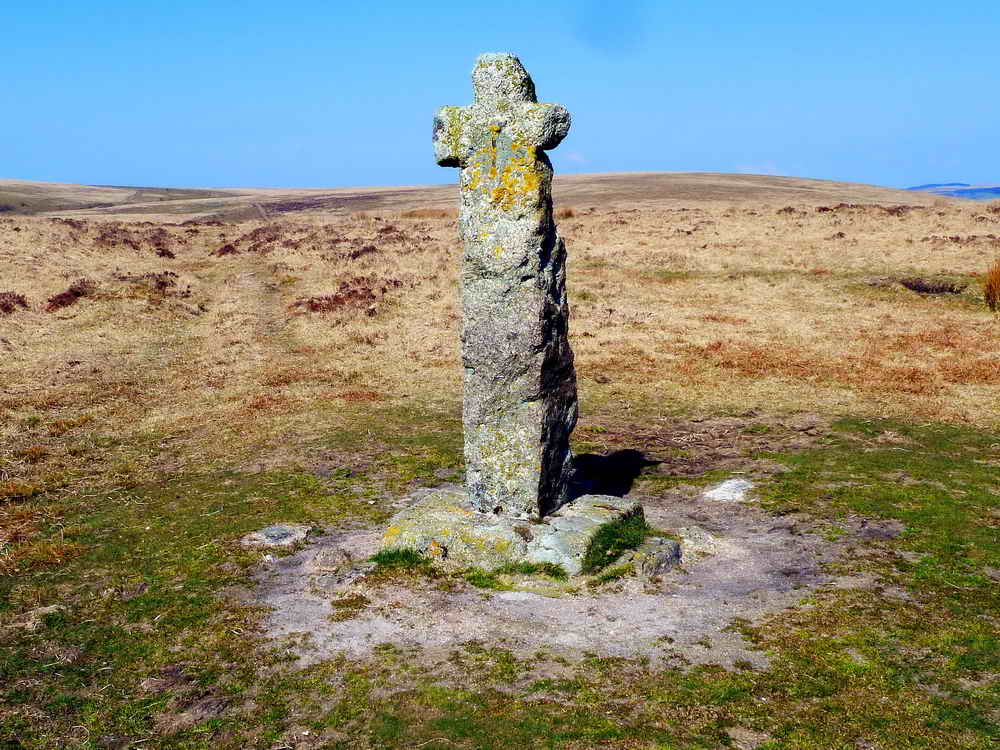
Horn's Cross, SX 66983 71034, located on the old north-south Cumston Track between Huccaby, Hexworthy, Cumstun & Sherberton and South Brent at a crossing point with the east-west Monk's Path that links Buckfast Abbey with Tavistock and Buckland Abbeys. This place is known locally known as �Stacombe (or Stascombe) Telling Place, originating from a local farmer, called Staddicombe, who used to pasture his sheep in the area. He used to gather the sheep here to count or "tell" them (this no doubt relates to bank tellers who count or "tell" the money). The cross was restored in 1928.

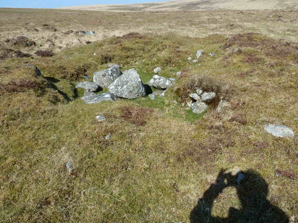
A cairn-like structure at SX 66903 70663 .....
Closer view, marked, imaginatively, as "Stones" on the map - but apparently this refers to the 49 PUDC stones around Venford Reservoir (my wife commented on "a lovely cup of tea!"
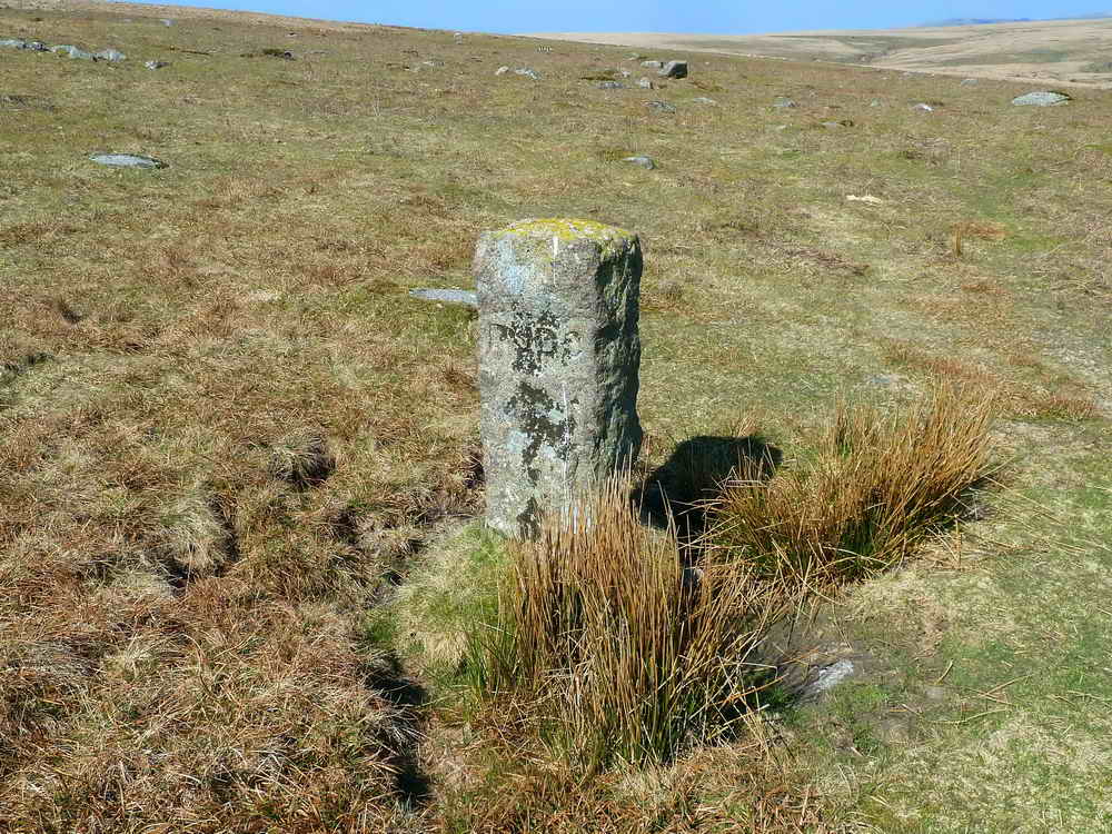
Venford reservoir catchment boundary stone SX 66828 70536, spaced at roughly 200-yard intervals, where PUDC signifies Paignton Rural District Council .....
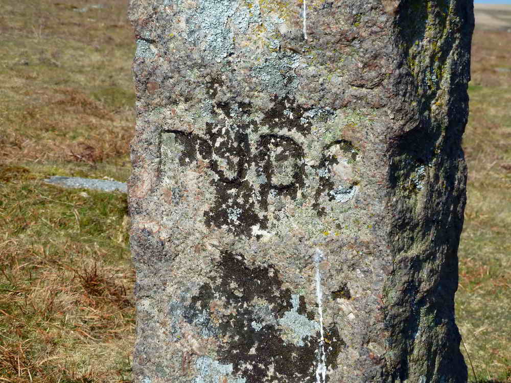
Closer view .....
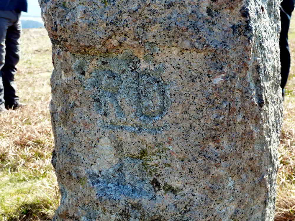
The reverse face of the stones showing RD / H, signifying land that still belonged to Holne after Richard Dawson, then Lord of the Manor of Holne, sold the land to Paignton for their water supply.

A probable tin-working seen along the way, at approximately SX 66125 69273, not to be confused with Bourne's Pit boundary stone, bearing "H" at SX 66133 69175 (marked on the Harvey map). The next stone is Rounder's Hole, further off our track, at SX 66495 69248. Source: Mike Brown's Guide to Dartmoor CD-ROM (2001), Dartmoor Press, Plymouth.

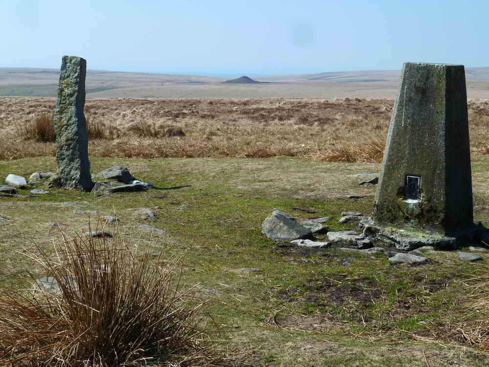
Ryder's Hill, SX 65976 69061, elevation 515 metres (1689 feet), the highest point on the south moor. This was one of the ancient boundary marks of the King's Forest of Dartmoor, visited by the knights during their perambulation in 1240 AD. At that time this hill was recorded as Battyshull. In the 1609 perambulation it was recorded as Knattleburoughe (previously Gnatteshill) .....

Two boundary stones and a triangulation pillar .....
According to the Wikipedia Lists of mountains and hills in the British Isles, this isn't a Munro, possibly a "Marilyn" which has a relative height of 150 metres (492 feet) - and for those counting, we climbed 165 metres (541 feet) from the car park (350 metres / 1148 feet) ..... however, we went over Holne Ridge and down a little so maybe the "relative height" is not correct?
In the distance is the spoil heap of the Redlake China Clay Works, visited 28th April 2011 .....

Bound stones: the larger and older stone bearing "B" signifies Buckfastleigh, known as Petre's Boundstone; this is not an ancient stone because it shows feather and tare marks and that method of splitting granite did not come into use until after 1800. The smaller stone bearing "H" signifies Holne. For many years there was a loose Holne stone that was usually found leaning against the old stone: it was known as "Petre on the Mount", but it had disappeared by 1986. This photograph is taken looking south-west to Redlake; to the south-east can be seen the Heap-of-Sinners aka Huntingdon Barrow, 2.3 km (1.4 miles) distant.

"B" in close-up .....

Ditto "H".

Zoomed view to Redlake waste tip.
![]()
Looking south-east from Ryder's Hill area, Snowdon (left-ish, cairn on summit). Pupers Hill, with Inner and Outer Pupers. To the right is Wellabrook Girt and the Western Wellabrook which leads down to Huntingdon Warren (and Keble Martin's Chapel). Click on the image to see a larger version.

Tinners' diggings seen on the way, as were several trial pits, looking for a lode of tin ore.
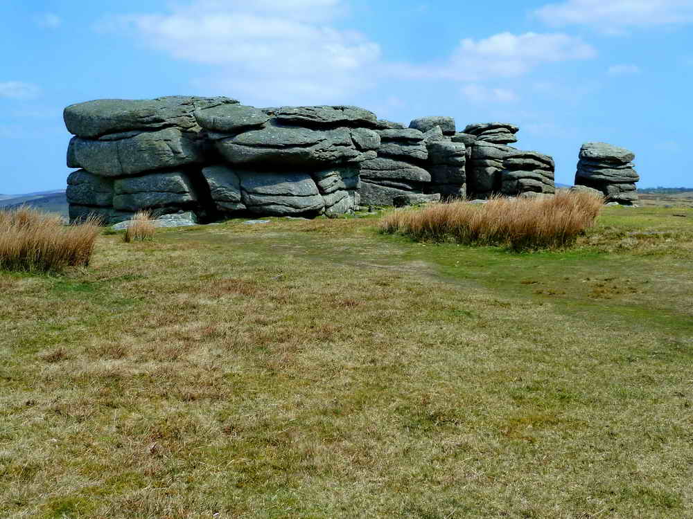
Combestone Tor, known previously as Cumston Tor, SX 67023 71850, 356 metres (1167 feet) .....

The other half of the tor .....
![]()
Overview of the whole tor. Click on the image to see a larger version.
MAP: Red = GPS satellite track of the walk.
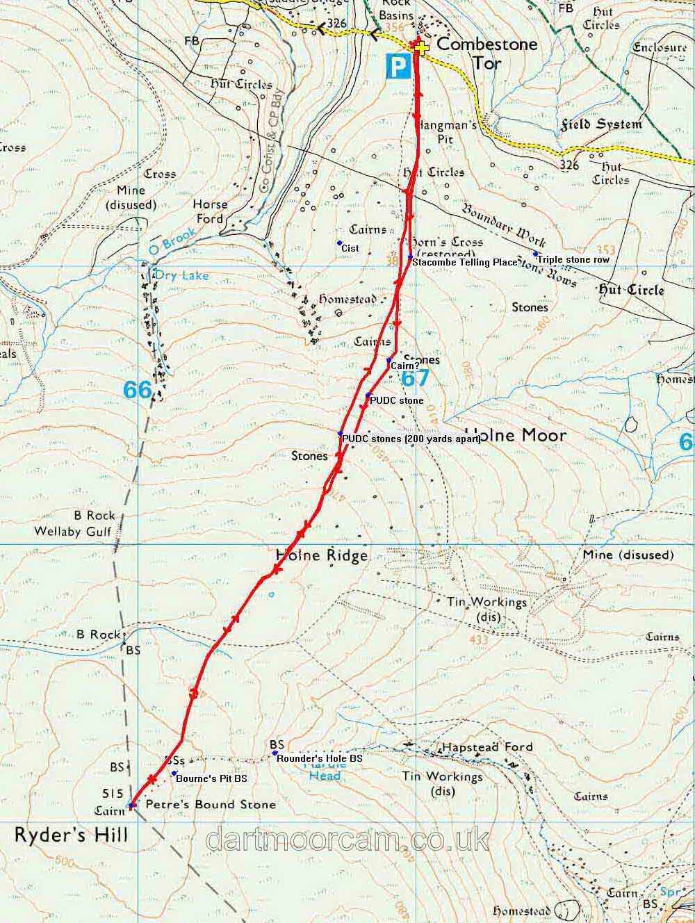
© Crown copyright and database rights 2012 Ordnance
Survey
Licence number 100047373
Also, Copyright © 2005, Memory-Map Europe, with permission.
This walk was reached by turning off the Two Bridges - Ashburton Road for Hexworthy and driving past The Forest Inn to park at Combestone Tor, at the P symbol and yellow cross symbol on the map.
Statistics
Distance - 6.46 km / 4.01 miles.
All photographs on this web site are copyright ©2007-2016 Keith Ryan.
All rights reserved - please email for permissions