![]()


This walk: 2013-3-13. Mardon Down, wild daffodils, Haytor, Giant's Grave, cairns, largest stone circle on Dartmoor, Haldon Belvedere, frozen puddles, cutting, growan, Maximajor Stone or Headless Cross, pillared circle.
Walk details below - Information about the route etc.
Link to Google Satellite view of the area - the car park can be seen on the north side of the road, about 1/3rd the way up the image and 1/4 the way in from the left edge. Mardon Down consists of two areas of Common lane joined by an isthmus. There is a short ridge at 355 m (1164 ft) elevation.

Narcissus pseudonarcissus, wild daffodil, also known as the Lent Lily,
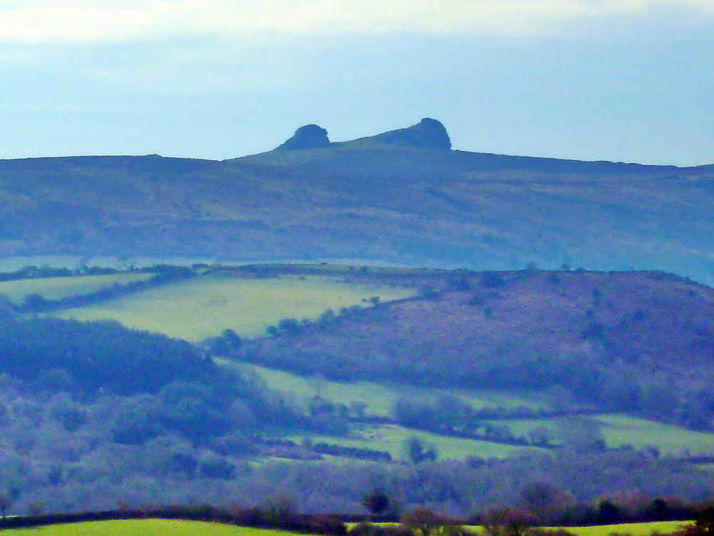
Zoomed view to Haytor, almost due south, 10.2 km (6.34 miles) distant.
The first of two neighbouring cairns, this largest being the Giant's Grave, the final resting place of the local giant, Maximajor, who was reputed to cure sick livestock for a price. He is said to have risen from the dead some time later and was turned to stone for his trouble (more below ....).

Image © J Butler
1997. Reproduced by kind permission (ref. 29 Sept. 2012).
J. Butler (1997), Dartmoor Atlas of Antiquities Vol. 5, The Second Millenium BC, Mardon Down Stone Circle and Cairns, page 147.

Remains of frozen puddles around the cairn.

Mardon Down stone circle - the biggest on Dartmoor, 38 metres in diameter, 119 metres in circumference (measured on the plan below) ..... it is believed that there were 61 stones originally .....
![]()
Panoarama of the circle ..... Click on the image to see a larger version.

Tall slab, in the most north-west point on the circle ......

Opposite the tallest (fallen) stone, in the most south-east part of the circle ..... this is seen in several circles on Dartmoor (Butler, Vol. 5, page 282) .....

Image © J Butler 1997. Reproduced by kind permission (ref. 29
Sept. 2012).
J. Butler (1997), Dartmoor Atlas of Antiquities Vol. 5, The Second Millenium BC, Mardon Down Stone Circle and Cairns, page 148 .....

GPS track (red) made by walking around the outer edge of the Giant's Grave cairn (above) and the stone circle (below).

Cairn just south of the stone circle ("cairn 1" on the plan of the circle, above) .....

Another view, with part of the circle in the background.
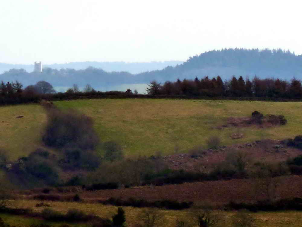
Haldon Belvedere, also known as Lawrence Castle, 10.7 km (6.65 miles) east. Click here for Google Earth view.

An Occasional tree ..... you look it up!
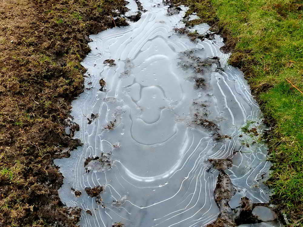
Frozen puddle, 1 of 4 .....

Frozen puddle, 2 of 4 .....
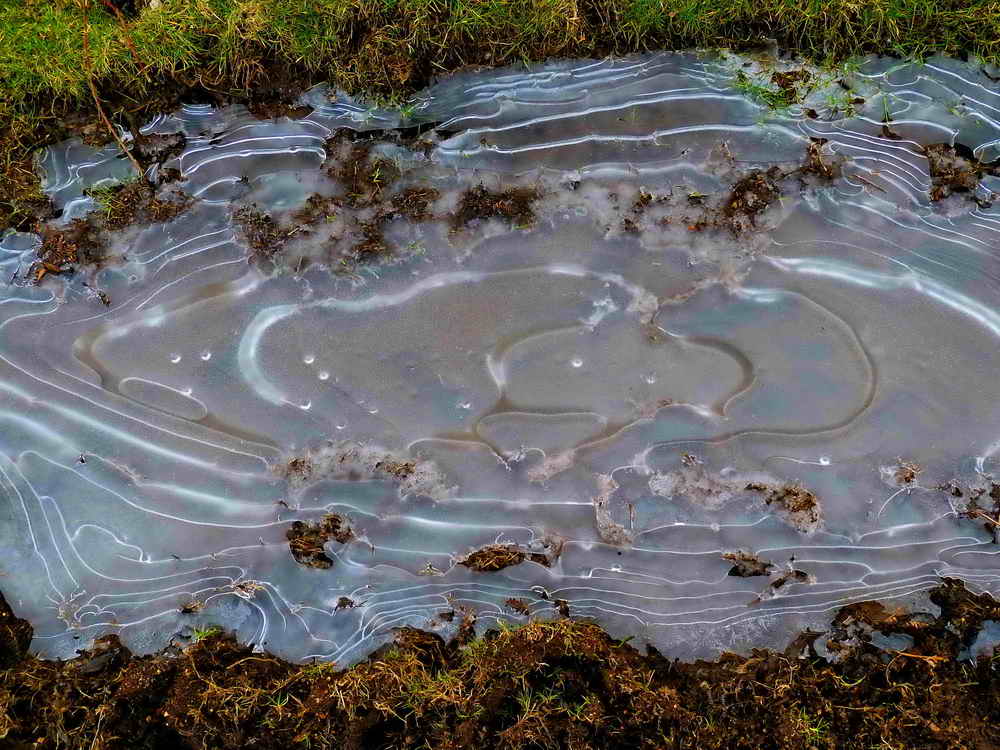
Frozen puddle, 3 of 4 .....

Frozen puddle, 4 of 4.
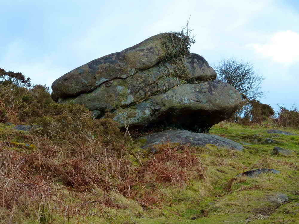
Bronze Age beef burger? Close to SX 77720 87511.

Entering a 'cut' that runs for some distance down the hill and across the road, of unknown origin and function (at present), this photo taken at SX 77193 87938 .....

Looking down the cutting .....
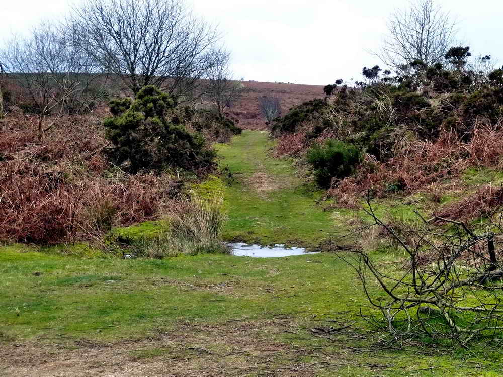
Zoomed view down the cutting .....

A cut face, showing growan (rotted granite) .....
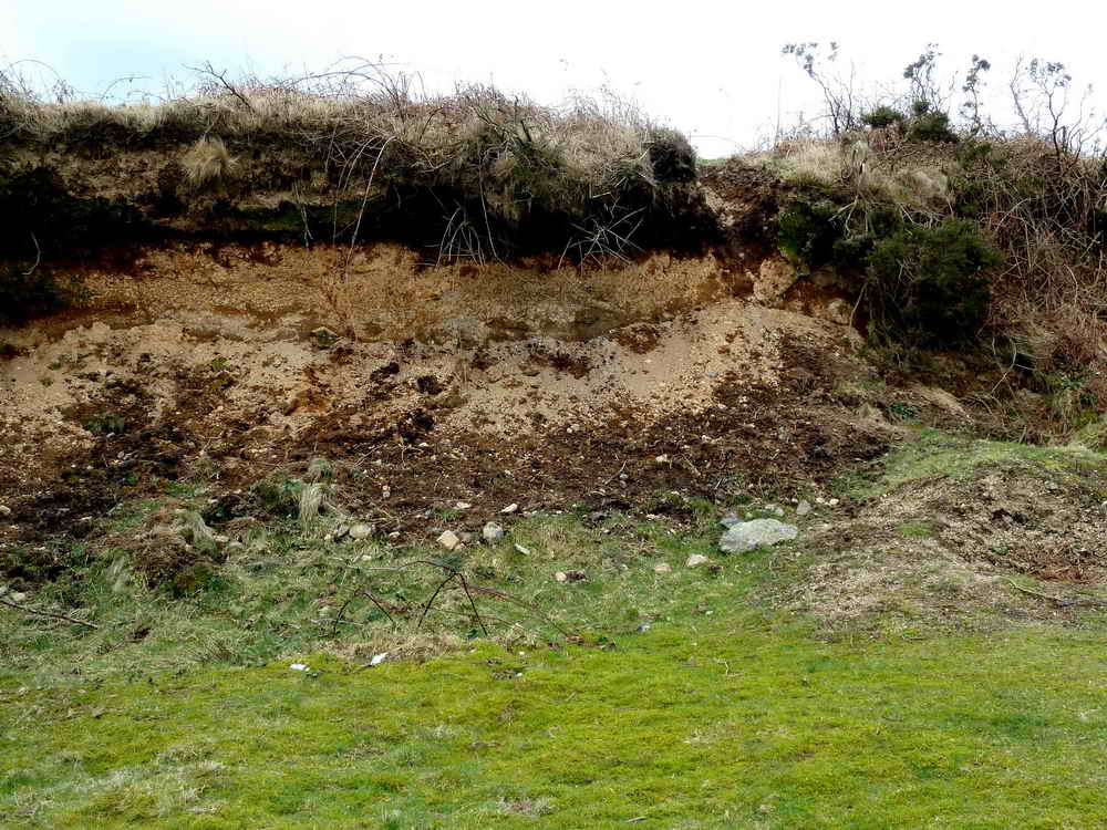
As previous photo .....

Zoomed view of the cutting 'cliff'.

The Maximajor Stone - "That'll learn him". Alternatively, The Headless Cross, located at SX 77076 87810.

Cairn up the hill from the Maximajor stone, "pillared circle 5" on the Jeremy Butler plan above ......

Another view of the pillared circle.
MAP: Red = GPS satellite track of the walk.

© Crown copyright and database rights 2012 Ordnance
Survey
Licence number 100047373
Also, Copyright © 2005, Memory-Map Europe, with permission.
This walk was reached by parking at the quite large car park at SX 76350 87198 marked by the yellow cross on the map above. For those using satnav devices that take Lat/Long entries, it is at 50�40'16.6"N, 3�45'04.3"W. I can't give detailed directions other than to enter Moretonhampstead and leave by the 'yellow' road going out in a generally north-east direction. This is the road to Clifford Bridge/Clifford Cross/Clifford Farm/Clifford Barton, the opposite side of Mardon Down: the road is narrow!
Google aerial view/street map showing the centre of Moretonhampstead, leave by Lime Street
Google Street View showing the centre of Moretonhampstead when entering from the west, either (1a) turn left at this point or (2a) the next left around this block; then either (1b) diagonally right across the road and then immediately left or (2b) turn right and then immediately left, both into Lime Street.
Statistics
Distance - 6.26 km / 3.89 miles.
All photographs on this web site are copyright ©2007-2016 Keith Ryan.
All rights reserved - please email for permissions