![]()


This walk: 2013-1-30. Black sheep, Arms Tor, memorial seat, step stile, Bray Tor, Widgery Cross, River Lyd, ford, stepping stones, footbridge, boundary stone, tin streaming site, Wheal Mary Emma leat, clapper bridge, Black Rock, memorial seat, commemorative plaque, large riverside construction, Hare Tor.
Walk details below - Information about the route etc.
Link to Google Satellite view of the area - three car parking areas can be seen just below the 'minus' sign on the zoom slider.

A fairly rare sight - a whole flock of black sheep, quite possibly Black Welsh Mountain Sheep.
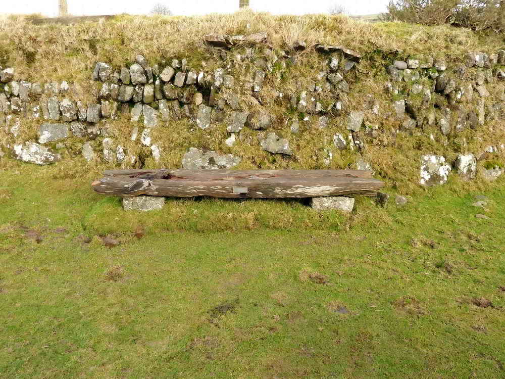
Seat beside the path to the River Lyd, with a memorial plaque ......

|
IN MEMORY OF A SPECIAL SON |
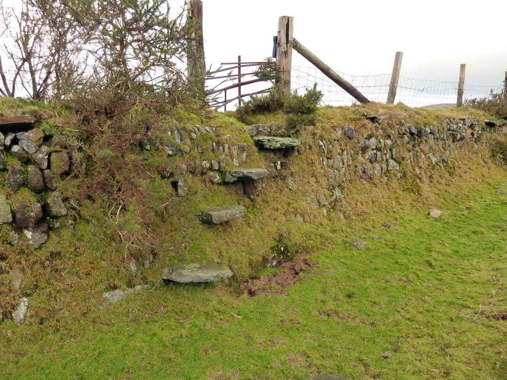
Step stile .....

Step stile in the background with overhanging stones in the top of the hedge, The hedge reminiscent of a corn ditch wall: Corn ditches originate from the time when Dartmoor was a royal hunting area and there was a need to keep the King�s deer out of the cultivated land. A stone revetted wall and external ditch faced onto the open moor which deterred deer and other animals from jumping over, whilst the sloping grassy bank on the inner face allowed those animals which had entered to exit again without difficulty. Source: http://www.dartmoor-npa.gov.uk/aboutus/news/au-geninterestnews/au_crosspr10

The track known locally as "The Miner's Track" this old track led (and still does!) to Higher & Lower Dunnagoats & Rattlebrook Peat Workings, also Rattlebrook Mine.

Arms Tor, SX 541 862, elevation 457 metres (1499 feet).

Remains of another leat that the path from the car park to the river crosses just before the river;' it once fed Wheal Emma Mary East.

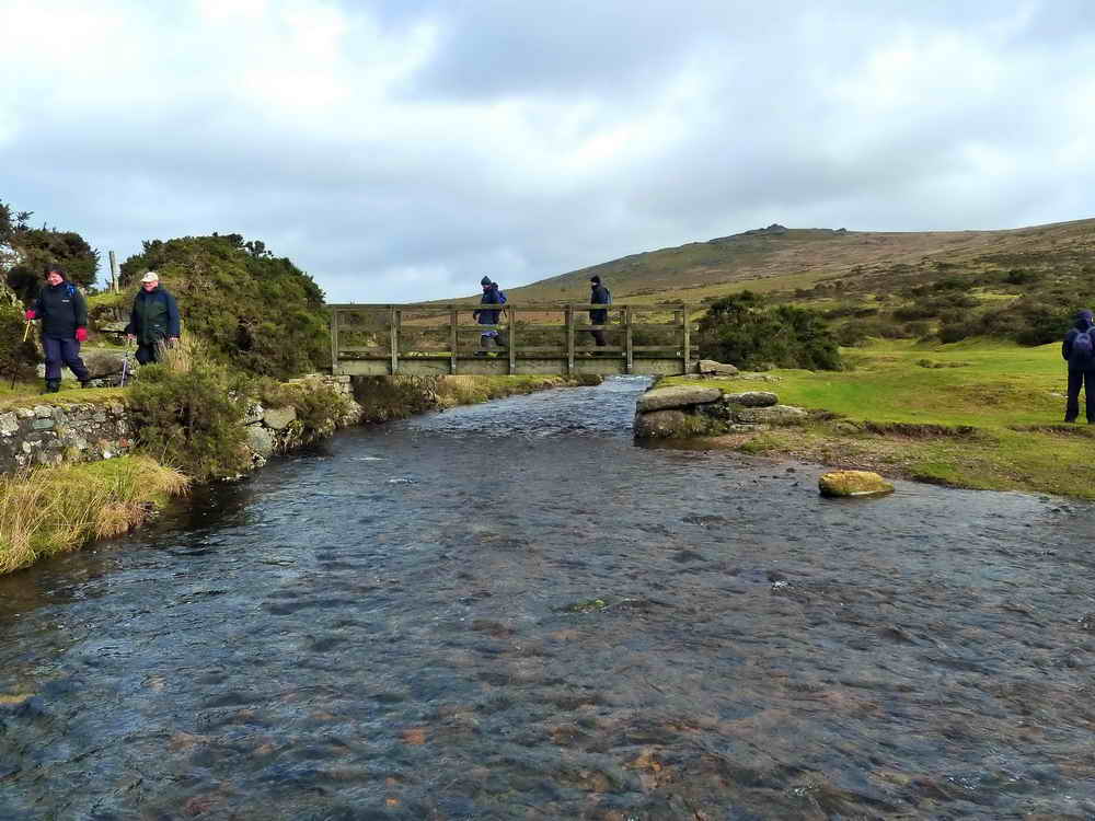
The old stepping stones and the modern footbridge across the River Lyd, an old fording place.
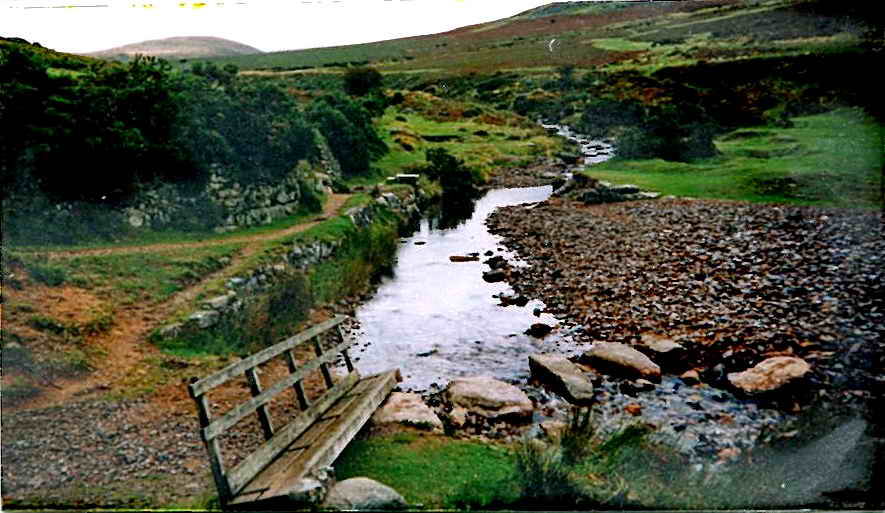
Believe it or not, the bridge was washed away during a rain storm that occurred on the same day as the Boscastle event, in 2004. Photo: Tom Soby.

Another view - remember Jess' crossing (12 Oct. 2011, almost bottom of the page)?
Dartmoor CAM movie.
TIP .....
A movie of the River Lyd crossing point |
|
Click the photo to download File size: 2.8 MB. Time to download: e.g. 13 secs Length 15 secs |

Looking down the River Lyd with Lydford High Down on the the right, the other side of the river.

Looking back at the crossing.

Boundary stone at SX 53574 86260.

Another tall stone below Arms Tor at SX 53623 86314 .....

Seen from a different angle, this tall stone looked as if it might have been part of a hut circle.

Looking back at "Nodden Ford" ...... Nodden Gate is just out of sight above it.

Crossing a small stream.

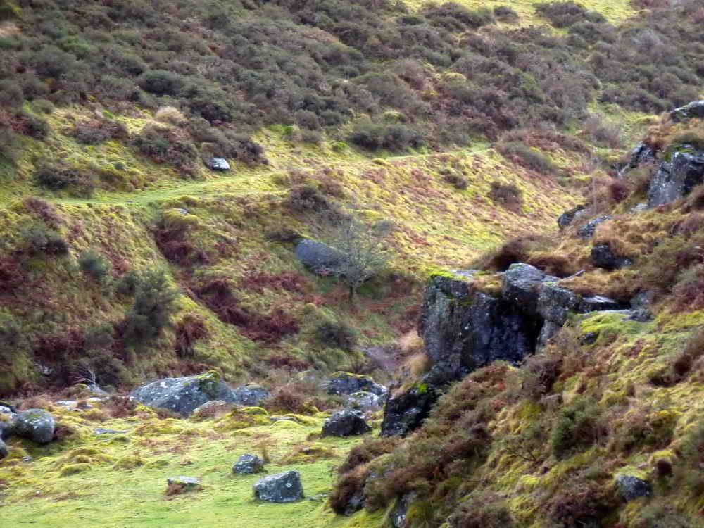
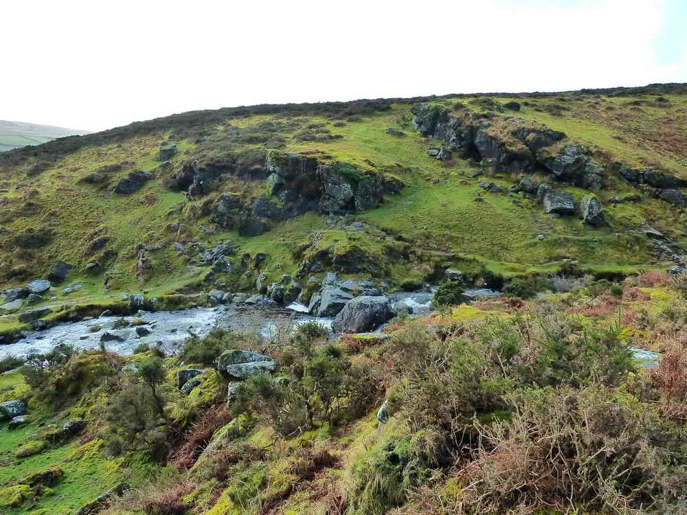
Old tin streaming site at SX 53683 85838, where the tinners led water across the hill to run down and wash away the top soil.

Looking along the old leat that we followed that supplied water into the Doe Tor Brook (& maybe the Wallabrook?) but that probably did not have a name, but it didn't go to any mine.

"Looking the other way"

Cut stone nearest the camera, with feather and tare marks, with a clapper bridge behind .....

The clapper bridge, looking forlorn.

Looking down the river valley, showing the Wheal Mary Emma East leat on the true left hand bank of the River Lyd: there was a mine on each bank (East and West mines) .....
Zoomed view to the bank and the leat.
Looking across the river to Black Rock .....

Memorial seat and plaque .....

|
IN LOVING MEMORY OF HE LOVED THE MOORS OF DEVON
AND ON HIS LAST VISIT "ARE WE NOT LIKE THIS MOORLAND STREAM SPRINGING NONE KNOWS WHERE FROM, TINKLING, BUBBLING, FLASHING A GLEAM BACK AT THE SUN; E'ER LONG GLOOMY AND DULL, UNDER A CLOUD, THEN RUSHING ONWARDS AGAIN; DASHING AT ROCKS WITH ANGER LOUD, ROARING AND FOAMING IN VAIN! WANDERING THUS FOR MANY A MILE, TWISTING AND TURNING AWAY FOR A WHILE. THEN OF A SUDDEN OVER THE FALL AND THE DARK
STILL POOL IS THE END OF ALL IS IT? I THOUGHT, AS I TURNED AWAY, AND I TURNED AGAIN TO THE SILENT MOOR. IS IT? I SAID, AND MY HEART SAID "NAY"! AS I GAZED AT THE CROSS ON "WIDGERY TOR".
Commemoration day and new plaque dedication, 28th March 2008 |

Part of a large construction beside the river .....

Zoomed view to a section of wall close to the river .....

Montage of the whole scene ... Click the image to see a large version.
Crossing the bridge on the way back .....

Looking downstream from mid-stream .....

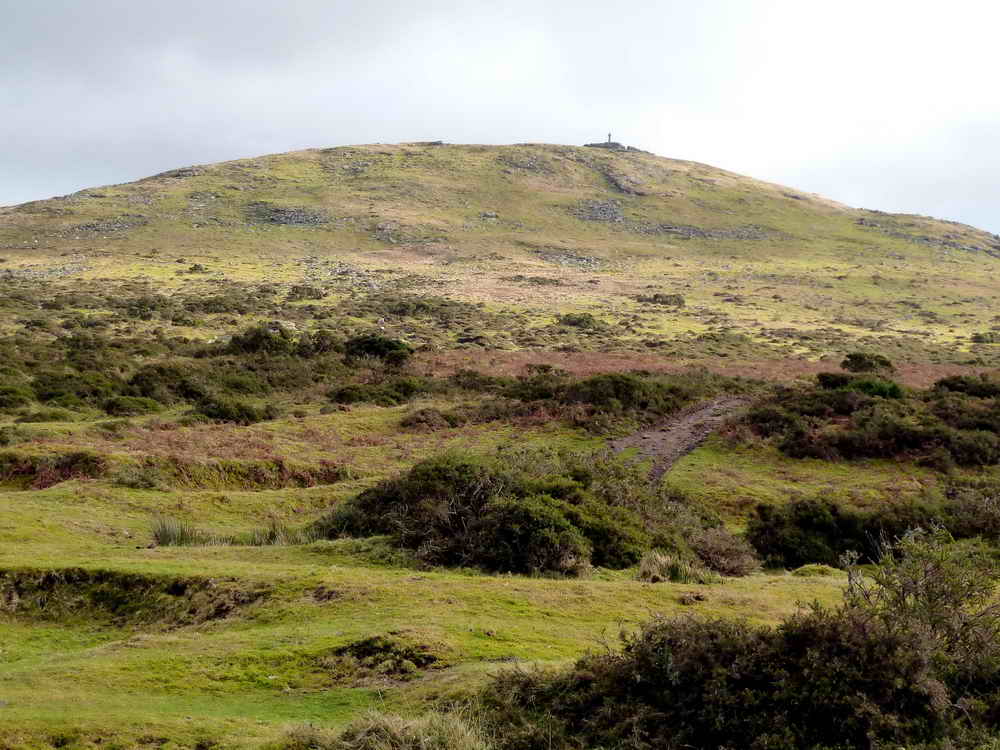
That man over there has been to Brat Tor, for those who didn't, it can be seen here - the cross is quite big.

Hare Tor, SX 5507 8423, elevation 531 metres (1742 feet), with a Willsworthy Firing Range warning flag pole

Looking upstream from the middle of the river - its not deep - but the underwater stones can be very slippery.
Another view of Bray Tor with Widgery Cross on top. Frederick John Widgery, (1861-1942), educated at Exeter Cathedral School, Exeter School of Art, South Kensington Art School, the Academy of Antwerp and lastly Bushley Art School in Herts. He took over his father's studio and painted regularly. became a city councillor, Freeman, Alderman, Justice of the Peace and Mayor of Exeter (1903-1904. When car registration came into force, his initials, FJ, were used locally on the city's registration plates. The family bought property in Lydford, with a local bungalow still being still known as Widgerys. The cross was ereceted by William Widgery to commemorate the Golden Jubilee of Queen Victoria in 1887.

One more across the bridge.

Last view of the crossing place: bridge, ford and stepping stones.
MAP: Red = GPS satellite track of the walk.

© Crown copyright and database rights 2012 Ordnance
Survey
Licence number 100047373
Also, Copyright © 2005, Memory-Map Europe, with permission.
This walk was reached by driving through Mary Tavy towards Okehampton and turning right up a lane beside the Dartmoor Inn, parking at the P symbol and yellow cross on the map.
Statistics
Distance - 4.44 km / 2.76 miles.
All photographs on this web site are copyright ©2007-2016 Keith Ryan.
