![]()


This walk: 2012-7-19. White Tor, Roos Tor, Great Staple Tor, Cox Tor, Wheal Jewell Reservoir, riders, thistle, Sharp tor, Hare Tor, Ger Tor, Great Links Tor, leats, spillways, cusecs, labyrinth spider's funnel web, stone chat. Second page: Wheal Betsy Mine, stonechat, bell heather, yellow brain fungus.
Walk details below - Information about the route etc.
Link to Google Satellite view of the area
This is a repeat of a walk done on 2nd September 2009.
Second page of this walk - mainly Wheal Betsy. *****
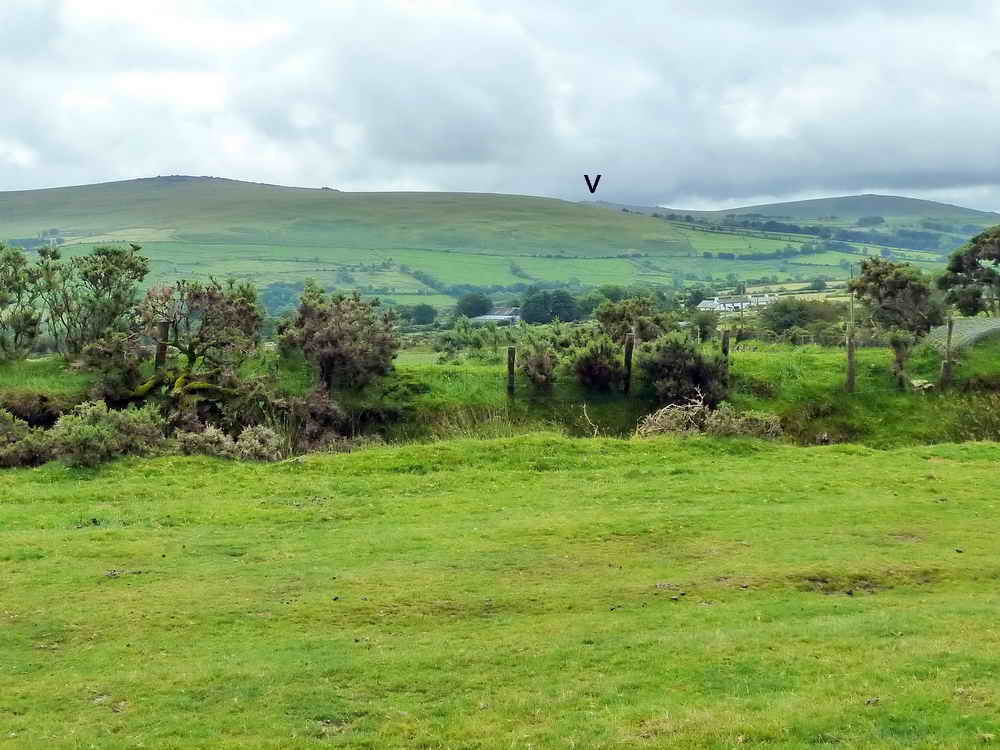
White Tor (left), Roos Tor (believed to be the rocks peeping over White Tor flank, to the right), Great Staple Tor (far distance, marked by the 'v') and Cox Tor (right) .....
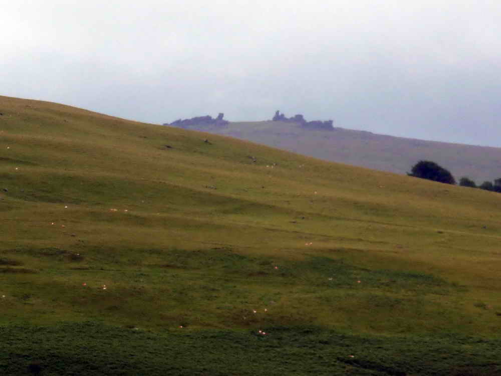
Zoomed view to Great Staple Tor, SX 542 760, elevation 455 metres (1492 feet) .....

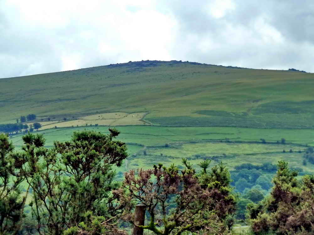
Cox Tor, SX 531 762, elevation 442 metres (1450 feet)
Zoomed view to White Tor (left), SX 542 786, elevation 468 metres (1538 feet) and believed Roos Tor, SX 543 765, elevation 454 metres (1489 feet) at far right.

Building at Wheal Jewell Reservoir.
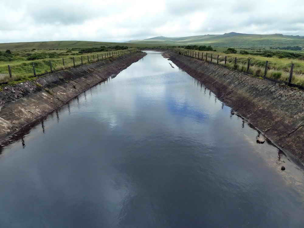
Looking north along Wheal Jewell Reservoir, an old mining gert, from the south end ..... holding 16 million gallons of water ..... the water taken by pipes to drive the hydro-electricity station at Mary Tavy .....

Riders.
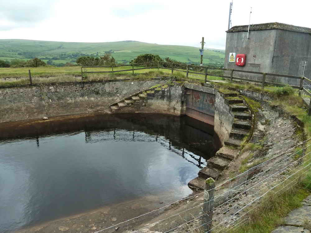
The first reservoir photograph was taken from behind the building (right) .....

Riders again.

Looking towards the tors in the north-east ....
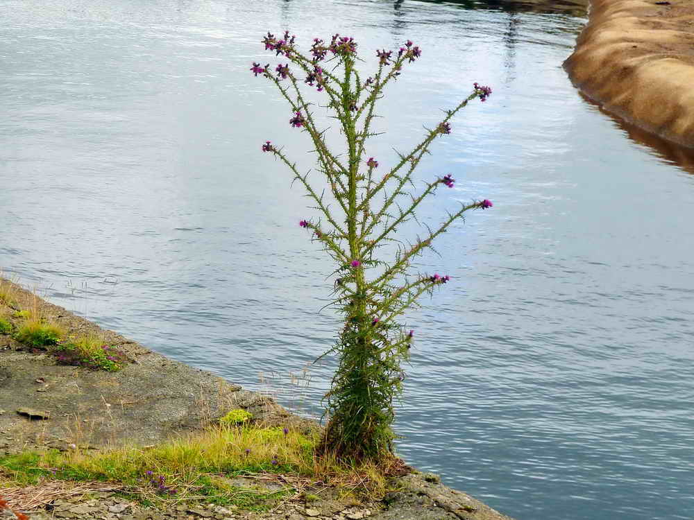
Thistle.
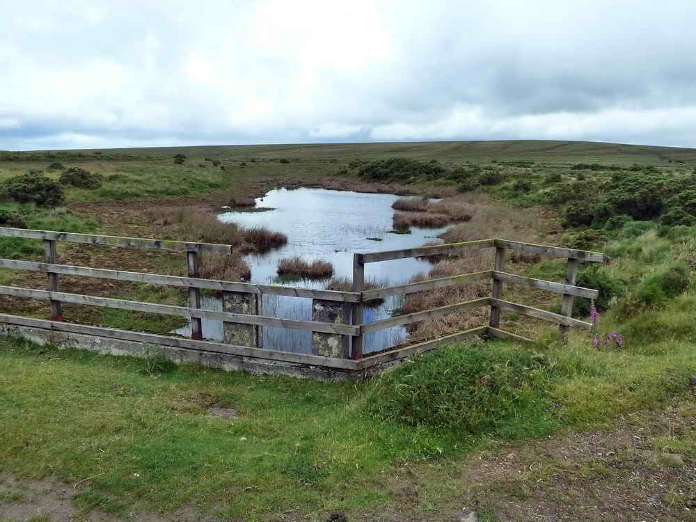
The "extension reservoir" - an overflow area?
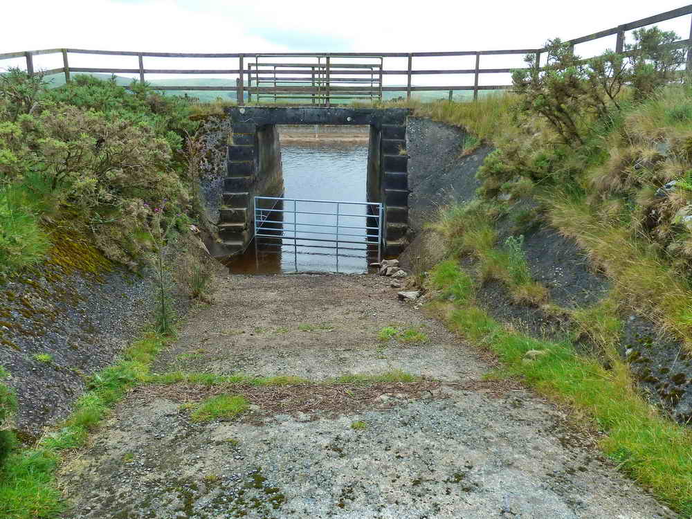
An entrance into the reservoir .....
Closer view.

Looking back along the path.

Looking ahead, the bend in the main reservoir.

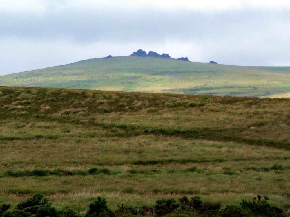
Sharp Tor (left), Hare Tor (centre) and Ger Tor (right).

Ger Tor, SX 546 830, elevation 430 metres (1410 feet) at the entrance to Tavy Cleave.

Hare Tor, SX 550 842, elevation 531 metres (1742 feet)

Sharp Tor, SX 550 848, elevation 519 metres (1702 feet)
Great Links Tor, SX 551 867, elevation 5896 metres (1922 feet), 3.6 miles distant.

Looking straight at the site where the water flows into the reservoir .....
Zoomed view of the previous photograph .....
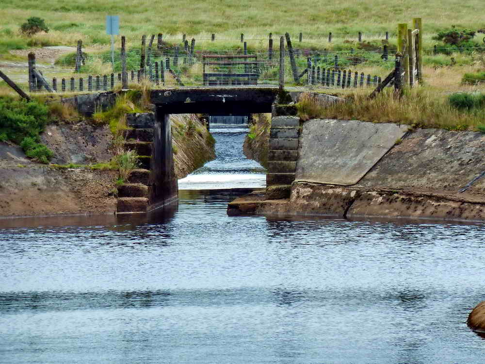
Looking north from a small bridge north of the end of the main reservoir .....
And, looking back south from the same small bridge to the main reservoir .....

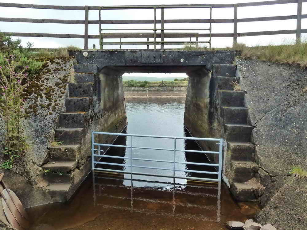
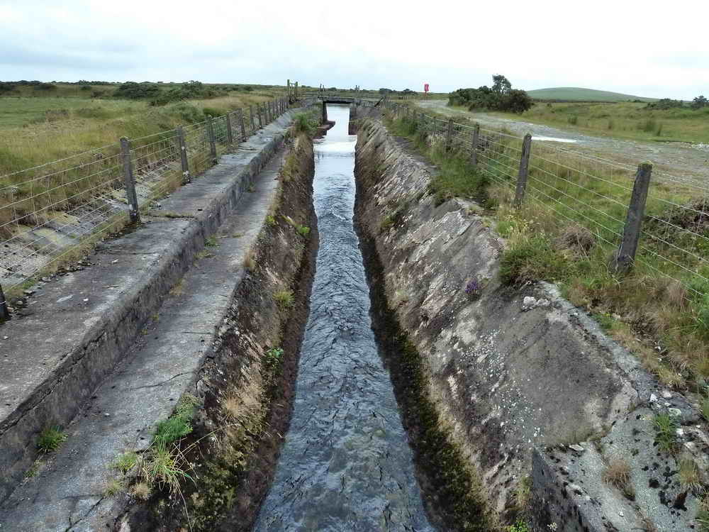
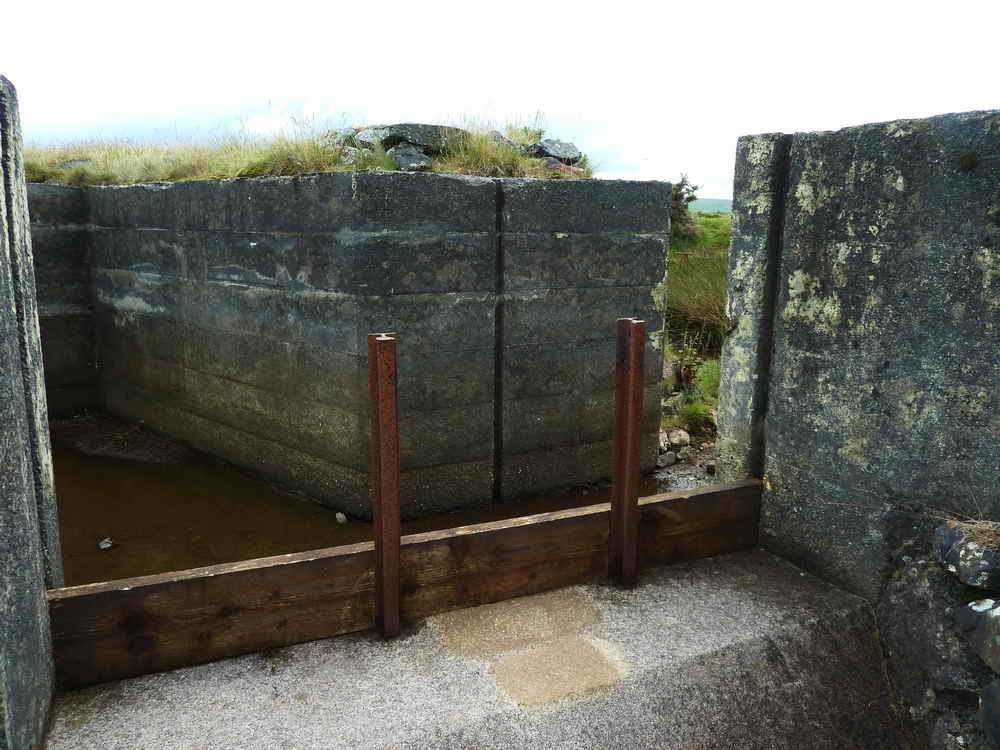
Where the water really flows in from a leat, with another leat feeding in from the left side - this second inflow can be seen just above the track over. There are controllable spillways on each side of this section .....
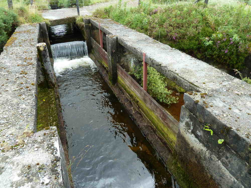
A view of a spillway where water levels etc. can be controlled by inserting baulks of timber ..... this route feeds water to a structure seen a little below .....
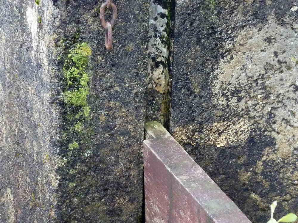
Where a piece of timber fits into the wall of the structure to divert flow or raise water level if both sides of the spillway are blocked .....

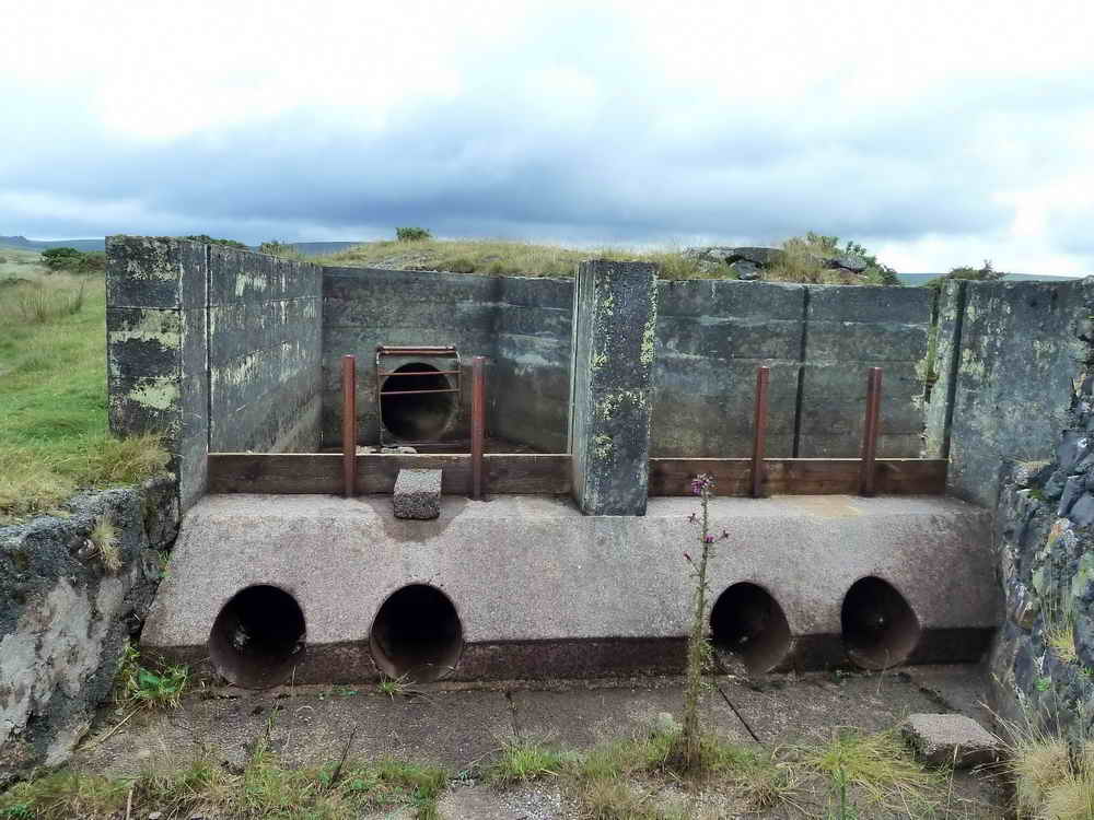
The spillway towards the east, down across the land?

Another blocking device (sluice) .....

Spillway towards the west and a system seen a little below .....

The side leat, which comes off the Walla Brook .....

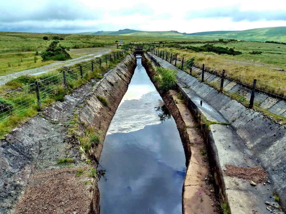
Looking along the side leat .....

Looking along the main leat (the side leat inflow can be seen at centre bottom). The main leat is taken off the River Tavy just inside Tavy Cleave. In the past, these leats supplied three mines with water - Wheal Friendship (a copper mine), Wheal Betsy (a lead and silver mine) and Wheal Jewell (a tin mine?). Source for some of this material: John Hayward (1991) Dartmoor 365, Curlew Publications, page 142.

Cusecs is a measure of flow rate and a shorthand for cubic feet per second.

Moss on a concrete post.
The above-mentioned other spillway, this appears to lead away in the direction of the Wheal Betsy valley, towards Mary Tavy and the Cholwell Brook .....
There are also blocking possibilities here to spill out onto the open moor.

The baulks of timber are backed-up by old railway rails.
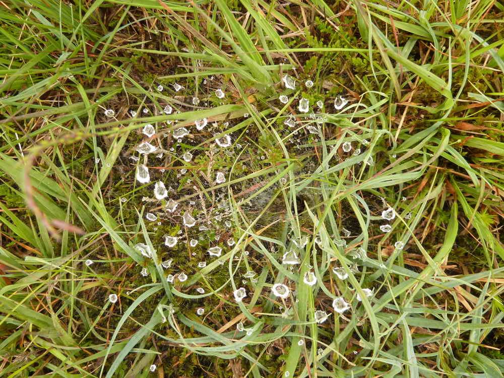
Rain water on the web of a Labyrinth spider (Agelena labyrinthica) waiting in bottom of the funnel web ..... not be confused with the Sydney Funnel-web Spider (Atrax robustus) found in Australia and which has a powerful venomous bite.

MAP: Red = GPS satellite track of the walk.
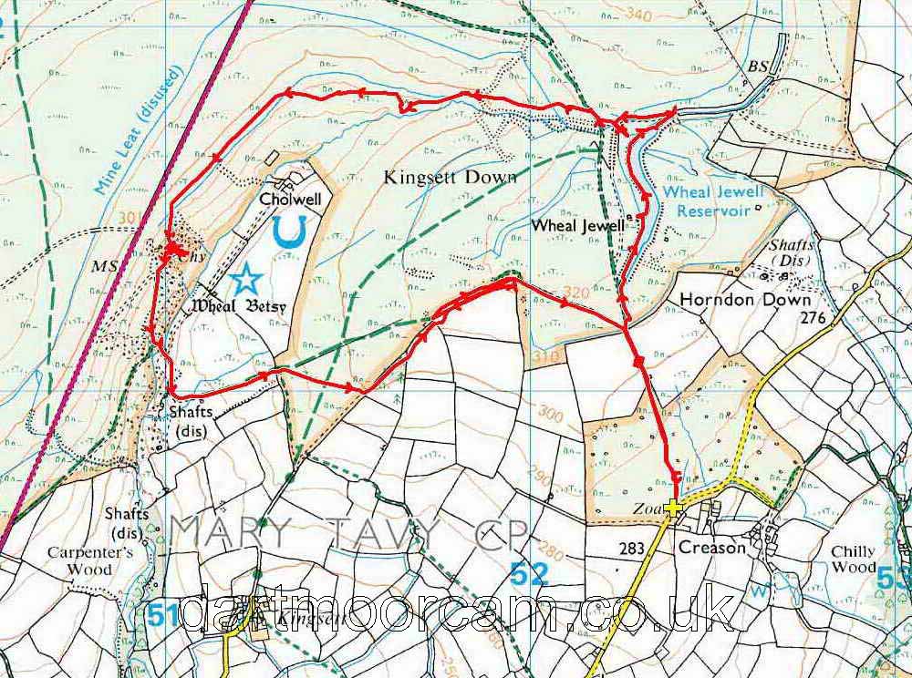
© Crown copyright and database rights 2012 Ordnance
Survey
Licence number 100047373
Also, Copyright © 2005, Memory-Map Europe, with permission.
This walk was reached from the A386 Tavistock-Okehampton road by turning off at the Mary Tavy Inn (just south of Mary Tavy), following the road down over a small bridge, bearing left, turning right to Horndon (passing the Elephant's Nest pub on the way), following the road to Zoar Cottages and parking just opposite on the rough track, marked by the yellow cross on the map.
Statistics
Distance - 6.55 km / 4.07 miles
Second page of this walk - mainly Wheal Betsy. *****
All photographs on this web site are copyright ©2007-2016 Keith Ryan.
All rights reserved - please email for permissions