![]()


This walk: 2012-5-17. Volvo articulated dump trucks, Shaugh Lake China Clay Works, hut circle, stone row, round house, Bickleigh Barracks, milkwort, reave, Hawks Tor, Shaugh Prior Church, "H" boundary stone (for Huxton Farm?), trig. pillar, excavator.
Walk details below - Information about the route etc.
Link to Google Satellite view of the area - the aerial view should open with the car park below "Traffic" and its red arrowhead on the extreme top right and Hawks Tor (a white dot) above the right-end scale bar marker at bottom-left.
This walk repeats that from 18th April 2012, only additional photographs are shown here.

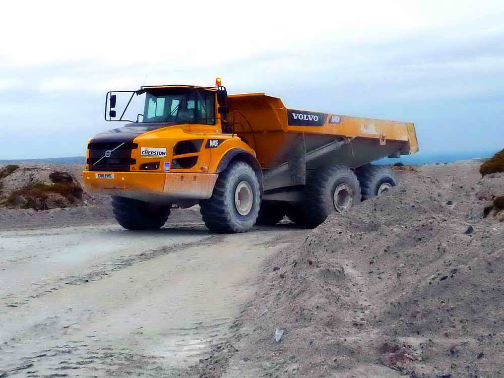
A big Tonka toy - a Volvo articulated hauler/dump truck in the china clay works, with a number plate ......

This driver stopped and told us that he carried 28-30 tons of clay per load and that the truck weighed 38 tons, also that "this is just a baby!" This truck has no number plate.

Marker erected in the 1970's by the Inspectorate of Ancient Monuments to identify features of importance.

A hut circle with a view to the north-west, over Shaugh Lake China Clay Works.

Stone row running up the centre of photograph, at SX 5546 6351, the stones do not stand very high.

Round house at SX 5546 6333. In the middle distance is the road from Beatland Corner (Shaugh) to Cadover Bridge.

View to Bickleigh Barracks (home of 42 Commando) with Woolwell, Plymouth, behind.

Believed Heath Milkwort, Polygala serpyllifolia, (leaves are opposite at base of stem, likes wet, acid ground = Dartmoor). Otherwise, Common Milkwort, Polygala vulgaris, (the leaves are not opposite, likes dry neutral ground).

View along an old reave, a bronze age field boundary, running up the centre of the photograph.

Hawks Tor, SX 5539 6249, aka Oxter Tor, elevation approx. 273 metres (895 feet) .....

Another view, looking approx. north .....
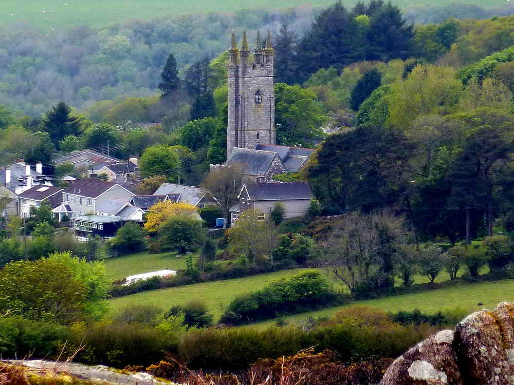
Zoomed view to Shaugh Prior Church.

View from the space "inside" Hawks Tor to an upright boundary stone .....

Looking back into the Hawks Tor "cave" or "shelter" .....
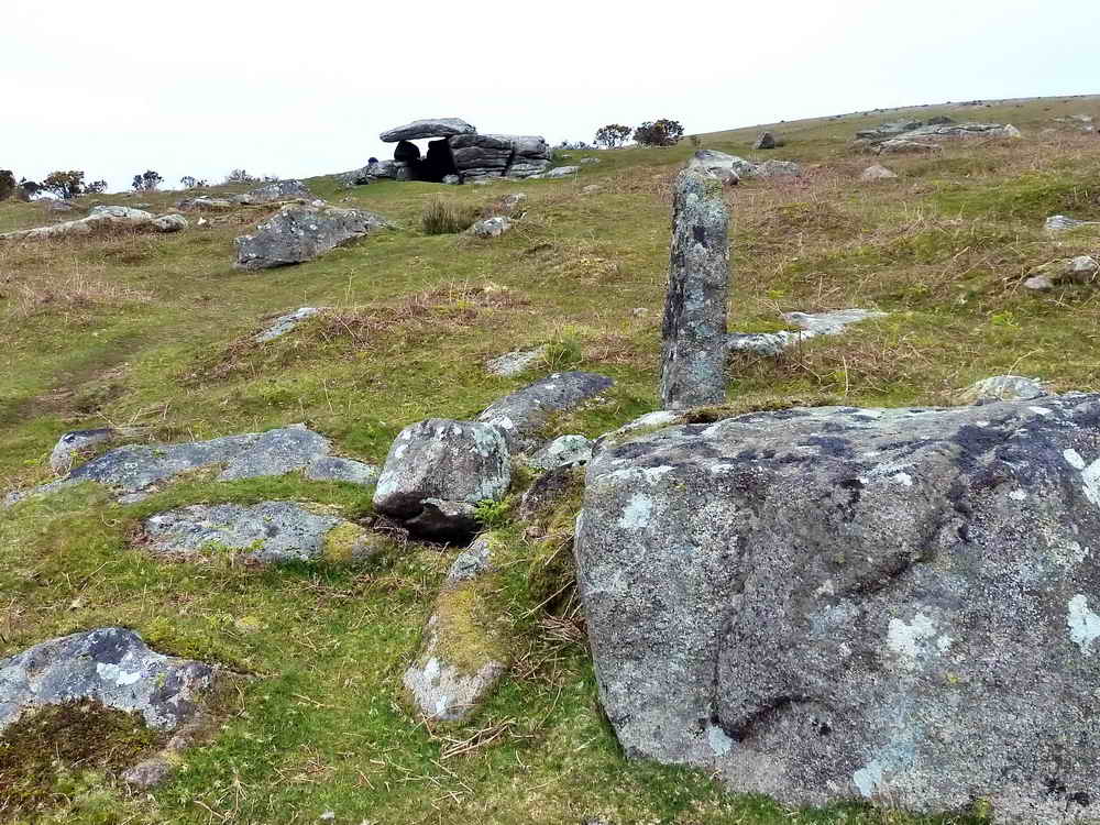
Boundary stone at SX 55373 62469, with Hawks Tor behind .....

Standing with your back to Shaugh Prior, an "H" is seen. There are apparently several of these in the area and they may relate to the land so circumscribed by Huxton Farm. Source: Dave Brewer (2002) Dartmoor Boundary Markers, Halsgrove, page 233 .....
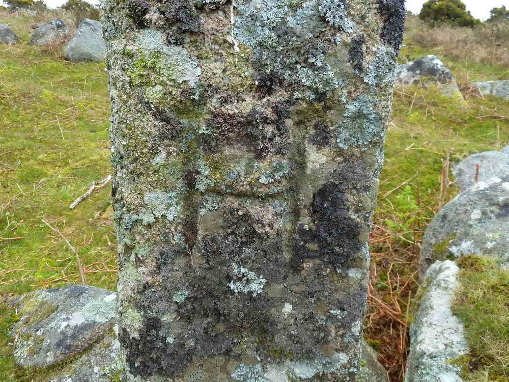
The "H" in close-up .....

The reverse face has no inscription.

A final look at Hawks Tor.
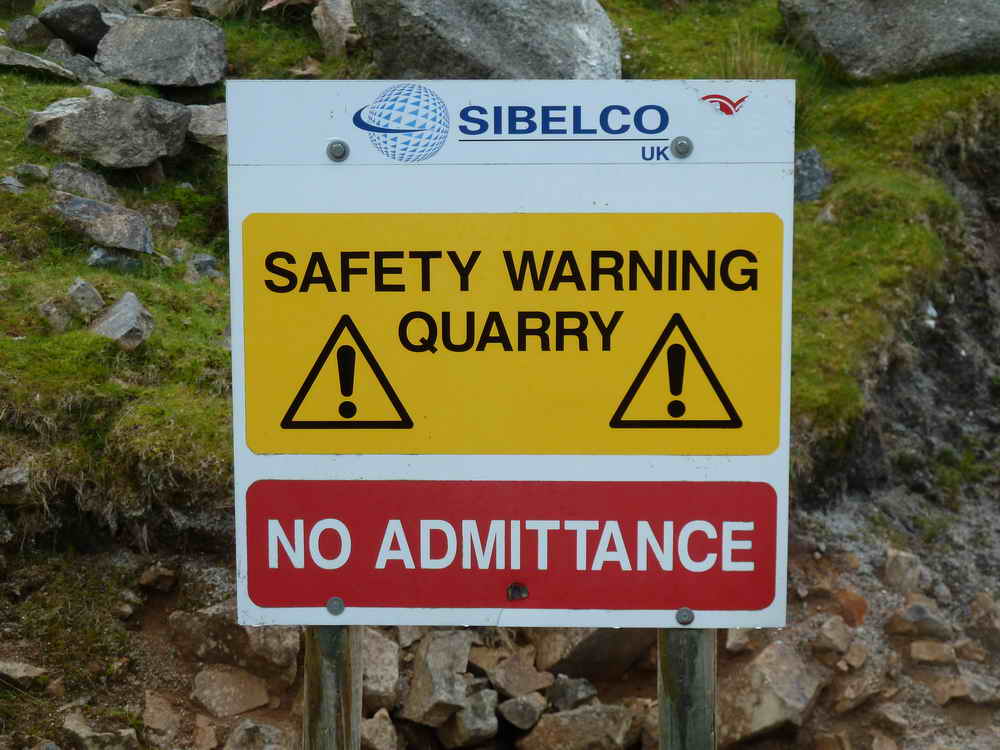
A Sibelco notice - see the previous walk for details of china clay companies.

The trig. pillar near Luxton Tor ..... with Sheep's Tor to its left and Leather Tor at the extreme left .....

There are some unusual pits close to the trig. pillar.
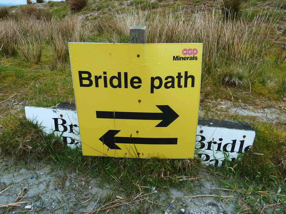
Another sign, bearing the logo of Watts Blake Bearne - explanation given in the previous walk.

A Volvo excavator at work .....

Another view of a truck .....
As previous photo - this driver actually stopped for us to take the photograph - Thank you!

Final view as the truck started off again.
MAP: Red = GPS satellite track of the walk.
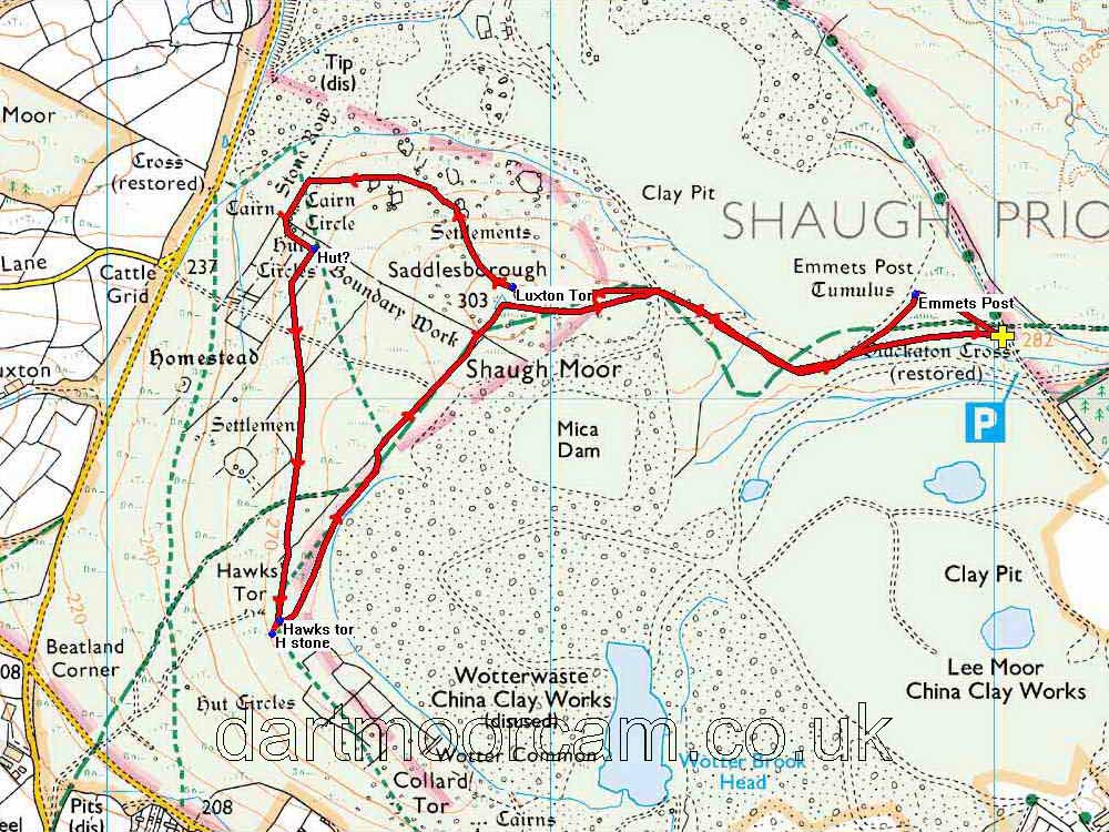
Ordnance Survey © Crown copyright 2005. All rights reserved. Licence number
100047373.
Also, Copyright © 2005, Memory-Map Europe, with permission.
This walk was accessed from the turn-off at Cadover Bridge (SX 5555 6461), reaching the car park at the end of the road marked by the green dots. The car park is marked by the yellow cross.
Statistics
Distance - 5.17 km / 3.2 miles.
All photographs on this web site are copyright ©2007-2016 Keith Ryan.
All rights reserved - please email for permissions