Car park
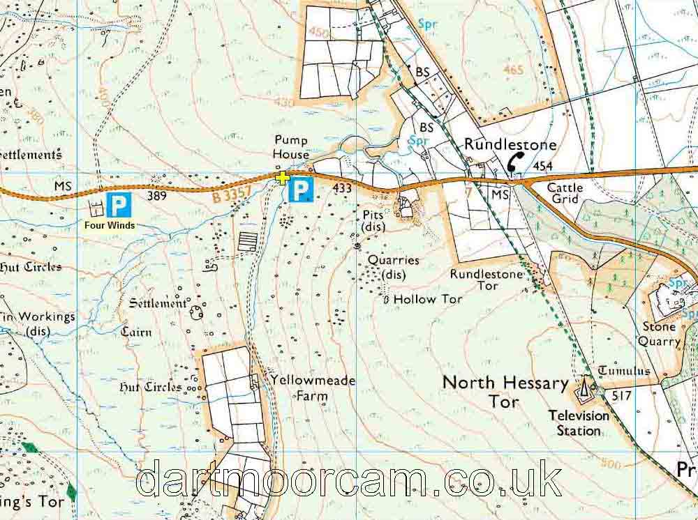
Yellowmeade Track, Mission Hall, Pump House and Four Winds
There are four car park areas below.
Map reference: SX 567 749
Nearby post code:
PL20 6SS (for
Yellowmeade Farm)
what3words:
///applies.crossings.ample
1 - Yellowmeade Track old quarry -
indicated by the yellow cross and the "P" symbol.
2 - Across the road, by the old Mission Hall / School
3 - Up the road, is more space at the
old Pump House
4 - Four Winds, down the road and we will 'taxi' you.
Link to Google Satellite map
- see the blue markers on the road between
Tavistock
and Princetown. You can zoom in and out on the map with the
thumbwheel etc.
Link to Google Street View
- this is looking towards Two Bridges / Princetown.
The old Pump House can be seen ahead, right beside the road. The
car park is seen in on the right. You can click ahead to drive ahead, drag the
scene left or right to turn about, click ahead again to drive back
along the route You can also zoom in or out with the mouse
thumbwheel - I'm not sure about other devices.

2 - Four Winds - towards the left
edge of the map above, surrounded by trees.
Map reference: SX 560 749
Nearby post code - PL20
6SS (for Yellowmeade Farm)
Link to Google Street View
- this is the view driving from Two Bridges towards
Tavistock, the car park is on the left, among the trees. You can click ahead to drive ahead, drag the
scene left or right to turn about, click ahead again to drive back
along the route You can also zoom in or out with the mouse
thumbwheelor pinching the pad.
