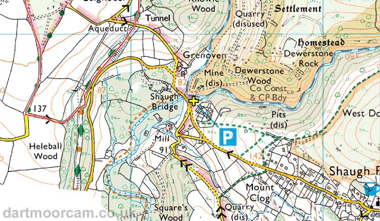
Car park
Shaugh Bridge, near Shaugh Prior
Can be approached via (1) Roborough and then
Bickleigh, (2) Yelverton and Cadover Bridge or (3) Plympton
direction.
Link to Google Satellite map
- You can zoom in and out on the map with the
thumbwheel etc. The car park is the blue marker in the centre of
the map - you can click on it for confirmation.
Map reference:
SX 533 636, north-west of
the village
Nearby post code:
PL4
5HA (for
the White Thorn Inn, Shaugh Prior)
Lat / Long - used by some sat navs: 50�27'13.7"N,
4�4'02.4"W
Link to Google Street View
- You can click ahead to drive ahead, drag the
scene left or right to turn about, click ahead again to drive back
along the route You can also zoom in or out with the mouse
thumbwheel - I'm not sure about other devices.
This shows Shaugh bridge ahead and the car
park on the right, approaching from Shaugh Prior village.
If you "drag" the view around 180�, you can "click" your way up
the road to the village. The White Thorn pub is across the road
from the church - this takes several "clicks" to reach the church
/ pub.
The car park is indicated by the yellow cross .....

� Crown copyright 2018 - Ordnance
Survey
Licence number 100047373
All photographs on this web site are copyright © Keith Ryan.
All rights reserved - please email for permissions
