Map reference: SX 596 922
Nearby post code: EX20 1QR (St. Michael's Bungalow & Gunnery Lodge, Okehampton Camp )
Okehampton Railway Station Tea Room Menu - also good for toilets!
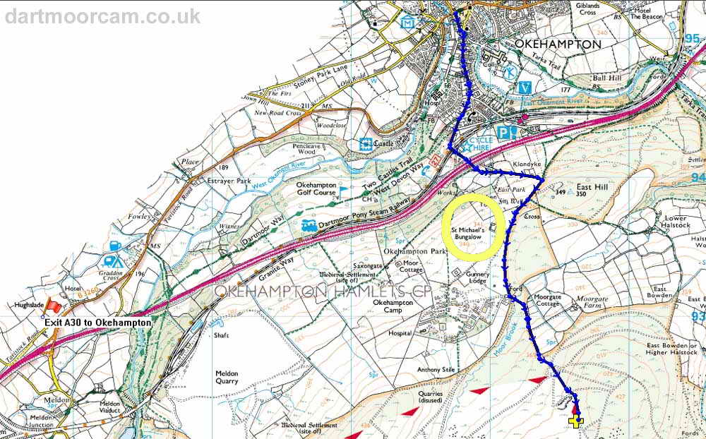
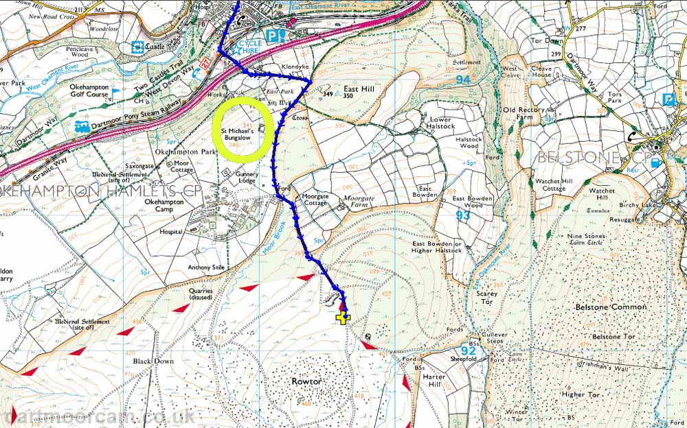
High Dartmoor - near Rowtor - two maps below .....
Park on west side of road before junction, north-east of Rowtor
Take A30 and follow signs into Okehampton & Meldon.
from Plymouth direction, go down into the centre of Okehampton and turn RIGHT at the traffic lights, into Station Road.
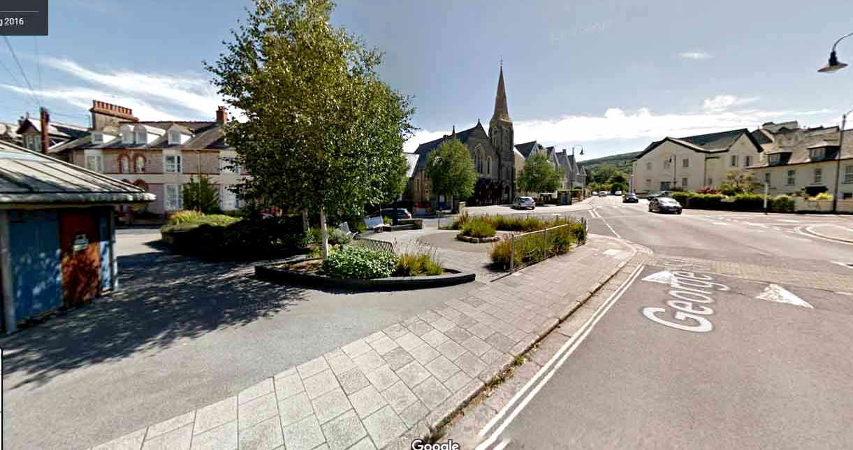
bending left, TOILETS ON LEFT, park on pavement outside the church
pass Castle Road on the right, next .....
turn RIGHT into Station Road, up the hill
drive all the way up the hill - DO NOT take the left branch at the top of the road where there is a statue(?) in the middle of the junction - keep going stright up the hill
the road becomes Tors Road (Station Road branches to the left) - keep going up the hill
the road becomes small, goes over a narrow railway bridge and then over the A30 dual carriageway
up onto the moor, pass St Michael's Bungalow and the side road entrance on the right to Okehampton Camp
at a T-junction, turn LEFT down over a grid and a bridge and drive straight on, DO NOT take the road to the right
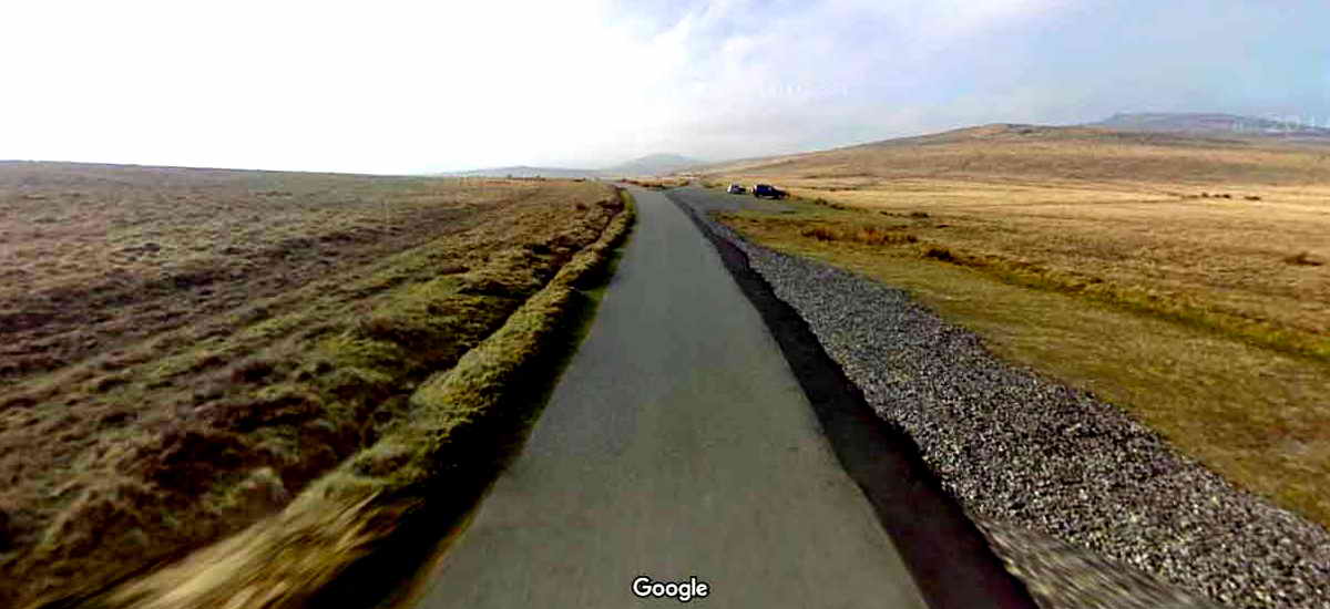
follow the main track to the car park - the side tracks on the map are not so obvious on the ground - you'll be alright!
Follow the BLUE route from the traffic lights to the car park (the yellow cross)
There are 2 maps below .....


Reproduced from Dartmoor OS Explorer map 1:25 000 scale by
permission of Ordnance Survey
on behalf of The Controller of Her Majesty's
Stationery Office.
� Crown copyright. All rights reserved. Licence number 100047373.

After crossing the cattle grid outside the army camp, drive a further 1200 yards (0.7 mile), 1.1.km. When you reach the car park - it is big!
Ignore all side-turnings.
TOILETS
There are toilets in Okehampton just after turning RIGHT at the traffic lights, they are one the LEFT - coloured blue on the left edge of this image. There is a little street parking on the far side or on the pavement outside the church.
You can also drive straight past the church out towards the park where there is street parking.
Afterwards, we go up Station Road - over off the right edge of the image.
Alternatively (my choice) is to drive up Station Road to the railway station (see next section below).

Drive up Station Road (a hill) until you reach a road junction with an old steet light in the middle of the junction. TURN LEFT UP THIS ROAD .....
After visiting the station, come back to this junction and turn LEFT, up the hill to the moor.
Drive up to the LEFT turning into the station area - DO NOT GO UNDER THE NARROW RAILWAY BRIDGE.
Now, park on the left if there is room, or drive past the building into a big car park.
If you enter through the main door, go through the entry area onto the platform, Gents turn RIGHT, Ladies turn LEFT, go to the door almost at the end of the building.
The Station Tea Rooms offer a very reasonable menu: opening hours Mon-Fri 10.00-16.00; Sat-Sun 09.00-17.00. Tel. 01837 55164.
End of page