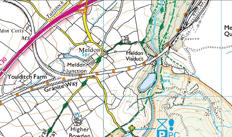
Map reference: SX 562 917
Nearby post code: EX20 4LU (Meldon Village Hall)
From Tavistock direction on A30, take slip road as seen in
the Street View.
Turn RIGHT to "Meldon" at the end of
the slip road.
Pass a sign to "Village Hall" and BEAR
RIGHT, passing the turning and white cottages(?) road on the left.
Go under a railway bridge and .....
IMMEDIATELY turn LEFT
by the "Reservoir Car Park" sign.
Drive to the end of the road
and turn (left) into the car park - and toilets.

Reproduced from Dartmoor OS Explorer map 1:25 000 scale by
permission of Ordnance Survey
on behalf of The Controller of Her Majesty's
Stationery Office.
� Crown copyright. All rights reserved. Licence number 100047373.
If you approach from the east i.e. Exeter direction, you need to
turn off for Sourton, after the
reservoir area.
Then TURN RIGHT, going under the A30,
passing Burger King and the Travelodge
then TURN RIGHT to rejoin the
A30 and drive back along the A30 to the
Okehampton & Meldon exit.