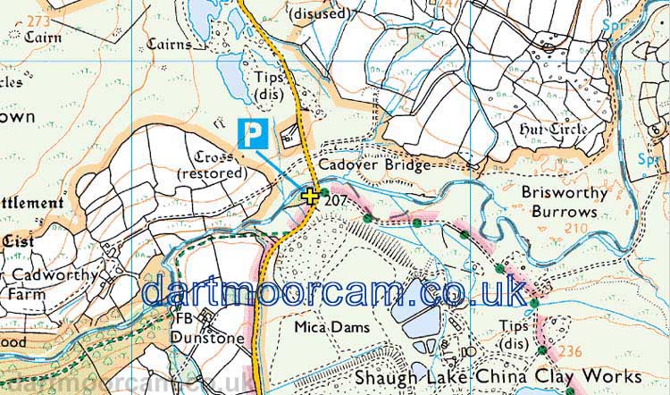
Car park
Cadover Bridge
Map reference: SX 555 646
Nearby post code: PL7 5EL - for nearby "The Counting House, Cadover Bridge, Plympton" just up the hill from the bridge.
Lat / Long - used by some car sat navs: 50�27'48"N, 4�2'13"W
Link to Google Satellite map
- You can drag the human figure onto the road, to
go to Street View, or click the link below .....
Link to Google Street View -
Cadover Bridge is ahead of, crossing the River
Plym, and the large car park is over to the right.
You can click ahead to drive ahead, "drag" the
scene left or right to turn about, click ahead again to drive back
along the route You can also zoom in or out with the mouse
thumbwheel - I'm not sure about other devices. This works using
Google Chrome.
Directions from Yelverton Roundabout
- Exit roundabout towards Plymouth
- IMMEDIATELY after roundabout turn LEFT - public toilets are in front of you
- Turn LEFT again and then RIGHT into Meavy Lane, for 0.25 mile - down past the end of the Yelverton shops
- This runs on ahead as GRATTON LANE, stay on this for 1.5 miles
- At a CROSSROADS, TURN LEFT
- FOLLOW THIS ROAD FOR 1.4 MILES,
- This includes a SHARP BEND RIGHT at a junction where there is a small road going back to the left
- Go over Cadover Bridge (and River Plym) and enter large car park on the right
- This is PL20 6PX according to Google Directions.
The car park is indicated by the yellow cross.

� Crown copyright 2018 Ordnance
Survey
Licence number 100047373
Also, Copyright � 2005, Memory-Map Europe, with permission.